Middle Potomac Watershed Plan Dead Run Stream Restoration
•Als PPTX, PDF herunterladen•
1 gefällt mir•1,060 views

Dead Run Stream Restoration May 2014 Middle Potomac Watershed Plan Implementation Public Meeting McLean Community Center April 23, 2014

Empfohlen
Empfohlen
Weitere ähnliche Inhalte
Was ist angesagt?
Was ist angesagt? (20)
Andere mochten auch
Andere mochten auch (8)
Ähnlich wie Middle Potomac Watershed Plan Dead Run Stream Restoration
Ähnlich wie Middle Potomac Watershed Plan Dead Run Stream Restoration (20)
Mehr von Fairfax County
Mehr von Fairfax County (20)
Kürzlich hochgeladen
Kürzlich hochgeladen (14)
Middle Potomac Watershed Plan Dead Run Stream Restoration
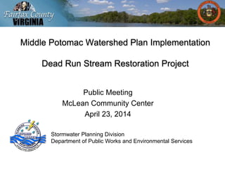
- 1. Middle Potomac Watershed Plan Implementation Dead Run Stream Restoration Project Public Meeting McLean Community Center April 23, 2014 Stormwater Planning Division Department of Public Works and Environmental Services
- 2. Meeting Outline • Fairfax County Stormwater Management • Countywide Watershed Plan Implementation • Project Introduction and Objectives • Existing Conditions • Proposed Improvements - Options • Example Projects • Questions?
- 3. Fairfax County Department of Public Works and Environmental Services (DPWES)Department of Public Works and Environmental Services Land Development Services Capital Facilities Solid Waste Stormwater Stormwater Planning Division Maintenance and Stormwater Management Division Wastewater
- 4. Stormwater Infrastructure • Conveyance System – 1,600 miles of pipe and paved channel – 43,000 structures – 6,800 outfalls • Management Facilities – 1,540 county maintained – 3,720 privately maintained • State Regulated Dams A typical outfall A dam in Fairfax County
- 5. Service Drivers In response to The Clean Water Act of 1972 National Pollutant Discharge Elimination System (NPDES) Virginia Stormwater Management Program (VSMP) Regulations Municipal Separate Storm Sewer Permit (MS4) Total Maximum Daily Loads (TMDLs) Chesapeake Bay Local Streams
- 6. Countywide Watershed Planning “Healthy Watersheds, Healthy Communities” • 30 Designated Watersheds • All 15 watershed plans have been adopted by Fairfax County http://www.fairfaxcounty.gov/dpwes/watersheds/
- 7. Middle Potomac Watershed Plan • Watershed Characterization – Water Quality Monitoring – Land Use Change – Pollutant Loading • Structural Project – 25 Year Plan • Non-Structural Practices – Policy and Regulationshttp://www.fairfaxcounty.gov/dpwes/watersheds/
- 8. Dead Run Watershed Plan • Dead Run has a drainage area just over 3 square miles • 24 priority projects identified in the watershed management plan • Pond retrofits • LID Stormwater Enhancements • Stream Restoration • Neighborhood Stormwater Improvements http://www.fairfaxcounty.gov/dpwes/stormwater /projects/project_list.htm
- 9. Approximately one third of the roof is covered with vegetation. The benefits of a “living roof” include: • Reduces the amount of stormwater runoff • Absorbs air pollution and carbon dioxide • Reduces the energy needed to cool the building in summer Partnership:LIDStormwaterEnhancements Dolley MadisonLibrary Vegetated Roof- Delosperma and Allium plants in bloom
- 10. Partnership: LID Stormwater Enhancements Dolley Madison Library Sustainable Site Design
- 11. Dead Run – Before and After Drainage Area (acres) Phosphorous Removal (lbs/yr) Nitrogen Removal (lbs/yr) Sediment Removal (tons/yr) 415 15 283 3 Stream Restoration
- 12. Dead Run – Stream Restoration
- 13. Stream Monitoring Program Study Objectives 1. Generate long-term monitoring data. 2. Evaluate relations between observed conditions/trends and BMP implementation. 3. Transfer the understanding gained to other less-intensively monitored watersheds. http://va.water.usgs.gov/projects/ffx_co_monitoring.htm
- 14. Dead Run Stream Restoration
- 15. Dead Run Stream Restoration Segment 1 – Dominican Retreat • 2,000 Linear Feet • Extends to Old Dominion Drive • Residential lots along Merrimac Drive and Van Ness Court
- 16. Dead Run Stream Restoration Segment 2 – McLean Central Park • 800 Linear Feet • Completely in Park • Starts below previously restored section near library
- 17. Dead Run Stream Restoration Segment 3 – McLean Central Park • 1,500 Linear Feet • Extends to Churchill Road • Residential lots along Elizabeth Drive and Carol Rayes Street
- 18. Next Steps • Conceptual Design • Land Acquisition/Coordination • Preliminary Design • Public Meeting • Final Design • Project Construction • Funding FY2016 and FY2017 • Community Coordination: Pardon Our Dust • Maintenance and Operation
- 19. Natural Channel Design Background and Design Approach
- 22. Stream Design Approaches Natural Channel Design 3 design approaches 1)Analog 2)Empirical 3)Analytical
- 36. Segment 2 & 3 Mclean Central Park Dead Run Stream Valley Park
- 52. Looking upstream at boulder rock toe and constructed riffle Looking upstream at boulder rock toe – 2 and 3 courses
- 55. Cross Vane Cross Vane Cross Vane
- 56. Step Pool
- 57. Infill mix comprised of cobbles, gravels, sand, silt, topsoil Larger material, usually cobble Constructed Riffle (aka Reinforced Streambed)
- 58. Riffle
- 59. Access
- 61. John Palmer John.Palmer@fairfaxcounty.gov Dipmani Kumar Dipmani.Kumar@fairfaxcounty.gov Matt Meyers Matthew.Meyers@fairfaxcounty.gov Stormwater Planning Division Department of Public Works and Environmental Services Fairfax County 12000 Government Center Parkway, Suite 449 Fairfax, Virginia 22035 Questions ? Contact Information A Fairfax County Publication, April 2014 To request this information in an alternate format call 703-324-5500, TTY 711 www.fairfaxcounty.gov/dpwes/ stormwater Thank You!
Hinweis der Redaktion
- Fluvial Geomorphology Principles Lanes Balance Equation Changes in one variable tip the balance and must be accounted for by a shift in a combination of the other variables. Streams adjust their width, depth, slope, and pattern through erosional and depositional processes to accommodate changes in discharge and sediment load. When discharge and sediment load are not significantly changing, stream adjustment processes shift toward stability. Streams that transport sediment loads and convey flows without significant erosion or deposition are in balance and have achieved dynamic equilibrium. Dynamic equilibrium represents a state of natural stability. Streams in dynamic equilibrium maintain a consistent dimension, pattern, and profile in the current environment, although some change may occur in the short term. Changes in watershed hydrology or sediment supplies (i.e. current environment), may result in changes in the dimension, pattern and/or profile, as the stream adjusts to a new state of equilibrium.
- Conduct Geomorphic and Watershed (HH assessment). CEM Incision (also know as downcutting or headcutting) can occur independently or simultaneously with meander migration. The bed is eroded and the base level of the stream is lowered. Downcutting increases bank height, which can eventually lead to bank failure and channel widening. Widening and downcutting continue until equilibrium is regained. Aggradation occurs when sediment supply exceeds transport capacity and the stream deposits sediment in the channel. Aggradation can be triggered by an increase in sediment supply due to upstream channel erosion or land development, or by a decrease in discharge, which reduces the transport capacity of the system. Deposition continues until a new state of dynamic equilibrium is achieved.
- Stream Design Approaches – Natural Channel Design – 3 design approaches 1)Analog 2)Empirical 3)Analytical. All 3 are part of the NCD process. Analog approaches use a stream in dynamic equilibrium as a template for design. This approach represents one of three approaches to NCD. Empirical design uses equations derived from regional data sets of various channel characteristics of dynamically stable streams. Analytical design makes use of hydraulic equations and sediment transport functions to derive equilibrium conditions. These three approaches must be given equal validity if the end product meets the above definition of stream design. 1- Analog / Reference Reach 2-Empirical: e.g. Regional Curves 3-Analytical:
- NCD process Dimension Plan Profile
- NCD process Hydrologic Analysis Hydraulic Analysis Bankfull Discharge
- Design strategies Priority 1 establish new channel at historic FP elev. Priority 2 Create New Floodplain and Stream Pattern Below the Historical Floodplain Elevation but Above Current Stream Elevation Priority 3 Widen FP at existing BF elev. Priority 4 Stabilize channel in place
- Ex Cond Seg 1
- Ex Cond Seg 1
- Ex Cond Seg 1
- Ex Cond Seg 1 – special features
- Seg 1 Aerial overview
- Seg 1 XS
- Seg 1 Upper Rest
- Seg 1 Mid Rest
- Seg 1 Lower Rest
- Ex Cond Seg 2-3
- Ex Cond Seg 2-3
- Ex Cond Seg 2-3
- Ex Cond Seg 2-3
- Ex Cond Seg 2-3
- Seg 2 & 3 Upper Aerial
- Seg 3 Lower Aerial
- Seg 2 Rest.
- Alt Alignment
- Alt Access 3 lower
- Alt Access 3 lower
- Goose Creek – small trib
- Selma Estates constructed riffle
- Taft Ave. Riffle and modified CV aka Jhook