
Empfohlen
Weitere ähnliche Inhalte
Mehr von eventspat
Mehr von eventspat (9)
Kürzlich hochgeladen
Kürzlich hochgeladen (20)
Web GIS Application: iVAULT Municipalities
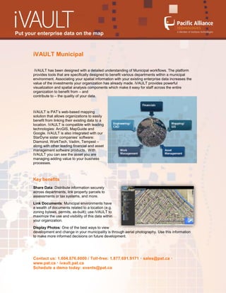
- 1. Put your enterprise data on the map iVAULT Municipal iVAULT has been designed with a detailed understanding of Municipal workflows. The platform provides tools that are specifically designed to benefit various departments within a municipal environment. Associating your spatial information with your existing enterprise data increases the value of the investments your organization has already made. iVAULT provides powerful visualization and spatial analysis components which make it easy for staff across the entire organization to benefit from – and contribute to – the quality of your data. iVAULT is PAT’s web-based mapping solution that allows organizations to easily benefit from linking their existing data to a location. iVAULT is compatible with leading technologies: ArcGIS, MapGuide and Google. iVAULT is also integrated with our StarDyne sister companies’ software: Diamond, WorkTech, Vadim, Tempest – along with other leading financial and asset management software products. With iVAULT you can see the asset you are managing adding value to your business processes. Key benefits Share Data: Distribute information securely across departments, link property parcels to assessments or tax systems, and more. Link Documents: Municipal environments have a wealth of documents related to a location (e.g. zoning bylaws, permits, as-built); use iVAULT to maximize the use and visibility of this data within your organization. Display Photos: One of the best ways to view development and change in your municipality is through aerial photography. Use this information to make more informed decisions on future development. Contact us: 1.604.676.6000 / Toll-free: 1.877.691.9171 sales@pat.ca www.pat.ca ivault.pat.ca Schedule a demo today: events@pat.ca
- 2. Put your enterprise data on the map Spatial Tools: Reduce the time it takes for staff to complete their regular business workflows. Export addresses to Microsoft Word based on parcels that are explicitly selected or are located within a specified distance from specific map feature(s). Manage Assets: Get specific details on assets, such as location, procurement, and service dates. Improve Workflows: Web access for your data encourages use and adds to greater accuracy and content while reducing service times and costs. Save Money: Access asset data without complex GIS and CAD software across your departments while reducing the cost of desktop licenses. Municipal Uses: Land Info and Mapping Finance and Supply Environmental Management Community Services City Auditor and Clerk Waterworks and Wastewater Emergency Services Tax Assessment Parks and Recreation Roads and Transportation Land Use Planning and Policy iVAULT Municipal Parcel Reporting & Agreements Management A municipal parcel module consolidates parcel reporting from multiple enterprise systems and agreements management into a single pop-up form. The interface manages Right of Way and Easements on land parcels. It includes individual printable pages, as well as a printable parcel summary report. The report is customized to the requirements of each municipality. Examples of existing management modules and reports include: Parcel Summary Rights of Way and Easements Planning Ownership Sewer Capacity Utility Connections Contact us: 1.604.676.6000 / Toll-free: 1.877.691.9171 sales@pat.ca www.pat.ca ivault.pat.ca Schedule a demo today: events@pat.ca
- 3. Put your enterprise data on the map Contact us: 1.604.676.6000 / Toll-free: 1.877.691.9171 sales@pat.ca www.pat.ca ivault.pat.ca Schedule a demo today: events@pat.ca
- 4. Put your enterprise data on the map iVAULT System Architecture Easy Integration: iVAULT’s open architecture makes it easy to design and configure components. Leverage existing data sets and systems to minimize implementation and training costs. No programming skills required. Open Approach: iVAULT is compatible with leading technologies: ArcGIS Server, MapGuide, Microsoft SQL Server and Oracle, allowing you to use your data and systems in their existing structure. Cross-Platform Support: Access your data with any industry-standard web-browser. iVAULT driven by technology and Passion! iVAULT was designed from the ground up to provide simplicity for business workflows. Since its inception in 2002, iVAULT has migrated through various iterations of software technology in the market to become one of the most configurable and open web mapping applications available. About Pacific Alliance Technologies Pacific Alliance Technologies, a member of StarDyne Technologies, provides proven CAD and GIS solutions and services for local and regional governments. Easy, flexible and affordable, Pacific Alliance’s solutions enable government staff to manage, query and analyze spatial, attribute and financial information. Delivered via a web browser, data is integrated from multiple sources to deliver a solution that streamlines Asset Management and facilitates self-service for the public. With a combined 120+ years of technical experience, Pacific Alliance is lauded in the industry as a GIS technology and service provider. Contact us: 1.604.676.6000 / Toll-free: 1.877.691.9171 sales@pat.ca www.pat.ca ivault.pat.ca Schedule a demo today: events@pat.ca