
Empfohlen
Weitere ähnliche Inhalte
Was ist angesagt?
Was ist angesagt? (20)
Ähnlich wie Climate Change and Disaster Risk Reduction in Georgia
Ähnlich wie Climate Change and Disaster Risk Reduction in Georgia (20)
Kürzlich hochgeladen
Kürzlich hochgeladen (20)
Climate Change and Disaster Risk Reduction in Georgia
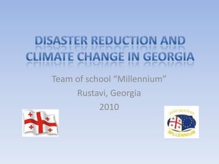
- 1. Disaster Reduction and Climate Change in Georgia Team of school “Millennium” Rustavi, Georgia 2010
- 2. Take care of the earth and she will take care of you Team consist of students of 6th and 9th grades: MariamKolbaia MariamTvaliashvili IuzaChubinidze Davit Kalmakhelidze Lazare Chabashvili School “Millennium” Rustavi city Georgia
- 3. School “MILLENNIUM” School Introduction: The private school of "Millennium" is actively functioning since 2000. It was founded by the LTD "N & N 2000". The presence is full with new events Future-is well-planned. The School is orientated on the classes with small groups. The goal of the school is to assess pupil's performances on a daily bases and meet the main program set according to plan of school year. At our school the subjects such as math and English are taken with the intense studies. The English language course starts from first year, while the Russian is taught from the second year. There is every possible condition at disposal of the students in order to ease their formation as true followers of national or internationally accepted values.
- 4. Georgia Georgia is a sovereign state in the Caucasus region of Europe. Situated at the juncture of Eastern Europe and Western Asia, it is bounded to the west by the Black Sea, to the north by Russia, to the south by Turkey and Armenia, and to the east by Azerbaijan. Georgia covers a territory of 69,700 km² and its population is 4.436 million. Capital: Tbilisi Geographic coordinates:42°00′N, 43°30′E
- 5. Mountains Mountains are the dominant geographic feature of Georgia. The highest mountain in Georgia is Mount Shkhara at 5,201 meters (17,064 ft) above sea level. Other prominent peaks include Kazbegi (Kazbek) at 5,074 meters (16,647 ft). Out of the 2,100 glaciers that exist in the Caucasus today, approximately 30% are located within Georgia.
- 6. Landscape The landscape within the nation's boundaries is quite varied. Western Georgia's landscape ranges from low-land marsh-forests, swamps, and temperate rain forests to eternal snows and glaciers, while the eastern part of the country even contains a small segment of semi-arid plains characteristic of Central Asia. Forests cover around 40% of Georgia's territory while the alpine/subalpine zone accounts for roughly around 10% of the land.
- 7. Natural disasters in Georgia Disasters in Georgia are as diversity such as his nature. The main disasters in Georgia are earthquakes, landslides, floods, hailstones, heavy winds and fire in woods .
- 8. Earthquakes Caucasus mountains common are earthquake’s active zone. Average every 10 years there are strong earthquake measuring up to 6.2 in magnitude, which break-up the most flats, unfortunately killing people and causing significant damage. A few low earthquakes, measuring 5-6 in magnitude, struck mountainous northwestern Georgia during every year . In the early 1990s in western Georgia was huge earthquake, a lot of people have been homeless an ecorefugess.
- 10. Earthquake in Tbilisi The last major earthquake in Georgia, measuring 6 in magnitude, struck Tbilisi in April 2002, killing six people and causing significant damage to the capital’s Old Town.
- 11. Landslides Landslides are a major hazard in most mountainous and hilly regions of Georgia. Landslides can be triggered by natural physical processes such as heavy or prolonged rainfall, earthquakes, volcanic eruptions, rapid snow melt, slope undercutting by rivers or sea waves and permafrost thawing.
- 12. Human causes include: deforestation, cultivation and construction, which destabilize the already fragile slopes. About number of 2000 landslide’s dangerous places are in Georgia, the 700 of them are very scary.
- 13. The rainfalls and floods Heavy raining in Spring and Autumn are causing to rise the size of the rivers. It can occur the floods. The major rivers in Georgia are Mtkvari, Rioni and Alazani, which overflows or breaks levees, with the result that some of the water escapes its usual boundaries in Spring. Floods often cause damage to homes and businesses, which are placed in natural flood plains of rivers; also bridges, sewer systems, roadways and canals, people loses of entire harvest.
- 14. Hailstones Hail is most common in eastern Georgia, in Kaxeti, which call wine homeland. It damage farmers’ crops such vegetables and grapes. Hail is the biggest problem for natives in Kaxeti.
- 15. Fire in woods The rapid increasing of temperature causes the fire breaks out in woods in summer. In the last years the number of this natural disaster was growing. This summer wood was burning into flame in famous Borjomi-Kharagauli reserve in southern Georgia. Fire deforested and harmed the unique conifers’ forest in the 15 hectares. In the August of 2008, during the war conflict with Russia, Borjomi-Kharagauli reserve was burning during 20 days and there were deforested about several hundred hectares .
- 16. Heavy winds There are heavy winds in the western Georgia often. They blow over the Colkhis plain from the Black sea. Seaport Poti and Kutaisi are the most damaged in this point. Heavy winds toppled power lines, uprooted trees and damaged a lot of buildings each time. They made a few million dollars of losses every years.
- 17. Tornado In past years across the Black sea coasts appeared tornado, which have ever been there. Fortunately it did not move ashore and people looked from far away.
- 18. The global warming effect in Georgia temperature increased such as in the world; glacier retreat by 12-15 m per year; Rivers levels rise, which causes a more floods than usually. In this case the most dangerous places are delta of river Rioni, KvemoSvaneti and Dedoplistskaro Municipality; Rising Black sea level is a danger for the Colchis plain, especially for seaport Poti; There are more a lot of Fire breaks out in woods than before; There are tornado from the sea, that never was be.
- 19. Activities for reduction of disaster effects at school “Millennium”
- 20. Safety map
- 21. IEARN project “Daffodil and Tulip”
- 22. Save our Nature
- 23. “Drops of life”
- 24. SIQA, iEARN-Georgia and iEARN coordinator in Georgia PavleTvaliashvili supported us to take part in NDYS 2010 Turkey