Why mapping software is great for sales
•Als PPT, PDF herunterladen•
0 gefällt mir•1,102 views

eSpatial is a Mapping Software that provides sales professionals with advanced methods to visualize and analyze their data. This Slideshare aims to help sales professionals understand why they should be mapping their sales data, what the benefits are and how to go about getting started.

Empfohlen
Empfohlen
Weitere ähnliche Inhalte
Ähnlich wie Why mapping software is great for sales
Ähnlich wie Why mapping software is great for sales (20)
Kürzlich hochgeladen
Why mapping software is great for sales
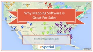
- 1. Why Mapping Software is Great For Sales Benefits of Mapping Sales Data
- 3. Why Map sales Data? Having clearly defined and aligned sales territories is a key driver of success Good sales territory alignment enhances customer coverage, increases sales and reduces costs* Data mapping enables you to develop a comprehensive sales strategy and allocate your resources effectively Managers who use visual data discovery tools are 28% more likely to find timely information than those who rely solely on managed reporting and dashboards** *Zoltners, A. A., & Lorimer, S. E. (2000). Sales territory alignment: An overlooked productivity tool. Journal of Personal selling & sales Management, 20(3), 139-150. **Aberdeen Group: White, D. (2013) Visualization. Set Your Analytics Users Free.
- 4. -Mark Hagenberg Perfection Learning eSpatial is a game-changer in terms of helping our sales reps visualize and target their territories!“
- 6. Benefits of Sales Mapping Analyze sales performance instantly Ability to allocate sales teams more effectively, leading to higher profits and greater efficiency Plan a more effective sales strategy to reduce costs Reduce risk by identifying re-alignment opportunities Cultivate leads Realign sales territories Rapidly report on key sales data
- 7. Benefits of Sales Mapping Analyzing These Regions Allows You To: Discover and reveal sales trends Uncover insights through visualization Track the impact of market changes on a regular basis and easily adjust territory sizes
- 8. -Graham Oliver Door Entry IP It’s the whole visual thing. It’s simple. It’s pretty cost effective as well...it just works!“
- 9. How Can You Map Your Sales Data? 2
- 10. How Can you Map Your Sales Data? 1. Define your Sales Territories with Territory Mapping Create a territory map by stitching together existing geographic boundaries or by drawing customized areas. Territories can be given unique names and used as base-maps on which you can place other relevant data. Territories can be formed by combining small geographic boundaries such as zip codes, or large geographic boundaries such as countries.
- 11. How Can you Map Your Sales Data? 2. Upload Your Sales Data You can upload your sales data associated with each region and can assign different areas to sales teams or reps Adjustable color coding lets you easily define and visualize individual regions
- 12. How Can you Map Your Sales Data? 3. Analyze Your Sales Performance Territory Balancing Tool can instantly show the effect of boundary changes Aggregate by Value lets you combine a map, table and chart to track and compare performance of your sales team
- 13. -Bradi Dobson American Credit Acceptance We started out looking at 12 types of mapping software. We cut that down to 7. eSpatial was the final – and best – choice “
- 15. Importing Your Data Now that you can clearly see you need to switch to eSpatial to help you with your sales performance, the remaining question is, how easy is it to use? Luckily, it's a really simple process. We’ve outlined all you need to do in the following two-step guide.
- 16. Step 1 – Ensure your data is arranged correctly It is unlikely that this will be an issue but it is a good idea to check your dataset is formatted correctly. There are 4 simple rules: Address, City, County, State and ZIP should all be in separate columns. Each column has a unique header Each Column has only one type of data (e.g. Numerical, Text) The file must be in a standard spreadsheet format, CSV, XLS or XLSX format Importing Your Data
- 17. Step 2 – Upload your data to eSpatial This is quite a simple process. Your data most likely falls under three categories; Spreadsheet file containing addresses Spreadsheet file containing X and Y coordinates Spreadsheet file containing geographic region names Spreadsheet file containing a list of your territories Importing Your Data
- 18. Here’s what you can do nowFind out more by downloading our eBook today Download eBook