Marine Digimap
•Als PPT, PDF herunterladen•
1 gefällt mir•1,150 views

Slides used in an EDINA webinar on 6 March 2013, covering the Marine Digimap service. The service offers view and download functions for Admiralty Charts of the UK and surrounding seas, plus Hydrospatial vector mapping data.

Empfohlen
Empfohlen
Weitere ähnliche Inhalte
Andere mochten auch
Andere mochten auch (18)
Mehr von EDINA, University of Edinburgh
Mehr von EDINA, University of Edinburgh (20)
Kürzlich hochgeladen
Kürzlich hochgeladen (20)
Marine Digimap
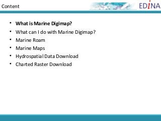
- 1. Content What is Marine Digimap? What can I do with Marine Digimap? Marine Roam Marine Maps Hydrospatial Data Download Charted Raster Download
- 2. What is Marine Digimap? • Online service, one of Digimap Collections of geospatial data • Subscription service, user registration required • SeaZone Solutions data, licensed by JISC for use in education • 2 datasets are used in the service, Hydrospatial and Charted Raster
- 3. Content What is Marine Digimap? What can I do with Marine Digimap? Marine Roam Marine Maps Hydrospatial Data Download Charted Raster Download
- 4. What can I do with Marine Digimap? View maps online, print/download PDF, A3, A4 Download 2 types of Marine digital map data • Charter Raster data • Hydrospatial data
- 5. Charted Raster Data • Raster data product, used to create online maps in Marine Maps within Marine Digimap. • Scanned Admiralty Charts covering the UK and the surrounding seas from 1:3.5million to 1:2,500. • Data supplied as GeoTiff images, ready for use in a GIS. • Each map has its own projection, referenced to WGS84. Not British National Grid. • These data make ideal backdrop maps, but must NOT be used for navigation. Current Admiralty Charts can be purchased from the UK Hydrographic Office. • Last update to data in Marine Digimap in 2005.
- 6. Charted Raster data • Marine Maps facility • Search Charted Raster Maps • Grouped into 6 scale bands; ocean, sea, general, coastal, approaches and harbour (roughly equivalent to the usage bands of Admiralty Charts).
- 7. Data in Digimap – 2 types
- 8. Hydrospatial Data • Vector data product from SeaZone, designed for use in a GIS: http://www.seazone.com/dataHydroSpatial.php • Used to create online maps in Marine Roam, within Marine Digimap. • 7 Topic Layers – each layer has themes: –Bathymetry and Elevation –Socio-Economic and Marine Use –Conservation and Environment –Structures and Obstructions (themes include Navigation Aides, Obstructions, Offshore Installations, Shoreline Constructions and Wrecks) –Climate and Oceanography –Natural and Physical Features –Metafeatures and Cartography • Data is collected at various scales, the best available for each source. • Projected in WGS84 not British National Grid. • Available in 2 formats - Shapefile (for ArcGIS), MapInfo Tab. • Last updated in Marine Digimap in 2011.
- 11. Content What is Marine Digimap? What can I do with Marine Digimap? Marine Roam Marine Maps Hydrospatial Data Download Charted Raster Download
- 12. Marine Roam Task Menu: search, custom view, map info., save Tools: measure, annotate, identify features, print, navigation
- 13. Views • Online maps, uses Hydrospatial data • Print/download A3/A4 PDF maps • 13 fixed scales, ranging from 1:2500 to 1:5,000,000 • Zoom in and out of different scales • Not all details from Hydrospatial data can be viewed at each scale • Default view or ‘Basemap content view’ – contains a selection of layers from the data appropriate for that scale • Select layers of your choice for ‘Customised content view’ – in Map Content Control
- 14. Search options
- 16. Navigate • Zoom in – double click or use scroll wheel • Click on scale bar to zoom in/out • Click and drag on map to move around • Or use compass to move NSEW
- 17. Overview Map • Click and drag red box to reposition your map location
- 18. Map Content Control • Check the boxes next to the topics and layers you wish to display • Map updates automatically
- 19. Map Content Control • Basemap Content View shows a selection of features from the Hydrospatial data, appropriate to the scale of your map view • Add/remove any features from the display > Customised Content View
- 23. Map Information • Displays: – coordinates of current map, – print scale, and – cursor coordinates
- 24. MyMaps • Save up to 200 maps within MyMaps • Click any entry in the list to regenerate that map
- 27. Annotation tools • Add markers, shapes, labels, measurements • Save, display in any Digimap Roam application • Export • import
- 28. Annotation tools
- 29. Export annotations • You can export your annotations, to use in GIS or other applications
- 30. Import annotations • You can import spatial datasets into any Roam application to view those features as annotations. This could be a dataset you have created in a GIS, downloaded from Digimap or another data provider, tracks or points surveyed using a GPS unit or a geocoded table of survey results. • You can import Shapefiles, KML, GPX, CSV and GeoJSON datasets. • In this example we uploaded a zip file, which contained a Shapefile (and other associated files) • Location of operational windfarms in GB
- 31. Feature Info. • Click then on your selected feature on the map • Marker placed where you click
- 32. Print • If you have all layers selected (in the Map Content Control area), likely to receive an error message. • De-select some layers and try again.
- 33. Print • Reposition map by clicking and dragging preview map. • Set title, grid lines, annotations options. • Select portrait/landscape, A3/A4. • Click Generate Print File.
- 34. PDF print
- 35. Content What is Marine Digimap? What can I do with Marine Digimap? Marine Roam Marine Maps Hydrospatial Data Download Charted Raster Download
- 36. Marine Maps • Online map creation, uses scanned Admiralty Chart images (Charted Raster data) • Print/download A4 maps • The maps are grouped into 6 scale bands; ocean, sea, general, coastal, approaches and harbour (roughly equivalent to the usage bands of Admiralty Charts). • Each scale band features a different set of Admiralty Charts, with features most relevant to the scale. The scanned images are used to build up a mosaic of maps for each scale band. • Scales vary from 1:3.5million to 1:2,500. • These make ideal backdrop maps, but must NOT be used for navigation.
- 37. Scale/Usage bands • Ocean - small scale ( 1:3,500,000 to 1:750,000) • Sea - small scale (> 1:750,000 to 1:300,000) • General - small to mid scale (1:200,000 to 1:100,000) • Coastal - mid scale ( 1:100,000 to 1:50,000) • Approaches - mid to large scale ( 1:50,000 to 1:15,000) • Harbour - large scale ( 1:25,000 to 1:2,500)
- 38. Marine Maps • Source maps may be at different scales. • In Marine Maps, maps of different source scales are viewed at same scale…so you may find some differences in detail in adjacent areas.
- 39. Opening screen
- 40. Marine Maps home page • Use the drop down menu to view areas covered by different usage bands. • To search, enter details in a search box or click on the map to go to your area of interest.
- 41. Different map views • Switch views by clicking on the icons above the map • Zoom in and out of that view, using the bar to the left of the map
- 42. Legend • The legend shows the more commonly found symbols on Marine Maps • More detailed information available from the Marine Lexicon
- 43. Map Chest • Maps can be saved in Map Chest • Unique to each user • Maps erased after 5 days • Print from Map Chest as: – PNG format, A4
- 44. Content What is Marine Digimap? What can I do with Marine Digimap? Marine Roam Marine Maps Hydrospatial Data Download Charted Raster Download
- 45. Hydrospatial Download Hydrospatial download process: • Identify product / format • Search for your location • Select the required data • Make download settings • Download data
- 46. Step 1: select product/format
- 47. Step 4: Choose data
- 48. Data layer selection • Each product has layers of detail. • Depending on the area selected for download, they may not all be available. • Example: – Structures and Obstructions • Navigation Aides • Obstructions • Offshore Installations • Shoreline Constructions • Wrecks
- 49. Onward use of data in ArcGIS Hydrospatial data: • Older versions of ArcGIS not supported. Can’t guarantee data will work in ArcView 3.x • Shape files, no need to convert • All of the files provided with Shape files must be kept in the same folder • To view data as it is seen in Marine Digimap, need to download and install 2 folders with cartographic styles and apply these: – fonts.zip – style.zip • Folders and information on applying styles available in Help > Using data with ArcGIS
- 50. Content What is Marine Digimap? What can I do with Marine Digimap? Marine Roam Marine Maps Hydrospatial Data Download Charted Raster Download
- 51. Charted Raster Download – 4 step process
- 52. Step 1: Search 1. Select the Scale bands of interest – use the coverage map to see which bands are available for your area – bands deselected can be added back in when choosing maps 1. Search using one of the options (Select your location from the list of results, if applicable)
- 53. Step 3: Choose data • Choose the maps you want from the list or click on the map • Zoom in and out to see larger or smaller maps in the area • Click Continue • Next step is to order, then download data in zip file
- 54. Download • Check order • Agree ‘aware not to be used for navigational purposes’ • Click Extract data
- 55. Download • Click Data.zip file • Save File
- 56. What do I download? • Unzip the folder from Marine Digimap to access the data
- 57. Download folder contents • TIFF image is your map • TIFF image has georeferencing encoded within it • GIS software will know where to place your map
Hinweis der Redaktion
- Last Amended: 3 September 2001
- Last Amended: 3 September 2001
- Last Amended: 3 September 2001 From Marine Maps you can create a map from one of six predefined scale bands based on the Charted Raster product. The maps in each scale band can be zoomed in and out to best display the selected area. The map can be viewed on screen or printed at A4 size as a PNG format file. The Marine Lexicon (based on the International Hydrographic Organization's ecPilot demo) allows the user to explore the symbols and abbreviations used on Admiralty Charts that are used within Marine Maps. Marine Lexicon is available to any registered user. The Marine Lexicon (based on the International Hydrographic Organization's ecPilot demo) allows the user to explore the symbols and abbreviations used on Admiralty Charts that are used within Marine Maps.
- Last Amended: 3 September 2001
- Last Amended: 3 September 2001
- Last Amended: 3 September 2001 Admiralty Charts – come from SeaZone Solutions Ltd, which is part of the UK Hydrographic Office. hydrospatial is 2008 and 2009 has just arrived - not sure when it'll go live yet (3 Sept 2009) charted raster is 2006 The Usage Band's map scales used in Marine Maps are as follows: Ocean - small scale ( 1:3,500,000 to 1:750,000) Sea - small scale (> 1:750,000 to 1:300,000) General - small to mid scale (1:200,000 to 1:100,000) Coastal - mid scale ( 1:100,000 to 1:50,000) Approaches - mid to large scale ( 1:50,000 to 1:15,000) Harbour - large scale ( 1:25,000 to 1:2,500) Why can I see black triangular slivers around some of the Marine Maps? The Marine Maps facility in Marine Digimap uses the Charted Raster product to build up a mosaic of maps for each scale band. These mosaics are made up of many different maps and each one has its own geographical projection. In order to display the mosaics as a continuous map each individual map has to be reprojected so that they are all the same. As most of the maps' projections are very similar they fit well together. However, some have been rotated considerably to fit with the other maps; in these cases it is possible that you will see black triangular slivers between them and the surrounding maps.
- Last Amended: 3 September 2001
- Last Amended: 3 September 2001 Zoom bar at the left is handy where the maps in a usage band have varying scales.
- Last Amended: 3 September 2001
- Last Amended: 3 September 2001
- Last Amended: 3 September 2001
- Last Amended: 3 September 2001
- Last Amended: 3 September 2001
- Last Amended: 3 September 2001
- Last Amended: 3 September 2001
- Last Amended: 3 September 2001