Intracanyon lava flows: Does the river give a dam
•Als PPTX, PDF herunterladen•
1 gefällt mir•1,279 views

Talk given at GSA about intracanyon lava flows on the Owyhee River, OR

Empfohlen
Weitere ähnliche Inhalte
Was ist angesagt?
Was ist angesagt? (19)
Ähnlich wie Intracanyon lava flows: Does the river give a dam
Ähnlich wie Intracanyon lava flows: Does the river give a dam (20)
Kürzlich hochgeladen
Kürzlich hochgeladen (20)
Intracanyon lava flows: Does the river give a dam
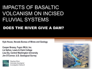
- 1. IMPACTS OF BASALTIC VOLCANISM ON INCISED FLUVIAL SYSTEMS DOES THE RIVER GIVE A DAM? Kyle House, Nevada Bureau of Mines and Geology Cooper Brossy, Fugro /WLA, Inc. Liz Safran, Lewis & Clark College Lisa Ely, Central Washington University Jim O’Connor, U.S. Geological Survey Owyhee River Interstate Geological Investigation Network
- 2. Goal of this talk Describe the characteristics of the response of the Owyhee River, OR to the incursion of voluminous basaltic lava flows. Thanks to input from NinadBondre Kathy Cashman Duane Champion Ryan Crow Natalia Deligne Cassie Fenton Nick Foit Gordon Grant Chris Henry Keith Howard Karl Karlstrom Caitlin Orem Shannon Othus Tabitha Prosser Terry Spell Brent Turrin
- 3. ‘When lava met valley’ Intracanyon lavas create extreme disruption of ‘normal’ fluvial processes Geomorphic effects Hydrological effects / Ecological effects Regional landscape effects
- 4. ‘When lava met valley’ Morphological effects Channel and valley re-paving River diversion / realignment Channel Blockage and damming
- 5. Intracanyon flows: ‘When lava met valley’ Hydrological effects / Ecological effects Hey, there’s a lake! What the…there’s no sediment! Uh-oh, the new dam is leaking! !
- 6. ‘When lava met valley’ Regional effects Master stream forced to cut lava for 10ks of years ‘Normal’ vertical and lateral erosion thwarted Huge rock and sediment pulse to manage Deceleration of landscape lowering
- 7. The Owyhee River Tributary to the Snake River Junction of Nevada, Oregon, and Idaho Drainage area 8600 sq. miles Bulk of watershed on volcanic plateau Miocene rhyolite lavas Dispersed lacustrine basins Mio-Pliocene plateau basalt Pliocene river canyon Plio-Pleistocene intra-canyon basalt flows (6-8) Idaho Oregon Nevada
- 8. Middle Owyhee River: Quaternary lava flows Many late Cenozoic flows on the plateau, but only 6 extensive and well-preserved Quaternary intracanyon flows at surface Greeley lava Qbg: .78 to 1.8 Ma Coffee Pot Qbcp < 7 ka Bogus Rim Qbr: 1.8 Ma Clarks Butte Qbc: 240 ka Rocky Butte Qbrb: 30 ka Saddle Butte Qbs:145 ka West Crater Qbw: 60 ka 10 km
- 9. Re-Paving courtesy of Bogus Lavas
- 10. The Bogus Lava paleovalley: upstream view
- 11. Intracanyon lava flow stratigraphy: flow margins
- 12. Middle Owyhee River: Quaternary lava dams 6 principal intacanyon lava flows 5 extant lava dams / deltas Greeley Bar Qbg: .78 to 1.8 Ma Iron Point Qbcp < 7 ka Ryegrass Qbr: 1.8 Ma Sand Spring Qbc: 240 ka Granite Ck Qbrb: 30 ka Qbw: 60 ka Qbs:145 ka 10 km
- 13. Saddle Butte Lava Dam
- 14. Hello, water? It’s me…lava! Passage zone Subaerial lava 40 m Lava delta ‘foresets’ Saddle Butte lava-water interaction features
- 15. Saddle Butte lava dam Subaerial lava Lava delta Dam Forebay Fluvio-lacustrine sediments landslide Earlier advance
- 16. Greeley Bar lava dam Greeley lava flow and lava delta Bogus Rim lava
- 17. West Crater Lava Dam
- 18. West Crater lava dam stratigraphy West Crater lava delta Fossil tributary Paleovalley divide Saddle Butte lava
- 19. West Crater lava delta and fossil tributary
- 20. Lava dam models: Crow et al., 2008
- 21. Type section of lava dam failure? Mile 192, Colorado River in Grand Canyon
- 22. Grand Canyon lava dam failure deposit
- 23. Grand Canyon lava dam failure deposit
- 24. Lava dam models: Crow et al., 2008 Owyhee lava dams
- 25. Spillway gravels on Bogus Lavas
- 26. Bogus Rim lava spillway gravels human
- 27. Spillway Gravels, West Crater lava Yep, that’s a fault
- 28. 1400 sq. km
- 29. West Crater lava dam lake seds Saddle Butte lava West Crater lava dam (60-80 ka) 47 ka 55 ka 25 m of lacustrine sediments with Cascadian tephra layers. Evidence for long-lived lake
- 30. Why does the river give a dam?
- 31. The gift that keeps on giving:The lava-landslide link Lava flows in the Owyhee lead to landslides River diversion Undercutting Lateral Unloading Landslide-rebound Stratigraphic loading
- 32. West Crater Lava Margin FAIL
- 34. Undercutting
- 35. ‘Rebound’
- 36. Lava UnloadingSediments Valley wall landslide Intracanyon Lava flow undercutting displacement unloading Lava margin landslide The Lava-Landslide Link
- 37. Owyhee landslide dam breach
- 38. Fluvial Incision History: river scale Cooper Brossy figure
- 39. Fluvial incision chronometers 1.8 Ma 1146 m 240 ka 972 m 70 ka 930 m 915 m
- 40. Lava Flow profiles: Reach-scale Meters Meters
- 41. The Bogus Lava background rate 80 m 220 m
- 42. Long term incision rate from Bogus Rim lava 270m in 1.8 Ma 0.15 mm /yr
- 43. Incision Rates at Dogleg Bend T5 Spillway 38.13 ka 50 T4 34.95 ka Meters above river surface 40 30 1 mm/yr 20 T3 T2 14.77 ka 11.1 ka 10 T3 T4 T5 T2
- 44. Thwarted Erosion That which may have transpired in absence of intracanyon lava flows What is the tangible influence of extrafluvial processes? What isn’t in the landscape because of this? From Hamblin, 1994