SlideShare a Scribd company logo
1 of 29
Download to read offline
21st Century Skills Map
DESIGNED IN COOPERATION W I T H T H E N AT I O N A L C O U N C I L F O R G E O G R A P H I C E D U C AT I O N ( N C G E )


This 21st Century Skills Map     The Partnership advocates for the integration of 21st Century Skills into K-12
is the result of hundreds of
hours of research, development   education so that students can advance their learning in core academic subjects.
and feedback from educators
and business leaders across
the nation. The Partnership      The Partnership has forged alliances with key national organizations that represent the core academic subjects, including Social
has issued this map for the      Studies, English, Math, Science and Geography. As a result of these collaborations, the Partnership has developed this map to
core subject of Geography.       illustrate the intersection between 21st Century Skills and Geography. The maps will enable educators, administrators and
This tool is available at        policymakers to gain concrete examples of how 21st Century Skills can be integrated into core subjects.
www.21stcenturyskills.org.


 A     21st Century
       Skills

 B     Skill Definition
                                                                                                                     C Interdisciplinary Theme

                                                                                                                     D Sample Student
                                                                                                                            Outcome/Examples


                                                                                                                    An example from the Geography 21st Century
                                                                                                                    Skills Map illustrates sample outcomes for
                                                                                                                    teaching Media Literacy.


                                 177 N Church Avenue, Suite 305   Tucson, AZ 85701   520-623-2466   21stcenturyskills.org     Publication date: 05/09               1
Geography and 21st Century Skills
Based on key geographic             This map provides opportunities to engage students and teachers in geographic
concepts and principles and
                                    inquiry that align with contemporary methods and concepts for studying Earth in
incorporating best classroom
practices, this document suggests   terms of its natural and human characteristics.
ways to enhance classroom
                                    Geography integrates the study of the natural and human elements of Earth to reveal their complex relationships. Such concepts
geography and skills relative
                                    and skills are incorporated in Geography for Life: The National Geography Content Standards (1994), with an updated 2nd
to the demands of the 21st          edition to be released in 2010. The study of the spatial relationships among the components of the human and physical systems
century. It represents a starting   is enhanced by using the latest and most reliable geographic information available through technology. The opportunities by
point for ideas and discussions     students and geographers to observe, synthesize, and present data from satellites, ground stations, and local observations represent
with an eye to the future.          collaborative processes within geography that are adding value to a wide range of interdisciplinary studies in the 21st century.

                                    Geography’s major contributions for 21st century skills development can be viewed through three lenses: 1) Scholarship; 2)
                                    Stewardship; and 3) Citizenship. Scholarship reflects geography’s continued quest for knowledge about Earth and its systems using
                                    the most appropriate technologies. Digital information and virtual representations of Earth and its systems are commonly applied
                                    in geographic scholarship. Stewardship reflects the concerns for the positive relationship between people and the environment
                                    through sustainable interactions. Responding to challenges of global changes in climate, population changes, natural resources
                                    availability, and land use are within the realm of stewardship. Citizenship reflects equipping every person with the necessary 21st
                                    century skills and access to information that will enable them to become responsible and effective in their active roles as citizens.

                                    Geography for Life: National Geography Standards 1994 (1994). Washington, DC: National Geographic Society (available through the store at www.ncge.org).


                                       It should be noted that most of the examples in this map are well-suited for cross-disciplinary approaches. For example, the
                                       ideas contained in this map can and should integrate student use of other core subjects including science, mathematics, language
                                       arts, history, art and world languages.


                                    177 N Church Avenue, Suite 305         Tucson, AZ 85701       520-623-2466      21stcenturyskills.org         Publication date: 11/08                      2
INFORMATION, MEDIA & TECHNOLOGY LITERACY


  Information Literacy
                                  4th Grade                                                   8th Grade                                                    12th Grade


•	 Accessing	information	         OUTCOME: Accesses information                               OUTCOME: Evaluates information critically                    OUTCOME: Uses information accurately and
   efficiently and effectively,   efficiently and effectively, evaluates                      and competently and uses information                         creatively for the issue or problem at hand
   evaluating information         information critically and                                  accurately and creatively for the
   critically and competently     competently                                                 issue or problem at hand                                     EXAMPLE: Students use images from the
   and using information                                                                                                                                   web to compare and contrast classical and
   accurately and creatively      EXAMPLE: Using a variety of                                 EXAMPLE: Compare and contrast                                contemporary art by Dutch, French, U.S., Chinese,
   for the issue or problem       sources (such as www.worldmapper.org, and                   shapes of different countries (e.g.,                         Korean, Zimbabwean, and other artists that
   at hand                        www.nationmaster.com), and working in small                 Italy and Chile as elongated, Japan and                      portray geographic landscapes. Students analyze
                                  teams, students access information about places             Indonesia as a string of islands, and Egypt and              Earth’s landscapes (climatic events, volcanism,
•	 Possessing	a	fundamental	      around the world and create a poster display,               Spain as roughly square); students explain how               vegetation, people using the land, resource
   understanding of the           slideshow, or other multimedia presentation of              the shape may affect political cohesiveness or a             extraction) in art as evidence of environmental
   ethical/legal issues           3 selected variables (such as high tech exports,            sense of civic attachment to the larger political            change on a dynamic Earth.
   surrounding the access         birth rate, percentage of youth in school)                  unit; discuss providing government services within
   and use of information         and how those 3 selected variables compare                  compact countries compared to countries that                 EXAMPLE: Students compare and contrast
                                  between countries, and why.                                 have territories scattered. Students analyze the             natural and cultural scenes using repeat
                                                                                              effects that country shape may have on the time              photography as an art form that presents
                                  EXAMPLE: Students provide accurate citations                and costs necessary to develop civic linkages in a           evidence of geographic and environmental change.
                                  and references to the information they use                  country with scattered territories.
                                  from electronic and print sources to judge                                                                               FIELD TRIP OPPORTUNITY: Local art
                                  authenticity. They reflect how errors and gaps              EXAMPLE: Students discuss the impact that                    museum, or see fine arts digital images available
                                  can exist in the information that is gathered               changes in communications, such as the Internet,             on the web, including those from many countries
                                  by the UN, national statistics agencies, and by             World Wide Web, cellular phones, etc., have on               and cultures.
                                  other sources, and how those errors can be                  the flow of civic information in countries, such
                                  recognized and managed.                                     as community issues and governmental response;
                                                                                              forming responses to community emergencies.
                                  TECHNOLOGY USE: Web-based access                                                                                         OUTCOME: Possesses a
                                  to print information, graphics, maps, and                   SUPPORTING STRUCTURE: Web maps to                            fundamental understanding of the
                                  photographs.                                                show countries with different shapes; classify               ethical/legal issues surrounding
                                                                                              countries on the map as compact or scattered.                the access and use of information

                                                                                              SUPPORTING STRUCTURE: Map the                                EXAMPLE: Students use widely
                                        OUTCOME: Accesses information                         distances and time necessary to support civic                available public digital imagery from the web to
                                        efficiently and effectively, evaluates                activities, NGOs, and citizen groups from the                analyze the information that can be observed on
                                        information critically and competently                national governmental center.                                the images, such as residences, swimming pools,
                                                                                                                                                           banks, parking lots, and parks. The students then
                                      EXAMPLE: Students choose 3 countries                                                                                 discuss the ways that different people could
                                  from the book Hungry Planet, collect food labels                                                                         use the information, such as land speculators,
                                  from their homes, analyze advertisements for


                                  177 N Church Avenue, Suite 305           Tucson, AZ 85701     520-623-2466     21stcenturyskills.org        Publication date: 05/09                                  3
LEARNING & INNOVATION SKILLS


Creativity and Innovation (continued)
                  4th Grade                                               8th Grade                                                    12th Grade

                  food, and use the web to classify information           OUTCOME: Uses information accurately and                     burglars, or urban planners, and judge the ethical
                  relative to the categories on the food pyramid;         creatively for the issue or problem at hand                  and legal issues that may accompany the use of
                  use digital map sources from the web to map                                                                          geographic information.
                  locations where their food is grown; and discuss        EXAMPLE: After identifying a local issue
                  how climate and culture play roles in food              (i.e., recycling opportunities, congested traffic,           EXAMPLE: Students evaluate the pros and cons
                  production. They assess how natural events              excessive litter in a park, noise pollution, water           of the following arguments: (1) Should countries
                  (hurricanes, floods) and human actions (wars,           contamination, recreation facilities), students              have the right to prohibit satellite images as
                  land use) affect food production and distribution.      conduct primary research, gather numerical                   satellites orbit across their territory? (2) Should
                                                                          data, convert it to statistical information (means,          countries have the right to blur the satellite
                  EXAMPLE: Students compare foods grown                   trends, correlations), present it in graphs, charts,         images in areas deemed sensitive (nuclear power
                  locally with foods grown in their 3 selected            and maps, use software to develop community                  plants, military bases, etc.)?
                  countries to analyze the spatial pattern of food        digital data bases, and present a position on
                  production and distribution.                            the issue by preparing an editorial slideshow                EXAMPLE: Students evaluate the use of
                                                                          presentation for a local governing board, or                 satellite images to collect data on human rights
                  EXAMPLE: Students analyze the spatial                   develop a website to use in presenting their                 violations such as mass graves, deforestation in
                  patterns of food production and transportation          position, and make a multimedia presentation for             protected nature preserves, and cultivation of
                  to judge the impact that agriculture has on the         local service clubs, such a Kiwanis, Rotary, Library         illegal crops, such as narcotics.
                  natural environment.                                    Guild, etc.
                                                                                                                                       EXAMPLE: Students discuss the spatial
                  FIELD TRIP OPPORTUNITY: Local farm                      EXAMPLE: Exercise civic responsibility by                    arrangement of surveillance cameras to record
                  or garden; local farmers market; digital maps           taking a position on a local issue and support its           activities at locations (parking lots, stores, malls,
                  on the web to plot the spatial patterns of food         resolution through participating in discussions,             along streets, banks) in a geographical area and
                  production and consumption.                             making presentations, being interviewed by media,            the uses of the information and citizen’s rights
                                                                          and writing narratives to be published.                      (invasion of privacy, legal rights).

                                                                          FIELD STUDY OPPORTUNITY OR                                   TECHNOLOGY USE: Remotely sensed
                  OUTCOME: Uses information accurately and                INDIVIDUAL STUDENT PROJECT:                                  images and digital images of Earth’s surface
                  creatively for the issue or problem at hand             Local community issues may be observed and                   available on the web.
                                                                          recorded using digital cameras, surveys, and field
                  EXAMPLE: Students gather original data, such            measurements for analysis and presentation.
                  as observations of local weather (temperature
                  and precipitation) and climate (comparing daily
                  with long term trends), and create digital graphs
                  or charts to display the information.

                  EXAMPLE: Using the web and archival sources
                  students research historical weather patterns
                  (temperature and precipitation) in the area and


                  177 N Church Avenue, Suite 305       Tucson, AZ 85701     520-623-2466     21stcenturyskills.org        Publication date: 05/09                                       4
LEARNING & INNOVATION SKILLS


Creativity and Innovation (continued)
                  4th Grade                                                8th Grade                                                     12th Grade

                  create a graphical presentation (e.g.climograph),        OUTCOME: Possesses a
                  comparing the annual and daily variations using          fundamental understanding of the
                  values such as mean, maximum, and minimum for            ethical/legal issues surrounding
                  both temperature and precipitation.                      the access and use of information

                  EXAMPLE: Discuss the authenticity and                    EXAMPLE: Students create an
                  reliability of data from the U.S. Weather Service,       address database of 3 types of
                  such as how the information is collected,                economic activities in their community
                  stored, and used and its accuracy. Compare               (service, governmental, production,
                  and contrast the reliance on the collection              processing), map those addresses with virtual
                  of weather data remotely using ocean buoys,              globe software such as ArcGIS Explorer, analyze
                  satellites, automatic instrument stations, and           the resulting geographic patterns, and assess
                  weather stations with personnel in order to              where gaps exist for a new business or service
                  get coverage of many places on Earth. Students           not currently available in the community (e.g.: fast
                  describe that each weather station is connected          food outlet; recycling center; big box store).
                  to computers that process and store data.
                                                                           EXAMPLE: Develop and present a report using
                  EQUIPMENT NEEDED: Have students build                    digital information focusing on responsible civic
                  their own weather-gathering instruments; rely on         land use in the community, such as parks, bicycle
                  local remote weather reporting stations located          paths, walking trails, canoe/water trails.
                  at schools, industrial centers, and malls that are
                  presented on websites.                                   EXAMPLE: Apply civic questions to the land use
                                                                           decisions and resolve them through discussion
                  SPEAKER OPPORTUNITY: Invite the local                    and debate, such as: Does this land use abide by
                  TV weather person or meteorologist to speak              zoning laws? Does the land use change traffic
                  to the class.                                            patterns and have unintended consequences? Is
                                                                           there an environmental impact on the site and
                  FIELD TRIP OPPORTUNITY: Local weather                    adjacent land uses?
                  station and/or Doppler radar center; TV weather
                  broadcast studio.                                        TECHNOLOGY USES: Digital images and
                                                                           maps from the web.

                                                                           FIELD STUDY OPPORTUNITY OR
                                                                           INDIVIDUAL STUDENT PROJECT: Use
                                                                           digital images to locate and classify economic
                                                                           activities and land uses. Make civic judgments
                                                                           regarding the proposal for land uses within a
                                                                           community.


                  177 N Church Avenue, Suite 305        Tucson, AZ 85701     520-623-2466     21stcenturyskills.org         Publication date: 05/09   5
INFORMATION, MEDIA & TECHNOLOGY LITERACY


  Media Literacy
                                4th Grade                                               8th Grade                                                  12th Grade


•	 Understanding	how	           OUTCOME: Understands how media                          OUTCOME: Examines how individuals interpret                OUTCOME: Understands how
   media messages are           messages are constructed, for                           messages differently and how values and points of          media messages are constructed,
   constructed, for what        what purposes, and uses tools,                          view are included or excluded                              for what purposes, and uses tools,
   purposes and using which     characteristics and conventions                                                                                    characteristics and conventions
   tools, characteristics and                                                           EXAMPLE: Students read and analyze the
   conventions                  EXAMPLE: Students use digital                           positions on environmental issues taken by                 EXAMPLE: Students make an
                                weather maps to explain that                            organizations and posted on the web (green                 inventory of the way that geography
•	 Examining	how	individuals	   severe and changing daily and weekly weather            groups, conservative environmental groups,                 content (landscapes, globes, maps, land uses,
   interpret messages           patterns are important in making sound civic            property rights groups) to determine the issues            cultural depictions, etc.) are used as company
   differently, how values      decisions about individual and group activities,        on which there are major differences, where                logos, web sites, backdrops, screen savers,
   and points of view are       such as sports, recreation , travel (e.g.: tornado      there may be some agreement, and where the                 panoramas, etc. in the digital and print media and
   included	or	excluded	and	    watch, severe weather, frost advisories, travel         issues addressed are based on different values             categorize them by media and content. Assess
   how media can influence      delays, driving conditions, heat indexes, and wind      relative to the natural environment.                       the appropriateness of the geography content
   beliefs and behaviors        advisories).                                                                                                       used as a backdrop relative to the expectations
•	 Possessing	a	fundamental	                                                            EXAMPLE: Students develop a plan for                       (criteria) that people use for getting a person’s
                                EXAMPLE: Students discuss the ways people               implementing an environmentally-focused project            attention.
   understanding of the
                                respond to weather warnings.                            in the local community such as protecting a local
   ethical/legal issues
                                                                                        wetland or developing an urban greenway along a            EXAMPLE: Students develop criteria and
   surrounding the access
                                EXAMPLE: Students use computer software                 stream that uses digital mapping, data collection,         compare their preferences for logos and
   and use of information
                                and web pages to create an announcement                 land use analysis, economic development,                   backdrops in advertisements with those of
                                that promotes the recycling of plastics and             population change, and other relevant variables.           others in their class to discover patterns about
                                other materials in the local community, and the                                                                    the uses of geography to set tone and emotional
                                beneficial consequences for the local and global        TECHNOLOGY USE: World Wide Web.                            context in advertising. (i.e., auto commercials
                                environment.                                                                                                       often use salt flats, energy commercials often
                                                                                        SPEAKER OPPORTUNITY: Invite                                show drilling rigs, bottled water often uses
                                TECHNOLOGY USE: The Internet to review                  individuals representing environmental and non-            mountain settings, etc.).
                                and analyze the civic importance of weather             environmental perspectives on the future of the
                                information; Computer software.                         local community to speak to the class.                     TECHNOLOGY USE: World Wide Web and
                                                                                                                                                   computer software; Digital and print advertising.


                                177 N Church Avenue, Suite 305       Tucson, AZ 85701     520-623-2466     21stcenturyskills.org      Publication date: 05/09                                   6
LEARNING & INNOVATION SKILLS


Media Literacy (continued)
                  4th Grade                                              8th Grade                                                  12th Grade

                  OUTCOME: Examines how individuals                      OUTCOME: Possesses a                                       OUTCOME: Examines how individuals
                  interpret messages differently and how values          fundamental understanding of the                           interpret messages differently and how values
                  and points of view are included or excluded            ethical/legal issues surrounding                           and points of view are included or excluded
                                                                         the access and use of information
                  EXAMPLE: Students read geography content                                                                          EXAMPLE: Students compare
                  based literature about a topic written by              EXAMPLE: Students apply                                    and contrast the ways to apply
                  different authors and compare and contrast the         Geographic information Systems (GIS) technology            repeat photography and digital
                  perspectives on the topic.                             using specific GIS software or digital maps on the         mapping to build a rationale for
                                                                         web to play the role of a geography consultant.            public and private decisions on
                  EXAMPLE: Students compare and contrast the             Using ethical and legal procedures, the consultant         community issues that result in long
                  influences of well-illustrated books compared          must select the location for a new youth center            term environmental and economic advantages or
                  to books with few illustrations of geography           (or another appropriate activity) in the local             disadvantages for citizens (e.g.: site and situation
                  content or the inclusion of maps to analyze the        community where they must consider distance,               analysis for a public hearing to rezone land for
                  ways that different values and points of view may      nearby land uses, nearby businesses, traffic               a new use; spatial pattern of displacement of
                  be presented.                                          patterns, population distribution and density,             housing, businesses, streets in favor of a new land
                                                                         and available sites to arrive at their final site          use activity).
                  EXAMPLE: Students critically analyze books             recommendations.
                  by cross checking information against other                                                                       EXAMPLE: Students select examples of repeat
                  sources, such as the web, to determine accuracy        EXAMPLE: Students develop a plan for                       imaging of the landscape and analyze digital
                  and fairness in the presentation of geographic         implementing an environmentally-focused project            imagery (aerial photographs) showing ethical
                  information.                                           in the local community such as protecting a local          practices of landscape restoration that provide
                                                                         wetland or developing an urban greenway along a            sustainable benefits to society (e.g.: benefits of
                  SUPPORTING STRUCTURE: Content based                    stream that uses digital mapping, data collection,         investment in reducing soil erosion; sustainable
                  literature for elementary grades; confer with          land use analysis, economic development,                   use of former environmental cleanup sites;
                  librarian.                                             population change, and other relevant variables.           socially constructed environments and land uses;
                                                                                                                                    urban restoration).
                  TECHNOLOGY USE: Use websites to search                 TECHNOLOGY USE: : Examples of
                  titles of age appropriate books on geography.          applications of Geographic Information Systems             WORLD WIDE WEB: Search repeat
                                                                         (GIS) and their uses.                                      photography topics for early and present images
                                                                                                                                    of landscapes to provide evidence of change,
                                                                                                                                    improved business practices, and entrepreneurial
                                                                                                                                    activities.


                  177 N Church Avenue, Suite 305      Tucson, AZ 85701     520-623-2466     21stcenturyskills.org      Publication date: 05/09                                     7
LEARNING & INNOVATION SKILLS


Media Literacy (continued)
                  4th Grade                                           8th Grade                                                   12th Grade

                                                                      OUTCOME: Possesses a
                                                                      fundamental understanding of the
                                                                      ethical/legal issues surrounding the
                                                                      access and use of information

                                                                      EXAMPLE: Students research
                                                                      the number of TV and radio programs and
                                                                      languages reported for a specific day or week
                                                                      for broadcasts within the United States by
                                                                      researching data from the World Wide Web
                                                                      (Federal Communications Commission Licensing,
                                                                      programming information) and map the
                                                                      information to present the diversity of language
                                                                      use globally and in the USA.
                                                                      (via www.mla.org/maps)

                                                                      TECHNOLOGY USE: World Wide Web:
                                                                      Research language diversity in broadcast TV and
                                                                      radio by state using digital database development,
                                                                      digitally based mapping and graphing.


                  177 N Church Avenue, Suite 305   Tucson, AZ 85701     520-623-2466     21stcenturyskills.org       Publication date: 05/09   8
INFORMATION, MEDIA & TECHNOLOGY LITERACY


  ICT Literacy
                                4th Grade                                                 8th Grade                                                        12th Grade


•	 Using	digital	technology,	   OUTCOME: Uses digital technology,                         OUTCOME: Uses digital technology,                                OUTCOME: Uses digital technology,
   communication tools and/     communication tools and/or networks                       communication tools and/or networks                              communication tools and/or networks
   or networks appropriately    appropriately to access, manage, integrate,               appropriately to access, manage, and integrate                   appropriately to access information in order to
   to access, manage,           evaluate, and create information in order to              information in order to function in a                            function in a knowledge economy
   integrate, evaluate, and     function in a knowledge economy                           knowledge economy
   create information in                                                                                                                                   EXAMPLE: Students use country digital
   order to function in a       EXAMPLE: Students compare and contrast                    EXAMPLE: Students use digital population data                    databases from websites to analyze the
   knowledge economy            aerial and ground photographs of their own                for the United States to analyze the population                  relationships between Gross Domestic Product
                                community to identify and classify the changes            distribution of the country in 1860 and 1870,                    (GDP) and the percentage of the population
•	 Using	technology	as	         that have occurred over time (e.g.: the size of           copy and paste the data and organize it using                    engaged in agriculture for different regions of
   a tool to research,          the place in area; the land uses; types of buildings;     a spreadsheet, rank the states from highest to                   the world. The data may be categorized into
   organize, evaluate and       number and locations of schools, churches, and            lowest in population, develop quartiles (group                   quartiles and entered by category on digital
   communicate information,     retail stores) and prepare a digital graph or             states on population size into quarters), color                  maps to visualize the spatial patterns between
   and understanding of         table that summarizes the changes. They then              code the quartiles on maps for each year, and                    the variables. Recommendations regarding the
   the ethical/legal issues     compare the changes in their own community                use the maps to write a narrative describing the                 role of agriculture in the improvement of the
   surrounding the access       to one other community in a different state and           changes in population distribution before and                    GDP may be discussed and economic alternatives
   and use of information       compare the similarities and differences.                 after the Civil War.                                             proposed based on the comparisons of the data.
                                                                                                                                                           Alternatives for the improvement of GDP may be
                                EXAMPLE: Students conduct research and                    TECHNOLOGY USE: Internet, archival                               discussed further through networks of students
                                prepare a project booklet focusing on “our                sources of data such as the Census Bureau,                       both in the United States and in the region or
                                community and how it has changed” using digital           http://fisher.lib.virginia.edu/collections/stats/                country being studied. Students will reflect upon
                                sources and software to distribute the final              histcensus/, the National Historical GIS                         the impact of proposed changes on the social and
                                product in electronic form on a website and/or            (www.nhgis.org), and Social Explorer (www.                       cultural fabric of the region.
                                in print.                                                 socialexplorer.com).
                                                                                                                                                           TECHNOLOGY USE: Web: Worldmapper
                                TECHNOLOGY USE: Internet, historical                                                                                       (www.worldmapper.org) , Nation Master (www.
                                image archives of maps, photographs,                                                                                       nationmaster.com), United Nations economic
                                newspapers, special library collection, State             OUTCOME: Uses technology as a tool to                            information data bases; http://unstats.un.org/
                                library collection; community archivist, local            research, organize, evaluate and communicate                     unsd/demographic/products/socind/inc-eco.
                                librarian, state departments of natural                   information, and understands the ethical/                        htm and http://www.nationmaster.com/graph/
                                resources, museums.                                       legal issues surrounding the access and use of                   lab_emp_in_agr_of_tot_emp-labor-employment-
                                                                                          information.                                                     agriculture-total.

                                                                                          EXAMPLE: Use the World Wide Web to locate
                                                                                          health services (medical, dental, and mental
                                                                                          health) in the local community (physicians,
                                                                                          hospitals, immediate care clinics) and online local
                                                                                          commercial yellow pages, so that two sources


                                177 N Church Avenue, Suite 305         Tucson, AZ 85701     520-623-2466       21stcenturyskills.org          Publication date: 05/09                                  9
LEARNING & INNOVATION SKILLS


ICT Literacy (continued)
                  4th Grade                                            8th Grade                                                   12th Grade

                                                                       have been used to ensure the integrity of the data.         OUTCOME: Uses digital technology,
                                                                       Map the locations of health services using a web            communication tools and/or networks
                                                                       based digital map (or in 3D using ArcGIS Explorer           appropriately to access, manage, integrate,
                                                                       or Google Earth) to display the spatial patterns            evaluate, and create information in order to
                                                                       of health services. Analyze the spatial pattern of          function in a knowledge economy
                                                                       health services to determine if any geographic
                                                                       areas or ethnic groups in the local community are           EXAMPLE: Students use data and maps
                                                                       underserved.                                                prepared in a geographic information system
                                                                                                                                   to compare and analyze alternative land use
                                                                       TECHNOLOGY USE: World Wide Web,                             proposals and communicate conclusions using
                                                                       Online Yellow Pages (such as www.dexknows.com);             tools such as advanced multimedia applications
                                                                       GIS software.                                               and video technologies.

                                                                                                                                   EXAMPLE: Students identify and locate on
                                                                                                                                   digital maps the sites of webcams that provide
                                                                       OUTCOME: Uses networks                                      information about patterns of interaction among
                                                                       appropriately to access, manage,                            people and environmental monitoring. They
                                                                       integrate, evaluate, and create                             analyze the types of geographical information
                                                                       information in order to function                            presented and construct a recording and
                                                                       in a knowledge economy.                                     observation plan to digitally collect and map
                                                                                                                                   remotely sensed information (the daily and
                                                                       EXAMPLE: Students network with another                      weekly commuting patterns in a large city; the
                                                                       school or other students in the same political              environmental changes over several months
                                                                       jurisdiction to plan citizen awareness and action           in a wildlife preserve; the observable weather
                                                                       activities in support of a particular issue that will       patterns from geographically varied locations
                                                                       be determined in a future election, such as an              such as mountains, plains, and coastlines;
                                                                       educational bond election, state appropriation for          incubation and growth of bald eagles and other
                                                                       education, gender equality in sports, length of the         species). Information observed is categorized,
                                                                       school year, and continuation of community youth            processed and presented in digital and image
                                                                       programs. Use is made of the Internet, World Wide           formats on class and school Web pages as
                                                                       Web, cellular telephones, digital communications,           posters and projects.
                                                                       and blogging to develop a systematic plan with
                                                                       goals, a strategy, and future steps.                        TECHNOLOGY USE: Web cams, digital maps,
                                                                                                                                   and information retrieval.
                                                                       TECHNOLOGY USE: Web networking,
                                                                       including blogging and organizing groups to
                                                                       support issues of importance.


                   177 N Church Avenue, Suite 305   Tucson, AZ 85701     520-623-2466      21stcenturyskills.org       Publication date: 05/09                                    10
LEARNING & INNOVATION SKILLS


ICT Literacy (continued)
                  4th Grade                                           8th Grade                                                     12th Grade

                                                                      OUTCOME: Uses technology as a tool to                         OUTCOME: Uses technology as a tool to
                                                                      research, organize, evaluate and communicate                  organize and communicate information, and
                                                                      information, and understands the ethical/                     demonstrates understanding of the ethical/
                                                                      legal issues surrounding the access and use of                legal issues surrounding the access and use of
                                                                      information                                                   information

                                                                      EXAMPLE: Students access information on the                   EXAMPLE: Students
                                                                      World Wide Web regarding an environmental                     organize an electronic forum
                                                                      issue that is the cause for different positions               that includes a network of
                                                                      and perspectives by different groups (e.g.,                   students in other communities
                                                                      global climate change; energy sources; non-                   to evaluate the humanitarian
                                                                      governmental organizations’ position on issues;               response to a natural disaster or conflict. They
                                                                      prominent individuals’ positions on issues). The              apply ethical standards in the collection of
                                                                      students identify the positions of each group                 information regarding the geographical context
                                                                      or person and then compare and contrast the                   of the event and the people involved and
                                                                      positions on the issue, considering the special               validate the digital data by cross referencing
                                                                      interests that a particular group may represent               sources. Digital maps and images and on-site
                                                                      by researching the public information available               information accessible through electronic
                                                                      through web database sources. Declarations                    contacts with relief agencies and individuals
                                                                      of intent and affiliation are a legal and ethical             are used to ascertain the practical and legal
                                                                      responsibility of groups and individuals that                 aspects for providing assistance to people
                                                                      students evaluate.                                            affected by the event.

                                                                      TECHNOLOGY USE: Interpreting and                              TECHNOLOGY USE: World Wide Web
                                                                      judging information from the World Wide Web:                  geographical data, digital news reports,
                                                                      validating and verifying the geographic validity              scientific information regarding natural events
                                                                      of positions taken by different groups on an                  and news releases regarding conflict; web sites
                                                                      environmental issue.                                          for relief agencies.


                  177 N Church Avenue, Suite 305   Tucson, AZ 85701     520-623-2466     21stcenturyskills.org         Publication date: 05/09                                   11
LIFE AND C AREER SKILLS


  Flexibility & Adaptability
                               4th Grade                                                8th Grade                                                    12th Grade


•	 Adapting	to	varied	roles	   OUTCOME: Adapts to varied roles and                      OUTCOME: Works effectively in                                OUTCOME: Works effectively in a
   and responsibilities        responsibilities                                         a climate of ambiguity                                       climate of ambiguity

•	 Working	effectively	in	a	   EXAMPLE: While preparing a group                         EXAMPLE: When comparing                                      EXAMPLE: Students use blogs
   climate of ambiguity and    presentation about what makes the geography              demographics of U.S. cities and                              to engage in dialogue about an
   changing priorities         of their local community unique, students decide         states, students gather and critically analyze               issue of importance to them,
                               what data need to be collected, discussing the           information from a variety of sources and                    such as sustainability efforts at
                               roles needed to carry out their assignment,              understand (and “tolerate”) how and why data                 a local university campus, health
                               identifying the skills needed, and discussing            may not be consistent, e.g., from two different              problems in their local community
                               among themselves how to best match their                 sources, the population of Los Angeles may vary              (such as asthma or diabetes), or
                               talents and learning styles to the needed                from 3.5 million (within city limits) to nearly 10           immigration policies in their state, demonstrating
                               skill sets.                                              million (metro area).                                        understanding, tolerance, and respect for the
                                                                                                                                                     points of view of others.
                               FIELD TRIP OPPORTUNITY:
                               Local Community.                                                                                                      TECHNOLOGY USE: Online bulletin boards.

                               INSTRUCTIONAL OPPORTUNITY:
                               Combine students of various learning styles and
                               strengths in multiple intelligences in each group.


                               OUTCOME: Works effectively with
                               changing priorities

                               EXAMPLE: Students use online historical and
                               contemporary maps and aerial photographs to
                               document how land use, transportation, and
                               urbanization have changed over time, and what it
                               might look like in the future. They will examine
                               how the priorities of what one group wants the
                               future of the community to be might be different
                               from the priorities of another group (i.e. one
                               group might want the community to remain
                               rural, while another group might want the
                               community to become a bedroom community
                               for an adjacent metropolitan area).


                               177 N Church Avenue, Suite 305        Tucson, AZ 85701     520-623-2466     21stcenturyskills.org        Publication date: 05/09                                   12
LIFE AND C AREER SKILLS


Flexibility & Adaptability (continued)
                    4th Grade                                               8th Grade                                            12th Grade

                    TECHNOLOGY USE: Investigating online
                    maps hosted by historical societies, local
                    governments, university map libraries, and
                    commercial sources (such as http://historical.
                    maptech.com).


                     177 N Church Avenue, Suite 305      Tucson, AZ 85701    520-623-2466   21stcenturyskills.org   Publication date: 05/09   13
LIFE AND C AREER SKILLS


  Initiative & Self-Direction
                                 4th Grade                                              8th Grade                                                    12th Grade


•	 Monitoring	one’s	own	         OUTCOME: Monitors one’s own                            OUTCOME: Monitors one’s own understanding                    OUTCOME: Monitors one’s own understanding
   understanding and             understanding and learning needs                       and learning needs                                           and learning needs
   learning needs
                                 EXAMPLE: As a result of a mapping skills               EXAMPLE: As a result of studying a historic                  EXAMPLE: Using a GIS (Geographic Information
•	 Going	beyond	basic	           unit, students create an age-appropriate               event, students create an age-appropriate                    System), students prepare maps using different
   mastery of skills and/        electronic portfolio of maps that describe their       electronic portfolio of historic maps and other              classification methods of a single phenomenon
   or	curriculum	to	explore	     local community, and write a reflective essay          geographic perspectives related to the historic              (such as the percent of school-age population by
   and	expand	one’s	own	         explaining how selected portfolio pieces indicate      event and write a reflective essay explaining                county in the USA, or the percent of agricultural
   learning and opportunities    what they have learned about specific topics           how selected portfolio pieces describe how                   land by county in the USA), including equal
   to	gain	expertise             related to their community’s history, landforms,       what they have learned historically is related to            area, natural breaks, standard deviation, quantile,
•	 Demonstrating	initiative	     climate, people, government, and vegetation, and       the geography of the region. The essay needs                 and manual. In conjunction with readings from
   to advance skill levels       also the topics that they would like to learn          to include a reflection on the new skills and                the book How To Lie With Maps, reflect how
   towards a professional        more about in the coming years.                        knowledge the student acquired in the process,               different classification methods affect how that
   level                                                                                the additional skills and knowledge they would               phenomenon is understood. Reflect on how
                                                                                        like to explore further, and the resources that              the data as shown by the histogram affects how
•	 Defining,	prioritizing	and	                                                          they might use to acquire those skills.                      those data are shown on maps. Reflect further
   completing tasks without      OUTCOME: Explores and expands one’s own                                                                             how maps are powerful phenomena that can
   direct oversight              learning and opportunities to gain expertise           TECHNOLOGY USE: Electronic portfolio.                        purposely or inadvertently mislead or inform
                                                                                                                                                     different audiences. Reflect on the skills and
•	 Utilizing	time	efficent	
                                 EXAMPLE: After examining online weather                                                                             knowledge they have gained in creating these
   efficiently and managing
                                 reports and satellite imagery, students use                                                                         different maps, and what areas they see as
   workload                                                                             OUTCOME: Demonstrates initiative to advance
                                 latitude and longitude data to track the                                                                            important to how they will critically examine
•	 Demonstrating	                movement of common weather fronts over a               skill levels towards a professional level                    maps in the future, especially post high school.
   commitment to learning        week’s time period across the continental USA,
   as a lifelong process         and use ArcExplorer or other GIS (Geographic           EXAMPLE: Students use time sequence of                       TECHNOLOGY USE: Electronic portfolio.
                                 Information System) to map the latitude-               remotely-sensed satellite images to identify
                                 longitude data that they have gathered.                changes in the forests of Colorado over time,
                                                                                        identifying areas infested with pine beetles. They
                                                                                        should interview one U.S. Forest Ranger using
                                                                                        remote Internet and a computer camera to
                                                                                        survey the forests that they identify as most
                                                                                        severely impacted, discovering what skills and
                                                                                        resources the forest rangers gain and use to help
                                                                                        mitigate these invasive beetles.

                                                                                        PROFESSIONAL DEVELOPMENT FOR
                                                                                        TEACHERS: How to access and read remotely-
                                                                                        sensed images.


                                 177 N Church Avenue, Suite 305      Tucson, AZ 85701    520-623-2466      21stcenturyskills.org       Publication date: 05/09                                    14
LIFE AND C AREER SKILLS


Initiative & Self-Direction (continued)
                    4th Grade                                                 8th Grade                                                  12th Grade

                    OUTCOME: Utilizes time efficiently and                    OUTCOME: Demonstrates commitment to                        OUTCOME: Demonstrates initiative to
                    manages workload                                          learning as a lifelong process                             advance skill levels towards a professional level

                    EXAMPLE: On a weekly basis, students draw                 EXAMPLE: Students examine the magnitude of                 EXAMPLE: Students interview
                    a map of the USA, gradually constructing a map            the stars each evening for two weeks, (1) assessing        local health officials, and/or
                    portfolio, including one new layer each week,             the amount of light pollution in their community,          interact with experts at a distance
                    with the goal that the final portfolio of maps            (2) comparing their community to the amount                to understand how health
                    include the following items; landforms, climate,          of light pollution in other communities using the          agencies collect appropriate data.
                    vegetation, population, ethnicity, agriculture, and       Globe at Night project, and (3) comparing the              Students then access publicly available
                    median age. These 7 layers need to be planned             magnitude as affected by the phases of the moon.           data in map and tabular form from the Center
                    and constructed as the units are introduced               They make predictions as to how the community’s            for Disease Control, use a GIS (Geographic
                    and turned in at the end of each 2 week period            light pollution compares to other communities              Information System) to monitor the spread of
                    during the semester.                                      and how the magnitude will be affected by the last         disease within a region, and reflect upon (1)
                                                                              two weeks of the lunar phase cycle.                        how maps are similar and different from tables,
                                                                                                                                         and (2) how CDC officials use data in map and
                                                                              TECHNOLOGY USE: Online resources.                          tabular form.

                                                                                                                                         TECHNOLOGY USE: GIS.

                                                                              OUTCOME: Utilizes time efficiently and
                                                                              manages workload
                                                                                                                                         OUTCOME: Defines, prioritizes, and completes
                                                                              EXAMPLE: On a quarterly basis, students                    tasks without direct oversight
                                                                              examine phonological (cyclical seasonal patterns)
                                                                              data and remotely sensed imagery of the advance            EXAMPLE: To test the law of retail gravitation
                                                                              and contraction of the “greenness index”, which            (i.e., the number of visits a resident makes
                                                                              shows the greening up of deciduous vegetation              to competing shopping centers is inversely
                                                                              across North America as the seasons change.                proportional to the distances between residence
                                                                              They predict and assess why and how the seasons            and center and proportional to the size of
                                                                              affect the changes in vegetation, and why the              the center), students work in small groups to
                                                                              vegetation does not change uniformly with latitude         conduct a community survey of a retail area’s
                                                                              across the USA. Rather, vegetation is affected by          “retail gravity” on a non-school attendance day.
                                                                              precipitation, the ecoregion, and the elevation.           Students develop a project plan, assign roles and
                                                                              They must plan their work so that they can                 timelines, and develop a rubric for their work
                                                                              conduct this assessment on a quarterly basis as            with minimal guidance from their teacher.
                                                                              close to the equinoxes and solstices as possible.


                    177 N Church Avenue, Suite 305         Tucson, AZ 85701     520-623-2466     21stcenturyskills.org      Publication date: 05/09                                    15
LIFE AND C AREER SKILLS


  Social & Cross-Cultural Skills
                                4th Grade                                                 8th Grade                                                   12th Grade


•	 Working	appropriately	       OUTCOME: Works appropriately and                          OUTCOME: Works appropriately                                OUTCOME: Works appropriately and
   and productively with        productively with others                                  and productively with others                                productively with others
   others
                                EXAMPLE: Students divide themselves into                  EXAMPLE: Students work on a                                 EXAMPLE: Students work on
•	 Leveraging	the	collective	   teams to prepare a class news report exploring            team to investigate the major types                         a team to prepare a multimedia
   intelligence of groups       a key economic issue facing a particular world            of natural hazards present in their community.              presentation on one toxic and
   when appropriate             region, such as regulating the lion population            Using a GIS (Geographic Information System)                 hazardous material, discussing how
•	 Bridging	cultural	           while trying to raise cattle in Kenya. Students           and selecting one of these hazards, they prepare            it affects the local community, how it
   differences and using        determine who will do which type of research,             appropriate maps and a community response plan              affects the global community, why it is created and
   differing perspectives to    who will do the presenting, who will film                 in the event of a natural disaster in the chosen            used, and how it is handled, moved, processed, and
   increase innovation and      the presentation, who will show the final                 hazard. After presenting their findings to the              stored at a local and a global scale. The materials
   the quality of work          presentation video to the class, and how they             class and hearing the hazards chosen by the other           could be those used in dry cleaning, in gas stations,
                                will collect feedback from the rest of the class          groups, they discuss how their hazard response              in power plants, in university biology labs, and in
                                via a class survey.                                       plan is similar to and different from those plans           other common settings. They will use OSHA’s
                                                                                          developed with other hazards as their main focus.           resources to determine the chemical’s toxicity.
                                Based on an actual issue, as reported on Sixty            They consider the types of hazards present in               They will prepare their report for the EPA and
                                Minutes (March 29, 2009).                                 other communities in other parts of the USA and             present it to their peers in class. Their peers
                                                                                          in other parts of the world.                                in class act as EPA representatives, and prepare
                                                                                                                                                      questions that the presenter must answer about
                                                                                          TECHNOLOGY USE: GIS.                                        their chosen material.
                                OUTCOME: Leverages the collective
                                intelligence of groups when appropriate                                                                               TECHNOLOGY USE: Multimedia presentation.

                                EXAMPLE: Students in the class role-play                  OUTCOME: Bridges cultural differences and
                                citizens in a town meeting where members                  uses differing perspectives to increase innovation
                                of the community express different points of              and the quality of work                                     OUTCOME: Bridges cultural
                                view about a local issue, such as the location                                                                        differences and uses differing
                                of a new school, building a bypass for traffic,           EXAMPLE: Students write a dialogue between                  perspectives to increase
                                or a re-zoning of downtown to be “pedestrian              different people who use water resources in a               innovation and the quality of work
                                only” without vehicles, etc. They decide which            region, including a farmer/rancher, a manufacturer,
                                roles are needed, who will play each role, what           a parent concerned about pesticide runoff, and an           EXAMPLE: Students create a website with
                                information is required to understand the                 owner of 20 car washes in the region. Students              guidelines and information for humanitarian aid
                                viewpoint of each role, and how that role will be         reflect on the common concerns of these 4                   workers to assist them with the transition to
                                presented to the rest of the class.                       groups, and the differences between these 4                 living in one chosen different culture other than
                                                                                          groups of people. What common themes could                  the USA.
                                                                                          bring these groups together to form a community
                                                                                          water board?                                                TECHNOLOGY USE: Internet, Digital libraries.


                                177 N Church Avenue, Suite 305         Tucson, AZ 85701     520-623-2466     21stcenturyskills.org       Publication date: 05/09                                    16
LIFE AND C AREER SKILLS


Social & Cross-Cultural Skills (continued)
                    4th Grade                                              8th Grade                                                    12th Grade

                    OUTCOME: Bridges cultural differences                  OUTCOME: Bridges cultural differences and
                                                                           uses differing perspectives to increase innovation
                    EXAMPLE: As students study                             and the quality of work
                    countries around the world, they
                    list the predominant language                          EXAMPLE: Students conduct research on a
                    spoken; at the end of the school                       native culture of North America, and one of
                    year, students tabulate and map                        South America, investigating why motifs, artwork,
                    major languages. Students discuss                      and materials were similar and were different, and
                    how physical and cultural geography (including         how the artwork represented the culture. They
                    electronic communication) has shaped the origin        create a multimedia report showing their findings
                    and spread of language groups of the world, and        and present these findings to their class. They
                    what the world language map might look like            work in the school’s art classroom to create one
                    100 years from the present.                            object (sculpture, painting, wood carving, etc) that
                                                                           reflects one of their two chosen cultures.
                    GUEST SPEAKER OPPORTUNITY:
                    Invite speakers of other languages to speak            FIELD TRIP OPPORTUNITY: Visit an art or
                    about the language and culture of their country,       anthropological museum to see authentic artistic
                    helping students learn numbers (or colors,             representations of past cultures.
                    months, names of countries, etc.) in the guest
                    speaker’s language.

                    ENGLISH AS SECOND LANGUAGE
                    STUDENTS: Have students share their native
                    language and discuss what it is like to
                    be bilingual.


                    177 N Church Avenue, Suite 305      Tucson, AZ 85701     520-623-2466     21stcenturyskills.org        Publication date: 05/09   17
LIFE AND C AREER SKILLS


  Productivity & Accountability
                                4th Grade                                              8th Grade                                                   12th Grade


•	 Setting	and	meeting	high	    OUTCOME: Sets and meets high standards                 OUTCOME: Sets and meets high standards and                  OUTCOME: Sets and meets high standards and
   standards and goals for      and goals for delivering quality work on time          goals for delivering quality work on time                   goals for delivering quality work on time
   delivering quality work on
   time                         EXAMPLE: Students develop and execute                  EXAMPLE: Students actively participate in                   EXAMPLE: Students create a high-quality set
                                a plan to gather data about the height, girth,         international investigation projects, such as               of digital maps, including data that the students
•	 Demonstrating	diligence	     species, and health of all trees in a specified        GLOBE, in which student participants are held               have gathered in the local community, to submit
   and a positive work ethic    geographic area—on their school campus, or             responsible for the quality of the data they                to an agency outside the classroom, e.g., for a
   (e.g., being punctual and    in a local park. First, they conduct research as       submit. The data could range from pH of soil                national contest (such as the ESRI Community
   reliable)                    to the aesthetic, environmental, and property          on their school grounds to daily readings of                Mapping program), the local newspaper, or for
                                value of urban trees, and how communities              temperature and precipitation over a month’s                a community member’s presentation to the city
                                use and value tree inventories. They then use          time period.                                                council. The topic could be the conversion of
                                GPS hand held receivers in small groups to                                                                         abandoned big box stores to community uses,
                                record the location of the trees and create            TECHNOLOGY USE: Internet.                                   the creation of a bike trail along an abandoned
                                a spreadsheet with the tree data that they                                                                         railway line, or another project aligned with
                                will map using a GIS (Geographic Information                                                                       the themes of geography such as movement or
                                System). They will assess the pattern that they                                                                    human-environment interaction.
                                see as a result of mapping their data, and create      OUTCOME: Demonstrates diligence and a
                                a tree management plan for their campus or             positive work ethic                                         TECHNOLOGY USE: Digital Map.
                                park to ensure that tree cover will increase in
                                the future. They will share this database with         EXAMPLE: Students initiate                                  EXAMPLE: Students gather, map, and analyze
                                school groundskeepers, community foresters,            and carry out a long-term                                   data from police records, e.g., crime,
                                and other municipal managers at a scheduled            community-mapping project                                   accident, or graffiti, and overlay
                                board meeting.                                         whereby students, in collaboration                          other variables to detect and
                                                                                       with a community partner, use                               interpret any spatial and temporal
                                TECHNOLOGY USE: GPS, GIS.                              spatial locations instruments such as GPS units,            patterns, and share results with
                                                                                       schedule meetings, and manage timelines and                 the community at a local meeting.
                                                                                       deliverables to create a product for use in the             Students must geocode the addresses
                                                                                       community. The community partner could be                   of the police records to the correct location, and
                                                                                       a librarian, city planning official, or community           reflect on the quality and completeness of the
                                                                                       board member. The product created could                     data received from the police department. They
                                                                                       be an assessment of the city’s attempts to                  make recommendations as to how the crime or
                                                                                       develop greenways along its major rivers, the               accident analyzed could be mitigated, and how
                                                                                       city’s attempts to create bikeways along specific           the geographic perspective aids in understanding
                                                                                       thoroughfares, or the city’s attempts to plant low-         the phenomenon.
                                                                                       water plants at its public building grounds.

                                                                                       TECHNOLOGY USE: GPS, GIS.


                                177 N Church Avenue, Suite 305      Tucson, AZ 85701    520-623-2466     21stcenturyskills.org       Publication date: 05/09                                   18
LIFE AND C AREER SKILLS


Productivity & Accountability (continued)
                    4th Grade                                                8th Grade                                            12th Grade

                    OUTCOME: Demonstrates
                    diligence and a positive work ethic

                    EXAMPLE: Students read a series
                    of fiction books/short stories about
                    other cultures according to an assigned
                    schedule. They then discuss their impressions
                    and conclusions via email/Facebook/Skype with
                    students in other cities and countries about
                    the same reading. They develop chat rooms
                    and networks and make commitments to other
                    students in other locations to analyze the
                    presentation of other groups within literature.

                    TECHNOLOGY USE: Email, Facebook, Skype.


                    177 N Church Avenue, Suite 305        Tucson, AZ 85701    520-623-2466   21stcenturyskills.org   Publication date: 05/09   19
LIFE AND C AREER SKILLS


  Leadership & Responsibility
                                 4th Grade                                                 8th Grade                                                    12th Grade


•	 Using	interpersonal	and	      OUTCOME: Leverages strengths                              OUTCOME: Demonstrates                                        OUTCOME: Uses interpersonal and problem-
   problem-solving skills to     of others to accomplish a                                 integrity and ethical behavior                               solving skills to influence and guide others
   influence and guide others    common goal                                                                                                            toward a goal
   toward a goal                                                                           EXAMPLE: After reading fiction
                                 EXAMPLE: After gathering                                  and non-fiction novels about                                 EXAMPLE: Working in groups,
•	 Leveraging	strengths	of	      data from reliable Internet and                           contemporary young refugees in                               students develop a strategy to
   others to accomplish a        traditional sources to describe and                       various situations around the world, students                substitute alternative sustainable
   common goal                   assess the impact of litter in the community,             participate in simulation or role-playing                    activities for present economic
•	 Demonstrating	integrity	      students design and implement a community                 activities in which they grapple with the ethics             activities in regions of significant
   and ethical behavior          service project, (e.g., brochure, posters, etc.), to      of complex issues, such as the refugee crisis in             resource depletion, e.g., fisheries off of the
                                 raise awareness of this issue. They also reflect          Sudan or elsewhere.                                          Grand Banks of Canada, logging in the Pacific
•	 Acting	responsibly	with	      on the accuracy of the data sources that they                                                                          Northwest, or extensive irrigation practices in
   the interests of the larger   analyzed.                                                                                                              desert climates of Uzbekistan or Arizona. They
   community in mind                                                                                                                                    share their results with local officials or with
                                                                                                                                                        local media.

                                 OUTCOME: Demonstrates
                                 integrity and ethical behavior
                                                                                                                                                        OUTCOME: Demonstrates integrity and
                                 EXAMPLE: While studying                                                                                                ethical behavior
                                 countries around the world, students
                                 establish ongoing communication with students                                                                          EXAMPLE: While studying contemporary
                                 from other countries (via letters, email, or                                                                           political and economic alliances, students explain
                                 electronic bulletin boards) to learn about                                                                             how these affect the traditional cohesiveness
                                 how cultures are the same and different, (e.g.,                                                                        of world cultures and discuss ethical issues
                                 language, clothing, music, activities, etc.). They                                                                     associated with the loss of diverse cultures. They
                                 will begin the communication with generative                                                                           apply what they have learned globally to conduct
                                 questions such as “Where do your clothes                                                                               an in-depth study of how one culture is grappling
                                 come from? Where does your food come                                                                                   with globalization, and they demonstrate their
                                 from? What activities do you engage in after                                                                           understanding with a multimedia presentation
                                 school?”, etc. They write reports to summarize                                                                         (using Windows Movie Maker or iMovie) of the
                                 their findings and discuss the similarities and                                                                        implications that this has for other cultures.
                                 differences.

                                 TECHNOLOGY USE: Email, Electronic
                                 bulletin board.


                                 177 N Church Avenue, Suite 305         Tucson, AZ 85701    520-623-2466     21stcenturyskills.org        Publication date: 05/09                                   20
LIFE AND C AREER SKILLS


Leadership & Responsibility (continued)
                    4th Grade                                                 8th Grade                                            12th Grade

                    OUTCOME: Acts responsibly
                    with the interests of the larger
                    community in mind

                    EXAMPLE: Students propose and
                    discuss specific actions that can help
                    alleviate an environmental problem or relevant
                    community issue and the likely consequences
                    of such actions, e.g., recycling, biking to school,
                    reducing consumption, buying local products,
                    etc. They conduct research as to how a
                    citizen proposal to the city council needs to
                    be formatted, and use that format to create
                    their recommendations. They record a video of
                    themselves making their recommendations to
                    the council, and send the video to the council
                    before the council’s next meeting.


                    177 N Church Avenue, Suite 305         Tucson, AZ 85701    520-623-2466   21stcenturyskills.org   Publication date: 05/09   21
21st century skills map for geography

More Related Content

Similar to 21st century skills map for geography

P21 arts map for JCS sharing
P21 arts map for JCS sharingP21 arts map for JCS sharing
P21 arts map for JCS sharingkevinsevigny
 
4th Grade Geography Workshop
4th Grade Geography Workshop4th Grade Geography Workshop
4th Grade Geography Workshopprimarysource
 
Geography with a Diferent View Through GIS
Geography with a Diferent View Through GISGeography with a Diferent View Through GIS
Geography with a Diferent View Through GISEsri
 
Cultural interface as an approach to new media art education
Cultural interface as an approach to new media art educationCultural interface as an approach to new media art education
Cultural interface as an approach to new media art educationLinaIn87
 
Crimson Publishers-Trends of Change and Alternative Models for Existence of A...
Crimson Publishers-Trends of Change and Alternative Models for Existence of A...Crimson Publishers-Trends of Change and Alternative Models for Existence of A...
Crimson Publishers-Trends of Change and Alternative Models for Existence of A...CrimsonPublishersRDMS
 
Augmented Reality and Hybrid Reality Affordances for Education
Augmented Reality and Hybrid Reality Affordances for EducationAugmented Reality and Hybrid Reality Affordances for Education
Augmented Reality and Hybrid Reality Affordances for EducationCathleen Galas
 
Parkinson UGI Paper 2022
Parkinson UGI Paper 2022Parkinson UGI Paper 2022
Parkinson UGI Paper 2022GeoBlogs
 
21 Century Skills w pigułce
21 Century Skills w pigułce21 Century Skills w pigułce
21 Century Skills w pigułceJacekKupras
 
Paper semantic pathways
Paper semantic pathwaysPaper semantic pathways
Paper semantic pathwaysEIFLINQ2014
 
Atlas Use In Teaching Geography In Higher Education In The U.S. And Canada
Atlas Use In Teaching Geography In Higher Education In The U.S. And CanadaAtlas Use In Teaching Geography In Higher Education In The U.S. And Canada
Atlas Use In Teaching Geography In Higher Education In The U.S. And CanadaMichelle Shaw
 
Back To School Night2009slideshare
Back To School Night2009slideshareBack To School Night2009slideshare
Back To School Night2009slidesharebkind2animals
 
Research Studies Quantitative or Qualitative
Research Studies Quantitative or QualitativeResearch Studies Quantitative or Qualitative
Research Studies Quantitative or QualitativeLyca Mae
 
Geocapabilities3: teaching social justice, EUROGEO 2021 conference 22-23 Apr...
Geocapabilities3: teaching social justice,  EUROGEO 2021 conference 22-23 Apr...Geocapabilities3: teaching social justice,  EUROGEO 2021 conference 22-23 Apr...
Geocapabilities3: teaching social justice, EUROGEO 2021 conference 22-23 Apr...Luc Zwartjes
 
S and d-spring_2008
S and d-spring_2008S and d-spring_2008
S and d-spring_2008qaz wsx
 
ICT in Arts Education
ICT in Arts EducationICT in Arts Education
ICT in Arts EducationEmma Grice
 
Uea Pgce Global 08
Uea Pgce Global 08Uea Pgce Global 08
Uea Pgce Global 08communicty
 
Plexus presentation
Plexus presentationPlexus presentation
Plexus presentationPhilwood
 

Similar to 21st century skills map for geography (20)

P21 arts map for JCS sharing
P21 arts map for JCS sharingP21 arts map for JCS sharing
P21 arts map for JCS sharing
 
4th Grade Geography Workshop
4th Grade Geography Workshop4th Grade Geography Workshop
4th Grade Geography Workshop
 
Geography with a Diferent View Through GIS
Geography with a Diferent View Through GISGeography with a Diferent View Through GIS
Geography with a Diferent View Through GIS
 
Cultural interface as an approach to new media art education
Cultural interface as an approach to new media art educationCultural interface as an approach to new media art education
Cultural interface as an approach to new media art education
 
SOW 2015 (Revised)
SOW 2015 (Revised)SOW 2015 (Revised)
SOW 2015 (Revised)
 
Crimson Publishers-Trends of Change and Alternative Models for Existence of A...
Crimson Publishers-Trends of Change and Alternative Models for Existence of A...Crimson Publishers-Trends of Change and Alternative Models for Existence of A...
Crimson Publishers-Trends of Change and Alternative Models for Existence of A...
 
Augmented Reality and Hybrid Reality Affordances for Education
Augmented Reality and Hybrid Reality Affordances for EducationAugmented Reality and Hybrid Reality Affordances for Education
Augmented Reality and Hybrid Reality Affordances for Education
 
Parkinson UGI Paper 2022
Parkinson UGI Paper 2022Parkinson UGI Paper 2022
Parkinson UGI Paper 2022
 
21 Century Skills w pigułce
21 Century Skills w pigułce21 Century Skills w pigułce
21 Century Skills w pigułce
 
Paper semantic pathways
Paper semantic pathwaysPaper semantic pathways
Paper semantic pathways
 
Atlas Use In Teaching Geography In Higher Education In The U.S. And Canada
Atlas Use In Teaching Geography In Higher Education In The U.S. And CanadaAtlas Use In Teaching Geography In Higher Education In The U.S. And Canada
Atlas Use In Teaching Geography In Higher Education In The U.S. And Canada
 
Back To School Night2009slideshare
Back To School Night2009slideshareBack To School Night2009slideshare
Back To School Night2009slideshare
 
Research Studies Quantitative or Qualitative
Research Studies Quantitative or QualitativeResearch Studies Quantitative or Qualitative
Research Studies Quantitative or Qualitative
 
Geocapabilities3: teaching social justice, EUROGEO 2021 conference 22-23 Apr...
Geocapabilities3: teaching social justice,  EUROGEO 2021 conference 22-23 Apr...Geocapabilities3: teaching social justice,  EUROGEO 2021 conference 22-23 Apr...
Geocapabilities3: teaching social justice, EUROGEO 2021 conference 22-23 Apr...
 
Online assignment
Online  assignmentOnline  assignment
Online assignment
 
S and d-spring_2008
S and d-spring_2008S and d-spring_2008
S and d-spring_2008
 
ICT in Arts Education
ICT in Arts EducationICT in Arts Education
ICT in Arts Education
 
Geography Third year Assignmet
Geography Third year AssignmetGeography Third year Assignmet
Geography Third year Assignmet
 
Uea Pgce Global 08
Uea Pgce Global 08Uea Pgce Global 08
Uea Pgce Global 08
 
Plexus presentation
Plexus presentationPlexus presentation
Plexus presentation
 

More from Toni Theisen

LFLTA 2016 Designing learning and creating meaningful assessments
LFLTA 2016 Designing learning and creating meaningful assessmentsLFLTA 2016 Designing learning and creating meaningful assessments
LFLTA 2016 Designing learning and creating meaningful assessments Toni Theisen
 
Fairness respect and dignity ACTFL 2015
Fairness respect and dignity ACTFL  2015Fairness respect and dignity ACTFL  2015
Fairness respect and dignity ACTFL 2015Toni Theisen
 
Rt i family academy
Rt i family academyRt i family academy
Rt i family academyToni Theisen
 
Thompson school district RTI
Thompson school district RTIThompson school district RTI
Thompson school district RTIToni Theisen
 
Exceptional student services rigorous curriculum design
Exceptional student services rigorous curriculum designExceptional student services rigorous curriculum design
Exceptional student services rigorous curriculum designToni Theisen
 
Accommodations and Modifications for students -pp
 Accommodations and Modifications for students -pp Accommodations and Modifications for students -pp
Accommodations and Modifications for students -ppToni Theisen
 
ACTFL Best of Toys 2011 3 modes presentation
ACTFL Best of Toys 2011  3 modes presentation ACTFL Best of Toys 2011  3 modes presentation
ACTFL Best of Toys 2011 3 modes presentation Toni Theisen
 
ACTFL 2011, Best of TOYS, Ken Stewart 2011
ACTFL 2011, Best of TOYS, Ken Stewart 2011ACTFL 2011, Best of TOYS, Ken Stewart 2011
ACTFL 2011, Best of TOYS, Ken Stewart 2011Toni Theisen
 
San Diego 21st Century Learning aug school district summer 2011
San Diego 21st Century Learning aug school district summer 2011San Diego 21st Century Learning aug school district summer 2011
San Diego 21st Century Learning aug school district summer 2011Toni Theisen
 
ACTFL 21st century skills map explanation
ACTFL 21st century skills map explanationACTFL 21st century skills map explanation
ACTFL 21st century skills map explanationToni Theisen
 
NYSAFLT summer lab session 2011
NYSAFLT summer lab session 2011NYSAFLT summer lab session 2011
NYSAFLT summer lab session 2011Toni Theisen
 
NYSAFLT summer Theisen tech workshop handout 2011 21st century tools to teac...
NYSAFLT summer Theisen tech  workshop handout 2011 21st century tools to teac...NYSAFLT summer Theisen tech  workshop handout 2011 21st century tools to teac...
NYSAFLT summer Theisen tech workshop handout 2011 21st century tools to teac...Toni Theisen
 
NYSALT Technology keynote summer 2011
NYSALT Technology keynote summer 2011 NYSALT Technology keynote summer 2011
NYSALT Technology keynote summer 2011 Toni Theisen
 
Actfl World Languages 21st century skills map
Actfl World Languages  21st century skills mapActfl World Languages  21st century skills map
Actfl World Languages 21st century skills mapToni Theisen
 
La maison française Yima O.
La maison française Yima O.La maison française Yima O.
La maison française Yima O.Toni Theisen
 
ACTFL World Language 21st century skills map
ACTFL World Language 21st century skills mapACTFL World Language 21st century skills map
ACTFL World Language 21st century skills mapToni Theisen
 
L’eau Chloé 2011
L’eau Chloé 2011L’eau Chloé 2011
L’eau Chloé 2011Toni Theisen
 
Le palaudisme Laurine 2011
Le palaudisme Laurine 2011Le palaudisme Laurine 2011
Le palaudisme Laurine 2011Toni Theisen
 
L'eau dans le monde entier Anne 2011
L'eau dans le monde entier Anne 2011L'eau dans le monde entier Anne 2011
L'eau dans le monde entier Anne 2011Toni Theisen
 
CCFLT 2011 Loveland elem. program presentation
CCFLT 2011 Loveland elem. program presentation CCFLT 2011 Loveland elem. program presentation
CCFLT 2011 Loveland elem. program presentation Toni Theisen
 

More from Toni Theisen (20)

LFLTA 2016 Designing learning and creating meaningful assessments
LFLTA 2016 Designing learning and creating meaningful assessmentsLFLTA 2016 Designing learning and creating meaningful assessments
LFLTA 2016 Designing learning and creating meaningful assessments
 
Fairness respect and dignity ACTFL 2015
Fairness respect and dignity ACTFL  2015Fairness respect and dignity ACTFL  2015
Fairness respect and dignity ACTFL 2015
 
Rt i family academy
Rt i family academyRt i family academy
Rt i family academy
 
Thompson school district RTI
Thompson school district RTIThompson school district RTI
Thompson school district RTI
 
Exceptional student services rigorous curriculum design
Exceptional student services rigorous curriculum designExceptional student services rigorous curriculum design
Exceptional student services rigorous curriculum design
 
Accommodations and Modifications for students -pp
 Accommodations and Modifications for students -pp Accommodations and Modifications for students -pp
Accommodations and Modifications for students -pp
 
ACTFL Best of Toys 2011 3 modes presentation
ACTFL Best of Toys 2011  3 modes presentation ACTFL Best of Toys 2011  3 modes presentation
ACTFL Best of Toys 2011 3 modes presentation
 
ACTFL 2011, Best of TOYS, Ken Stewart 2011
ACTFL 2011, Best of TOYS, Ken Stewart 2011ACTFL 2011, Best of TOYS, Ken Stewart 2011
ACTFL 2011, Best of TOYS, Ken Stewart 2011
 
San Diego 21st Century Learning aug school district summer 2011
San Diego 21st Century Learning aug school district summer 2011San Diego 21st Century Learning aug school district summer 2011
San Diego 21st Century Learning aug school district summer 2011
 
ACTFL 21st century skills map explanation
ACTFL 21st century skills map explanationACTFL 21st century skills map explanation
ACTFL 21st century skills map explanation
 
NYSAFLT summer lab session 2011
NYSAFLT summer lab session 2011NYSAFLT summer lab session 2011
NYSAFLT summer lab session 2011
 
NYSAFLT summer Theisen tech workshop handout 2011 21st century tools to teac...
NYSAFLT summer Theisen tech  workshop handout 2011 21st century tools to teac...NYSAFLT summer Theisen tech  workshop handout 2011 21st century tools to teac...
NYSAFLT summer Theisen tech workshop handout 2011 21st century tools to teac...
 
NYSALT Technology keynote summer 2011
NYSALT Technology keynote summer 2011 NYSALT Technology keynote summer 2011
NYSALT Technology keynote summer 2011
 
Actfl World Languages 21st century skills map
Actfl World Languages  21st century skills mapActfl World Languages  21st century skills map
Actfl World Languages 21st century skills map
 
La maison française Yima O.
La maison française Yima O.La maison française Yima O.
La maison française Yima O.
 
ACTFL World Language 21st century skills map
ACTFL World Language 21st century skills mapACTFL World Language 21st century skills map
ACTFL World Language 21st century skills map
 
L’eau Chloé 2011
L’eau Chloé 2011L’eau Chloé 2011
L’eau Chloé 2011
 
Le palaudisme Laurine 2011
Le palaudisme Laurine 2011Le palaudisme Laurine 2011
Le palaudisme Laurine 2011
 
L'eau dans le monde entier Anne 2011
L'eau dans le monde entier Anne 2011L'eau dans le monde entier Anne 2011
L'eau dans le monde entier Anne 2011
 
CCFLT 2011 Loveland elem. program presentation
CCFLT 2011 Loveland elem. program presentation CCFLT 2011 Loveland elem. program presentation
CCFLT 2011 Loveland elem. program presentation
 

Recently uploaded

4.16.24 21st Century Movements for Black Lives.pptx
4.16.24 21st Century Movements for Black Lives.pptx4.16.24 21st Century Movements for Black Lives.pptx
4.16.24 21st Century Movements for Black Lives.pptxmary850239
 
Food processing presentation for bsc agriculture hons
Food processing presentation for bsc agriculture honsFood processing presentation for bsc agriculture hons
Food processing presentation for bsc agriculture honsManeerUddin
 
ANG SEKTOR NG agrikultura.pptx QUARTER 4
ANG SEKTOR NG agrikultura.pptx QUARTER 4ANG SEKTOR NG agrikultura.pptx QUARTER 4
ANG SEKTOR NG agrikultura.pptx QUARTER 4MiaBumagat1
 
ENGLISH 7_Q4_LESSON 2_ Employing a Variety of Strategies for Effective Interp...
ENGLISH 7_Q4_LESSON 2_ Employing a Variety of Strategies for Effective Interp...ENGLISH 7_Q4_LESSON 2_ Employing a Variety of Strategies for Effective Interp...
ENGLISH 7_Q4_LESSON 2_ Employing a Variety of Strategies for Effective Interp...JhezDiaz1
 
Keynote by Prof. Wurzer at Nordex about IP-design
Keynote by Prof. Wurzer at Nordex about IP-designKeynote by Prof. Wurzer at Nordex about IP-design
Keynote by Prof. Wurzer at Nordex about IP-designMIPLM
 
ISYU TUNGKOL SA SEKSWLADIDA (ISSUE ABOUT SEXUALITY
ISYU TUNGKOL SA SEKSWLADIDA (ISSUE ABOUT SEXUALITYISYU TUNGKOL SA SEKSWLADIDA (ISSUE ABOUT SEXUALITY
ISYU TUNGKOL SA SEKSWLADIDA (ISSUE ABOUT SEXUALITYKayeClaireEstoconing
 
How to Add Barcode on PDF Report in Odoo 17
How to Add Barcode on PDF Report in Odoo 17How to Add Barcode on PDF Report in Odoo 17
How to Add Barcode on PDF Report in Odoo 17Celine George
 
Transaction Management in Database Management System
Transaction Management in Database Management SystemTransaction Management in Database Management System
Transaction Management in Database Management SystemChristalin Nelson
 
Music 9 - 4th quarter - Vocal Music of the Romantic Period.pptx
Music 9 - 4th quarter - Vocal Music of the Romantic Period.pptxMusic 9 - 4th quarter - Vocal Music of the Romantic Period.pptx
Music 9 - 4th quarter - Vocal Music of the Romantic Period.pptxleah joy valeriano
 
ICS2208 Lecture6 Notes for SL spaces.pdf
ICS2208 Lecture6 Notes for SL spaces.pdfICS2208 Lecture6 Notes for SL spaces.pdf
ICS2208 Lecture6 Notes for SL spaces.pdfVanessa Camilleri
 
Q4-PPT-Music9_Lesson-1-Romantic-Opera.pptx
Q4-PPT-Music9_Lesson-1-Romantic-Opera.pptxQ4-PPT-Music9_Lesson-1-Romantic-Opera.pptx
Q4-PPT-Music9_Lesson-1-Romantic-Opera.pptxlancelewisportillo
 
Virtual-Orientation-on-the-Administration-of-NATG12-NATG6-and-ELLNA.pdf
Virtual-Orientation-on-the-Administration-of-NATG12-NATG6-and-ELLNA.pdfVirtual-Orientation-on-the-Administration-of-NATG12-NATG6-and-ELLNA.pdf
Virtual-Orientation-on-the-Administration-of-NATG12-NATG6-and-ELLNA.pdfErwinPantujan2
 
GRADE 4 - SUMMATIVE TEST QUARTER 4 ALL SUBJECTS
GRADE 4 - SUMMATIVE TEST QUARTER 4 ALL SUBJECTSGRADE 4 - SUMMATIVE TEST QUARTER 4 ALL SUBJECTS
GRADE 4 - SUMMATIVE TEST QUARTER 4 ALL SUBJECTSJoshuaGantuangco2
 
Student Profile Sample - We help schools to connect the data they have, with ...
Student Profile Sample - We help schools to connect the data they have, with ...Student Profile Sample - We help schools to connect the data they have, with ...
Student Profile Sample - We help schools to connect the data they have, with ...Seán Kennedy
 
Active Learning Strategies (in short ALS).pdf
Active Learning Strategies (in short ALS).pdfActive Learning Strategies (in short ALS).pdf
Active Learning Strategies (in short ALS).pdfPatidar M
 
Integumentary System SMP B. Pharm Sem I.ppt
Integumentary System SMP B. Pharm Sem I.pptIntegumentary System SMP B. Pharm Sem I.ppt
Integumentary System SMP B. Pharm Sem I.pptshraddhaparab530
 
MULTIDISCIPLINRY NATURE OF THE ENVIRONMENTAL STUDIES.pptx
MULTIDISCIPLINRY NATURE OF THE ENVIRONMENTAL STUDIES.pptxMULTIDISCIPLINRY NATURE OF THE ENVIRONMENTAL STUDIES.pptx
MULTIDISCIPLINRY NATURE OF THE ENVIRONMENTAL STUDIES.pptxAnupkumar Sharma
 

Recently uploaded (20)

4.16.24 21st Century Movements for Black Lives.pptx
4.16.24 21st Century Movements for Black Lives.pptx4.16.24 21st Century Movements for Black Lives.pptx
4.16.24 21st Century Movements for Black Lives.pptx
 
FINALS_OF_LEFT_ON_C'N_EL_DORADO_2024.pptx
FINALS_OF_LEFT_ON_C'N_EL_DORADO_2024.pptxFINALS_OF_LEFT_ON_C'N_EL_DORADO_2024.pptx
FINALS_OF_LEFT_ON_C'N_EL_DORADO_2024.pptx
 
Food processing presentation for bsc agriculture hons
Food processing presentation for bsc agriculture honsFood processing presentation for bsc agriculture hons
Food processing presentation for bsc agriculture hons
 
ANG SEKTOR NG agrikultura.pptx QUARTER 4
ANG SEKTOR NG agrikultura.pptx QUARTER 4ANG SEKTOR NG agrikultura.pptx QUARTER 4
ANG SEKTOR NG agrikultura.pptx QUARTER 4
 
ENGLISH 7_Q4_LESSON 2_ Employing a Variety of Strategies for Effective Interp...
ENGLISH 7_Q4_LESSON 2_ Employing a Variety of Strategies for Effective Interp...ENGLISH 7_Q4_LESSON 2_ Employing a Variety of Strategies for Effective Interp...
ENGLISH 7_Q4_LESSON 2_ Employing a Variety of Strategies for Effective Interp...
 
Keynote by Prof. Wurzer at Nordex about IP-design
Keynote by Prof. Wurzer at Nordex about IP-designKeynote by Prof. Wurzer at Nordex about IP-design
Keynote by Prof. Wurzer at Nordex about IP-design
 
ISYU TUNGKOL SA SEKSWLADIDA (ISSUE ABOUT SEXUALITY
ISYU TUNGKOL SA SEKSWLADIDA (ISSUE ABOUT SEXUALITYISYU TUNGKOL SA SEKSWLADIDA (ISSUE ABOUT SEXUALITY
ISYU TUNGKOL SA SEKSWLADIDA (ISSUE ABOUT SEXUALITY
 
How to Add Barcode on PDF Report in Odoo 17
How to Add Barcode on PDF Report in Odoo 17How to Add Barcode on PDF Report in Odoo 17
How to Add Barcode on PDF Report in Odoo 17
 
Transaction Management in Database Management System
Transaction Management in Database Management SystemTransaction Management in Database Management System
Transaction Management in Database Management System
 
Music 9 - 4th quarter - Vocal Music of the Romantic Period.pptx
Music 9 - 4th quarter - Vocal Music of the Romantic Period.pptxMusic 9 - 4th quarter - Vocal Music of the Romantic Period.pptx
Music 9 - 4th quarter - Vocal Music of the Romantic Period.pptx
 
ICS2208 Lecture6 Notes for SL spaces.pdf
ICS2208 Lecture6 Notes for SL spaces.pdfICS2208 Lecture6 Notes for SL spaces.pdf
ICS2208 Lecture6 Notes for SL spaces.pdf
 
LEFT_ON_C'N_ PRELIMS_EL_DORADO_2024.pptx
LEFT_ON_C'N_ PRELIMS_EL_DORADO_2024.pptxLEFT_ON_C'N_ PRELIMS_EL_DORADO_2024.pptx
LEFT_ON_C'N_ PRELIMS_EL_DORADO_2024.pptx
 
Q4-PPT-Music9_Lesson-1-Romantic-Opera.pptx
Q4-PPT-Music9_Lesson-1-Romantic-Opera.pptxQ4-PPT-Music9_Lesson-1-Romantic-Opera.pptx
Q4-PPT-Music9_Lesson-1-Romantic-Opera.pptx
 
Virtual-Orientation-on-the-Administration-of-NATG12-NATG6-and-ELLNA.pdf
Virtual-Orientation-on-the-Administration-of-NATG12-NATG6-and-ELLNA.pdfVirtual-Orientation-on-the-Administration-of-NATG12-NATG6-and-ELLNA.pdf
Virtual-Orientation-on-the-Administration-of-NATG12-NATG6-and-ELLNA.pdf
 
YOUVE GOT EMAIL_FINALS_EL_DORADO_2024.pptx
YOUVE GOT EMAIL_FINALS_EL_DORADO_2024.pptxYOUVE GOT EMAIL_FINALS_EL_DORADO_2024.pptx
YOUVE GOT EMAIL_FINALS_EL_DORADO_2024.pptx
 
GRADE 4 - SUMMATIVE TEST QUARTER 4 ALL SUBJECTS
GRADE 4 - SUMMATIVE TEST QUARTER 4 ALL SUBJECTSGRADE 4 - SUMMATIVE TEST QUARTER 4 ALL SUBJECTS
GRADE 4 - SUMMATIVE TEST QUARTER 4 ALL SUBJECTS
 
Student Profile Sample - We help schools to connect the data they have, with ...
Student Profile Sample - We help schools to connect the data they have, with ...Student Profile Sample - We help schools to connect the data they have, with ...
Student Profile Sample - We help schools to connect the data they have, with ...
 
Active Learning Strategies (in short ALS).pdf
Active Learning Strategies (in short ALS).pdfActive Learning Strategies (in short ALS).pdf
Active Learning Strategies (in short ALS).pdf
 
Integumentary System SMP B. Pharm Sem I.ppt
Integumentary System SMP B. Pharm Sem I.pptIntegumentary System SMP B. Pharm Sem I.ppt
Integumentary System SMP B. Pharm Sem I.ppt
 
MULTIDISCIPLINRY NATURE OF THE ENVIRONMENTAL STUDIES.pptx
MULTIDISCIPLINRY NATURE OF THE ENVIRONMENTAL STUDIES.pptxMULTIDISCIPLINRY NATURE OF THE ENVIRONMENTAL STUDIES.pptx
MULTIDISCIPLINRY NATURE OF THE ENVIRONMENTAL STUDIES.pptx
 

21st century skills map for geography

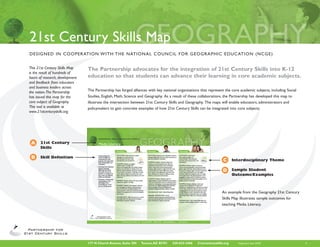
  • 1. 21st Century Skills Map DESIGNED IN COOPERATION W I T H T H E N AT I O N A L C O U N C I L F O R G E O G R A P H I C E D U C AT I O N ( N C G E ) This 21st Century Skills Map The Partnership advocates for the integration of 21st Century Skills into K-12 is the result of hundreds of hours of research, development education so that students can advance their learning in core academic subjects. and feedback from educators and business leaders across the nation. The Partnership The Partnership has forged alliances with key national organizations that represent the core academic subjects, including Social has issued this map for the Studies, English, Math, Science and Geography. As a result of these collaborations, the Partnership has developed this map to core subject of Geography. illustrate the intersection between 21st Century Skills and Geography. The maps will enable educators, administrators and This tool is available at policymakers to gain concrete examples of how 21st Century Skills can be integrated into core subjects. www.21stcenturyskills.org. A 21st Century Skills B Skill Definition C Interdisciplinary Theme D Sample Student Outcome/Examples An example from the Geography 21st Century Skills Map illustrates sample outcomes for teaching Media Literacy. 177 N Church Avenue, Suite 305 Tucson, AZ 85701 520-623-2466 21stcenturyskills.org Publication date: 05/09 1
  • 2. Geography and 21st Century Skills Based on key geographic This map provides opportunities to engage students and teachers in geographic concepts and principles and inquiry that align with contemporary methods and concepts for studying Earth in incorporating best classroom practices, this document suggests terms of its natural and human characteristics. ways to enhance classroom Geography integrates the study of the natural and human elements of Earth to reveal their complex relationships. Such concepts geography and skills relative and skills are incorporated in Geography for Life: The National Geography Content Standards (1994), with an updated 2nd to the demands of the 21st edition to be released in 2010. The study of the spatial relationships among the components of the human and physical systems century. It represents a starting is enhanced by using the latest and most reliable geographic information available through technology. The opportunities by point for ideas and discussions students and geographers to observe, synthesize, and present data from satellites, ground stations, and local observations represent with an eye to the future. collaborative processes within geography that are adding value to a wide range of interdisciplinary studies in the 21st century. Geography’s major contributions for 21st century skills development can be viewed through three lenses: 1) Scholarship; 2) Stewardship; and 3) Citizenship. Scholarship reflects geography’s continued quest for knowledge about Earth and its systems using the most appropriate technologies. Digital information and virtual representations of Earth and its systems are commonly applied in geographic scholarship. Stewardship reflects the concerns for the positive relationship between people and the environment through sustainable interactions. Responding to challenges of global changes in climate, population changes, natural resources availability, and land use are within the realm of stewardship. Citizenship reflects equipping every person with the necessary 21st century skills and access to information that will enable them to become responsible and effective in their active roles as citizens. Geography for Life: National Geography Standards 1994 (1994). Washington, DC: National Geographic Society (available through the store at www.ncge.org). It should be noted that most of the examples in this map are well-suited for cross-disciplinary approaches. For example, the ideas contained in this map can and should integrate student use of other core subjects including science, mathematics, language arts, history, art and world languages. 177 N Church Avenue, Suite 305 Tucson, AZ 85701 520-623-2466 21stcenturyskills.org Publication date: 11/08 2
  • 3. INFORMATION, MEDIA & TECHNOLOGY LITERACY Information Literacy 4th Grade 8th Grade 12th Grade • Accessing information OUTCOME: Accesses information OUTCOME: Evaluates information critically OUTCOME: Uses information accurately and efficiently and effectively, efficiently and effectively, evaluates and competently and uses information creatively for the issue or problem at hand evaluating information information critically and accurately and creatively for the critically and competently competently issue or problem at hand EXAMPLE: Students use images from the and using information web to compare and contrast classical and accurately and creatively EXAMPLE: Using a variety of EXAMPLE: Compare and contrast contemporary art by Dutch, French, U.S., Chinese, for the issue or problem sources (such as www.worldmapper.org, and shapes of different countries (e.g., Korean, Zimbabwean, and other artists that at hand www.nationmaster.com), and working in small Italy and Chile as elongated, Japan and portray geographic landscapes. Students analyze teams, students access information about places Indonesia as a string of islands, and Egypt and Earth’s landscapes (climatic events, volcanism, • Possessing a fundamental around the world and create a poster display, Spain as roughly square); students explain how vegetation, people using the land, resource understanding of the slideshow, or other multimedia presentation of the shape may affect political cohesiveness or a extraction) in art as evidence of environmental ethical/legal issues 3 selected variables (such as high tech exports, sense of civic attachment to the larger political change on a dynamic Earth. surrounding the access birth rate, percentage of youth in school) unit; discuss providing government services within and use of information and how those 3 selected variables compare compact countries compared to countries that EXAMPLE: Students compare and contrast between countries, and why. have territories scattered. Students analyze the natural and cultural scenes using repeat effects that country shape may have on the time photography as an art form that presents EXAMPLE: Students provide accurate citations and costs necessary to develop civic linkages in a evidence of geographic and environmental change. and references to the information they use country with scattered territories. from electronic and print sources to judge FIELD TRIP OPPORTUNITY: Local art authenticity. They reflect how errors and gaps EXAMPLE: Students discuss the impact that museum, or see fine arts digital images available can exist in the information that is gathered changes in communications, such as the Internet, on the web, including those from many countries by the UN, national statistics agencies, and by World Wide Web, cellular phones, etc., have on and cultures. other sources, and how those errors can be the flow of civic information in countries, such recognized and managed. as community issues and governmental response; forming responses to community emergencies. TECHNOLOGY USE: Web-based access OUTCOME: Possesses a to print information, graphics, maps, and SUPPORTING STRUCTURE: Web maps to fundamental understanding of the photographs. show countries with different shapes; classify ethical/legal issues surrounding countries on the map as compact or scattered. the access and use of information SUPPORTING STRUCTURE: Map the EXAMPLE: Students use widely OUTCOME: Accesses information distances and time necessary to support civic available public digital imagery from the web to efficiently and effectively, evaluates activities, NGOs, and citizen groups from the analyze the information that can be observed on information critically and competently national governmental center. the images, such as residences, swimming pools, banks, parking lots, and parks. The students then EXAMPLE: Students choose 3 countries discuss the ways that different people could from the book Hungry Planet, collect food labels use the information, such as land speculators, from their homes, analyze advertisements for 177 N Church Avenue, Suite 305 Tucson, AZ 85701 520-623-2466 21stcenturyskills.org Publication date: 05/09 3
  • 4. LEARNING & INNOVATION SKILLS Creativity and Innovation (continued) 4th Grade 8th Grade 12th Grade food, and use the web to classify information OUTCOME: Uses information accurately and burglars, or urban planners, and judge the ethical relative to the categories on the food pyramid; creatively for the issue or problem at hand and legal issues that may accompany the use of use digital map sources from the web to map geographic information. locations where their food is grown; and discuss EXAMPLE: After identifying a local issue how climate and culture play roles in food (i.e., recycling opportunities, congested traffic, EXAMPLE: Students evaluate the pros and cons production. They assess how natural events excessive litter in a park, noise pollution, water of the following arguments: (1) Should countries (hurricanes, floods) and human actions (wars, contamination, recreation facilities), students have the right to prohibit satellite images as land use) affect food production and distribution. conduct primary research, gather numerical satellites orbit across their territory? (2) Should data, convert it to statistical information (means, countries have the right to blur the satellite EXAMPLE: Students compare foods grown trends, correlations), present it in graphs, charts, images in areas deemed sensitive (nuclear power locally with foods grown in their 3 selected and maps, use software to develop community plants, military bases, etc.)? countries to analyze the spatial pattern of food digital data bases, and present a position on production and distribution. the issue by preparing an editorial slideshow EXAMPLE: Students evaluate the use of presentation for a local governing board, or satellite images to collect data on human rights EXAMPLE: Students analyze the spatial develop a website to use in presenting their violations such as mass graves, deforestation in patterns of food production and transportation position, and make a multimedia presentation for protected nature preserves, and cultivation of to judge the impact that agriculture has on the local service clubs, such a Kiwanis, Rotary, Library illegal crops, such as narcotics. natural environment. Guild, etc. EXAMPLE: Students discuss the spatial FIELD TRIP OPPORTUNITY: Local farm EXAMPLE: Exercise civic responsibility by arrangement of surveillance cameras to record or garden; local farmers market; digital maps taking a position on a local issue and support its activities at locations (parking lots, stores, malls, on the web to plot the spatial patterns of food resolution through participating in discussions, along streets, banks) in a geographical area and production and consumption. making presentations, being interviewed by media, the uses of the information and citizen’s rights and writing narratives to be published. (invasion of privacy, legal rights). FIELD STUDY OPPORTUNITY OR TECHNOLOGY USE: Remotely sensed OUTCOME: Uses information accurately and INDIVIDUAL STUDENT PROJECT: images and digital images of Earth’s surface creatively for the issue or problem at hand Local community issues may be observed and available on the web. recorded using digital cameras, surveys, and field EXAMPLE: Students gather original data, such measurements for analysis and presentation. as observations of local weather (temperature and precipitation) and climate (comparing daily with long term trends), and create digital graphs or charts to display the information. EXAMPLE: Using the web and archival sources students research historical weather patterns (temperature and precipitation) in the area and 177 N Church Avenue, Suite 305 Tucson, AZ 85701 520-623-2466 21stcenturyskills.org Publication date: 05/09 4
  • 5. LEARNING & INNOVATION SKILLS Creativity and Innovation (continued) 4th Grade 8th Grade 12th Grade create a graphical presentation (e.g.climograph), OUTCOME: Possesses a comparing the annual and daily variations using fundamental understanding of the values such as mean, maximum, and minimum for ethical/legal issues surrounding both temperature and precipitation. the access and use of information EXAMPLE: Discuss the authenticity and EXAMPLE: Students create an reliability of data from the U.S. Weather Service, address database of 3 types of such as how the information is collected, economic activities in their community stored, and used and its accuracy. Compare (service, governmental, production, and contrast the reliance on the collection processing), map those addresses with virtual of weather data remotely using ocean buoys, globe software such as ArcGIS Explorer, analyze satellites, automatic instrument stations, and the resulting geographic patterns, and assess weather stations with personnel in order to where gaps exist for a new business or service get coverage of many places on Earth. Students not currently available in the community (e.g.: fast describe that each weather station is connected food outlet; recycling center; big box store). to computers that process and store data. EXAMPLE: Develop and present a report using EQUIPMENT NEEDED: Have students build digital information focusing on responsible civic their own weather-gathering instruments; rely on land use in the community, such as parks, bicycle local remote weather reporting stations located paths, walking trails, canoe/water trails. at schools, industrial centers, and malls that are presented on websites. EXAMPLE: Apply civic questions to the land use decisions and resolve them through discussion SPEAKER OPPORTUNITY: Invite the local and debate, such as: Does this land use abide by TV weather person or meteorologist to speak zoning laws? Does the land use change traffic to the class. patterns and have unintended consequences? Is there an environmental impact on the site and FIELD TRIP OPPORTUNITY: Local weather adjacent land uses? station and/or Doppler radar center; TV weather broadcast studio. TECHNOLOGY USES: Digital images and maps from the web. FIELD STUDY OPPORTUNITY OR INDIVIDUAL STUDENT PROJECT: Use digital images to locate and classify economic activities and land uses. Make civic judgments regarding the proposal for land uses within a community. 177 N Church Avenue, Suite 305 Tucson, AZ 85701 520-623-2466 21stcenturyskills.org Publication date: 05/09 5
  • 6. INFORMATION, MEDIA & TECHNOLOGY LITERACY Media Literacy 4th Grade 8th Grade 12th Grade • Understanding how OUTCOME: Understands how media OUTCOME: Examines how individuals interpret OUTCOME: Understands how media messages are messages are constructed, for messages differently and how values and points of media messages are constructed, constructed, for what what purposes, and uses tools, view are included or excluded for what purposes, and uses tools, purposes and using which characteristics and conventions characteristics and conventions tools, characteristics and EXAMPLE: Students read and analyze the conventions EXAMPLE: Students use digital positions on environmental issues taken by EXAMPLE: Students make an weather maps to explain that organizations and posted on the web (green inventory of the way that geography • Examining how individuals severe and changing daily and weekly weather groups, conservative environmental groups, content (landscapes, globes, maps, land uses, interpret messages patterns are important in making sound civic property rights groups) to determine the issues cultural depictions, etc.) are used as company differently, how values decisions about individual and group activities, on which there are major differences, where logos, web sites, backdrops, screen savers, and points of view are such as sports, recreation , travel (e.g.: tornado there may be some agreement, and where the panoramas, etc. in the digital and print media and included or excluded and watch, severe weather, frost advisories, travel issues addressed are based on different values categorize them by media and content. Assess how media can influence delays, driving conditions, heat indexes, and wind relative to the natural environment. the appropriateness of the geography content beliefs and behaviors advisories). used as a backdrop relative to the expectations • Possessing a fundamental EXAMPLE: Students develop a plan for (criteria) that people use for getting a person’s EXAMPLE: Students discuss the ways people implementing an environmentally-focused project attention. understanding of the respond to weather warnings. in the local community such as protecting a local ethical/legal issues wetland or developing an urban greenway along a EXAMPLE: Students develop criteria and surrounding the access EXAMPLE: Students use computer software stream that uses digital mapping, data collection, compare their preferences for logos and and use of information and web pages to create an announcement land use analysis, economic development, backdrops in advertisements with those of that promotes the recycling of plastics and population change, and other relevant variables. others in their class to discover patterns about other materials in the local community, and the the uses of geography to set tone and emotional beneficial consequences for the local and global TECHNOLOGY USE: World Wide Web. context in advertising. (i.e., auto commercials environment. often use salt flats, energy commercials often SPEAKER OPPORTUNITY: Invite show drilling rigs, bottled water often uses TECHNOLOGY USE: The Internet to review individuals representing environmental and non- mountain settings, etc.). and analyze the civic importance of weather environmental perspectives on the future of the information; Computer software. local community to speak to the class. TECHNOLOGY USE: World Wide Web and computer software; Digital and print advertising. 177 N Church Avenue, Suite 305 Tucson, AZ 85701 520-623-2466 21stcenturyskills.org Publication date: 05/09 6
  • 7. LEARNING & INNOVATION SKILLS Media Literacy (continued) 4th Grade 8th Grade 12th Grade OUTCOME: Examines how individuals OUTCOME: Possesses a OUTCOME: Examines how individuals interpret messages differently and how values fundamental understanding of the interpret messages differently and how values and points of view are included or excluded ethical/legal issues surrounding and points of view are included or excluded the access and use of information EXAMPLE: Students read geography content EXAMPLE: Students compare based literature about a topic written by EXAMPLE: Students apply and contrast the ways to apply different authors and compare and contrast the Geographic information Systems (GIS) technology repeat photography and digital perspectives on the topic. using specific GIS software or digital maps on the mapping to build a rationale for web to play the role of a geography consultant. public and private decisions on EXAMPLE: Students compare and contrast the Using ethical and legal procedures, the consultant community issues that result in long influences of well-illustrated books compared must select the location for a new youth center term environmental and economic advantages or to books with few illustrations of geography (or another appropriate activity) in the local disadvantages for citizens (e.g.: site and situation content or the inclusion of maps to analyze the community where they must consider distance, analysis for a public hearing to rezone land for ways that different values and points of view may nearby land uses, nearby businesses, traffic a new use; spatial pattern of displacement of be presented. patterns, population distribution and density, housing, businesses, streets in favor of a new land and available sites to arrive at their final site use activity). EXAMPLE: Students critically analyze books recommendations. by cross checking information against other EXAMPLE: Students select examples of repeat sources, such as the web, to determine accuracy EXAMPLE: Students develop a plan for imaging of the landscape and analyze digital and fairness in the presentation of geographic implementing an environmentally-focused project imagery (aerial photographs) showing ethical information. in the local community such as protecting a local practices of landscape restoration that provide wetland or developing an urban greenway along a sustainable benefits to society (e.g.: benefits of SUPPORTING STRUCTURE: Content based stream that uses digital mapping, data collection, investment in reducing soil erosion; sustainable literature for elementary grades; confer with land use analysis, economic development, use of former environmental cleanup sites; librarian. population change, and other relevant variables. socially constructed environments and land uses; urban restoration). TECHNOLOGY USE: Use websites to search TECHNOLOGY USE: : Examples of titles of age appropriate books on geography. applications of Geographic Information Systems WORLD WIDE WEB: Search repeat (GIS) and their uses. photography topics for early and present images of landscapes to provide evidence of change, improved business practices, and entrepreneurial activities. 177 N Church Avenue, Suite 305 Tucson, AZ 85701 520-623-2466 21stcenturyskills.org Publication date: 05/09 7
  • 8. LEARNING & INNOVATION SKILLS Media Literacy (continued) 4th Grade 8th Grade 12th Grade OUTCOME: Possesses a fundamental understanding of the ethical/legal issues surrounding the access and use of information EXAMPLE: Students research the number of TV and radio programs and languages reported for a specific day or week for broadcasts within the United States by researching data from the World Wide Web (Federal Communications Commission Licensing, programming information) and map the information to present the diversity of language use globally and in the USA. (via www.mla.org/maps) TECHNOLOGY USE: World Wide Web: Research language diversity in broadcast TV and radio by state using digital database development, digitally based mapping and graphing. 177 N Church Avenue, Suite 305 Tucson, AZ 85701 520-623-2466 21stcenturyskills.org Publication date: 05/09 8
  • 9. INFORMATION, MEDIA & TECHNOLOGY LITERACY ICT Literacy 4th Grade 8th Grade 12th Grade • Using digital technology, OUTCOME: Uses digital technology, OUTCOME: Uses digital technology, OUTCOME: Uses digital technology, communication tools and/ communication tools and/or networks communication tools and/or networks communication tools and/or networks or networks appropriately appropriately to access, manage, integrate, appropriately to access, manage, and integrate appropriately to access information in order to to access, manage, evaluate, and create information in order to information in order to function in a function in a knowledge economy integrate, evaluate, and function in a knowledge economy knowledge economy create information in EXAMPLE: Students use country digital order to function in a EXAMPLE: Students compare and contrast EXAMPLE: Students use digital population data databases from websites to analyze the knowledge economy aerial and ground photographs of their own for the United States to analyze the population relationships between Gross Domestic Product community to identify and classify the changes distribution of the country in 1860 and 1870, (GDP) and the percentage of the population • Using technology as that have occurred over time (e.g.: the size of copy and paste the data and organize it using engaged in agriculture for different regions of a tool to research, the place in area; the land uses; types of buildings; a spreadsheet, rank the states from highest to the world. The data may be categorized into organize, evaluate and number and locations of schools, churches, and lowest in population, develop quartiles (group quartiles and entered by category on digital communicate information, retail stores) and prepare a digital graph or states on population size into quarters), color maps to visualize the spatial patterns between and understanding of table that summarizes the changes. They then code the quartiles on maps for each year, and the variables. Recommendations regarding the the ethical/legal issues compare the changes in their own community use the maps to write a narrative describing the role of agriculture in the improvement of the surrounding the access to one other community in a different state and changes in population distribution before and GDP may be discussed and economic alternatives and use of information compare the similarities and differences. after the Civil War. proposed based on the comparisons of the data. Alternatives for the improvement of GDP may be EXAMPLE: Students conduct research and TECHNOLOGY USE: Internet, archival discussed further through networks of students prepare a project booklet focusing on “our sources of data such as the Census Bureau, both in the United States and in the region or community and how it has changed” using digital http://fisher.lib.virginia.edu/collections/stats/ country being studied. Students will reflect upon sources and software to distribute the final histcensus/, the National Historical GIS the impact of proposed changes on the social and product in electronic form on a website and/or (www.nhgis.org), and Social Explorer (www. cultural fabric of the region. in print. socialexplorer.com). TECHNOLOGY USE: Web: Worldmapper TECHNOLOGY USE: Internet, historical (www.worldmapper.org) , Nation Master (www. image archives of maps, photographs, nationmaster.com), United Nations economic newspapers, special library collection, State OUTCOME: Uses technology as a tool to information data bases; http://unstats.un.org/ library collection; community archivist, local research, organize, evaluate and communicate unsd/demographic/products/socind/inc-eco. librarian, state departments of natural information, and understands the ethical/ htm and http://www.nationmaster.com/graph/ resources, museums. legal issues surrounding the access and use of lab_emp_in_agr_of_tot_emp-labor-employment- information. agriculture-total. EXAMPLE: Use the World Wide Web to locate health services (medical, dental, and mental health) in the local community (physicians, hospitals, immediate care clinics) and online local commercial yellow pages, so that two sources 177 N Church Avenue, Suite 305 Tucson, AZ 85701 520-623-2466 21stcenturyskills.org Publication date: 05/09 9
  • 10. LEARNING & INNOVATION SKILLS ICT Literacy (continued) 4th Grade 8th Grade 12th Grade have been used to ensure the integrity of the data. OUTCOME: Uses digital technology, Map the locations of health services using a web communication tools and/or networks based digital map (or in 3D using ArcGIS Explorer appropriately to access, manage, integrate, or Google Earth) to display the spatial patterns evaluate, and create information in order to of health services. Analyze the spatial pattern of function in a knowledge economy health services to determine if any geographic areas or ethnic groups in the local community are EXAMPLE: Students use data and maps underserved. prepared in a geographic information system to compare and analyze alternative land use TECHNOLOGY USE: World Wide Web, proposals and communicate conclusions using Online Yellow Pages (such as www.dexknows.com); tools such as advanced multimedia applications GIS software. and video technologies. EXAMPLE: Students identify and locate on digital maps the sites of webcams that provide OUTCOME: Uses networks information about patterns of interaction among appropriately to access, manage, people and environmental monitoring. They integrate, evaluate, and create analyze the types of geographical information information in order to function presented and construct a recording and in a knowledge economy. observation plan to digitally collect and map remotely sensed information (the daily and EXAMPLE: Students network with another weekly commuting patterns in a large city; the school or other students in the same political environmental changes over several months jurisdiction to plan citizen awareness and action in a wildlife preserve; the observable weather activities in support of a particular issue that will patterns from geographically varied locations be determined in a future election, such as an such as mountains, plains, and coastlines; educational bond election, state appropriation for incubation and growth of bald eagles and other education, gender equality in sports, length of the species). Information observed is categorized, school year, and continuation of community youth processed and presented in digital and image programs. Use is made of the Internet, World Wide formats on class and school Web pages as Web, cellular telephones, digital communications, posters and projects. and blogging to develop a systematic plan with goals, a strategy, and future steps. TECHNOLOGY USE: Web cams, digital maps, and information retrieval. TECHNOLOGY USE: Web networking, including blogging and organizing groups to support issues of importance. 177 N Church Avenue, Suite 305 Tucson, AZ 85701 520-623-2466 21stcenturyskills.org Publication date: 05/09 10
  • 11. LEARNING & INNOVATION SKILLS ICT Literacy (continued) 4th Grade 8th Grade 12th Grade OUTCOME: Uses technology as a tool to OUTCOME: Uses technology as a tool to research, organize, evaluate and communicate organize and communicate information, and information, and understands the ethical/ demonstrates understanding of the ethical/ legal issues surrounding the access and use of legal issues surrounding the access and use of information information EXAMPLE: Students access information on the EXAMPLE: Students World Wide Web regarding an environmental organize an electronic forum issue that is the cause for different positions that includes a network of and perspectives by different groups (e.g., students in other communities global climate change; energy sources; non- to evaluate the humanitarian governmental organizations’ position on issues; response to a natural disaster or conflict. They prominent individuals’ positions on issues). The apply ethical standards in the collection of students identify the positions of each group information regarding the geographical context or person and then compare and contrast the of the event and the people involved and positions on the issue, considering the special validate the digital data by cross referencing interests that a particular group may represent sources. Digital maps and images and on-site by researching the public information available information accessible through electronic through web database sources. Declarations contacts with relief agencies and individuals of intent and affiliation are a legal and ethical are used to ascertain the practical and legal responsibility of groups and individuals that aspects for providing assistance to people students evaluate. affected by the event. TECHNOLOGY USE: Interpreting and TECHNOLOGY USE: World Wide Web judging information from the World Wide Web: geographical data, digital news reports, validating and verifying the geographic validity scientific information regarding natural events of positions taken by different groups on an and news releases regarding conflict; web sites environmental issue. for relief agencies. 177 N Church Avenue, Suite 305 Tucson, AZ 85701 520-623-2466 21stcenturyskills.org Publication date: 05/09 11
  • 12. LIFE AND C AREER SKILLS Flexibility & Adaptability 4th Grade 8th Grade 12th Grade • Adapting to varied roles OUTCOME: Adapts to varied roles and OUTCOME: Works effectively in OUTCOME: Works effectively in a and responsibilities responsibilities a climate of ambiguity climate of ambiguity • Working effectively in a EXAMPLE: While preparing a group EXAMPLE: When comparing EXAMPLE: Students use blogs climate of ambiguity and presentation about what makes the geography demographics of U.S. cities and to engage in dialogue about an changing priorities of their local community unique, students decide states, students gather and critically analyze issue of importance to them, what data need to be collected, discussing the information from a variety of sources and such as sustainability efforts at roles needed to carry out their assignment, understand (and “tolerate”) how and why data a local university campus, health identifying the skills needed, and discussing may not be consistent, e.g., from two different problems in their local community among themselves how to best match their sources, the population of Los Angeles may vary (such as asthma or diabetes), or talents and learning styles to the needed from 3.5 million (within city limits) to nearly 10 immigration policies in their state, demonstrating skill sets. million (metro area). understanding, tolerance, and respect for the points of view of others. FIELD TRIP OPPORTUNITY: Local Community. TECHNOLOGY USE: Online bulletin boards. INSTRUCTIONAL OPPORTUNITY: Combine students of various learning styles and strengths in multiple intelligences in each group. OUTCOME: Works effectively with changing priorities EXAMPLE: Students use online historical and contemporary maps and aerial photographs to document how land use, transportation, and urbanization have changed over time, and what it might look like in the future. They will examine how the priorities of what one group wants the future of the community to be might be different from the priorities of another group (i.e. one group might want the community to remain rural, while another group might want the community to become a bedroom community for an adjacent metropolitan area). 177 N Church Avenue, Suite 305 Tucson, AZ 85701 520-623-2466 21stcenturyskills.org Publication date: 05/09 12
  • 13. LIFE AND C AREER SKILLS Flexibility & Adaptability (continued) 4th Grade 8th Grade 12th Grade TECHNOLOGY USE: Investigating online maps hosted by historical societies, local governments, university map libraries, and commercial sources (such as http://historical. maptech.com). 177 N Church Avenue, Suite 305 Tucson, AZ 85701 520-623-2466 21stcenturyskills.org Publication date: 05/09 13
  • 14. LIFE AND C AREER SKILLS Initiative & Self-Direction 4th Grade 8th Grade 12th Grade • Monitoring one’s own OUTCOME: Monitors one’s own OUTCOME: Monitors one’s own understanding OUTCOME: Monitors one’s own understanding understanding and understanding and learning needs and learning needs and learning needs learning needs EXAMPLE: As a result of a mapping skills EXAMPLE: As a result of studying a historic EXAMPLE: Using a GIS (Geographic Information • Going beyond basic unit, students create an age-appropriate event, students create an age-appropriate System), students prepare maps using different mastery of skills and/ electronic portfolio of maps that describe their electronic portfolio of historic maps and other classification methods of a single phenomenon or curriculum to explore local community, and write a reflective essay geographic perspectives related to the historic (such as the percent of school-age population by and expand one’s own explaining how selected portfolio pieces indicate event and write a reflective essay explaining county in the USA, or the percent of agricultural learning and opportunities what they have learned about specific topics how selected portfolio pieces describe how land by county in the USA), including equal to gain expertise related to their community’s history, landforms, what they have learned historically is related to area, natural breaks, standard deviation, quantile, • Demonstrating initiative climate, people, government, and vegetation, and the geography of the region. The essay needs and manual. In conjunction with readings from to advance skill levels also the topics that they would like to learn to include a reflection on the new skills and the book How To Lie With Maps, reflect how towards a professional more about in the coming years. knowledge the student acquired in the process, different classification methods affect how that level the additional skills and knowledge they would phenomenon is understood. Reflect on how like to explore further, and the resources that the data as shown by the histogram affects how • Defining, prioritizing and they might use to acquire those skills. those data are shown on maps. Reflect further completing tasks without OUTCOME: Explores and expands one’s own how maps are powerful phenomena that can direct oversight learning and opportunities to gain expertise TECHNOLOGY USE: Electronic portfolio. purposely or inadvertently mislead or inform different audiences. Reflect on the skills and • Utilizing time efficent EXAMPLE: After examining online weather knowledge they have gained in creating these efficiently and managing reports and satellite imagery, students use different maps, and what areas they see as workload OUTCOME: Demonstrates initiative to advance latitude and longitude data to track the important to how they will critically examine • Demonstrating movement of common weather fronts over a skill levels towards a professional level maps in the future, especially post high school. commitment to learning week’s time period across the continental USA, as a lifelong process and use ArcExplorer or other GIS (Geographic EXAMPLE: Students use time sequence of TECHNOLOGY USE: Electronic portfolio. Information System) to map the latitude- remotely-sensed satellite images to identify longitude data that they have gathered. changes in the forests of Colorado over time, identifying areas infested with pine beetles. They should interview one U.S. Forest Ranger using remote Internet and a computer camera to survey the forests that they identify as most severely impacted, discovering what skills and resources the forest rangers gain and use to help mitigate these invasive beetles. PROFESSIONAL DEVELOPMENT FOR TEACHERS: How to access and read remotely- sensed images. 177 N Church Avenue, Suite 305 Tucson, AZ 85701 520-623-2466 21stcenturyskills.org Publication date: 05/09 14
  • 15. LIFE AND C AREER SKILLS Initiative & Self-Direction (continued) 4th Grade 8th Grade 12th Grade OUTCOME: Utilizes time efficiently and OUTCOME: Demonstrates commitment to OUTCOME: Demonstrates initiative to manages workload learning as a lifelong process advance skill levels towards a professional level EXAMPLE: On a weekly basis, students draw EXAMPLE: Students examine the magnitude of EXAMPLE: Students interview a map of the USA, gradually constructing a map the stars each evening for two weeks, (1) assessing local health officials, and/or portfolio, including one new layer each week, the amount of light pollution in their community, interact with experts at a distance with the goal that the final portfolio of maps (2) comparing their community to the amount to understand how health include the following items; landforms, climate, of light pollution in other communities using the agencies collect appropriate data. vegetation, population, ethnicity, agriculture, and Globe at Night project, and (3) comparing the Students then access publicly available median age. These 7 layers need to be planned magnitude as affected by the phases of the moon. data in map and tabular form from the Center and constructed as the units are introduced They make predictions as to how the community’s for Disease Control, use a GIS (Geographic and turned in at the end of each 2 week period light pollution compares to other communities Information System) to monitor the spread of during the semester. and how the magnitude will be affected by the last disease within a region, and reflect upon (1) two weeks of the lunar phase cycle. how maps are similar and different from tables, and (2) how CDC officials use data in map and TECHNOLOGY USE: Online resources. tabular form. TECHNOLOGY USE: GIS. OUTCOME: Utilizes time efficiently and manages workload OUTCOME: Defines, prioritizes, and completes EXAMPLE: On a quarterly basis, students tasks without direct oversight examine phonological (cyclical seasonal patterns) data and remotely sensed imagery of the advance EXAMPLE: To test the law of retail gravitation and contraction of the “greenness index”, which (i.e., the number of visits a resident makes shows the greening up of deciduous vegetation to competing shopping centers is inversely across North America as the seasons change. proportional to the distances between residence They predict and assess why and how the seasons and center and proportional to the size of affect the changes in vegetation, and why the the center), students work in small groups to vegetation does not change uniformly with latitude conduct a community survey of a retail area’s across the USA. Rather, vegetation is affected by “retail gravity” on a non-school attendance day. precipitation, the ecoregion, and the elevation. Students develop a project plan, assign roles and They must plan their work so that they can timelines, and develop a rubric for their work conduct this assessment on a quarterly basis as with minimal guidance from their teacher. close to the equinoxes and solstices as possible. 177 N Church Avenue, Suite 305 Tucson, AZ 85701 520-623-2466 21stcenturyskills.org Publication date: 05/09 15
  • 16. LIFE AND C AREER SKILLS Social & Cross-Cultural Skills 4th Grade 8th Grade 12th Grade • Working appropriately OUTCOME: Works appropriately and OUTCOME: Works appropriately OUTCOME: Works appropriately and and productively with productively with others and productively with others productively with others others EXAMPLE: Students divide themselves into EXAMPLE: Students work on a EXAMPLE: Students work on • Leveraging the collective teams to prepare a class news report exploring team to investigate the major types a team to prepare a multimedia intelligence of groups a key economic issue facing a particular world of natural hazards present in their community. presentation on one toxic and when appropriate region, such as regulating the lion population Using a GIS (Geographic Information System) hazardous material, discussing how • Bridging cultural while trying to raise cattle in Kenya. Students and selecting one of these hazards, they prepare it affects the local community, how it differences and using determine who will do which type of research, appropriate maps and a community response plan affects the global community, why it is created and differing perspectives to who will do the presenting, who will film in the event of a natural disaster in the chosen used, and how it is handled, moved, processed, and increase innovation and the presentation, who will show the final hazard. After presenting their findings to the stored at a local and a global scale. The materials the quality of work presentation video to the class, and how they class and hearing the hazards chosen by the other could be those used in dry cleaning, in gas stations, will collect feedback from the rest of the class groups, they discuss how their hazard response in power plants, in university biology labs, and in via a class survey. plan is similar to and different from those plans other common settings. They will use OSHA’s developed with other hazards as their main focus. resources to determine the chemical’s toxicity. Based on an actual issue, as reported on Sixty They consider the types of hazards present in They will prepare their report for the EPA and Minutes (March 29, 2009). other communities in other parts of the USA and present it to their peers in class. Their peers in other parts of the world. in class act as EPA representatives, and prepare questions that the presenter must answer about TECHNOLOGY USE: GIS. their chosen material. OUTCOME: Leverages the collective intelligence of groups when appropriate TECHNOLOGY USE: Multimedia presentation. EXAMPLE: Students in the class role-play OUTCOME: Bridges cultural differences and citizens in a town meeting where members uses differing perspectives to increase innovation of the community express different points of and the quality of work OUTCOME: Bridges cultural view about a local issue, such as the location differences and uses differing of a new school, building a bypass for traffic, EXAMPLE: Students write a dialogue between perspectives to increase or a re-zoning of downtown to be “pedestrian different people who use water resources in a innovation and the quality of work only” without vehicles, etc. They decide which region, including a farmer/rancher, a manufacturer, roles are needed, who will play each role, what a parent concerned about pesticide runoff, and an EXAMPLE: Students create a website with information is required to understand the owner of 20 car washes in the region. Students guidelines and information for humanitarian aid viewpoint of each role, and how that role will be reflect on the common concerns of these 4 workers to assist them with the transition to presented to the rest of the class. groups, and the differences between these 4 living in one chosen different culture other than groups of people. What common themes could the USA. bring these groups together to form a community water board? TECHNOLOGY USE: Internet, Digital libraries. 177 N Church Avenue, Suite 305 Tucson, AZ 85701 520-623-2466 21stcenturyskills.org Publication date: 05/09 16
  • 17. LIFE AND C AREER SKILLS Social & Cross-Cultural Skills (continued) 4th Grade 8th Grade 12th Grade OUTCOME: Bridges cultural differences OUTCOME: Bridges cultural differences and uses differing perspectives to increase innovation EXAMPLE: As students study and the quality of work countries around the world, they list the predominant language EXAMPLE: Students conduct research on a spoken; at the end of the school native culture of North America, and one of year, students tabulate and map South America, investigating why motifs, artwork, major languages. Students discuss and materials were similar and were different, and how physical and cultural geography (including how the artwork represented the culture. They electronic communication) has shaped the origin create a multimedia report showing their findings and spread of language groups of the world, and and present these findings to their class. They what the world language map might look like work in the school’s art classroom to create one 100 years from the present. object (sculpture, painting, wood carving, etc) that reflects one of their two chosen cultures. GUEST SPEAKER OPPORTUNITY: Invite speakers of other languages to speak FIELD TRIP OPPORTUNITY: Visit an art or about the language and culture of their country, anthropological museum to see authentic artistic helping students learn numbers (or colors, representations of past cultures. months, names of countries, etc.) in the guest speaker’s language. ENGLISH AS SECOND LANGUAGE STUDENTS: Have students share their native language and discuss what it is like to be bilingual. 177 N Church Avenue, Suite 305 Tucson, AZ 85701 520-623-2466 21stcenturyskills.org Publication date: 05/09 17
  • 18. LIFE AND C AREER SKILLS Productivity & Accountability 4th Grade 8th Grade 12th Grade • Setting and meeting high OUTCOME: Sets and meets high standards OUTCOME: Sets and meets high standards and OUTCOME: Sets and meets high standards and standards and goals for and goals for delivering quality work on time goals for delivering quality work on time goals for delivering quality work on time delivering quality work on time EXAMPLE: Students develop and execute EXAMPLE: Students actively participate in EXAMPLE: Students create a high-quality set a plan to gather data about the height, girth, international investigation projects, such as of digital maps, including data that the students • Demonstrating diligence species, and health of all trees in a specified GLOBE, in which student participants are held have gathered in the local community, to submit and a positive work ethic geographic area—on their school campus, or responsible for the quality of the data they to an agency outside the classroom, e.g., for a (e.g., being punctual and in a local park. First, they conduct research as submit. The data could range from pH of soil national contest (such as the ESRI Community reliable) to the aesthetic, environmental, and property on their school grounds to daily readings of Mapping program), the local newspaper, or for value of urban trees, and how communities temperature and precipitation over a month’s a community member’s presentation to the city use and value tree inventories. They then use time period. council. The topic could be the conversion of GPS hand held receivers in small groups to abandoned big box stores to community uses, record the location of the trees and create TECHNOLOGY USE: Internet. the creation of a bike trail along an abandoned a spreadsheet with the tree data that they railway line, or another project aligned with will map using a GIS (Geographic Information the themes of geography such as movement or System). They will assess the pattern that they human-environment interaction. see as a result of mapping their data, and create OUTCOME: Demonstrates diligence and a a tree management plan for their campus or positive work ethic TECHNOLOGY USE: Digital Map. park to ensure that tree cover will increase in the future. They will share this database with EXAMPLE: Students initiate EXAMPLE: Students gather, map, and analyze school groundskeepers, community foresters, and carry out a long-term data from police records, e.g., crime, and other municipal managers at a scheduled community-mapping project accident, or graffiti, and overlay board meeting. whereby students, in collaboration other variables to detect and with a community partner, use interpret any spatial and temporal TECHNOLOGY USE: GPS, GIS. spatial locations instruments such as GPS units, patterns, and share results with schedule meetings, and manage timelines and the community at a local meeting. deliverables to create a product for use in the Students must geocode the addresses community. The community partner could be of the police records to the correct location, and a librarian, city planning official, or community reflect on the quality and completeness of the board member. The product created could data received from the police department. They be an assessment of the city’s attempts to make recommendations as to how the crime or develop greenways along its major rivers, the accident analyzed could be mitigated, and how city’s attempts to create bikeways along specific the geographic perspective aids in understanding thoroughfares, or the city’s attempts to plant low- the phenomenon. water plants at its public building grounds. TECHNOLOGY USE: GPS, GIS. 177 N Church Avenue, Suite 305 Tucson, AZ 85701 520-623-2466 21stcenturyskills.org Publication date: 05/09 18
  • 19. LIFE AND C AREER SKILLS Productivity & Accountability (continued) 4th Grade 8th Grade 12th Grade OUTCOME: Demonstrates diligence and a positive work ethic EXAMPLE: Students read a series of fiction books/short stories about other cultures according to an assigned schedule. They then discuss their impressions and conclusions via email/Facebook/Skype with students in other cities and countries about the same reading. They develop chat rooms and networks and make commitments to other students in other locations to analyze the presentation of other groups within literature. TECHNOLOGY USE: Email, Facebook, Skype. 177 N Church Avenue, Suite 305 Tucson, AZ 85701 520-623-2466 21stcenturyskills.org Publication date: 05/09 19
  • 20. LIFE AND C AREER SKILLS Leadership & Responsibility 4th Grade 8th Grade 12th Grade • Using interpersonal and OUTCOME: Leverages strengths OUTCOME: Demonstrates OUTCOME: Uses interpersonal and problem- problem-solving skills to of others to accomplish a integrity and ethical behavior solving skills to influence and guide others influence and guide others common goal toward a goal toward a goal EXAMPLE: After reading fiction EXAMPLE: After gathering and non-fiction novels about EXAMPLE: Working in groups, • Leveraging strengths of data from reliable Internet and contemporary young refugees in students develop a strategy to others to accomplish a traditional sources to describe and various situations around the world, students substitute alternative sustainable common goal assess the impact of litter in the community, participate in simulation or role-playing activities for present economic • Demonstrating integrity students design and implement a community activities in which they grapple with the ethics activities in regions of significant and ethical behavior service project, (e.g., brochure, posters, etc.), to of complex issues, such as the refugee crisis in resource depletion, e.g., fisheries off of the raise awareness of this issue. They also reflect Sudan or elsewhere. Grand Banks of Canada, logging in the Pacific • Acting responsibly with on the accuracy of the data sources that they Northwest, or extensive irrigation practices in the interests of the larger analyzed. desert climates of Uzbekistan or Arizona. They community in mind share their results with local officials or with local media. OUTCOME: Demonstrates integrity and ethical behavior OUTCOME: Demonstrates integrity and EXAMPLE: While studying ethical behavior countries around the world, students establish ongoing communication with students EXAMPLE: While studying contemporary from other countries (via letters, email, or political and economic alliances, students explain electronic bulletin boards) to learn about how these affect the traditional cohesiveness how cultures are the same and different, (e.g., of world cultures and discuss ethical issues language, clothing, music, activities, etc.). They associated with the loss of diverse cultures. They will begin the communication with generative apply what they have learned globally to conduct questions such as “Where do your clothes an in-depth study of how one culture is grappling come from? Where does your food come with globalization, and they demonstrate their from? What activities do you engage in after understanding with a multimedia presentation school?”, etc. They write reports to summarize (using Windows Movie Maker or iMovie) of the their findings and discuss the similarities and implications that this has for other cultures. differences. TECHNOLOGY USE: Email, Electronic bulletin board. 177 N Church Avenue, Suite 305 Tucson, AZ 85701 520-623-2466 21stcenturyskills.org Publication date: 05/09 20
  • 21. LIFE AND C AREER SKILLS Leadership & Responsibility (continued) 4th Grade 8th Grade 12th Grade OUTCOME: Acts responsibly with the interests of the larger community in mind EXAMPLE: Students propose and discuss specific actions that can help alleviate an environmental problem or relevant community issue and the likely consequences of such actions, e.g., recycling, biking to school, reducing consumption, buying local products, etc. They conduct research as to how a citizen proposal to the city council needs to be formatted, and use that format to create their recommendations. They record a video of themselves making their recommendations to the council, and send the video to the council before the council’s next meeting. 177 N Church Avenue, Suite 305 Tucson, AZ 85701 520-623-2466 21stcenturyskills.org Publication date: 05/09 21