SlideShare ist ein Scribd-Unternehmen logo
1 von 17
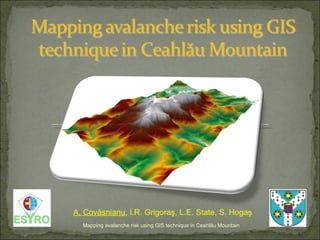
Mapping avalanche risk using GIS technique in Ceahl ă u Mountain A. Cov ăsnianu , I.R. Grigoraş, L.E. State, S. Hogaş
[object Object],[object Object],[object Object],[object Object],[object Object],[object Object],[object Object],[object Object],Mapping avalanche risk using GIS technique in Ceahl ă u Mountain
[object Object],[object Object],Mapping avalanche risk using GIS technique in Ceahl ă u Mountain Concept ,[object Object],[object Object],[object Object],[object Object],Past background  in Romania ,[object Object],[object Object],[object Object],[object Object]
 
[object Object],[object Object],[object Object],[object Object],Mapping avalanche risk using GIS technique in Ceahl ă u Mountain
[object Object],[object Object],[object Object],[object Object],Mapping avalanche risk using GIS technique in Ceahl ă u Mountain
[object Object],[object Object],[object Object],[object Object],[object Object],[object Object],[object Object],[object Object],[object Object],Mapping avalanche risk using GIS technique in Ceahl ă u Mountain
Mapping avalanche risk using GIS technique in Ceahl ă u Mountain ,[object Object],[object Object],[object Object]
Mapping avalanche risk using GIS technique in Ceahl ă u Mountain Aspect map The South, South-West and South-East versants are the most representative  due to the fact that the avalanche risk is higher in those areas.
Mapping avalanche risk using GIS technique in Ceahl ă u Mountain Landforms map  describes the concavit y/convexity of the terrain.  The landform is very useful for snow avalanche risk because it determines the probable snow accumulation  areas  or the possible areas of propagation . The concave  areas  are mostly represented by the bed’s rivers.  The convex  one’s ,  in general ,  are represented by the highest slope values.
[object Object],[object Object],[object Object],[object Object],[object Object],Mapping avalanche risk using GIS technique in Ceahl ă u Mountain
Mapping avalanche risk using GIS technique in Ceahl ă u Mountain The higher probability of producing a snow avalanche is near Toaca Peak and close to Dochia chalet.  Avalanche risk classes: 0-5 = low risk  (tourism activity not forbidden in winter season) 5-10 = moderate risk  (tourism activity permitted only for experienced users) 10-15 = considerable risk  (tourism activity admitted under certain conditions) 15-20 = high risk  (restricted under certain conditions).
Mapping avalanche risk using GIS technique in Ceahl ă u Mountain - The tourist tracks were obtained by GPS technique - Any of  those three tourist tracks passes through areas with avalanche risk
Mapping avalanche risk using GIS technique in Ceahl ă u Mountain
[object Object],[object Object],[object Object],[object Object],Mapping avalanche risk using GIS technique in Ceahl ă u Mountain
[object Object],[object Object],Problems occurred : Future abordation : ,[object Object],[object Object],[object Object],Mapping avalanche risk using GIS technique in Ceahl ă u Mountain

Weitere ähnliche Inhalte

Was ist angesagt?

GIS LANDSLIDES ANALYSIS ii
GIS LANDSLIDES ANALYSIS iiGIS LANDSLIDES ANALYSIS ii
GIS LANDSLIDES ANALYSIS iiEdmundo Zevallos
 
Spatial Technology Resources for Teachers
Spatial Technology Resources for TeachersSpatial Technology Resources for Teachers
Spatial Technology Resources for TeachersRebecca Nicholas
 
INFRARISK. Novel Indicators for identifying critical INFRAstructure at RISK f...
INFRARISK. Novel Indicators for identifying critical INFRAstructure at RISK f...INFRARISK. Novel Indicators for identifying critical INFRAstructure at RISK f...
INFRARISK. Novel Indicators for identifying critical INFRAstructure at RISK f...Infra Risk
 
GeoAvalanche Avalanche danger index processing
GeoAvalanche Avalanche danger index processingGeoAvalanche Avalanche danger index processing
GeoAvalanche Avalanche danger index processingGeobeyond
 
Using Spatial Technologies in the Geography Classroom
Using Spatial Technologies in the Geography ClassroomUsing Spatial Technologies in the Geography Classroom
Using Spatial Technologies in the Geography ClassroomRebecca Nicholas
 
Geography school talk on GIS, mapping, spatial analytics, industry applicatio...
Geography school talk on GIS, mapping, spatial analytics, industry applicatio...Geography school talk on GIS, mapping, spatial analytics, industry applicatio...
Geography school talk on GIS, mapping, spatial analytics, industry applicatio...Thierry Gregorius
 
Application of GIS
Application of GISApplication of GIS
Application of GISRohit Pant
 
Geographic Information Systems in the Oil & Gas Industry
Geographic Information Systems in the Oil & Gas IndustryGeographic Information Systems in the Oil & Gas Industry
Geographic Information Systems in the Oil & Gas IndustryFrancois Viljoen
 
WHAT'S THERE IN GEOMATICS ENGINEERING???
WHAT'S THERE IN GEOMATICS ENGINEERING???WHAT'S THERE IN GEOMATICS ENGINEERING???
WHAT'S THERE IN GEOMATICS ENGINEERING???Nepal Flying Labs
 
Urbanization of mancherial town
Urbanization of mancherial town Urbanization of mancherial town
Urbanization of mancherial town avinash111d
 
Geospatial Applications in Civil Engineering
Geospatial Applications in Civil EngineeringGeospatial Applications in Civil Engineering
Geospatial Applications in Civil EngineeringSriharsha Rangineni
 
Application of gis and gps in civil engineering
Application of gis and gps in civil engineeringApplication of gis and gps in civil engineering
Application of gis and gps in civil engineeringAvinash Anand
 
Introduction To and Arcaeological Apps of GIS
Introduction To and Arcaeological Apps of GIS Introduction To and Arcaeological Apps of GIS
Introduction To and Arcaeological Apps of GIS Jo Dyson
 

Was ist angesagt? (19)

GIS LANDSLIDES ANALYSIS ii
GIS LANDSLIDES ANALYSIS iiGIS LANDSLIDES ANALYSIS ii
GIS LANDSLIDES ANALYSIS ii
 
Spatial Technology Resources for Teachers
Spatial Technology Resources for TeachersSpatial Technology Resources for Teachers
Spatial Technology Resources for Teachers
 
Geomatics
Geomatics Geomatics
Geomatics
 
INFRARISK. Novel Indicators for identifying critical INFRAstructure at RISK f...
INFRARISK. Novel Indicators for identifying critical INFRAstructure at RISK f...INFRARISK. Novel Indicators for identifying critical INFRAstructure at RISK f...
INFRARISK. Novel Indicators for identifying critical INFRAstructure at RISK f...
 
Google map
Google mapGoogle map
Google map
 
Introduction to geomatics
Introduction to geomaticsIntroduction to geomatics
Introduction to geomatics
 
application of gis
application of gisapplication of gis
application of gis
 
GeoAvalanche Avalanche danger index processing
GeoAvalanche Avalanche danger index processingGeoAvalanche Avalanche danger index processing
GeoAvalanche Avalanche danger index processing
 
Using Spatial Technologies in the Geography Classroom
Using Spatial Technologies in the Geography ClassroomUsing Spatial Technologies in the Geography Classroom
Using Spatial Technologies in the Geography Classroom
 
civil engineer
civil engineercivil engineer
civil engineer
 
Geography school talk on GIS, mapping, spatial analytics, industry applicatio...
Geography school talk on GIS, mapping, spatial analytics, industry applicatio...Geography school talk on GIS, mapping, spatial analytics, industry applicatio...
Geography school talk on GIS, mapping, spatial analytics, industry applicatio...
 
Application of GIS
Application of GISApplication of GIS
Application of GIS
 
Urban planing & gis
Urban planing & gisUrban planing & gis
Urban planing & gis
 
Geographic Information Systems in the Oil & Gas Industry
Geographic Information Systems in the Oil & Gas IndustryGeographic Information Systems in the Oil & Gas Industry
Geographic Information Systems in the Oil & Gas Industry
 
WHAT'S THERE IN GEOMATICS ENGINEERING???
WHAT'S THERE IN GEOMATICS ENGINEERING???WHAT'S THERE IN GEOMATICS ENGINEERING???
WHAT'S THERE IN GEOMATICS ENGINEERING???
 
Urbanization of mancherial town
Urbanization of mancherial town Urbanization of mancherial town
Urbanization of mancherial town
 
Geospatial Applications in Civil Engineering
Geospatial Applications in Civil EngineeringGeospatial Applications in Civil Engineering
Geospatial Applications in Civil Engineering
 
Application of gis and gps in civil engineering
Application of gis and gps in civil engineeringApplication of gis and gps in civil engineering
Application of gis and gps in civil engineering
 
Introduction To and Arcaeological Apps of GIS
Introduction To and Arcaeological Apps of GIS Introduction To and Arcaeological Apps of GIS
Introduction To and Arcaeological Apps of GIS
 

Ähnlich wie Mapping Avalanche Risk Using Gis Technique In Ceahlau

Assessment of landslide susceptibility using geospatial analysis and interfer...
Assessment of landslide susceptibility using geospatial analysis and interfer...Assessment of landslide susceptibility using geospatial analysis and interfer...
Assessment of landslide susceptibility using geospatial analysis and interfer...Pavlos Krassakis
 
Gis avalanche hazard report daniel
Gis avalanche hazard report danielGis avalanche hazard report daniel
Gis avalanche hazard report danielDaniel Jalili
 
11__Saurav Poudel__Landslide Hazard mapping.pptx
11__Saurav Poudel__Landslide Hazard mapping.pptx11__Saurav Poudel__Landslide Hazard mapping.pptx
11__Saurav Poudel__Landslide Hazard mapping.pptxTribhuwan University
 
gis in natural disaster management geo hazards
gis in natural disaster management  geo hazardsgis in natural disaster management  geo hazards
gis in natural disaster management geo hazardsSoumik Chakraborty
 
Analysis of snow-drifting_vulnerability._application_to_botosani_county
Analysis of snow-drifting_vulnerability._application_to_botosani_countyAnalysis of snow-drifting_vulnerability._application_to_botosani_county
Analysis of snow-drifting_vulnerability._application_to_botosani_countyBărcăcianu Florentina
 
Abstract Shuvra
Abstract ShuvraAbstract Shuvra
Abstract Shuvra065msw418
 
IRJET- Landslide Susceptibility Mapping using Weights of Evidence Method ...
IRJET-  	  Landslide Susceptibility Mapping using Weights of Evidence Method ...IRJET-  	  Landslide Susceptibility Mapping using Weights of Evidence Method ...
IRJET- Landslide Susceptibility Mapping using Weights of Evidence Method ...IRJET Journal
 
LANDSLIDE HAZARD ZONATION MAPPING USING RS AND GIS
LANDSLIDE HAZARD ZONATION MAPPING USING RS AND GISLANDSLIDE HAZARD ZONATION MAPPING USING RS AND GIS
LANDSLIDE HAZARD ZONATION MAPPING USING RS AND GISAditya Ghumare
 
Role of Geologists in Natural Hazard Mapping and Application_Dr Kyi Khin_MGSS...
Role of Geologists in Natural Hazard Mapping and Application_Dr Kyi Khin_MGSS...Role of Geologists in Natural Hazard Mapping and Application_Dr Kyi Khin_MGSS...
Role of Geologists in Natural Hazard Mapping and Application_Dr Kyi Khin_MGSS...KYI KHIN
 
Refinement of regionally modeled coastal zone population data enabling more a...
Refinement of regionally modeled coastal zone population data enabling more a...Refinement of regionally modeled coastal zone population data enabling more a...
Refinement of regionally modeled coastal zone population data enabling more a...Global Risk Forum GRFDavos
 
LANDSLIDE SUSCEPTIBILITY MAPPING OF THE AITOLOAKARNANIA AND EVRYTANIA REGIONA...
LANDSLIDE SUSCEPTIBILITY MAPPING OF THE AITOLOAKARNANIA AND EVRYTANIA REGIONA...LANDSLIDE SUSCEPTIBILITY MAPPING OF THE AITOLOAKARNANIA AND EVRYTANIA REGIONA...
LANDSLIDE SUSCEPTIBILITY MAPPING OF THE AITOLOAKARNANIA AND EVRYTANIA REGIONA...Pavlos Krassakis
 
Gis Applications Presentation
Gis Applications PresentationGis Applications Presentation
Gis Applications PresentationIdua Olunwa
 
Landslide Susceptibility Map using Remote Sensing and GIS
Landslide Susceptibility Map using Remote Sensing and GISLandslide Susceptibility Map using Remote Sensing and GIS
Landslide Susceptibility Map using Remote Sensing and GISAtif248367
 
Investigation of the Lake Victoria Region (Africa: Tanzania, Kenya and Uganda)
Investigation of the Lake Victoria Region (Africa: Tanzania, Kenya and Uganda)Investigation of the Lake Victoria Region (Africa: Tanzania, Kenya and Uganda)
Investigation of the Lake Victoria Region (Africa: Tanzania, Kenya and Uganda)Universität Salzburg
 
Combined ariborne and ground geophysics Flåm Norway
Combined ariborne and ground geophysics Flåm NorwayCombined ariborne and ground geophysics Flåm Norway
Combined ariborne and ground geophysics Flåm NorwayBjorn Sture Rosenvold
 
Development of avalanche hazard maps by ArcGIS for Alpine Italy
Development of avalanche hazard maps by ArcGIS for Alpine ItalyDevelopment of avalanche hazard maps by ArcGIS for Alpine Italy
Development of avalanche hazard maps by ArcGIS for Alpine ItalyMaryam Izadifar
 
Development of avalanche hazard maps by ArcGIS for Trentino (Alpine Italy)
Development of avalanche hazard maps by ArcGIS for Trentino (Alpine Italy)Development of avalanche hazard maps by ArcGIS for Trentino (Alpine Italy)
Development of avalanche hazard maps by ArcGIS for Trentino (Alpine Italy)Alireza Babaee
 

Ähnlich wie Mapping Avalanche Risk Using Gis Technique In Ceahlau (20)

Assessment of landslide susceptibility using geospatial analysis and interfer...
Assessment of landslide susceptibility using geospatial analysis and interfer...Assessment of landslide susceptibility using geospatial analysis and interfer...
Assessment of landslide susceptibility using geospatial analysis and interfer...
 
Gis avalanche hazard report daniel
Gis avalanche hazard report danielGis avalanche hazard report daniel
Gis avalanche hazard report daniel
 
11__Saurav Poudel__Landslide Hazard mapping.pptx
11__Saurav Poudel__Landslide Hazard mapping.pptx11__Saurav Poudel__Landslide Hazard mapping.pptx
11__Saurav Poudel__Landslide Hazard mapping.pptx
 
gis in natural disaster management geo hazards
gis in natural disaster management  geo hazardsgis in natural disaster management  geo hazards
gis in natural disaster management geo hazards
 
Analysis of snow-drifting_vulnerability._application_to_botosani_county
Analysis of snow-drifting_vulnerability._application_to_botosani_countyAnalysis of snow-drifting_vulnerability._application_to_botosani_county
Analysis of snow-drifting_vulnerability._application_to_botosani_county
 
Risks reading1
Risks reading1Risks reading1
Risks reading1
 
Risks reading1
Risks reading1Risks reading1
Risks reading1
 
Abstract Shuvra
Abstract ShuvraAbstract Shuvra
Abstract Shuvra
 
IRJET- Landslide Susceptibility Mapping using Weights of Evidence Method ...
IRJET-  	  Landslide Susceptibility Mapping using Weights of Evidence Method ...IRJET-  	  Landslide Susceptibility Mapping using Weights of Evidence Method ...
IRJET- Landslide Susceptibility Mapping using Weights of Evidence Method ...
 
LANDSLIDE HAZARD ZONATION MAPPING USING RS AND GIS
LANDSLIDE HAZARD ZONATION MAPPING USING RS AND GISLANDSLIDE HAZARD ZONATION MAPPING USING RS AND GIS
LANDSLIDE HAZARD ZONATION MAPPING USING RS AND GIS
 
Role of Geologists in Natural Hazard Mapping and Application_Dr Kyi Khin_MGSS...
Role of Geologists in Natural Hazard Mapping and Application_Dr Kyi Khin_MGSS...Role of Geologists in Natural Hazard Mapping and Application_Dr Kyi Khin_MGSS...
Role of Geologists in Natural Hazard Mapping and Application_Dr Kyi Khin_MGSS...
 
Refinement of regionally modeled coastal zone population data enabling more a...
Refinement of regionally modeled coastal zone population data enabling more a...Refinement of regionally modeled coastal zone population data enabling more a...
Refinement of regionally modeled coastal zone population data enabling more a...
 
LANDSLIDE SUSCEPTIBILITY MAPPING OF THE AITOLOAKARNANIA AND EVRYTANIA REGIONA...
LANDSLIDE SUSCEPTIBILITY MAPPING OF THE AITOLOAKARNANIA AND EVRYTANIA REGIONA...LANDSLIDE SUSCEPTIBILITY MAPPING OF THE AITOLOAKARNANIA AND EVRYTANIA REGIONA...
LANDSLIDE SUSCEPTIBILITY MAPPING OF THE AITOLOAKARNANIA AND EVRYTANIA REGIONA...
 
Gis Applications Presentation
Gis Applications PresentationGis Applications Presentation
Gis Applications Presentation
 
Landslide Susceptibility Map using Remote Sensing and GIS
Landslide Susceptibility Map using Remote Sensing and GISLandslide Susceptibility Map using Remote Sensing and GIS
Landslide Susceptibility Map using Remote Sensing and GIS
 
Investigation of the Lake Victoria Region (Africa: Tanzania, Kenya and Uganda)
Investigation of the Lake Victoria Region (Africa: Tanzania, Kenya and Uganda)Investigation of the Lake Victoria Region (Africa: Tanzania, Kenya and Uganda)
Investigation of the Lake Victoria Region (Africa: Tanzania, Kenya and Uganda)
 
Combined ariborne and ground geophysics Flåm Norway
Combined ariborne and ground geophysics Flåm NorwayCombined ariborne and ground geophysics Flåm Norway
Combined ariborne and ground geophysics Flåm Norway
 
Development of avalanche hazard maps by ArcGIS for Alpine Italy
Development of avalanche hazard maps by ArcGIS for Alpine ItalyDevelopment of avalanche hazard maps by ArcGIS for Alpine Italy
Development of avalanche hazard maps by ArcGIS for Alpine Italy
 
Development of avalanche hazard maps by ArcGIS for Trentino (Alpine Italy)
Development of avalanche hazard maps by ArcGIS for Trentino (Alpine Italy)Development of avalanche hazard maps by ArcGIS for Trentino (Alpine Italy)
Development of avalanche hazard maps by ArcGIS for Trentino (Alpine Italy)
 
Cat hazard maps
Cat hazard mapsCat hazard maps
Cat hazard maps
 

Kürzlich hochgeladen

How AI, OpenAI, and ChatGPT impact business and software.
How AI, OpenAI, and ChatGPT impact business and software.How AI, OpenAI, and ChatGPT impact business and software.
How AI, OpenAI, and ChatGPT impact business and software.Curtis Poe
 
Gen AI in Business - Global Trends Report 2024.pdf
Gen AI in Business - Global Trends Report 2024.pdfGen AI in Business - Global Trends Report 2024.pdf
Gen AI in Business - Global Trends Report 2024.pdfAddepto
 
Are Multi-Cloud and Serverless Good or Bad?
Are Multi-Cloud and Serverless Good or Bad?Are Multi-Cloud and Serverless Good or Bad?
Are Multi-Cloud and Serverless Good or Bad?Mattias Andersson
 
"ML in Production",Oleksandr Bagan
"ML in Production",Oleksandr Bagan"ML in Production",Oleksandr Bagan
"ML in Production",Oleksandr BaganFwdays
 
TrustArc Webinar - How to Build Consumer Trust Through Data Privacy
TrustArc Webinar - How to Build Consumer Trust Through Data PrivacyTrustArc Webinar - How to Build Consumer Trust Through Data Privacy
TrustArc Webinar - How to Build Consumer Trust Through Data PrivacyTrustArc
 
DSPy a system for AI to Write Prompts and Do Fine Tuning
DSPy a system for AI to Write Prompts and Do Fine TuningDSPy a system for AI to Write Prompts and Do Fine Tuning
DSPy a system for AI to Write Prompts and Do Fine TuningLars Bell
 
"Debugging python applications inside k8s environment", Andrii Soldatenko
"Debugging python applications inside k8s environment", Andrii Soldatenko"Debugging python applications inside k8s environment", Andrii Soldatenko
"Debugging python applications inside k8s environment", Andrii SoldatenkoFwdays
 
Powerpoint exploring the locations used in television show Time Clash
Powerpoint exploring the locations used in television show Time ClashPowerpoint exploring the locations used in television show Time Clash
Powerpoint exploring the locations used in television show Time Clashcharlottematthew16
 
SAP Build Work Zone - Overview L2-L3.pptx
SAP Build Work Zone - Overview L2-L3.pptxSAP Build Work Zone - Overview L2-L3.pptx
SAP Build Work Zone - Overview L2-L3.pptxNavinnSomaal
 
Developer Data Modeling Mistakes: From Postgres to NoSQL
Developer Data Modeling Mistakes: From Postgres to NoSQLDeveloper Data Modeling Mistakes: From Postgres to NoSQL
Developer Data Modeling Mistakes: From Postgres to NoSQLScyllaDB
 
The Ultimate Guide to Choosing WordPress Pros and Cons
The Ultimate Guide to Choosing WordPress Pros and ConsThe Ultimate Guide to Choosing WordPress Pros and Cons
The Ultimate Guide to Choosing WordPress Pros and ConsPixlogix Infotech
 
Unleash Your Potential - Namagunga Girls Coding Club
Unleash Your Potential - Namagunga Girls Coding ClubUnleash Your Potential - Namagunga Girls Coding Club
Unleash Your Potential - Namagunga Girls Coding ClubKalema Edgar
 
Tampa BSides - Chef's Tour of Microsoft Security Adoption Framework (SAF)
Tampa BSides - Chef's Tour of Microsoft Security Adoption Framework (SAF)Tampa BSides - Chef's Tour of Microsoft Security Adoption Framework (SAF)
Tampa BSides - Chef's Tour of Microsoft Security Adoption Framework (SAF)Mark Simos
 
TeamStation AI System Report LATAM IT Salaries 2024
TeamStation AI System Report LATAM IT Salaries 2024TeamStation AI System Report LATAM IT Salaries 2024
TeamStation AI System Report LATAM IT Salaries 2024Lonnie McRorey
 
Search Engine Optimization SEO PDF for 2024.pdf
Search Engine Optimization SEO PDF for 2024.pdfSearch Engine Optimization SEO PDF for 2024.pdf
Search Engine Optimization SEO PDF for 2024.pdfRankYa
 
What's New in Teams Calling, Meetings and Devices March 2024
What's New in Teams Calling, Meetings and Devices March 2024What's New in Teams Calling, Meetings and Devices March 2024
What's New in Teams Calling, Meetings and Devices March 2024Stephanie Beckett
 
Designing IA for AI - Information Architecture Conference 2024
Designing IA for AI - Information Architecture Conference 2024Designing IA for AI - Information Architecture Conference 2024
Designing IA for AI - Information Architecture Conference 2024Enterprise Knowledge
 
Ensuring Technical Readiness For Copilot in Microsoft 365
Ensuring Technical Readiness For Copilot in Microsoft 365Ensuring Technical Readiness For Copilot in Microsoft 365
Ensuring Technical Readiness For Copilot in Microsoft 3652toLead Limited
 
Scanning the Internet for External Cloud Exposures via SSL Certs
Scanning the Internet for External Cloud Exposures via SSL CertsScanning the Internet for External Cloud Exposures via SSL Certs
Scanning the Internet for External Cloud Exposures via SSL CertsRizwan Syed
 

Kürzlich hochgeladen (20)

How AI, OpenAI, and ChatGPT impact business and software.
How AI, OpenAI, and ChatGPT impact business and software.How AI, OpenAI, and ChatGPT impact business and software.
How AI, OpenAI, and ChatGPT impact business and software.
 
Gen AI in Business - Global Trends Report 2024.pdf
Gen AI in Business - Global Trends Report 2024.pdfGen AI in Business - Global Trends Report 2024.pdf
Gen AI in Business - Global Trends Report 2024.pdf
 
Are Multi-Cloud and Serverless Good or Bad?
Are Multi-Cloud and Serverless Good or Bad?Are Multi-Cloud and Serverless Good or Bad?
Are Multi-Cloud and Serverless Good or Bad?
 
"ML in Production",Oleksandr Bagan
"ML in Production",Oleksandr Bagan"ML in Production",Oleksandr Bagan
"ML in Production",Oleksandr Bagan
 
TrustArc Webinar - How to Build Consumer Trust Through Data Privacy
TrustArc Webinar - How to Build Consumer Trust Through Data PrivacyTrustArc Webinar - How to Build Consumer Trust Through Data Privacy
TrustArc Webinar - How to Build Consumer Trust Through Data Privacy
 
DSPy a system for AI to Write Prompts and Do Fine Tuning
DSPy a system for AI to Write Prompts and Do Fine TuningDSPy a system for AI to Write Prompts and Do Fine Tuning
DSPy a system for AI to Write Prompts and Do Fine Tuning
 
"Debugging python applications inside k8s environment", Andrii Soldatenko
"Debugging python applications inside k8s environment", Andrii Soldatenko"Debugging python applications inside k8s environment", Andrii Soldatenko
"Debugging python applications inside k8s environment", Andrii Soldatenko
 
Powerpoint exploring the locations used in television show Time Clash
Powerpoint exploring the locations used in television show Time ClashPowerpoint exploring the locations used in television show Time Clash
Powerpoint exploring the locations used in television show Time Clash
 
SAP Build Work Zone - Overview L2-L3.pptx
SAP Build Work Zone - Overview L2-L3.pptxSAP Build Work Zone - Overview L2-L3.pptx
SAP Build Work Zone - Overview L2-L3.pptx
 
Developer Data Modeling Mistakes: From Postgres to NoSQL
Developer Data Modeling Mistakes: From Postgres to NoSQLDeveloper Data Modeling Mistakes: From Postgres to NoSQL
Developer Data Modeling Mistakes: From Postgres to NoSQL
 
The Ultimate Guide to Choosing WordPress Pros and Cons
The Ultimate Guide to Choosing WordPress Pros and ConsThe Ultimate Guide to Choosing WordPress Pros and Cons
The Ultimate Guide to Choosing WordPress Pros and Cons
 
Unleash Your Potential - Namagunga Girls Coding Club
Unleash Your Potential - Namagunga Girls Coding ClubUnleash Your Potential - Namagunga Girls Coding Club
Unleash Your Potential - Namagunga Girls Coding Club
 
Tampa BSides - Chef's Tour of Microsoft Security Adoption Framework (SAF)
Tampa BSides - Chef's Tour of Microsoft Security Adoption Framework (SAF)Tampa BSides - Chef's Tour of Microsoft Security Adoption Framework (SAF)
Tampa BSides - Chef's Tour of Microsoft Security Adoption Framework (SAF)
 
TeamStation AI System Report LATAM IT Salaries 2024
TeamStation AI System Report LATAM IT Salaries 2024TeamStation AI System Report LATAM IT Salaries 2024
TeamStation AI System Report LATAM IT Salaries 2024
 
Search Engine Optimization SEO PDF for 2024.pdf
Search Engine Optimization SEO PDF for 2024.pdfSearch Engine Optimization SEO PDF for 2024.pdf
Search Engine Optimization SEO PDF for 2024.pdf
 
What's New in Teams Calling, Meetings and Devices March 2024
What's New in Teams Calling, Meetings and Devices March 2024What's New in Teams Calling, Meetings and Devices March 2024
What's New in Teams Calling, Meetings and Devices March 2024
 
Designing IA for AI - Information Architecture Conference 2024
Designing IA for AI - Information Architecture Conference 2024Designing IA for AI - Information Architecture Conference 2024
Designing IA for AI - Information Architecture Conference 2024
 
E-Vehicle_Hacking_by_Parul Sharma_null_owasp.pptx
E-Vehicle_Hacking_by_Parul Sharma_null_owasp.pptxE-Vehicle_Hacking_by_Parul Sharma_null_owasp.pptx
E-Vehicle_Hacking_by_Parul Sharma_null_owasp.pptx
 
Ensuring Technical Readiness For Copilot in Microsoft 365
Ensuring Technical Readiness For Copilot in Microsoft 365Ensuring Technical Readiness For Copilot in Microsoft 365
Ensuring Technical Readiness For Copilot in Microsoft 365
 
Scanning the Internet for External Cloud Exposures via SSL Certs
Scanning the Internet for External Cloud Exposures via SSL CertsScanning the Internet for External Cloud Exposures via SSL Certs
Scanning the Internet for External Cloud Exposures via SSL Certs
 

Mapping Avalanche Risk Using Gis Technique In Ceahlau

  • 1. Mapping avalanche risk using GIS technique in Ceahl ă u Mountain A. Cov ăsnianu , I.R. Grigoraş, L.E. State, S. Hogaş
  • 2.
  • 3.
  • 4.  
  • 5.
  • 6.
  • 7.
  • 8.
  • 9.
  • 10. Mapping avalanche risk using GIS technique in Ceahl ă u Mountain Aspect map The South, South-West and South-East versants are the most representative due to the fact that the avalanche risk is higher in those areas.
  • 11. Mapping avalanche risk using GIS technique in Ceahl ă u Mountain Landforms map describes the concavit y/convexity of the terrain. The landform is very useful for snow avalanche risk because it determines the probable snow accumulation areas or the possible areas of propagation . The concave areas are mostly represented by the bed’s rivers. The convex one’s , in general , are represented by the highest slope values.
  • 12.
  • 13. Mapping avalanche risk using GIS technique in Ceahl ă u Mountain The higher probability of producing a snow avalanche is near Toaca Peak and close to Dochia chalet. Avalanche risk classes: 0-5 = low risk (tourism activity not forbidden in winter season) 5-10 = moderate risk (tourism activity permitted only for experienced users) 10-15 = considerable risk (tourism activity admitted under certain conditions) 15-20 = high risk (restricted under certain conditions).
  • 14. Mapping avalanche risk using GIS technique in Ceahl ă u Mountain - The tourist tracks were obtained by GPS technique - Any of those three tourist tracks passes through areas with avalanche risk
  • 15. Mapping avalanche risk using GIS technique in Ceahl ă u Mountain
  • 16.
  • 17.