David B / Julian R - Climate change and subtropical bananas (2010 08 22 ESRI User Conference)
•Als PPT, PDF herunterladen•
2 gefällt mir•1,269 views

![Introduction ,[object Object],[object Object],[object Object]](data:image/gif;base64,R0lGODlhAQABAIAAAAAAAP///yH5BAEAAAAALAAAAAABAAEAAAIBRAA7)
Empfohlen
Empfohlen
Weitere ähnliche Inhalte
Was ist angesagt?
Was ist angesagt? (12)
Andere mochten auch
Andere mochten auch (20)
Ähnlich wie David B / Julian R - Climate change and subtropical bananas (2010 08 22 ESRI User Conference)
Ähnlich wie David B / Julian R - Climate change and subtropical bananas (2010 08 22 ESRI User Conference) (20)
Mehr von Decision and Policy Analysis Program
Mehr von Decision and Policy Analysis Program (20)
Kürzlich hochgeladen
Kürzlich hochgeladen (20)
David B / Julian R - Climate change and subtropical bananas (2010 08 22 ESRI User Conference)
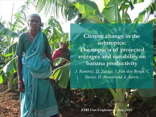
- 1. Climate change in the subtropics: The impacts of projected averages and variability on banana productivity J. Ramirez, D. Turner , I. Van den Bergh, C. Staver, D. Brown and A. Jarvis ESRI User Conference – July, 2011
- 6. Identification of current banana areas by means of expert consultation
- 9. Results: Current suitability + limiting factor
- 10. Results: 2020s suitability + change
- 11. Results: 2050s suitability + change
- 16. Thank you
Hinweis der Redaktion
- Underline the process to obtain the current banana production areas
- In most cases the expert print the map, marks the areas over it, scan the marked map and send it back to us.
- Current map after merge all the maps after expert consultation
- This is just to show from where we take the climate data
- The International Centre for Tropical Agriculture, with the support of Bioversity International and the International Potato Centre (CIP) has developed a simple mechanistic model based on the FAO database of crop ecological requirements Ecocrop. The model, which stands with the same name as the FAO's database uses temperature and precipitation thresholds in order to evaluate the suitability of a certain place to hold a certain crop species by means of the WorldClim database (Hijmans et al., 2005). The model was implemented in the software DIVA-GIS (Hijmans et al., 2005) and has been largely used to predict suitability of various crops under different climatic conditions – Of course you know what it is…
- While, as can be expected for a tropical crop, overall suitability in the subtropics is much lower than in the tropics, there is a great variation between the different subtropical sites. Some of our key sites have reasonably high suitability (Paraguay, Formosa in Argentina, the Mozambique-South Africa border and Hainan province in China), while others have very low suitability (northern India, southern non-coastal China, southern Brazil, northern Morocco and the Canary Islands). Rainfall is the most limiting factor in most sites (Fig. 1b), except in Paraguay, Argentina and Brazil.
- Of the 9 key sites, 3 sites seem to be largely unaffected by expected changes in climate in 2020s (the Mozambique-South Africa border, the Canary islands and northern Morocco), 4 sites will be disadvantaged (northern India, Paraguay, Formosa in Argentina and southern coastal China including Hainan province), and 2 sites are expected to become more favorable for banana production (southern Brazil and southern non-coastal China. We can thus not generalize across the subtropics, but need to deal with each region individually.
- These trends are confirmed in 2050s.
- The larger the homoclime area and the higher the probability, the more likely it is to achieve significant impact through technology transfer to homologue sites and adoption by farmers, current and in future The highest proportion (in terms of area) in similarity, meaning the highest potential for transferability of technologies between sites, was found for the northern India, with 49% of the total aggregated area being a homoclime with a probability threshold above 0.1. The Canary Islands and northern Morocco, on the other hand, resulted as areas with a very low proportion of homoclimes, probably due to their marked dry periods throughout the year. Southern Brazil also had only a very small proportion of homoclimes.
- The highest proportion (in terms of area) in similarity, meaning the highest potential for transferability of technologies between sites, was found for the northern India, with 49% of the total aggregated area being a homoclime with a probability threshold above 0.1. The Canary Islands and northern Morocco, on the other hand, resulted as areas with a very low proportion of homoclimes, probably due to their marked dry periods throughout the year. Southern Brazil also had only a very small proportion of homoclimes.
- The highest proportion (in terms of area) in similarity, meaning the highest potential for transferability of technologies between sites, was found for the northern India, with 49% of the total aggregated area being a homoclime with a probability threshold above 0.1. The Canary Islands and northern Morocco, on the other hand, resulted as areas with a very low proportion of homoclimes, probably due to their marked dry periods throughout the year. Southern Brazil also had only a very small proportion of homoclimes.
- Using a simple technique we have obtained usefull data that could be used to make complex analysis like the we have presented