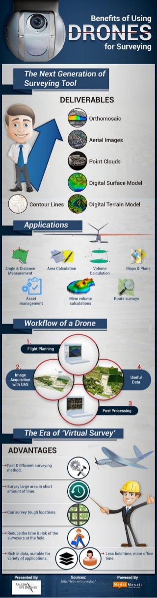
"Last few years have witnessed a sea change in surveying and engineering measurement technology. With its wide range of applications the future of drones is going to be exciting. Drones have delivered a lot of never before services that have revolutionized human life to a large extent. These deliverable are orthomosaic images, aerial images, point clouds, digital surface models, digital terrain models and contour lines.
The Infographic shows various applications of drones. Drones can be helpful in angle and distance measurement, area calculation, volume calculation; helps draw maps and plans, mine volume calculations, does route surveys and asset management. The workflow of a drone begins with flight planning, followed by image acquisition with UAS (unmanned aerial vehicle). Useful data is acquired once the image is processed. This Infographic will also highlight different advantages of drones, which has made ‘virtual surveys’ possible. Drones survey locations fast and efficiently. Large areas are surveyed in shorter span of time which reduces the time and risk of surveyors on the spots. This lets surveyors get less field time and can devote that time in the office. Vast data can be acquired through drones that can be used for multiple applications further."
http://feds.ae/benefits-of-using-drones-for-surveying-infographic/