
Empfohlen
Weitere ähnliche Inhalte
Was ist angesagt?
Was ist angesagt? (16)
Andere mochten auch
Andere mochten auch (18)
Ähnlich wie Open Historical Maps Putting a Map Library Online
Ähnlich wie Open Historical Maps Putting a Map Library Online (20)
Mehr von chippy
Mehr von chippy (19)
Kürzlich hochgeladen
Kürzlich hochgeladen (20)
Open Historical Maps Putting a Map Library Online
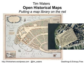
- 1. Tim Waters Open Historical Maps Putting a map library on the net http://thinkwhere.wordpress.com @tim_waters Geothings & Entropy Free
- 10. Crowdsourcing ? “ I find the term incredibly irritating... Any company that thinks it’s going to build a site by outsourcing all the work to its users not only disrespects the users but completely misunderstands what it should be doing. Your job is to provide a structure for your users to Collaborate, and that takes a lot of work”. Jimmy Wales, Wikipedia
- 12. Making people happy to put your maps on the interwebs and trace over them for you!
- 13. Core Technology – traditional GIS stuff. Georectification Digitization
- 15. Isothermal chart, or, View of climates & productions / drawn from the accounts of Humboldt & others, by W.C. Woodbridge. 1843
- 16. A new systeme of the mathematicks: containing I. Arithmetick,.... 1681
- 17. The English Empire in America.from Atlas minimus, or, A book of geography : shewing all the empires, monarchies, kingdomes, regions, dominions, principalities and c ountries, in the whole world 1679
- 18. Sacrifice Island. from America: being the latest, and most accurate description o f the Nevv vvorld 1671
- 23. Um, huh?
- 27. Demo time!
- 32. Layers: Buildings Districts Points of Interest Transport Network Hydrography
- 36. Conclusions
- 37. http://maps.nypl.org/warper Find me for beta login details or email [email_address] More details: http://thinkwhere.wordpress.com Upload and geo rectify your own imagery now: http://warper.geothings.net Have a go now! Future: Dynamic HTML5 space age stuff Open Historical Map
- 38. http://thinkwhere.wordpress.com @tim_waters Geothings & Entropy Free