Nell’iperspazio con Rocket: il Framework Web di Rust!
Systems Level Approach To Sustainable Urban Arterial Revitalization
1. Systems-Level Approach to Sustainable
Urban Arterial Revitalization
Case Study of San Pablo Avenue,
San Francisco Bay Area, California
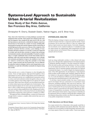
Christopher R. Cherry, Elizabeth Deakin, Nathan Higgins, and S. Brian Huey
Many cities in the United States are facing challenges associated with SYSTEMS-LEVEL ANALYSIS
antiquated urban arterials, whose purpose has changed greatly since
their development. Once considered the main streets of the city, with When developing a strategy to improve an arterial, it is important to
thriving businesses and attractive residential development, many have consider all aspects that have a connection with the arterial. Transit
deteriorated over the decades for a number of reasons, including shift- investments can be much more effective if they are coupled with
ing demand for housing and retail development and the construction of land use improvements near transit stations. Conversely, transporta-
parallel high-speed urban expressways. Because of the complexity of the tion investments can be rendered ineffective if contradictory land
problems associated with these arterials, a great challenge of trans- use improvements are implemented. Both transportation and land
portation and land use planners is to develop a systems-level approach use improvements can be blocked if there is inadequate community
to revitalize and reinvent these arterials in a manner that encourages outreach and involvement.
environmental, economic, and social sustainability. Presented is a method-
ology to revitalize multimodal urban arterials that includes land use
planning, traffic and transit operations management, street redesign, Land Use
and community participation to improve the conditions of such arteri-
als. Analysis is carried out by using these principles on San Pablo
Land use along multimodal corridors is often infused with many
Avenue, a major arterial in the San Francisco Bay Area in California.
types of uses, through either unplanned historic development patterns
or deliberate planning strategies to develop commercial corridors.
By using these analysis techniques, land use and transportation recom-
Often the land use plans and zoning ordinances for these corridors
mendations are made that will facilitate sustainable development along
are not developed specifically for the corridor, and unreasonable
this corridor.
requirements (such as minimum parking requirements) are imposed
on potential developers. As a result of organic development patterns,
Urban arterials serve a variety of purposes in cities throughout the many of the infill opportunities for development or redevelopment
country. Some are high-capacity, high-speed thoroughfares whose along an urban corridor include small, irregularly shaped lots that are
main purpose is to move vehicles a large distance across an urban area. not conducive to the general ordinances set forth by planning agen-
Other multimodal arterials serve neighborhood communities and act cies. As a result, development is difficult, and most developers choose
as a dense retail and residential corridor through the urban area, with to develop more unrestrained parcels on the urban fringe.
a secondary purpose of providing a high level of capacity for vehicle To develop a transit-oriented corridor, bus stop or station areas
movement. Many times these arterials were developed around tran- must be developed with easy connections to an assortment of trip
sit, before urban expressways and high levels of motorization. Thus, attractions, including residential, retail, and service land uses. This
the development patterns do not cater to private automobile use, and mixed-use development should be centered around major transit sta-
tions or transfer points but not necessarily along the entire corridor.
there is often a conflict between providing a high level of service to
Land use control is a powerful tool with which to influence the effec-
auto users and providing neighborhood scale shopping and residen-
tiveness of transportation investments. If transit-oriented develop-
tial land uses. Often, there is a disconnect between city planning and
ment is allowed near transit stations, large increases in ridership can
transportation engineering, whose goals have a tendency to conflict.
be experienced. However, land use controls that allow suburban-style
This paper provides a multidisciplinary, systems-level framework
development along urban corridors can effectively negate the effects
through which to analyze a complex urban arterial that must serve
of any public transportation investment.
multiple purposes.
Traffic Operations and Street Design
UC Transportation Center, University of California, 2614 Dwight Way, Berkeley,
CA 94720. For a major arterial to be a vibrant place where people would like to
Transportation Research Record: Journal of the Transportation Research Board,
live and shop, traffic and transit must operate efficiently. There must
No. 1977, Transportation Research Board of the National Academies, Washington, be high levels of accessibility for both automobiles and transit; how-
D.C., 2006, pp. 206–213. ever, many aspects of these two modes conflict. Transit must operate
206
2. Cherry, Deakin, Higgins, and Huey 207
with high levels of service, with minimum delay caused by traffic sig-
nals or congestion. The pedestrian environment must be conducive to
walking and bicycling. Sidewalks and bus stops must have adequate
amenities to encourage connectivity between trip generators.
Traffic must flow smoothly, and high-speed traffic must be calmed
to improve the pedestrian environment. Congestion should be limited
wherever possible, or priority treatment should be given to transit to
reduce the adverse effects of auto congestion on mixed flow transit
modes. Optimization of signal timing to account for buses and sim-
ulation of geometric changes to improve bus performance can be
powerful tools for evaluating prospective level of service changes
from different priority treatment strategies. Pedestrians should have
adequate crossing opportunities, and signals should allow adequate
crossing time. Finally, nonlocal traffic should be diverted, whenever
possible, to limit the negative externalities of noise, pollution, and
congestion.
Community Outreach
Perhaps the most important aspect of urban arterial revitalization is
community outreach. Local interest groups have the power to make FIGURE 1 Map of San Pablo Avenue
or break development or transportation improvement projects, and study area.
their input must be considered from the beginning or before the con-
ceptualization of any project. Developers or public agencies spend
large sums of money on the beginning processes of projects, only to
have them defeated by community members. Developers, public For most of the length of San Pablo Avenue, the road is two lanes
agencies, and community groups should have a predictable channel in each direction with turning lanes at major intersections. Sidewalks
through which to communicate. Focus groups with interested par- line both sides of the street for its entire length, and on-street parking
ties, residential surveys, and merchant interviews are effective ways is permitted in most locations. In Berkeley, a tree-lined median
to determine the needs of interest groups before implementation of developed in the 1960s divides the thoroughfare and limits cross traf-
a transportation or land use project. fic at many intersections. The city of El Cerrito has recently installed
a median as well. Other areas include a two-way left-turn lane.
Average daily traffic (ADT) ranges from about 15,000 at the north-
CASE STUDY OF SAN PABLO ern terminus of the study area to 27,000 around its busiest intersection
AVENUE, CALIFORNIA (1). Thirty-seven bus routes are operated on at least part of San Pablo
Avenue by four different transit properties: AC Transit, WestCAT,
Background Vallejo Transit, and Golden Gate Transit. Many of these routes also
connect to BART and AMTRAK stations. During peak periods, as
San Pablo Avenue is an urban arterial near the east shore of San many as 20 buses per hour travel on key San Pablo Avenue blocks. The
Francisco Bay in California. The study area spans 8 mi and runs most significant recent investment in transit has been the implementa-
through five cities—Oakland, Emeryville, Berkeley, Albany, and El tion of the 72 Rapid bus service operated by AC Transit. This bus
Cerrito—and two counties, Alameda and Contra Costa (Figure 1). serves the length of the study corridor from Oakland to Richmond and
San Pablo Avenue is designated as CA-123 from Oakland to Cutting provides high-speed, high-quality, limited-stop service to the corridor.
Boulevard in El Cerrito. The avenue lies parallel to and within a half- The study area of San Pablo Avenue is a complex corridor where
mile or less of I-80, and before the Interstate was built it was the main five cities, two counties, and the state department of transportation
north–south thoroughfare through the five cities in the study area. all have authority over their particular jurisdiction. AC Transit, the pre-
Land uses and urban design vary substantially along San Pablo dominant transit property for Alameda and Contra Costa Counties,
Avenue. Along the Oakland stretches of the avenue are many four-to has authority regarding bus stops. The Alameda County Congestion
six-story apartment buildings interspersed with one- to three-story Management Agency (ACCMA), created in 1995 to coordinate traffic
commercial buildings with housing on upper floors. In Berkeley and management and transportation investments for Alameda County,
downtown Albany, two- to three-story buildings, again with first-floor has built a working agreement among the involved jurisdictions
retail and upper-story housing, are interspersed with small-scale through which ACCMA administers San Pablo Avenue traffic sig-
single-story retail, auto dealers, and auto repair shops. El Cerrito’s nals through its East Bay SMART corridors program (1), which has
downtown is along the avenue, with single-story retail and a small produced a rich field of data with which to work.
mall as the predominant land uses. Through these three cities, most of
the retail and housing units are oriented to the street with little setback Land Use on San Pablo Avenue
and only occasional off-street parking. Farther north along the avenue,
the older single-story retail is interspersed with minimalls, fast food Zoning
drive-ins and big-box retail, each with its own parking lot. In the last
decade or so, multifamily housing developments have replaced older Zoning requirements along San Pablo Avenue are similar to zoning
retail and parking at locations scattered along the avenue. along many urban corridors throughout the United States; however,
3. 208 Transportation Research Record 1977
because San Pablo Avenue runs through several cities, there are sub- blank walls or privacy-invading windows into neighbors’ yards.
tle differences that make development along the avenue quite het- The most powerful feature of form-based zoning is that once all
erogeneous. Much of the avenue is zoned for high-density residential, interested parties have agreed on a design, the approval process of
retail, or mixed-use development. The maximum floor area ratio development plans can be streamlined to expedite development.
along the avenue varies from 3.0 to 7.0 in its densest areas (at the Figure 3 shows an example of a form-based zoning requirement in
southern portion near downtown Oakland). One of the major issues Virginia.
arising from high-density development along San Pablo Avenue is
the lack of integration of dense development fronting the avenue with
the low-density single-family dwellings immediately behind those Parking
high-density developments. Community opposition has stopped sev-
eral dense developments and has discouraged developers and plan- Parking availability is one of the most powerful demand manage-
ning agencies from allowing such development because of difficulty ment tools available to a transportation planner. “Plentiful free park-
integrating high-density development into medium- and low-density ing can counteract the total benefits achieved by virtually all other
neighborhoods (2). Figure 2 shows a mixed-use development that trip reduction tactics, frustrating efforts to mitigate transportation
elicited such a response. problems through such programs,” according to Shaw (3). However,
parking is a major contributor to economic development. Researchers
have found that workers generally will change modes when encoun-
Form-Based Zoning tering stricter parking regulations, but shoppers will generally change
their destination to shopping centers with better parking (4–6).
Much of the conflict about new development is centered around the Thus, the strategy should be to provide adequate short-term park-
building dimensions themselves and is less about use. An over-
ing for shoppers and good transit service for long-term shoppers or
whelming majority of residents along San Pablo Avenue recog-
commuters.
nize a need for more high-density housing in the area. Likewise,
Parking requirements are one constraint that makes it difficult to
they want more neighborhood-serving retail development along the
develop vacant lots on San Pablo Avenue. Planning agencies gen-
avenue. However, the zoning ordinances and land use plans place
erally adopt parking generation rates based on the ITE parking gen-
a large emphasis on the land use and institute generic building
eration manual (7 ), which has been criticized for its presentation of
envelopes that allow the scale and setbacks of buildings along the
statistically insignificant parking generation rates (8). Most of the
avenue to be discontinuous and heterogeneous. Buildings that
parking generation rates are based on suburban land uses, in which
are designed to conform to the zoning ordinances often do not
take into consideration the needs of the immediate neighborhood. personal automobile use is much higher and all parking generation
As a result, developers risk defeat when their plans are approved by rates are based on the assumption of unlimited free parking. Multi-
the planning agency, but the form of the building is not consistent modal urban arterials do not exhibit the same level of personal auto-
with the needs of the neighborhood. Form-based zoning ordinances mobile use, but developments are required to provide the same
have been developed and successfully implemented in several amount of parking. For instance, areas along the corridor have cen-
cities in the United States; these focus on a standard building design sus tracts with 50% to 77% zero-vehicle households, but zoning
that is agreed on in advance by all interested parties. These zoning requirements still require new development to have one parking
ordinances include standard setback requirements and building space per residential unit.
lines to ensure continuous street frontage. They also include stan- Because of the widespread adoption of these parking generation
dard height and step-down requirements to ensure that the building rates, many urban development projects become fiscally impossi-
fits into lower-density neighborhoods without constructing large ble because a large portion of a small lot would have to be devoted
to parking, or small-scale developments would have to invest in
structured parking. Moreover, because a large number of vacant
lots on San Pablo Avenue are long and narrow, the only possible
way to build a parking lot is to build the building at the back of the
lot and build the parking lot in front of the building. This exacer-
bates the problem of discontinuous building frontage, degrading the
pedestrian environment. A typical vacant lot on San Pablo Avenue
is about 50 ft wide and about 120 ft deep. Figure 4 illustrates the
infeasibility of developing urban structures with suburban parking
requirements.
This figure illustrates the difficulty building high-density retail,
commercial, or residential development. For this building to be fea-
sible, the building footprint would have to be reduced to occupy
only half the lot, or about 5,000 ft2, thus reducing the parking require-
ment while providing more space for parking cars. Additionally, if
there was no back entrance, the parking lot would have to be devel-
oped in front of the building. This parking ordinance discourages
potential development.
Adequate parking protects neighborhoods from parking spillover
and is directly related to the regional competitiveness of a retail
FIGURE 2 Example of mixed-use development on San Pablo Avenue. district. Merchants along the corridor cite parking as one of the
4. Cherry, Deakin, Higgins, and Huey 209
Special Conditions:
Within 100 FT of MAIN-STREET RBL:
- Wakefield to Four Mile Run, MAX 4 STORIES
Within 60 FT of Local Street Lot
MAX 6 or existing single family use
STORIES MAX 32 FT EAVES or PARAPET height
STREET WALLS
MIN 3
Required on ALLEY and
STORIES COMMON LOT LINES
MIN
9 FT 4 IN. 7 FT
CLEAR Height
15 FT
18 IN. CLEAR
MAX
FIGURE 3 Arlington, Virginia, form-based zoning requirement (RBL = required
building line).
major deficiencies of the avenue, so convenient and appropriate lev- environments by reducing the amount of land devoted to parking,
els of parking must be provided for employees and shoppers. Forcing thus reducing parking demand even more.
developments to devote half of their already small lots to parking is
unreasonable, especially on a corridor with high levels of mixed-use
development and transit service. TRAFFIC, TRANSIT, AND
Several strategies have been developed that hold large potential PEDESTRIAN IMPROVEMENTS
for some of the difficulties of providing parking on San Pablo Avenue.
These include the construction of shared parking lots at shopping San Pablo Avenue is a California state highway and is under the juris-
or commercial districts, in lieu parking fees for construction of pub- diction of the California Department of Transportation (Caltrans).
lic parking lots, parking exemptions and reductions, and parking However, it runs through several cities, and the street design varies
maximums (9, 10). These strategies can reduce the demand associ- slightly from city to city. On-street parking lines all sections of the
ated with overabundant parking, reduce parking supply by sharing avenue, two lanes run in each direction, and major intersections
space and utilizing parking more efficiently throughout all periods have designated left- and right-turn lanes. Sections of the street along
of the day, and enable development of more pedestrian accessible the study corridor have two-way left-turn lanes, whereas others have
120 ft
Parking Parking
Parking Parking
San Pablo Ave
Parking Parking 8,000 sq ft/2-story
commercial 50 ft
building
Parking Parking
Parking Parking
C-W West Berkeley Commercial
Parking Requirements: 2 spaces/1000 sq ft
16 spaces required for 8,000 sq ft building
-5 feasible parking spaces or
-10 double-parked spaces
FIGURE 4 Example of parking requirements of typical infill lot.
5. 210 Transportation Research Record 1977
raised medians. All sections of the study area have sidewalks of Active priority takes green time from undersaturated cross streets.
varying width and quality. However, many of the intersections on San Pablo Avenue are highly
saturated on all approaches. This reduces the effectiveness of active
priority because it imposes more delay on cross-street traffic and
Pedestrian and Transit Amenities buses. Passive priority simply requires optimizing the signal timings
while properly weighting the transit movements to account for the
Pedestrian fact that they carry many more people than do cars and trucks.
For this analysis, the congested morning peak period was chosen
For a transit corridor to be successful, the pedestrian environment as the study period. For the morning peak, a fixed-time signal tim-
must be accessible and pleasant. Most of the sidewalks along the ing plan was developed, by making the assumption that the north
corridor conform to the Americans with Disabilities Act (11), hav- and south thoroughfares already get the maximum allotment of
ing adequate sidewalk widths, ramps, and limited obstructions (12). green time. Assuming that the arterial is already allotted its maxi-
Some areas of the corridor have very long cross-street crossings, mum green time allows elimination of active priority strategies since
particularly in southern parts of the corridor, where cross streets inter- their effectiveness is limited when the side streets are already receiv-
sect San Pablo at acute angles. Adequate crossing time must be given ing their minimum green and there is no green time to spare. Addi-
at these signalized intersections or pedestrian refuges or bulb-outs tionally, the assumption was made that all the cycle lengths will be
must be provided to ensure safe passage of pedestrians across and the same so as to create a corridor with good progression and good
along the corridor. Based on sidewalk width, lateral separation, on- passive transit priority. The existing cycle length varies from 60 s to
street parking utilization, and vehicle speed and volume counts, a 120 s, and the optimized signal timing plan will have a fixed cycle
pedestrian level-of-service (LOS) analysis (12) gives most major length of 100 s.
nodes along the corridor an average LOS of C. This indicates that The base case was modeled, the new cycle length was modeled
the area is adequate for pedestrians but does not attract as many without bus weighting, then weighting was added to buses for a third
pedestrian trips as possible. The major deficiency, per this analysis, case. The improved signal timing plan does not provide a large dis-
is the high volume of traffic at busy intersections. advantage to the normal traffic flow while providing significant
benefit to the flow of buses. The optimized conditions with weighted
buses reduce bus passenger delay by 33% from the existing condi-
Transit
tions. The total stops were reduced substantially, by 41%, and the
The investment in the San Pablo Rapid Bus service has provided high- travel time was reduced by 9%. These improved measures of effec-
quality bus shelters and transit information, including real-time arrival tiveness come at the expense of cross-street and low-weight vehicles
information at many of the stops. Many sections of the avenue, par- (single-occupant vehicles), but the total systemwide person-hour
ticularly the more recently developed areas of Emeryville and El Cer- delay, number of stops, and travel time are reduced significantly
rito, have adequate pedestrian scale lighting. The Rapid Bus service (Table 1).
provides appropriate lighting at some of its stops but inadequate light-
ing at several other stops. All San Pablo Rapid stops should have the
same amenities unless there are physical constraints to providing Geometric Changes to Improve
those amenities. Several Rapid stops have been poorly placed and Bus Performance: Microsimulation
obstruct the sidewalk, creating a more hostile pedestrian environment.
Innovative shelter design should be implemented to fit the shelter into Microsimulation models give analysts the ability to investigate
the exiting pedestrian environment and reduce obstructions. the effect of geometric changes on traffic operations. A Paramics
microsimulation model was developed to simulate the morning peak
traffic conditions along both San Pablo Avenue and the parallel free-
Optimizing Traffic Flow: Passive Transit Priority way, I-80, by using data provided by Caltrans and ACCMA (14,
Signal Optimization 15). Hourly traffic counts, continuous speed, and travel times were
provided for San Pablo Avenue and I-80. By using these data, a net-
Signal timing schemes often are developed to minimize vehicle work was developed and calibrated that included San Pablo Avenue,
delay and vehicle stops. Vehicle delay is an appropriate proxy for the I-80 freeway, and all interchanges along the segment and those
delay imposed to a person in many urban areas where average portions of major arterials that connect San Pablo Avenue with I-80.
vehicle occupancy is close to one. However, in transit corridors, The existing signal timing as well as the optimized signal timing
such as San Pablo Avenue, one should weight buses more heavily schemes were modeled (13).
than automobiles because of their high load factors. To achieve the Once the network was fully built, an express bus route was inserted
highest people-moving capacity of the arterial, which minimizes into the network. This route follows the San Pablo Rapid bus route
delay to all people, TRANSYT-7F signal timing software was (72R) operated by AC Transit from Downtown Oakland to Contra
used to develop and demonstrate a passive transit priority signal Costa County Community College in the city of San Pablo. The route
optimizing scheme (13). and associated bus stops were entered into the model so that improve-
Two distinctly different kinds of transit priority can be modeled ments could be measured in travel time improvements to the bus
with TRANSYT-7F. Passive priority relies on inexpensive geometric service, in addition to the vehicle travel time.
and signal timing changes that can significantly decrease the delay The model was calibrated by following procedures documented
and number of stops for transit vehicles while minimizing negative in the literature (16–19). The calibrated network was used to pro-
effects on the normal traffic flow. Active priority uses different detec- duce base case measures of effectiveness and then simulated several
tion techniques to give extra green time to the transit movement when alternative infrastructure and signal operation improvements for
the transit vehicle comes at the end of its green phase. San Pablo Avenue.
6. Cherry, Deakin, Higgins, and Huey 211
TABLE 1 Comparison of Measures of Effectiveness Among Simulated Signal Timing Alternatives
Total Travel Time (vhph) Total Delay (vhph) Total Stops (vph)
Performance Measure Buses Other System Total Buses Other System Total Buses Other System Total
Existing; no bus weight 23 1,505 1,528 6 794 800 884 91,970 92,854
Optimized; no bus weight 22 1,307 1,329 5 596 601 578 64,521 65,099
Optimized; bus weight 21 1,340 1,361 4 629 633 519 69,278 69,797
Percentage difference from existing conditions
Optimized; no bus weight −4 −13 −13 −17 −25 −25 −35 −30 −30
Optimized; bus weight −9 −11 −11 −33 −21 −21 −41 −25 −25
Benefit of bus weight 4 −2 −2 17 −4 −4 7 −5 −5
vhph = vehicle hours per hour, vph = vehicles per hour.
Although the travel time for the buses improves slightly under the may not be vastly improved by the addition of queue jumpers in the
new signal scheme, the passive priority timing alternative does not study, the time that is saved will benefit a large number of riders.
give the express bus any advantage over cars because the bus still Traffic signal timing models and network simulation models can
operates in mixed flow lanes. To give the express bus an advantage, be effective tools not only in traffic operations and management but
geometric alternatives were simulated in which a queue jumper lane also for transit planning and street design. By using data available
was added at each intersection with long queues during the peak from state departments of transportation, local governments, and
period. These are the intersections where the bus stands to gain the simple field observations, this study shows that alternative bus pri-
greatest increase in travel time. ority schemes and simple geometric improvements can be evaluated
Intersections with slow approaches and residual queues were easily, once the models are calibrated. Such improvements can be a
identified by using data from previous studies (14), and those inter- low-cost, highly effective way to improve the performance of urban
sections were improved by widening the approach and taking width arterials such as San Pablo Avenue.
from the existing lanes. The two-through-lane, 24-ft cross section
(12 ft per lane) was widened by 6 ft to make a three-through-lane,
30-ft cross section (10 ft per lane). In the northbound direction, four COMMUNITY INVOLVEMENT
queue jumper lanes were added at the most problematic intersec-
The end users of the system are the ones whom public agencies are
tions. In the southbound direction, eight queue jumper lanes were
meant to serve. There are many stakeholders in transportation or
added at the problematic intersections. The queue jumper lanes were
development decisions, and many times these stakeholders have the
added to the shoulder side of the roadway to facilitate easy entrance
power to stop or alter the outcome of specific projects or plans. Thus,
to the bus bay on the far side of the intersections. The additional
it is in every party’s best interest to be involved in the decision-
space required for the queue jumper lanes can be taken exclusively
making process from the earliest phases of project implementa-
from the existing right-of-way by restriping, limiting on-street park-
tion. In the case of San Pablo Avenue, the revitalization process is
ing, narrowing the median, or widening the road (by narrowing the
a long-term endeavor.
sidewalk). Many of the on-street parking spaces have very low lev-
els of utilization, especially during the morning peak before retail
businesses open (12). Utilizing this space for queue jumper lanes Developer Interviews
could be a better use of this road space, at least for portions of the day.
The addition of queue jump lanes did not significantly improve Developers can offer tremendous insight into land use markets as
travel time along the entire corridor, because of conflicts with the well as some of the hurdles that must be overcome to construct a
mixed-flow traffic and bus stop configuration. However, for one inter- successful development. In the case of San Pablo Avenue, develop-
mediate trip, from the El Cerrito Del Norte BART station to Broad- ers that specialize in infill development were interviewed regarding
way and 14th Street in Oakland, a statistically significant (99% some of the difficulties with developing in the Bay Area as well as
confidence level) 3.5-min travel time decrease is found when queue some of the current market influences (21). Planning agencies encour-
jumpers are added, in addition to a smaller standard deviation age mixed-use residential development with first-floor retail. Devel-
(1.53 versus 2.37). This time savings becomes more significant given opers cite the tremendous housing demand and the low retail demand
that the destinations are two of the heaviest boarded and alighted along many sections of San Pablo Avenue as a major difficulty when
stops on the 72R route (20, p. 21). The smaller standard deviations developing a parcel. Retail space is often vacant long after all the res-
observed are also of considerable importance because they imply that idential units have sold. Forcing developers to incorporate a mix of
arrival times are more consistent when queue jumpers are added; uses in all large-scale developments increases the cost of the resi-
they result in less disparity between the bus schedule and actual dential development in an already expensive housing market. Rather
bus arrivals. Previous studies looking at the performance of the 72R than requiring mixed-use development along all sections of San
route have pointed to the on-time performance as an area of diffi- Pablo Avenue, nodal activity centers should be designated around
culty (20). Both on-time performance and travel time performance major transit stops and transfer points. Mixed-use development
to highly serviced areas are of main concern to express bus operators should be required only at these activity centers, and high-density
and their patrons. Although the travel time performance of the 72R residential development should be filled into the intermediate areas.
7. 212 Transportation Research Record 1977
Most developers stated that parking minimums were too high and were given an option to participate in neighborhood focus groups to
parking should be market driven. Some developments have a higher discuss specific issues related to their communities. Some interest-
market for parking space than others. Generally, the developers rec- ing insights came from these meetings. Focus groups reinforce the
ognize that parking is needed and that their developments appeal to desire for more neighborhood-serving retail and restaurants. One of
different markets with varying parking needs. Restrictive parking the perceived problems along the avenue is a large amount of auto
policy reduces the marketability of some developments. Some plan- uses (garages, gas stations, etc.); however, most residents use those
ning agencies along San Pablo Avenue have been more lenient and services on a regular basis. Although city planners might recommend
responsive than others along San Pablo Avenue, and this has led to phasing out these uses, residents rely on them and would prefer that
rapid development in some cities and slow development in others. they improve their façades and operating procedures, minimizing
Streamlined permit approval processes and community involvement noise and other annoyances. There are successful examples of attrac-
processes could significantly reduce the cost of development along tive auto uses near residential developments that are assets to the
the avenue, thus reducing the cost to the residents and making the community. Interestingly, in the survey many people mentioned that
avenue a more attractive place to live. their favorite places along the avenue are big-box shopping devel-
opments, but in the focus groups, they mention that they like the
shopping opportunities of such a development but they dislike the
Merchant Interviews design. Although focus groups can sometimes be biased, depending
on who participates, these subtleties are difficult to capture with
Interviews were carried out with merchants at key activity centers on other, less biased methods of attaining community attitudes.
San Pablo Avenue. Their impression of the avenue, key problems, and
reasons for locating on San Pablo Avenue were investigated. Most
merchants enjoy the amount of activity on the avenue, as it is one of CONCLUSION
the busiest north–south corridors in the East Bay. Although they dis-
like the traffic and congestion, they appreciate the exposure they Redevelopment of an urban arterial whose original purpose is obso-
bring. Merchants had mixed feelings about the bus investments. lete is a difficult task. Many parties have a stake in transportation
Most did not think that it improved the business in the area, and few and land use improvements, and it is vitally important to look at the
of their employees or customers use the service. Most thought that revitalization process from a systems perspective. Transportation
parking infrastructure is inadequate (especially those without their improvements will have limited effect with inconsistent land use
own lots), and they would like more available parking. One of the improvements. Expensive transit investments coupled with suburban
greatest benefits of interviewing merchants is that one can identify land use requirements result in marginal increases in transit ridership.
accurate trip generation patterns (i.e., when and how many customers Conversely, land use improvements without adequate transportation
frequent their establishment). This could aid the planning process in infrastructure yield congestion and spillover effects that alarm neigh-
the future when the impact of such development is determined. borhood organizations and other stakeholders. Stakeholder input is
vitally important at all stages of the development process, particularly
early in the process, so there is little at stake when the desires of
Community Surveys stakeholders are negotiated.
This paper identified several important tools related to land use
Surveying residents of the immediate neighborhoods surrounding San planning, transportation operations and design, and community
Pablo Avenue can give a sense of what types of services are demanded involvement and applied them to the analysis of San Pablo Avenue.
and what services are used. Important demographic information can Land use plans must be specific to a particular corridor, and within
be collected, and travel patterns can be identified. More than 500 that corridor, areas of activity or high transit access must have
residents were surveyed in neighborhoods surrounding San Pablo incentives or mandates to develop in a transit-oriented matter. This
Avenue, spanning all demographic groups. Most people said they includes providing incentives for high-density mixed-use develop-
choose to live on San Pablo Avenue because it is affordable and it ment with lower parking requirements that reflect high levels of
has convenient transportation access. Very few people think that the transit access. Parking should be consolidated and shared between
avenue has an attractive design. Most people use the avenue as a trans- uses. Different land uses have different parking requirements at dif-
portation corridor to access the parallel freeway or to access shopping ferent times of the day, so parking should be utilized as much as pos-
or restaurants. One of the most frequent responses to a question related sible throughout the day. This consolidated parking can be funded
to possible improvements is the desire for more restaurants or cafés by using in lieu fees, and the reduction of scattered parking lots will
along the avenue. The greatest problems associated with the avenue make access by both auto and transit easier and more efficient. The
are mostly related to appearance, as residents cite that many areas are permit process should be streamlined to encourage development.
dirty and rundown. Because of the mixed-use development and high This can be done by using form-based zoning that the community
level of transit service, more than 54% of residents choose to com- agrees on beforehand, limiting the risk to developers and encourag-
mute to work by an alternative mode of transportation. Overall, com- ing community participation at the beginning of the development
munity surveys can be an effective tool with which to identify travel process.
patterns and residential choices and desires of a community. Streets should be designed to encourage pedestrian accessibility.
Transit amenities should not be obtrusive and should be built into
the pedestrian environment. Simulation tools are a powerful resource
Focus Groups with which to test and optimize traffic signal operation and geo-
metric changes to the roadway. Improvements can be quantitatively
To identify some of the more subtle interests of communities, focus analyzed with a minimum amount of investment, and their effect
groups should be conducted. Respondents of the community survey on transit, traffic, and the pedestrian environment can be analyzed.
8. Cherry, Deakin, Higgins, and Huey 213
Community involvement is of utmost importance. Surveys and 5. Shiftan, Y., and R. Burd-Eden. Modeling Response to Parking Policy. In
interviews of stakeholders, including developers, residents, and Transportation Research Record: Journal of the Transportation Research
Board, No. 1765, TRB, National Research Council, Washington, D.C.,
merchants, can give unparalleled insight into the market conditions 2001, pp. 27–34.
driving development and commerce as well as peoples’ motivations 6. Mildner, G. C. S., J. G. Strathman, and M. J. Bianco. Parking Policies
for residence location and travel. This gives all parties a forum in and Commuting Behavior. Transportation Quarterly, Vol. 51, No. 1,
which to express their opinions and needs. As community members Winter 1997.
are gaining more influence in the decision-making process, their 7. Parking Generation, 2nd ed. ITE, Washington, D.C., 1987.
8. Shoup, D. The Trouble with Minimum Parking Requirements. Trans-
views are becoming more critical during policy development. portation Research Part A, Vol. 33, 1999, pp. 549–574.
San Pablo Avenue is an excellent example of a corridor that used 9. Shared Parking. Urban Land Institute, Washington, D.C., 1983.
to serve a very different purpose than it does today. There are tremen- 10. Smith, T. P. Flexible Parking Requirements. American Planning
dous opportunities for infill development and densification, but many Association, Washington, D.C., 1983.
11. ADA Standards for Accessible Design. www.usdoj.gov/crt/ada/stdspdf.
of the opportunities are not economically feasible because of uncer- htm. Accessed July 29, 2004.
tain planning processes and unreasonable requirements. As a result, 12. Deakin, E. Revitalization of San Pablo Avenue: Oakland Through El
the avenue is dotted with vacant or underutilized parcels that severely Cerrito. University of California, Berkeley. Dec. 2004. www.uctc.net/
reduce the attractiveness of the street. Developers choose to invest sanpablo. Accessed July 20, 2005.
in easier greenfield development on the urban fringe, perpetuating 13. Higgins, N., S. B. Huey, C. Cherry, E. Deakin, and A. Skabardonis.
Optimizing Transit Priority on a High Volume Urban Arterial: A Case
unsustainable growth and transportation patterns. Changes in trans- Study of San Pablo Avenue. In Regional Express Bus Plan, Caltrans
portation engineering and city planning practices are required for District 4, Oakland, Calif., 2004.
streets like San Pablo Avenue to undergo true revitalization. 14. Fehr & Peers Associates. San Pablo Corridor ITS Project Technical Mem-
orandum Field Data Collection Report. Alameda County Congestion
Management Agency, Oakland, Calif., 2003.
15. Fehr & Peers Associates. San Pablo Corridor ITS Project Technical Mem-
ACKNOWLEDGMENTS orandum #2 Existing Conditions and Model Validations Report. Alameda
County Congestion Management Agency, Oakland, Calif., 2003.
This work was funded by the University of California Transportation 16. Dowling, R., A. Skabardonis, J. Halkias, G. McHale, and G. Zammit.
Guidelines for Calibration of Microsimulation Models: Framework and
Center, Caltrans District 4, and the Environmental Protection Agency.
Applications. In Transportation Research Record: Journal of the Trans-
The authors thank the students of CP 218 and CP 114 for their help portation Research Board, No. 1876, Transportation Research Board of
with data collection and analysis. Caltrans District 4 provided sup- the National Academies, Washington, D.C., 2004, pp. 1–9.
port in collecting and sharing the data and information used in this 17. Dowling, R., A. Skabardonis, and V. Alexiadis. Traffic Analysis Toolbox
study. The authors thank Becky Frank and Wingate Lew. The authors Volume III: Guidelines for Applying Traffic Microsimulation Software.
FHWA-HRT-04-040. FHWA, U.S. Department of Transportation, 2004.
also thank Cyrus Minoofar of ACCMA, who provided valuable 18. Gardes, Y., A. D. May, Jr., J. W. Dahlgren, and A. Skabardonis. Free-
information. way Calibration and Application of the PARAMICS Model. Presented
at 81st Annual Meeting of the Transportation Research Board, Wash-
ington, D.C., 2002.
19. PARAMICS V4.1 Calibration Note. Quadstone Ltd., Edinburgh, United
REFERENCES Kingdom, July 2003.
20. Nelson/Nygaard Consulting Associates. San Pablo Corridor Analysis:
1. Bay Area Smart Corridors Program. www.smartcorridors.com. Accessed Phase 2. AC Transit Agency, Oakland, Calif., 2004.
June 1, 2004. 21. Mejias, L., and E. Deakin. Redevelopment and Revitalization Along
2. Brenneman, R. ZAB Approves San Pablo Condos. Berkeley Daily Urban Arterials: Case Study of San Pablo Avenue, California, from the
Planet, Dec. 14, 2004. Developer Perspective. In Transportation Research Record: Journal of
3. Shaw, J. G. Planning for Parking. University of Iowa Public Policy the Transportation Research Board, No. 1902, Transportation Research
Center, Ames, 1997. Board of the National Academies, Washington, D.C., 2005, pp. 26–34.
4. Innes, D., M. C. Ircha, and D. A. Badoe. Factors Affecting Automobile
Shopping Trip Destinations. Journal of Urban Planning and Development, The Transportation and Land Development Committee sponsored publication of
Vol. 116, No. 3, 1990, pp. 106–136. this paper.