

Empfohlen
Weitere ähnliche Inhalte
Was ist angesagt?
Was ist angesagt? (19)
Andere mochten auch
Andere mochten auch (10)
Ähnlich wie 15 rivers forstudents
Ähnlich wie 15 rivers forstudents (20)
Mehr von Alex Puszczynski
Kürzlich hochgeladen
Kürzlich hochgeladen (16)
15 rivers forstudents
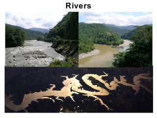
- 1. Rivers Chapter 17
- 2. Outline • Streamflow -streams/rivers, runoff, hydrologic cycle component -forming streams/rivers • Drainage networks -Patterns (dendritic to trellis) -Drainage basins, drainage divides • Rivers/Streams -Permanent vs. ephemeral -Discharge, channel velocity, erosion/transport/deposition -Longitudinal (downstream) changes • Further details -Base level, valleys & canyons, terraces, rapids/waterfalls -Depositional environments (e.g. alluvial fans, braiding, deltas..) -Drainage evolution and flooding Chapter 17 Chapter 17
- 3. Streamflow • Stream/River – • Runoff – • Stream runoff is crucial for humans: Chapter 17
- 4. Streamflow • Stream runoff also Chapter 17
- 5. Streamflow • Stream runoff is an important • Flowing water… • Earth: only planet Chapter 17
- 6. The Hydrologic Cycle • Stream flow – Chapter 17
- 7. Forming Streams • Streamflow begins Chapter 17
- 8. Forming Streams Streamflow begins as • Sheetwash erosion • Rills coalesce & deepen into channels. Chapter 17
- 9. Forming Streams • Scouring can mark entry into the channel • Rapid erosion lengthens channel upslope • Process is called headward erosion Chapter 17
- 10. Forming Streams • Over time, channels merge. • Smaller tributaries join larger trunk steam • A drainage network –array of linked channels Chapter 17
- 11. Outline • Streamflow -streams/rivers, runoff, hydrologic cycle component -forming streams/rivers • Drainage networks -Patterns (dendritic to trellis) -Drainage basins, drainage divides • Rivers/Streams -Permanent vs. ephemeral -Discharge, channel velocity, erosion/transport/deposition -Longitudinal (downstream) changes • Further details -Base level, valleys & canyons, terraces, rapids/waterfalls -Depositional environments (e.g. alluvial fans, braiding, deltas..) -Drainage evolution and flooding Chapter 17 Chapter 17
- 12. Drainage Networks • Drainage networks form geometric patterns • Patterns reflect geolgoy and landscape form • Several common drainage patterns 1. Dendritic – branching, tree like, due to uniform material Chapter 17
- 13. Drainage Networks • Common drainage patterns: 2. Radial – form a point uplift Chapter 17
- 14. Drainage Networks • Common drainage patterns: 3. Rectangular – controlled by jointed rocks Chapter 17
- 15. Drainage Networks • Common drainage patterns: 4. Trellis (garden) – due to atlernating resistant/weak rocks common in fold-in thrust belts Chapter 17
- 16. A Drainage Basin • Land area that drains into a specific trunk stream Also called catchment or watershed • Divides are boundaries that separate drainage basins Chapter 17
- 17. Drainage Divides • Watersheds exist across scales. • Tiny tributaries • Continentals rivers • Large watersheds… • Feed large rivers • Section continents • Continental divides separate flow to different oceans Chapter 17
- 18. Outline • Streamflow -streams/rivers, runoff, hydrologic cycle component -forming streams/rivers • Drainage networks -Patterns (dendritic to trellis) -Drainage basins, drainage divides • Rivers/Streams -Permanent vs. ephemeral -Discharge, channel velocity, erosion/transport/deposition -Longitudinal (downstream) changes • Further details -Base level, valleys & canyons, terraces, rapids/waterfalls -Depositional environments (e.g. alluvial fans, braiding, deltas..) -Drainage evolution and flooding Chapter 17 Chapter 17
- 19. Permanent vs. Ephemeral • Permanent streams • Ephemeral streams • Water flows all year. • Do not flow all year. • At or below the water table. • Above the water table. • Humid or temperate. • Dry climates. • Sufficient rainfall. • Low rainfall. • Lower evaporation. • High evaporation. • Discharge varies seasonally. • Flow mostly during rare flash floods. Chapter 17
- 20. Discharge • Amount of water flowing in a channel • Water volume passing a point per unit time • Cubic meters per second • Given by cross-sectional area • Varies seasonally due to precipation and runoff Chapter 17
- 21. Channel Velocity • Velocity is • Friction • Greater in • Lesser in • Magnitude determined by • In straight channels, Chapter 17
- 22. Channel Velocity • Velocity is not uniform within a channel • Max. velocity near outside in bending channels • Outside is preferentially scoured and deepened • Inside is locus of deposition due to reduced velocity • Deepest part is called the thalweg Chapter 17
- 23. Channel Velocity • Velocity is not uniform in all areas of a channel • Stream flow is turbulent • Chaotic • Turbulence caused by… • Flow obstructions • Shear in water • Eddies scour channel bed. Chapter 17
- 24. Erosion Processes • River flow does work • Energy imparted is derived from gravity • Do work by converting potential to kinetic energy • Erosion is maximized during floods Large water volumes, high velocties Chapter 17
- 25. Erosion Processes • Stream erosion: 1. Scouring – 2. Breaking & lifting – Chapter 17
- 26. Erosion Processes 3. Abrasion – • Exposed bedrock in channels gets • Gravel swirled by turbulent eddies • Bowl-shaped depressions are called 4. Dissolution – Chapter 17
- 27. Sediment Transport • Sediment load - • 3 types: 1. Dissolved load – 2. Suspended load – 3. Bed load – Chapter 17
- 28. Sediment Transport • Competence – • Capacity – • Change with discharge: • High discharge – • Low discharge – Chapter 17
- 29. Sediment Deposition • When flow velocity decreases… • Competence is • Grain sizes are sorted by water. • Sands are removed from gravels; muds from both. • Gravels settle in channels. • Sands drop out in near channel environments. • Silts & clays drape floodplains away from channels. Chapter 17
- 30. Sediment Deposition • Sediment size tracks with • Coarsest particles typify • Fine particles typify Chapter 17
- 31. Sediment Deposition Fluvial (river) sediments are called • Channels may have • Sands build up • A stream builds a Chapter 17
- 32. Longitudinal Changes • Stream character • In profile, the gradient describes Chapter 17
- 33. Longitudinal Changes • Near stream headwaters… • Gradient is • Sediment sizes are • Channels are Chapter 17
- 34. Longitudinal Changes • Toward the mouth (downstream end)… • Gradient is • Smaller • Channels are Chapter 17
- 35. Outline • Streamflow -streams/rivers, runoff, hydrologic cycle component -forming streams/rivers • Drainage networks -Patterns (dendritic to trellis) -Drainage basins, drainage divides • Rivers/Streams -Permanent vs. ephemeral -Discharge, channel velocity, erosion/transport/deposition -Longitudinal (downstream) changes • Further details -Base level, valleys & canyons, terraces, rapids/waterfalls -Depositional environments (e.g. alluvial fans, braiding, deltas..) -Drainage evolution and flooding Chapter 17 Chapter 17
- 36. Base Level Concept Lowest point to which a stream • Ultimate base level is • A lake serves as a • Base level changes cause • Raising base level results in an • Lowering base level Chapter 17
- 37. Valleys and Canyons • Land far above base level • Rapid down cutting creates • Valley – • Canyon – • Determined Chapter 17
- 38. Stream Terraces • Valleys store sediment when • Stability, then renewed Chapter 17
- 39. Rapids & Waterfalls • Rapids are • Waterfalls are • Reflect geologic control: • Flow over • Flow • Sudden increase Chapter 17
- 40. Alluvial Fans • Build at mountain front by • Sediments rapidly • Sediments create Chapter 17
- 41. Braided Streams • Form where channels • Flow is forced around • Diverging - converging flow • Bars are unstable • Flow occupies Chapter 17
- 42. Meandering Streams • Channels can form • Along • Where streams travel over • When substrates are • Meanders increase • Meanders Chapter 17
- 43. Meandering Streams • Max velocity swings back & • Fast water erodes • Point bar • Meanders change due to natural variation in... • Thalweg • Get cutoff when Chapter 17
- 44. Meandering Streams • Meanders become • Cut bank erodes; point bar accretes. • Curves become Chapter 17
- 45. Deltas • Deltas form a river enters • Flow • Channel divides into a Chapter 17
- 46. Deltas • Mississippi has a • Distinct lobes indicate • River periodically • River breaks • Establishes a shorter, steeper path Chapter 17
- 47. Drainage Evolution • Streamflow is cause of most • Example: • Uplift changes • Streams cut • Valleys • Landscape lowered Chapter 17
- 48. Drainage Evolution Stream piracy • One stream • Results from • A stream with • Captured • Below capture point, Chapter 17
- 49. Drainage Evolution Drainage reversal • Tectonic uplift can • South America used to • Western uplift Chapter 17
- 50. Drainage Evolution Antecedent drainages • Tectonic uplift can raise • If erosion keeps pace with uplift, • Called • If uplift rate exceeds incision, Chapter 17
- 51. Drainage Evolution • Some antecedent streams • Meanders initially develop • Uplift raises • Meanders incise Chapter 17
- 52. Raging Waters • During a flood… • Flow exceeds • Velocity (thus, competence & capacity) • Water leaves • Moving water & debris • Water slows away from the Chapter 17
- 53. Raging Waters • Numerous causes of floods: Chapter 17
- 54. Raging Waters • Case history: Mississippi and Missouri Rivers, 1993. • Spring 1993: • July 1993: • Covered 40,000 mi2. • Flood lasted 79 days. • 50 people died. • 55,000 homes destroyed. • $12 billion in damage. Chapter 17
- 55. Raging Waters • Seasonal floods recur on an annual basis. • Monsoons – • Intense period of • Many people live in floodplain & delta plain settings. • 1990 - monsoon killed 100,000 people in Bangladesh. • 2008 – monsoon caused the Kosi river to avulse, displacing ~2.3 million people in Nepal/India. Chapter 17
- 56. Raging Waters • Kosi River flood before and after. • New channel width ~20 km! Chapter 17
- 57. Raging Waters • Kosi River flood before and after. Chapter 17
- 58. Raging Waters • Ancient floods: Ice-Age megafloods. • 11 Ka, • Water scoured • Created Chapter 17
- 59. Living with Floods • People living in floodplains • Land use changes may • Establish floodways – • Remove Chapter 17
- 60. Living with Floods • Flood risk borne by • Use hydrologic data to • Maps allow agencies to • Building in flood-prone settings is Chapter 17
- 61. Living with Floods • Flood risk is calculated • Discharges are plotted against • On semi-log, this plots as a • Probability (% chance of occurrence) given discharge will happen Chapter 17