SlideShare ist ein Scribd-Unternehmen logo
1 von 213
Downloaden Sie, um offline zu lesen
BBIIBBLLIIOOGGRRAAPPHHYY OOFF TTHHEE GGEEOOLLOOGGYY OOFF IINNDDOONNEESSIIAA
AANNDD SSUURRRROOUUNNDDIINNGG AARREEAASS
55tthh EEddiittiioonn,, OOccttoobbeerr 22001133
JJ..TT.. VVAANN GGOORRSSEELL
II.. RREEGGIIOONNAALL GGEEOOLLOOGGYY
www.vangorselslist.com
Bibliography of Indonesian Geology, 5th Ed. www.vangorselslist.com Oct 20131
I. REGIONAL GEOLOGY
The first chapter of the bibliography contains 212 pages with over 2100 titles of papers on the regional geology
of Indonesia and adjacent SE Asia- Pacific, as well as general papers that do not fit in any of the regions or
specialist categories listed separately. It is subdivided in five chapters:
I.1. Indonesia Regional Geology
I.2. SE Asia Tectonics, Paleobiogeography
I.3. Volcanism, Volcanic rocks geochemistry
I.4. Modern environments, Oceanography
I.5. Carbonates, Coral Reefs
I.1. Indonesia Regional Geology
This chapter includes the references of textbooks and papers on the tectonics and regional geology of
Indonesia.
The Indonesian archipelago is an extremely complex collection of continental blocks, active and extinct
volcanic arcs and associated subduction complexes (commonly with ophiolites, marking sutures where former
oceans were consumed) and old and young ocean basins. It is now at the convergence of three major tectonic
plates: Eurasia, Pacific and Australia. The area of Sulawesi contains elements of all three plates.
A pre-plate tectonics depiction of 'tectonostratigraphic provinces' in Indonesia, fairly accurately grouping areas
with similar tectonic histories, mainly based on similarities/ differences in Permian- Eocene stratigraphic
successions (Umbgrove, 1938)
Bibliography of Indonesian Geology, 5th Ed. www.vangorselslist.com Oct 20132
Western Indonesia ('Sundaland') is a complex of continental blocks that amalgamated in Late Paleozoic- Early
Mesozoic time. Eastern Indonesia contains a number of small continental microplates derived from the
Australia- New Guinea Gondwanan margin, now separated by young age oceanic marginal basins and
volcanic arc systems.
Many parts of Indonesia's tectonic history remain poorly understood. Numerous reconstructions have been
proposed in the last 40 years since the acceptance of plate tectonics theory. Most agree on the broad relative
motions of the three major plates, but they vary in many other details. Places like Timor, Seram, W Papua
Birds Head, etc. continue to generate debate. Umbgrove (1938) lamented that 'in the last decades at least one
or two new hypotheses have been suggested every year to explain the structure of the East Indian
Archipelago'. Now, more than 70 years later, new models continue to be proposed and debated. Much
progress has been made, but there is still no agreement on the 'final answer'.
Suggested Reading
Text books: Rutten (1927; remarkable understanding of Indonesian geology for its time; in Dutch),
Van Bemmelen (1949), Umbgrove (1949), Hamilton (1979), Hutchison (1989, 2007),
Darman and Sidi (1999).
Tectonics, Reconstructions: Katili (1971, 1989, etc.), Pigram and Panggabean (1984), Rangin et al. (1990),
Struckmeyer et al. (1993), Simanjuntak (1993-2000), Prasetyo (1995),
Lee and Lawver (1995), Packham (1996), Simandjuntak and Barber (1996),
Hall (1996, 1998, 2002, 2012, etc.), Hall, Clements and Smyth (2009),
Harris (2006), Longley (1997), Villeneuve et al. (1998, 2001, 2010),
Charlton (2000, 2013), Milsom (2000, 2001), Pubellier et al. (2003, 2005),
Satyana (2003, 2009), Spakman & Hall (2010), Hall and Sevastjanova (2012).
I.2. SE Asia Tectonics, Paleobiogeography
This chapter contains a large (>500 titles), mixed collection of papers on regional SE Asia tectonics, as well as
papers on the tectonics and geology of parts of mainland SE Asia that are relevant to the understanding of
parts of Indonesia (Thailand, S China, Myanmar, some Vietnam, etc.).
Numerous papers on Paleozoic- Mesozoic faunas and floras are also included, especially those that help
identify faunal and floral provinces indicative of paleoclimate and relative positions of plates through time.
Paleobiogeographic patterns and stratigraphic successions are key tools underpinning plate reconstructions of
SE Asia, especially in the pre-Cenozoic.
The main patterns of the geologic evolution of SE Asia are reasonably well understood, but details and exact
timing of events are still debated. SE Asia is a complex collage of continental blocks, all once part of the
Gondwana supercontinent, separated from the New Guinea- Australia- India margin during multiple episodes
of Devonian- Jurassic rifting (S China, Indochina, Sibumasu, W Burma, etc.). After Northward drift from the S
Hemisphere to equatorial latitudes (recorded by changes in flora and fauna from colder to warmer climates),
the various Gondwanan-origin blocks amalgamated with mainland Eurasia during multiple Late Paleozoic-
Eocene episodes of collision.
Multiple suture zones, many with ophiolites, represent the closing of a succession of ocean basins (Paleo-
Tethys, Meso-Tethys, Neo-Tethys/ Indian Ocean) by subduction along the S Eurasia margin. These are
accompanied by volcanic-plutonic arc systems and associated subduction complexes.
Oceanic marginal basins formed by slab rollback after various collisions, some of which are already
consumed, some of the Eocene and younger ones still remain (Andaman Sea, South China Sea, Sulu Sea,
Celebes Sea, Banda Seas). Probably related with these are widespread Tertiary basins, mainly initiating in the
Late Eocene-Oligocene. Several large strike slip fault zones, many still active today, further add to the
complexity of the region.
Suggested Reading
Tectonics, Terrane reconstructions: Stauffer (1974-1986), Ridd (1980), Metcalfe (1988, 1996, 2009 a.o.)
Sengor et al. (1988, 2009), Hutchison (1989, 1994, 1996, 2007),
Hall (1997, 1998, 2002, 2009, 2012), Pubellier et al. (2003, 2005),
C. Morley (2002, 2012)Satyana (2003, 2009) and others.
Bibliography of Indonesian Geology, 5th Ed. www.vangorselslist.com Oct 20133
I.3. Volcanism, Volcanic rocks geochemistry
Krakatau after 1883 eruption (Verbeek 1885).
This chapter contains mainly papers on regional volcanism; many additional papers that are specific to one
area will be under the chapter for that area. Most of the papers on modern volcanoes and descriptions of
historic activity are not included, unless they contain data or observations that are relevant to interpretation of
the regional geology.
With its 128 active and many additional extinct volcanoes, Indonesia has attracted volcanological studies for a
long time. Active volcanism occurs along four arc segments, Sunda, Banda, Sangihe and Halmahera, the first
three of which were probably once continuous and related to the same subducting Indian Ocean plate.
Cretaceous- recent magmatic arcs/ subduction zones Indonesian Archipelago (Katili 1974)
Bibliography of Indonesian Geology, 5th Ed. www.vangorselslist.com Oct 20134
Most of the volcanism in the modern Sunda- Banda Arc is quite young, starting in the last 3-6 Ma. Up to 15
older volcanic-plutonic arc systems have been recognized in Indonesia, ranging in age from Permian to
Recent. Eight of these have associated commercial mineral deposits.
Arc systems may be classified by age and whether the subducting oceanic plates were from the South
(Tethys, Indian ocean: most Indonesian arcs), the East (Pacific Ocean- Philippine Sea Plate: Halmahera,
Philippines, W Sulawesi) or the North ('Proto-South China Sea Plate': Kalimantan Cretaceous- M Miocene,
post-collision New Guinea Late Miocene- Pleistocene)
Suggested reading (see more complete listing in Van Gorsel 2009)
Volcanic arcs through time: Katili (1973, 1974, 1989), Carlile and Mitchell (1994), Harris (2006), Hartono
(2009), Soeria-Atmadja et al. (1986-2001)
Volcanic rocks chemistry: Westerveld (1954), Hutchison and Jezek (1978), Hutchison (1975, 1981),
papers by Bellon, Elburg, Foden, Handley, Hoogewerff, MacPherson, Turner,
Van Bergen, Vroon, Whitford, U. Hartono, etc.
Modern volcanoes and activity: Stehn (1927), Neumann van Padang (1936,1983),
Kusumadinata et al. (1979), A. Sudradjat, S. Bronto, and many others
I.4. Modern environments, Oceanography
This section contains papers on modern environments and depositional processes in Indonesia. An
understanding of this is obviously important to interpret the geological record. Indonesia has been a
study area for many types of modern environments, like tropical rainforests, peat swamps, coral
reefs, deltas and deep marine environments and oceanography.
A recent topic of great academic interest has been the flow of deep Pacific Ocean water to the
Indian Ocean through the Indonesian Archipelago ('Indonesian Throughflow') and its imact on
climate in the region.
Suggested reading
General text books: Ecology of Indonesia series, Gupta (2005)
Oceanographic Expeditions: Reports of expeditions Challenger (Brady 1884, etc.), Siboga (Weber 1902),
Snellius (Kuenen 1935, etc.) and Snellius II (Van Hinte et al. 1989)
Physical Oceanography: Wyrtki (1961)
Marine Geology: Molengraaff (1922, 1930), Kuenen (1950), Tomascik et al. (1997)
Indonesian Throughflow: Kuhnt et al. (2004), Gordon (2005 and others)
SE Asia deltas: Sidi et al. (2003), Woodroffe (2005).
Bibliography of Indonesian Geology, 5th Ed. www.vangorselslist.com Oct 20135
I.5. Carbonates, Coral Reefs
The Indonesia archipelago has long been a research area for the study of modern coral reefs. Early papers
were by Molengraaff (1930), Kuenen (1933) and Umbgrove (1928-1947), more recent ones include Longman
et al. (1993).
Renewed interest in reefal limestone deposits came with the string of oil and gas discoveries in mainly
Oligocene-Miocene age reefal buildup reservoirs on Java, Sumatra, Sulawesi and West Papua. A
comprehensive overview of the widespread Tertiary limestones is Wilson (2002).
Pre-Tertiary carbonates are relatively rare in Indonesia. Carboniferous- Permian limestones with fusulinid
foraminifera are known from Sumatra, W Kalimantan- W Sarawak (Terbat Limestone) and Timor (papers by
Fontaine, etc.). The E-M Permian of Sumatra includes the only true reefal Permian limestones in Indonesia
(Guguk Bulat, W Sumatra).
Late Triassic shallow water carbonates have been reported from Sumatra (Gafoer and Fontaine 1989),
Bangka (De Neve and De Roever 1947), Timor (Vinassa de Regny 1915, Haig et al. 2007), E Sulawesi
(Cornee et al. 1994, 1995, Martini et al. 1997), Buru (Gerth 1910, Wanner 1923), Seram (Wanner et al. 1952,
Martini et al. 2004), Banda Sea (Sinta Ridge ;Villeneuve et al. 1994) and the Kubor terrane of Papua New
Guinea (Skwarko et al. 1976, Kristan-Tollman 1986, 1989).
Late Jurassic- Early Cretaceous shallow marine carbonates are present in Sumatra (Gafoer and Fontaine
1989) and W Kalimantan- W Sarawak (Bau Limestone). Deep water pelagic limestones of these ages are
relatively widespread in Eastern Indonesia.
Fractured Upper Triassic limestones are secondary oil reservoirs on Seram Island.
Most of the references on individual carbonates are found in the chapters on areas in which they occur.
Detail of Molengraaff (1922) map of modern distribution of coral reefs.
Red = fringing reefs, Blue = barrier reefs and atolls formed as response to sea level changes,
Green = barrier reefs/ atolls caused by 'diastrophism'. Uplifted coral reefs are common East of the yellow line.
Bibliography of Indonesian Geology, 5th Ed. www.vangorselslist.com Oct 20136
I. REGIONAL GEOLOGY
I.1. Indonesia Regional Geology
Aadland, A.J. & R.S.K. Phoa (eds.) (1981)- Geothermal gradient map of Indonesia, 2nd
ed.. Indon. Petrol.
Assoc., Spec. Publ., p. 1-43 + 2 map sheets 1: 2,500,000.
(Compilation of temperature data from petroleum wells in Indonesia. See also updated version by Thamrin &
Mey, 1987)
Abendanon, E.C. (1914)- Geologische schetskaart van Nederlandsch Oost-Indie, 1:2,500,000. Koninkl. Nederl.
Aardrijksk. Genootschap, Smulders, The Hague, 6 sheets.
( Geological overview map of the Netherlands East Indies . First geological overview map of Indonesia,
120x225cm, commissioned by Netherlands Royal Geographical Society. Java and Sumatra rel. complete map,
but much of Kalimantan, Sulawesi and New Guinea still mostly uncharted territory)
Abendanon, E.C. (1919)- Aequinoctia, an old Palaeozoic continent. J. Geol. 27, 7, p. 562-578.
(Early tectonic interpretation of Indonesia. Presence of crystalline schists across E Indonesia suggests area
from Borneo to New Guinea may all be parts of one ancient continent, stretching from Sulawesi to Tasmania,
here named Aequinoctia)
Adinegoro, A.R. Udin (1973)- Stratigraphic studies by the Indonesian Petroleum Institute (LEMIGAS). United
Nations ECAFE, CCOP Techn. Bull. 7, p. 55-74.
(Review of Cenozoic stratigraphic successions in NE Java, Jambi-Sumatra, NE Sumatra and E Kalimantan.
One of first attempts to tie these local stratigraphies to global low latitude planktonic foram zonations)
Ali, J.R. & R. Hall (1995)- Evolution of the boundary between the Philippine Sea plate and Australia:
paleomagnetic evidence from eastern Indonesia. Tectonophysics 251, p. 251-275.
(New paleomag from Sorong Fault Zone, Obi and Taliabu. Sula Platform Coniacian-Santonian paleolatitude at
19°+/- 6°, similar to Misool, suggesting Sula/Taliabu and Misool part of single microcontinent, >10° farther N
than expected if attached to Australia, implying region separated from Australia before Late Cretaceous. Obi
contains rocks of Philippine Sea and Australian origin. Volcanic arc at S edge Philippine Sea Plate collided
with New Guinea at ~25 Ma, changing Philippine Sea-Australian plate boundary from subduction to strike-slip)
Ali, J.R., S. Roberts & R. Hall (1994)- The closure of the Indo-Pacific ocean gateway: new plate tectonic
perspective. In: F. Hehuwat et al. (eds.) Proc. Int. Workshop Neogene evolution of Pacific Ocean gateways,
Bandar Lampung 1993, p. 10-20.
(Reconstructions of W Pacific 45-10 Ma. Area N of Sorong Fault Zone ~40° CW rotation and 15° N-ward
motion since ~25 Ma. Prior to 22 Ma collision between Australia (New Guinea)- Philippine Sea open
Equatorial seaway between Indian and Pacific oceans. Connection mostly closed by initiation of Halmahera
Arc at 11 Ma)
Alzwar, M. (1986)- Geothermal energy potential related to active volcanism in Indonesia. Geothermics 15, p.
601-607.
(90 geothermal areas identified in Indonesia, mostly located in active volcanic belts)
Amiruddin (2007)- Permo-Triassic magmatic arc and back arc basins of Gondwana land with reference of
Eastern Indonesia, Papua New Guinea and Eastern Australia. Proc. Joint Conv. 32nd HAGI, 36th IAGI and
29th IATMI, Bali 2007, JCB2007-019, 1p. (Abstract only)
(Permian-Triassic granitoid plutons and volcanics exposed in E Indonesia, in belt from Banggai Sula in W
through Birds Head (Netoni, Anggi, Maransabadi), Birds Neck, Central Range of W Papua (Eilanden,
Idenburg) to PNG (Strickland and Kubor Granodiorites) in E, then belt continues S to E Australia through
Cape York, NE Queensland to New England Fault Belt. Syn-collision and volcanic arc I and S-type granites)
Bibliography of Indonesian Geology, 5th Ed. www.vangorselslist.com Oct 20137
Amiruddin (2009)- A review on Permian to Triassic active or convergent margin in Southeasternmost
Gondwanaland: possibility of exploration target for tin and hydrocarbon deposits in the Eastern Indonesia.
Jurnal Geol. Indonesia 4, 1, p. 31-41.
(online at: www.bgl.esdm.go.id/dmdocuments/jurnal20090104.pdf)
(Permian-Triassic magmatic-volcanic belts signify active Paleo-Pacific margin along New Guinea- E Australia
part of SE Gondwanaland. Granitic plutons of S- type and may be tin-bearing. Back-arc basins of S Papua and
Galille-Bowen-Gunnedah-Sydney basins filled by fluvial, fluvio-deltaic to marine Permian-Triassic sediments,
locally with coal, unconformably overlain by marine Jurassic-Cretaceous)
Anderson, R.N. (1980)- Update of heat flow in the East and Southeast Asian seas. In: D.E. Hayes (ed.) The
tectonic and geologic evolution of Southeast Asian seas and islands, 1, Amer. Geoph. Union, Geoph. Mon. Ser.
23, p. 319-326.
Angelich, M.T., R.L. Brovey, M.E. Ruder & C.C. Wielchowsky (1986)- Use of Seasat-derived free-air gravity
to interpret the structure of Southeast Asia. Proc. 15th Ann. Conv. Indon. Petrol. Assoc. 1, p. 1-18.
(In areas of low sea-bottom relief SEASAT-derived gravity data can be treated qualitatively as low-pass-filtered
Bouguer gravity field. Examples from SE Asia)
Astjario, P. (1995)- A study of the uplifted coral reef terraces in the eastern part of Indonesia. In: J. Ringis (ed.)
Proc. 31st Sess. Comm. Co ord. Joint Prospecting Min. Res. Asian Offshore Areas (CCOP), Kuala Lumpur
1994, 2, p. 116-121.
Audley-Charles, M.G. (1965)- Permian palaeogeography of the northern Australia-Timor region. Palaeogeogr.,
Palaeoclim., Palaeoecol. 1, p. 297-305.
('Autochthonous' Permian rocks of Timor believed to be detritus from Kimberley region of N Australia. This
conflicts with suggestions of large crustal dislocations immediately N of Australia recently advocated on basis
of regional paleomagnetic studies)
Audley-Charles, M.G. (1966)- Mesozoic palaeogeography of Australasia. Palaeogeogr., Palaeoclim.,
Palaeoecol. 2, p. 1-25.
Audley-Charles, M.G. (1976)- Mesozoic evolution of the margins of Tethys in Indonesia and The Philippines.
Proc. 5th
Ann. Conv. Indon. Petrol. Assoc. 2, p. 25-52.
Audley-Charles, M.G. (1978)- The Indonesian and Philippine archipelagoes. In: M. Moullade & A.E.M. Nairn
(eds.) The Phanerozoic geology of the world, II, The Mesozoic, Elsevier, p. 165-207.
Audley-Charles, M.G. (1981)- Geological history of the region of Wallace s Line. In: T.C. Whitmore (ed.)
Wallace s Line and plate tectonics. Clarendon Press, Oxford, p. 5-25.
Audley-Charles, M.G., D.J. Carter & A.J. Barber (1974)- Stratigraphic basis for tectonic interpretations of the
Outer Banda Arc, Eastern Indonesia. Proc. 3rd
Ann. Conv. Indon. Petrol. Assoc., p. 25-44.
(Outer Banda Arc islands (Timor, Tanimbar, etc.) are imbricated N margin of Australian shelf and slope on
which overthrust Asian elements and major olistostrome have been superimposed, all emplaced from N)
Audley-Charles, M.G., D.J. Carter & J.S. Milsom (1972)- Tectonic development of Eastern Indonesia in
relation to Gondwanaland dispersal. Nature Phys. Sci. 239, p. 35-39.
Audley-Charles, M.G. & R. Harris (1990)- Allochtonous terranes of the Southwest Pacific and Indonesia.
Philos. Trans. Royal Soc. London A331, p. 571-587.
(Mainly on Timor island. Deformed Australian margin, overridden by three allochtonous nappes)
Audley-Charles, M.G. & D.A. Hooijer (1973)- Relation of Pleistocene migrations of pygmy stegodonts to
island arc tectonics in eastern Indonesia. Nature 241, p. 197-198.
Bibliography of Indonesian Geology, 5th Ed. www.vangorselslist.com Oct 20138
(Pleistocene pygmy stegodonts in Sulawesi, Flores and Timor, areas now separated by deep seas. Dwarf
Stegodon co-existed in Flores and Timor in Pleistocene. Flores now separated from Timor by 3,000 m deep
Savu Sea, narrowest in Ombai Strait (30 km) between Alor and Timor. Because elephants (and presumably
stegodonts) could not swim across Savu Sea- Ombai Strait, a Pleistocene land connection between Flores and
Timor must be postulated (but elephantoids now believed to be rel. good swimmers; HvG)
Audley-Charles, M.G. & J.S. Milsom (1974)- Comment on Plate convergence, transcurrent faults, and internal
deformation adjacent to southeast Asia and the western Pacific . J. Geophys. Res. 79, 32, p. 4980-4981.
(A&M suggest Timor Trough and its eastward extensions are 'downbuckle in continental crust', not the surface
trace of a subduction zone. See also reply by Fitch and Hamilton 1974 who do interpret this as subduction zone
that continues East from the Java Trench)
Badan Geologi (2009)- Sedimentary basins map of Indonesia based on gravity and geological data, 1:5000,000.
Geol. Survey Indonesia, Bandung. (online at: www.grdc.esdm.go.id)
(Map of Indonesia sedimentary basins, color-coded by age and labeled by basin type)
Badings, H.H. (1936)- Het Palaeogeen in den Indischen Archipel. Verhand. Geol. Mijnbouwk. Gen. Nederland
en Kol., Geol. Ser. 11, 3, p. 233-292.
('The Paleogene in the Indies Archipelago'. Overview of Paleogene sediments in Indonesia and Philippines.
With outcrop distribution/ basic paleogeographic maps for Tertiary a, b, c and d (Eocene- Oligocene). Useful
compilation, but severely criticized in series of papers by Van Bemmelen, Koolhoven, Ubaghs, etc. in 1936)
Baker, S., R. Hall & E. Forde (1994)- Geology and jungle fieldwork in Eastern Indonesia. Geology Today 10, 1,
p. 18-23.
Barber, A.J. (1985)- The relationship between the tectonic evolution of Southeast Asia and hydrocarbon
occurrences. In: D.G. Howell (ed.) Tectonostratigraphic terranes of the Circum-Pacific region, Circum-Pacific
Council Energy Mineral Res. 1, Houston, p. 523-528.
(SE Asia consists of cratonic Sundaland core of continental fragments that had stabilized by end-Mesozoic.
Additional terranes added through Late Mesozoic- Tertiary in Sumatra, Borneo, E Indonesia and Philippines.
Early Tertiary widespread extension, followed by Late Tertiary compression, resulting in favorable locations
for hydrocarbon generation and accumulation)
Barber, A.J. (1993)- Dispersion, subduction and collision in Eastern Indonesia. Proc. 22nd Ann. Conv. Indon.
Assoc. Geol. (IAGI), 1, p. 23- .
Barber, A.J. (2013)- The origin of melanges: cautionary tales from Indonesia. J. Asian Earth Sci. 76, p. 428-
438.
(Description of two examples of melanges from Banda arc (Timor Bobonaro melange) and Sunda arc (Nias,
Oyo melange, with common ophiolitic blocks). Evidence from Australian continental Shelf S of Sumba shows
large quantities of diapiric melange generated in accretionary complex. Comparable diapirs can be recognised
in Timor accreted at earlier stage. Evidence from Timor and Nias shows that diapiric melange can be
generated well after initial accretion process was completed)
Barber, A.J. & S. Wiryosujono (eds.) (1981)- The geology and tectonics of Eastern Indonesia. Proc. CCOP-IOC
Working Group Meeting, Bandung 1979, Geol. Res. Dev. Centre, Spec. Publ. 2, 415 p.
(Conference volume with many benchmark papers on tectonics of Eastern Indonesia)
Barley, M.E., P. Rak & D. Wyman (2002)- Tectonic controls on magmatic-hydrothermal gold mineralization in
the magmatic arcs of SE Asia. In: D.J. Blundell, F. Neubauer & A. von Avadt (eds.) The timing and location of
major ore deposits in an evolving orogen. Geol. Soc. London, Spec. Publ. 204, p. 39-47.
(Most gold deposits in SE Asian arcs formed during tectonic reorganization intervals rather than steady-state
subduction: (1) 25 Ma collision of Australian craton with Philippine Sea plate arc; (2) M Miocene/ 17 Ma
mineralization following maximum extrusion of Indochina and cessation S China Sea spreading; (3) majority
Bibliography of Indonesian Geology, 5th Ed. www.vangorselslist.com Oct 20139
and largest deposits formed since 5 Ma during plate reorganization with change in relative motion between
Indian-Australian and Pacific plates between 5- 3.5 Ma following Philippine arc- Eurasia collision in Taiwan)
Barr, S.M. & A.S. MacDonald (1981)- Geochemistry and geochronology of Late Cenozoic basalts of Southeast
Asia: summary. Geol. Soc. Amer. Bull. 92, 8, p. 508-512.
Baumann, P. (1982)- Depositional cycles on magmatic and back arcs: an example from Western Indonesia.
Revue Inst. Francais Petrole 37, 1, p. 3-17.
(Five main depositional cycles in Eocene- Recent of Java, Sumatra: (1) M Eocene- E Oligocene (P11-P17),
followed by uplift, block faulting, volcanism; (2) Latest Oligocene- E Miocene (P22/N3- N7?, ending with
volcanism- uplift?; (3) late E Miocene- M Miocene (N8- N10-11; poorly known); (4) M- Late Miocene (N11/12-
N14/17), followed by uplift, faulting; (5) Pliocene-Recent, starting with major transgression at Miocene-
Pliocene boundary, N18. Major Late Pliocene- Recent volcanic phase)
Beck, R.H. & P. Lehner (1975)- Oceans, new frontiers in exploration. Am. Assoc. Petrol. Geol. Bull. 58, p.
376-395.
(Old seismic profiles and interpretation NW Australia- Sunda Arc)
Becker, M., E. Reinhart, S. Bin Nordin, D. Angermann, G. Michel & C. Reigber (2000)- Improving the velocity
field in South and South-East Asia: the third round of GEODYSSEA. Earth Planets Space 52, p. 721-726.
(online at: http://www.terrapub.co.jp/journals/EPS/pdf/5210/52100721.pdf)
(Review of GEODYnamics of S and SE Asia (GEODYSSEA) project, a network of 42 GPS stations across SE
Asia, observed between 1994-1998)
Beckley, L., L.A. Lawver & T.Y. Lee (1993)- Cenozoic basin formation in Southeast Asia. Univ. of Texas,
Austin, PLATES Project, Progress Rept. 62, 16p.
Beltz, E.W. (1944)- Principal sedimentary basins in the East Indies. AAPG Bull. 28, 10, p. 1440-1454.
(Vintage Indonesian basins map and basin summaries by Stanvac (Standard Oil NJ) geologist)
Ben-Avraham, Z. (1978)- The evolution of marginal basins and adjacent shelves in East and Southeast Asia.
Tectonophysics 45, p. 269-288.
Benioff, H. (1954)- Orogenesis and deep crustal structure; additional evidence from seismology. Geol. Soc.
Amer. Bull. 65, p. 385-400.
(Sunda arc example of dipping earthquake zones below volcanic arcs; now called Benioff zone )
Benson, W.N. (1923)- Palaeozoic and Mesozoic seas in Australasia. Trans. Proc. Royal Soc. New Zealand 54,
p. 1-62.
(Old, but still interesting discussion of Australia- E Indonesia paleogeography)
Benson, W.N. (1925)- The structural features of the margin of Australasia. Trans. Proc. Royal Soc. New
Zealand 55, p. 99-137.
(Old, but still interesting discussion of tectonics- structure of East Indonesia, NW Australia, etc.)
Berlage, H.P. (1937)- A provisional catalogue of deep-focus earthquakes in the Netherlands East Indies, 1918-
1936. Gerland Beitr. Geophysik 50, p. 7-17.
(First text to notice deep earthquakes in Indonesia are on plane dipping toward Asian mainland (now known as
Benioff zone)
Berlage, H.P. (1939)- One hundred deep-focus earthquakes in the Netherlands Indies. Proc. 6th Pacific Science
Congr., California, p. 135-138.
Bibliography of Indonesian Geology, 5th Ed. www.vangorselslist.com Oct 201310
Bijlaard, P.P. (1936)- De verklaring voor het optreden van zwaartekracht anomalieen, diepzeetroggen,
geosynclinalen, gebergtevorming en vulkanisme bij plaatselijke plastische vervorming van de aardkorst. De
Ingenieur in Nederl. Indie (I), 7, p. 93-97.
( The explanation for gravity anomalies, deep sea troughs, geosynclines, mountain building and volcanism near
local plastic deformation of the earth s crust )
Blom, J. (1934)- Geologische Probleme im Malayischen Archipel. Inaugural-Dissertation Friedrich Schiller
University, Jena, p. 1-71.
('Geological problems in the Malayan Archipelago'. Overview of pre-1934 tectonic theories on Indonesia,
without new synthesis or opinion)
Blundell, D.J. (2002)- The timing and location of major ore deposits in an evolving orogen; the geodynamic
context. In: D.J. Blundell, F. Neubauer & A. von Quadt (eds.) The timing and location of major ore deposits in
an evolving orogen. Geol. Soc., London, Spec. Publ. 204, p. 39-47.
Bock, Y., L. Prawirodirdjo, J.F. Genrich, C.W. Stevens, R. McCaffrey, C. Subarya et al. (2003)- Crustal motion
in Indonesia from Global Positioning System measurements. J. Geophys. Res. 108, B8, 2367, 17p.
(GPS surveys suggest tectonics dominated by interaction of 4 blocks: Sunda Shelf (moves 6 mm/yr SE rel. to
Eurasia), S Banda Arc (CW rotation rel. to Sunda and Australia), Birds Head (rapidly moves WSW, subducting
beneath Seram Trough) and E Sulawesi (CW rotation, transferring E-W Pacific motion into N-S shortening
across N Sulawesi trench. Crustal blocks all experience significant internal deformation).
Boehm, G. (1901)- Aus den Molukken. Zeitschr. Deutsch. Geol. Ges. 53, p. 4-10.
('From the Moluccas'. First brief report by Boehm from his geological travels in E Indonesia in 1900-1901.
Mainly on visit to S coast of Sula Islands, first report on Mesozoic fossils in 200 years since Rumphius)
Boehm, G. (1901)- Weiteres aus den Molukken. Zeitschr. Deutsch. Geol. Ges. 54, p. 74-78.
('More from the Moluccas'. Continuation of paper above. On Ambon Mesozoic sandstone-limestone, etc.))
Boehm, G. (1904)- Geologische Ergebnisse einer Reise in den Molukken. Proc. Compt. Rend. 9th
Int. Geol.
Congress, Vienna 1903, p. 657-662.
( Geological results of a trip in the Moluccas . Brief, early report on widespread Triassic and Jurassic marine
sediments on islands of E Indonesia, noticing similarities of rocks and faunas with those from European Alps)
Boehm, G. (ed.) (1904-1959)- Beitrage zur Geologie von Niederlandisch-Indien. Palaeontographica, Suppl.
Vol. IV, 5 vols.
( Contributions to the geology of the Netherlands Indies . Series of mainly paleontological papers from E
Indonesia. Listed individually)
Boehm, G. (1906)- Neues aus dem Indo-Australischen Archipel. Geologische Mitteilungen aus dem Indo-
Australischen Archipel I, Neues Jahrb. Min. Geol. Pal., Beil. Band 22, p. 385-412.
('News from the Indo-Australian Archipelago, etc.'.Early overview of Mesozoic macrofossil localites in E
Indonesia: Sula islands, W Cenderawasih Bay (Wendesi M Jurassic ammonite Phylloceras), New Guinea N
Coast (Walckenaer Bay ammonites and Inoceramus), Buru)
Bostrom, R.C. (1984)- Westward Pacific drift and the tectonics of eastern Asia. Tectonophysics 102, p. 359-
376.
(Brief overview of tectonic history and shared Paleozoic- Mesozoic petroleum systems between N Australia,
New Guinea, Timor and other parts of eastern Indonesia)
Bradshaw, M. (2001)- Australia and Eastern Indonesia at the cross-roads of Gondwana and Tethys- the
implications for petroleum resources. SEAPEX Expl. Conf. 2001, Singapore, 8p.
Branson, C.C. (1941)- Age of abyssal deposits of East Indian Archipelago. AAPG Bull. 41, 2, p. 320-322.
Bibliography of Indonesian Geology, 5th Ed. www.vangorselslist.com Oct 201311
(Brief review of very deep marine deposits in East Indies: Danau Fm of Borneo (Molengraaff, 1910, 'probably
Jurassic', but could be E Cretaceous: HvG) and Permian, Triassic and Lower Cretaceous abyssal deposits of
Timor)
Brouwer, H.A. (1915)- Over de tektoniek der Oostelijke Molukken. Proc. Kon. Akad. Wetensch. Amsterdam
24, p. 987-994.
(Early, brief overview of tectonics of the E Moluccas. See Brouwer (1917) for English version)
Brouwer, H.A. (1916)- Reisbericht omtrent geologische verkenningstochten op verschillende eilanden der
Molukken. Tijdschr. Kon. Nederl. Aardrijksk. Gen. 33, p. 83-89.
( Travel notes of geological reconnaissance trips to various islands of the Moluccas )
Brouwer, H.A. (1916)- Geologische verkenningen in de Oostelijke Molukken. Verhand. Geol. Mijnbouwk.
Gen. Nederl. Kol., Geol. Ser., III (Molengraaff issue), p. 31-56.
('Geological reconnaissance in the East Moluccas'. Brief overview of reconnaissance trips in E Indonesia
islands)
Brouwer, H.A. (1917)- On the tectonics of the eastern Moluccas. Proc. Kon. Akad. Wetensch., Amsterdam 19,
1, p. 242-248. (online at http://www.digitallibrary.nl)
(Early review of E Indonesia tectonics)
Brouwer, H.A. (1918)- Phasen der bergvorming in de Molukken. Inaugural speech Techn. Univ. Delft, 32p.
( Phases of mountain building in the Moluccas . Early, dated overview of Indonesia tectonics. No maps,
figures)
Brouwer, H.A. (1918)- Uber Gebirgsbildung und Vulkanismus in den Molukken. Geol. Rundschau 8, 5-8, p.
197-209.
( On mountain building and volcanism in the Moluccas )
Brouwer, H.A. (1918)- Kort overzicht onzer kennis omtrent geologische formaties en bergvormende
bewegingen in den O.I. Archipel beoosten Java en Celebes. Verhand. Geol. Mijnbouwk. Gen. Nederl. Kol.,
Geol. Ser. II, p. 293-332.
('Brief overview of our knowledge of the geological formations and mountain building movements in the east
Indies archipelago East of Java and Sulawesi'. Early overview of distribution of Paleozoic- Mesozoic- Tertiary
rocks across E Indonesia)
Brouwer, H.A. (1919)- On the age of the igneous rocks in the Moluccas. Proc. Kon. Nederl. Akad. Wetensch.,
Amsterdam, 21, p. 803-815. (online at: http://www.dwc.knaw.nl/DL/publications/PU00012138.pdf)
(On a variety of different age volcanic-plutonic rocks in E Indonesia)
Brouwer, H.A. (1919)- Geologisch overzicht van het oostelijk gedeelte van den Oost-lndischen Archipel.
Jaarboek Mijnwezen Nederl. Oost-Indie 46 (1917), Verhand. II, p. 145-452.
(Rel. comprehensive overview of 1917 state of knowledge of East Indonesia geology)
Brouwer, H.A. (1920)- On the crustal movements in the region of the curving rows of islands in the eastern part
of the East-Indian Archipelago. Proc. Kon. Nederl. Akad. Wetensch., Amsterdam, 22, 7-8, p. 772-782.
(online at: http://www.dwc.knaw.nl/DL/publications/PU00012027.pdf)
(Curving rows of islands of Moluccas similar to many chains of Alpine structure. Rows of islands of Moluccas
may be grouped into (1) zone characterized by outward-directed overthrusts (Timor-Ceram row); (2) marginal
zone without overthrust tectonics (Sula-islands, Misool, W New Guinea S of Mac Cluer Bay (= Bintuni) and
probably also Kei-islands; (3) inner zone with young active volcanoes)
Brouwer, H.A. (1921)- Some relations of earthquakes to geologic structure in the East Indian archipelago. Bull.
Seismol. Soc. America 11, 3-4, p. 166-182.
Bibliography of Indonesian Geology, 5th Ed. www.vangorselslist.com Oct 201312
Brouwer, H.A. (1921)- The horizontal movement of geanticlines and the fractures near their surface. J. of
Geology 29, 6, p. 560-577.
(Early attempt to explain deep basins and uplifted islands of E Indonesia)
Brouwer, H.A. (1922)- The major tectonic features of the Dutch East Indies. J. Washington Acad. Sci. 12, 7, p.
172-185.
Brouwer, H.A. (1925)- The geology of the Netherlands East Indies. MacMillan, New York, p. 1-160.
(First 'text-book' on the geology of Indonesia, based on series of lectures at University of Michigan)
Brouwer, H.A. (1926)- Structure of the East Indies. Proc. 2nd
Pan-Pacific Sci. Congr., Australia 1923, p. 784- .
Brouwer, H.A. (1926)- Volcanic action and mountain building in the Dutch East Indies. Proc. 2nd
Pan-Pacific
Sci. Congr., Australia 1923, p. 856- .
Brouwer, H.A. (1926)- The Carboniferous and Permian of the Netherlands East Indies. Proc. 2nd
Pan-Pacific
Sci. Congr., Australia 1923, 2, p. 1024-1027.
Brouwer, H.A. (1929)- Geology of the Netherlands East Indies. In: L.M.R. Rutten (ed.) Science in the
Netherlands Indies, Kon. Nederl. Akad. Wetensch., Amsterdam, p. 101-125.
Brouwer, H.A. (1931)- Paleozoic. In: In: B.G. Escher et al. (eds.) De palaeontologie en stratigraphie van
Nederlandsch Oost-Indie, Leidsche Geol. Meded. 5 (K. Martin memorial volume), p. 552-566.
(Overview of occurrences of Paleozoic in Indonesia: Sumatra, Borneo, Timor, New Guinea)
Brouwer, H.A. (1949)- Evolution orogenique ou consolidation prochaine aux Indes orientales. Ann. Hebert et
Haug 7, p. 31-42.
(Account of orogenic history of Indonesia, with special reference to Sulawesi and Timor islands)
Brown, J.L. & J.E. McCallum (1997)- An atlas of sealing faults in SE Asia. In: J.V.C. Howes & R.A. Noble
(eds.) Proc. Int. Conf. Petroleum Systems SE Asia & Australia, Jakarta 1997, Indon. Petrol. Assoc. p. 837-841.
Bucking, H. (1904)- Zur Geologie des nordostlichen Indischen Archipels. Sammlung. Geol. Reichs-Mus.
Leiden, ser. 1, 7, p. 231-253.
( On the geology of the NE Indies archipelago . Descriptions of rocks from Bacan, Mandioli, Kasiruta, Obi
Besar, Manipa and Sulabesi)
Budiman, I., J. Nasution, I. Sobari & W.H. Simamora (2000)- Gravity anomaly map of western part of
Indonesia, scale 1:2,000,000. Geol. Res. Dev. Centre, Bandung.
Calais, E., L. Dong, M. Wang, Z. Shen & M. Vergnolle (2006)- Continental deformation in Asia from a
combined GPS solution. Geophys. Res. Lett. 33, L24391, p. 1-6.
(New model of Asia tectonic plates relative horizontal motions from GPS measurements)
Cardwell, R.K. & B.L. Isacks (1978)- Geometry of the subducted lithosphere beneath the Banda Sea in Eastern
Indonesia from seismicity and fault plane solutions. J. Geophys. Res. 83, B6, p. 2825-2838.
(Earthquake data fault plane solutions suggest two lithospheric plates descending into upper mantle beneath
Banda Sea: (1) along Banda arc, laterally continuous slab that subducted at plate boundary defined by Java
trench-Timor Trough-Aru Trough system; (2) descends to SW to ~100 km depth in Seram Trough region and
may be joined to Banda subduction system by W extension of New Guinea Tarera- Aiduna fault zone. Banda arc
slab contorted at E end of arc where trench and line of active volcanoes curve NE. Contortion appears to be
lateral bend in subducted slab that is continuous from surface to depths of 600 km)
Bibliography of Indonesian Geology, 5th Ed. www.vangorselslist.com Oct 201313
Cardwell, R.K. & B.L. Isacks (1981)- A review of the configuration of the lithosphere subducted beneath the
eastern Indonesian and Philippine Islands. In: A.J. Barber & S. Wiryosujono (eds.) The geology and tectonics of
Eastern Indonesia, Geol. Res. Dev. Centre Bandung, Spec. Publ. 2, p. 29-47.
(Identification of subducting slabs from earthquake data. Seismic zone from Timor Trough to >600km depth
below S Banda Basin, but does not appear to be linked to Seram Trough)
Cardwell, R.K., B.L. Isacks & D.E. Karig (1980)- The spatial distribution of earthquakes, focal mechanism
solutions and subduced lithosphere in the Philippine and North-eastern Indonesian islands. In: D.E. Hayes (ed.)
The tectonic and geologic evolution of Southeast Asian seas and islands, AGU Geophys. Mon. 23, p. 1-35.
(Earthquake focal mechanisms used to estimate configuration of lithosphere subducted beneath Philippine and
NE Indonesian islands and to estimate geometry and nature of plate boundaries in region. Philippine region is
aggregate of island arcs between Philippine Sea Plate and SE Asian Plate. Major share of deformation along
Philippine Fault and opposing subduction zones. Convergence between Philippine Islands and SE Asian Plate
along Manila Trench, Negros Trench, and Cotabato Trench. S-dipping zone of earthquake hypocenters
indicates that lithosphere of Celebes Basin subducted along W part of N Sulawesi Trench to depth of >200 km
beneath N arm of Sulawesi. Convergence between Philippine Islands and W boundary of Philippine Sea Plate
along E Luzon Trough and the Philippine Trench. S Philippine Trench is young feature)
Carey, S.W. (1975)- Tectonic evolution of Southeast Asia. Proc. 4th
Ann. Conv. Indon. Petrol. Assoc., p. 17-48.
(Tectonic model for SE Asia using the expanding earth theory (Carey did not believe in subduction))
Carlile, J.C. & A.H.G. Mitchell (1994)- Magmatic arcs and associated gold and copper mineralization in
Indonesia. In: T.M. van Leeuwen et al. (eds.) Indonesian mineral deposits- discoveries of the past 25 years. J.
Geochem. Expl. 50, p. 91-142.
(Gold mineralization in andesitic arcs, active for 3-20 My intervals from Cretaceous- Pliocene. Fifteen major
arcs; known ore bodies in six mid-Tertiary- Pliocene arcs. Indonesia arcs total ~7,000 kms in length. Individual
arcs or segments of arcs characterized by specific mineralization types reflecting arc basement related to
earlier collisions and reversals in tectonic polarity and erosion level)
Caughey, C.A., D.C. Carter, J. Clure, M.J. Gresko, P. Lowry, R.K. Park & A. Wonders (1996)- Proc.
International Symposium on Sequence Stratigraphy in S.E. Asia. Jakarta 1995, Indon. Petrol. Assoc., 487 p.
CCOP-IOC (1981)- Studies in East Asian tectonics and resources. ESCAP, CCOP Techn. Paper 7a, 2nd
ed., p.
1-250.
(Report on ongoing geological research along nine SEATAR mega-regional transects )
CCOP (1991)- Total sedimentary isopach maps, offshore East Asia. CCOP Techn. Bull. 23, sheets 1-6, p 1-116.
(Sediment isopach maps and summaries of SE and E Asia basins)
CCOP, T. Sato and Working Group (2000)- Geotectonic map of East and Southeast Asia: sheets 4, 5 and 6.
CCOP-CPCEMR Geotectonic map project. CCOP Tech. Bull. 27, p. 1-16.
(Geotectonic Map of E and SE Asia. Sheet 4: Philippines, Vietnam, S China, Sheet 5: Malaysia, W Indonesia,
Sheet 6: E Indonesia)
CCOP, T. Sato and Working Group (2002)- Geotectonic map of East and Southeast Asia: sheets 1, 2, 3 and 8.
CCOP-CPCEMR Geotectonic map project. CCOP Tech. Bull. 31, p. 1-16.
(Geotectonic Map of E and SE Asia. Sheets 1,2 NE Asia, 3: S China, Indochina, Myanmar, Sheet 8: W Pacific
Ocean)
Chamot-Rooke, N. & X. Le Pichon (1999)- GPS determined eastward Sundaland motion with respect to Eurasia
confirmed by earthquakes slip vectors at Sunda and Philippine trenches. Earth Planet. Sci. Lett. 173, p. 439-455.
(GPS over SE Asia revealed Indochina, Sunda shelf and part of Indonesia behave as rigid Sundaland platelet,
which rotates clockwise relative to Eurasia. Sundaland E-ward velocity of ~10 mm/yr on S boundary increasing
to 16-18 mm/yr on N boundary)
Bibliography of Indonesian Geology, 5th Ed. www.vangorselslist.com Oct 201314
Chamot-Rooke, N., X. Le Pichon, C. Rangin, P. Huchon, M. Pubellier, C. Vigny & A. Walpersdorf (1999)-
Sundaland motion in a global reference frame detected from GEODYSSEA GPS measurements: implications
for relative motions at the boundaries with the Australo-Indian plates and the South China block. In: The
Geodynamics of S and SE Asia (GEODYSSEA) Project, GeoForschungsZentrum, Potsdam, STR 98/14, p. 39-
74.
Chapman, D.R. (1964)- On the unity and origin of the Australasian tektites. Geochim. Cosmochim. Acta 28, p.
841-888.
(Review of widespread Pleistocene tektites, distributed several 1000 km across SE Asia and Australia. Tektites
remarkably similar in composition. Probably caused by major meteorite impact, probably on moon. Size and
shape of tektites interpreted to reflect higher T portion of crater ejecta descended over SE Australia and lower
T portions were strewn progressively over SW Australia-Indonesia and further North. 'Glass pebbles' locally
known as billitonites, philippinites, australites, javanites, philippinites, etc.)
Charlton, T.R. (1986)- A plate tectonic model of the eastern Indonesia collision zone. Nature 319, p. 394-396.
(E Indonesia interpreted in terms of rel. simpe three plate indentation model)
Charlton, T.R. (1991)- Postcollision extension in arc-continent collision zones, eastern Indonesia. Geology 19,
p. 28-31.
(Postcollisional extension common in E Indonesia orogenic belts, starting <5 My after compressional
deformation (Timor area, Gulf of Bone in Sulawesi, Wandamen Terrane of Irian Jaya). Extension results from
decoupling of subducting oceanic lithosphere from unsubductable continental lithosphere; superimposition of
extension is virtually unavoidable consequence of arc-continent collision)
Charlton, T.R. (2000)- Tertiary evolution of the Eastern Indonesia collision complex. J. Asian Earth Sci. 18, 5,
p. 603-631.
(Interpretations of last 35 My of tectonic evolution of E Indonesia, with plate reconstructions at 5 My intervals.
Oldest reconstruction predates collisional deformation between N-moving Australian continent and E-W
oriented, S- facing subduction zone extending from S margin of Eurasian continent E-wards. Beginning at ~30
Ma the Australian continental margin commenced collision with subduction zone along restored N margin,
from Sulawesi in W to PNG in E. At ~24 Ma present-day pattern of oblique convergence between N margin of
Australia and Philippine Sea Plate began. From ca 18 Ma S-directed subduction commenced at Maramuni Arc
in N New Guinea. Sorong Fault Zone strike-slip system active from ~12 -6 Ma)
Charlton, T.R. (2001)- Permo-Triassic evolution of Gondwanan eastern Indonesia, and the final Mesozoic
separation of SE Asia from Australia. J. Asian Earth Sci. 19, 5, p. 595-617.
(E Indonesia continental fragments with Australian/Gondwanan affinities remarkably uniform Permo-Triassic
tectonostratigraphy, ranging from granitoid belt in N, through continental platform, to intracontinental rift
system in S. In rift system complementary upper and lower plate rifted margins recognised in N and S Banda
Arcs. N granitoid belt initiated in mid-Carboniferous, intracontinental rift system began in latest
Carboniferous- earliest Permian. Extension in N rift margin ceased in M Carnian, with decline in igneous
activity in granitoid belt to North. Sibumasu Terrane originated on Gondwanaland margin, rifted away in E
Permian. Gondwanan E Indonesia acted as continental connection between Sibumasu/Indochina and Australia
in Permian- Triassic, permitting limited floral- faunal interchange between Gondwanaland and SE Asia until
final separation in Late Triassic. M Carnian structural event in E Indonesia may be related to this separation)
Charlton, T.R. (2004)- The petroleum potential of inversion anticlines in the Banda Arc. AAPG Bull. 88, 5, p.
565-585.
(Timor, Tanimbar and Seram perceived structural complexity may be overstated. Proposes inversions of
Permian-Jurassic grabens as fundamental structural style)
Charlton, T.R. (2012)- Permian-Jurassic palaeogeography of the SE Banda Arc region. Berita Sedimentologi
24, p. 5-17.
Bibliography of Indonesian Geology, 5th Ed. www.vangorselslist.com Oct 201315
(online at: http://www.iagi.or.id/fosi/berita-sedimentologi-no-24-timor-and-arafura-sea.html)
(Paleogeographic maps of S and E Banda forearc (Savu to Kei islands, incl. Timor-Tanimbar) and adjacent
parts of NW Australian continental margin for E Permian, M-L Permian, E-M Triassic, Late Triassic, and E, M
and Late Jurassic. Three main rift phases (E Permian, Late Triassic and M-Late Jurassic) separated by quieter
tectonic intervals with low facies diversity)
Charlton, T.R. (2013)- Sundaland Timor Paleogene rifting and regional palaeotectonics. Proc. 37th
Ann. Conv.
Indon. Petrol. Assoc., Jakarta, IPA13-G-005, p. 1-11.
(Alternative plate reconstruction of Paleogene of Indonesia- NW Australia, suggesting E Sundaland and
Gondwanaland/ NW Australia remained attached until final separation by rifting in Paleogene. Main driver for
model is similarity of Paleogene rifting in both Sundaland and on Timor island, which is interpreted as part of
the Australian continental margin)
Chi, Y.H., P.B. Yuan, W.L. Ching, T.K. Wang & P.C. Chung (2000)- Geodynamic processes of Taiwan arc-
continent collision and comparisons with analogs in Timor, Papua New Guinea, Urals and Corsica.
Tectonophysics 325, p. 1-21.
Choi, D.R. (2005)- Deep earthquakes and deep-seated tectonic zones: a new interpretation of the Wadati-
Benioff zone. In: F.C. Wezel (ed.) Earth dynamics beyond the plate paradigm. Bol. Soc. Geol. Ital., Spec.Vol. 5,
p. 79-118.
(Unorthodox tectonic model for SE Asia tectonics, etc.)
Clements, B., P.M. Burgess, R. Hall & M.A. Cottam (2011)- Subsidence and uplift by slab-related mantle
dynamics: a driving mechanism for the Late Cretaceous and Cenozoic evolution of continental SE Asia? In: R.
Hall et al. (eds.) The SE Asian gateway: history and tectonics of Australia-Asia collision, Geol. Soc., London,
Spec. Publ. 355, p. 37-51.
(Extensive Cretaceous-Paleocene regional unconformity from Indochina to Java may be due to subduction-
driven mantle processes. Cessation of subduction, descent of N- dipping slab into mantle, and consequent uplift
and denudation of sediment-filled Late Jurassic- E Cretaceous dynamic topographic low help explain extent
and timing of unconformity. Sediments started to accumulate above unconformity from M Eocene when
subduction recommenced under Sundaland)
Clements, B. & R. Hall (2011)- A record of continental collision and regional sediment flux for the Cretaceous
and Palaeogene core of SE Asia: implications for early Cenozoic palaeogeography. J. Geol. Soc. London 168, p.
1187-1200.
(online at: http://searg.rhul.ac.uk/pubs/clements_hall_2011%20Sundaland%20emergence.pdf)
(Detrital zircons from Eo-Oligocene sandstones of SW West Java derived from local volcanic sources and
Sundaland. Populations with ages of 50-80 Ma (from two discrete volcanic arcs in Java and Sulawesi), 74-145
Ma (E-M Cretaceous granites of Schwaner Mts of SW Borneo), 202-298 Ma (Permian-Triassic Tin Belt
granites), 480-653 Ma and 723-1290 Ma (Proterozoic SE Asia basement once part of Gondwana). M Eocene
sediment derived mainly from Tin Belt, Late Eocene and after Borneo source more important. Microcontinental
collision at Java margin (~80 Ma) halted Cretaceous subduction and resulted in elevation of large parts of
continental SE Asia)
Clermonte, J. (1982)- Eastern Indonesia peripheral to northern Australia: post-Mesozoic structures and orogeny.
Bull. Centr. Rech. Expl.-Prod. Elf- Aquitaine 6, 2, p. 503-511.
Clure, J. (1998)- Complex Eastern Indonesia poses exploration challenges. Oil and Gas J. 96, 38, p. 91-95.
Cockroft, P. & K. Robinson (1988)- Chemistry of oilfield waters in South East Asia and their application to
petroleum exploration. Proc. Offshore South East Asia Conf., Singapore 1988, SEAPEX Proc. 8, p. 221-238.
(Study of formation waters from 400 SE Asia wells. Majority fresh or brackish meteoric to connate waters)
Bibliography of Indonesian Geology, 5th Ed. www.vangorselslist.com Oct 201316
Cole, J.M. & S. Crittenden (1997)- Early Tertiary basin formation and the development of lacustrine and quasi-
lacustrine/marine source rocks on the Sunda Shelf of SE Asia. In: A.J. Fraser, S.J. Matthews & R.W. Murphy
(eds.) Petroleum Geology of Southeast Asia, Geol. Soc., London, Spec. Publ. 126, p. 147-183.
(Tertiary basins of Sunda Shelf of SE Asia formed in ?Mid- Late Eocene and accumulated thick syn-rift
lacustrine and low salinity organic-rich shales through Late Paleogene. Towards end Oligocene- E Miocene
marine transgression throughout region. Syn-rift sediments most important hydrocarbon source rocks)
Collette, B.J. (1954)- On the gravity field of the Sunda region (West Indonesia). Geol. Mijnbouw 16, 7, p. 271-
300.
(Interpretation of five gravity profiles through Sumatra and Java, based on broadly spaced gravity data from
Vening Meinesz and BPM)
Corbett, G.J. & T.M. Leach (1998)- Southwest Pacific Rim gold-copper systems: structure, alteration and
mineralization. Soc. Econ. Geol., Spec. Publ. 6, p. 1-238.
(draft online at: www.corbettgeology.com/corbett_and_leach_1997.pdf) (On Indonesia- New Guinea-
Philippines gold deposits. Includes discussions of Masupa Ria, Kalimantan, Wetar, etc.)
CoreLab/ PERTAMINA (1995)- The petroleum geology and economic assessment of the foreland basin areas
of Eastern Indonesia. 5 vols.
Courteney, S. (1995)- Sequence stratigraphy applied to the hydrocarbon productive basins of western Indonesia.
In: G.H. Teh (ed.) Southeast Asian basins: oil and gas for the 21st century, Proc. AAPG-GSM Int. Conf. 1994,
Bull. Geol. Soc. Malaysia 37, p. 363-394.
(>3,000 exploratory wells drilled since 1870 in W Indonesia with 750 discoveries. By 1992 over 300 producing
fields in 11 basins and 100 fields shut-in or abandoned. Published work is of regional nature. Lithostratigraphy
mainly based on pre-1960's work, with terminology varying between companies. Biostratigraphy handicapped
by lack of age diagnostic fossils in E Miocene and older sediments in most of Sumatra and Natuna. Java-
Kalimantan older section more marine with age diagnostic fossils, but errors in age determination due to
reworking. Propose correlative framework using sequence stratigraphy)
Courteney, S. (1996)- Western Indonesia-1: Sequence stratigraphy buoys W. Indonesia basins. Oil and Gas J.
94, May 20, p. 86-90.
Courteney, S. (1996)- Western Indonesia-2: Middle Eocene, older sequences in rifts key to potential in Western
Indonesia. Oil and Gas J. 94, 22, May 27, p. 71-74.
(Hydrocarbons in Sumatra, Natuna, Sunda Basin, Lombok, Barito, NW Java, possibly also E Java basins all
tied to M Eocene source rocks, mainly lacustrine, limited to Paleogene rifts)
Curray, J.R. (1989)- The Sunda Arc: a model for oblique plate convergence. Netherlands J. Sea Res. 24, p. 131-
140.
(Sunda Arc extends from Himalayas to Banda Arc. Variations along arc function of direction and speed of
convergence across subduction zone and sediment thickness on underthrusting plate)
Daly, M.C., M.A. Cooper, I. Wilson, D.G. Smith & B.G.D. Hooper (1991)- Cenozoic plate tectonics and basin
evolution in Indonesia. Marine Petrol. Geol. 8, 1, p. 2-21.
(BP plate reconstruction. Includes Oligocene arc polarity reversal in Sumatra, Timor is part of NW Australian
margin, etc.)
Daly, M.C., B.G.D. Hooper & D.G. Smith (1987)- Tertiary plate tectonics and basin evolution in Indonesia.
Proc. 16th Ann. Conv. Indon. Petrol. Assoc., p. 399-428.
(Late 1980 s BP plate reconstructions)
Daly, M.C., B.G.D. Hooper & D.G. Smith (1987)- Tertiary plate tectonics and basin evolution in Indonesia. In:
B. Situmorang (ed.) Proc. 6th Reg. Conf.geology mineral hydrocarbon res. Southeast Asia, IAGI, p. 105-134.
Bibliography of Indonesian Geology, 5th Ed. www.vangorselslist.com Oct 201317
(Same paper as above)
Darian, J.P., A.L. Clark & Djumhani (1985)- A geologic and mineral resource assessment of Indonesia. East-
West Resource Systems Institute, Honolulu, Working Paper 85-5, p. (Unpublished?)
Darman, H. & H. Sidi (eds.) (1999)- Tectonics and sedimentation of Indonesia. Proc. 1st
Reg. Mtg. Indonesian
Sedimentologists Forum, Bandung 1999, 99p.
(Symposium commemorating 50th
anniversary Van Bemmelen (1949) book Geology of Indonesia)
Darman, H. & H. Sidi (eds.) (2000)- An outline of the geology of Indonesia. Indonesian Assoc. Geol. (IAGI),
Jakarta, p. 1-192.
(The most recent, concise overview of Indonesian geology by collective of 25 Indonesian geologists. Much of
book also as online chapters on Wikipedia)
Das, S., H. Schoffel & F. Gilbert (2000)- Mechanism of slab thickening near 670 km under Indonesia. Geophys.
Res. Lett. 27, 6, p. 831-834.
(New data set of relocated earthquakes >400 km under Indonesia, developed by Schöffel and Das, 1999. Slab
thickens, shortens and weakens before penetrating below 670 km by shearing along conjugate fault planes on
upper and lower portions of seismic zone)
De Bruyn, J.W. (1951)- Isogam maps of Caribbean Sea and surroundings and of Southeast Asia. 3rd World
Petroleum Congress, The Hague 1951, p.
(Two 1:10 million scale isogam maps, (1) Caribbean Sea and surroundings; (2) SE Asia, including Indonesia,
Philippines and New Guinea. Maps based on published Royal Dutch Shell gravity surveys)
De Neve, G.A. (1981)- Indonesian non-metallic mineral resources, outline on a decade of development aspects
in exploration and evaluation for Mining (1970-1980). Proc. 10th Ann. Conv. Indon. Assoc. Geol. (IAGI), p.
248-262.
Deninger, K. (1914)- Einige Bemerkungen uber die Stratigraphie der Molukken und uber den Wert
palaeontologischer Altersbestimmungen uberhaupt. Neues Jahrb. Min., 1910, 2, p. 1-15.
( Some remarks on the stratigraphy of the Moluccas and the value of paleontological age determinations )
Derksen, S.J. & J. McLean-Hodgson (1988)- Hydrocarbon potential and structural style of continental rifts:
examples from East Africa and Southeast Asia. Proc. 7th
Offshore SE Asia Conf., Singapore 1988, SEAPEX
Proc. 8, p. 47-62.
(Overview of rift basins structure and sediment fill, with examples from Sumatra, Sunda, Thailand)
De Smet, M.E.M. (1989)- A geometrically consistent plate-tectonic model for Eastern Indonesia. In: J.E. van
Hinte et al. (eds.) Proc. Symposium Snellius II Expedition, Jakarta 1987, I, Netherlands J. Sea Res. 24, 2/3, p.
173-183.
(E Indonesia plate tectonic model for last 10 Myr assuming six rigid rotating plates: Banda Sea, Buru-Seram,
Sula, W Pacific, Irian Jaya, Australia)
De Waele, B., P. Williams & G. Chan (2009)- Tectonic controls on the distribution of large copper and gold
deposits in Southeast Asia to identify productive and non-productive structures. In: P.J. Williams et al. (eds.)
Proc. 10th Bienn. SGA Meeting, Smart science for exploration and mining, Townsville 2009, p. 933-935.
(Extended abstract) (On distribution of porphyry copper and epithermal gold deposits in SE Asia region and
plate-tectonic controls)
Di Leo, J.F., J. Wookey, J.O. Hammond, J.M. Kendall, S. Kaneshima, H. Inoue, J.M. Yamashina & P. Harjadi
(2012)- Mantle flow in regions of complex tectonics: insights from Indonesia. Geochem. Geophys. Geosyst.
13, 12, p. 1-20.
(online at: http://onlinelibrary.wiley.com/doi/10.1029/2012GC004417/pdf)
Bibliography of Indonesian Geology, 5th Ed. www.vangorselslist.com Oct 201318
(Seismic shear wave splitting indicates direction of mantle flow. Deformational features across Indonesian
region: (1) block rotation history of Borneo reflected in coast-parallel fast directions (2) mantle flow patterns in
Sulawesi and Banda region: toroidal flow around Celebes Sea slab, oblique corner flow in Banda wedge, and
sub-slab mantle flow around arcuate Banda slab. (3) evidence for deep, sub-520 km anisotropy at Java
subduction zone; (4) Sumatran backarc trench-perpendicular fast orientations (mantle flow beneath overriding
Eurasian plate?))
Djohari, S. & U. Kuntjara (1990)- The occurrences of rare metal minerals in Indonesia. Proc. 19th Ann. Conv.
Indon. Assoc. Geol. (IAGI), p. 350-364.
Durbaum, H.J. & K. Hinz (1982)- SEATAR-related geophysical studies by BGR in the Southwest Pacific. In:
S.T. Watson (ed.) Trans. Third Circum-Pacific Energy and Mineral Resources Conf., Hawaii, Amer. Assoc.
Petrol. Geol., p. 129-133.
(Summary of BGR 1977-1981 geophysical surveys in Sulu Sea, Makassar Straits, Arafura Sea, Wharton Basin
and Coral Sea)
Edelman, C.H. (1941)- Studien over de bodemkunde van Nederlandsch-Indie. Veenman, Wageningen, p. 1-416.
(online at: http://library.wur.nl/isric/fulltext/isricu_i00000621_001.pdf)
('Studies on the soil science of Netherlands Indies')
Elbert, J. (1911)- Die Sunda-Expedition des Vereins fur Geographie und Statistik zu Frankfurt am Main.
Festschrift zur Feier des 75 jahrigen Bestehens des Vereins. Hermann Minjon, Frankfurt, vol. XXV, p. 1-274..
('The Sunda-Expedition of the Frankfurt Geographic Society, etc'. Report of 1910 geographic expedition to
Bali, Lombok, Sumbawa, Salayer, Tukang Besi, Flores, Wetar, Muna, Buton, Kabaena, Rubia, Mengkoda, and
parts of Java and Sumatra. Main purpose of expedition was to explore geographical relationship between Asia
and Australia)
Elbert, J. (1912)- Die Sunda-Expedition des Vereins fur Geographie und Statistik zu Frankfurt am Main.
Festschrift zur Feier des 75 jahrigen Bestehens des Vereins, Hermann Minjon, Frankfurt, 15, p. 1-373.
(Volume 2 of 'The Sunda-Expedition of the Frankfurt Geographic Society, etc'.)
England, P., R. Engdahl & W. Thatcher (2004)- Systematic variation in the depths of slabs beneath arc
volcanoes. Geoph. J. Int. 156, 2, p. 377-408.
(Depth to top subducting slab below Java volcanoes ~100km. Worldwide ranges 65-130 km. Inverse correlation
between depth and descent speed of subducting plate. No correlation with age of subducting ocean floor or
thermal parameters of slab)
Ernst, W.G, S. Maruyama & S. Wallis (1997)- Buoyancy-driven, rapid exhumation of ultrahigh-pressure
metamorphosed continental crust. Proc. Nat. Acad. Sci. USA 94, p. 9532-9537.
(online at: http://www.pnas.org/content/94/18/9532.full.pdf)
(Preservation of ultrahigh-pressure (UHP) minerals formed at depths of 90-125 km require unusual conditions.
Our subduction model involves (1) underflow of continental crust embedded in cold, largely oceanic crust-
capped lithosphere, (2) loss of leading portions of high-density oceanic lithosphere by slab break-off as
increasing volumes of microcontinental material enter subduction zone, (3) buoyancy-driven return to mid-
crustal levels of thin (2-15 km thick), low-density slice, (4) uplift, backfolding, normal faulting and exposure of
UHP terrane. Intracratonal position of most UHP complexes reflects consumption of intervening ocean basin
and introduction of sialic promontory into subduction zone. UHP metamorphic terranes consist chiefly of
transformed continental crust (otherwise could not return to shallow depths). UHP paragneisses contain most
abundantly preserved crustal diamonds. Banda Arc used as example)
ESCAP (1976)- Stratigraphic correlation between sedimentary basins in the ECAFE regions (Vols. 3 and 4)
Proc. Spec. Regional Working Group, UN ECAFE Min. Res. Dev. Ser. 42, 263p.
Bibliography of Indonesian Geology, 5th Ed. www.vangorselslist.com Oct 201319
Escher, B.G. (1933)- On the relation between the volcanic activity in the Netherlands East Indies and the belt of
negative gravity anomalies discovered by Vening Meinesz. Proc. Kon. Nederl. Akad. Wetensch., Amsterdam,
36, 6, p. 677-685.
(online at: http://www.dwc.knaw.nl/DL/publications/PU00016465.pdf)
(Pre-plate tectonics paper exploring the apparent relationships between belts of active volcanoes, dipping zone
of earthquakes and zone of negative gravity anomalies as recently identified by Vening Meinesz (early
recognition of what became known in 1960's as Benioff-Wadati subduction zones; HvG))
Escher, B.G. (1933)- Over het indirecte verband tusschen het vulkanisme in Ned.-Indie en de strook van
negatieve anomalie van Vening Meinesz. Tijdschr. Kon. Nederl. Aardrijksk. Gen. (2), 50, p. 727-740.
( On the indirect relationship between volcanism and Vening Meinesz belt of negative gravity anomalies in E
Indies )
Escher, B.G., I.M. van der Vlerk, J.H.F. Umbgrove & P.H. Kuenen (eds.) (1931)- De palaeontologie en
stratigraphie van Nederlandsch Oost-Indie, Leidsche Geologische Mededelingen. 5, 1, p. 1-648.
('The paleontology and stratigraphy of Netherlands East Indies'. Memorial volume in honor of Prof. Dr. K.
Martin 1851-1931, part I)
(Voluminous K. Martin commerative volume, with 20 chapters summarizing state of knowledge of
paleontology and stratigraphy in Netherlands East Indies. With listings of species and fossil localities and
stratigraphic tables. No illustrations of fossils)
Evans, C.D., C.P. Brett, J.W.C. James & R. Holmes (1995)- Shallow seismic reflection profiles from the waters
of east and southeast Asia: an interpretation manual and atlas. BGS Technical Report, WC/94/60, p.
(Unpublished)
Fairhead, J.D., I. Somerton &G. Gifford (2004)- A new global satellite gravity dataset for screening and
evaluating offshore basins in S.E. Asia. In: R.A. Noble et al. (eds.) Proc. Deepwater and Frontier Exploration in
Asia & Australia Symposium, Jakarta, Indon. Petrol. Assoc., DFE04-PO-006, 7p.
(New GETECH processing method ERS-1 and GEOSAT satellite gravity recovers gravity anomalies with
wavelengths down to 10 km)
Fainstein, R. (1998)- Deep water exploration off Southeast Asia. SEAPEX meeting, Singapore 1998, p.
Fichtner, A., M. De Wit & M. van Bergen (2010)- Subduction of continental lithosphere in the Banda Sea
region: combining evidence from full waveform tomography and isotope ratios. Earth Planet. Sci. Lett. 297, p.
405-412
(Subduction of old continental lithosphere to depths of >100 km under Banda arc suggested by tomographic
images and isotope signatures in arc volcanics. Late Jurassic ocean lithosphere N of N Australian craton was
capable of entraining large volumes of continental lithosphere. Timor tomographic images indicate island not
directly above N margin of N Australian craton. Possible explanation involves delamination within continental
crust, separating upper from lower crustal units, consistent with massive accretionary complex on Timor island,
with evidence from Pb isotopes for lower-crust involvement in arc volcanism)
Fitch, T.J. (1970)- Earthquake mechanisms and island arc tectonics in the Indonesian-Philippine region. Bull.
Seismol. Soc. America 60, 2, p. 565-591.
(One of first papers applying new plate tectonics concepts to Indonesia)
Fitch, T.J. (1972)- Plate convergence, transcurrent faults and internal deformation adjacent to southeast Asia
and western Pacific. J. Geophys. Res. 77, p. 4432-4460.
(Earthquake data used to delineate convergence and transcurrent fault zones in Indonesia. Weber Deep
erroneously interpreted in earlier Fitch papers as eastern continuation of Java Trench. See also comment by
Audley Charles and Milsom 1974)
Bibliography of Indonesian Geology, 5th Ed. www.vangorselslist.com Oct 201320
Fitch, T.J. & W. Hamilton (1974)- Reply to Audley Charles and Milsom comments on Fitch 1972 paper. J.
Geophys. Res. 79, 32, p. 4982-4985.
(Agree with Audley Charles and Milsom that Timor is product of collision of Banda island-arc system with
continental shelf of Australia and New Guinea. Advancing arc has ramped up onto shelf, bulldozing shelf strata
and incorporating them into imbricated and melanged material riding at the front of the arc. Timor trough, like
the Java trench with which it is continuous to W, is angle between gently dipping undersliding southern plate
and wedge of shuffled material above it to N)
Fitch, T.J. & P. Molnar (1970)- Focal mechanisms along inclined earthquake zones in the Indonesia- Philippine
region. J. Geophys. Res. 75, p. 1431-1444.
(28 new focal mechanisms for intermediate and deep-focus earthquakes in Indonesia-Philippine region. At
intermediate depths of Sunda and Philippine arcs descending slab of lithosphere is under extension. Deep-focus
mechanisms beneath Sunda arc suggest descending slab is under compression at great depth. In Banda Sea and
N Celebes regions seismicity indicates possible contortions in underthrust slabs)
Fletcher, G.L. & R.A. Soeparjadi (1976)- Indonesia's Tertiary basins- the land of plenty. In: Proc. SEAPEX
1976, Offshore South East Asia Conf., Singapore, Paper 8, p. 1-54.
(Good overview of geology and hydrocarbon plays in Indonesian Tertiary basins)
Fortuin, A.R. & M.E.M. de Smet (1991)- Rates and magnitudes of Late Cenozoic vertical movements in the
Indonesian Banda Arc and the distinction of eustatic effects. In: D.I.M. MacDonald (ed.) Sedimentation,
tectonics and eustasy: sea level changes at active margins, Int. Assoc. Sedimentol., Spec. Publ. 12, p. 79-89.
Fraser, A.J., S.J. Matthews & R.W.Murphy (eds.) (1997)- Petroleum geology of SE Asia. Geol. Soc., London,
Spec. Publ. 126, 427p.
(Good collection of papers on SE Asia tectonics, basins and hydrocarbon plays)
Fugro-Robertson (2008)- Exploration opportunity screening: Eastern Indonesia-Papua New Guinea. Multi-
client study, vol. I: Text; vol. II: Enclosures. (Unpublished)
Gage, M.S. & R.S. Wing (1980)- Southeast Asian basin-types versus oil opportunities. Proc. 9th
Ann. Conv.
Indon. Petrol. Assoc. 9, p. 124-147.
(Genetic classification of 63 SE Asia basins. Over 35 billion bbl oil found, another 35 remains to be found.
Four of 11 recognized basin types contain 84% of all SE Asian oil: ocean margin, backarc, wrench and suture-
related basins)
Gaina C. & D. Muller (2007)- Cenozoic tectonic and depth/age evolution of the Indonesian gateway and
associated back-arc basins. Earth Sci. Rev. 83, p. 177-203.
(Reconstruction of tectonics and depth history of Indonesian seaway and associated SE Asian back-arc basins.
All marginal seas N of Australia formed in back-arc setting, with Caroline (37-24 Ma) and Celebes Seas (48-35
Ma) opening N of N- dipping subduction zone, and Solomon Sea (42-33 Ma) S of S- dipping subduction. Several
major tectonic events N of Australia at ~45 Ma, related to relocation of subduction zone NW of Australia under
Philippine Sea plate due to collision and accretion of old Pacific plate material to N-subducting Australian
plate. Negative anomalous depth of several back-arc basins is ~650-800 m (range 300-1100 m), accompanied
by negative regional heatflow anomalies, suggesting mantle-driven dynamic topography. Tomography shows
marginal basins with negative dynamic topography underlain by massive buried slab material, suggesting
negative dynamic topography and heatflow anomalies due to basin formation above slab burial grounds)
Garwin, S. L. (1996)- The settings and styles of gold mineralisation in Southeast Asia. Geol. Soc. Malaysia.
Ann. Geol. Conference, Keynote Papers, p. 1-27.
Garwin, S., R. Hall & Y. Watanabe (2005)- Tectonic setting, geology and gold and copper mineralization in
Cenozoic magmatic arcs of Southeast Asia and the West Pacific. Econ. Geol., 100th Anniv. Vol., p. 891-930.
Bibliography of Indonesian Geology, 5th Ed. www.vangorselslist.com Oct 201321
(Gold and copper deposits in SE Asia and W Pacific largely in M-L Cenozoic (25-1 Ma) magmatic arcs. Twenty
major arcs and several less extensive Cenozoic arcs form complex border to Sundaland core and N margin of
Australian continent. Three major plate reorganizations at ~45, 25 and 5 Ma, characterized by collisional
events that changed plate boundaries and motions. Most deposits developed during episodes of plate
reorganization. Hydrothermal systems active for durations of <100,000 years)
Garwin, S., R. Hall & Y. Watanabe (2005)- Descriptions of the geologic settings and mineral deposit styles for
major Cenozoic magmatic arcs of Southeast Asia and the West Pacific. Appendix I of Garwin, S., R. Hall & Y.
Watanabe (2005), Economic Geol. 100, p. 1-32.
(Descriptions of major Cenozoic volcanic arcs and associated mineral deposits from Japan through Philippines
to Indonesia/ New Guinea)
Genrich, J.F., Y. Bock, R. McCaffrey, E. Calais et al. (1996)- Accretion of the southern Banda Arc to the
Australian plate margin determined by global positioning system measurements. Tectonics 15, p. 288-295.
(GPS measurements show Australian continent has accreted to Banda arc. Timor Trough now inactive. Most of
Australia- Eurasia convergence appears to occur as N-ward translation of Banda Arc, with shortening on
Flores and Wetar thrusts)
Geological Survey of Japan (2004)- Digital geologic map of East and Southeast Asia, 1: 2,000,000, 2nd
ed.
Digital Geoscience Map Series G-2, CD-ROM.
Ghose, R. & K. Oike (1988)- Characteristics of seismicity distribution along the Sunda Arc: some new
observations. Bull. Disaster Prev. Res. Inst., Kyoto Univ., 38, 2, p. 29-48.
(online at: http://repository.kulib.kyoto-u.ac.jp/dspace/bitstream/2433/124954/1/b38p2n332p03.pdf)
(Depth distribution of earthquakes revealed zone of rare seismicity at intermediate depth in eastern Sunda arc)
Ghose, R., S. Yoshioka & K. Oike (1990)-Three-dimensional numerical simulation of the subduction dynamics
in the Sunda arc region, Southeast Asia. Tectonophysics 181, p. 223-255.
Gingele, F.X., P. De Deckker & C.D. Hillenbrand (2001)- Clay mineral distribution in surface sediments
between Indonesia and NW Australia- source and transport by ocean currents. Marine Geol. 179, p. 135-146.
Granath, J.W., J. Christ, D. Fairhead & W. Dickson (2001)- Tertiary tectonic compilation in a GIS for
Indonesia. Proc. 28th
Ann. Conv. Indon. Petrol. Assoc., p. 345-351.
(E Indonesia tectonic blocks in GIS format)
Green, R., J.S. Adkins, H.J. Harrington & M. Untung (1979)- Bouguer gravity anomaly map of Indonesia.
Univ. of New England, Armidale, Australia.
Green, R., J.S. Adkins, H.J. Harrington & M. Untung (1981)- Bouguer gravity map of Indonesia.
Tectonophysics 71, p. 267-280.
(Summary of 1:5M map; map not included)
Grevemeyer, I. & V.M. Tiwari (2006)- Overriding plate controls spatial distribution of megathrust earthquakes
in the Sunda-Andaman subduction zone. Earth Planet. Sci. Lett. 251, p. 199-208.
(Thermal models and structural constraints derived from seismic and gravity data used to explain seismogenic
behaviour in Sunda subduction zone. With respect to Java, oblique subduction of young oceanic crust shifts
seismogenic coupling zone roughly 40 km trenchward offshore of N Sumatra and increases width of locked
megathrust. Prominent positive gravity anomaly offshore Java caused by shallow mantle wedge underlying
forearc basin. Serpentinized mantle wedge would limit width of coupling zone to 30 40 km, compared to N120
km off Sumatra. Sumatra remains therefore most vulnerable for future megathrust earthquakes, while shallow
mantle wedge may limit violence of rupture off Java)
Bibliography of Indonesian Geology, 5th Ed. www.vangorselslist.com Oct 201322
Gribi, E.A. (1973)- Tectonics and oil prospects of the Moluccas, Eastern Indonesia. Bull. Geol. Soc. Malaysia
6, p. 11-16.
Gribi, E.A. (1974)- Petroleum geology of the Moluccas, Eastern Indonesia. Proc. SEAPEX 1973 Conf.,
Singapore, 1, p. 23-30.
(Older, broad overview of potential hydrocarbon plays in E Indonesia)
Griffiths, J.R. & C.F. Burrett (1973)- Were South-East Asia and Indonesia parts of Gondwanaland? Nature
Phys. Sci. 245, p. 92-93.
Grunau, H.R. (1958)- Radiolarian cherts and associated rocks in space and time. Eclogae Geol. Helv. 58, p.
157-206.
(Review of radiolarian cherts worldwide, incl. descriptions of ?Jurassic Danau Fm and Cretaceous Lupar Fm
of Borneo, and similar rocks from Sumatra, Triassic and Cretaceous of Seram, Cretaceous of Timor, Jurassic-
Cretaceous of E Sulawesi and Triassic of Malay Peninsula. Radiolarian cherts typical deep water 'geosynclinal'
deposits (mainly Tethys eugeosyncline), typically intensely folded and associated with turbidites and ophiolites.
As already concluded by Molengraaf (1909) these are remnants of former ocean basins)
Guntoro, A. (1995)- Tectonic evolution and crustal structure of the Central Indonesian region from geology,
gravity and other geophysical data. Ph.D. Thesis University College London, p. 1-335. (Unpublished)
Guntoro, A. (1999)- A new propose of geological division in the Indonesian archipelago from tectonic
evolution point of view. In: FOSI 1st Regional Seminar: Tectonics and sedimentation of Southeast Asia,
Bandung 1999 (Abstract only?)
(Indonesian archipelago often divided into E and W parts, with boundary in Makassar Straits and Lombok
Strait. New subdivision proposed here, introducing C Indonesia Province, a transition between Eurasian W
Indonesia and Pacific- Australasian related elements of E Indonesia. Boundary between W and C Indonesian
regions is Pre-Tertiary subduction zone at SE Eurasian margin. Boundary between C and E Indonesia at
Paleogene subduction complex accreted to this margin, marked by Selayar-Bonerate Ridge, separating Flores
and Banda Seas. C Indonesian region Cretaceous- Eocene site of complex subduction, fore arcs and magmatic
arcs and subsequent opening of Makassar Strait)
Guntoro, A. (1999)- The effect of collision of the Banggai-Sula microcontinent to the tectonic development in
Central Indonesian region. In: G.H. Teh (ed.) Proc. GEOSEA '98, Kuala Lumpur, Geol. Soc. Malaysia Bull. 43,
p. 103-111.
(No data on Banggai-Sula. Bone Bay rifting in S Sulawesi attributed to Banggai-Sula collision)
Hafkenscheid, E. (2004)- Subduction of the Tethys oceans reconstructed from plate kinematics and mantle
tomography. Geol. Ultraiectana 241, 191p. (Ph.D. Thesis University of Utrecht; online)
Hafkenscheid, E., S.J.H. Buiter, M.J.R. Wortel, W. Spakman & H. Bijwaard (2001)- Modelling the seismic
velocity structure beneath Indonesia: a comparison with tomography. Tectonophysics 333, p. 35-46.
(Generally good agreement between modeled tomography velocity structure and Rangin (1999) and Lee &
Lawver (1995) plate reconstructions)
Hafkenscheid, E., M.J.R. Wortel, W. Spakman (2006)- Subduction history of the Tethyan region derived from
seismic tomography and tectonic reconstructions. J. Geoph. Res. 111, B08401, doi:10.1029/2005JB003791, p.
1-26.
(Tomography, mainly on Western Tethys)
Haile, N.S. (1973)- The recognition of former subduction zones in Southeast Asia. In: D.H. Tarling & S.K.
Runcorn (eds.) Implications of continental drift to the earth sciences, vol. 2, Academic Press, London, p. 885-
892.
(Early paper on plate tectonics application in SE Asia, focused around W Borneo- Malay Peninsula)
Bibliography of Indonesian Geology, 5th Ed. www.vangorselslist.com Oct 201323
Haile, N.S. (1976)- The regional implications of paleomagnetic research in Southeast Asia. SEAPEX Proc. 3, p.
39-44.
Haile, N.S. (1978)- Progress report on paleomagnetic research in Southeast Asia. Proc. Reg. Conf. Geol. Min.
Res. SE Asia, 1975, p. 33-36.
Haile, N.S. (1981)- Paleomagnetism of Southeast and East Asia. In: M.W. McElhinny & D.A.Valencio (eds.)
Paleoreconstruction of the continents, Amer. Geoph. Union (AGU), Geodyn. Ser. 2, p. 129-135.
(Summary of paleomagnetic results from Borneo, Sumatra (40° CW rotation since Mesozoic, 34° of which
accomplished since Oligocene), Sulawesi, Sumatra, Sumba, Timor, Seram (Seram at 12°S in Late Triassic,
rotated CCW 98° since then). Late Mesozoic of W Kalimantan and SW Sulawesi indicate little change from
present latitude, but 49° and 33° anticlockwise rotation)
Haile, N.S. (1981)- Paleomagnetic evidence and paleotectonic history and paleogeography of eastern Indonesia.
In: A.J. Barber & S. Wiryosujono (eds.) The geology and tectonics of Eastern Indonesia, Geol. Res. Dev.
Centre, Bandung, Spec. Publ. 2, p. 81-87.
(Seram 74° anticlockwise rotation since Late Miocene. Timor Permian Cribas Fm higher paleolatitude (34°)
than Maubisse Fm (27°), but within margin of error. SW Sulawesi E Cretaceous radiolarian chert formed at
~3° and, with Kalimantan and Malay Peninsula, may have rotated 30-40° anticlockwise since Jurassic. Similar
cherts from E arm Sulawesi formed at 42°S)
Haile, N.S. & J.C. Briden (1983)- Past and future paleomagnetic research and tectonic history of East and
Southeast Asia. Proc. CCOP Workshop Paleomagnetic Research in E and SE Asia, Kuala Lumpur 1982, p. 25-
46.
Hall, R. (1990)- Subduction-related ophiolite terrains: evidence from southeast Asia. In: J. Malpas et al. (eds.)
Ophiolites: oceanic crustal analogues, Geol. Survey Cyprus, 1987, p. 449-460.
Hall, R. (1995)- Plate tectonic reconstructions of the Indonesian region. Proc. 24th Ann. Conv. Indon. Petrol.
Assoc. 1995, 1, p.71-84.
(Early version of R. Hall SE Asia plate reconstructions series, Eocene (50 Ma)- Recent)
Hall, R. (1996)- Reconstructing Cenozoic SE Asia. In: R. Hall & D. Blundell (eds.) Tectonic evolution of
Southeast Asia, Geol. Soc. London Spec. Publ. 106, p. 153-184.
Hall, R. (1997)- Cenozoic plate tectonic reconstructions of SE Asia. In: A.J. Fraser et al. (eds.) Petroleum
geology of Southeast Asia, Geol. Soc. London Spec. Publ. 126, p. 11-23.
Hall, R. (1997)- Cenozoic tectonics of SE Asia and Australasia. In: J.V.C. Howes & R.A. Noble (eds.)
Petroleum systems of SE Asia and Australasia, Indon. Petrol. Assoc., p. 47-62.
Hall, R. (1998)- The plate tectonics of Cenozoic SE Asia and the distribution of land and sea. In: R. Hall & J.D.
Holloway (eds.) Biogeography and geological evolution of SE Asia, Backhuys Publ., Leiden, p. 99-131.
(Larger SE Asia plate reconstruction,s 50 Ma-Recent)
Hall, R. (2001)- Extension during Late Neogene collision in East Indonesia and New Guinea. J. Virtual
Explorer 4, 13p.
(Important plate motion changes in SE Asia- W Pacific at ~45 Ma, 25 Ma and 5 Ma. Australia and SE Asia
made contact at ~25 Ma, with collision-related deformation in Sulawesi and between Philippines-Halmahera- S
Caroline Arc and New Guinea. Ophiolites obducted in SE Sulawesi in E Miocene)
Bibliography of Indonesian Geology, 5th Ed. www.vangorselslist.com Oct 201324
Hall, R. (2001)- Cenozoic reconstructions of SE Asia and the SW Pacific: changing patterns of land and sea. In:
I. Metcalfe et al. (eds.) Faunal and floral migrations and evolution in SE Asia-Australasia. Balkema, Lisse, p.
35-56.
Hall, R. (2002)- Cenozoic geological and plate tectonic evolution of SE Asia and the SW Pacific: computer-
based reconstructions, model and animations. J. Asian Earth Sci. 20, 4, p. 353-431.
(Most comprehensive of R. Hall papers on SE Asia- SW Pacific plate reconstructions, from Early Eocene (55
Ma)- Recent. See also updated/ expanded version of Hall (2012))
Hall, R. (2008)- Continental growth at the Indonesian margins of SE Asia. In: J.E. Spencer & S.R. Titley (eds.)
Ores and orogenesis: Circum-Pacific tectonics, geologic evolution and ore deposits, Arizona Geol. Soc. Digest
22, p. 245-258.
Hall, R. (2009)- Southeast Asia s changing palaeogeography. Blumea- biodiversity, evolution and
biogeography of plants 54, p. 148-161.
(SE Asia grew incrementally by addition of continental fragments, mainly rifted from Australia, and added to
margins of Sundaland as result of subduction. Sundaland was almost permanent land area from beginning of
Mesozoic. Addition of continental fragments of SW Borneo and later East Java-W Sulawesi formed larger
emergent land area by Late Cretaceous. Subduction resumed at Sundaland margin in Eocene, leading to
widespread rifting within Sundaland and formation of Makassar Straits. Australia began to collide with
Southeast Asia ~25 Ma, effectively closing former deep ocean between two continents)
Hall, R. (2009)- Hydrocarbon basins in SE Asia: understanding why they are there. Petroleum Geosc. 15, 2, p.
131-146.
(Almost all hydrocarbon basins in SE Asia began to form in Early Cenozoic and filled with Cenozoic sediments.
Most are rifted basins formed by regional extension on continental crust. Weakness of Sundaland lithosphere,
unusually responsive to changing forces at the plate edges, meant that basins record complex tectonic history)
Hall, R. (2009)- The Eurasian SE Asian margin as a modern example of an accretionary orogen. In: P.A.
Cawood & A. Kroner (eds.) Earth accretionary systems in space and time, Geol. Soc. London, Spec. Publ. 318,
p. 351-372.
(Eurasian margin in SE Asia surrounds Sundaland continental core. Continental growth since Cretaceous in
episodic way, related primarily to arrival of continental fragments at subduction margins, after which
subduction resumed in new locations. There have been subordinate contributions from ophiolite accretion, and
arc magmatism. Relatively small amounts of material accreted during subduction from downgoing plate. In E
Indonesia the wide plate boundary zone includes continental fragments and several arcs. One of first versions
to show Early Cretaceous age of addition of SW Borneo Block and Late Cretaceous addition of large E Java- W
Sulawesi accreted block outboard of Meratus- C Java trend)
Hall, R. (2009)- Indonesia, Geology. In: R.G. Gillespie & D.A. Clague (eds.) The encyclopedia of islands,
University of California Press, p. 454-460.
Hall, R. (2011)- Australia-SE Asia collision: plate tectonics and crustal flow. In: R. Hall, M.A. Cottam &
M.E.J. Wilson (eds.) The SE Asian gateway: history and tectonics of the Australia-Asia collision, Geol. Soc.
London, Spec. Publ. 355, p. 75-109.
(Latest version of R. Hall Jurassic- Recent Indonesia tectonic reconstruction. Sundaland core of SE Asia is
heterogeneous assemblage of Tethyan sutures and Gondwana fragments. Fragments that rifted from Australia
in Jurassic collided with Sundaland in Cretaceous and terminated subduction. From 90-45 Ma Sundaland
surrounded by inactive margins with localized strike-slip deformation, extension and subduction. At 45 Ma
Australia began to move N and subduction resumed beneath Sundaland. At 23 Ma Sula Spur promontory
collided with Sundaland margin. From 15 Ma subduction hinge rollback into Banda oceanic embayment, major
extension, and later collision of Banda volcanic arc with S margin of embayment. Sundaland has weak thin
lithosphere, highly responsive to plate boundary forces and hot weak deep crust flowed in response to tectonic
Bibliography of Indonesian Geology, 5th Ed. www.vangorselslist.com Oct 201325
and topographic forces and sedimentary loading. Gravity-driven movements of upper crust, unusually rapid
vertical motions, exceptionally high rates of erosion, and massive movements of sediment characterized region)
Hall, R. (2011)- SE Asian reconstructions, plate tectonics and crustal flow- any importance for hydrocarbon
exploration? SEAPEX Expl. Conf., Singapore 2011, Presentation, 82p. (Abstract +presentation)
(Most of SE Asia not rigid plate or multiple rigid microplates bounded by lithospheric faults. Sundaland formed
by collision of Sibumasu and E Malaya-Indochina in Triassic and other fragments rifted from Australia in late
Jurassic- E Cretaceous were added in Cretaceous (now in Borneo, Java, Sulawesi))
Hall, R. (2012)- Late Jurassic-Cenozoic reconstructions of the Indonesian region and the Indian Ocean.
Tectonophysics 570-571, p. 1-41.
(online at: http://www.sciencedirect.com/science/article/pii/S0040195112002533)
(New Mesozoic- Cenozoic plate tectonic reconstructions. A continental block (Luconia-Dangerous Grounds)
rifted from E Asia was added to E Sundaland N of Borneo in Cretaceous. Banda (SW Borneo) and Argo (E
Java- W Sulawesi) blocks separated from W Australia and collided with SE Asia between 110- 90 Ma. At 90 Ma
Woyla intra-oceanic arc collided with Sumatra margin. Subduction beneath Sundaland terminated at this time.
Between 90-45 Ma Australia remained close to Antarctica and there was no significant subduction beneath
Sumatra and Java, while Sundaland was surrounded by inactive margins with some strike-slip deformation and
extension, except for subduction beneath Sumba- W Sulawesi between 63- 50 Ma. At 45 Ma Australia began to
move N; subduction resumed beneath Indonesia and has continued to present. Cenozoic deformation influenced
by deep structure of Australian fragments added to Sundaland core, shape of Australian margin formed during
Jurassic rifting, and age of now-subducted ocean lithosphere)
Hall, R. (2012)- Sundaland and Wallacea. In: D.J. Gower et al. (eds.) Biotic evolution and environmental
change in Southeast Asia, The Systematics Association, Cambridge University Press, p. 32-78.
Hall, R. (2012)- East Indies. In: McGraw-Hill Encyclopedia of Science and Technology, 11th Ed., 5, p. 850-
853.
Hall, R., J. Ali, C. Anderson & G.J. Nichols (1992)- Dispersion and accretion recorded in Eastern Indonesia. In:
Proc. First Int. Symp. Gondwana dispersion and Asian accretion, China 1991, IGCP Project 321, p. 133-138.
Hall, R., B. Clements & H.R. Smyth (2009)- Sundaland: basement character, structure and plate tectonic
development. Proc. 33rd
Ann. Conv. Indon. Petrol. Assoc., IPA09-G-134, 26 p.
(New plate reconstructions going back to 150 Ma, showing Borneo terranes separating from Australian NW
shelf in Late Jurassic and colliding with Asia in Early Cretaceous)
Hall, R. & J.D. Holloway (eds.) (1998)- Biogeography and geological evolution of SE Asia. Backhuys Publ.,
Leiden, 410p.
(Collection of papers from 1996 conference on SE Asia tectonics and biogeography. Some papers available
online at http://searg.rhul.ac.uk/publications/papers/pdf_publications/.. )
Hall, R. & C.K. Morley (2004)- Sundaland Basins. In: P. Clift, P. Wang et al. (eds.) Continent-ocean
interactions within the East Asian marginal seas, Am. Geophys. Union (AGU), Geoph. Mon. 149, p. 55-85.
(Continental core of Sundaland, comprising Sumatra, Java, Borneo, Thai-Malay Peninsula and Indochina, was
assembled during Triassic Indosinian orogeny. Region includes extensive shallow seas, is not significantly
elevated, but not stable for long time. Today surrounded by subduction and collision zones. Cenozoic
deformation recorded in numerous deep sedimentary basins along highlands. Sediment fill mostly locally
derived. Conventional basin modeling fails to predict heat flow, elevation, basin depths and subsidence history
of Sundaland and overestimates stretching factors. Can be explained by interaction of hot upper mantle, weak
lower crust, and lower crustal flow in response to changing forces at the plate edges)
Hall, R. & I. Sevastjanova (2012)- Australian crust in Indonesia. Australian J. Earth Sci. 59, 6, p. 827-844.
(at: http://searg.rhul.ac.uk/pubs/hall_sevastjanova_2012%20Australian%20crust%20in%20Indonesia.pdf)
Bibliography of Indonesian Geology, 5th Ed. www.vangorselslist.com Oct 201326
(Core of SE Asia assembled from continental blocks that separated from Gondwana in Paleozoic and collided
with Asian blocks in Triassic. Fragments of Gondwana/Cathaysia blocks rifted and separated from Asia and
later re-amalgamated with SE Asian continental core. Mesozoic rifting of fragments from Australian margins
followed by Cretaceous collisions. Cenozoic collision of Australia with SE Asian margin added more
continental crust. Fragments of Cathaysian/Asian continental crust form parts of NW Borneo and offshore and
Australian blocks underlie much of Borneo. W Sulawesi and Java rifted from Australia in Jurassic and arrived
in present positions in Cretaceous. Sula Spur collided with SE Asian margin in E Miocene, then fragmented by
subduction-driven extension)
Hall, R. & H.R. Smyth (2008)- Cenozoic arc processes in Indonesia: identification of the key influences on the
stratigraphic record in active volcanic arcs. In: A.E. Draut, P.D. Clift & D.W. Scholl (eds.) Formation and
applications of the sedimentary record in arc collision zones. Geol. Soc. America Spec. Pap. 436, p. 27-54.
(Record of Cenozoic subduction volcanic activity at SE Asia margins. Stratigraphic record in Indonesian region
reflects complex tectonic history, including collisions, changing plate boundaries, subduction polarity
reversals, elimination of volcanic arcs and extension. Growth of region in episodic way by addition of
ophiolites and continental slivers, and as result of arc magmatism)
Hall, R. & W. Spakman (2002)- Subducted slabs beneath the eastern Indonesia-Tonga region: insights from
tomography. Earth Planet. Sci. Lett. 201, 2, p. 321-336.
(Tomographic images of mantle structure N and NE of Australia show anomalously fast regions, interpreted in
terms of current and former subduction systems)
Hall, R. & W. Spakman (2004)- Mantle structure and tectonic evolution of the region North and East of
Australia. In: R.R. Hillis & R.D. Muller (eds.) Evolution and dynamics of the Australian Plate, Geol. Soc.
America Spec. Paper 372, p. 361-381.
(Tomographic images of mantle reveal a number of high seismic-velocity anomalies, interpreted as subducted
slabs. Several generally flat deeper anomalies not related to present subduction. Mainly discussion of potential
Tertiary subducted slabs around NE Australia-New Guinea)
Hall, R. & W. Spakman (2005)- Mantle tomography and Southeast Asian tectonics. Indon. Petrol. Assoc.
Newsletter, July 2005, p. 31-36. (online at: www.ipa.or.id/download/news/IPA_Newsletter_07_2005_9.pdf)
Hall, R. & M.E.J. Wilson (2000)- Neogene sutures in Eastern Indonesia. J. Asian Earth Sci. 18, p. 781- 808.
(Five suture zones: Molucca, Sorong, Sulawesi, Banda and Borneo sutures, each with relatively short history)
Hamilton, W. (1970)- Tectonic map of the Indonesian region, a progress report. U.S. Geol. Survey, Denver,
Open File Report, p. 1-29.
(Preliminary report on Hamilton's major work, eventually published in 1978))
Hamilton, W. (1973)- Tectonics of the Indonesian Region. Proc. Reg. Conf. Geol. SE Asia, Geol. Soc. Malaysia
Bull. 6, p. 3-10.
Hamilton, W. (1974)- Map of the sedimentary basins of the Indonesian region. U.S. Geol. Survey Map I-875-B,
1:5,000,000.
(online at: http://pubs.usgs.gov/imap/0875b/plate-1.pdf)
Hamilton, W. (1974)- Earthquake map of the Indonesian region. U.S. Geol. Survey, Misc. Inv. Ser., Map I-875-
C, 1:5,000,000.
(online at: http://pubs.usgs.gov/imap/0875c/plate-1.pdf)
(Map showing earthquake epicenters and depth recorded from 1961-197, with interpreted subduction zones)
Hamilton, W. (1976)- Subduction in the Indonesian Region. Proc. 5th
Ann. Conv. Indon. Petrol. Assoc., Jakarta,
p. 3-23.
(Early plate tectonic interpretation of Indonesia)
Bibliography of Indonesian Geology, 5th Ed. www.vangorselslist.com Oct 201327
Hamilton, W. (1977)- Subduction in the Indonesian Region. In: M.Talwani & W.C. Pitman (eds.) Island arcs,
deep sea trenches and back-arc basins. Am. Geophys. Union (AGU), p. 15-31.
(As above. Outer-arc ridge between Java-Sumatra and active Java Trench is top of wedge of melange and
imbricated rocks whose steep-moderate dips are sharply disharmonic to gently dipping, subducting oceanic
plate beneath. Wedge has grown by scraping off of oceanic sediments and basement against and beneath its toe,
and by internal imbrication. Outer-arc basin behind ridge originated from Paleogene continental shelf-and-
slope assemblage whose seaward side was raised by melange stuffed beneath it by Neogene subduction. Banda
Arc now colliding with Australian-New Guinea continent. Sumba is microcontinental fragment derived from
Java Shelf. Philippines are product of aggregation of segments of various island arcs)
Hamilton, W.B. (1978)- Tectonic map of the Indonesian region. U.S. Geol. Survey Map I-875-D, 1:5,000,000.
(online at: http://pubs.usgs.gov/) (Reprinted with corrections in 1981)
Hamilton, W. (1979)- Tectonics of the Indonesian Region. U.S. Geol. Survey Prof. Paper 1078, p. 1-345.
(online at: http://pubs.usgs.gov/pp/1078/report.pdf)
(Classic, first comprehensive overview of Indonesia tectonics in plate tectonics context. An aging, but unrivaled
masterpiece, still with abundant good information, observations and insights. First to interpret Banda Sea as
Neogene extensional basin. Etc.)
Hamilton, W. (1988)- Plate tectonics and island arcs. Geol. Soc. America Bull. 100, p. 1503-1527.
(Discussion of plate tectonics, with many examples from Indonesia. Modern Sunda volcanic arc system,
involving subduction of Indian Ocean lithosphere beneath Sumatra and Java, was inaugurated only in middle
Tertiary time. Variations in composition of lavas along Sunda-Banda Arc reflects continental crust in Sumatra
segment, transitional crust in Java and mature oceanic island arc developing from Bali to Sumbawa Much of
the older geology records subduction in quite different tectonic systems. Sumatra may have been rifted from
what is now medial New Guinea in M Jurassic time. Java constructed entirely by post-Jurassic subduction-
related processes of magmatism and tectonic accretion. Etc.)
Hamilton, W. (1989)- Convergent-plate tectonics viewed from the Indonesian region. In: A.M.C. Sengor (ed.)
Tectonic evolution of the Tethyan region. Kluwer Academic Publishers, Dordrecht, p. 655-698.
Hamilton, W. (1989)- Convergent plate tectonics viewed from the Indonesian region. Geol. Indon. 12, 1 (Katili
special volume), p. 35-88.
(Same paper as above)
Hamilton, W.B. (1995)- Subduction systems and magmatism. In: J.L. Smellie (ed.) Volcanism associated with
extension at consuming plate margins, Geol. Soc., London, Spec. Publ. 81, p. 3-28.
Hammond, J.O.S., J. Wookey, S. Kaneshima, H. Inoue, T. Yamashina & P. Harjadi (2010)- Systematic
variation in anisotropy beneath the mantle wedge in the Java-Sumatra subduction system from shear-wave
splitting. Physics Earth Planet. Interiors 178, p. 189-201.
Hantoro, W.S. (1992)- Etude des terrasses recifales quaternaries soulevees entre le detroit de la Sonde et l'Ie de
Timor, Indonesie: mouvements verticaux de la croute terrestre et variations du niveau de la mer. Ph.D Thesis
Universite Aix Marseille II, Vol. 1, 761 p. and Vol. 2, 225 p.
('Study of Quaternary reef terraces between Sunda Strait and Timor island: vertical crustal movements and sea
level variations')
Hantoro, W.S., R. Lafont, S. Bieda, L. Handayani, E. Sebowo & S. Hadiwisastra (1996)- Holocene to Recent
vertical movement in Indonesia; study on emerged coral reef. In: Proc. IGCP Symp. Geology SE Asia and
adjacent areas, Hanoi 1995, J. Geol., B, 7-8, p. 93-113.
Bibliography of Indonesian Geology, 5th Ed. www.vangorselslist.com Oct 201328
(Many Indonesian islands have emerged coral reef platforms in sheltered beach setting, refecting mid-Holocene
sea level highstand, ~3m above present-day sea level. Vertical movements can be identified by coral reefs
'outside stepping' (uplift; Banda Arc from Alor to E) or 'inside stepping' (subsidence, e.g. S Sunda Strait))
Harahap, B.H., S. Bachri, Baharuddin, N. Suwarna, H. Panggabean & T.O. Simanjuntak (2003)- Stratigraphic
lexicon of Indonesia. Geol. Res. Dev. Centre, Bandung, Spec. Publ. 29, p. 1-729.
(Comprehensive overview of names, definitions, ages and type localities of 1856 formations used on Geological
Survey maps in Indonesia. Many formation names used through Indonesia by other authors, oil industry, etc.,
not included)
Harder, S.H. et al. (1992)- Mechanism for Cenozoic extension in and around Indonesia. Bull. Geol. Soc.
Malaysia, p.
Harder, S.H., S.J. Mauri & S. Marshall-Arrazola (1993)- Gravity modelling of extensional basins in Southeast
Asia. In: G.H. Teh (ed.) Tectonic framework and energy resources of the western margin of the Pacific Basin,
Kuala Lumpur 1992, Bull. Geol. Soc. Malaysia 33, p. 153-162.
(Comparison of free-air gravity with sediment thickness of SE Asia sedimentary basins shows no correlation
due to differences in crustal structure under basins in extensional vs. covergent regimes. Thickened crust in
convergent regimes creates negative anomalies)
Hardjawidjaksana, K. & H. Prasetyo (1994)- Review of the development of the eastern Indonesia triple
junction. Proc. 30th
Sess. Comm. Co-ord Joint Prospecting Mineral Res Asian Offshore Areas (CCOP),
Bangkok, 2, p. 109-136.
(Review of structure and tectonic development of Eastern Indonesia. Complex area for which at least seven
different tectonic frameworks have been proposed)
Harris, R. (2003)- Geodynamic patterns of ophiolites and marginal basins in the Indonesian and New Guinea
regions. In: Y. Dilek & P.T. Robinson (eds.) Ophiolites in Earth history, Geol. Soc. London, Spec. Publ. 218, p.
481-505.
(Ophiolites in E Indonesia- New Guinea region suggest strong correlation with marginal basin development
and closure. Most ophiolite slabs represent fragments of oceanic lithosphere with subduction zone component
as indicated by petrochemistry and occurrence of boninite)
Hartono, H.M.S. (co-ord.), C.S. Hutchison, S. Tjokrosapoetro & B. Dwiyanto (1991)-Studies in East Asian
tectonics and resources (SEATAR). Crustal transect IV: Banda Sea. CCOP, Bangkok, p. 1-30.
(Overview of SEATAR Banda Sea crustal Transect. Banda Sea underlain by oceanic crust, believed to be
Cretaceous age. Oldest Banda Sea volcanics 12 Ma)
Hartono, M.H.S. & S. Tjokrosapoetro (1984)- Preliminary account and reconstruction of Indonesian terranes.
Proc. 13th
Ann. Conv. Indon. Petrol. Assoc., p. 185-226.
(Indonesian Archipelago 13 terranes (accretionary terranes excluded). Proto-Kalimantan and Sumatra
basement include island arcs and amalgamated in Late Triassic along Bentong-Raub suture to form Sunda
Platform. In Paleogene SW Sulawesi rifted from E Kalimantan to collide with oceanic crust to E. In Tertiary W
Sulawesi magmatic arc came into existence. Sulawesi Ophiolite from oceanic crust pushed W by Banggai-Sula
terrane and blocked by Tertiary W Sulawesi arc. Sumba, Buton, Seram and Timor terranes result of rift-drift
from NW Australia in Jurassic. Banggai-Sula, Bacan and Buru terranes formed by Sorong Fault slicing off NW
Irian Jaya and moving W. NW Australia /Irian Jaya passive margin, moving N behind front of oceanic crust. It
collided with N Irian Jaya island Arc in Oligocene, after which polarity of subduction changed to S)
Hartono, M.H.S. & S. Tjokrosapoetro (1986)- Geological evolution of the Indonesia Archipelago. In: G.H. Teh
& S. Paramananthan (eds.) Proc. GEOSEA V Conf., Kuala Lumpur 1984, 2, Bull. Geol. Soc. Malaysia 20, p.
97-136.
(Same paper as above)
Bibliography of the geology of indonesia and surrounding areas

Weitere ähnliche Inhalte

Was ist angesagt?

Cenozoic Geodynamic Evolution of the Burma-Andaman Platelet* by Claude Rangin
Cenozoic Geodynamic Evolution of the Burma-Andaman Platelet*  by Claude RanginCenozoic Geodynamic Evolution of the Burma-Andaman Platelet*  by Claude Rangin
Cenozoic Geodynamic Evolution of the Burma-Andaman Platelet* by Claude RanginMYO AUNG Myanmar
 
EARTH SCIENCES FIELD WORK ALONG JAINTIAPUR - TAMABIL – JAFLONG SECTION; SYLHE...
EARTH SCIENCES FIELD WORK ALONG JAINTIAPUR - TAMABIL – JAFLONG SECTION; SYLHE...EARTH SCIENCES FIELD WORK ALONG JAINTIAPUR - TAMABIL – JAFLONG SECTION; SYLHE...
EARTH SCIENCES FIELD WORK ALONG JAINTIAPUR - TAMABIL – JAFLONG SECTION; SYLHE...University of Dhaka
 
A new look to the yemeni geology based on new solutions to the most chaotic y...
A new look to the yemeni geology based on new solutions to the most chaotic y...A new look to the yemeni geology based on new solutions to the most chaotic y...
A new look to the yemeni geology based on new solutions to the most chaotic y...Dr. Eng. Mohammed Darsi Abdulrahman Nedham
 
Earth Sciences Fieldwork Along Jaintapur-Tamabil-Jaflong Section; Sylhet
Earth Sciences Fieldwork Along Jaintapur-Tamabil-Jaflong Section; SylhetEarth Sciences Fieldwork Along Jaintapur-Tamabil-Jaflong Section; Sylhet
Earth Sciences Fieldwork Along Jaintapur-Tamabil-Jaflong Section; SylhetAriful Islam
 
Anorthosite and Associated Rocks of Oddanchatram, Dindigul Anna District, Tam...
Anorthosite and Associated Rocks of Oddanchatram, Dindigul Anna District, Tam...Anorthosite and Associated Rocks of Oddanchatram, Dindigul Anna District, Tam...
Anorthosite and Associated Rocks of Oddanchatram, Dindigul Anna District, Tam...IJERA Editor
 
Group 4 presentation 2019
Group 4 presentation 2019Group 4 presentation 2019
Group 4 presentation 2019AkeemAdetola
 
ES300 EARTH SCIENCE PROJECT_S11076243
ES300 EARTH SCIENCE PROJECT_S11076243ES300 EARTH SCIENCE PROJECT_S11076243
ES300 EARTH SCIENCE PROJECT_S11076243Livai Tbuitamana
 
Comparison between Peninsula India and Extra-Peninsular India.
Comparison between Peninsula India and Extra-Peninsular India.Comparison between Peninsula India and Extra-Peninsular India.
Comparison between Peninsula India and Extra-Peninsular India.Tahsin Islam Ornee
 
Tectono-magmatic Development of Accreted West Burma Block from Gondwana Land-...
Tectono-magmatic Development of Accreted West Burma Block from Gondwana Land-...Tectono-magmatic Development of Accreted West Burma Block from Gondwana Land-...
Tectono-magmatic Development of Accreted West Burma Block from Gondwana Land-...MYO AUNG Myanmar
 
Earth sciences field work along jointiapur tamabil-jaflong section; sylhet
Earth sciences field work along jointiapur tamabil-jaflong section; sylhetEarth sciences field work along jointiapur tamabil-jaflong section; sylhet
Earth sciences field work along jointiapur tamabil-jaflong section; sylhetSyadur Rahaman
 
The formation of the makassar strait guntoro (1999)
The formation of the makassar strait   guntoro (1999)The formation of the makassar strait   guntoro (1999)
The formation of the makassar strait guntoro (1999)Godang Shaban
 
Marmara Sea: Deep Seismic Survey
Marmara Sea: Deep Seismic SurveyMarmara Sea: Deep Seismic Survey
Marmara Sea: Deep Seismic SurveyAli Osman Öncel
 
A critical assessment of the problems and prospects of geoarchaeological rese...
A critical assessment of the problems and prospects of geoarchaeological rese...A critical assessment of the problems and prospects of geoarchaeological rese...
A critical assessment of the problems and prospects of geoarchaeological rese...Alexander Decker
 
Tectonic Processes and Metallogeny along the Tethyan Mountain Ranges of the M...
Tectonic Processes and Metallogeny along the Tethyan Mountain Ranges of the M...Tectonic Processes and Metallogeny along the Tethyan Mountain Ranges of the M...
Tectonic Processes and Metallogeny along the Tethyan Mountain Ranges of the M...MYO AUNG Myanmar
 
GEOLOGICAL MAPPING, PETROGRAPHIC STUDY and FIELD RELATION OF KARIGHATTA SCHIS...
GEOLOGICAL MAPPING, PETROGRAPHIC STUDY and FIELD RELATION OF KARIGHATTA SCHIS...GEOLOGICAL MAPPING, PETROGRAPHIC STUDY and FIELD RELATION OF KARIGHATTA SCHIS...
GEOLOGICAL MAPPING, PETROGRAPHIC STUDY and FIELD RELATION OF KARIGHATTA SCHIS...Pramoda Raj
 

Was ist angesagt? (19)

Cenozoic Geodynamic Evolution of the Burma-Andaman Platelet* by Claude Rangin
Cenozoic Geodynamic Evolution of the Burma-Andaman Platelet*  by Claude RanginCenozoic Geodynamic Evolution of the Burma-Andaman Platelet*  by Claude Rangin
Cenozoic Geodynamic Evolution of the Burma-Andaman Platelet* by Claude Rangin
 
C0274015028
C0274015028C0274015028
C0274015028
 
GPS Slip Rates
GPS Slip RatesGPS Slip Rates
GPS Slip Rates
 
EARTH SCIENCES FIELD WORK ALONG JAINTIAPUR - TAMABIL – JAFLONG SECTION; SYLHE...
EARTH SCIENCES FIELD WORK ALONG JAINTIAPUR - TAMABIL – JAFLONG SECTION; SYLHE...EARTH SCIENCES FIELD WORK ALONG JAINTIAPUR - TAMABIL – JAFLONG SECTION; SYLHE...
EARTH SCIENCES FIELD WORK ALONG JAINTIAPUR - TAMABIL – JAFLONG SECTION; SYLHE...
 
A new look to the yemeni geology based on new solutions to the most chaotic y...
A new look to the yemeni geology based on new solutions to the most chaotic y...A new look to the yemeni geology based on new solutions to the most chaotic y...
A new look to the yemeni geology based on new solutions to the most chaotic y...
 
Earth Sciences Fieldwork Along Jaintapur-Tamabil-Jaflong Section; Sylhet
Earth Sciences Fieldwork Along Jaintapur-Tamabil-Jaflong Section; SylhetEarth Sciences Fieldwork Along Jaintapur-Tamabil-Jaflong Section; Sylhet
Earth Sciences Fieldwork Along Jaintapur-Tamabil-Jaflong Section; Sylhet
 
Anorthosite and Associated Rocks of Oddanchatram, Dindigul Anna District, Tam...
Anorthosite and Associated Rocks of Oddanchatram, Dindigul Anna District, Tam...Anorthosite and Associated Rocks of Oddanchatram, Dindigul Anna District, Tam...
Anorthosite and Associated Rocks of Oddanchatram, Dindigul Anna District, Tam...
 
Group 4 presentation 2019
Group 4 presentation 2019Group 4 presentation 2019
Group 4 presentation 2019
 
ES300 EARTH SCIENCE PROJECT_S11076243
ES300 EARTH SCIENCE PROJECT_S11076243ES300 EARTH SCIENCE PROJECT_S11076243
ES300 EARTH SCIENCE PROJECT_S11076243
 
Comparison between Peninsula India and Extra-Peninsular India.
Comparison between Peninsula India and Extra-Peninsular India.Comparison between Peninsula India and Extra-Peninsular India.
Comparison between Peninsula India and Extra-Peninsular India.
 
Tectono-magmatic Development of Accreted West Burma Block from Gondwana Land-...
Tectono-magmatic Development of Accreted West Burma Block from Gondwana Land-...Tectono-magmatic Development of Accreted West Burma Block from Gondwana Land-...
Tectono-magmatic Development of Accreted West Burma Block from Gondwana Land-...
 
Earth sciences field work along jointiapur tamabil-jaflong section; sylhet
Earth sciences field work along jointiapur tamabil-jaflong section; sylhetEarth sciences field work along jointiapur tamabil-jaflong section; sylhet
Earth sciences field work along jointiapur tamabil-jaflong section; sylhet
 
The formation of the makassar strait guntoro (1999)
The formation of the makassar strait   guntoro (1999)The formation of the makassar strait   guntoro (1999)
The formation of the makassar strait guntoro (1999)
 
Marmara Sea: Deep Seismic Survey
Marmara Sea: Deep Seismic SurveyMarmara Sea: Deep Seismic Survey
Marmara Sea: Deep Seismic Survey
 
S11076243_FIELD_REPORT
S11076243_FIELD_REPORTS11076243_FIELD_REPORT
S11076243_FIELD_REPORT
 
A critical assessment of the problems and prospects of geoarchaeological rese...
A critical assessment of the problems and prospects of geoarchaeological rese...A critical assessment of the problems and prospects of geoarchaeological rese...
A critical assessment of the problems and prospects of geoarchaeological rese...
 
Tectonic Processes and Metallogeny along the Tethyan Mountain Ranges of the M...
Tectonic Processes and Metallogeny along the Tethyan Mountain Ranges of the M...Tectonic Processes and Metallogeny along the Tethyan Mountain Ranges of the M...
Tectonic Processes and Metallogeny along the Tethyan Mountain Ranges of the M...
 
Wilson200722222222222
Wilson200722222222222Wilson200722222222222
Wilson200722222222222
 
GEOLOGICAL MAPPING, PETROGRAPHIC STUDY and FIELD RELATION OF KARIGHATTA SCHIS...
GEOLOGICAL MAPPING, PETROGRAPHIC STUDY and FIELD RELATION OF KARIGHATTA SCHIS...GEOLOGICAL MAPPING, PETROGRAPHIC STUDY and FIELD RELATION OF KARIGHATTA SCHIS...
GEOLOGICAL MAPPING, PETROGRAPHIC STUDY and FIELD RELATION OF KARIGHATTA SCHIS...
 

Andere mochten auch

Gondwana university prospectus 2016 17 educationiconnect.com 7862004786 (2)
Gondwana university prospectus 2016 17 educationiconnect.com 7862004786 (2)Gondwana university prospectus 2016 17 educationiconnect.com 7862004786 (2)
Gondwana university prospectus 2016 17 educationiconnect.com 7862004786 (2)00007123
 
02 iaea 2012- a majumdar
02 iaea 2012- a majumdar02 iaea 2012- a majumdar
02 iaea 2012- a majumdarMonatom Mgl
 
Physiographic divisions of india
Physiographic divisions of indiaPhysiographic divisions of india
Physiographic divisions of indiaUtkarsh Verma
 
Review of deccan trap in Malwa region
Review of deccan trap in Malwa regionReview of deccan trap in Malwa region
Review of deccan trap in Malwa regionRizwan Siddique
 
physical features of india class 9
physical features of india class 9physical features of india class 9
physical features of india class 9Subhash Gaur
 

Andere mochten auch (8)

Gondwana university prospectus 2016 17 educationiconnect.com 7862004786 (2)
Gondwana university prospectus 2016 17 educationiconnect.com 7862004786 (2)Gondwana university prospectus 2016 17 educationiconnect.com 7862004786 (2)
Gondwana university prospectus 2016 17 educationiconnect.com 7862004786 (2)
 
Gondwana tectonism
Gondwana tectonismGondwana tectonism
Gondwana tectonism
 
02 iaea 2012- a majumdar
02 iaea 2012- a majumdar02 iaea 2012- a majumdar
02 iaea 2012- a majumdar
 
Gondwana Collection Namibia
Gondwana Collection NamibiaGondwana Collection Namibia
Gondwana Collection Namibia
 
Physiographic divisions of india
Physiographic divisions of indiaPhysiographic divisions of india
Physiographic divisions of india
 
Review of deccan trap in Malwa region
Review of deccan trap in Malwa regionReview of deccan trap in Malwa region
Review of deccan trap in Malwa region
 
physical features of india class 9
physical features of india class 9physical features of india class 9
physical features of india class 9
 
Physiography of india
Physiography of indiaPhysiography of india
Physiography of india
 

Ähnlich wie Bibliography of the geology of indonesia and surrounding areas

BIG_VII_Banda_Lesser_Sunda_7.pdf
BIG_VII_Banda_Lesser_Sunda_7.pdfBIG_VII_Banda_Lesser_Sunda_7.pdf
BIG_VII_Banda_Lesser_Sunda_7.pdfBUMIManilapai1
 
Geology Complete (Earth Science Topic)
Geology Complete (Earth Science Topic)Geology Complete (Earth Science Topic)
Geology Complete (Earth Science Topic)Avigail Gabaleo Maximo
 
Plate tectonics theory.docx
Plate tectonics theory.docxPlate tectonics theory.docx
Plate tectonics theory.docxzohaibGiLL6
 
Cole, J. M. & Crittenden, S., 1997_sundabasins[1]
Cole, J. M. &  Crittenden, S.,  1997_sundabasins[1]Cole, J. M. &  Crittenden, S.,  1997_sundabasins[1]
Cole, J. M. & Crittenden, S., 1997_sundabasins[1]Stephen Crittenden
 
2.10 Tectonostratigraphy framework and paleo
2.10 Tectonostratigraphy framework and paleo2.10 Tectonostratigraphy framework and paleo
2.10 Tectonostratigraphy framework and paleoAnonymousiInKGkMC
 
Mineral potentials of ethiopia
Mineral potentials of ethiopiaMineral potentials of ethiopia
Mineral potentials of ethiopiaasmamawkiros1
 
Timor non volcanic
Timor non volcanicTimor non volcanic
Timor non volcanicEll Qosta
 
audley-charles1972.pdf
audley-charles1972.pdfaudley-charles1972.pdf
audley-charles1972.pdfBUMIManilapai1
 
THE DYNAMIC-EARTH AND CONSEQUENCE
THE DYNAMIC-EARTH AND CONSEQUENCETHE DYNAMIC-EARTH AND CONSEQUENCE
THE DYNAMIC-EARTH AND CONSEQUENCEshahzadebaujiti
 
2013 updated plate tectonics new one use this one
2013 updated plate tectonics new one use this one2013 updated plate tectonics new one use this one
2013 updated plate tectonics new one use this oneharvey09
 
Continental drift theory and plate techtonics
Continental drift theory and plate techtonicsContinental drift theory and plate techtonics
Continental drift theory and plate techtonicsatia fiaz
 
Unifying theory
Unifying theoryUnifying theory
Unifying theoryJm Ramos
 

Ähnlich wie Bibliography of the geology of indonesia and surrounding areas (20)

BIG_VII_Banda_Lesser_Sunda_7.pdf
BIG_VII_Banda_Lesser_Sunda_7.pdfBIG_VII_Banda_Lesser_Sunda_7.pdf
BIG_VII_Banda_Lesser_Sunda_7.pdf
 
Geology Complete (Earth Science Topic)
Geology Complete (Earth Science Topic)Geology Complete (Earth Science Topic)
Geology Complete (Earth Science Topic)
 
earthsciencereporting.pptx
earthsciencereporting.pptxearthsciencereporting.pptx
earthsciencereporting.pptx
 
Plate tectonics theory.docx
Plate tectonics theory.docxPlate tectonics theory.docx
Plate tectonics theory.docx
 
Tectonic Plates
Tectonic PlatesTectonic Plates
Tectonic Plates
 
Island arc
Island arcIsland arc
Island arc
 
Island arc
Island arcIsland arc
Island arc
 
Cole, J. M. & Crittenden, S., 1997_sundabasins[1]
Cole, J. M. &  Crittenden, S.,  1997_sundabasins[1]Cole, J. M. &  Crittenden, S.,  1997_sundabasins[1]
Cole, J. M. & Crittenden, S., 1997_sundabasins[1]
 
2.10 Tectonostratigraphy framework and paleo
2.10 Tectonostratigraphy framework and paleo2.10 Tectonostratigraphy framework and paleo
2.10 Tectonostratigraphy framework and paleo
 
2. Continental Drift.pptx
2. Continental Drift.pptx2. Continental Drift.pptx
2. Continental Drift.pptx
 
Mineral potentials of ethiopia
Mineral potentials of ethiopiaMineral potentials of ethiopia
Mineral potentials of ethiopia
 
Timor non volcanic
Timor non volcanicTimor non volcanic
Timor non volcanic
 
Supercontinents
SupercontinentsSupercontinents
Supercontinents
 
audley-charles1972.pdf
audley-charles1972.pdfaudley-charles1972.pdf
audley-charles1972.pdf
 
THE DYNAMIC-EARTH AND CONSEQUENCE
THE DYNAMIC-EARTH AND CONSEQUENCETHE DYNAMIC-EARTH AND CONSEQUENCE
THE DYNAMIC-EARTH AND CONSEQUENCE
 
2013 updated plate tectonics new one use this one
2013 updated plate tectonics new one use this one2013 updated plate tectonics new one use this one
2013 updated plate tectonics new one use this one
 
Evolution of tethys
Evolution of tethysEvolution of tethys
Evolution of tethys
 
Continental drift theory and plate techtonics
Continental drift theory and plate techtonicsContinental drift theory and plate techtonics
Continental drift theory and plate techtonics
 
Lithosphere
LithosphereLithosphere
Lithosphere
 
Unifying theory
Unifying theoryUnifying theory
Unifying theory
 

Kürzlich hochgeladen

Call Girls in Munirka Delhi 💯Call Us 🔝8264348440🔝
Call Girls in Munirka Delhi 💯Call Us 🔝8264348440🔝Call Girls in Munirka Delhi 💯Call Us 🔝8264348440🔝
Call Girls in Munirka Delhi 💯Call Us 🔝8264348440🔝soniya singh
 
Behavioral Disorder: Schizophrenia & it's Case Study.pdf
Behavioral Disorder: Schizophrenia & it's Case Study.pdfBehavioral Disorder: Schizophrenia & it's Case Study.pdf
Behavioral Disorder: Schizophrenia & it's Case Study.pdfSELF-EXPLANATORY
 
REVISTA DE BIOLOGIA E CIÊNCIAS DA TERRA ISSN 1519-5228 - Artigo_Bioterra_V24_...
REVISTA DE BIOLOGIA E CIÊNCIAS DA TERRA ISSN 1519-5228 - Artigo_Bioterra_V24_...REVISTA DE BIOLOGIA E CIÊNCIAS DA TERRA ISSN 1519-5228 - Artigo_Bioterra_V24_...
REVISTA DE BIOLOGIA E CIÊNCIAS DA TERRA ISSN 1519-5228 - Artigo_Bioterra_V24_...Universidade Federal de Sergipe - UFS
 
Microphone- characteristics,carbon microphone, dynamic microphone.pptx
Microphone- characteristics,carbon microphone, dynamic microphone.pptxMicrophone- characteristics,carbon microphone, dynamic microphone.pptx
Microphone- characteristics,carbon microphone, dynamic microphone.pptxpriyankatabhane
 
Neurodevelopmental disorders according to the dsm 5 tr
Neurodevelopmental disorders according to the dsm 5 trNeurodevelopmental disorders according to the dsm 5 tr
Neurodevelopmental disorders according to the dsm 5 trssuser06f238
 
Vision and reflection on Mining Software Repositories research in 2024
Vision and reflection on Mining Software Repositories research in 2024Vision and reflection on Mining Software Repositories research in 2024
Vision and reflection on Mining Software Repositories research in 2024AyushiRastogi48
 
Microteaching on terms used in filtration .Pharmaceutical Engineering
Microteaching on terms used in filtration .Pharmaceutical EngineeringMicroteaching on terms used in filtration .Pharmaceutical Engineering
Microteaching on terms used in filtration .Pharmaceutical EngineeringPrajakta Shinde
 
The dark energy paradox leads to a new structure of spacetime.pptx
The dark energy paradox leads to a new structure of spacetime.pptxThe dark energy paradox leads to a new structure of spacetime.pptx
The dark energy paradox leads to a new structure of spacetime.pptxEran Akiva Sinbar
 
Topic 9- General Principles of International Law.pptx
Topic 9- General Principles of International Law.pptxTopic 9- General Principles of International Law.pptx
Topic 9- General Principles of International Law.pptxJorenAcuavera1
 
Call Girls In Nihal Vihar Delhi ❤️8860477959 Looking Escorts In 24/7 Delhi NCR
Call Girls In Nihal Vihar Delhi ❤️8860477959 Looking Escorts In 24/7 Delhi NCRCall Girls In Nihal Vihar Delhi ❤️8860477959 Looking Escorts In 24/7 Delhi NCR
Call Girls In Nihal Vihar Delhi ❤️8860477959 Looking Escorts In 24/7 Delhi NCRlizamodels9
 
Harmful and Useful Microorganisms Presentation
Harmful and Useful Microorganisms PresentationHarmful and Useful Microorganisms Presentation
Harmful and Useful Microorganisms Presentationtahreemzahra82
 
Base editing, prime editing, Cas13 & RNA editing and organelle base editing
Base editing, prime editing, Cas13 & RNA editing and organelle base editingBase editing, prime editing, Cas13 & RNA editing and organelle base editing
Base editing, prime editing, Cas13 & RNA editing and organelle base editingNetHelix
 
Fertilization: Sperm and the egg—collectively called the gametes—fuse togethe...
Fertilization: Sperm and the egg—collectively called the gametes—fuse togethe...Fertilization: Sperm and the egg—collectively called the gametes—fuse togethe...
Fertilization: Sperm and the egg—collectively called the gametes—fuse togethe...D. B. S. College Kanpur
 
Pests of Bengal gram_Identification_Dr.UPR.pdf
Pests of Bengal gram_Identification_Dr.UPR.pdfPests of Bengal gram_Identification_Dr.UPR.pdf
Pests of Bengal gram_Identification_Dr.UPR.pdfPirithiRaju
 
Pests of soyabean_Binomics_IdentificationDr.UPR.pdf
Pests of soyabean_Binomics_IdentificationDr.UPR.pdfPests of soyabean_Binomics_IdentificationDr.UPR.pdf
Pests of soyabean_Binomics_IdentificationDr.UPR.pdfPirithiRaju
 
FREE NURSING BUNDLE FOR NURSES.PDF by na
FREE NURSING BUNDLE FOR NURSES.PDF by naFREE NURSING BUNDLE FOR NURSES.PDF by na
FREE NURSING BUNDLE FOR NURSES.PDF by naJASISJULIANOELYNV
 
Best Call Girls In Sector 29 Gurgaon❤️8860477959 EscorTs Service In 24/7 Delh...
Best Call Girls In Sector 29 Gurgaon❤️8860477959 EscorTs Service In 24/7 Delh...Best Call Girls In Sector 29 Gurgaon❤️8860477959 EscorTs Service In 24/7 Delh...
Best Call Girls In Sector 29 Gurgaon❤️8860477959 EscorTs Service In 24/7 Delh...lizamodels9
 
REVISTA DE BIOLOGIA E CIÊNCIAS DA TERRA ISSN 1519-5228 - Artigo_Bioterra_V24_...
REVISTA DE BIOLOGIA E CIÊNCIAS DA TERRA ISSN 1519-5228 - Artigo_Bioterra_V24_...REVISTA DE BIOLOGIA E CIÊNCIAS DA TERRA ISSN 1519-5228 - Artigo_Bioterra_V24_...
REVISTA DE BIOLOGIA E CIÊNCIAS DA TERRA ISSN 1519-5228 - Artigo_Bioterra_V24_...Universidade Federal de Sergipe - UFS
 
RESPIRATORY ADAPTATIONS TO HYPOXIA IN HUMNAS.pptx
RESPIRATORY ADAPTATIONS TO HYPOXIA IN HUMNAS.pptxRESPIRATORY ADAPTATIONS TO HYPOXIA IN HUMNAS.pptx
RESPIRATORY ADAPTATIONS TO HYPOXIA IN HUMNAS.pptxFarihaAbdulRasheed
 
THE ROLE OF PHARMACOGNOSY IN TRADITIONAL AND MODERN SYSTEM OF MEDICINE.pptx
THE ROLE OF PHARMACOGNOSY IN TRADITIONAL AND MODERN SYSTEM OF MEDICINE.pptxTHE ROLE OF PHARMACOGNOSY IN TRADITIONAL AND MODERN SYSTEM OF MEDICINE.pptx
THE ROLE OF PHARMACOGNOSY IN TRADITIONAL AND MODERN SYSTEM OF MEDICINE.pptxNandakishor Bhaurao Deshmukh
 

Kürzlich hochgeladen (20)

Call Girls in Munirka Delhi 💯Call Us 🔝8264348440🔝
Call Girls in Munirka Delhi 💯Call Us 🔝8264348440🔝Call Girls in Munirka Delhi 💯Call Us 🔝8264348440🔝
Call Girls in Munirka Delhi 💯Call Us 🔝8264348440🔝
 
Behavioral Disorder: Schizophrenia & it's Case Study.pdf
Behavioral Disorder: Schizophrenia & it's Case Study.pdfBehavioral Disorder: Schizophrenia & it's Case Study.pdf
Behavioral Disorder: Schizophrenia & it's Case Study.pdf
 
REVISTA DE BIOLOGIA E CIÊNCIAS DA TERRA ISSN 1519-5228 - Artigo_Bioterra_V24_...
REVISTA DE BIOLOGIA E CIÊNCIAS DA TERRA ISSN 1519-5228 - Artigo_Bioterra_V24_...REVISTA DE BIOLOGIA E CIÊNCIAS DA TERRA ISSN 1519-5228 - Artigo_Bioterra_V24_...
REVISTA DE BIOLOGIA E CIÊNCIAS DA TERRA ISSN 1519-5228 - Artigo_Bioterra_V24_...
 
Microphone- characteristics,carbon microphone, dynamic microphone.pptx
Microphone- characteristics,carbon microphone, dynamic microphone.pptxMicrophone- characteristics,carbon microphone, dynamic microphone.pptx
Microphone- characteristics,carbon microphone, dynamic microphone.pptx
 
Neurodevelopmental disorders according to the dsm 5 tr
Neurodevelopmental disorders according to the dsm 5 trNeurodevelopmental disorders according to the dsm 5 tr
Neurodevelopmental disorders according to the dsm 5 tr
 
Vision and reflection on Mining Software Repositories research in 2024
Vision and reflection on Mining Software Repositories research in 2024Vision and reflection on Mining Software Repositories research in 2024
Vision and reflection on Mining Software Repositories research in 2024
 
Microteaching on terms used in filtration .Pharmaceutical Engineering
Microteaching on terms used in filtration .Pharmaceutical EngineeringMicroteaching on terms used in filtration .Pharmaceutical Engineering
Microteaching on terms used in filtration .Pharmaceutical Engineering
 
The dark energy paradox leads to a new structure of spacetime.pptx
The dark energy paradox leads to a new structure of spacetime.pptxThe dark energy paradox leads to a new structure of spacetime.pptx
The dark energy paradox leads to a new structure of spacetime.pptx
 
Topic 9- General Principles of International Law.pptx
Topic 9- General Principles of International Law.pptxTopic 9- General Principles of International Law.pptx
Topic 9- General Principles of International Law.pptx
 
Call Girls In Nihal Vihar Delhi ❤️8860477959 Looking Escorts In 24/7 Delhi NCR
Call Girls In Nihal Vihar Delhi ❤️8860477959 Looking Escorts In 24/7 Delhi NCRCall Girls In Nihal Vihar Delhi ❤️8860477959 Looking Escorts In 24/7 Delhi NCR
Call Girls In Nihal Vihar Delhi ❤️8860477959 Looking Escorts In 24/7 Delhi NCR
 
Harmful and Useful Microorganisms Presentation
Harmful and Useful Microorganisms PresentationHarmful and Useful Microorganisms Presentation
Harmful and Useful Microorganisms Presentation
 
Base editing, prime editing, Cas13 & RNA editing and organelle base editing
Base editing, prime editing, Cas13 & RNA editing and organelle base editingBase editing, prime editing, Cas13 & RNA editing and organelle base editing
Base editing, prime editing, Cas13 & RNA editing and organelle base editing
 
Fertilization: Sperm and the egg—collectively called the gametes—fuse togethe...
Fertilization: Sperm and the egg—collectively called the gametes—fuse togethe...Fertilization: Sperm and the egg—collectively called the gametes—fuse togethe...
Fertilization: Sperm and the egg—collectively called the gametes—fuse togethe...
 
Pests of Bengal gram_Identification_Dr.UPR.pdf
Pests of Bengal gram_Identification_Dr.UPR.pdfPests of Bengal gram_Identification_Dr.UPR.pdf
Pests of Bengal gram_Identification_Dr.UPR.pdf
 
Pests of soyabean_Binomics_IdentificationDr.UPR.pdf
Pests of soyabean_Binomics_IdentificationDr.UPR.pdfPests of soyabean_Binomics_IdentificationDr.UPR.pdf
Pests of soyabean_Binomics_IdentificationDr.UPR.pdf
 
FREE NURSING BUNDLE FOR NURSES.PDF by na
FREE NURSING BUNDLE FOR NURSES.PDF by naFREE NURSING BUNDLE FOR NURSES.PDF by na
FREE NURSING BUNDLE FOR NURSES.PDF by na
 
Best Call Girls In Sector 29 Gurgaon❤️8860477959 EscorTs Service In 24/7 Delh...
Best Call Girls In Sector 29 Gurgaon❤️8860477959 EscorTs Service In 24/7 Delh...Best Call Girls In Sector 29 Gurgaon❤️8860477959 EscorTs Service In 24/7 Delh...
Best Call Girls In Sector 29 Gurgaon❤️8860477959 EscorTs Service In 24/7 Delh...
 
REVISTA DE BIOLOGIA E CIÊNCIAS DA TERRA ISSN 1519-5228 - Artigo_Bioterra_V24_...
REVISTA DE BIOLOGIA E CIÊNCIAS DA TERRA ISSN 1519-5228 - Artigo_Bioterra_V24_...REVISTA DE BIOLOGIA E CIÊNCIAS DA TERRA ISSN 1519-5228 - Artigo_Bioterra_V24_...
REVISTA DE BIOLOGIA E CIÊNCIAS DA TERRA ISSN 1519-5228 - Artigo_Bioterra_V24_...
 
RESPIRATORY ADAPTATIONS TO HYPOXIA IN HUMNAS.pptx
RESPIRATORY ADAPTATIONS TO HYPOXIA IN HUMNAS.pptxRESPIRATORY ADAPTATIONS TO HYPOXIA IN HUMNAS.pptx
RESPIRATORY ADAPTATIONS TO HYPOXIA IN HUMNAS.pptx
 
THE ROLE OF PHARMACOGNOSY IN TRADITIONAL AND MODERN SYSTEM OF MEDICINE.pptx
THE ROLE OF PHARMACOGNOSY IN TRADITIONAL AND MODERN SYSTEM OF MEDICINE.pptxTHE ROLE OF PHARMACOGNOSY IN TRADITIONAL AND MODERN SYSTEM OF MEDICINE.pptx
THE ROLE OF PHARMACOGNOSY IN TRADITIONAL AND MODERN SYSTEM OF MEDICINE.pptx
 

Bibliography of the geology of indonesia and surrounding areas

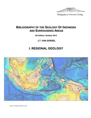
  • 1. BBIIBBLLIIOOGGRRAAPPHHYY OOFF TTHHEE GGEEOOLLOOGGYY OOFF IINNDDOONNEESSIIAA AANNDD SSUURRRROOUUNNDDIINNGG AARREEAASS 55tthh EEddiittiioonn,, OOccttoobbeerr 22001133 JJ..TT.. VVAANN GGOORRSSEELL II.. RREEGGIIOONNAALL GGEEOOLLOOGGYY www.vangorselslist.com
  • 2. Bibliography of Indonesian Geology, 5th Ed. www.vangorselslist.com Oct 20131 I. REGIONAL GEOLOGY The first chapter of the bibliography contains 212 pages with over 2100 titles of papers on the regional geology of Indonesia and adjacent SE Asia- Pacific, as well as general papers that do not fit in any of the regions or specialist categories listed separately. It is subdivided in five chapters: I.1. Indonesia Regional Geology I.2. SE Asia Tectonics, Paleobiogeography I.3. Volcanism, Volcanic rocks geochemistry I.4. Modern environments, Oceanography I.5. Carbonates, Coral Reefs I.1. Indonesia Regional Geology This chapter includes the references of textbooks and papers on the tectonics and regional geology of Indonesia. The Indonesian archipelago is an extremely complex collection of continental blocks, active and extinct volcanic arcs and associated subduction complexes (commonly with ophiolites, marking sutures where former oceans were consumed) and old and young ocean basins. It is now at the convergence of three major tectonic plates: Eurasia, Pacific and Australia. The area of Sulawesi contains elements of all three plates. A pre-plate tectonics depiction of 'tectonostratigraphic provinces' in Indonesia, fairly accurately grouping areas with similar tectonic histories, mainly based on similarities/ differences in Permian- Eocene stratigraphic successions (Umbgrove, 1938)
  • 3. Bibliography of Indonesian Geology, 5th Ed. www.vangorselslist.com Oct 20132 Western Indonesia ('Sundaland') is a complex of continental blocks that amalgamated in Late Paleozoic- Early Mesozoic time. Eastern Indonesia contains a number of small continental microplates derived from the Australia- New Guinea Gondwanan margin, now separated by young age oceanic marginal basins and volcanic arc systems. Many parts of Indonesia's tectonic history remain poorly understood. Numerous reconstructions have been proposed in the last 40 years since the acceptance of plate tectonics theory. Most agree on the broad relative motions of the three major plates, but they vary in many other details. Places like Timor, Seram, W Papua Birds Head, etc. continue to generate debate. Umbgrove (1938) lamented that 'in the last decades at least one or two new hypotheses have been suggested every year to explain the structure of the East Indian Archipelago'. Now, more than 70 years later, new models continue to be proposed and debated. Much progress has been made, but there is still no agreement on the 'final answer'. Suggested Reading Text books: Rutten (1927; remarkable understanding of Indonesian geology for its time; in Dutch), Van Bemmelen (1949), Umbgrove (1949), Hamilton (1979), Hutchison (1989, 2007), Darman and Sidi (1999). Tectonics, Reconstructions: Katili (1971, 1989, etc.), Pigram and Panggabean (1984), Rangin et al. (1990), Struckmeyer et al. (1993), Simanjuntak (1993-2000), Prasetyo (1995), Lee and Lawver (1995), Packham (1996), Simandjuntak and Barber (1996), Hall (1996, 1998, 2002, 2012, etc.), Hall, Clements and Smyth (2009), Harris (2006), Longley (1997), Villeneuve et al. (1998, 2001, 2010), Charlton (2000, 2013), Milsom (2000, 2001), Pubellier et al. (2003, 2005), Satyana (2003, 2009), Spakman & Hall (2010), Hall and Sevastjanova (2012). I.2. SE Asia Tectonics, Paleobiogeography This chapter contains a large (>500 titles), mixed collection of papers on regional SE Asia tectonics, as well as papers on the tectonics and geology of parts of mainland SE Asia that are relevant to the understanding of parts of Indonesia (Thailand, S China, Myanmar, some Vietnam, etc.). Numerous papers on Paleozoic- Mesozoic faunas and floras are also included, especially those that help identify faunal and floral provinces indicative of paleoclimate and relative positions of plates through time. Paleobiogeographic patterns and stratigraphic successions are key tools underpinning plate reconstructions of SE Asia, especially in the pre-Cenozoic. The main patterns of the geologic evolution of SE Asia are reasonably well understood, but details and exact timing of events are still debated. SE Asia is a complex collage of continental blocks, all once part of the Gondwana supercontinent, separated from the New Guinea- Australia- India margin during multiple episodes of Devonian- Jurassic rifting (S China, Indochina, Sibumasu, W Burma, etc.). After Northward drift from the S Hemisphere to equatorial latitudes (recorded by changes in flora and fauna from colder to warmer climates), the various Gondwanan-origin blocks amalgamated with mainland Eurasia during multiple Late Paleozoic- Eocene episodes of collision. Multiple suture zones, many with ophiolites, represent the closing of a succession of ocean basins (Paleo- Tethys, Meso-Tethys, Neo-Tethys/ Indian Ocean) by subduction along the S Eurasia margin. These are accompanied by volcanic-plutonic arc systems and associated subduction complexes. Oceanic marginal basins formed by slab rollback after various collisions, some of which are already consumed, some of the Eocene and younger ones still remain (Andaman Sea, South China Sea, Sulu Sea, Celebes Sea, Banda Seas). Probably related with these are widespread Tertiary basins, mainly initiating in the Late Eocene-Oligocene. Several large strike slip fault zones, many still active today, further add to the complexity of the region. Suggested Reading Tectonics, Terrane reconstructions: Stauffer (1974-1986), Ridd (1980), Metcalfe (1988, 1996, 2009 a.o.) Sengor et al. (1988, 2009), Hutchison (1989, 1994, 1996, 2007), Hall (1997, 1998, 2002, 2009, 2012), Pubellier et al. (2003, 2005), C. Morley (2002, 2012)Satyana (2003, 2009) and others.
  • 4. Bibliography of Indonesian Geology, 5th Ed. www.vangorselslist.com Oct 20133 I.3. Volcanism, Volcanic rocks geochemistry Krakatau after 1883 eruption (Verbeek 1885). This chapter contains mainly papers on regional volcanism; many additional papers that are specific to one area will be under the chapter for that area. Most of the papers on modern volcanoes and descriptions of historic activity are not included, unless they contain data or observations that are relevant to interpretation of the regional geology. With its 128 active and many additional extinct volcanoes, Indonesia has attracted volcanological studies for a long time. Active volcanism occurs along four arc segments, Sunda, Banda, Sangihe and Halmahera, the first three of which were probably once continuous and related to the same subducting Indian Ocean plate. Cretaceous- recent magmatic arcs/ subduction zones Indonesian Archipelago (Katili 1974)
  • 5. Bibliography of Indonesian Geology, 5th Ed. www.vangorselslist.com Oct 20134 Most of the volcanism in the modern Sunda- Banda Arc is quite young, starting in the last 3-6 Ma. Up to 15 older volcanic-plutonic arc systems have been recognized in Indonesia, ranging in age from Permian to Recent. Eight of these have associated commercial mineral deposits. Arc systems may be classified by age and whether the subducting oceanic plates were from the South (Tethys, Indian ocean: most Indonesian arcs), the East (Pacific Ocean- Philippine Sea Plate: Halmahera, Philippines, W Sulawesi) or the North ('Proto-South China Sea Plate': Kalimantan Cretaceous- M Miocene, post-collision New Guinea Late Miocene- Pleistocene) Suggested reading (see more complete listing in Van Gorsel 2009) Volcanic arcs through time: Katili (1973, 1974, 1989), Carlile and Mitchell (1994), Harris (2006), Hartono (2009), Soeria-Atmadja et al. (1986-2001) Volcanic rocks chemistry: Westerveld (1954), Hutchison and Jezek (1978), Hutchison (1975, 1981), papers by Bellon, Elburg, Foden, Handley, Hoogewerff, MacPherson, Turner, Van Bergen, Vroon, Whitford, U. Hartono, etc. Modern volcanoes and activity: Stehn (1927), Neumann van Padang (1936,1983), Kusumadinata et al. (1979), A. Sudradjat, S. Bronto, and many others I.4. Modern environments, Oceanography This section contains papers on modern environments and depositional processes in Indonesia. An understanding of this is obviously important to interpret the geological record. Indonesia has been a study area for many types of modern environments, like tropical rainforests, peat swamps, coral reefs, deltas and deep marine environments and oceanography. A recent topic of great academic interest has been the flow of deep Pacific Ocean water to the Indian Ocean through the Indonesian Archipelago ('Indonesian Throughflow') and its imact on climate in the region. Suggested reading General text books: Ecology of Indonesia series, Gupta (2005) Oceanographic Expeditions: Reports of expeditions Challenger (Brady 1884, etc.), Siboga (Weber 1902), Snellius (Kuenen 1935, etc.) and Snellius II (Van Hinte et al. 1989) Physical Oceanography: Wyrtki (1961) Marine Geology: Molengraaff (1922, 1930), Kuenen (1950), Tomascik et al. (1997) Indonesian Throughflow: Kuhnt et al. (2004), Gordon (2005 and others) SE Asia deltas: Sidi et al. (2003), Woodroffe (2005).
  • 6. Bibliography of Indonesian Geology, 5th Ed. www.vangorselslist.com Oct 20135 I.5. Carbonates, Coral Reefs The Indonesia archipelago has long been a research area for the study of modern coral reefs. Early papers were by Molengraaff (1930), Kuenen (1933) and Umbgrove (1928-1947), more recent ones include Longman et al. (1993). Renewed interest in reefal limestone deposits came with the string of oil and gas discoveries in mainly Oligocene-Miocene age reefal buildup reservoirs on Java, Sumatra, Sulawesi and West Papua. A comprehensive overview of the widespread Tertiary limestones is Wilson (2002). Pre-Tertiary carbonates are relatively rare in Indonesia. Carboniferous- Permian limestones with fusulinid foraminifera are known from Sumatra, W Kalimantan- W Sarawak (Terbat Limestone) and Timor (papers by Fontaine, etc.). The E-M Permian of Sumatra includes the only true reefal Permian limestones in Indonesia (Guguk Bulat, W Sumatra). Late Triassic shallow water carbonates have been reported from Sumatra (Gafoer and Fontaine 1989), Bangka (De Neve and De Roever 1947), Timor (Vinassa de Regny 1915, Haig et al. 2007), E Sulawesi (Cornee et al. 1994, 1995, Martini et al. 1997), Buru (Gerth 1910, Wanner 1923), Seram (Wanner et al. 1952, Martini et al. 2004), Banda Sea (Sinta Ridge ;Villeneuve et al. 1994) and the Kubor terrane of Papua New Guinea (Skwarko et al. 1976, Kristan-Tollman 1986, 1989). Late Jurassic- Early Cretaceous shallow marine carbonates are present in Sumatra (Gafoer and Fontaine 1989) and W Kalimantan- W Sarawak (Bau Limestone). Deep water pelagic limestones of these ages are relatively widespread in Eastern Indonesia. Fractured Upper Triassic limestones are secondary oil reservoirs on Seram Island. Most of the references on individual carbonates are found in the chapters on areas in which they occur. Detail of Molengraaff (1922) map of modern distribution of coral reefs. Red = fringing reefs, Blue = barrier reefs and atolls formed as response to sea level changes, Green = barrier reefs/ atolls caused by 'diastrophism'. Uplifted coral reefs are common East of the yellow line.
  • 7. Bibliography of Indonesian Geology, 5th Ed. www.vangorselslist.com Oct 20136 I. REGIONAL GEOLOGY I.1. Indonesia Regional Geology Aadland, A.J. & R.S.K. Phoa (eds.) (1981)- Geothermal gradient map of Indonesia, 2nd ed.. Indon. Petrol. Assoc., Spec. Publ., p. 1-43 + 2 map sheets 1: 2,500,000. (Compilation of temperature data from petroleum wells in Indonesia. See also updated version by Thamrin & Mey, 1987) Abendanon, E.C. (1914)- Geologische schetskaart van Nederlandsch Oost-Indie, 1:2,500,000. Koninkl. Nederl. Aardrijksk. Genootschap, Smulders, The Hague, 6 sheets. ( Geological overview map of the Netherlands East Indies . First geological overview map of Indonesia, 120x225cm, commissioned by Netherlands Royal Geographical Society. Java and Sumatra rel. complete map, but much of Kalimantan, Sulawesi and New Guinea still mostly uncharted territory) Abendanon, E.C. (1919)- Aequinoctia, an old Palaeozoic continent. J. Geol. 27, 7, p. 562-578. (Early tectonic interpretation of Indonesia. Presence of crystalline schists across E Indonesia suggests area from Borneo to New Guinea may all be parts of one ancient continent, stretching from Sulawesi to Tasmania, here named Aequinoctia) Adinegoro, A.R. Udin (1973)- Stratigraphic studies by the Indonesian Petroleum Institute (LEMIGAS). United Nations ECAFE, CCOP Techn. Bull. 7, p. 55-74. (Review of Cenozoic stratigraphic successions in NE Java, Jambi-Sumatra, NE Sumatra and E Kalimantan. One of first attempts to tie these local stratigraphies to global low latitude planktonic foram zonations) Ali, J.R. & R. Hall (1995)- Evolution of the boundary between the Philippine Sea plate and Australia: paleomagnetic evidence from eastern Indonesia. Tectonophysics 251, p. 251-275. (New paleomag from Sorong Fault Zone, Obi and Taliabu. Sula Platform Coniacian-Santonian paleolatitude at 19°+/- 6°, similar to Misool, suggesting Sula/Taliabu and Misool part of single microcontinent, >10° farther N than expected if attached to Australia, implying region separated from Australia before Late Cretaceous. Obi contains rocks of Philippine Sea and Australian origin. Volcanic arc at S edge Philippine Sea Plate collided with New Guinea at ~25 Ma, changing Philippine Sea-Australian plate boundary from subduction to strike-slip) Ali, J.R., S. Roberts & R. Hall (1994)- The closure of the Indo-Pacific ocean gateway: new plate tectonic perspective. In: F. Hehuwat et al. (eds.) Proc. Int. Workshop Neogene evolution of Pacific Ocean gateways, Bandar Lampung 1993, p. 10-20. (Reconstructions of W Pacific 45-10 Ma. Area N of Sorong Fault Zone ~40° CW rotation and 15° N-ward motion since ~25 Ma. Prior to 22 Ma collision between Australia (New Guinea)- Philippine Sea open Equatorial seaway between Indian and Pacific oceans. Connection mostly closed by initiation of Halmahera Arc at 11 Ma) Alzwar, M. (1986)- Geothermal energy potential related to active volcanism in Indonesia. Geothermics 15, p. 601-607. (90 geothermal areas identified in Indonesia, mostly located in active volcanic belts) Amiruddin (2007)- Permo-Triassic magmatic arc and back arc basins of Gondwana land with reference of Eastern Indonesia, Papua New Guinea and Eastern Australia. Proc. Joint Conv. 32nd HAGI, 36th IAGI and 29th IATMI, Bali 2007, JCB2007-019, 1p. (Abstract only) (Permian-Triassic granitoid plutons and volcanics exposed in E Indonesia, in belt from Banggai Sula in W through Birds Head (Netoni, Anggi, Maransabadi), Birds Neck, Central Range of W Papua (Eilanden, Idenburg) to PNG (Strickland and Kubor Granodiorites) in E, then belt continues S to E Australia through Cape York, NE Queensland to New England Fault Belt. Syn-collision and volcanic arc I and S-type granites)
  • 8. Bibliography of Indonesian Geology, 5th Ed. www.vangorselslist.com Oct 20137 Amiruddin (2009)- A review on Permian to Triassic active or convergent margin in Southeasternmost Gondwanaland: possibility of exploration target for tin and hydrocarbon deposits in the Eastern Indonesia. Jurnal Geol. Indonesia 4, 1, p. 31-41. (online at: www.bgl.esdm.go.id/dmdocuments/jurnal20090104.pdf) (Permian-Triassic magmatic-volcanic belts signify active Paleo-Pacific margin along New Guinea- E Australia part of SE Gondwanaland. Granitic plutons of S- type and may be tin-bearing. Back-arc basins of S Papua and Galille-Bowen-Gunnedah-Sydney basins filled by fluvial, fluvio-deltaic to marine Permian-Triassic sediments, locally with coal, unconformably overlain by marine Jurassic-Cretaceous) Anderson, R.N. (1980)- Update of heat flow in the East and Southeast Asian seas. In: D.E. Hayes (ed.) The tectonic and geologic evolution of Southeast Asian seas and islands, 1, Amer. Geoph. Union, Geoph. Mon. Ser. 23, p. 319-326. Angelich, M.T., R.L. Brovey, M.E. Ruder & C.C. Wielchowsky (1986)- Use of Seasat-derived free-air gravity to interpret the structure of Southeast Asia. Proc. 15th Ann. Conv. Indon. Petrol. Assoc. 1, p. 1-18. (In areas of low sea-bottom relief SEASAT-derived gravity data can be treated qualitatively as low-pass-filtered Bouguer gravity field. Examples from SE Asia) Astjario, P. (1995)- A study of the uplifted coral reef terraces in the eastern part of Indonesia. In: J. Ringis (ed.) Proc. 31st Sess. Comm. Co ord. Joint Prospecting Min. Res. Asian Offshore Areas (CCOP), Kuala Lumpur 1994, 2, p. 116-121. Audley-Charles, M.G. (1965)- Permian palaeogeography of the northern Australia-Timor region. Palaeogeogr., Palaeoclim., Palaeoecol. 1, p. 297-305. ('Autochthonous' Permian rocks of Timor believed to be detritus from Kimberley region of N Australia. This conflicts with suggestions of large crustal dislocations immediately N of Australia recently advocated on basis of regional paleomagnetic studies) Audley-Charles, M.G. (1966)- Mesozoic palaeogeography of Australasia. Palaeogeogr., Palaeoclim., Palaeoecol. 2, p. 1-25. Audley-Charles, M.G. (1976)- Mesozoic evolution of the margins of Tethys in Indonesia and The Philippines. Proc. 5th Ann. Conv. Indon. Petrol. Assoc. 2, p. 25-52. Audley-Charles, M.G. (1978)- The Indonesian and Philippine archipelagoes. In: M. Moullade & A.E.M. Nairn (eds.) The Phanerozoic geology of the world, II, The Mesozoic, Elsevier, p. 165-207. Audley-Charles, M.G. (1981)- Geological history of the region of Wallace s Line. In: T.C. Whitmore (ed.) Wallace s Line and plate tectonics. Clarendon Press, Oxford, p. 5-25. Audley-Charles, M.G., D.J. Carter & A.J. Barber (1974)- Stratigraphic basis for tectonic interpretations of the Outer Banda Arc, Eastern Indonesia. Proc. 3rd Ann. Conv. Indon. Petrol. Assoc., p. 25-44. (Outer Banda Arc islands (Timor, Tanimbar, etc.) are imbricated N margin of Australian shelf and slope on which overthrust Asian elements and major olistostrome have been superimposed, all emplaced from N) Audley-Charles, M.G., D.J. Carter & J.S. Milsom (1972)- Tectonic development of Eastern Indonesia in relation to Gondwanaland dispersal. Nature Phys. Sci. 239, p. 35-39. Audley-Charles, M.G. & R. Harris (1990)- Allochtonous terranes of the Southwest Pacific and Indonesia. Philos. Trans. Royal Soc. London A331, p. 571-587. (Mainly on Timor island. Deformed Australian margin, overridden by three allochtonous nappes) Audley-Charles, M.G. & D.A. Hooijer (1973)- Relation of Pleistocene migrations of pygmy stegodonts to island arc tectonics in eastern Indonesia. Nature 241, p. 197-198.
  • 9. Bibliography of Indonesian Geology, 5th Ed. www.vangorselslist.com Oct 20138 (Pleistocene pygmy stegodonts in Sulawesi, Flores and Timor, areas now separated by deep seas. Dwarf Stegodon co-existed in Flores and Timor in Pleistocene. Flores now separated from Timor by 3,000 m deep Savu Sea, narrowest in Ombai Strait (30 km) between Alor and Timor. Because elephants (and presumably stegodonts) could not swim across Savu Sea- Ombai Strait, a Pleistocene land connection between Flores and Timor must be postulated (but elephantoids now believed to be rel. good swimmers; HvG) Audley-Charles, M.G. & J.S. Milsom (1974)- Comment on Plate convergence, transcurrent faults, and internal deformation adjacent to southeast Asia and the western Pacific . J. Geophys. Res. 79, 32, p. 4980-4981. (A&M suggest Timor Trough and its eastward extensions are 'downbuckle in continental crust', not the surface trace of a subduction zone. See also reply by Fitch and Hamilton 1974 who do interpret this as subduction zone that continues East from the Java Trench) Badan Geologi (2009)- Sedimentary basins map of Indonesia based on gravity and geological data, 1:5000,000. Geol. Survey Indonesia, Bandung. (online at: www.grdc.esdm.go.id) (Map of Indonesia sedimentary basins, color-coded by age and labeled by basin type) Badings, H.H. (1936)- Het Palaeogeen in den Indischen Archipel. Verhand. Geol. Mijnbouwk. Gen. Nederland en Kol., Geol. Ser. 11, 3, p. 233-292. ('The Paleogene in the Indies Archipelago'. Overview of Paleogene sediments in Indonesia and Philippines. With outcrop distribution/ basic paleogeographic maps for Tertiary a, b, c and d (Eocene- Oligocene). Useful compilation, but severely criticized in series of papers by Van Bemmelen, Koolhoven, Ubaghs, etc. in 1936) Baker, S., R. Hall & E. Forde (1994)- Geology and jungle fieldwork in Eastern Indonesia. Geology Today 10, 1, p. 18-23. Barber, A.J. (1985)- The relationship between the tectonic evolution of Southeast Asia and hydrocarbon occurrences. In: D.G. Howell (ed.) Tectonostratigraphic terranes of the Circum-Pacific region, Circum-Pacific Council Energy Mineral Res. 1, Houston, p. 523-528. (SE Asia consists of cratonic Sundaland core of continental fragments that had stabilized by end-Mesozoic. Additional terranes added through Late Mesozoic- Tertiary in Sumatra, Borneo, E Indonesia and Philippines. Early Tertiary widespread extension, followed by Late Tertiary compression, resulting in favorable locations for hydrocarbon generation and accumulation) Barber, A.J. (1993)- Dispersion, subduction and collision in Eastern Indonesia. Proc. 22nd Ann. Conv. Indon. Assoc. Geol. (IAGI), 1, p. 23- . Barber, A.J. (2013)- The origin of melanges: cautionary tales from Indonesia. J. Asian Earth Sci. 76, p. 428- 438. (Description of two examples of melanges from Banda arc (Timor Bobonaro melange) and Sunda arc (Nias, Oyo melange, with common ophiolitic blocks). Evidence from Australian continental Shelf S of Sumba shows large quantities of diapiric melange generated in accretionary complex. Comparable diapirs can be recognised in Timor accreted at earlier stage. Evidence from Timor and Nias shows that diapiric melange can be generated well after initial accretion process was completed) Barber, A.J. & S. Wiryosujono (eds.) (1981)- The geology and tectonics of Eastern Indonesia. Proc. CCOP-IOC Working Group Meeting, Bandung 1979, Geol. Res. Dev. Centre, Spec. Publ. 2, 415 p. (Conference volume with many benchmark papers on tectonics of Eastern Indonesia) Barley, M.E., P. Rak & D. Wyman (2002)- Tectonic controls on magmatic-hydrothermal gold mineralization in the magmatic arcs of SE Asia. In: D.J. Blundell, F. Neubauer & A. von Avadt (eds.) The timing and location of major ore deposits in an evolving orogen. Geol. Soc. London, Spec. Publ. 204, p. 39-47. (Most gold deposits in SE Asian arcs formed during tectonic reorganization intervals rather than steady-state subduction: (1) 25 Ma collision of Australian craton with Philippine Sea plate arc; (2) M Miocene/ 17 Ma mineralization following maximum extrusion of Indochina and cessation S China Sea spreading; (3) majority
  • 10. Bibliography of Indonesian Geology, 5th Ed. www.vangorselslist.com Oct 20139 and largest deposits formed since 5 Ma during plate reorganization with change in relative motion between Indian-Australian and Pacific plates between 5- 3.5 Ma following Philippine arc- Eurasia collision in Taiwan) Barr, S.M. & A.S. MacDonald (1981)- Geochemistry and geochronology of Late Cenozoic basalts of Southeast Asia: summary. Geol. Soc. Amer. Bull. 92, 8, p. 508-512. Baumann, P. (1982)- Depositional cycles on magmatic and back arcs: an example from Western Indonesia. Revue Inst. Francais Petrole 37, 1, p. 3-17. (Five main depositional cycles in Eocene- Recent of Java, Sumatra: (1) M Eocene- E Oligocene (P11-P17), followed by uplift, block faulting, volcanism; (2) Latest Oligocene- E Miocene (P22/N3- N7?, ending with volcanism- uplift?; (3) late E Miocene- M Miocene (N8- N10-11; poorly known); (4) M- Late Miocene (N11/12- N14/17), followed by uplift, faulting; (5) Pliocene-Recent, starting with major transgression at Miocene- Pliocene boundary, N18. Major Late Pliocene- Recent volcanic phase) Beck, R.H. & P. Lehner (1975)- Oceans, new frontiers in exploration. Am. Assoc. Petrol. Geol. Bull. 58, p. 376-395. (Old seismic profiles and interpretation NW Australia- Sunda Arc) Becker, M., E. Reinhart, S. Bin Nordin, D. Angermann, G. Michel & C. Reigber (2000)- Improving the velocity field in South and South-East Asia: the third round of GEODYSSEA. Earth Planets Space 52, p. 721-726. (online at: http://www.terrapub.co.jp/journals/EPS/pdf/5210/52100721.pdf) (Review of GEODYnamics of S and SE Asia (GEODYSSEA) project, a network of 42 GPS stations across SE Asia, observed between 1994-1998) Beckley, L., L.A. Lawver & T.Y. Lee (1993)- Cenozoic basin formation in Southeast Asia. Univ. of Texas, Austin, PLATES Project, Progress Rept. 62, 16p. Beltz, E.W. (1944)- Principal sedimentary basins in the East Indies. AAPG Bull. 28, 10, p. 1440-1454. (Vintage Indonesian basins map and basin summaries by Stanvac (Standard Oil NJ) geologist) Ben-Avraham, Z. (1978)- The evolution of marginal basins and adjacent shelves in East and Southeast Asia. Tectonophysics 45, p. 269-288. Benioff, H. (1954)- Orogenesis and deep crustal structure; additional evidence from seismology. Geol. Soc. Amer. Bull. 65, p. 385-400. (Sunda arc example of dipping earthquake zones below volcanic arcs; now called Benioff zone ) Benson, W.N. (1923)- Palaeozoic and Mesozoic seas in Australasia. Trans. Proc. Royal Soc. New Zealand 54, p. 1-62. (Old, but still interesting discussion of Australia- E Indonesia paleogeography) Benson, W.N. (1925)- The structural features of the margin of Australasia. Trans. Proc. Royal Soc. New Zealand 55, p. 99-137. (Old, but still interesting discussion of tectonics- structure of East Indonesia, NW Australia, etc.) Berlage, H.P. (1937)- A provisional catalogue of deep-focus earthquakes in the Netherlands East Indies, 1918- 1936. Gerland Beitr. Geophysik 50, p. 7-17. (First text to notice deep earthquakes in Indonesia are on plane dipping toward Asian mainland (now known as Benioff zone) Berlage, H.P. (1939)- One hundred deep-focus earthquakes in the Netherlands Indies. Proc. 6th Pacific Science Congr., California, p. 135-138.
  • 11. Bibliography of Indonesian Geology, 5th Ed. www.vangorselslist.com Oct 201310 Bijlaard, P.P. (1936)- De verklaring voor het optreden van zwaartekracht anomalieen, diepzeetroggen, geosynclinalen, gebergtevorming en vulkanisme bij plaatselijke plastische vervorming van de aardkorst. De Ingenieur in Nederl. Indie (I), 7, p. 93-97. ( The explanation for gravity anomalies, deep sea troughs, geosynclines, mountain building and volcanism near local plastic deformation of the earth s crust ) Blom, J. (1934)- Geologische Probleme im Malayischen Archipel. Inaugural-Dissertation Friedrich Schiller University, Jena, p. 1-71. ('Geological problems in the Malayan Archipelago'. Overview of pre-1934 tectonic theories on Indonesia, without new synthesis or opinion) Blundell, D.J. (2002)- The timing and location of major ore deposits in an evolving orogen; the geodynamic context. In: D.J. Blundell, F. Neubauer & A. von Quadt (eds.) The timing and location of major ore deposits in an evolving orogen. Geol. Soc., London, Spec. Publ. 204, p. 39-47. Bock, Y., L. Prawirodirdjo, J.F. Genrich, C.W. Stevens, R. McCaffrey, C. Subarya et al. (2003)- Crustal motion in Indonesia from Global Positioning System measurements. J. Geophys. Res. 108, B8, 2367, 17p. (GPS surveys suggest tectonics dominated by interaction of 4 blocks: Sunda Shelf (moves 6 mm/yr SE rel. to Eurasia), S Banda Arc (CW rotation rel. to Sunda and Australia), Birds Head (rapidly moves WSW, subducting beneath Seram Trough) and E Sulawesi (CW rotation, transferring E-W Pacific motion into N-S shortening across N Sulawesi trench. Crustal blocks all experience significant internal deformation). Boehm, G. (1901)- Aus den Molukken. Zeitschr. Deutsch. Geol. Ges. 53, p. 4-10. ('From the Moluccas'. First brief report by Boehm from his geological travels in E Indonesia in 1900-1901. Mainly on visit to S coast of Sula Islands, first report on Mesozoic fossils in 200 years since Rumphius) Boehm, G. (1901)- Weiteres aus den Molukken. Zeitschr. Deutsch. Geol. Ges. 54, p. 74-78. ('More from the Moluccas'. Continuation of paper above. On Ambon Mesozoic sandstone-limestone, etc.)) Boehm, G. (1904)- Geologische Ergebnisse einer Reise in den Molukken. Proc. Compt. Rend. 9th Int. Geol. Congress, Vienna 1903, p. 657-662. ( Geological results of a trip in the Moluccas . Brief, early report on widespread Triassic and Jurassic marine sediments on islands of E Indonesia, noticing similarities of rocks and faunas with those from European Alps) Boehm, G. (ed.) (1904-1959)- Beitrage zur Geologie von Niederlandisch-Indien. Palaeontographica, Suppl. Vol. IV, 5 vols. ( Contributions to the geology of the Netherlands Indies . Series of mainly paleontological papers from E Indonesia. Listed individually) Boehm, G. (1906)- Neues aus dem Indo-Australischen Archipel. Geologische Mitteilungen aus dem Indo- Australischen Archipel I, Neues Jahrb. Min. Geol. Pal., Beil. Band 22, p. 385-412. ('News from the Indo-Australian Archipelago, etc.'.Early overview of Mesozoic macrofossil localites in E Indonesia: Sula islands, W Cenderawasih Bay (Wendesi M Jurassic ammonite Phylloceras), New Guinea N Coast (Walckenaer Bay ammonites and Inoceramus), Buru) Bostrom, R.C. (1984)- Westward Pacific drift and the tectonics of eastern Asia. Tectonophysics 102, p. 359- 376. (Brief overview of tectonic history and shared Paleozoic- Mesozoic petroleum systems between N Australia, New Guinea, Timor and other parts of eastern Indonesia) Bradshaw, M. (2001)- Australia and Eastern Indonesia at the cross-roads of Gondwana and Tethys- the implications for petroleum resources. SEAPEX Expl. Conf. 2001, Singapore, 8p. Branson, C.C. (1941)- Age of abyssal deposits of East Indian Archipelago. AAPG Bull. 41, 2, p. 320-322.
  • 12. Bibliography of Indonesian Geology, 5th Ed. www.vangorselslist.com Oct 201311 (Brief review of very deep marine deposits in East Indies: Danau Fm of Borneo (Molengraaff, 1910, 'probably Jurassic', but could be E Cretaceous: HvG) and Permian, Triassic and Lower Cretaceous abyssal deposits of Timor) Brouwer, H.A. (1915)- Over de tektoniek der Oostelijke Molukken. Proc. Kon. Akad. Wetensch. Amsterdam 24, p. 987-994. (Early, brief overview of tectonics of the E Moluccas. See Brouwer (1917) for English version) Brouwer, H.A. (1916)- Reisbericht omtrent geologische verkenningstochten op verschillende eilanden der Molukken. Tijdschr. Kon. Nederl. Aardrijksk. Gen. 33, p. 83-89. ( Travel notes of geological reconnaissance trips to various islands of the Moluccas ) Brouwer, H.A. (1916)- Geologische verkenningen in de Oostelijke Molukken. Verhand. Geol. Mijnbouwk. Gen. Nederl. Kol., Geol. Ser., III (Molengraaff issue), p. 31-56. ('Geological reconnaissance in the East Moluccas'. Brief overview of reconnaissance trips in E Indonesia islands) Brouwer, H.A. (1917)- On the tectonics of the eastern Moluccas. Proc. Kon. Akad. Wetensch., Amsterdam 19, 1, p. 242-248. (online at http://www.digitallibrary.nl) (Early review of E Indonesia tectonics) Brouwer, H.A. (1918)- Phasen der bergvorming in de Molukken. Inaugural speech Techn. Univ. Delft, 32p. ( Phases of mountain building in the Moluccas . Early, dated overview of Indonesia tectonics. No maps, figures) Brouwer, H.A. (1918)- Uber Gebirgsbildung und Vulkanismus in den Molukken. Geol. Rundschau 8, 5-8, p. 197-209. ( On mountain building and volcanism in the Moluccas ) Brouwer, H.A. (1918)- Kort overzicht onzer kennis omtrent geologische formaties en bergvormende bewegingen in den O.I. Archipel beoosten Java en Celebes. Verhand. Geol. Mijnbouwk. Gen. Nederl. Kol., Geol. Ser. II, p. 293-332. ('Brief overview of our knowledge of the geological formations and mountain building movements in the east Indies archipelago East of Java and Sulawesi'. Early overview of distribution of Paleozoic- Mesozoic- Tertiary rocks across E Indonesia) Brouwer, H.A. (1919)- On the age of the igneous rocks in the Moluccas. Proc. Kon. Nederl. Akad. Wetensch., Amsterdam, 21, p. 803-815. (online at: http://www.dwc.knaw.nl/DL/publications/PU00012138.pdf) (On a variety of different age volcanic-plutonic rocks in E Indonesia) Brouwer, H.A. (1919)- Geologisch overzicht van het oostelijk gedeelte van den Oost-lndischen Archipel. Jaarboek Mijnwezen Nederl. Oost-Indie 46 (1917), Verhand. II, p. 145-452. (Rel. comprehensive overview of 1917 state of knowledge of East Indonesia geology) Brouwer, H.A. (1920)- On the crustal movements in the region of the curving rows of islands in the eastern part of the East-Indian Archipelago. Proc. Kon. Nederl. Akad. Wetensch., Amsterdam, 22, 7-8, p. 772-782. (online at: http://www.dwc.knaw.nl/DL/publications/PU00012027.pdf) (Curving rows of islands of Moluccas similar to many chains of Alpine structure. Rows of islands of Moluccas may be grouped into (1) zone characterized by outward-directed overthrusts (Timor-Ceram row); (2) marginal zone without overthrust tectonics (Sula-islands, Misool, W New Guinea S of Mac Cluer Bay (= Bintuni) and probably also Kei-islands; (3) inner zone with young active volcanoes) Brouwer, H.A. (1921)- Some relations of earthquakes to geologic structure in the East Indian archipelago. Bull. Seismol. Soc. America 11, 3-4, p. 166-182.
  • 13. Bibliography of Indonesian Geology, 5th Ed. www.vangorselslist.com Oct 201312 Brouwer, H.A. (1921)- The horizontal movement of geanticlines and the fractures near their surface. J. of Geology 29, 6, p. 560-577. (Early attempt to explain deep basins and uplifted islands of E Indonesia) Brouwer, H.A. (1922)- The major tectonic features of the Dutch East Indies. J. Washington Acad. Sci. 12, 7, p. 172-185. Brouwer, H.A. (1925)- The geology of the Netherlands East Indies. MacMillan, New York, p. 1-160. (First 'text-book' on the geology of Indonesia, based on series of lectures at University of Michigan) Brouwer, H.A. (1926)- Structure of the East Indies. Proc. 2nd Pan-Pacific Sci. Congr., Australia 1923, p. 784- . Brouwer, H.A. (1926)- Volcanic action and mountain building in the Dutch East Indies. Proc. 2nd Pan-Pacific Sci. Congr., Australia 1923, p. 856- . Brouwer, H.A. (1926)- The Carboniferous and Permian of the Netherlands East Indies. Proc. 2nd Pan-Pacific Sci. Congr., Australia 1923, 2, p. 1024-1027. Brouwer, H.A. (1929)- Geology of the Netherlands East Indies. In: L.M.R. Rutten (ed.) Science in the Netherlands Indies, Kon. Nederl. Akad. Wetensch., Amsterdam, p. 101-125. Brouwer, H.A. (1931)- Paleozoic. In: In: B.G. Escher et al. (eds.) De palaeontologie en stratigraphie van Nederlandsch Oost-Indie, Leidsche Geol. Meded. 5 (K. Martin memorial volume), p. 552-566. (Overview of occurrences of Paleozoic in Indonesia: Sumatra, Borneo, Timor, New Guinea) Brouwer, H.A. (1949)- Evolution orogenique ou consolidation prochaine aux Indes orientales. Ann. Hebert et Haug 7, p. 31-42. (Account of orogenic history of Indonesia, with special reference to Sulawesi and Timor islands) Brown, J.L. & J.E. McCallum (1997)- An atlas of sealing faults in SE Asia. In: J.V.C. Howes & R.A. Noble (eds.) Proc. Int. Conf. Petroleum Systems SE Asia & Australia, Jakarta 1997, Indon. Petrol. Assoc. p. 837-841. Bucking, H. (1904)- Zur Geologie des nordostlichen Indischen Archipels. Sammlung. Geol. Reichs-Mus. Leiden, ser. 1, 7, p. 231-253. ( On the geology of the NE Indies archipelago . Descriptions of rocks from Bacan, Mandioli, Kasiruta, Obi Besar, Manipa and Sulabesi) Budiman, I., J. Nasution, I. Sobari & W.H. Simamora (2000)- Gravity anomaly map of western part of Indonesia, scale 1:2,000,000. Geol. Res. Dev. Centre, Bandung. Calais, E., L. Dong, M. Wang, Z. Shen & M. Vergnolle (2006)- Continental deformation in Asia from a combined GPS solution. Geophys. Res. Lett. 33, L24391, p. 1-6. (New model of Asia tectonic plates relative horizontal motions from GPS measurements) Cardwell, R.K. & B.L. Isacks (1978)- Geometry of the subducted lithosphere beneath the Banda Sea in Eastern Indonesia from seismicity and fault plane solutions. J. Geophys. Res. 83, B6, p. 2825-2838. (Earthquake data fault plane solutions suggest two lithospheric plates descending into upper mantle beneath Banda Sea: (1) along Banda arc, laterally continuous slab that subducted at plate boundary defined by Java trench-Timor Trough-Aru Trough system; (2) descends to SW to ~100 km depth in Seram Trough region and may be joined to Banda subduction system by W extension of New Guinea Tarera- Aiduna fault zone. Banda arc slab contorted at E end of arc where trench and line of active volcanoes curve NE. Contortion appears to be lateral bend in subducted slab that is continuous from surface to depths of 600 km)
  • 14. Bibliography of Indonesian Geology, 5th Ed. www.vangorselslist.com Oct 201313 Cardwell, R.K. & B.L. Isacks (1981)- A review of the configuration of the lithosphere subducted beneath the eastern Indonesian and Philippine Islands. In: A.J. Barber & S. Wiryosujono (eds.) The geology and tectonics of Eastern Indonesia, Geol. Res. Dev. Centre Bandung, Spec. Publ. 2, p. 29-47. (Identification of subducting slabs from earthquake data. Seismic zone from Timor Trough to >600km depth below S Banda Basin, but does not appear to be linked to Seram Trough) Cardwell, R.K., B.L. Isacks & D.E. Karig (1980)- The spatial distribution of earthquakes, focal mechanism solutions and subduced lithosphere in the Philippine and North-eastern Indonesian islands. In: D.E. Hayes (ed.) The tectonic and geologic evolution of Southeast Asian seas and islands, AGU Geophys. Mon. 23, p. 1-35. (Earthquake focal mechanisms used to estimate configuration of lithosphere subducted beneath Philippine and NE Indonesian islands and to estimate geometry and nature of plate boundaries in region. Philippine region is aggregate of island arcs between Philippine Sea Plate and SE Asian Plate. Major share of deformation along Philippine Fault and opposing subduction zones. Convergence between Philippine Islands and SE Asian Plate along Manila Trench, Negros Trench, and Cotabato Trench. S-dipping zone of earthquake hypocenters indicates that lithosphere of Celebes Basin subducted along W part of N Sulawesi Trench to depth of >200 km beneath N arm of Sulawesi. Convergence between Philippine Islands and W boundary of Philippine Sea Plate along E Luzon Trough and the Philippine Trench. S Philippine Trench is young feature) Carey, S.W. (1975)- Tectonic evolution of Southeast Asia. Proc. 4th Ann. Conv. Indon. Petrol. Assoc., p. 17-48. (Tectonic model for SE Asia using the expanding earth theory (Carey did not believe in subduction)) Carlile, J.C. & A.H.G. Mitchell (1994)- Magmatic arcs and associated gold and copper mineralization in Indonesia. In: T.M. van Leeuwen et al. (eds.) Indonesian mineral deposits- discoveries of the past 25 years. J. Geochem. Expl. 50, p. 91-142. (Gold mineralization in andesitic arcs, active for 3-20 My intervals from Cretaceous- Pliocene. Fifteen major arcs; known ore bodies in six mid-Tertiary- Pliocene arcs. Indonesia arcs total ~7,000 kms in length. Individual arcs or segments of arcs characterized by specific mineralization types reflecting arc basement related to earlier collisions and reversals in tectonic polarity and erosion level) Caughey, C.A., D.C. Carter, J. Clure, M.J. Gresko, P. Lowry, R.K. Park & A. Wonders (1996)- Proc. International Symposium on Sequence Stratigraphy in S.E. Asia. Jakarta 1995, Indon. Petrol. Assoc., 487 p. CCOP-IOC (1981)- Studies in East Asian tectonics and resources. ESCAP, CCOP Techn. Paper 7a, 2nd ed., p. 1-250. (Report on ongoing geological research along nine SEATAR mega-regional transects ) CCOP (1991)- Total sedimentary isopach maps, offshore East Asia. CCOP Techn. Bull. 23, sheets 1-6, p 1-116. (Sediment isopach maps and summaries of SE and E Asia basins) CCOP, T. Sato and Working Group (2000)- Geotectonic map of East and Southeast Asia: sheets 4, 5 and 6. CCOP-CPCEMR Geotectonic map project. CCOP Tech. Bull. 27, p. 1-16. (Geotectonic Map of E and SE Asia. Sheet 4: Philippines, Vietnam, S China, Sheet 5: Malaysia, W Indonesia, Sheet 6: E Indonesia) CCOP, T. Sato and Working Group (2002)- Geotectonic map of East and Southeast Asia: sheets 1, 2, 3 and 8. CCOP-CPCEMR Geotectonic map project. CCOP Tech. Bull. 31, p. 1-16. (Geotectonic Map of E and SE Asia. Sheets 1,2 NE Asia, 3: S China, Indochina, Myanmar, Sheet 8: W Pacific Ocean) Chamot-Rooke, N. & X. Le Pichon (1999)- GPS determined eastward Sundaland motion with respect to Eurasia confirmed by earthquakes slip vectors at Sunda and Philippine trenches. Earth Planet. Sci. Lett. 173, p. 439-455. (GPS over SE Asia revealed Indochina, Sunda shelf and part of Indonesia behave as rigid Sundaland platelet, which rotates clockwise relative to Eurasia. Sundaland E-ward velocity of ~10 mm/yr on S boundary increasing to 16-18 mm/yr on N boundary)
  • 15. Bibliography of Indonesian Geology, 5th Ed. www.vangorselslist.com Oct 201314 Chamot-Rooke, N., X. Le Pichon, C. Rangin, P. Huchon, M. Pubellier, C. Vigny & A. Walpersdorf (1999)- Sundaland motion in a global reference frame detected from GEODYSSEA GPS measurements: implications for relative motions at the boundaries with the Australo-Indian plates and the South China block. In: The Geodynamics of S and SE Asia (GEODYSSEA) Project, GeoForschungsZentrum, Potsdam, STR 98/14, p. 39- 74. Chapman, D.R. (1964)- On the unity and origin of the Australasian tektites. Geochim. Cosmochim. Acta 28, p. 841-888. (Review of widespread Pleistocene tektites, distributed several 1000 km across SE Asia and Australia. Tektites remarkably similar in composition. Probably caused by major meteorite impact, probably on moon. Size and shape of tektites interpreted to reflect higher T portion of crater ejecta descended over SE Australia and lower T portions were strewn progressively over SW Australia-Indonesia and further North. 'Glass pebbles' locally known as billitonites, philippinites, australites, javanites, philippinites, etc.) Charlton, T.R. (1986)- A plate tectonic model of the eastern Indonesia collision zone. Nature 319, p. 394-396. (E Indonesia interpreted in terms of rel. simpe three plate indentation model) Charlton, T.R. (1991)- Postcollision extension in arc-continent collision zones, eastern Indonesia. Geology 19, p. 28-31. (Postcollisional extension common in E Indonesia orogenic belts, starting <5 My after compressional deformation (Timor area, Gulf of Bone in Sulawesi, Wandamen Terrane of Irian Jaya). Extension results from decoupling of subducting oceanic lithosphere from unsubductable continental lithosphere; superimposition of extension is virtually unavoidable consequence of arc-continent collision) Charlton, T.R. (2000)- Tertiary evolution of the Eastern Indonesia collision complex. J. Asian Earth Sci. 18, 5, p. 603-631. (Interpretations of last 35 My of tectonic evolution of E Indonesia, with plate reconstructions at 5 My intervals. Oldest reconstruction predates collisional deformation between N-moving Australian continent and E-W oriented, S- facing subduction zone extending from S margin of Eurasian continent E-wards. Beginning at ~30 Ma the Australian continental margin commenced collision with subduction zone along restored N margin, from Sulawesi in W to PNG in E. At ~24 Ma present-day pattern of oblique convergence between N margin of Australia and Philippine Sea Plate began. From ca 18 Ma S-directed subduction commenced at Maramuni Arc in N New Guinea. Sorong Fault Zone strike-slip system active from ~12 -6 Ma) Charlton, T.R. (2001)- Permo-Triassic evolution of Gondwanan eastern Indonesia, and the final Mesozoic separation of SE Asia from Australia. J. Asian Earth Sci. 19, 5, p. 595-617. (E Indonesia continental fragments with Australian/Gondwanan affinities remarkably uniform Permo-Triassic tectonostratigraphy, ranging from granitoid belt in N, through continental platform, to intracontinental rift system in S. In rift system complementary upper and lower plate rifted margins recognised in N and S Banda Arcs. N granitoid belt initiated in mid-Carboniferous, intracontinental rift system began in latest Carboniferous- earliest Permian. Extension in N rift margin ceased in M Carnian, with decline in igneous activity in granitoid belt to North. Sibumasu Terrane originated on Gondwanaland margin, rifted away in E Permian. Gondwanan E Indonesia acted as continental connection between Sibumasu/Indochina and Australia in Permian- Triassic, permitting limited floral- faunal interchange between Gondwanaland and SE Asia until final separation in Late Triassic. M Carnian structural event in E Indonesia may be related to this separation) Charlton, T.R. (2004)- The petroleum potential of inversion anticlines in the Banda Arc. AAPG Bull. 88, 5, p. 565-585. (Timor, Tanimbar and Seram perceived structural complexity may be overstated. Proposes inversions of Permian-Jurassic grabens as fundamental structural style) Charlton, T.R. (2012)- Permian-Jurassic palaeogeography of the SE Banda Arc region. Berita Sedimentologi 24, p. 5-17.
  • 16. Bibliography of Indonesian Geology, 5th Ed. www.vangorselslist.com Oct 201315 (online at: http://www.iagi.or.id/fosi/berita-sedimentologi-no-24-timor-and-arafura-sea.html) (Paleogeographic maps of S and E Banda forearc (Savu to Kei islands, incl. Timor-Tanimbar) and adjacent parts of NW Australian continental margin for E Permian, M-L Permian, E-M Triassic, Late Triassic, and E, M and Late Jurassic. Three main rift phases (E Permian, Late Triassic and M-Late Jurassic) separated by quieter tectonic intervals with low facies diversity) Charlton, T.R. (2013)- Sundaland Timor Paleogene rifting and regional palaeotectonics. Proc. 37th Ann. Conv. Indon. Petrol. Assoc., Jakarta, IPA13-G-005, p. 1-11. (Alternative plate reconstruction of Paleogene of Indonesia- NW Australia, suggesting E Sundaland and Gondwanaland/ NW Australia remained attached until final separation by rifting in Paleogene. Main driver for model is similarity of Paleogene rifting in both Sundaland and on Timor island, which is interpreted as part of the Australian continental margin) Chi, Y.H., P.B. Yuan, W.L. Ching, T.K. Wang & P.C. Chung (2000)- Geodynamic processes of Taiwan arc- continent collision and comparisons with analogs in Timor, Papua New Guinea, Urals and Corsica. Tectonophysics 325, p. 1-21. Choi, D.R. (2005)- Deep earthquakes and deep-seated tectonic zones: a new interpretation of the Wadati- Benioff zone. In: F.C. Wezel (ed.) Earth dynamics beyond the plate paradigm. Bol. Soc. Geol. Ital., Spec.Vol. 5, p. 79-118. (Unorthodox tectonic model for SE Asia tectonics, etc.) Clements, B., P.M. Burgess, R. Hall & M.A. Cottam (2011)- Subsidence and uplift by slab-related mantle dynamics: a driving mechanism for the Late Cretaceous and Cenozoic evolution of continental SE Asia? In: R. Hall et al. (eds.) The SE Asian gateway: history and tectonics of Australia-Asia collision, Geol. Soc., London, Spec. Publ. 355, p. 37-51. (Extensive Cretaceous-Paleocene regional unconformity from Indochina to Java may be due to subduction- driven mantle processes. Cessation of subduction, descent of N- dipping slab into mantle, and consequent uplift and denudation of sediment-filled Late Jurassic- E Cretaceous dynamic topographic low help explain extent and timing of unconformity. Sediments started to accumulate above unconformity from M Eocene when subduction recommenced under Sundaland) Clements, B. & R. Hall (2011)- A record of continental collision and regional sediment flux for the Cretaceous and Palaeogene core of SE Asia: implications for early Cenozoic palaeogeography. J. Geol. Soc. London 168, p. 1187-1200. (online at: http://searg.rhul.ac.uk/pubs/clements_hall_2011%20Sundaland%20emergence.pdf) (Detrital zircons from Eo-Oligocene sandstones of SW West Java derived from local volcanic sources and Sundaland. Populations with ages of 50-80 Ma (from two discrete volcanic arcs in Java and Sulawesi), 74-145 Ma (E-M Cretaceous granites of Schwaner Mts of SW Borneo), 202-298 Ma (Permian-Triassic Tin Belt granites), 480-653 Ma and 723-1290 Ma (Proterozoic SE Asia basement once part of Gondwana). M Eocene sediment derived mainly from Tin Belt, Late Eocene and after Borneo source more important. Microcontinental collision at Java margin (~80 Ma) halted Cretaceous subduction and resulted in elevation of large parts of continental SE Asia) Clermonte, J. (1982)- Eastern Indonesia peripheral to northern Australia: post-Mesozoic structures and orogeny. Bull. Centr. Rech. Expl.-Prod. Elf- Aquitaine 6, 2, p. 503-511. Clure, J. (1998)- Complex Eastern Indonesia poses exploration challenges. Oil and Gas J. 96, 38, p. 91-95. Cockroft, P. & K. Robinson (1988)- Chemistry of oilfield waters in South East Asia and their application to petroleum exploration. Proc. Offshore South East Asia Conf., Singapore 1988, SEAPEX Proc. 8, p. 221-238. (Study of formation waters from 400 SE Asia wells. Majority fresh or brackish meteoric to connate waters)
  • 17. Bibliography of Indonesian Geology, 5th Ed. www.vangorselslist.com Oct 201316 Cole, J.M. & S. Crittenden (1997)- Early Tertiary basin formation and the development of lacustrine and quasi- lacustrine/marine source rocks on the Sunda Shelf of SE Asia. In: A.J. Fraser, S.J. Matthews & R.W. Murphy (eds.) Petroleum Geology of Southeast Asia, Geol. Soc., London, Spec. Publ. 126, p. 147-183. (Tertiary basins of Sunda Shelf of SE Asia formed in ?Mid- Late Eocene and accumulated thick syn-rift lacustrine and low salinity organic-rich shales through Late Paleogene. Towards end Oligocene- E Miocene marine transgression throughout region. Syn-rift sediments most important hydrocarbon source rocks) Collette, B.J. (1954)- On the gravity field of the Sunda region (West Indonesia). Geol. Mijnbouw 16, 7, p. 271- 300. (Interpretation of five gravity profiles through Sumatra and Java, based on broadly spaced gravity data from Vening Meinesz and BPM) Corbett, G.J. & T.M. Leach (1998)- Southwest Pacific Rim gold-copper systems: structure, alteration and mineralization. Soc. Econ. Geol., Spec. Publ. 6, p. 1-238. (draft online at: www.corbettgeology.com/corbett_and_leach_1997.pdf) (On Indonesia- New Guinea- Philippines gold deposits. Includes discussions of Masupa Ria, Kalimantan, Wetar, etc.) CoreLab/ PERTAMINA (1995)- The petroleum geology and economic assessment of the foreland basin areas of Eastern Indonesia. 5 vols. Courteney, S. (1995)- Sequence stratigraphy applied to the hydrocarbon productive basins of western Indonesia. In: G.H. Teh (ed.) Southeast Asian basins: oil and gas for the 21st century, Proc. AAPG-GSM Int. Conf. 1994, Bull. Geol. Soc. Malaysia 37, p. 363-394. (>3,000 exploratory wells drilled since 1870 in W Indonesia with 750 discoveries. By 1992 over 300 producing fields in 11 basins and 100 fields shut-in or abandoned. Published work is of regional nature. Lithostratigraphy mainly based on pre-1960's work, with terminology varying between companies. Biostratigraphy handicapped by lack of age diagnostic fossils in E Miocene and older sediments in most of Sumatra and Natuna. Java- Kalimantan older section more marine with age diagnostic fossils, but errors in age determination due to reworking. Propose correlative framework using sequence stratigraphy) Courteney, S. (1996)- Western Indonesia-1: Sequence stratigraphy buoys W. Indonesia basins. Oil and Gas J. 94, May 20, p. 86-90. Courteney, S. (1996)- Western Indonesia-2: Middle Eocene, older sequences in rifts key to potential in Western Indonesia. Oil and Gas J. 94, 22, May 27, p. 71-74. (Hydrocarbons in Sumatra, Natuna, Sunda Basin, Lombok, Barito, NW Java, possibly also E Java basins all tied to M Eocene source rocks, mainly lacustrine, limited to Paleogene rifts) Curray, J.R. (1989)- The Sunda Arc: a model for oblique plate convergence. Netherlands J. Sea Res. 24, p. 131- 140. (Sunda Arc extends from Himalayas to Banda Arc. Variations along arc function of direction and speed of convergence across subduction zone and sediment thickness on underthrusting plate) Daly, M.C., M.A. Cooper, I. Wilson, D.G. Smith & B.G.D. Hooper (1991)- Cenozoic plate tectonics and basin evolution in Indonesia. Marine Petrol. Geol. 8, 1, p. 2-21. (BP plate reconstruction. Includes Oligocene arc polarity reversal in Sumatra, Timor is part of NW Australian margin, etc.) Daly, M.C., B.G.D. Hooper & D.G. Smith (1987)- Tertiary plate tectonics and basin evolution in Indonesia. Proc. 16th Ann. Conv. Indon. Petrol. Assoc., p. 399-428. (Late 1980 s BP plate reconstructions) Daly, M.C., B.G.D. Hooper & D.G. Smith (1987)- Tertiary plate tectonics and basin evolution in Indonesia. In: B. Situmorang (ed.) Proc. 6th Reg. Conf.geology mineral hydrocarbon res. Southeast Asia, IAGI, p. 105-134.
  • 18. Bibliography of Indonesian Geology, 5th Ed. www.vangorselslist.com Oct 201317 (Same paper as above) Darian, J.P., A.L. Clark & Djumhani (1985)- A geologic and mineral resource assessment of Indonesia. East- West Resource Systems Institute, Honolulu, Working Paper 85-5, p. (Unpublished?) Darman, H. & H. Sidi (eds.) (1999)- Tectonics and sedimentation of Indonesia. Proc. 1st Reg. Mtg. Indonesian Sedimentologists Forum, Bandung 1999, 99p. (Symposium commemorating 50th anniversary Van Bemmelen (1949) book Geology of Indonesia) Darman, H. & H. Sidi (eds.) (2000)- An outline of the geology of Indonesia. Indonesian Assoc. Geol. (IAGI), Jakarta, p. 1-192. (The most recent, concise overview of Indonesian geology by collective of 25 Indonesian geologists. Much of book also as online chapters on Wikipedia) Das, S., H. Schoffel & F. Gilbert (2000)- Mechanism of slab thickening near 670 km under Indonesia. Geophys. Res. Lett. 27, 6, p. 831-834. (New data set of relocated earthquakes >400 km under Indonesia, developed by Schöffel and Das, 1999. Slab thickens, shortens and weakens before penetrating below 670 km by shearing along conjugate fault planes on upper and lower portions of seismic zone) De Bruyn, J.W. (1951)- Isogam maps of Caribbean Sea and surroundings and of Southeast Asia. 3rd World Petroleum Congress, The Hague 1951, p. (Two 1:10 million scale isogam maps, (1) Caribbean Sea and surroundings; (2) SE Asia, including Indonesia, Philippines and New Guinea. Maps based on published Royal Dutch Shell gravity surveys) De Neve, G.A. (1981)- Indonesian non-metallic mineral resources, outline on a decade of development aspects in exploration and evaluation for Mining (1970-1980). Proc. 10th Ann. Conv. Indon. Assoc. Geol. (IAGI), p. 248-262. Deninger, K. (1914)- Einige Bemerkungen uber die Stratigraphie der Molukken und uber den Wert palaeontologischer Altersbestimmungen uberhaupt. Neues Jahrb. Min., 1910, 2, p. 1-15. ( Some remarks on the stratigraphy of the Moluccas and the value of paleontological age determinations ) Derksen, S.J. & J. McLean-Hodgson (1988)- Hydrocarbon potential and structural style of continental rifts: examples from East Africa and Southeast Asia. Proc. 7th Offshore SE Asia Conf., Singapore 1988, SEAPEX Proc. 8, p. 47-62. (Overview of rift basins structure and sediment fill, with examples from Sumatra, Sunda, Thailand) De Smet, M.E.M. (1989)- A geometrically consistent plate-tectonic model for Eastern Indonesia. In: J.E. van Hinte et al. (eds.) Proc. Symposium Snellius II Expedition, Jakarta 1987, I, Netherlands J. Sea Res. 24, 2/3, p. 173-183. (E Indonesia plate tectonic model for last 10 Myr assuming six rigid rotating plates: Banda Sea, Buru-Seram, Sula, W Pacific, Irian Jaya, Australia) De Waele, B., P. Williams & G. Chan (2009)- Tectonic controls on the distribution of large copper and gold deposits in Southeast Asia to identify productive and non-productive structures. In: P.J. Williams et al. (eds.) Proc. 10th Bienn. SGA Meeting, Smart science for exploration and mining, Townsville 2009, p. 933-935. (Extended abstract) (On distribution of porphyry copper and epithermal gold deposits in SE Asia region and plate-tectonic controls) Di Leo, J.F., J. Wookey, J.O. Hammond, J.M. Kendall, S. Kaneshima, H. Inoue, J.M. Yamashina & P. Harjadi (2012)- Mantle flow in regions of complex tectonics: insights from Indonesia. Geochem. Geophys. Geosyst. 13, 12, p. 1-20. (online at: http://onlinelibrary.wiley.com/doi/10.1029/2012GC004417/pdf)
  • 19. Bibliography of Indonesian Geology, 5th Ed. www.vangorselslist.com Oct 201318 (Seismic shear wave splitting indicates direction of mantle flow. Deformational features across Indonesian region: (1) block rotation history of Borneo reflected in coast-parallel fast directions (2) mantle flow patterns in Sulawesi and Banda region: toroidal flow around Celebes Sea slab, oblique corner flow in Banda wedge, and sub-slab mantle flow around arcuate Banda slab. (3) evidence for deep, sub-520 km anisotropy at Java subduction zone; (4) Sumatran backarc trench-perpendicular fast orientations (mantle flow beneath overriding Eurasian plate?)) Djohari, S. & U. Kuntjara (1990)- The occurrences of rare metal minerals in Indonesia. Proc. 19th Ann. Conv. Indon. Assoc. Geol. (IAGI), p. 350-364. Durbaum, H.J. & K. Hinz (1982)- SEATAR-related geophysical studies by BGR in the Southwest Pacific. In: S.T. Watson (ed.) Trans. Third Circum-Pacific Energy and Mineral Resources Conf., Hawaii, Amer. Assoc. Petrol. Geol., p. 129-133. (Summary of BGR 1977-1981 geophysical surveys in Sulu Sea, Makassar Straits, Arafura Sea, Wharton Basin and Coral Sea) Edelman, C.H. (1941)- Studien over de bodemkunde van Nederlandsch-Indie. Veenman, Wageningen, p. 1-416. (online at: http://library.wur.nl/isric/fulltext/isricu_i00000621_001.pdf) ('Studies on the soil science of Netherlands Indies') Elbert, J. (1911)- Die Sunda-Expedition des Vereins fur Geographie und Statistik zu Frankfurt am Main. Festschrift zur Feier des 75 jahrigen Bestehens des Vereins. Hermann Minjon, Frankfurt, vol. XXV, p. 1-274.. ('The Sunda-Expedition of the Frankfurt Geographic Society, etc'. Report of 1910 geographic expedition to Bali, Lombok, Sumbawa, Salayer, Tukang Besi, Flores, Wetar, Muna, Buton, Kabaena, Rubia, Mengkoda, and parts of Java and Sumatra. Main purpose of expedition was to explore geographical relationship between Asia and Australia) Elbert, J. (1912)- Die Sunda-Expedition des Vereins fur Geographie und Statistik zu Frankfurt am Main. Festschrift zur Feier des 75 jahrigen Bestehens des Vereins, Hermann Minjon, Frankfurt, 15, p. 1-373. (Volume 2 of 'The Sunda-Expedition of the Frankfurt Geographic Society, etc'.) England, P., R. Engdahl & W. Thatcher (2004)- Systematic variation in the depths of slabs beneath arc volcanoes. Geoph. J. Int. 156, 2, p. 377-408. (Depth to top subducting slab below Java volcanoes ~100km. Worldwide ranges 65-130 km. Inverse correlation between depth and descent speed of subducting plate. No correlation with age of subducting ocean floor or thermal parameters of slab) Ernst, W.G, S. Maruyama & S. Wallis (1997)- Buoyancy-driven, rapid exhumation of ultrahigh-pressure metamorphosed continental crust. Proc. Nat. Acad. Sci. USA 94, p. 9532-9537. (online at: http://www.pnas.org/content/94/18/9532.full.pdf) (Preservation of ultrahigh-pressure (UHP) minerals formed at depths of 90-125 km require unusual conditions. Our subduction model involves (1) underflow of continental crust embedded in cold, largely oceanic crust- capped lithosphere, (2) loss of leading portions of high-density oceanic lithosphere by slab break-off as increasing volumes of microcontinental material enter subduction zone, (3) buoyancy-driven return to mid- crustal levels of thin (2-15 km thick), low-density slice, (4) uplift, backfolding, normal faulting and exposure of UHP terrane. Intracratonal position of most UHP complexes reflects consumption of intervening ocean basin and introduction of sialic promontory into subduction zone. UHP metamorphic terranes consist chiefly of transformed continental crust (otherwise could not return to shallow depths). UHP paragneisses contain most abundantly preserved crustal diamonds. Banda Arc used as example) ESCAP (1976)- Stratigraphic correlation between sedimentary basins in the ECAFE regions (Vols. 3 and 4) Proc. Spec. Regional Working Group, UN ECAFE Min. Res. Dev. Ser. 42, 263p.
  • 20. Bibliography of Indonesian Geology, 5th Ed. www.vangorselslist.com Oct 201319 Escher, B.G. (1933)- On the relation between the volcanic activity in the Netherlands East Indies and the belt of negative gravity anomalies discovered by Vening Meinesz. Proc. Kon. Nederl. Akad. Wetensch., Amsterdam, 36, 6, p. 677-685. (online at: http://www.dwc.knaw.nl/DL/publications/PU00016465.pdf) (Pre-plate tectonics paper exploring the apparent relationships between belts of active volcanoes, dipping zone of earthquakes and zone of negative gravity anomalies as recently identified by Vening Meinesz (early recognition of what became known in 1960's as Benioff-Wadati subduction zones; HvG)) Escher, B.G. (1933)- Over het indirecte verband tusschen het vulkanisme in Ned.-Indie en de strook van negatieve anomalie van Vening Meinesz. Tijdschr. Kon. Nederl. Aardrijksk. Gen. (2), 50, p. 727-740. ( On the indirect relationship between volcanism and Vening Meinesz belt of negative gravity anomalies in E Indies ) Escher, B.G., I.M. van der Vlerk, J.H.F. Umbgrove & P.H. Kuenen (eds.) (1931)- De palaeontologie en stratigraphie van Nederlandsch Oost-Indie, Leidsche Geologische Mededelingen. 5, 1, p. 1-648. ('The paleontology and stratigraphy of Netherlands East Indies'. Memorial volume in honor of Prof. Dr. K. Martin 1851-1931, part I) (Voluminous K. Martin commerative volume, with 20 chapters summarizing state of knowledge of paleontology and stratigraphy in Netherlands East Indies. With listings of species and fossil localities and stratigraphic tables. No illustrations of fossils) Evans, C.D., C.P. Brett, J.W.C. James & R. Holmes (1995)- Shallow seismic reflection profiles from the waters of east and southeast Asia: an interpretation manual and atlas. BGS Technical Report, WC/94/60, p. (Unpublished) Fairhead, J.D., I. Somerton &G. Gifford (2004)- A new global satellite gravity dataset for screening and evaluating offshore basins in S.E. Asia. In: R.A. Noble et al. (eds.) Proc. Deepwater and Frontier Exploration in Asia & Australia Symposium, Jakarta, Indon. Petrol. Assoc., DFE04-PO-006, 7p. (New GETECH processing method ERS-1 and GEOSAT satellite gravity recovers gravity anomalies with wavelengths down to 10 km) Fainstein, R. (1998)- Deep water exploration off Southeast Asia. SEAPEX meeting, Singapore 1998, p. Fichtner, A., M. De Wit & M. van Bergen (2010)- Subduction of continental lithosphere in the Banda Sea region: combining evidence from full waveform tomography and isotope ratios. Earth Planet. Sci. Lett. 297, p. 405-412 (Subduction of old continental lithosphere to depths of >100 km under Banda arc suggested by tomographic images and isotope signatures in arc volcanics. Late Jurassic ocean lithosphere N of N Australian craton was capable of entraining large volumes of continental lithosphere. Timor tomographic images indicate island not directly above N margin of N Australian craton. Possible explanation involves delamination within continental crust, separating upper from lower crustal units, consistent with massive accretionary complex on Timor island, with evidence from Pb isotopes for lower-crust involvement in arc volcanism) Fitch, T.J. (1970)- Earthquake mechanisms and island arc tectonics in the Indonesian-Philippine region. Bull. Seismol. Soc. America 60, 2, p. 565-591. (One of first papers applying new plate tectonics concepts to Indonesia) Fitch, T.J. (1972)- Plate convergence, transcurrent faults and internal deformation adjacent to southeast Asia and western Pacific. J. Geophys. Res. 77, p. 4432-4460. (Earthquake data used to delineate convergence and transcurrent fault zones in Indonesia. Weber Deep erroneously interpreted in earlier Fitch papers as eastern continuation of Java Trench. See also comment by Audley Charles and Milsom 1974)
  • 21. Bibliography of Indonesian Geology, 5th Ed. www.vangorselslist.com Oct 201320 Fitch, T.J. & W. Hamilton (1974)- Reply to Audley Charles and Milsom comments on Fitch 1972 paper. J. Geophys. Res. 79, 32, p. 4982-4985. (Agree with Audley Charles and Milsom that Timor is product of collision of Banda island-arc system with continental shelf of Australia and New Guinea. Advancing arc has ramped up onto shelf, bulldozing shelf strata and incorporating them into imbricated and melanged material riding at the front of the arc. Timor trough, like the Java trench with which it is continuous to W, is angle between gently dipping undersliding southern plate and wedge of shuffled material above it to N) Fitch, T.J. & P. Molnar (1970)- Focal mechanisms along inclined earthquake zones in the Indonesia- Philippine region. J. Geophys. Res. 75, p. 1431-1444. (28 new focal mechanisms for intermediate and deep-focus earthquakes in Indonesia-Philippine region. At intermediate depths of Sunda and Philippine arcs descending slab of lithosphere is under extension. Deep-focus mechanisms beneath Sunda arc suggest descending slab is under compression at great depth. In Banda Sea and N Celebes regions seismicity indicates possible contortions in underthrust slabs) Fletcher, G.L. & R.A. Soeparjadi (1976)- Indonesia's Tertiary basins- the land of plenty. In: Proc. SEAPEX 1976, Offshore South East Asia Conf., Singapore, Paper 8, p. 1-54. (Good overview of geology and hydrocarbon plays in Indonesian Tertiary basins) Fortuin, A.R. & M.E.M. de Smet (1991)- Rates and magnitudes of Late Cenozoic vertical movements in the Indonesian Banda Arc and the distinction of eustatic effects. In: D.I.M. MacDonald (ed.) Sedimentation, tectonics and eustasy: sea level changes at active margins, Int. Assoc. Sedimentol., Spec. Publ. 12, p. 79-89. Fraser, A.J., S.J. Matthews & R.W.Murphy (eds.) (1997)- Petroleum geology of SE Asia. Geol. Soc., London, Spec. Publ. 126, 427p. (Good collection of papers on SE Asia tectonics, basins and hydrocarbon plays) Fugro-Robertson (2008)- Exploration opportunity screening: Eastern Indonesia-Papua New Guinea. Multi- client study, vol. I: Text; vol. II: Enclosures. (Unpublished) Gage, M.S. & R.S. Wing (1980)- Southeast Asian basin-types versus oil opportunities. Proc. 9th Ann. Conv. Indon. Petrol. Assoc. 9, p. 124-147. (Genetic classification of 63 SE Asia basins. Over 35 billion bbl oil found, another 35 remains to be found. Four of 11 recognized basin types contain 84% of all SE Asian oil: ocean margin, backarc, wrench and suture- related basins) Gaina C. & D. Muller (2007)- Cenozoic tectonic and depth/age evolution of the Indonesian gateway and associated back-arc basins. Earth Sci. Rev. 83, p. 177-203. (Reconstruction of tectonics and depth history of Indonesian seaway and associated SE Asian back-arc basins. All marginal seas N of Australia formed in back-arc setting, with Caroline (37-24 Ma) and Celebes Seas (48-35 Ma) opening N of N- dipping subduction zone, and Solomon Sea (42-33 Ma) S of S- dipping subduction. Several major tectonic events N of Australia at ~45 Ma, related to relocation of subduction zone NW of Australia under Philippine Sea plate due to collision and accretion of old Pacific plate material to N-subducting Australian plate. Negative anomalous depth of several back-arc basins is ~650-800 m (range 300-1100 m), accompanied by negative regional heatflow anomalies, suggesting mantle-driven dynamic topography. Tomography shows marginal basins with negative dynamic topography underlain by massive buried slab material, suggesting negative dynamic topography and heatflow anomalies due to basin formation above slab burial grounds) Garwin, S. L. (1996)- The settings and styles of gold mineralisation in Southeast Asia. Geol. Soc. Malaysia. Ann. Geol. Conference, Keynote Papers, p. 1-27. Garwin, S., R. Hall & Y. Watanabe (2005)- Tectonic setting, geology and gold and copper mineralization in Cenozoic magmatic arcs of Southeast Asia and the West Pacific. Econ. Geol., 100th Anniv. Vol., p. 891-930.
  • 22. Bibliography of Indonesian Geology, 5th Ed. www.vangorselslist.com Oct 201321 (Gold and copper deposits in SE Asia and W Pacific largely in M-L Cenozoic (25-1 Ma) magmatic arcs. Twenty major arcs and several less extensive Cenozoic arcs form complex border to Sundaland core and N margin of Australian continent. Three major plate reorganizations at ~45, 25 and 5 Ma, characterized by collisional events that changed plate boundaries and motions. Most deposits developed during episodes of plate reorganization. Hydrothermal systems active for durations of <100,000 years) Garwin, S., R. Hall & Y. Watanabe (2005)- Descriptions of the geologic settings and mineral deposit styles for major Cenozoic magmatic arcs of Southeast Asia and the West Pacific. Appendix I of Garwin, S., R. Hall & Y. Watanabe (2005), Economic Geol. 100, p. 1-32. (Descriptions of major Cenozoic volcanic arcs and associated mineral deposits from Japan through Philippines to Indonesia/ New Guinea) Genrich, J.F., Y. Bock, R. McCaffrey, E. Calais et al. (1996)- Accretion of the southern Banda Arc to the Australian plate margin determined by global positioning system measurements. Tectonics 15, p. 288-295. (GPS measurements show Australian continent has accreted to Banda arc. Timor Trough now inactive. Most of Australia- Eurasia convergence appears to occur as N-ward translation of Banda Arc, with shortening on Flores and Wetar thrusts) Geological Survey of Japan (2004)- Digital geologic map of East and Southeast Asia, 1: 2,000,000, 2nd ed. Digital Geoscience Map Series G-2, CD-ROM. Ghose, R. & K. Oike (1988)- Characteristics of seismicity distribution along the Sunda Arc: some new observations. Bull. Disaster Prev. Res. Inst., Kyoto Univ., 38, 2, p. 29-48. (online at: http://repository.kulib.kyoto-u.ac.jp/dspace/bitstream/2433/124954/1/b38p2n332p03.pdf) (Depth distribution of earthquakes revealed zone of rare seismicity at intermediate depth in eastern Sunda arc) Ghose, R., S. Yoshioka & K. Oike (1990)-Three-dimensional numerical simulation of the subduction dynamics in the Sunda arc region, Southeast Asia. Tectonophysics 181, p. 223-255. Gingele, F.X., P. De Deckker & C.D. Hillenbrand (2001)- Clay mineral distribution in surface sediments between Indonesia and NW Australia- source and transport by ocean currents. Marine Geol. 179, p. 135-146. Granath, J.W., J. Christ, D. Fairhead & W. Dickson (2001)- Tertiary tectonic compilation in a GIS for Indonesia. Proc. 28th Ann. Conv. Indon. Petrol. Assoc., p. 345-351. (E Indonesia tectonic blocks in GIS format) Green, R., J.S. Adkins, H.J. Harrington & M. Untung (1979)- Bouguer gravity anomaly map of Indonesia. Univ. of New England, Armidale, Australia. Green, R., J.S. Adkins, H.J. Harrington & M. Untung (1981)- Bouguer gravity map of Indonesia. Tectonophysics 71, p. 267-280. (Summary of 1:5M map; map not included) Grevemeyer, I. & V.M. Tiwari (2006)- Overriding plate controls spatial distribution of megathrust earthquakes in the Sunda-Andaman subduction zone. Earth Planet. Sci. Lett. 251, p. 199-208. (Thermal models and structural constraints derived from seismic and gravity data used to explain seismogenic behaviour in Sunda subduction zone. With respect to Java, oblique subduction of young oceanic crust shifts seismogenic coupling zone roughly 40 km trenchward offshore of N Sumatra and increases width of locked megathrust. Prominent positive gravity anomaly offshore Java caused by shallow mantle wedge underlying forearc basin. Serpentinized mantle wedge would limit width of coupling zone to 30 40 km, compared to N120 km off Sumatra. Sumatra remains therefore most vulnerable for future megathrust earthquakes, while shallow mantle wedge may limit violence of rupture off Java)
  • 23. Bibliography of Indonesian Geology, 5th Ed. www.vangorselslist.com Oct 201322 Gribi, E.A. (1973)- Tectonics and oil prospects of the Moluccas, Eastern Indonesia. Bull. Geol. Soc. Malaysia 6, p. 11-16. Gribi, E.A. (1974)- Petroleum geology of the Moluccas, Eastern Indonesia. Proc. SEAPEX 1973 Conf., Singapore, 1, p. 23-30. (Older, broad overview of potential hydrocarbon plays in E Indonesia) Griffiths, J.R. & C.F. Burrett (1973)- Were South-East Asia and Indonesia parts of Gondwanaland? Nature Phys. Sci. 245, p. 92-93. Grunau, H.R. (1958)- Radiolarian cherts and associated rocks in space and time. Eclogae Geol. Helv. 58, p. 157-206. (Review of radiolarian cherts worldwide, incl. descriptions of ?Jurassic Danau Fm and Cretaceous Lupar Fm of Borneo, and similar rocks from Sumatra, Triassic and Cretaceous of Seram, Cretaceous of Timor, Jurassic- Cretaceous of E Sulawesi and Triassic of Malay Peninsula. Radiolarian cherts typical deep water 'geosynclinal' deposits (mainly Tethys eugeosyncline), typically intensely folded and associated with turbidites and ophiolites. As already concluded by Molengraaf (1909) these are remnants of former ocean basins) Guntoro, A. (1995)- Tectonic evolution and crustal structure of the Central Indonesian region from geology, gravity and other geophysical data. Ph.D. Thesis University College London, p. 1-335. (Unpublished) Guntoro, A. (1999)- A new propose of geological division in the Indonesian archipelago from tectonic evolution point of view. In: FOSI 1st Regional Seminar: Tectonics and sedimentation of Southeast Asia, Bandung 1999 (Abstract only?) (Indonesian archipelago often divided into E and W parts, with boundary in Makassar Straits and Lombok Strait. New subdivision proposed here, introducing C Indonesia Province, a transition between Eurasian W Indonesia and Pacific- Australasian related elements of E Indonesia. Boundary between W and C Indonesian regions is Pre-Tertiary subduction zone at SE Eurasian margin. Boundary between C and E Indonesia at Paleogene subduction complex accreted to this margin, marked by Selayar-Bonerate Ridge, separating Flores and Banda Seas. C Indonesian region Cretaceous- Eocene site of complex subduction, fore arcs and magmatic arcs and subsequent opening of Makassar Strait) Guntoro, A. (1999)- The effect of collision of the Banggai-Sula microcontinent to the tectonic development in Central Indonesian region. In: G.H. Teh (ed.) Proc. GEOSEA '98, Kuala Lumpur, Geol. Soc. Malaysia Bull. 43, p. 103-111. (No data on Banggai-Sula. Bone Bay rifting in S Sulawesi attributed to Banggai-Sula collision) Hafkenscheid, E. (2004)- Subduction of the Tethys oceans reconstructed from plate kinematics and mantle tomography. Geol. Ultraiectana 241, 191p. (Ph.D. Thesis University of Utrecht; online) Hafkenscheid, E., S.J.H. Buiter, M.J.R. Wortel, W. Spakman & H. Bijwaard (2001)- Modelling the seismic velocity structure beneath Indonesia: a comparison with tomography. Tectonophysics 333, p. 35-46. (Generally good agreement between modeled tomography velocity structure and Rangin (1999) and Lee & Lawver (1995) plate reconstructions) Hafkenscheid, E., M.J.R. Wortel, W. Spakman (2006)- Subduction history of the Tethyan region derived from seismic tomography and tectonic reconstructions. J. Geoph. Res. 111, B08401, doi:10.1029/2005JB003791, p. 1-26. (Tomography, mainly on Western Tethys) Haile, N.S. (1973)- The recognition of former subduction zones in Southeast Asia. In: D.H. Tarling & S.K. Runcorn (eds.) Implications of continental drift to the earth sciences, vol. 2, Academic Press, London, p. 885- 892. (Early paper on plate tectonics application in SE Asia, focused around W Borneo- Malay Peninsula)
  • 24. Bibliography of Indonesian Geology, 5th Ed. www.vangorselslist.com Oct 201323 Haile, N.S. (1976)- The regional implications of paleomagnetic research in Southeast Asia. SEAPEX Proc. 3, p. 39-44. Haile, N.S. (1978)- Progress report on paleomagnetic research in Southeast Asia. Proc. Reg. Conf. Geol. Min. Res. SE Asia, 1975, p. 33-36. Haile, N.S. (1981)- Paleomagnetism of Southeast and East Asia. In: M.W. McElhinny & D.A.Valencio (eds.) Paleoreconstruction of the continents, Amer. Geoph. Union (AGU), Geodyn. Ser. 2, p. 129-135. (Summary of paleomagnetic results from Borneo, Sumatra (40° CW rotation since Mesozoic, 34° of which accomplished since Oligocene), Sulawesi, Sumatra, Sumba, Timor, Seram (Seram at 12°S in Late Triassic, rotated CCW 98° since then). Late Mesozoic of W Kalimantan and SW Sulawesi indicate little change from present latitude, but 49° and 33° anticlockwise rotation) Haile, N.S. (1981)- Paleomagnetic evidence and paleotectonic history and paleogeography of eastern Indonesia. In: A.J. Barber & S. Wiryosujono (eds.) The geology and tectonics of Eastern Indonesia, Geol. Res. Dev. Centre, Bandung, Spec. Publ. 2, p. 81-87. (Seram 74° anticlockwise rotation since Late Miocene. Timor Permian Cribas Fm higher paleolatitude (34°) than Maubisse Fm (27°), but within margin of error. SW Sulawesi E Cretaceous radiolarian chert formed at ~3° and, with Kalimantan and Malay Peninsula, may have rotated 30-40° anticlockwise since Jurassic. Similar cherts from E arm Sulawesi formed at 42°S) Haile, N.S. & J.C. Briden (1983)- Past and future paleomagnetic research and tectonic history of East and Southeast Asia. Proc. CCOP Workshop Paleomagnetic Research in E and SE Asia, Kuala Lumpur 1982, p. 25- 46. Hall, R. (1990)- Subduction-related ophiolite terrains: evidence from southeast Asia. In: J. Malpas et al. (eds.) Ophiolites: oceanic crustal analogues, Geol. Survey Cyprus, 1987, p. 449-460. Hall, R. (1995)- Plate tectonic reconstructions of the Indonesian region. Proc. 24th Ann. Conv. Indon. Petrol. Assoc. 1995, 1, p.71-84. (Early version of R. Hall SE Asia plate reconstructions series, Eocene (50 Ma)- Recent) Hall, R. (1996)- Reconstructing Cenozoic SE Asia. In: R. Hall & D. Blundell (eds.) Tectonic evolution of Southeast Asia, Geol. Soc. London Spec. Publ. 106, p. 153-184. Hall, R. (1997)- Cenozoic plate tectonic reconstructions of SE Asia. In: A.J. Fraser et al. (eds.) Petroleum geology of Southeast Asia, Geol. Soc. London Spec. Publ. 126, p. 11-23. Hall, R. (1997)- Cenozoic tectonics of SE Asia and Australasia. In: J.V.C. Howes & R.A. Noble (eds.) Petroleum systems of SE Asia and Australasia, Indon. Petrol. Assoc., p. 47-62. Hall, R. (1998)- The plate tectonics of Cenozoic SE Asia and the distribution of land and sea. In: R. Hall & J.D. Holloway (eds.) Biogeography and geological evolution of SE Asia, Backhuys Publ., Leiden, p. 99-131. (Larger SE Asia plate reconstruction,s 50 Ma-Recent) Hall, R. (2001)- Extension during Late Neogene collision in East Indonesia and New Guinea. J. Virtual Explorer 4, 13p. (Important plate motion changes in SE Asia- W Pacific at ~45 Ma, 25 Ma and 5 Ma. Australia and SE Asia made contact at ~25 Ma, with collision-related deformation in Sulawesi and between Philippines-Halmahera- S Caroline Arc and New Guinea. Ophiolites obducted in SE Sulawesi in E Miocene)
  • 25. Bibliography of Indonesian Geology, 5th Ed. www.vangorselslist.com Oct 201324 Hall, R. (2001)- Cenozoic reconstructions of SE Asia and the SW Pacific: changing patterns of land and sea. In: I. Metcalfe et al. (eds.) Faunal and floral migrations and evolution in SE Asia-Australasia. Balkema, Lisse, p. 35-56. Hall, R. (2002)- Cenozoic geological and plate tectonic evolution of SE Asia and the SW Pacific: computer- based reconstructions, model and animations. J. Asian Earth Sci. 20, 4, p. 353-431. (Most comprehensive of R. Hall papers on SE Asia- SW Pacific plate reconstructions, from Early Eocene (55 Ma)- Recent. See also updated/ expanded version of Hall (2012)) Hall, R. (2008)- Continental growth at the Indonesian margins of SE Asia. In: J.E. Spencer & S.R. Titley (eds.) Ores and orogenesis: Circum-Pacific tectonics, geologic evolution and ore deposits, Arizona Geol. Soc. Digest 22, p. 245-258. Hall, R. (2009)- Southeast Asia s changing palaeogeography. Blumea- biodiversity, evolution and biogeography of plants 54, p. 148-161. (SE Asia grew incrementally by addition of continental fragments, mainly rifted from Australia, and added to margins of Sundaland as result of subduction. Sundaland was almost permanent land area from beginning of Mesozoic. Addition of continental fragments of SW Borneo and later East Java-W Sulawesi formed larger emergent land area by Late Cretaceous. Subduction resumed at Sundaland margin in Eocene, leading to widespread rifting within Sundaland and formation of Makassar Straits. Australia began to collide with Southeast Asia ~25 Ma, effectively closing former deep ocean between two continents) Hall, R. (2009)- Hydrocarbon basins in SE Asia: understanding why they are there. Petroleum Geosc. 15, 2, p. 131-146. (Almost all hydrocarbon basins in SE Asia began to form in Early Cenozoic and filled with Cenozoic sediments. Most are rifted basins formed by regional extension on continental crust. Weakness of Sundaland lithosphere, unusually responsive to changing forces at the plate edges, meant that basins record complex tectonic history) Hall, R. (2009)- The Eurasian SE Asian margin as a modern example of an accretionary orogen. In: P.A. Cawood & A. Kroner (eds.) Earth accretionary systems in space and time, Geol. Soc. London, Spec. Publ. 318, p. 351-372. (Eurasian margin in SE Asia surrounds Sundaland continental core. Continental growth since Cretaceous in episodic way, related primarily to arrival of continental fragments at subduction margins, after which subduction resumed in new locations. There have been subordinate contributions from ophiolite accretion, and arc magmatism. Relatively small amounts of material accreted during subduction from downgoing plate. In E Indonesia the wide plate boundary zone includes continental fragments and several arcs. One of first versions to show Early Cretaceous age of addition of SW Borneo Block and Late Cretaceous addition of large E Java- W Sulawesi accreted block outboard of Meratus- C Java trend) Hall, R. (2009)- Indonesia, Geology. In: R.G. Gillespie & D.A. Clague (eds.) The encyclopedia of islands, University of California Press, p. 454-460. Hall, R. (2011)- Australia-SE Asia collision: plate tectonics and crustal flow. In: R. Hall, M.A. Cottam & M.E.J. Wilson (eds.) The SE Asian gateway: history and tectonics of the Australia-Asia collision, Geol. Soc. London, Spec. Publ. 355, p. 75-109. (Latest version of R. Hall Jurassic- Recent Indonesia tectonic reconstruction. Sundaland core of SE Asia is heterogeneous assemblage of Tethyan sutures and Gondwana fragments. Fragments that rifted from Australia in Jurassic collided with Sundaland in Cretaceous and terminated subduction. From 90-45 Ma Sundaland surrounded by inactive margins with localized strike-slip deformation, extension and subduction. At 45 Ma Australia began to move N and subduction resumed beneath Sundaland. At 23 Ma Sula Spur promontory collided with Sundaland margin. From 15 Ma subduction hinge rollback into Banda oceanic embayment, major extension, and later collision of Banda volcanic arc with S margin of embayment. Sundaland has weak thin lithosphere, highly responsive to plate boundary forces and hot weak deep crust flowed in response to tectonic
  • 26. Bibliography of Indonesian Geology, 5th Ed. www.vangorselslist.com Oct 201325 and topographic forces and sedimentary loading. Gravity-driven movements of upper crust, unusually rapid vertical motions, exceptionally high rates of erosion, and massive movements of sediment characterized region) Hall, R. (2011)- SE Asian reconstructions, plate tectonics and crustal flow- any importance for hydrocarbon exploration? SEAPEX Expl. Conf., Singapore 2011, Presentation, 82p. (Abstract +presentation) (Most of SE Asia not rigid plate or multiple rigid microplates bounded by lithospheric faults. Sundaland formed by collision of Sibumasu and E Malaya-Indochina in Triassic and other fragments rifted from Australia in late Jurassic- E Cretaceous were added in Cretaceous (now in Borneo, Java, Sulawesi)) Hall, R. (2012)- Late Jurassic-Cenozoic reconstructions of the Indonesian region and the Indian Ocean. Tectonophysics 570-571, p. 1-41. (online at: http://www.sciencedirect.com/science/article/pii/S0040195112002533) (New Mesozoic- Cenozoic plate tectonic reconstructions. A continental block (Luconia-Dangerous Grounds) rifted from E Asia was added to E Sundaland N of Borneo in Cretaceous. Banda (SW Borneo) and Argo (E Java- W Sulawesi) blocks separated from W Australia and collided with SE Asia between 110- 90 Ma. At 90 Ma Woyla intra-oceanic arc collided with Sumatra margin. Subduction beneath Sundaland terminated at this time. Between 90-45 Ma Australia remained close to Antarctica and there was no significant subduction beneath Sumatra and Java, while Sundaland was surrounded by inactive margins with some strike-slip deformation and extension, except for subduction beneath Sumba- W Sulawesi between 63- 50 Ma. At 45 Ma Australia began to move N; subduction resumed beneath Indonesia and has continued to present. Cenozoic deformation influenced by deep structure of Australian fragments added to Sundaland core, shape of Australian margin formed during Jurassic rifting, and age of now-subducted ocean lithosphere) Hall, R. (2012)- Sundaland and Wallacea. In: D.J. Gower et al. (eds.) Biotic evolution and environmental change in Southeast Asia, The Systematics Association, Cambridge University Press, p. 32-78. Hall, R. (2012)- East Indies. In: McGraw-Hill Encyclopedia of Science and Technology, 11th Ed., 5, p. 850- 853. Hall, R., J. Ali, C. Anderson & G.J. Nichols (1992)- Dispersion and accretion recorded in Eastern Indonesia. In: Proc. First Int. Symp. Gondwana dispersion and Asian accretion, China 1991, IGCP Project 321, p. 133-138. Hall, R., B. Clements & H.R. Smyth (2009)- Sundaland: basement character, structure and plate tectonic development. Proc. 33rd Ann. Conv. Indon. Petrol. Assoc., IPA09-G-134, 26 p. (New plate reconstructions going back to 150 Ma, showing Borneo terranes separating from Australian NW shelf in Late Jurassic and colliding with Asia in Early Cretaceous) Hall, R. & J.D. Holloway (eds.) (1998)- Biogeography and geological evolution of SE Asia. Backhuys Publ., Leiden, 410p. (Collection of papers from 1996 conference on SE Asia tectonics and biogeography. Some papers available online at http://searg.rhul.ac.uk/publications/papers/pdf_publications/.. ) Hall, R. & C.K. Morley (2004)- Sundaland Basins. In: P. Clift, P. Wang et al. (eds.) Continent-ocean interactions within the East Asian marginal seas, Am. Geophys. Union (AGU), Geoph. Mon. 149, p. 55-85. (Continental core of Sundaland, comprising Sumatra, Java, Borneo, Thai-Malay Peninsula and Indochina, was assembled during Triassic Indosinian orogeny. Region includes extensive shallow seas, is not significantly elevated, but not stable for long time. Today surrounded by subduction and collision zones. Cenozoic deformation recorded in numerous deep sedimentary basins along highlands. Sediment fill mostly locally derived. Conventional basin modeling fails to predict heat flow, elevation, basin depths and subsidence history of Sundaland and overestimates stretching factors. Can be explained by interaction of hot upper mantle, weak lower crust, and lower crustal flow in response to changing forces at the plate edges) Hall, R. & I. Sevastjanova (2012)- Australian crust in Indonesia. Australian J. Earth Sci. 59, 6, p. 827-844. (at: http://searg.rhul.ac.uk/pubs/hall_sevastjanova_2012%20Australian%20crust%20in%20Indonesia.pdf)
  • 27. Bibliography of Indonesian Geology, 5th Ed. www.vangorselslist.com Oct 201326 (Core of SE Asia assembled from continental blocks that separated from Gondwana in Paleozoic and collided with Asian blocks in Triassic. Fragments of Gondwana/Cathaysia blocks rifted and separated from Asia and later re-amalgamated with SE Asian continental core. Mesozoic rifting of fragments from Australian margins followed by Cretaceous collisions. Cenozoic collision of Australia with SE Asian margin added more continental crust. Fragments of Cathaysian/Asian continental crust form parts of NW Borneo and offshore and Australian blocks underlie much of Borneo. W Sulawesi and Java rifted from Australia in Jurassic and arrived in present positions in Cretaceous. Sula Spur collided with SE Asian margin in E Miocene, then fragmented by subduction-driven extension) Hall, R. & H.R. Smyth (2008)- Cenozoic arc processes in Indonesia: identification of the key influences on the stratigraphic record in active volcanic arcs. In: A.E. Draut, P.D. Clift & D.W. Scholl (eds.) Formation and applications of the sedimentary record in arc collision zones. Geol. Soc. America Spec. Pap. 436, p. 27-54. (Record of Cenozoic subduction volcanic activity at SE Asia margins. Stratigraphic record in Indonesian region reflects complex tectonic history, including collisions, changing plate boundaries, subduction polarity reversals, elimination of volcanic arcs and extension. Growth of region in episodic way by addition of ophiolites and continental slivers, and as result of arc magmatism) Hall, R. & W. Spakman (2002)- Subducted slabs beneath the eastern Indonesia-Tonga region: insights from tomography. Earth Planet. Sci. Lett. 201, 2, p. 321-336. (Tomographic images of mantle structure N and NE of Australia show anomalously fast regions, interpreted in terms of current and former subduction systems) Hall, R. & W. Spakman (2004)- Mantle structure and tectonic evolution of the region North and East of Australia. In: R.R. Hillis & R.D. Muller (eds.) Evolution and dynamics of the Australian Plate, Geol. Soc. America Spec. Paper 372, p. 361-381. (Tomographic images of mantle reveal a number of high seismic-velocity anomalies, interpreted as subducted slabs. Several generally flat deeper anomalies not related to present subduction. Mainly discussion of potential Tertiary subducted slabs around NE Australia-New Guinea) Hall, R. & W. Spakman (2005)- Mantle tomography and Southeast Asian tectonics. Indon. Petrol. Assoc. Newsletter, July 2005, p. 31-36. (online at: www.ipa.or.id/download/news/IPA_Newsletter_07_2005_9.pdf) Hall, R. & M.E.J. Wilson (2000)- Neogene sutures in Eastern Indonesia. J. Asian Earth Sci. 18, p. 781- 808. (Five suture zones: Molucca, Sorong, Sulawesi, Banda and Borneo sutures, each with relatively short history) Hamilton, W. (1970)- Tectonic map of the Indonesian region, a progress report. U.S. Geol. Survey, Denver, Open File Report, p. 1-29. (Preliminary report on Hamilton's major work, eventually published in 1978)) Hamilton, W. (1973)- Tectonics of the Indonesian Region. Proc. Reg. Conf. Geol. SE Asia, Geol. Soc. Malaysia Bull. 6, p. 3-10. Hamilton, W. (1974)- Map of the sedimentary basins of the Indonesian region. U.S. Geol. Survey Map I-875-B, 1:5,000,000. (online at: http://pubs.usgs.gov/imap/0875b/plate-1.pdf) Hamilton, W. (1974)- Earthquake map of the Indonesian region. U.S. Geol. Survey, Misc. Inv. Ser., Map I-875- C, 1:5,000,000. (online at: http://pubs.usgs.gov/imap/0875c/plate-1.pdf) (Map showing earthquake epicenters and depth recorded from 1961-197, with interpreted subduction zones) Hamilton, W. (1976)- Subduction in the Indonesian Region. Proc. 5th Ann. Conv. Indon. Petrol. Assoc., Jakarta, p. 3-23. (Early plate tectonic interpretation of Indonesia)
  • 28. Bibliography of Indonesian Geology, 5th Ed. www.vangorselslist.com Oct 201327 Hamilton, W. (1977)- Subduction in the Indonesian Region. In: M.Talwani & W.C. Pitman (eds.) Island arcs, deep sea trenches and back-arc basins. Am. Geophys. Union (AGU), p. 15-31. (As above. Outer-arc ridge between Java-Sumatra and active Java Trench is top of wedge of melange and imbricated rocks whose steep-moderate dips are sharply disharmonic to gently dipping, subducting oceanic plate beneath. Wedge has grown by scraping off of oceanic sediments and basement against and beneath its toe, and by internal imbrication. Outer-arc basin behind ridge originated from Paleogene continental shelf-and- slope assemblage whose seaward side was raised by melange stuffed beneath it by Neogene subduction. Banda Arc now colliding with Australian-New Guinea continent. Sumba is microcontinental fragment derived from Java Shelf. Philippines are product of aggregation of segments of various island arcs) Hamilton, W.B. (1978)- Tectonic map of the Indonesian region. U.S. Geol. Survey Map I-875-D, 1:5,000,000. (online at: http://pubs.usgs.gov/) (Reprinted with corrections in 1981) Hamilton, W. (1979)- Tectonics of the Indonesian Region. U.S. Geol. Survey Prof. Paper 1078, p. 1-345. (online at: http://pubs.usgs.gov/pp/1078/report.pdf) (Classic, first comprehensive overview of Indonesia tectonics in plate tectonics context. An aging, but unrivaled masterpiece, still with abundant good information, observations and insights. First to interpret Banda Sea as Neogene extensional basin. Etc.) Hamilton, W. (1988)- Plate tectonics and island arcs. Geol. Soc. America Bull. 100, p. 1503-1527. (Discussion of plate tectonics, with many examples from Indonesia. Modern Sunda volcanic arc system, involving subduction of Indian Ocean lithosphere beneath Sumatra and Java, was inaugurated only in middle Tertiary time. Variations in composition of lavas along Sunda-Banda Arc reflects continental crust in Sumatra segment, transitional crust in Java and mature oceanic island arc developing from Bali to Sumbawa Much of the older geology records subduction in quite different tectonic systems. Sumatra may have been rifted from what is now medial New Guinea in M Jurassic time. Java constructed entirely by post-Jurassic subduction- related processes of magmatism and tectonic accretion. Etc.) Hamilton, W. (1989)- Convergent-plate tectonics viewed from the Indonesian region. In: A.M.C. Sengor (ed.) Tectonic evolution of the Tethyan region. Kluwer Academic Publishers, Dordrecht, p. 655-698. Hamilton, W. (1989)- Convergent plate tectonics viewed from the Indonesian region. Geol. Indon. 12, 1 (Katili special volume), p. 35-88. (Same paper as above) Hamilton, W.B. (1995)- Subduction systems and magmatism. In: J.L. Smellie (ed.) Volcanism associated with extension at consuming plate margins, Geol. Soc., London, Spec. Publ. 81, p. 3-28. Hammond, J.O.S., J. Wookey, S. Kaneshima, H. Inoue, T. Yamashina & P. Harjadi (2010)- Systematic variation in anisotropy beneath the mantle wedge in the Java-Sumatra subduction system from shear-wave splitting. Physics Earth Planet. Interiors 178, p. 189-201. Hantoro, W.S. (1992)- Etude des terrasses recifales quaternaries soulevees entre le detroit de la Sonde et l'Ie de Timor, Indonesie: mouvements verticaux de la croute terrestre et variations du niveau de la mer. Ph.D Thesis Universite Aix Marseille II, Vol. 1, 761 p. and Vol. 2, 225 p. ('Study of Quaternary reef terraces between Sunda Strait and Timor island: vertical crustal movements and sea level variations') Hantoro, W.S., R. Lafont, S. Bieda, L. Handayani, E. Sebowo & S. Hadiwisastra (1996)- Holocene to Recent vertical movement in Indonesia; study on emerged coral reef. In: Proc. IGCP Symp. Geology SE Asia and adjacent areas, Hanoi 1995, J. Geol., B, 7-8, p. 93-113.
  • 29. Bibliography of Indonesian Geology, 5th Ed. www.vangorselslist.com Oct 201328 (Many Indonesian islands have emerged coral reef platforms in sheltered beach setting, refecting mid-Holocene sea level highstand, ~3m above present-day sea level. Vertical movements can be identified by coral reefs 'outside stepping' (uplift; Banda Arc from Alor to E) or 'inside stepping' (subsidence, e.g. S Sunda Strait)) Harahap, B.H., S. Bachri, Baharuddin, N. Suwarna, H. Panggabean & T.O. Simanjuntak (2003)- Stratigraphic lexicon of Indonesia. Geol. Res. Dev. Centre, Bandung, Spec. Publ. 29, p. 1-729. (Comprehensive overview of names, definitions, ages and type localities of 1856 formations used on Geological Survey maps in Indonesia. Many formation names used through Indonesia by other authors, oil industry, etc., not included) Harder, S.H. et al. (1992)- Mechanism for Cenozoic extension in and around Indonesia. Bull. Geol. Soc. Malaysia, p. Harder, S.H., S.J. Mauri & S. Marshall-Arrazola (1993)- Gravity modelling of extensional basins in Southeast Asia. In: G.H. Teh (ed.) Tectonic framework and energy resources of the western margin of the Pacific Basin, Kuala Lumpur 1992, Bull. Geol. Soc. Malaysia 33, p. 153-162. (Comparison of free-air gravity with sediment thickness of SE Asia sedimentary basins shows no correlation due to differences in crustal structure under basins in extensional vs. covergent regimes. Thickened crust in convergent regimes creates negative anomalies) Hardjawidjaksana, K. & H. Prasetyo (1994)- Review of the development of the eastern Indonesia triple junction. Proc. 30th Sess. Comm. Co-ord Joint Prospecting Mineral Res Asian Offshore Areas (CCOP), Bangkok, 2, p. 109-136. (Review of structure and tectonic development of Eastern Indonesia. Complex area for which at least seven different tectonic frameworks have been proposed) Harris, R. (2003)- Geodynamic patterns of ophiolites and marginal basins in the Indonesian and New Guinea regions. In: Y. Dilek & P.T. Robinson (eds.) Ophiolites in Earth history, Geol. Soc. London, Spec. Publ. 218, p. 481-505. (Ophiolites in E Indonesia- New Guinea region suggest strong correlation with marginal basin development and closure. Most ophiolite slabs represent fragments of oceanic lithosphere with subduction zone component as indicated by petrochemistry and occurrence of boninite) Hartono, H.M.S. (co-ord.), C.S. Hutchison, S. Tjokrosapoetro & B. Dwiyanto (1991)-Studies in East Asian tectonics and resources (SEATAR). Crustal transect IV: Banda Sea. CCOP, Bangkok, p. 1-30. (Overview of SEATAR Banda Sea crustal Transect. Banda Sea underlain by oceanic crust, believed to be Cretaceous age. Oldest Banda Sea volcanics 12 Ma) Hartono, M.H.S. & S. Tjokrosapoetro (1984)- Preliminary account and reconstruction of Indonesian terranes. Proc. 13th Ann. Conv. Indon. Petrol. Assoc., p. 185-226. (Indonesian Archipelago 13 terranes (accretionary terranes excluded). Proto-Kalimantan and Sumatra basement include island arcs and amalgamated in Late Triassic along Bentong-Raub suture to form Sunda Platform. In Paleogene SW Sulawesi rifted from E Kalimantan to collide with oceanic crust to E. In Tertiary W Sulawesi magmatic arc came into existence. Sulawesi Ophiolite from oceanic crust pushed W by Banggai-Sula terrane and blocked by Tertiary W Sulawesi arc. Sumba, Buton, Seram and Timor terranes result of rift-drift from NW Australia in Jurassic. Banggai-Sula, Bacan and Buru terranes formed by Sorong Fault slicing off NW Irian Jaya and moving W. NW Australia /Irian Jaya passive margin, moving N behind front of oceanic crust. It collided with N Irian Jaya island Arc in Oligocene, after which polarity of subduction changed to S) Hartono, M.H.S. & S. Tjokrosapoetro (1986)- Geological evolution of the Indonesia Archipelago. In: G.H. Teh & S. Paramananthan (eds.) Proc. GEOSEA V Conf., Kuala Lumpur 1984, 2, Bull. Geol. Soc. Malaysia 20, p. 97-136. (Same paper as above)