Intro to ITS in MS
•Download as PPTX, PDF•
1 like•1,259 views

This document provides an overview of Intelligent Transportation Systems (ITS). ITS uses technology and computer power to increase safety and efficiency of transportation systems. It has the potential to solve future congestion problems as populations increase. ITS encompasses traffic management systems, traveler information systems, commercial vehicle operations, and advanced vehicle safety systems. ITS offers benefits like time savings, improved traffic flow, reduced crashes, and environmental benefits. The document discusses ITS applications in Mississippi like traffic cameras, message signs, and emergency response during Hurricane Gustav.

Recommended
Recommended
More Related Content
What's hot
What's hot (20)
Viewers also liked
Viewers also liked (20)
Similar to Intro to ITS in MS
Similar to Intro to ITS in MS (20)
More from Acey Roberts
Recently uploaded
Recently uploaded (20)
Intro to ITS in MS
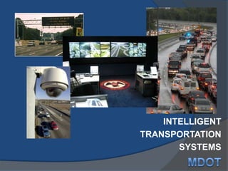
- 1. INTELLIGENT TRANSPORTATION SYSTEMS MDOT
- 2. Learning Objectives Definition of ITS Why ITS is important ITS benefits Major ITS areas ITS in Mississippi
- 3. Transportation Facts Americans lose 4.2 billion hours annually in traffic jams Americans burn 2.8 billion gallons of gas in traffic jams The cost of sitting in traffic congestion costs travelers and businesses $87 billion each year.
- 4. What are Intelligent Transportation Systems? The application of high technology and computer power to current freeway, traffic, and transit systems to increase the safety and efficiency of the surface transportation system. Have the potential to solve future problems.
- 5. ITS is.. ...Traffic and Transit Management
- 6. ITS is… …Traffic Signal Systems
- 7. ITS is … …Global Positioning Systems
- 8. ITS is… Weather Information Systems Commercial Vehicle Electronic Clearance
- 9. ITS is… …Real Time Traveler Information
- 10. Why is ITS Important? Offers the next major leap forward in improving safety, convenience, and productivity of our personal and commercial travel. Critical as population and congestion increase, and land and funding for new roads decrease.
- 11. What are we doing differently? Improving productivity through advanced technology and management techniques Operating existing programs more efficiently Integrating systems Providing travel information
- 12. ITS Benefits Time Savings Improved Traffic Flow Reduced Crashes and Fatalities Cost Avoidance Increased Traveler Satisfaction Energy and Environmental Benefits
- 13. Major ITS Areas Multimodal Travel Management and Traveler Information Commercial Vehicle Operations Advanced Vehicle Control and Safety Systems
- 14. Multimodel Travel Managementand Traveler Information Multimodal Regional Traveler Information Transit Management Incident Management Electronic Toll Collection Freeway Management Emergency Management Electronic Fare Payment Highway Rail Intersection Safety Traffic Signal Control
- 15. Highway Rail Intersection Safety Freeway Management Systems Incident Management Systems Transit Management Systems Traffic Signal Control Systems Electronic Fare Payment Systems Electronic Toll Collection Systems The Key is Integration and Communications Emergency Response Management Traveler Information Systems System Users
- 16. Major ITS Areas Multimodal Travel Management and Traveler Information Commercial Vehicle Operations Advanced Vehicle Control and Safety Systems
- 18. Commercial Vehicle Operations Achieve safe, simple, and cost-effective commercial vehicle operation through cooperation and advanced technologies Meet demands by: Automating operations and technologies Networking systems and information sources Changing traditional public/private sector processes, roles and relationships
- 19. Major ITS Areas Multimodal Travel Management and Traveler Information Commercial Vehicle Operations Advanced Vehicle Control and Safety Systems
- 20. Advanced Vehicle Control and Safety Systems Intellidrive Congestion Initiative Next Generation 911 Collision Avoidance Corridor Management Clarus Emergency Transportation Operations
- 21. ITS in Mississippi * All Traffic Video & Data Statewide * CCTV Cameras 250 – Statewide 96 – Jackson Metro * Dynamic Message Signs Hattiesburg, Jackson, Shaven * Operations 6:00 a.m. – 8:00 p.m. Monday – Friday Four Traffic Operators Plus Manager
- 22. Metro Jackson DMS Project
- 24. Hurricane Gustav Timeline Monday, Aug. 25th. TMC began full time operations of statewide TMC in Jackson. Thursday, Aug. 27th. TMC began formal preparations for emergency operations. Friday, Aug 29th. MS orders partial evacuation orders. Saturday, Aug. 30th. TMC began 24 hour operations in response to evacuations and contraflow. Sunday, Aug. 31st. Gustav enters Gulf as a Cat 3. Expectations are for a Cat 5 for the US coast. Wednesday, Sept. 3rd. TMC ended 24 hour operations while still handling massive return traffic volume.
Editor's Notes
- The Mississippi Department of Transportation is constantly looking for ways to better manage its existing highway infrastructure in lieu of continuing to build & expand highway lane miles. Intelligent Transportation Systems (ITS) combine computer & communications technology with real-time traffic management & information coordination. ITS offers tremendous promise for improving the efficiency & safety of both rural & urban transportation networks. MSTraffic is Mississippi’s Statewide ITS Program & a solid telecommunications network is the “heart & soul” of the program.
- Slide 2 - Learning ObjectivesDuring this segment, you will learn the following:Increased awareness of ITS. What is it? What technologies are involved? What makes it “intelligent”?Importance of ITS and how it fits into the overall framework of transportation and how it impacts the future of transportation. How ITS benefits the public and the environment.The major areas of ITS in which transportation professionals work. Potential career paths in ITS and transportation.
- Slide 3 - Transportation FactsHere are some interesting facts about transportation and our society.If all Americans who take transit to work drove instead, their cars would circle the earth in a line of traffic 23,000 miles long. - 10 million Americans use public transit every working day.There are more than 160,000 traffic signals in the U.S.The cost of sitting in traffic congestion costs travelers and businesses $40 billion each year.- Americans lose more than 1.6 million hours a day stuck in traffic.- The average American driver spends about one hour in a car each day, including weekends.Ask the class what the various modes are: air, rail, highways, water, and pipeline (intermodal transportation).
- Slide 4 - What are Intelligent Transportation Systems (ITS)?The application of high technology and computer power to current freeway, traffic, and transit systems to increase the safety and efficiency of the surface transportation system.Have the potential to solve future problems.Various components and products in use in everyday life can be applied to the transportation arena (bring some of these “toys” if you have them). -computers -CCTV -cellular phones -loop detectors -modems -GPS bus antenna -E-mail -RWIS -World Wide Web -electronic fare card -pagersWith ITS, as with other areas of life, lots of information is exchanged, communicated, and managed.The private sector (rail, trucking, air, water) are well ahead in these applications. -Traveler information services -Ford and GM Mayday systemsHow does technology affect your life daily? Aside from transportation.
- Slide 5 - ITS is . . .Traffic and Transit ManagementITS can assist us in operating our facilities as safely and efficiently as possible, especially as new construction becomes more scarce.PictureManagement/Operations Center
- Slide 6 - ITS is . . .Traffic Signal SystemsAdvanced traffic signal systems can minimize the stop and go traffic flow. They are especially helpful during incident management or during special events. PictureTraffic signal control cabinet. Can change signal timing here. With computerized signal system and a link to your office and/or home, you can change it from those locations, to
- Slide 7 - ITS is . . . Global Positioning SystemsUseful for tracking car, bus, truck, train, and ferry location.Pictures (left to right)1) Satellites used for determining positions of objects (a good example is transit operators locating their buses).2) Using global positioning systems for surveying instead of traditional equipment-more accurate and precise.
- Slide 8 - ITS is . . .Weather Information SystemsITS can provide information such as: Are the roads flooded? Are the roads covered with snow?Is visibility reduced because of heavy fog?Commercial Vehicle Electronic ClearanceWith this system, trucks don’t have to stop numerous times on a single trip to be checked.
- Slide 9 - ITS is . . .Real-Time Traveler Information:ITS lets travelers, businesses, and commercial carriers know what to expect so that the trip time can be precisely predicted.Pictures (left to right)1)Real-time display of bus information at a bus stop (Atlanta)2)Dynamic Message Sign (message reads: COURTLAND ST EXIT MOVING SLOWLY USE ALTERNATE EXIT)3)Traveler information on the Internet
- Slide 10 - Why is ITS Important?Offers the next major leap forward in improving safety, convenience, and productivity of our personal and commercial travel.Critical as population and congestion increase, and land and funding for new roads decrease.It is time for a paradigm shift. We have to think in terms of operating what we already have more efficiently rather than building our way out of congestion.
- Slide 11 - What Are We Doing Differently?Improving productivity through advanced technology and management techniques.Operating existing programs more efficiently. - In urban areas, no more room to build highways - Greater attention to efficient operation and management of systems - With advances in communications and computing, it has become easier to do more with greater information, and exchange and access information easier than ever before - Miniaturization of electronic components (Seiko watch), affordability, software capabilities (graphics, data processing) - Computer and communications infrastructure- Greater emphasis and need for electronics, telecommunications, and software skills in the workforce- Need for continuous technology training of the current workforce to keep them up to date in the world of rapidly changing technologyIntegrating systems (making older systems “talk” to each other)Providing travel information (travelers, business, commercial carriers)- Give examples (ETTM, ATIS, etc.)
- Slide 13 - Projected ITS Infrastructure BenefitsThese are 6 good measures for the Federal Government Performance Results Act:Time Savings -Faster to respond to incidents from CCTV; Select fastest mode from advanced traveler information-Electronic toll facilities reduce stopping delays; Electronic clearance for CVO-Inform (Long Island): estimates of savings as high as 1900 vehicle-hours for peak period incidentImproved Throughput-Seattle freeway management: traffic up 10% to 100% along I-5-Doing what we can to keep traffic off of residential streets; Improve transit vehicle on-time performance-Helping highway throughput due to advanced traveler info decision.Reduced Crashes and Fatalities -Minneapolis: 27% reduction in annual accident rates on I-35W-Faster incident notification time means a reduction in fatalities-With Mayday systems in rural areas; with cellular phones, urban areas-Blind spot detection sensors - on school busesCost Avoidance-NJ Transit: annual reduction of $2.7 m in cash handling with electronic fare -Trucking deliveries up 10-20% with computer assisted dispatching-Trucking also save money by saving time thru electronic clearanceIncreased Customer Satisfaction-Improve on-time performance for transit vehicles/customers-Smart Card - interoperability; can use one card for many systems-Express bus routes (Phoenix, AZ) report 90% of fares paid by bus pass cards Energy and Environmental Benefits-Improved efficiency results in reduced emissions and fuel savings
- Slide 14 - Major ITS Areas(Highlighted - Multimodal Travel Management and Traveler Information)Advanced Traffic Management Systems (ATMS)Advanced Traveler Information Systems (ATIS)Advanced Public Transportation Systems (APTS)Advanced Rural Transportation Systems (ARTS)Now that we’ve given you a snapshot of the benefits of ITS, we want to key in on 3 major areas and begin to show you how everything fits together.This sets the stage for the discussion to occur from now on.These three topics set the context for “what is ITS” - 3 major areas for ITS implementation. Federal, State and local governments have strong roles to play.Other information to help people to understand the “big picture”
- Slide 15 - Multimodal Travel Management and Traveler InformationThis is the first of the three ITS areas.These are the various components of Multimodal ITS (individual slides and subsequent discussion will follow).Applicable in both urban and rural areas.Emphasize that they are interrelated - they can all work together to make a better system.Traveler Information can let people what’s ahead so they can accurately predict their trip time. It can especially be important for just-in-time deliveries.En-route Traveler InformationIn-vehicle units and AM/FM radio (traffic reports); Highway Advisory Radio (HAR)Kiosks at rest areasWatches and/or pagers that receive information and display it on the deviceTelephonePre-Trip Traveler Information Cable TVInteractive TVInternetTelephone / FaxPictures (left to right)Receiving information by 1) Cellular phone and watch 2) Handheld personal device 3) Internet 4) In-vehicle deviceFreeway ManagementKnow what is happening to maximize safe flow.Advanced Traffic Management Systems (ATMS)Meter ramp traffic (as shown in left-most slide) can achieve smoother traffic flow on freeways by not allowing traffic to enter all at one time; stagger their entrance onto the freeway every couple of seconds.Freeway Management goes hand-in-hand with incident management and emergency services component .Pictures (left to right)1) Receiving roadway information by Closed Circuit Television2) Ramp metering/Flow signals3) Providing information to motorists by Dynamic Message SignsTraffic Signal ControlThink of the last time the signals along your way home were goofed up and you suffered delays.Signals should be retimed every 2 years to reflect current traffic flows.Every signal within 0.4 to 0.8 kilometers (1/4 to 1/2 mile) of another should be interconnected (coordinated) and hopefully to a central computer system. If these things occur, you will not experience as much delay. Coordination with freeway system (frontage roads and surface streets) can assist when handling an incident on the freeway and traffic diversion is necessary.Are especially helpful to aid police and fire vehicles respond to an emergency.Transit ManagementOperate our bus and rail systems as efficiently as possible.know where buses are at all times for security and schedule adherence AND to facilitate paratransit services.possibly include bus fleet systemsAdvanced Public Transportation Systems (APTS)Components of system- computer-aided dispatching- automatic passenger counting- automatic vehicle location- advanced voice and data communication- electronic paymentElectronic Toll CollectionWhere areas have toll facilities, electronic toll collection not only reduces delays to travelers, but also reduces the costs and security of counting coins.Electronic Fare PaymentIn many situations, travelers have to pay as they use the system - at times they need to have exact change.Wouldn’t it be nice to use your charge/banking card or some other electronic card?The idea is to use a single card to pay bus, rail, parking, and even toll fares; works as a debit card.Expedites transactions; eliminates need for cash. Incident ManagementEvery minute an incident remains on the roadway causes an additional 5 minutes of delay after the incident is cleared.Through an incident management system:Detect the incidents (crashes, disabled vehicles, spilled debris, etc.)Determine the nature of the incidentNotify the proper authorities Manage the scene safely Remove the vehicles as quickly as possible Reduce delay and possible secondary incidents.Think of what agencies might need to be involved in the management of an incident:police, fire, EMS, hazardous material team, state DOT, city transportation department, emergency management agency, medical examiner, traveler information agencies, etc.Emergency ManagementGetting the proper resources to the scene as quickly as possible.Use vehicle location technologies to know where vehicles areSignal pre-emption to clear the way for emergency vehicleGeographical Information Systems to tell response teams where to goWorks as part of an incident management strategy. Critical to periodically assemble key personnel from various agencies to map out strategies, discuss roles and responsibilities, and find ways to enhance the process to improve efficiency and safety.Highway Rail Intersection SafetyWe must make our highway/intersections as safe as possible. In the future, ITS may warn drivers through an in-vehicle device on an on-coming train - can avoid fatal collisions and reduce delay.ITS can also warn train operators of automobiles or any objects obstructing their path. It is important that they receive such information quickly since it takes a heavy train a few miles until it can stop.
- Slide 16 - The Key is Integration and CommunicationsEach successful alone, together a powerful system. Example: Hurricanes, floods, snow, fires, earthquakes, and other emergencies/disasters tend to uncover gaps in communication among emergency response agencies.3 levels of integration: -Share information -Provide travel info. to public, business and commercial carriers -Share control-part-time, weekend or evening, or full-timeExample of integration vs. non-integration-Non-integration: stand-alone signal system-Integration: pull example from case studyDiscuss the importance of an ITS infrastructure to achieve this integration.Mustard example- you wouldn’t eat mustard by itself. You have to have the other “components” with it (bread, lunchmeat, etc.) for it to “work.”Do you see any common threads in the 9 components - information - need to share it!!What you’ve heard so far basically applies to urban areas. These solutions address our urban issues of congestion, delay, throughput, and transit.
- Slide 17 - Major ITS Areas(Highlighted - Commercial Vehicle Operations)Describe CVO briefly and why it is importantPrivate sector is already well ahead of public sector for CVOImportance of CVO operation for the economy
- Slide 18 - Commercial Vehicle OperationsWhy make trucks stop every so often, especially when most are safe and legal?Let’s do our credential checking and weighing electronically at highway speeds.Cooperation is needed within states, as well as between states and across international borders.Today, all commercial vehicles must stop at every weigh and inspection station, regardless of time of previous weight or inspection (intra-state trucks may stop at the same station 6 or 8 times per day).Safe and compliant commercial vehicles should be able to pass weigh and inspection stations and cross borders as easily as automobiles.Working together and using advanced technology, regulatory agencies and the motor carrier industry can achieve safe, simple, and cost-effective operations.The idea is to have a seamless system.Why do all of this? For at least some part of the delivery from factory to consumer, commercial trucking carries every product we use! We need to increase safety & efficiency for carriers in order to reduce commercial carrier costs. This keeps the cost of our potato chips (etc.) down and keeps American products globally competitive. “If you’ve got it, a truck brought it.”Commercial vehicle electronic clearance can be achieved through the use of on-board transponders and electronic license plate readers. Once identified, safe and legal commercial vehicles may be electronically cleared to bypass weigh and inspection stations. Safety inspectors may signal any vehicle to be inspected. Portable computers are replacing pencil and clipboard for recording inspection information. This provides a reduction in inspection time and an electronic record that is sent to a database. Any other inspector may call up this record by entering the motor carrier DOT number. This type of electronic record provides the basis for improving safety and efficiency regarding administrative response.Commercial vehicles require license, fuel tax, insurance, and in some cases oversize/overweight permits. EDI allows information to be entered once and shared throughout regulatory agencies and the motor carrier. These records can also be checked by electronic screening devices, allowing safe and legal commercial vehicles to electronically clear weight and inspection sites. The ability to obtain licenses, permits, and pay taxes electronically is called one-stop shopping. It sure beats driving to three or four locations to obtain the same.The bottom line . . . Saves time and money!
- Slide 20 -Major ITS Areas(Highlighted - AVCSS)Advanced Vehicle Control and Safety Systems are especially important from safety aspects:Major segments of this part of the program -Short-term solutions to safety problems in the collision avoidance program led by NHTSA -Longer term solutions to congestion and safety in the Automated Highway System program led by FHWA-Intelligent Vehicle Initiative
- What Is IntelliDriveSM?IntelliDriveSM is a multimodal initiative that aims to enable safe, interoperable networked wireless communications among vehicles, the infrastructure, and passengers' personal communications devices. IntelliDriveSM research is being sponsored by the U.S. Department of Transportation (USDOT) and others to leverage the potentially transformative capabilities of wireless technology to make surface transportation safer, smarter and greener. USDOT research is supporting the development and testing of IntelliDriveSM technologies and applications, to determine their potential benefits and costs. If successfully deployed, IntelliDriveSM will ultimately enhance the safety, mobility and quality of life of all Americans, while helping to reduce the environmental impact of surface transportation.How Does IntelliDriveSM deliver networked connectivity?IntelliDriveSM applications provide connectivity:Among vehicles to enable crash prevention;Between vehicles and the infrastructure to enable safety, mobility and environmental benefits; andAmong vehicles, infrastructure, and wireless devices to provide continuous real-time connectivity to all system users.Like the Internet, which provides information connectivity, IntelliDriveSM provides a starting point for transportation connectivity. IntelliDriveSM has the potential to enable countless applications and spawn new industries. Today we can see only the tip of the iceberg.Merging of all vehicle-focused ITS activities-multi-agency research and development programEmphasizes the significant role of the driver in highway safetyDevelop and made available driving assistance and control intervention systems-objectives: to reduce motor vehicle crashes and increase traffic efficiency-integrate driving assistance and motorist information systemsApplications for all types of vehicles on all types of highways-provisions: warning drivers, recommending control actions, intervening with driver control, introducing temporary or partial automated control in hazardous situations-sensors, processors, actuators, control systems, driver displays, information systems all integrated into the vehicle Congestion InitiativeIn 2006, the U.S. Department of Transportation (USDOT) launched the National Strategy to Reduce Congestion on America’s Transportation Network – known as the “Congestion Initiative.” This Departmental endeavor serves as a blueprint for federal, state, and local officials to address needs resulting from congestion in their localities. Two elements of the Congestion Initiative are the Urban Partnership Agreements (UPA) program and follow-on Congestion Reduction Demonstration (CRD). Congestion on our nation’s transportation network poses a major threat to economic prosperity and our citizens’ quality of life. In 2007, Americans lost an estimated 4.2 billion hours and 2.8 billion gallons of fuel as a result of traffic congestion alone, at a cost of $87.2 billion in wasted fuel and lost productivity. Advancements in ITS have greatly improved the strategy and technological capabilities related to congestion mitigation and avoidance. While the tolling, transit, telecommuting and ITS have served for years in many of America's metropolitan areas, the primary purpose of the Congestion Initiative is to demonstrate the effectiveness of deploying these strategies in combination, not isolation.Next Generation 911The Nation's current 9-1-1 system is designed around telephone technology and cannot handle the text, data, images and video that are increasingly common in personal communications and critical to future transportation safety and mobility advances.The Next Generation 9-1-1 (NG 9-1-1) initiative will establish the foundation for public emergency communications services in a wireless mobile society. Collision Avoidance2003, more than 9,000 Americans died and roughly 1.5 million Americans were injured in intersection related crashes. Intersection collision avoidance systems can help save lives by preventing these crashes. Through the Cooperative Intersection Collision Avoidance Systems initiative, the USDOT is working in partnership with the automotive manufacturers and State and local departments of transportation to pursue an optimized combination of autonomous-vehicle, autonomous-infrastructure and cooperative communication systems that potentially address the full set of intersection crash problems.Corridor ManagementThe efforts to date to reduce surface transportation congestion have focused on optimization of individual networks. Corridors offer an opportunity to operate and optimize the entire system as opposed to the individual networks. Through the Integrated Corridor Management Systems initiative, the USDOT will provide guidance to assist agencies in implementing Integrated Corridor Operations, create supporting analysis tools, approaches, and technical standards, and demonstrate the value of Integrated Corridor Management.ClarusThe Clarus (the Latin word for "clear") Initiative is developing a system that will provide clear, relevant information on roadway conditions to all transportation managers and users to alleviate the effects of adverse weather conditions such as crash fatalities, injuries, and delays.Emergency Transportation OperationsTypically there is at least a 72-hour forewarning of a hurricane evacuation. There is time to take appropriate advance measures. However, there are major transportation challenges when incidents arise suddenly. The Emergency Transportation Operations initiative is designed to support these types of incidents. The outcome of this initiative will be the tools, techniques, demonstrated benefits, technical guidance, and standards necessary for state and local agencies and their private sector partners to effectively manage "no notice" evacuations.
- ITS Career OpportunitiesITS = High-Tech JobsCareer Goal: Improve the safety and responsiveness of the nation’s transportation systemNot limited to civil engineeringThe landscape of transportation is changing. No longer are only civil engineers with transportation backgrounds suited for careers in the industry. With the emergence and application of technology to the infrastructure, individuals with new and diverse knowledge, skills, and abilities (KSAs) are needed to plan, design, build, operate, and maintain the complex infrastructure of the 21st century.ITS Opportunities: SpecialistsAerospace EngineersEnvironmentalistsSystems EngineersComputer ScientistsCommunications EngineersEach of these specialists have a role to play in ITS, as evident by the information and technologies discussed in this session. Other fields of study for careers in ITS are: Economics Political Science Modeling / Simulation Logistics StatisticsAnthropomorphics Cognition MarketingRequired SkillsEngineeringElectronicsCommunicationsSystems IntegrationTogether, working as a team, individuals with these skills are necessary to plan, design, build, operate, and maintain the infrastructure being put in place today. These skills are critical to ensuring mobility in the next century.
- TMC went live Aug. 25 2008 operating 6am to 8pm, operating the DMS signs to manage traffic through the Jackson metro area. On Friday, Aug 29th Gustav’s projected track required evacuationsin LA and MS. This presented a major test for the MDOT TMC. Much effort had been put forth in planning normal operations but 24 hour operations were not fully established. With Hurricane Katrina still in the back of everyone’s mind MDOT was prepared for the worst. Much of the success of the effort is directed to the contacted operations personnel who were qualified and willing to complete the task.
- The landfall occurred on the morning on Sept 1 near Cocodrie LA about 80 miles sw of new orleans. The storm passed just south of Baton Rouge and caused the most damage to that city of any Hurricane. DMS locations shownDiscuss the placement of DMS signs and how they assist moving traffic through jacksonAfter much preparation and assistance from selected consultants, the TMC began officially operating the DMS signs for traffic mgmt purposes on 8/25/08. The same day Gustav formed as a tropical depression in the eastern carribean.As Gustav continued along the path to the US this week many informal meetings culminated in the actual preparations. As traffic picked up along I55, the experiences of Hurricane Katrina possibly helped coastal residents in MS and LA to evacuate ahead of the actual mandatory orders. MDOT TMC began 24 hr operations at noon with the expectations of contraflow beginning that night or the next morning. Contraflow officiallybegan on 4am Sunday aug 31 and ended at 5pm Sunday for I55 and at 930pm Sunday for I59.Operations continued in an emergency status until Wednesday at noon while still handling the onslaught of residents returning to the coast after the hurricane passed.ChallengesDMS locations shownThe TMC staff found that most agencies, MDOT, included were not clear how the TMC would fit in a Hurricane Evacuation scenario. The TMC functioned as a data exporter and as a data receiver, but not as a communications office or public relations arm. This was a specific hurdle as most of the MDOT staff was in the field prior to the hurricane and it was difficult for other agencies to reach their normal district contacts. As the TMC was staffed 24/7 for this event, the TMC began to receive calls and request for information that normally we would not receive. Due to the recent opening we were also not effectively communicating with all the other departments within MDOT (outreach). As MDOT TMC operators began to receive more and more information it became difficult to decide what to place on the DMS signs. When does information become too much information for the traveling public. The decision was made to place public radio frequencies on msg boards. This allowed motorists to find the public information radio station in the area so they could make informed decisions on shelters or lodging in jackson or passing thru to other cities northA normal part of the TMC duties is placing a traffic management email our to subscribers and on the website. This feature was suspended during the emergency operations and all public relations messages were deferred to the outreach division, unless asked to do otherwise by outreach or upper management. 24 hour operations staffing issues, worked out overtime for contract employees.Last minute agreement worked out with Lamar signs to include emergency messages on their digital billboard signs throughout mississippi, coast, hattiesburg and jackson. There was a request to install a camera at the MS/LA statelineweighscale in Pike County, MS. This would give a fixed view of the contraflow traffic during the event. With only a few days notice the ITS maintenance staff did erect the camera on an existing pole and provided access to the camera views through a web browser to MDOT staff and management. ResultsSome of the positive results of the DMS signage and 24 hour operation of such is the ability to share information with motorists quickly. As we discussed in our TIM model as motorists have information they can assist with reducing the que of traffic waiting to get through an incident or through an event. With the camera views available motorists can view the Interstate routes home and along evacuation routes and decide to take other routes. The traffic returning after the storm through Jackson created similar congestion on the southbound lanes as the evacuation traffic before the storm going northbound. The jackson area experienced a crush of traffic as the nearly 2 million people tried to return to their homes the next day after the storm. This created essentially a 4-5 day evacuation/return event on a magnitude never experienced in Jackson before. At one point the return traffic was 2500 veh per hour, 125 percent greater than the largest traffic event ever recorded on traffic counters. TMC operators continued alerting motorists of any emergency information as well as incidents, congestion and road closures that may lie ahead of them.Thanks to the ITS manager Mike Stokes and the State Traffic Engineer Wes Dean, the work put forth to plan the TMC operations, using all available information from other states and experienced consultants paid big dividends during this hurricane event. Not only were we able to quickly implement emergency operations we were also able to simply scale up the operations model to include additional data and information from field agents and other state agencies and representatives. The overall operations plan used on Monday the first day was essentially the same plan used on Sunday just with some necessary tweaks to accomplish our overall goal to provide residents and visitors with information to provide a more efficient roadway system. An interesting comparison to Jackson during Hurricane Gustav was the city of Meridian and the MS Gulf Coast. These areas had a harder time processing traffic through existing gas stations and hotel facilities, I-10 along the MS coast was backed up as motorists attempted to go to Mobile. These routes were not Contraflow but were also without the DMS signs to alert travelers the traffic was not managed as well.Due to the success of the TMC, MDOT began discussions with traffic engineering to expand ITS elements along the Coast, Hattiesburg and Jackson and along existing evacuation routes.