ClimateScope: a Google Earth storytelling of climate change
•Als PPT, PDF herunterladen•
3 gefällt mir•597 views

CliamteScope is an application based on Google Earth API to understand climate impacts and trends through powerfull global images. Visualizing data and allowing citizens to participate actively as local sensors. www.lamma.rete.toscana.it/climascopio

Empfohlen
Empfohlen
Weitere ähnliche Inhalte
Ähnlich wie ClimateScope: a Google Earth storytelling of climate change
Ähnlich wie ClimateScope: a Google Earth storytelling of climate change (20)
Mehr von Valentina Grasso
Mehr von Valentina Grasso (8)
Kürzlich hochgeladen
Kürzlich hochgeladen (20)
ClimateScope: a Google Earth storytelling of climate change
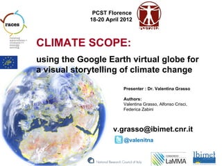
- 1. PCST Florence 18-20 April 2012 CLIMATE SCOPE: using the Google Earth virtual globe for a visual storytelling of climate change Presenter : Dr. Valentina Grasso Authors: Valentina Grasso, Alfonso Crisci, Federica Zabini v.grasso@ibimet.cnr.it @valenitna
- 2. E E SCOP Google Earth virtual globe for a visual storytelling of climate change CLIMAT Barriers in communication of climate change #CC # Misunderstanding Weather vs Climate # CC Causes are invisibles and complex CC is FAR in space and time for individual # perception; overwhelming “it doesn’t bother me”, “it’s not a threat” # Debate on CC within the scientific community is polarised by media: important to give effective representation of CC DATA # CC is a multi dimensional phenomenon
- 3. E E SCOP Google Earth virtual globe for a visual storytelling of climate change CLIMAT Climate Scope A powerful geographic environment to effectively communicate the physical and social dimension of climate change, from the global to the local scale. People can be information producers to improve the understanding of CC evidence.
- 4. E E SCOP Google Earth virtual globe for a visual storytelling of climate change CLIMAT Features Climate Scope is a Google Earth mash-up # Display global CC informative layers: • Climatic layers (Climate) • Real time data # Open to add local information (people, media, students) # Customisation for “climate hot-spotting” # “Citizen as sensors” model - (Goodchild 2007)
- 5. E E SCOP Google Earth virtual globe for a visual storytelling of climate change CLIMAT Google Earth and Web 2.0 opportunities – Use geographic environment to understand climate change dynamics – Powerful visual tool – Integrate climatic information layers with “local observations” uploaded by teachers, students and lay people – Disseminate schools’ activities using geographic environment – Contents/data sharing to produce “volunteered geographic information” (Goodchild 2007) - Citizen as sensors the CLIMATE SCOPE
- 6. E E SCOP Google Earth virtual globe for a visual storytelling of climate change CLIMAT Cloud Layer Real Time data
- 7. E E SCOP Google Earth virtual globe for a visual storytelling of climate change CLIMAT LST Anomaly - February 2012 Layer from Nasa
- 8. E E SCOP Google Earth virtual globe for a visual storytelling of climate change CLIMAT SST Anomaly - April 2012 Real Time Sea Surface Temperature “Coral Reef – NASA project” SST showing El Nino
- 9. E E SCOP Google Earth virtual globe for a visual storytelling of climate change CLIMAT 2012 EU Drought Index (LaMMA)
- 10. E E SCOP Google Earth virtual globe for a visual storytelling of climate change CLIMAT # Thank YOU! v.grasso@ibimet.cnr.it @valenitna