SlideShare ist ein Scribd-Unternehmen logo
1 von 26
Presented By:
Uttam Pudasaini
3rd Year,1st Semester
Kathmandu University
Contact Details: utmpudasaini@gmail.com
BEFORE +2
AFTER +2
HOW WE ENTERED THIS FIELD
• SENIOR’S ADVICE
• 75 %Scholarship 
• New and Dynamic course
What’s there in Geomatics???
Geodesy
Global positioning system(GPS) or Global navigation
satellite system(GNSS)
Surveying ( cadastral, aerial, mining and engineering
surveying)
Navigation AND Location-based services
Cartography , Geovisualization and Digital mapping
Geographic information systems(GIS)
 Spatial database management
 Computer-aided design and scientific visualization
 Visual communication design, graphic design and multimedia
technology
 Remote sensing and Image processing
 Photogrammetry
 Land information systems (LIS)
 Land management, cadastre, real property law
 Applications programming
Also known as land surveyors and mappers
 Design, develop, and operate systems for
collecting and analyzing spatial information
about the land, the oceans, natural resources,
and manmade features.
 A rapidly developing discipline that focuses
on spatial information (i.e. information that
has a location).
GEOMATICS ENGINEERS
Geomatics is a new term incorporating the older field
of land surveying along with many other aspects of
spatial data management. Following the advanced
developments in digital data processing, the nature
of the tasks required of the professional land
surveyor has evolved and the term "surveying" no
longer accurately covers the whole range of tasks
that the profession deals with. As our societies
become more complex, information with a spatial
position associated with it becomes more critical to
decision-making, both from a personal and a
business perspective, and also from a community
and a large-scale governmental viewpoint.
SURVEYING
 Determining the relative position
of objects on, above or below the
surface of earth
 Involves direct or indirect
measurements of distance,
direction and elevation
 Representing this information on
paper plans or on computer
based maps.
Traditional Surveyors Construction Survey
Levelling
GEODESY
 Determines the mathematical figure of
the earth
 Determine the exact positions of
points on the earth’s surface.
 To determine the figures and areas of
large portions of the earth’s surface
 To determine the shape and size of the
earth
 To determine the variations of
terrestrial gravity
GLOBAL POSITIONING SYSTEM
WE ARE SPATIAL ENGINEERSS WE TALK ABOUT POSITIONS..
WE TALK ABOUT X,Y,Z NOT A,B,C,D………
PHOTOGRAMMETRY
Aerial photography over a terrain
Recording, measuring and interpreting
photographic images and patterns of
recorded radiant EM energy to obtain
information about real world objects and
its environment
REMOTE SENSING
Collecting information
from a distance
A terrain model from RS images
Entire process
Google Earth
3D TERRAIN IN GOOGLE EARTH
3D MAN MADE FEATURES IN GOOGLE EARTH
GOOGLE EARTH’S INTERFACE
Programming
C,C++
JAVA
WEB GIS
DATABASE
COMPUTER NETWORKING
PYTHON
APPS DEVELOPMENT
WEB MAPPING
INTERACTIVE MAPPING
SPATIAL DATA MANAGEMENT
2D AND 3D COMPUTER MODELS
What we do is, We extract useful information
from large heterogeneous data related to any
phenomena around us and we make this
information easily understandable and usable by
concerned authorities making use of maps,
models, virtual realities, computer software and
applications.
3D city model-Berlin Interactive web map Virtual reality-Street View
If you are interested in
• Mathematics and Physics-Geodesy
• Computer programming-Integrate Programming with
Geomatics, Apps development
• Travelling places and collecting information-Surveying
• Analysis-Photogrammetry ,Remote Sensing and Digital
image processing
• Modeling and Simulation–Virtual Geomatics
• Conflict management and Policy making–Land
Administration
FEEL PROUD TO BE PART OF THE
WORLD’S FASTEST GROWING INDUSTRY:
THE GEOSPATIAL
INDUSTRY
AIR ,WATER AND LAND ALL THREE ARE OUR
WORKSPACE
WE HAVE ENTERED INTO A GREAT
PROFESSION .NOW ALL THAT COUNTS IS HOW
HARD WE TRY.
WELCOME TO GE FAMILY 
SOME SNAPSHOTS
CLICK ME

Weitere ähnliche Inhalte

Was ist angesagt?

Spatial Analysis Using GIS
Spatial Analysis Using GISSpatial Analysis Using GIS
Spatial Analysis Using GIS
Prachi Mehta
 

Was ist angesagt? (20)

An introduction to geographic information systems (gis) m goulbourne 2007
An introduction to geographic information systems (gis)   m goulbourne 2007An introduction to geographic information systems (gis)   m goulbourne 2007
An introduction to geographic information systems (gis) m goulbourne 2007
 
Principles of GIS unit 2
Principles of GIS unit 2Principles of GIS unit 2
Principles of GIS unit 2
 
Geomatics
Geomatics Geomatics
Geomatics
 
Components of a gis
Components of a gisComponents of a gis
Components of a gis
 
Gis
GisGis
Gis
 
Projections and coordinate system
Projections and coordinate systemProjections and coordinate system
Projections and coordinate system
 
Geo-spatial Analysis and Modelling
Geo-spatial Analysis and ModellingGeo-spatial Analysis and Modelling
Geo-spatial Analysis and Modelling
 
Getting started with GIS
Getting started with GISGetting started with GIS
Getting started with GIS
 
Gis
GisGis
Gis
 
Geographical Information System (GIS)
Geographical Information System (GIS)Geographical Information System (GIS)
Geographical Information System (GIS)
 
Spatial Analysis Using GIS
Spatial Analysis Using GISSpatial Analysis Using GIS
Spatial Analysis Using GIS
 
Geodatabases
GeodatabasesGeodatabases
Geodatabases
 
What is GIS
What is GISWhat is GIS
What is GIS
 
GIS - lecture-1.ppt
GIS - lecture-1.pptGIS - lecture-1.ppt
GIS - lecture-1.ppt
 
GIS
GISGIS
GIS
 
Map Design and Symbology in GIS Environment
Map Design and Symbology in GIS EnvironmentMap Design and Symbology in GIS Environment
Map Design and Symbology in GIS Environment
 
Distortions and displacement on aerial photograph
Distortions and displacement on aerial photographDistortions and displacement on aerial photograph
Distortions and displacement on aerial photograph
 
3. lecture 2 cadastral surveying
3. lecture 2   cadastral surveying3. lecture 2   cadastral surveying
3. lecture 2 cadastral surveying
 
photogrammetry
photogrammetryphotogrammetry
photogrammetry
 
Gis georeference
Gis georeferenceGis georeference
Gis georeference
 

Andere mochten auch

Standard_Digital_Cadastral_Maps_2015_Adopted
Standard_Digital_Cadastral_Maps_2015_AdoptedStandard_Digital_Cadastral_Maps_2015_Adopted
Standard_Digital_Cadastral_Maps_2015_Adopted
Michael Prestridge
 
Lec3 4 mm applications and use
Lec3 4 mm applications and useLec3 4 mm applications and use
Lec3 4 mm applications and use
Dom Mike
 

Andere mochten auch (20)

Introduction to Geomatics _2014
Introduction to Geomatics _2014Introduction to Geomatics _2014
Introduction to Geomatics _2014
 
Digital cadaster in Bulgaria. Information system of cadaster and property reg...
Digital cadaster in Bulgaria. Information system of cadaster and property reg...Digital cadaster in Bulgaria. Information system of cadaster and property reg...
Digital cadaster in Bulgaria. Information system of cadaster and property reg...
 
Survey camp ii
Survey camp iiSurvey camp ii
Survey camp ii
 
Ge 122 lecture 3 (CADASTRAL AND PUBLIC LAND SUBDIVISION SURVEY) by: Broddett ...
Ge 122 lecture 3 (CADASTRAL AND PUBLIC LAND SUBDIVISION SURVEY) by: Broddett ...Ge 122 lecture 3 (CADASTRAL AND PUBLIC LAND SUBDIVISION SURVEY) by: Broddett ...
Ge 122 lecture 3 (CADASTRAL AND PUBLIC LAND SUBDIVISION SURVEY) by: Broddett ...
 
Using unique and unusual archival records and data to illustrate and annotate...
Using unique and unusual archival records and data to illustrate and annotate...Using unique and unusual archival records and data to illustrate and annotate...
Using unique and unusual archival records and data to illustrate and annotate...
 
Standard_Digital_Cadastral_Maps_2015_Adopted
Standard_Digital_Cadastral_Maps_2015_AdoptedStandard_Digital_Cadastral_Maps_2015_Adopted
Standard_Digital_Cadastral_Maps_2015_Adopted
 
3D Web Services And Models For The Web: Where Do We Stand?
3D Web Services And Models For The Web: Where Do We Stand?3D Web Services And Models For The Web: Where Do We Stand?
3D Web Services And Models For The Web: Where Do We Stand?
 
Tips for Manipulating Data in Esri Geodatabase using FME
Tips for Manipulating Data in Esri Geodatabase using FME Tips for Manipulating Data in Esri Geodatabase using FME
Tips for Manipulating Data in Esri Geodatabase using FME
 
Curso de Geodatabase
Curso de Geodatabase Curso de Geodatabase
Curso de Geodatabase
 
Introducción a la geodatabase del SIOSE (I)
Introducción a la geodatabase del SIOSE (I)Introducción a la geodatabase del SIOSE (I)
Introducción a la geodatabase del SIOSE (I)
 
Research Areas In Geomatics
Research Areas In GeomaticsResearch Areas In Geomatics
Research Areas In Geomatics
 
Ge 122 lecture 1 (GEODETIC CONTROL SURVEY) by: Broddett Bello abatayo
Ge 122 lecture 1 (GEODETIC CONTROL SURVEY) by: Broddett Bello abatayoGe 122 lecture 1 (GEODETIC CONTROL SURVEY) by: Broddett Bello abatayo
Ge 122 lecture 1 (GEODETIC CONTROL SURVEY) by: Broddett Bello abatayo
 
Introducción a la geodatabase del SIOSE (II)
Introducción a la geodatabase del SIOSE (II)Introducción a la geodatabase del SIOSE (II)
Introducción a la geodatabase del SIOSE (II)
 
PCI Geomatics Synthetic Aperture Radar Processing Capabilities
PCI Geomatics Synthetic Aperture Radar Processing CapabilitiesPCI Geomatics Synthetic Aperture Radar Processing Capabilities
PCI Geomatics Synthetic Aperture Radar Processing Capabilities
 
Week 12 mm_dev_model
Week 12 mm_dev_modelWeek 12 mm_dev_model
Week 12 mm_dev_model
 
Graduate Research Thesis Defense Presentation
Graduate Research Thesis Defense Presentation  Graduate Research Thesis Defense Presentation
Graduate Research Thesis Defense Presentation
 
authoring tools
authoring toolsauthoring tools
authoring tools
 
Lec3 4 mm applications and use
Lec3 4 mm applications and useLec3 4 mm applications and use
Lec3 4 mm applications and use
 
Unit 17
Unit 17Unit 17
Unit 17
 
How to use R easily as GIS tools!
How to use R easily as GIS tools!How to use R easily as GIS tools!
How to use R easily as GIS tools!
 

Ähnlich wie WHAT'S THERE IN GEOMATICS ENGINEERING???

GEOMATIC WORLD WITH A SPECIAL LOOK TO GIS
GEOMATIC WORLDWITH A SPECIAL LOOK TO GISGEOMATIC WORLDWITH A SPECIAL LOOK TO GIS
GEOMATIC WORLD WITH A SPECIAL LOOK TO GIS
Mary Adel
 
Application of gis & rs in urban planning
Application of gis & rs in urban planning Application of gis & rs in urban planning
Application of gis & rs in urban planning
sathish1446
 

Ähnlich wie WHAT'S THERE IN GEOMATICS ENGINEERING??? (20)

Geographic Information System for Bachelor in Agriculture Engineering
Geographic Information System for Bachelor in Agriculture EngineeringGeographic Information System for Bachelor in Agriculture Engineering
Geographic Information System for Bachelor in Agriculture Engineering
 
Remote Sensing & GIS.ppt
Remote Sensing & GIS.pptRemote Sensing & GIS.ppt
Remote Sensing & GIS.ppt
 
1.pptx
1.pptx1.pptx
1.pptx
 
Basic of gis concept and theories
Basic of gis concept and theoriesBasic of gis concept and theories
Basic of gis concept and theories
 
Geoinformatics (1)
Geoinformatics (1)Geoinformatics (1)
Geoinformatics (1)
 
INTRODUCTION_TO_GIS.ppt
INTRODUCTION_TO_GIS.pptINTRODUCTION_TO_GIS.ppt
INTRODUCTION_TO_GIS.ppt
 
Intro to GIS and Remote Sensing
Intro to GIS and Remote SensingIntro to GIS and Remote Sensing
Intro to GIS and Remote Sensing
 
Introduction and Application of GIS
Introduction and Application of GISIntroduction and Application of GIS
Introduction and Application of GIS
 
GEOMATIC WORLD WITH A SPECIAL LOOK TO GIS
GEOMATIC WORLDWITH A SPECIAL LOOK TO GISGEOMATIC WORLDWITH A SPECIAL LOOK TO GIS
GEOMATIC WORLD WITH A SPECIAL LOOK TO GIS
 
ICT in Geography
ICT in GeographyICT in Geography
ICT in Geography
 
Intro of geographic info system
Intro of geographic info systemIntro of geographic info system
Intro of geographic info system
 
Introduction to Geoinformatics
Introduction to GeoinformaticsIntroduction to Geoinformatics
Introduction to Geoinformatics
 
GIS
GISGIS
GIS
 
Application of gis & rs in urban planning
Application of gis & rs in urban planning Application of gis & rs in urban planning
Application of gis & rs in urban planning
 
Introduction of GIS & Remote Sensing (RS)
Introduction of GIS & Remote Sensing (RS)Introduction of GIS & Remote Sensing (RS)
Introduction of GIS & Remote Sensing (RS)
 
Geoinformatics ppt
Geoinformatics pptGeoinformatics ppt
Geoinformatics ppt
 
gis-unit1_2.pdf
gis-unit1_2.pdfgis-unit1_2.pdf
gis-unit1_2.pdf
 
EVS G.I.S CONCEPTS OF SCIENCE PPT.pptx
EVS  G.I.S CONCEPTS  OF SCIENCE PPT.pptxEVS  G.I.S CONCEPTS  OF SCIENCE PPT.pptx
EVS G.I.S CONCEPTS OF SCIENCE PPT.pptx
 
A quick overview of geospatial analysis
A quick overview of geospatial analysisA quick overview of geospatial analysis
A quick overview of geospatial analysis
 
Archaeological Applications of Geographic Information Systems (GIS)
Archaeological Applications of Geographic Information Systems (GIS)Archaeological Applications of Geographic Information Systems (GIS)
Archaeological Applications of Geographic Information Systems (GIS)
 

Mehr von Nepal Flying Labs

Poster Presentation "Generation of High Resolution DSM Usin UAV Images"
Poster Presentation "Generation of High Resolution DSM Usin UAV Images"Poster Presentation "Generation of High Resolution DSM Usin UAV Images"
Poster Presentation "Generation of High Resolution DSM Usin UAV Images"
Nepal Flying Labs
 

Mehr von Nepal Flying Labs (16)

Use of Drones in Humanitarian Action and Disaster Management
Use of Drones in Humanitarian Action and Disaster ManagementUse of Drones in Humanitarian Action and Disaster Management
Use of Drones in Humanitarian Action and Disaster Management
 
Nepal Flying Labs - Getting to Scale
Nepal Flying Labs - Getting to ScaleNepal Flying Labs - Getting to Scale
Nepal Flying Labs - Getting to Scale
 
WeRobotics and Flying Labs: Uses of Drones in Humanitarian and Social Good p...
WeRobotics and Flying Labs:  Uses of Drones in Humanitarian and Social Good p...WeRobotics and Flying Labs:  Uses of Drones in Humanitarian and Social Good p...
WeRobotics and Flying Labs: Uses of Drones in Humanitarian and Social Good p...
 
Presentation on Drones and Open Street Maps
Presentation on Drones and Open Street MapsPresentation on Drones and Open Street Maps
Presentation on Drones and Open Street Maps
 
Usages and Challenges of using DRONES in Reconstruction Efforts of NEPAL
Usages and Challenges of using DRONES  in Reconstruction Efforts of NEPALUsages and Challenges of using DRONES  in Reconstruction Efforts of NEPAL
Usages and Challenges of using DRONES in Reconstruction Efforts of NEPAL
 
Poster Presentation "Generation of High Resolution DSM Usin UAV Images"
Poster Presentation "Generation of High Resolution DSM Usin UAV Images"Poster Presentation "Generation of High Resolution DSM Usin UAV Images"
Poster Presentation "Generation of High Resolution DSM Usin UAV Images"
 
Generation of high resolution DSM using UAV Images
Generation of high resolution DSM using UAV Images  Generation of high resolution DSM using UAV Images
Generation of high resolution DSM using UAV Images
 
Using arc map to create package map along with a report file [metadata]
Using arc map to create package map along with a report file [metadata]Using arc map to create package map along with a report file [metadata]
Using arc map to create package map along with a report file [metadata]
 
Geoprocessing(Building Your Own Tool) and Geostatistical Analysis(An Introdu...
Geoprocessing(Building Your Own Tool)  and Geostatistical Analysis(An Introdu...Geoprocessing(Building Your Own Tool)  and Geostatistical Analysis(An Introdu...
Geoprocessing(Building Your Own Tool) and Geostatistical Analysis(An Introdu...
 
Analysis of suggested Sites for Construction of a Shopping Mall at Banepa,Kavre
Analysis of suggested Sites for Construction of a Shopping Mall at Banepa,KavreAnalysis of suggested Sites for Construction of a Shopping Mall at Banepa,Kavre
Analysis of suggested Sites for Construction of a Shopping Mall at Banepa,Kavre
 
Survey and Design of Gravity Fed Water supply system at a DadaGaun ,Banepa
Survey and Design of Gravity Fed Water supply system at a DadaGaun ,BanepaSurvey and Design of Gravity Fed Water supply system at a DadaGaun ,Banepa
Survey and Design of Gravity Fed Water supply system at a DadaGaun ,Banepa
 
MODIS (Moderate Resolution Imaging Spectrometer)
MODIS (Moderate Resolution Imaging Spectrometer)MODIS (Moderate Resolution Imaging Spectrometer)
MODIS (Moderate Resolution Imaging Spectrometer)
 
FROM BIG BANG TO THE PRESENT TIME
FROM BIG BANG TO THE PRESENT TIMEFROM BIG BANG TO THE PRESENT TIME
FROM BIG BANG TO THE PRESENT TIME
 
MEASUREMENT OF SURFACE TEMPERATURE OF A GLACIER USING AN UNMANNED AERIAL VEHI...
MEASUREMENT OF SURFACE TEMPERATURE OF A GLACIER USING AN UNMANNED AERIAL VEHI...MEASUREMENT OF SURFACE TEMPERATURE OF A GLACIER USING AN UNMANNED AERIAL VEHI...
MEASUREMENT OF SURFACE TEMPERATURE OF A GLACIER USING AN UNMANNED AERIAL VEHI...
 
TWO MOST COMMON GEOGRAPHIC INFORMATION SERVICE STANDARDS 19116:2004 AND ISO ...
TWO MOST COMMON GEOGRAPHIC INFORMATION SERVICE STANDARDS 19116:2004 AND  ISO ...TWO MOST COMMON GEOGRAPHIC INFORMATION SERVICE STANDARDS 19116:2004 AND  ISO ...
TWO MOST COMMON GEOGRAPHIC INFORMATION SERVICE STANDARDS 19116:2004 AND ISO ...
 
3D MODELLING OF KATHMANDU UNIVERSITY
3D MODELLING OF KATHMANDU UNIVERSITY3D MODELLING OF KATHMANDU UNIVERSITY
3D MODELLING OF KATHMANDU UNIVERSITY
 

Kürzlich hochgeladen

Why Teams call analytics are critical to your entire business
Why Teams call analytics are critical to your entire businessWhy Teams call analytics are critical to your entire business
Why Teams call analytics are critical to your entire business
panagenda
 
Cloud Frontiers: A Deep Dive into Serverless Spatial Data and FME
Cloud Frontiers:  A Deep Dive into Serverless Spatial Data and FMECloud Frontiers:  A Deep Dive into Serverless Spatial Data and FME
Cloud Frontiers: A Deep Dive into Serverless Spatial Data and FME
Safe Software
 

Kürzlich hochgeladen (20)

Repurposing LNG terminals for Hydrogen Ammonia: Feasibility and Cost Saving
Repurposing LNG terminals for Hydrogen Ammonia: Feasibility and Cost SavingRepurposing LNG terminals for Hydrogen Ammonia: Feasibility and Cost Saving
Repurposing LNG terminals for Hydrogen Ammonia: Feasibility and Cost Saving
 
TrustArc Webinar - Stay Ahead of US State Data Privacy Law Developments
TrustArc Webinar - Stay Ahead of US State Data Privacy Law DevelopmentsTrustArc Webinar - Stay Ahead of US State Data Privacy Law Developments
TrustArc Webinar - Stay Ahead of US State Data Privacy Law Developments
 
HTML Injection Attacks: Impact and Mitigation Strategies
HTML Injection Attacks: Impact and Mitigation StrategiesHTML Injection Attacks: Impact and Mitigation Strategies
HTML Injection Attacks: Impact and Mitigation Strategies
 
Strategies for Landing an Oracle DBA Job as a Fresher
Strategies for Landing an Oracle DBA Job as a FresherStrategies for Landing an Oracle DBA Job as a Fresher
Strategies for Landing an Oracle DBA Job as a Fresher
 
Why Teams call analytics are critical to your entire business
Why Teams call analytics are critical to your entire businessWhy Teams call analytics are critical to your entire business
Why Teams call analytics are critical to your entire business
 
A Year of the Servo Reboot: Where Are We Now?
A Year of the Servo Reboot: Where Are We Now?A Year of the Servo Reboot: Where Are We Now?
A Year of the Servo Reboot: Where Are We Now?
 
Apidays New York 2024 - Scaling API-first by Ian Reasor and Radu Cotescu, Adobe
Apidays New York 2024 - Scaling API-first by Ian Reasor and Radu Cotescu, AdobeApidays New York 2024 - Scaling API-first by Ian Reasor and Radu Cotescu, Adobe
Apidays New York 2024 - Scaling API-first by Ian Reasor and Radu Cotescu, Adobe
 
Real Time Object Detection Using Open CV
Real Time Object Detection Using Open CVReal Time Object Detection Using Open CV
Real Time Object Detection Using Open CV
 
2024: Domino Containers - The Next Step. News from the Domino Container commu...
2024: Domino Containers - The Next Step. News from the Domino Container commu...2024: Domino Containers - The Next Step. News from the Domino Container commu...
2024: Domino Containers - The Next Step. News from the Domino Container commu...
 
Apidays New York 2024 - The value of a flexible API Management solution for O...
Apidays New York 2024 - The value of a flexible API Management solution for O...Apidays New York 2024 - The value of a flexible API Management solution for O...
Apidays New York 2024 - The value of a flexible API Management solution for O...
 
Understanding Discord NSFW Servers A Guide for Responsible Users.pdf
Understanding Discord NSFW Servers A Guide for Responsible Users.pdfUnderstanding Discord NSFW Servers A Guide for Responsible Users.pdf
Understanding Discord NSFW Servers A Guide for Responsible Users.pdf
 
Workshop - Best of Both Worlds_ Combine KG and Vector search for enhanced R...
Workshop - Best of Both Worlds_ Combine  KG and Vector search for  enhanced R...Workshop - Best of Both Worlds_ Combine  KG and Vector search for  enhanced R...
Workshop - Best of Both Worlds_ Combine KG and Vector search for enhanced R...
 
Polkadot JAM Slides - Token2049 - By Dr. Gavin Wood
Polkadot JAM Slides - Token2049 - By Dr. Gavin WoodPolkadot JAM Slides - Token2049 - By Dr. Gavin Wood
Polkadot JAM Slides - Token2049 - By Dr. Gavin Wood
 
How to Troubleshoot Apps for the Modern Connected Worker
How to Troubleshoot Apps for the Modern Connected WorkerHow to Troubleshoot Apps for the Modern Connected Worker
How to Troubleshoot Apps for the Modern Connected Worker
 
🐬 The future of MySQL is Postgres 🐘
🐬  The future of MySQL is Postgres   🐘🐬  The future of MySQL is Postgres   🐘
🐬 The future of MySQL is Postgres 🐘
 
A Domino Admins Adventures (Engage 2024)
A Domino Admins Adventures (Engage 2024)A Domino Admins Adventures (Engage 2024)
A Domino Admins Adventures (Engage 2024)
 
Mastering MySQL Database Architecture: Deep Dive into MySQL Shell and MySQL R...
Mastering MySQL Database Architecture: Deep Dive into MySQL Shell and MySQL R...Mastering MySQL Database Architecture: Deep Dive into MySQL Shell and MySQL R...
Mastering MySQL Database Architecture: Deep Dive into MySQL Shell and MySQL R...
 
Cloud Frontiers: A Deep Dive into Serverless Spatial Data and FME
Cloud Frontiers:  A Deep Dive into Serverless Spatial Data and FMECloud Frontiers:  A Deep Dive into Serverless Spatial Data and FME
Cloud Frontiers: A Deep Dive into Serverless Spatial Data and FME
 
Manulife - Insurer Innovation Award 2024
Manulife - Insurer Innovation Award 2024Manulife - Insurer Innovation Award 2024
Manulife - Insurer Innovation Award 2024
 
AWS Community Day CPH - Three problems of Terraform
AWS Community Day CPH - Three problems of TerraformAWS Community Day CPH - Three problems of Terraform
AWS Community Day CPH - Three problems of Terraform
 

WHAT'S THERE IN GEOMATICS ENGINEERING???

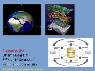
  • 1. Presented By: Uttam Pudasaini 3rd Year,1st Semester Kathmandu University Contact Details: utmpudasaini@gmail.com
  • 4. HOW WE ENTERED THIS FIELD • SENIOR’S ADVICE • 75 %Scholarship  • New and Dynamic course
  • 5. What’s there in Geomatics??? Geodesy Global positioning system(GPS) or Global navigation satellite system(GNSS) Surveying ( cadastral, aerial, mining and engineering surveying) Navigation AND Location-based services Cartography , Geovisualization and Digital mapping Geographic information systems(GIS)
  • 6.  Spatial database management  Computer-aided design and scientific visualization  Visual communication design, graphic design and multimedia technology  Remote sensing and Image processing  Photogrammetry  Land information systems (LIS)  Land management, cadastre, real property law  Applications programming
  • 7.
  • 8. Also known as land surveyors and mappers  Design, develop, and operate systems for collecting and analyzing spatial information about the land, the oceans, natural resources, and manmade features.  A rapidly developing discipline that focuses on spatial information (i.e. information that has a location). GEOMATICS ENGINEERS
  • 9. Geomatics is a new term incorporating the older field of land surveying along with many other aspects of spatial data management. Following the advanced developments in digital data processing, the nature of the tasks required of the professional land surveyor has evolved and the term "surveying" no longer accurately covers the whole range of tasks that the profession deals with. As our societies become more complex, information with a spatial position associated with it becomes more critical to decision-making, both from a personal and a business perspective, and also from a community and a large-scale governmental viewpoint.
  • 10. SURVEYING  Determining the relative position of objects on, above or below the surface of earth  Involves direct or indirect measurements of distance, direction and elevation  Representing this information on paper plans or on computer based maps. Traditional Surveyors Construction Survey Levelling
  • 11. GEODESY  Determines the mathematical figure of the earth  Determine the exact positions of points on the earth’s surface.  To determine the figures and areas of large portions of the earth’s surface  To determine the shape and size of the earth  To determine the variations of terrestrial gravity
  • 12. GLOBAL POSITIONING SYSTEM WE ARE SPATIAL ENGINEERSS WE TALK ABOUT POSITIONS.. WE TALK ABOUT X,Y,Z NOT A,B,C,D………
  • 13. PHOTOGRAMMETRY Aerial photography over a terrain Recording, measuring and interpreting photographic images and patterns of recorded radiant EM energy to obtain information about real world objects and its environment
  • 14. REMOTE SENSING Collecting information from a distance A terrain model from RS images Entire process
  • 15. Google Earth 3D TERRAIN IN GOOGLE EARTH 3D MAN MADE FEATURES IN GOOGLE EARTH GOOGLE EARTH’S INTERFACE
  • 16. Programming C,C++ JAVA WEB GIS DATABASE COMPUTER NETWORKING PYTHON APPS DEVELOPMENT WEB MAPPING INTERACTIVE MAPPING SPATIAL DATA MANAGEMENT 2D AND 3D COMPUTER MODELS
  • 17. What we do is, We extract useful information from large heterogeneous data related to any phenomena around us and we make this information easily understandable and usable by concerned authorities making use of maps, models, virtual realities, computer software and applications. 3D city model-Berlin Interactive web map Virtual reality-Street View
  • 18. If you are interested in • Mathematics and Physics-Geodesy • Computer programming-Integrate Programming with Geomatics, Apps development • Travelling places and collecting information-Surveying • Analysis-Photogrammetry ,Remote Sensing and Digital image processing • Modeling and Simulation–Virtual Geomatics • Conflict management and Policy making–Land Administration
  • 19.
  • 20. FEEL PROUD TO BE PART OF THE WORLD’S FASTEST GROWING INDUSTRY: THE GEOSPATIAL INDUSTRY
  • 21. AIR ,WATER AND LAND ALL THREE ARE OUR WORKSPACE
  • 22. WE HAVE ENTERED INTO A GREAT PROFESSION .NOW ALL THAT COUNTS IS HOW HARD WE TRY. WELCOME TO GE FAMILY 
  • 24.
  • 25.