
Empfohlen
Empfohlen
Weitere ähnliche Inhalte
Andere mochten auch
Andere mochten auch (13)
Mehr von Ushahidi
Mehr von Ushahidi (20)
Kürzlich hochgeladen
Kürzlich hochgeladen (20)
Map it, Change it
- 1. map it, change it
- 7. photo by Olga Werby
- 8. Photo by Sustainable Water Supply and Sanitation (SWSS) Project
- 10. Digital volunteers: Standby Task Force
- 12. map.occupy.net
- 13. Sentiment mapping: Community Networks with Local + Diaspora How: ask, mobile, translate, map, share
Hinweis der Redaktion
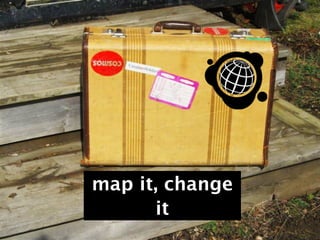
- Map it, Change it  - what can citizens do to collaborate and change the world using maps? This presentation was given on April 11th, 2012 in Istanbul, Turkey at TedxSilkRoad. (tedxsilkroad.com) \n\nWhen I am in airports, buses, trains and streetcars or even walking down the street, I play a game: "who are these people? Why are they here? What motivates them? And, what would inspire them to contribute their skills to the world? We’ve moved from analog travel to digital. And, in this digital travel and storytelling, we have a huge opportunity to make a difference in our world. We no longer need a boat or a plane ticket.\n\n This obsession of connectiveness to our world is due to my Grandfather. When I was young, he took all his hard savings and traveled the world. This is my grandfather’s suitcase. (Reference to Orhan Pamuk http://www.nobelprize.org/nobel_prizes/literature/laureates/2006/pamuk-lecture_en.pdf) (Suitcase picture by Elizabeth Leson)\n
- Maps unlock our stories, provide essential information and give us a sense of global connectiveness. They connect us to just how massive and globe-sized the world is. They tell us about history, geography, borders and change. What if a map was not static, but interactive? What if a map could connect us and let us share stories with each other? What if a map was not an end in itself, but a tool to build on? Let’s take a map tour. (Graffiti picture from Montreal, QC by Heather Leson) \n
- Ushahidi is information collection, visualization and interactive mapping software. We’re a non-profit.  It means Testimony and started in Kenya after post-election violence in 2008.  The goal was to collaborate and find information on the internet and have people share. They aimed to answer two questions: What do you see, what do you hear.\n\nWe made Ushahidi free and open source so that anyone could use the software platform to voice to their maps. People use to tell visual stories and collaborate. Some of the ways it has been used is for election monitoring, crisis and emergency response, civil society and city building.  \n \nWhat is it made of? Map, types of info, types of communication channels, mission/topic, and the key to action (people and outreach) Reports can come from all the communication channels (sms, web form, mobile apps, twitter, facebook, analog device (manual) and email.) Each red dot is a report. Each report is assigned a category, geolocated, given a description and added to the map. This map was used by Kenyans to get a comprehensive picture /story of what was happening throughout the country. This was not something that could be found in any of the mainstream media - a large map story of the violence. People helping each other understand the issues.\n\n \n\n
- Ushahidi has been used for election monitoring from Senegal to Argentina to Morocco to Guatemala to India. The Ushahidi Liberia team was run by the ilab and local citizens. They trained Non-government organizations, civil society organizations and community members to report. The Un Mission to Liberia said that “Their crowdseeding efforts provided the people of Liberia, UNMIL and others, with timely access to objective reports from around the country.”\n\nhttp://blog.ushahidi.com/index.php/2011/12/02/un-and-ushahidi-collaboration-suggests-an-interwoven-future-is-inevitable/\nUshahidiliberia.org\n
- Lessons in partnerships and community. Ushahidi has been used for crisis and emergencies from Haiti to Pakistan to New Zealand. At 8:30 EST Feb. 22nd, I saw a tweet from a friend. I knew at that very instant that we would all be logging online, dividing into groups and mapping. We had contacts in NZ but not in Christchurch. It started with three maps and a few hundred people. Existing online communities began to share and crosstrain. But, the global community of crisismappers is small. The Christchurch and Wellington teams took over the map. They connected with volunteers. These things can happen concurrently to official resources. They searched for important helpful items (petrol, open pharmacies). \n
- Ushahidi has been used for various civil society actions as well including human rights, corruption mapping and environmental issues. This mapper wanted to highlight peak oil issues, so they mapped them on Antarctica for more visibility. It also includes a layer of data from Powercuts.in. by Ajay Kumar\n\nThere are also a few petrol shortage maps. Each of these maps aim to amplify the issue of environmental sustainability. Teams of people plan around a map, they build community, they teach each other about important topics. \n
- What can kids do? What if a map is not an information tool but a teaching change tool? This is the 2012 AP Economics Class at Lowell High School in San Francisco, taught by Kristin B. Lubenow. They mapped the Cost of Chicken. Apparently, this is a base line measurement for food costs around the world. They learned that kids don’t know where their food comes from. The kids in India asked for category to map the cost of candy, because candy is very expensive in India. What else can we learn about food production and sustainability by collaborating with maps. \n\n\n
- Ushahidi has been used for social entrepreneurship. "Watertracker enables rural communities throughout Afghanistan to report on the working condition of local water wells using a toll-free multi-language IVR. This IVR service integrates with an Ushahidi instance that stores and maps detailed information about thousands of water points throughout the country. When community calls are completed the site displays malfunctioning well reports instantaneously on a country map. A Watertracker monitor listens to recorded IVR messages from communities, before responding to the community via mobile in order to provide technical assistance to help them resolve the technical issues that they face. The application was deployed in country in October 2011 by the Sustainable Water Supply and Sanitation project (SWSS), a USAID-supported rural infrastructure initiative. Watertracker's toll-free IVR service is the ongoing contribution of Roshan, Afghanistan's leading mobile operator. The application's development was conceived and managed by Arc Finance, a US-based NGO. In 2012 Watertracker's management will be transferred from SWSS to the Afghan Ministry of Rural Rehabilitation and Development (MRRD), and will ultimately incorporate nearly 100,000 wells throughout the the country."     (Picture by 'Sustainable Water Supply and Sanitation (SWSS) Project’ in April 2012 (Kapisa, Afghanistan) What is most important about this map is that is local owned, in their languages and giving them power to share and change their country’s water tracking. It is also a teaching tool which will allow people to get the help they need to learn how to fix their wells. \n\n
- Civil Society. Shemeer is a young man in India. He is on a mission to map all the violence against women. In doing so, he has started a best practice. He is not an NGO. He is an individual with a mission. He has set up his map to curate stories using multiple communication channels. Notice how he has also provided additional resources so that people can use his map as a place for find help too. He is now working on more projects using Ushahidi to enpower women and give voice to local issues. But, he is also very concerned about how to act on the information collected. \n
- \nWhat is a digital volunteer? Why is that borderless and important?  standbytaskforce.com = 750 volunteers around the world. Waiting for you to ask for help. They map it, change it.   They can do it 24 hours, in shifts, skilled and coordinated. They learn from each event.  \n\nThis is Melissa Elliot, a Canadian Mapper. She is part of the core team of the Standby Task Force and leads the Reports Team. The group has built a field of out volunteering. They have open source documentation on how to be a crowdsourced mapping project. When they mapped in Libya, they were human sensors sifting through the barrage of information. They were asked to do this map by the United Nations Office for the Coordination of Humanitarian Affairs. \n\n
- What can we learn from the Tohoku? (Japan Earthquake and Tsunami. What do you see, what do you need? Communities helping themselves in local language. Sharing.\n\nJapan’s OpenStreetMap Foundation created Sinsai.info to provide and aggregate disaster information by formatting them using geolocation data.  Results - over 12, 000 reports ,1 million page views in the first month, 500, 000 unique visitors, Most viewed from Sendai.  The OSM Japan team already had an instance of Ushahidi setup. This made it possible to prepare beyond the technology.  Deploy quickly, get feedback. Needs of disaster area is always changing. Twitter was the predominate tool. The teams were able to connect people in hospitals to those in need. They won the Rakuten Technology Award for this citizen activism: \n\nhttp://blog.ushahidi.com/index.php/2011/11/24/sinsai-harassmap-and-zabatak-win-awards/\n(slide courtesy of Hal Seki)\n\n
- This is map.occupy.net. They are Occupy Wall Street. Their map is very interactive including more pictures and a wiki. They are using Ushahidi to highlight their protest community. \n\n\n
- What if a map can tell us about how we feel about something? Can it connect us to stories about local issues? The potential of partnerships and mobile can collaborate to tell the story: Al Jazeera, Ushahidi, diaspora, local communities, Crowdflower and Souktel. More than 4,000 text messages were received within just a few days. Of these, over 1,000 were translated from Somali into English by about 80 translators. The resulting map of Somali voices received over 25,000 page views. The message sent was “Al Jazeera wants to know: how has the conflict of the last few months affected your life? Please include the name of your hometown in your response. Thank you! “I lost everything: the whole older generation of my family is wiped out, 100%. No grandmother, no grandfather, no one of the last generation. Many other families were killed by crossfire and artillery shells; they were always innocent bystanders, they got caught in the conflict while they didn't have any stake in it.”\n\n
- What about emergencies in Turkey? Al Jazeera and a few volunteers created this map. It is small prototype. But what is key is that it is local knowledge. The area of Van did not have many reports. The reasons could be outreach, use of mobile phones and technical connections. These types of projects need local knowledge, language and preparedness. Every country, every region is different. I would argue that each of you might consider how crowdsourcing during an emergency in Turkey should be done. Take the global lessons and tailor them for your own region. https://van.crowdmap.com/\n\nHow would mobile work in Turkey? Is there capacity? Could local street teams be trained now to prepare?\n
- We are all on a digital journey to be more connected. My whole life’s course changed the night of the Haiti earthquake. I received a Facebook message asking “What can technologists do to support the efforts?” I joined a movement of mappers and software makers who all want to use their skills for social good. My grandfather once traveled with a suitcase, but I am taking a world tour with maps, learning about amazing people who doing things in their cities, communities and world. \n\nOn this map journey, there are four basic themes I want to convey: \n\na/ power of individual to change world and be citizen engaged \nb/ power of relationships, partnerships outside formal corporations and institutions = (private, public, community based, individuals and more (like Occupy)\nc/the  global connectiveness of communities of topic (topical maps) and diaspora connections (Somalia Speaks) using all the tools, especially mobile\n \n\nd/ There is a new type of social entrepreneurship changing with maps. Some start with the mission/project, some tinker and fall it into. All see the potential and evolve it. They are asking institutions to participate. They are asking why.  They are the new mapmakers, storytellers, and disrupters. Often the map changes them more than they change the map. Why? Because the very act of civic engagement and being part of the story. Mappers of all kinds go onto other maps. It is addictive. They are driven by the desire to include citizens and online content for change. It is out there, so they collect, analyze and use it. As much as humans can be sensors, the value we offer is in our sense of right, the trust we build, the community we foster and the willingness to globally collaborate.\n\nThey are changing lives. And, most of all - they inspire us. \n\n