Weitere ähnliche Inhalte
Kürzlich hochgeladen (20)
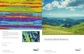
TGS NSA- Onshore Brochure
- 1. © 2014 TGS-NOPEC GEOPHYSICAL COMPANY ASA. ALL RIGHTS RESERVED.
Onshore North America
See the energy at TGS.com
© 2014 TGS-NOPEC GEOPHYSICAL COMPANY ASA. ALL RIGHTS RESERVED.
See the energy at TGS.com
Reservoir analysis
Seismic reservoir characterization assists in the definition of geometry
of a reservoir, the distribution of physical property characteristics within
a reservoir and in correlation of all available detail. TGS works with our
clients to address specific problems and find the best possible solution to
maximize reservoir assets.
TGS offers a full suite of services to harness unconventional plays: high
frequency enhancement, thin bed reflectivity inversion, relative acoustic
US
Tel: +1 713 860 2100
Email: info@tgs.com
For more information, contact TGS at:
- 2. © 2014 TGS-NOPEC GEOPHYSICAL COMPANY ASA. ALL RIGHTS RESERVED.
See the energy at TGS.com
National Geographic, Esri, DeLorme, NAVTEQ, UNEP-WCMC, USGS, NASA, ESA, METI, NRCAN, GEBCO, NOAA, iPC
80°W81°W82°W83°W84°W85°W86°W87°W88°W89°W90°W91°W92°W93°W94°W95°W96°W97°W98°W99°W100°W101°W102°W103°W
43°N42°N41°N40°N39°N38°N37°N36°N35°N34°N33°N
Bucklin 3D
Ford and Kiowa Cos., KS
262 mi2
Cheyenne 3D
Cheyenne and Kiowa Cos., CO
658 mi2
Wellington 3D
Sumner Co., KS
303 mi2
Firestone 3D
Carrol and Columbiana Cos., OH
407 mi2
Data Available
Mississippi Lime Oil Shale
Multi-client seismic
United States
TGS offers multi-client onshore seismic data across North America. The
Company applies the same high standards of quality and customer service
with onshore seismic as with its suite of geoscience data products around
the world. TGS considers all the needs of the client as well as all of the
operational, environmental and regulatory factors involved. TGS supervises
and collaborates with chosen seismic contractors to ensure quality
operations in all aspects of the project including permitting, surveying,
drilling, data acquisition and processing.
Firestone
© 2014 TGS-NOPEC GEOPHYSICAL COMPANY ASA. ALL RIGHTS RESERVED.
See the energy at TGS.com
Orthorhombic imaging
Orthorhombic imaging consists of a set of tools that allow azimuthal
anisotropy to be incorporated into velocity model building and pre-stack
depth migration. In areas of complex geology, especially where fractures
are present, commonly used Tilted Transverse Isotropy (TTI) may not be
sufficient for describing moveout variations with azimuth. Orthorhombic
anisotropy (ORT) provides a more comprehensive model and orthorhombic
migration is able to flatten migration gathers across different azimuth
sectors.
The top figure shows the comparison of migration stack images between
TTI and ORT. The ORT imaging provides clear uplift in image quality. The
bottom figures show the comparison of migration gathers produced by
TTI and ORT. ORT is able to resolve the conflicting residual moveout and
flatten events across different azimuthal sectors.
The orthorhombic model for azimuthal anisotropy includes nine
anisotropic parameters:
ƒƒ Vo
ƒƒ Del1 and eps1 in the vertical and horizontal (Vfast) plane
ƒƒ Del2 and eps2 in the vertical and horizontal (Vslow) plane
ƒƒ Del3 in the horizontal (Vfast Vslow) plane
ƒƒ Alpha (a), which represents the azimuthal rotation of Vfast
ƒƒ Theta, phi (q, f), which represent the normal vector of the symmetry axis
Orthorhombic Migration ImageTTI Migration Image
Azimuthal Gathers Before Orthorhombic (Standard TTI Migration) Azimuthal Gathers After Orthorhombic Migration
- 3. © 2014 TGS-NOPEC GEOPHYSICAL COMPANY ASA. ALL RIGHTS RESERVED.
See the energy at TGS.com
Digital well logs
Over seven million well logs in over thirty countries make up TGS’
collection of digital well log data from the most popular hydrocarbon plays
around the globe.
Depending on customer project needs, the digital formats available for
each well log range from depth-calibrated smartRASTER® image files
to completely digitized LAS and LAS Plus curve suites. Each format can
be conveniently accessed online, through the online well data portal
LOG-LINE Plus!®
LAS Plus format upgrades standard LAS to a full curve suite. Raw data is
correlated and edited providing the best open-hole curves. LAS Plus also
provides uniformed curve mnemonics and units. Curves are also merged
using the best data. LAS Plus data is ready for cross section, formation
evaluation and petrophysical analysis.
Directional surveys
TGS set a new standard of quality for ‘user-ready’ directional survey data
and well path control. TGS’ Directional Survey Plus (DS+) data are thoroughly
researched, re-processed and standardized to create the most accurate spatial
representation of the well path, from surface to total depth.
Well performance data
TGS offers a cost effective way to quickly identify and evaluate new prospects
across the country with unlimited access to TGS’ domestic U.S. Smart Rasters
and Well Performance Data.
TGS provides access to nationwide Oil and Gas Well production coverage.
Well Performance Datasets include: nationwide Well Headers, detailed
monthly production volumes for all wells and leases, a unique set of Oil and
Gas statistical well cumulative values and Lease-to-Well Allocated volumes
for all lease reported states.
Geological Products
© 2014 TGS-NOPEC GEOPHYSICAL COMPANY ASA. ALL RIGHTS RESERVED.
See the energy at TGS.com
Interpretation products
TGS’ multi-client interpretation products provide regional frameworks for
customer prospects. Ranging from complete hydrocarbon prospectivity
reports to velocity volumes, the TGS library has products worldwide to
supplement data resources. In addition, TGS is available for consulting
work in geology, geophysics and petrophysics on customers’ in-house
projects.
Digital mud logs
TGS has an extensive library of digital mud log curves and raster images
for wells across North America. Each log is evaluated to identify the best
complete digitizing suite. Mud log gas curves are available as digital LAS
files and include raster images (in color when available). ROP, total and
individual gas curves are captured as standard; digitized lithology and
cuttings remarks are optional.
Data / application integration solution
TGS’ Volant Solutions provides a data/application integration offering that
includes the ENVOY integration platform, the EnerConnect user interface and
various adapters. With the ability to facilitate application interoperability,
the days of data duplication and weak data governance will be eliminated.
The ENVOY integration platform is completely configurable and can meet the
specialized needs of E&P companies.
- 4. © 2014 TGS-NOPEC GEOPHYSICAL COMPANY ASA. ALL RIGHTS RESERVED.
See the energy at TGS.com
Time processing
ƒƒ Interactive geometry
ƒƒ AVO compliant processing
ƒƒ Noise attenuation
ƒƒ Multiple attenuation
ƒƒ Reflection and refraction statics
ƒƒ Merge processing
ƒƒ Pre-stack interpolation
ƒƒ Interactive velocity analysis
ƒƒ Pre-stack time migration
ƒƒ Fracture detection
ƒƒ Multicomponent processing
Depth processing
ƒƒ Anisotropic imaging (VTI,TTI and orthorhombic)
ƒƒ Kirchhoff, RTM and Q PSDM
ƒƒ Interpretation enhancing tools
ƒƒ Delayed Image Time (DIT) scans
ƒƒ Directional Imaging Stack (DIS)
ƒƒ Interpretation Driven Modeling (IDM)
ƒƒ Dip constrained tomography
ƒƒ RTM angle gathers
ƒƒ Linux CPU and GPU cluster based
Imaging
© 2014 TGS-NOPEC GEOPHYSICAL COMPANY ASA. ALL RIGHTS RESERVED.
See the energy at TGS.com
Canada
Through Arcis, a wholly owned subsidiary, TGS offers one of the most
current 2D and 3D seismic data libraries for the Western Canadian
Sedimentary Basin, including Northeast British Columbia.
Arcis has complemented its data library with global seismic solutions that
include seismic data processing (using its APXTM processing platform),
reservoir analysis, geoconsultancy and project management.
Ille Lake
National Geographic, Esri, DeLorme, NAVTEQ, UNEP-WCMC
95°W100°W105°W110°W115°W120°W125°W
550°N45°N
2D Seismic
3D Seismic 125°W
13
55°N50°N45°N
2D Seismic
3D Seismic