SlideShare ist ein Scribd-Unternehmen logo
1 von 2
Downloaden Sie, um offline zu lesen
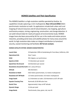
IKONOS Satellites and Their Specification

The IKONOS Satellite is a high-resolution satellite operated by GeoEye. Its
capabilities include capturing a 3.2m multispectral, Near-Infrared (NIR)/0.82m
panchromatic resolution at nadir. Its applications include both urban and rural
mapping of natural resources and of natural disasters, tax mapping, agriculture
and forestry analysis, mining, engineering, construction, and change detection. It
can yield relevant data for nearly all aspects of environmental study. IKONOS
images have also been procured by SIC for use in the media and motion picture
industries, providing aerial views and satellite photos for many areas around the
world. Its high resolution data makes an integral contribution to homeland
security, coastal monitoring and facilitates 3D Terrain analysis.

IKONOS SATELLITE SYSTEM: SENSOR CHARACTERISTICS

Launch Date                   24 September 1999 at Vandenberg Air Force Base, California, USA
Operational Life              Over 7 years
Orbit                         98.1 degree, sun synchronous
Speed on Orbit                7.5 kilometers per second
Speed Over the Ground         6.8 kilometers per second
Revolutions Around the Earth 14.7, every 24 hours
Altitude                      681 kilometers
Resolution at Nadir           0.82 meters panchromatic; 3.2 meters multispectral
Resolution 26° Off-Nadir      1.0 meter panchromatic; 4.0 meters multispectral
Image Swath                   11.3 kilometers at nadir; 13.8 kilometers at 26° off-nadir
Equator Crossing Time         Nominally 10:30 AM solar time
Revisit Time                  Approximately 3 days at 40° latitude
Dynamic Range                 11-bits per pixel
Image Bands                   Panchromatic, blue, green, red, near IR
Ikonos

Weitere ähnliche Inhalte

Was ist angesagt?

Basics of Remote Sensing
Basics of Remote SensingBasics of Remote Sensing
Basics of Remote SensingAkash Tikhe
 
Role of electromagnetic Radiation in Remote Sensing
Role of electromagnetic Radiation in  Remote SensingRole of electromagnetic Radiation in  Remote Sensing
Role of electromagnetic Radiation in Remote SensingNzar Braim
 
Scale and resolution
Scale and resolutionScale and resolution
Scale and resolutionshabir dar
 
Chapter 1 (Introduction to remote sensing)
Chapter 1 (Introduction to remote sensing)Chapter 1 (Introduction to remote sensing)
Chapter 1 (Introduction to remote sensing)Shankar Gangaju
 
Remote sensing - Sensors, Platforms and Satellite orbits
Remote sensing - Sensors, Platforms and Satellite orbitsRemote sensing - Sensors, Platforms and Satellite orbits
Remote sensing - Sensors, Platforms and Satellite orbitsAjay Singh Lodhi
 
Remote sensing and image interpretation
Remote sensing and image interpretationRemote sensing and image interpretation
Remote sensing and image interpretationMd. Nazir Hossain
 
Thermal Remote Sensing
Thermal Remote SensingThermal Remote Sensing
Thermal Remote SensingRohit Kumar
 
. Atmospheric window and reflectance curve
. Atmospheric window and  reflectance curve. Atmospheric window and  reflectance curve
. Atmospheric window and reflectance curvemarutiChilame
 
Fundamentals of Remote Sensing
Fundamentals of Remote Sensing Fundamentals of Remote Sensing
Fundamentals of Remote Sensing Pallab Jana
 
Thermal remote sensing BY Hariom Ahlawat
Thermal remote sensing BY Hariom AhlawatThermal remote sensing BY Hariom Ahlawat
Thermal remote sensing BY Hariom AhlawatHariom Ahlawat
 
Digital Elevation Models
Digital Elevation ModelsDigital Elevation Models
Digital Elevation ModelsBernd Flmla
 
Introduction to Remote Sensing- by Wankie Richman
Introduction to Remote Sensing- by Wankie RichmanIntroduction to Remote Sensing- by Wankie Richman
Introduction to Remote Sensing- by Wankie RichmanRichmanWankie
 
Image classification, remote sensing, P K MANI
Image classification, remote sensing, P K MANIImage classification, remote sensing, P K MANI
Image classification, remote sensing, P K MANIP.K. Mani
 

Was ist angesagt? (20)

Digital Elevation Model (DEM)
Digital Elevation Model (DEM)Digital Elevation Model (DEM)
Digital Elevation Model (DEM)
 
Historical Development of Photogrammetry
Historical Development of PhotogrammetryHistorical Development of Photogrammetry
Historical Development of Photogrammetry
 
Basics of Remote Sensing
Basics of Remote SensingBasics of Remote Sensing
Basics of Remote Sensing
 
Role of electromagnetic Radiation in Remote Sensing
Role of electromagnetic Radiation in  Remote SensingRole of electromagnetic Radiation in  Remote Sensing
Role of electromagnetic Radiation in Remote Sensing
 
Scale and resolution
Scale and resolutionScale and resolution
Scale and resolution
 
Chapter 1 (Introduction to remote sensing)
Chapter 1 (Introduction to remote sensing)Chapter 1 (Introduction to remote sensing)
Chapter 1 (Introduction to remote sensing)
 
Remote sensing - Sensors, Platforms and Satellite orbits
Remote sensing - Sensors, Platforms and Satellite orbitsRemote sensing - Sensors, Platforms and Satellite orbits
Remote sensing - Sensors, Platforms and Satellite orbits
 
Visual Interpretation
Visual InterpretationVisual Interpretation
Visual Interpretation
 
Thermal remote sensing
Thermal remote sensingThermal remote sensing
Thermal remote sensing
 
Introduction to Remote Sensing
Introduction to Remote SensingIntroduction to Remote Sensing
Introduction to Remote Sensing
 
Remote sensing
Remote sensingRemote sensing
Remote sensing
 
Remote sensing and image interpretation
Remote sensing and image interpretationRemote sensing and image interpretation
Remote sensing and image interpretation
 
Thermal Remote Sensing
Thermal Remote SensingThermal Remote Sensing
Thermal Remote Sensing
 
Concept of remote sensing
Concept of remote sensingConcept of remote sensing
Concept of remote sensing
 
. Atmospheric window and reflectance curve
. Atmospheric window and  reflectance curve. Atmospheric window and  reflectance curve
. Atmospheric window and reflectance curve
 
Fundamentals of Remote Sensing
Fundamentals of Remote Sensing Fundamentals of Remote Sensing
Fundamentals of Remote Sensing
 
Thermal remote sensing BY Hariom Ahlawat
Thermal remote sensing BY Hariom AhlawatThermal remote sensing BY Hariom Ahlawat
Thermal remote sensing BY Hariom Ahlawat
 
Digital Elevation Models
Digital Elevation ModelsDigital Elevation Models
Digital Elevation Models
 
Introduction to Remote Sensing- by Wankie Richman
Introduction to Remote Sensing- by Wankie RichmanIntroduction to Remote Sensing- by Wankie Richman
Introduction to Remote Sensing- by Wankie Richman
 
Image classification, remote sensing, P K MANI
Image classification, remote sensing, P K MANIImage classification, remote sensing, P K MANI
Image classification, remote sensing, P K MANI
 

Ähnlich wie Ikonos (20)

Envisat
EnvisatEnvisat
Envisat
 
RS_GIS_GPS.pdf
RS_GIS_GPS.pdfRS_GIS_GPS.pdf
RS_GIS_GPS.pdf
 
Rs
RsRs
Rs
 
Report
ReportReport
Report
 
Use of satellite imageries in weather forecasting
Use of satellite imageries in weather forecastingUse of satellite imageries in weather forecasting
Use of satellite imageries in weather forecasting
 
Remote Sensing_2020-21 (1).pdf
Remote Sensing_2020-21  (1).pdfRemote Sensing_2020-21  (1).pdf
Remote Sensing_2020-21 (1).pdf
 
remote sensing in coastal zone
remote sensing in coastal zone remote sensing in coastal zone
remote sensing in coastal zone
 
A Brief Introduction to Remote Sensing Satellites
A Brief Introduction to Remote Sensing Satellites A Brief Introduction to Remote Sensing Satellites
A Brief Introduction to Remote Sensing Satellites
 
space technology
space technologyspace technology
space technology
 
intro.pptx
intro.pptxintro.pptx
intro.pptx
 
Remote sensing
Remote sensing Remote sensing
Remote sensing
 
IKONOS-2.pptx
IKONOS-2.pptxIKONOS-2.pptx
IKONOS-2.pptx
 
remote sensing ppt.pptx
remote sensing ppt.pptxremote sensing ppt.pptx
remote sensing ppt.pptx
 
Remote sensing
Remote sensingRemote sensing
Remote sensing
 
APPLICATION OF REMOTE SENSING AND GIS IN AGRICULTURE
APPLICATION OF REMOTE SENSING AND GIS IN AGRICULTUREAPPLICATION OF REMOTE SENSING AND GIS IN AGRICULTURE
APPLICATION OF REMOTE SENSING AND GIS IN AGRICULTURE
 
Remote sensing in space krishna
Remote sensing in space krishnaRemote sensing in space krishna
Remote sensing in space krishna
 
Types of Remote Sensing.pdf
Types of Remote Sensing.pdfTypes of Remote Sensing.pdf
Types of Remote Sensing.pdf
 
Remote Sensing
Remote SensingRemote Sensing
Remote Sensing
 
WE4.L10.5: ADVANCES IN NIGHTTIME SATELLITE REMOTE SENSING CAPABILITIES VIA TH...
WE4.L10.5: ADVANCES IN NIGHTTIME SATELLITE REMOTE SENSING CAPABILITIES VIA TH...WE4.L10.5: ADVANCES IN NIGHTTIME SATELLITE REMOTE SENSING CAPABILITIES VIA TH...
WE4.L10.5: ADVANCES IN NIGHTTIME SATELLITE REMOTE SENSING CAPABILITIES VIA TH...
 
Remote sensing
Remote sensingRemote sensing
Remote sensing
 

Mehr von Sumant Diwakar

Hydrologic Assessment in a Middle Narmada Basin, India using SWAT Model
Hydrologic Assessment in a Middle Narmada Basin, India using SWAT ModelHydrologic Assessment in a Middle Narmada Basin, India using SWAT Model
Hydrologic Assessment in a Middle Narmada Basin, India using SWAT ModelSumant Diwakar
 
REMOTE SENSING & GIS APPLICATIONS IN WATERSHED MANAGEMENT
REMOTE SENSING & GIS APPLICATIONS IN WATERSHED MANAGEMENT REMOTE SENSING & GIS APPLICATIONS IN WATERSHED MANAGEMENT
REMOTE SENSING & GIS APPLICATIONS IN WATERSHED MANAGEMENT Sumant Diwakar
 
Relation between Ground-based Soil Moisture and Satellite Image-based NDVI
Relation between Ground-based Soil Moisture and Satellite Image-based NDVIRelation between Ground-based Soil Moisture and Satellite Image-based NDVI
Relation between Ground-based Soil Moisture and Satellite Image-based NDVISumant Diwakar
 
Solar irradiation & spectral signature
Solar irradiation & spectral signatureSolar irradiation & spectral signature
Solar irradiation & spectral signatureSumant Diwakar
 
Optical remote sensing
Optical remote sensingOptical remote sensing
Optical remote sensingSumant Diwakar
 
Interaction of EMR with atmosphere and earth surface
Interaction of EMR with atmosphere and earth surfaceInteraction of EMR with atmosphere and earth surface
Interaction of EMR with atmosphere and earth surfaceSumant Diwakar
 
History of remote sensing
History of remote sensingHistory of remote sensing
History of remote sensingSumant Diwakar
 
Electromagnetic radiation
Electromagnetic radiationElectromagnetic radiation
Electromagnetic radiationSumant Diwakar
 
Differential gps (dgps) 09 04-12
Differential gps (dgps) 09 04-12Differential gps (dgps) 09 04-12
Differential gps (dgps) 09 04-12Sumant Diwakar
 
Principle of photogrammetry
Principle of photogrammetryPrinciple of photogrammetry
Principle of photogrammetrySumant Diwakar
 
Automatic digital terrain modelling
Automatic digital terrain modellingAutomatic digital terrain modelling
Automatic digital terrain modellingSumant Diwakar
 
Aerial photography abraham thomas
Aerial photography abraham thomasAerial photography abraham thomas
Aerial photography abraham thomasSumant Diwakar
 
Aerial photographs and their interpretation
Aerial photographs and their interpretationAerial photographs and their interpretation
Aerial photographs and their interpretationSumant Diwakar
 

Mehr von Sumant Diwakar (20)

Hydrologic Assessment in a Middle Narmada Basin, India using SWAT Model
Hydrologic Assessment in a Middle Narmada Basin, India using SWAT ModelHydrologic Assessment in a Middle Narmada Basin, India using SWAT Model
Hydrologic Assessment in a Middle Narmada Basin, India using SWAT Model
 
C Programming
C ProgrammingC Programming
C Programming
 
C Programming
C ProgrammingC Programming
C Programming
 
Soil moisture
Soil moistureSoil moisture
Soil moisture
 
REMOTE SENSING & GIS APPLICATIONS IN WATERSHED MANAGEMENT
REMOTE SENSING & GIS APPLICATIONS IN WATERSHED MANAGEMENT REMOTE SENSING & GIS APPLICATIONS IN WATERSHED MANAGEMENT
REMOTE SENSING & GIS APPLICATIONS IN WATERSHED MANAGEMENT
 
Relation between Ground-based Soil Moisture and Satellite Image-based NDVI
Relation between Ground-based Soil Moisture and Satellite Image-based NDVIRelation between Ground-based Soil Moisture and Satellite Image-based NDVI
Relation between Ground-based Soil Moisture and Satellite Image-based NDVI
 
Solar irradiation & spectral signature
Solar irradiation & spectral signatureSolar irradiation & spectral signature
Solar irradiation & spectral signature
 
Optical remote sensing
Optical remote sensingOptical remote sensing
Optical remote sensing
 
Interaction of EMR with atmosphere and earth surface
Interaction of EMR with atmosphere and earth surfaceInteraction of EMR with atmosphere and earth surface
Interaction of EMR with atmosphere and earth surface
 
History of remote sensing
History of remote sensingHistory of remote sensing
History of remote sensing
 
Electromagnetic radiation
Electromagnetic radiationElectromagnetic radiation
Electromagnetic radiation
 
Map projection
Map projectionMap projection
Map projection
 
Differential gps (dgps) 09 04-12
Differential gps (dgps) 09 04-12Differential gps (dgps) 09 04-12
Differential gps (dgps) 09 04-12
 
Principle of photogrammetry
Principle of photogrammetryPrinciple of photogrammetry
Principle of photogrammetry
 
Digital terrain model
Digital terrain modelDigital terrain model
Digital terrain model
 
Digital orthophoto
Digital orthophotoDigital orthophoto
Digital orthophoto
 
Automatic digital terrain modelling
Automatic digital terrain modellingAutomatic digital terrain modelling
Automatic digital terrain modelling
 
Aerial photography abraham thomas
Aerial photography abraham thomasAerial photography abraham thomas
Aerial photography abraham thomas
 
Aerial photographs and their interpretation
Aerial photographs and their interpretationAerial photographs and their interpretation
Aerial photographs and their interpretation
 
Wide field sensor
Wide field sensorWide field sensor
Wide field sensor
 

Kürzlich hochgeladen

POINT- BIOCHEMISTRY SEM 2 ENZYMES UNIT 5.pptx
POINT- BIOCHEMISTRY SEM 2 ENZYMES UNIT 5.pptxPOINT- BIOCHEMISTRY SEM 2 ENZYMES UNIT 5.pptx
POINT- BIOCHEMISTRY SEM 2 ENZYMES UNIT 5.pptxSayali Powar
 
microwave assisted reaction. General introduction
microwave assisted reaction. General introductionmicrowave assisted reaction. General introduction
microwave assisted reaction. General introductionMaksud Ahmed
 
Grant Readiness 101 TechSoup and Remy Consulting
Grant Readiness 101 TechSoup and Remy ConsultingGrant Readiness 101 TechSoup and Remy Consulting
Grant Readiness 101 TechSoup and Remy ConsultingTechSoup
 
1029-Danh muc Sach Giao Khoa khoi 6.pdf
1029-Danh muc Sach Giao Khoa khoi  6.pdf1029-Danh muc Sach Giao Khoa khoi  6.pdf
1029-Danh muc Sach Giao Khoa khoi 6.pdfQucHHunhnh
 
A Critique of the Proposed National Education Policy Reform
A Critique of the Proposed National Education Policy ReformA Critique of the Proposed National Education Policy Reform
A Critique of the Proposed National Education Policy ReformChameera Dedduwage
 
Call Girls in Dwarka Mor Delhi Contact Us 9654467111
Call Girls in Dwarka Mor Delhi Contact Us 9654467111Call Girls in Dwarka Mor Delhi Contact Us 9654467111
Call Girls in Dwarka Mor Delhi Contact Us 9654467111Sapana Sha
 
Accessible design: Minimum effort, maximum impact
Accessible design: Minimum effort, maximum impactAccessible design: Minimum effort, maximum impact
Accessible design: Minimum effort, maximum impactdawncurless
 
JAPAN: ORGANISATION OF PMDA, PHARMACEUTICAL LAWS & REGULATIONS, TYPES OF REGI...
JAPAN: ORGANISATION OF PMDA, PHARMACEUTICAL LAWS & REGULATIONS, TYPES OF REGI...JAPAN: ORGANISATION OF PMDA, PHARMACEUTICAL LAWS & REGULATIONS, TYPES OF REGI...
JAPAN: ORGANISATION OF PMDA, PHARMACEUTICAL LAWS & REGULATIONS, TYPES OF REGI...anjaliyadav012327
 
Arihant handbook biology for class 11 .pdf
Arihant handbook biology for class 11 .pdfArihant handbook biology for class 11 .pdf
Arihant handbook biology for class 11 .pdfchloefrazer622
 
mini mental status format.docx
mini    mental       status     format.docxmini    mental       status     format.docx
mini mental status format.docxPoojaSen20
 
Student login on Anyboli platform.helpin
Student login on Anyboli platform.helpinStudent login on Anyboli platform.helpin
Student login on Anyboli platform.helpinRaunakKeshri1
 
Sports & Fitness Value Added Course FY..
Sports & Fitness Value Added Course FY..Sports & Fitness Value Added Course FY..
Sports & Fitness Value Added Course FY..Disha Kariya
 
Russian Call Girls in Andheri Airport Mumbai WhatsApp 9167673311 💞 Full Nigh...
Russian Call Girls in Andheri Airport Mumbai WhatsApp  9167673311 💞 Full Nigh...Russian Call Girls in Andheri Airport Mumbai WhatsApp  9167673311 💞 Full Nigh...
Russian Call Girls in Andheri Airport Mumbai WhatsApp 9167673311 💞 Full Nigh...Pooja Nehwal
 
Advanced Views - Calendar View in Odoo 17
Advanced Views - Calendar View in Odoo 17Advanced Views - Calendar View in Odoo 17
Advanced Views - Calendar View in Odoo 17Celine George
 
The Most Excellent Way | 1 Corinthians 13
The Most Excellent Way | 1 Corinthians 13The Most Excellent Way | 1 Corinthians 13
The Most Excellent Way | 1 Corinthians 13Steve Thomason
 
Software Engineering Methodologies (overview)
Software Engineering Methodologies (overview)Software Engineering Methodologies (overview)
Software Engineering Methodologies (overview)eniolaolutunde
 
Kisan Call Centre - To harness potential of ICT in Agriculture by answer farm...
Kisan Call Centre - To harness potential of ICT in Agriculture by answer farm...Kisan Call Centre - To harness potential of ICT in Agriculture by answer farm...
Kisan Call Centre - To harness potential of ICT in Agriculture by answer farm...Krashi Coaching
 
Q4-W6-Restating Informational Text Grade 3
Q4-W6-Restating Informational Text Grade 3Q4-W6-Restating Informational Text Grade 3
Q4-W6-Restating Informational Text Grade 3JemimahLaneBuaron
 

Kürzlich hochgeladen (20)

POINT- BIOCHEMISTRY SEM 2 ENZYMES UNIT 5.pptx
POINT- BIOCHEMISTRY SEM 2 ENZYMES UNIT 5.pptxPOINT- BIOCHEMISTRY SEM 2 ENZYMES UNIT 5.pptx
POINT- BIOCHEMISTRY SEM 2 ENZYMES UNIT 5.pptx
 
microwave assisted reaction. General introduction
microwave assisted reaction. General introductionmicrowave assisted reaction. General introduction
microwave assisted reaction. General introduction
 
Grant Readiness 101 TechSoup and Remy Consulting
Grant Readiness 101 TechSoup and Remy ConsultingGrant Readiness 101 TechSoup and Remy Consulting
Grant Readiness 101 TechSoup and Remy Consulting
 
1029-Danh muc Sach Giao Khoa khoi 6.pdf
1029-Danh muc Sach Giao Khoa khoi  6.pdf1029-Danh muc Sach Giao Khoa khoi  6.pdf
1029-Danh muc Sach Giao Khoa khoi 6.pdf
 
Código Creativo y Arte de Software | Unidad 1
Código Creativo y Arte de Software | Unidad 1Código Creativo y Arte de Software | Unidad 1
Código Creativo y Arte de Software | Unidad 1
 
A Critique of the Proposed National Education Policy Reform
A Critique of the Proposed National Education Policy ReformA Critique of the Proposed National Education Policy Reform
A Critique of the Proposed National Education Policy Reform
 
Call Girls in Dwarka Mor Delhi Contact Us 9654467111
Call Girls in Dwarka Mor Delhi Contact Us 9654467111Call Girls in Dwarka Mor Delhi Contact Us 9654467111
Call Girls in Dwarka Mor Delhi Contact Us 9654467111
 
Accessible design: Minimum effort, maximum impact
Accessible design: Minimum effort, maximum impactAccessible design: Minimum effort, maximum impact
Accessible design: Minimum effort, maximum impact
 
JAPAN: ORGANISATION OF PMDA, PHARMACEUTICAL LAWS & REGULATIONS, TYPES OF REGI...
JAPAN: ORGANISATION OF PMDA, PHARMACEUTICAL LAWS & REGULATIONS, TYPES OF REGI...JAPAN: ORGANISATION OF PMDA, PHARMACEUTICAL LAWS & REGULATIONS, TYPES OF REGI...
JAPAN: ORGANISATION OF PMDA, PHARMACEUTICAL LAWS & REGULATIONS, TYPES OF REGI...
 
Arihant handbook biology for class 11 .pdf
Arihant handbook biology for class 11 .pdfArihant handbook biology for class 11 .pdf
Arihant handbook biology for class 11 .pdf
 
mini mental status format.docx
mini    mental       status     format.docxmini    mental       status     format.docx
mini mental status format.docx
 
Mattingly "AI & Prompt Design: The Basics of Prompt Design"
Mattingly "AI & Prompt Design: The Basics of Prompt Design"Mattingly "AI & Prompt Design: The Basics of Prompt Design"
Mattingly "AI & Prompt Design: The Basics of Prompt Design"
 
Student login on Anyboli platform.helpin
Student login on Anyboli platform.helpinStudent login on Anyboli platform.helpin
Student login on Anyboli platform.helpin
 
Sports & Fitness Value Added Course FY..
Sports & Fitness Value Added Course FY..Sports & Fitness Value Added Course FY..
Sports & Fitness Value Added Course FY..
 
Russian Call Girls in Andheri Airport Mumbai WhatsApp 9167673311 💞 Full Nigh...
Russian Call Girls in Andheri Airport Mumbai WhatsApp  9167673311 💞 Full Nigh...Russian Call Girls in Andheri Airport Mumbai WhatsApp  9167673311 💞 Full Nigh...
Russian Call Girls in Andheri Airport Mumbai WhatsApp 9167673311 💞 Full Nigh...
 
Advanced Views - Calendar View in Odoo 17
Advanced Views - Calendar View in Odoo 17Advanced Views - Calendar View in Odoo 17
Advanced Views - Calendar View in Odoo 17
 
The Most Excellent Way | 1 Corinthians 13
The Most Excellent Way | 1 Corinthians 13The Most Excellent Way | 1 Corinthians 13
The Most Excellent Way | 1 Corinthians 13
 
Software Engineering Methodologies (overview)
Software Engineering Methodologies (overview)Software Engineering Methodologies (overview)
Software Engineering Methodologies (overview)
 
Kisan Call Centre - To harness potential of ICT in Agriculture by answer farm...
Kisan Call Centre - To harness potential of ICT in Agriculture by answer farm...Kisan Call Centre - To harness potential of ICT in Agriculture by answer farm...
Kisan Call Centre - To harness potential of ICT in Agriculture by answer farm...
 
Q4-W6-Restating Informational Text Grade 3
Q4-W6-Restating Informational Text Grade 3Q4-W6-Restating Informational Text Grade 3
Q4-W6-Restating Informational Text Grade 3
 

Ikonos

  • 1. IKONOS Satellites and Their Specification The IKONOS Satellite is a high-resolution satellite operated by GeoEye. Its capabilities include capturing a 3.2m multispectral, Near-Infrared (NIR)/0.82m panchromatic resolution at nadir. Its applications include both urban and rural mapping of natural resources and of natural disasters, tax mapping, agriculture and forestry analysis, mining, engineering, construction, and change detection. It can yield relevant data for nearly all aspects of environmental study. IKONOS images have also been procured by SIC for use in the media and motion picture industries, providing aerial views and satellite photos for many areas around the world. Its high resolution data makes an integral contribution to homeland security, coastal monitoring and facilitates 3D Terrain analysis. IKONOS SATELLITE SYSTEM: SENSOR CHARACTERISTICS Launch Date 24 September 1999 at Vandenberg Air Force Base, California, USA Operational Life Over 7 years Orbit 98.1 degree, sun synchronous Speed on Orbit 7.5 kilometers per second Speed Over the Ground 6.8 kilometers per second Revolutions Around the Earth 14.7, every 24 hours Altitude 681 kilometers Resolution at Nadir 0.82 meters panchromatic; 3.2 meters multispectral Resolution 26° Off-Nadir 1.0 meter panchromatic; 4.0 meters multispectral Image Swath 11.3 kilometers at nadir; 13.8 kilometers at 26° off-nadir Equator Crossing Time Nominally 10:30 AM solar time Revisit Time Approximately 3 days at 40° latitude Dynamic Range 11-bits per pixel Image Bands Panchromatic, blue, green, red, near IR