

Empfohlen
Empfohlen
Weitere ähnliche Inhalte
Kürzlich hochgeladen
Kürzlich hochgeladen (11)
Empfohlen
Empfohlen (20)
Coral Reef Conditions
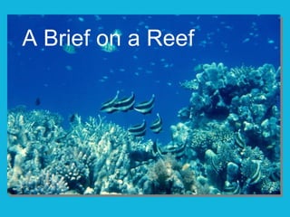
- 1. A Brief on a Reef
- 2. Where are coral reefs?
- 3. Why there ?
- 4. Temperature between 23 and 29°C January mean
- 5. Temperature between 23 and 29°C July mean
- 6. Sunlight and clear water
- 7. World rivers
- 8. Salinity between 32 and 42 ppt
- 10. How do those factors play out?
Hinweis der Redaktion
- Photo: Dr. James P. McVey, 1974, NOAA’s Sea Grant Program: http://www.photolib.noaa.gov/htmls/reef0365.htm Retrieved July 10, 2009.
- Red dots represent major coral reefs. Ask students to generalize about where the reefs lie. (Typically, they lie within tropical or semitropical waters.) Map from NOAA’s CoRIS, http://coris.noaa.gov/about/what_are/ Retrieved July 10, 2009.
- What conditions favor coral reefs? The next several slides present the optimal conditions for coral reef growth. This is an aerial photo of St. Croix, with the beach in the lower left corner, the barrier reef cutting diagonally across the photo. And the lagoon with patch reefs between the two. You can see a line of breakers crashing on the barrier reef. Photo of St. Croix by Sean Linehan, NOAA, National Geodetic Survey, Remote Sensing. In NOAA’s Photo Library: www.photolib.noaa.gov/htmls/line1511.htm Retrieved July 10, 2009.
- The optimal condition for coral reef growth is between 23 and 29 °C . Consolidated reefs grow where temperature stays above 18 °C most of the time , although reefs exist in Japan in places where the temperature falls as low as 11 °C . Reefs can survive in temperatures as high as 40 °C for short periods . (CoRIS, 2009, http://coris.noaa.gov/about/what_are/ Retrieved July 10, 2009.) In degrees Fahrenheit, the temperature range is 73 to 84 °F. (The conversion is (°C X 9/5) + 32 = °F) This is a conversion you might ask your students to make. Ask students to find the regions of ocean within the optimal range. Note this is monthly mean data for January, and was calculated from sea surface temperature data taken over seven years. Map from NOAA’s Satellite and information Service’s Coral Reef Watch, 2009, http://coralreefwwatch.noaa.gov/satellite/hdf/index.html Retrieved July 10, 2009.
- This map is similar but shows mean data for July. Students can look for regions that stay within the optimal temperature range the entire year. They can also look for differences and similarities between the two maps of sea surface temperatures. If you switch quickly between this slide and the previous one, your students can compare the two data sets. Map from NOAA’s Satellite and information Service’s Coral Reef Watch, 2009, http://coralreefwwatch.noaa.gov/satellite/hdf/index.html Retrieved July 10, 2009.
- For zooxanthellae to photosynthesize, water must be clear enough for sunlight to reach the organisms, as in the large photo. Light penetrates clear water to about 70 meters. ( CoRIS, 2009, http://coris.noaa.gov/about/what_are/) In contrast, sediment from the Mississippi river clouds the Gulf of Mexico in the smaller image. Cloudiness can stem from many sources, including sediment and pollution. (Sediment can also smother coral polyps). Photo of the fish in Palau taken by Dr. James P. McVey, 1974, NOAA Sea Grant Program, in NOAA’s Coral Kingdom Collection. www.photolib.noaa.gov/htmls/reef0369.htm Retrieved July 10, 2009. Image of Mississippi sediments in the Gulf of Mexico courtesy of NASA, 2009. http://earthobservatory.nasa.gov/IOTD/view.php?id-38273&src=iotdrss Retrieved July 10, 2009.
- Where are the sources of sediment? How do these correspond to the locations of coral reefs? This map shows major rivers of the world. Map by N. West, 2009.
- This is annual mean data of salinity, in parts per thousand. (If the water evaporated from 1000 grams of seawater, this is the mass of salt remaining. The salt is mostly sodium chloride, but includes other salts such as calcium chloride and magnesium sulfate.) The optimal range of salinity for coral reefs is between 32 and 42 parts per thousand. ( CoRIS, 2009, http://coris.noaa.gov/about/what_are/ Retrieved July 10, 2009. ) Ask students to look for areas that fall within this range and for those that do not. Does salinity seem to be much of a factor that would limit coral reef growth? Also, consider asking what factors control the salinity--what would make it be relatively higher or lower than the ocean’s mean of 35 ppt? Salinity data from the NOAA’s National Oceanographic Data Center, 2005, www.nodc.noaa.gov/cgi-bin/OCS/WOA05f/woa05f.pl This is an annual mean. Retrieved July 10, 2009.
- Photo by Florida Keys National Marine Sanctuary Staff, NOAA’s Coral Kingdom Collection, www.photolib.noaa.gov/htmls/reef2584.htm Retrieved July 11, 2009.
- How do the crucial factors play out? Do the reefs fall where water is the right temperature, salinity, and clarity, based on the previous maps? Map from NOAA’s CoRIS, http://coris.noaa.gov/about/what_are/ Retrieved July 10, 2009. Extension: fossil coral reefs exist in places that are currently high and dry. Examples include Late Jurassic (about 156 to 161 million years ago) reefs in Germany, France, Spain, Portugal, England, Italy, and even mountainous Switzerland and Austria. Similarities between these fossils and modern corals--macroscopic banding, microstructures, and specific complex structures--suggest the fossil corals included symbiotic zooxanthellae (Leinfelder, 2001). Consider asking students what they can infer from the existence of these fossil coral reefs. Leinfelder, R.R., in G.D. Stanley, ed., 2001. The History and Sedimentology of Ancient Reef Systems . Topics in Geobiology, v. 17. New York: Kluwer Academic/Plenum, pp. 251-260.