Impact of climate change in coastal environments with satellite data
•Als PPT, PDF herunterladen•
1 gefällt mir•858 views

Use of SPOTMaps and HRS elevation data to evaluate the potential impact of climate change in coastal environments. With Spot Image and Geospatial Intelligence.

Empfohlen
Empfohlen
Weitere ähnliche Inhalte
Was ist angesagt?
Was ist angesagt? (15)
Ähnlich wie Impact of climate change in coastal environments with satellite data
Ähnlich wie Impact of climate change in coastal environments with satellite data (20)
Mehr von Spot Image
Mehr von Spot Image (7)
Kürzlich hochgeladen
Kürzlich hochgeladen (20)
Impact of climate change in coastal environments with satellite data
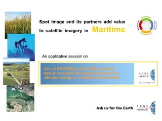
- 1. Spot Image and its partners add value to satellite imagery in Maritime An applicative session on Use of SPOTMaps and HRS elevation data to evaluate the potential impact of climate change in coastal environments
- 2. Use of SPOTMaps and HRS elevation data to evaluate the potential impact of climate change in coastal environments Authors Rob Lees – SPOT Imaging Services Rob Coorey – Geospatial Intelligence SPOT International Conference June 2009
- 3. Climate Change and Storm Surge There is no doubt that the earth’s climate is changing due in part to the impact of human industrial activity over the last 100 years Some of the direct effects of this change is a rise in global sea levels and an increase in the severity of storms resulting in a rise in Storm Surge damage along coastlines. Storm Surge occurs when powerful storm winds push water up onto the shoreline. This is often associated with Hurricanes or Cyclones The combination of the rising sea level and large amounts of rainfall causes severe destruction and erosion of coastal landscapes and $$ Billions in damages © Spot Image 2008 3
- 4. Global sea levels have risen 2m in the last 150 years © Spot Image 2008 4 Significantly, the rate of sea level rise is increasing over time
- 5. Storm Surge defined © Spot Image 2008 5
- 6. The real threat to coastlines comes from “STORM TIDES” © Spot Image 2008 6 Storm Surge + High Tide = 6 m STORM TIDE
- 7. Population at threat from Storm Surge © Spot Image 2008 7 10% of the world’s population live within 10m of sea level 85% of Australian’s live on the coast
- 8. SPOTMaps & SPOT HRS Elevation Data © Spot Image 2008 8 2.5m Natural Colour imagery 1 sec (25m) posting elevation data for 290 coastal geocells
- 9. Port Hedland – Largest Port in Australia (Iron Ore exports) © Spot Image 2008 9 Western Australia coastline is prone to cyclones in summer
- 10. Port Hedland at High Tide © Spot Image 2008 10
- 11. Port Hedland – Railroads (yellow) and Bridges (blue) © Spot Image 2008 11
- 12. Port Hedland coast – 5m Storm Surge © Spot Image 2008 12
- 13. Port Hedland - 5m Storm Surge in red © Spot Image 2008 13
- 14. Brisbane Airport and Port facilities © Spot Image 2008 14
- 15. Brisbane Airport and Port Facilities – 5m Storm Surge © Spot Image 2008 15
- 16. Mandurah – Western Australia – 1m Storm Surge © Spot Image 2008 16
- 17. Mandurah – Western Australia – 2m Storm Surge © Spot Image 2008 17
- 18. Mandurah – Western Australia – 5m Storm Surge © Spot Image 2008 18
- 19. Conclusions SPOTMaps (2.5m) and HRS Elevation (25m postings) are valuable tools for performing “first pass” assessment of vulnerable coastal environments especially for a country like Australia with 60,000 km of coastline From these studies areas can be identified which require more detailed datasets such as aerial photography (15cm) and LIDAR (1-2m Posting DEM). SPOTMaps is particularly useful for mapping coastline environmental parameters such as vulnerable ecosystems (mangroves), highly erodable coasts (sand dunes) and proximity of environment to human habitation and industrial infrastructure © Spot Image 2008 19
- 20. ‘‘Need the right imagery solutions for your job? Ask for Spot Image.’’ www.spotimage.com
Hinweis der Redaktion
- 2