SWAT Provides Tools for Space Situational Awareness and Satellite Attack Warning
•Als PPT, PDF herunterladen•
4 gefällt mir•2,067 views

How to fight and win the next space war.

Empfohlen
Empfohlen
Weitere ähnliche Inhalte
Was ist angesagt?
Was ist angesagt? (20)
Andere mochten auch
Andere mochten auch (13)
Ähnlich wie SWAT Provides Tools for Space Situational Awareness and Satellite Attack Warning
Ähnlich wie SWAT Provides Tools for Space Situational Awareness and Satellite Attack Warning (15)
Mehr von Paul Szymanski
Mehr von Paul Szymanski (13)
Kürzlich hochgeladen
Kürzlich hochgeladen (20)
SWAT Provides Tools for Space Situational Awareness and Satellite Attack Warning
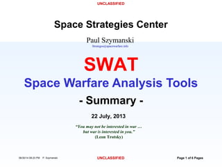
- 1. UNCLASSIFIED 06/30/14 08:23 PM P. Szymanski UNCLASSIFIED Page 1 of 6 Pages Paul Szymanski Strategos@spacewarfare.info Space Strategies Center 22 July, 2013 “You may not be interested in war … but war is interested in you.” (Leon Trotsky) - Summary - SWAT Space Warfare Analysis Tools
- 2. Page 2 of 6 Pages UNCLASSIFIED UNCLASSIFIED SWAT Purpose • Develop Space Warfare Theory, Doctrine, Strategies, Tactics, Techniques & Tools that Enable Informed Decision Making by Space Control Warfighters: – Will Space Systems be Under Attack In the Near Future? – Are Space Systems Currently Under Attack? – Who Is Attacking? – What is the Adversary Attack Strategy? – What Damage Has Been Caused to Military Capabilities? – What Is Optimal Blue Military/Diplomatic/Economic Response? Provides a “Unified Field Theory” for Space Situational Awareness (SSA) & Satellite Attack Warning (SAW)
- 3. Page 3 of 6 Pages UNCLASSIFIED UNCLASSIFIED SWAT Tools Developed (1) • Automatic Space Object Mission ID • Auto Space Object State Change Detection • Automatic Red Space COA ID • Space Choke Point Maps (SAW – Satellite Attack Warning) Anticipate What an Adversary’s Next Move Is View View View View
- 4. Page 4 of 6 Pages UNCLASSIFIED UNCLASSIFIED SWAT Tools Developed (2) • SSA Requirements (1,900) • Space INTEL Indicators List (6,000) • Auto INTEL Message Generation • Resolution Requirements (Space NIIRS) • Sensor Requirements Tasking Optimization Software, Plus Reconnaissance Contingency Checklists Determine What We Know & Don’t Know About an Adversary View View View View View
- 5. Page 5 of 6 Pages UNCLASSIFIED UNCLASSIFIED SWAT Tools Developed (3) • Space Blue COA Support – Space Strategies Checklist (Based on Sun Tzu) – Space Principles of War Checklist – Space Military Objectives Database (5,000 Objectives) – Space Centers of Gravity Checklist – Space Escalation Ladder – Auto Joint Space & Ground Target Prioritization – Information Targets Ranking • Space Control Scenario – Automatic Space Scenario Generation Tool & Space Game (In Work) SWAT Supports Timely & Decisive Blue Courses of Action Generation View View View View View View View View View View
- 6. Page 6 of 6 Pages UNCLASSIFIED UNCLASSIFIED SWAT Process Flow SWAT Provides an Integrated Space Warfare Conceptual Framework Observe – INTEL Indicators – Orbital Elements – RADAR Data – Optical Data Orient – Satellite State Change Detection – Space Choke Point Maps – Red COA Detect Decide – Space COA’s – SHIVA Space Target Ranking Tool Act – Space Choke Point Maps – Satellite State Change – Threat Envelopes Doctrine – Space Principles of War – Space COG – Space War Definitions Strategies – Space Escalation Ladder – Space Objectives – Space Strategies Sequence/Tempo Tactics – Space Tactics – Space RECON Contingencies – Space Wargame SWAT Products Listed Inside Boxes
- 7. Details Page 7 of 91 Pages UNCLASSIFIED UNCLASSIFIED SWAT 1 SWAT 2 SWAT 3 Space Object State Change Algorithms Backup
- 8. Details Page 8 of 91 Pages UNCLASSIFIED UNCLASSIFIED SWAT 1 SWAT 2 SWAT 3 SWAT State Change Parameters Analyzed (26 Total) • Radar Cross Section (RCS) • Optical Cross Section • Flashing or Not • Flash Period • Stabilization Type (Spinning or 3-Axis) • Object Shape (Sphere, Cylinder, Box) • Length • Width • Height • Mass • Spin Rate • Delta-V • Satellite Position (Geosynchronous) • Beginning of Life On-Board Power • Major COMM Antennas & COMM Signals • Major Optics On-Board • Retro Reflectors On-Board • Inclination • Eccentricity • Mean Motion • Mean Anomaly • RAN • Argument of Perigee • BStar • 1st Mean • 2nd Mean Physical Characteristics Orbital Characteristics SWAT Assesses State Changes Beyond Orbital Characteristics
- 9. Details Page 9 of 91 Pages UNCLASSIFIED UNCLASSIFIED SWAT 1 SWAT 2 SWAT 3 SWAT Automatic Space Object State Change Algorithm Unknown Space Objects Compared to Those of Known Mission Characteristics Inclination Range of Values for Weather Satellites Range of Values for Science Satellites Value for Unknown Satellite * *
- 10. Details Page 10 of 91 Pages UNCLASSIFIED UNCLASSIFIED SWAT 1 SWAT 2 SWAT 3 Data Correction & Segmenting •Correct Mission Designations – e.g.: “Science” vs. “Scientific” Missions •Correct Data Values – e.g.: Zero vs. Null Data •Change Zero Values to Null for Mass •Change Null Values to Zero for Spin •Segment Missions •By Satellite Status (Dead vs. Live) •By Space Object Orbital Location
- 11. Details Page 11 of 91 Pages UNCLASSIFIED UNCLASSIFIED SWAT 1 SWAT 2 SWAT 3 SWAT Databases • Space Objects: 37,932 Records – Also Includes Decayed Objects • Orbital Elements: 5.3 Million Records – 15 Months of Data Internal to SWAT – All Orbital Data Since 1957 In External Archives • RADAR Cross Sections: 1.5 Million Records – All RCS’s for All Space Objects Since 1957 • Satellite Characteristics History: 7.5 Million Records – Almost 3 Years History for All Space Objects (Live & Dead) • Optical Visual Magnitude & Flash Rate: 73 Thousand • Space Acronyms: 35,542 Records
- 12. Details Page 12 of 91 Pages UNCLASSIFIED UNCLASSIFIED SWAT 1 SWAT 2 SWAT 3 Orbital Location Segmenting Region Region Definition SDR GEO Space Defense Region Geosynchronous SDR GEO ASIA Space Defense Region Geosynchronous over Asia SDR GEO EU Space Defense Region Geosynchronous over Europe SDR GEO ME Space Defense Region Geosynchronous over the Middle East SDR GEO US Space Defense Region Geosynchronous over the United States SDR GEO-G-A Space Defense Region Graveyard Orbit Above Geosynchronous SDR GEO-G-B Space Defense Region Graveyard Orbit Below Geosynchronous SDR GEO-I Space Defense Region Geosynchronous Inclined SDR HEO Space Defense Region Above Geosynchronous (High Earth Orbit) SDR LEO-E Space Defense Region Low Earth Orbit Highly Eccentric SDR LEO-H Space Defense Region Low Earth Orbit - High (>600 and <5,000 km) SDR LEO-L Space Defense Region Low Earth Orbit - Low (<=500 km) SDR LEO-M Space Defense Region Low Earth Orbit - Medium (>500 and <=600 km) SDR LEO-R Space Defense Region Low Earth Orbit Retrograde SDR LEO-S Space Defense Region Low Earth Orbit Sun-Synchronous SDR MEO Space Defense Region Medium Earth Orbit (>=5,000 and <25,000 km) SDR MOLY Space Defense Region Molniya SDR NOE Space Defense Region No Orbital Elements
- 13. Details Page 13 of 91 Pages UNCLASSIFIED UNCLASSIFIED SWAT 1 SWAT 2 SWAT 3 SWAT Correlation Types •Current Correlations – All Objects (Dead & Live) Against All Objects for Current Analysis Date •Historical Correlations – All Objects (Dead & Live) Against All Objects for Current & Past Dates (6,056,355 records) •Self Correlations – All Objects (Dead & Live) Against Their Own Historical Characteristics
- 14. Details Page 14 of 91 Pages UNCLASSIFIED UNCLASSIFIED SWAT 1 SWAT 2 SWAT 3 Example State Changes • GPS • ECHOSTAR 5 • MOLNIYA • Beidou MEO • Beidou GEO • SJ’s
- 15. Details Page 15 of 91 Pages UNCLASSIFIED UNCLASSIFIED SWAT 1 SWAT 2 SWAT 3 ECHOSTAR 5 Maneuver Orbital Maneuver Detected In State Change Algorithms Orbital Maneuver (57 km) 1st Derivative of Altitude
- 16. Details Page 16 of 91 Pages UNCLASSIFIED UNCLASSIFIED SWAT 1 SWAT 2 SWAT 3 ECHOSTAR 5 Correlations Orbital Maneuver Affected RAN, Arg Perigee, Mean Anomaly, Sat Position, Inclination, Eccentricity, Mean Motion, RCS, and Visual Mag Correlations Against Other GEO Satellites.
- 17. Details Page 17 of 91 Pages UNCLASSIFIED UNCLASSIFIED SWAT 1 SWAT 2 SWAT 3 MOLNIYA Decay 3,097 Km Loss of Average Altitude
- 18. Details Page 18 of 91 Pages UNCLASSIFIED UNCLASSIFIED SWAT 1 SWAT 2 SWAT 3 Beidou - MEO 2,500 km 250 km
- 19. Details Page 19 of 91 Pages UNCLASSIFIED UNCLASSIFIED SWAT 1 SWAT 2 SWAT 3 Beidou - GEO Maneuver 251 Km Above GEO
- 20. Details Page 20 of 91 Pages UNCLASSIFIED UNCLASSIFIED SWAT 1 SWAT 2 SWAT 3 SJ’s 0.0000 0.5000 1.0000 1.5000 2.0000 2.5000 3.0000 3.5000 4.0000 4.5000 11/15/200811/22/200811/29/2008 12/6/200812/13/200812/20/200812/27/2008 1/3/2009 1/10/2009 1/17/2009 1/24/2009 1/31/2009 2/7/2009 2/14/2009 2/21/2009 2/28/2009 3/7/2009 3/14/2009 3/21/2009 3/28/2009 4/4/2009 4/11/2009 4/18/2009 4/25/2009 5/2/2009 5/9/2009 5/16/2009 5/23/2009 5/30/2009 Data Date RCS(dBsm) 33408 33409 COD FYL FYL FYL FYL FYL SHY SHY COD FYL FYL FYL BLE FYL
- 21. Details Page 21 of 91 Pages UNCLASSIFIED UNCLASSIFIED SWAT 1 SWAT 2 SWAT 3 SJ’s Orbits
- 22. Details Page 22 of 91 Pages UNCLASSIFIED UNCLASSIFIED SWAT 1 SWAT 2 SWAT 3 What Makes SWAT State Change Algorithms Different • SWAT Assesses All Space Objects – Particular Emphasis On Potentially Threatening Space Objects Playing “Dead” • SWAT Analyzes 26 Characteristics of Space Objects Simultaneously – Assessments Go Beyond Orbital Elements Alone – Simultaneous Changes (e.g. Maneuver & RCS) Increase State Change Scores • SWAT Compares Each Space Object To All Other Space Objects of Same Mission – Discovers Unusual Characteristics Out of Norm
- 23. Details Page 23 of 91 Pages UNCLASSIFIED UNCLASSIFIED SWAT 1 SWAT 2 SWAT 3 SWAT State Change Benefits • Filters 11,496 Space Objects Down to Top 10-20 With Most Activity for More Detailed Assessment by Other Space INTEL Assets • Possible Discovery of Hidden Adversary Intent • May Indicate Dying or Dead Satellites Before JSpOC Assessment • Helps Evaluate Friendly Satellite Cover Stories • AFRL Success – Working Now & Ready for Operational Evaluation SWAT Determines If Space Systems Have Changed State – Could Signal an ASAT Attack
- 24. Details Page 24 of 91 Pages UNCLASSIFIED UNCLASSIFIED SWAT 1 SWAT 2 SWAT 3 Satellite Attack Warning (SAW) – All Altitudes GEO MEO LEO Space Has Choke Points As In Terrestrial Systems – They’re Just Not Stationary Military Choke Point: A region of earth or space where systems of military consequence concentrate due to operational, environmental or geophysical constraints.Red Objects In Normally Blue Zone
- 25. Details Page 25 of 91 Pages UNCLASSIFIED UNCLASSIFIED SWAT 1 SWAT 2 SWAT 3 Traditional Orbital View >12,000 Space Objects Confuses Users as to Possible Attack Patterns Developing Click on Satellites to View Animation
- 26. Details Page 26 of 91 Pages UNCLASSIFIED UNCLASSIFIED SWAT 1 SWAT 2 SWAT 3 SAW – Icons Make SAW Maps Similar to Terrestrial Situation Maps • Based on Mil-Std-2525B • 220 New Space Icons Adversary UnknownNeutralFriend
- 27. Details Page 27 of 91 Pages UNCLASSIFIED UNCLASSIFIED SWAT 1 SWAT 2 SWAT 3 SAW – View 1 Space Objects Orbital Changes Are Easy to Identify JB-3C Altitude Increase
- 28. Details Page 28 of 91 Pages UNCLASSIFIED UNCLASSIFIED SWAT 1 SWAT 2 SWAT 3 SAW – View 2 COSMOS 2421 Breakup Space Debris Clouds & Their Source Can Easily be Viewed
- 29. Details Page 29 of 91 Pages UNCLASSIFIED UNCLASSIFIED SWAT 1 SWAT 2 SWAT 3 SAW – SDIZ SSA Detection Zones Help Partial Out Operational Responsibility Space Defense ID Zones (SDIZ)
- 30. Details Page 30 of 91 Pages UNCLASSIFIED UNCLASSIFIED SWAT 1 SWAT 2 SWAT 3 SAW – Simulated Attack Against GPS Major Maneuvers of Space Objects are Easily Visualized Red Objects Approaching Blue GPS Zone New Space Objects Conducting GEO Transfer Orbital Maneuvers
- 31. Details Page 31 of 91 Pages UNCLASSIFIED UNCLASSIFIED SWAT 1 SWAT 2 SWAT 3 SAW – “Dead” Stages as ASATS Simultaneous Attack Maneuvers Can Easily be Detected Orbital Change Over Time Launch Vehicle Stages With Hidden ASAT Capabilities
- 32. Details Page 32 of 91 Pages UNCLASSIFIED UNCLASSIFIED SWAT 1 SWAT 2 SWAT 3 SAW – Multiple Attacks Against One GPS Space Objects Playing Dead Can be Detected With Unusual Movements Red Rocket Stages Have Large SWAT State Change Scores for RCS (Stages Have Changed Orientation)
- 33. Details Page 33 of 91 Pages UNCLASSIFIED UNCLASSIFIED SWAT 1 SWAT 2 SWAT 3 SAW – 3D View SAW Displays 3D Space Situation Maps
- 34. Details Page 34 of 91 Pages UNCLASSIFIED UNCLASSIFIED SWAT 1 SWAT 2 SWAT 3 SAW – Flat Map View SAW Displays Geographic Space Situation Maps
- 35. Details Page 35 of 91 Pages UNCLASSIFIED UNCLASSIFIED SWAT 1 SWAT 2 SWAT 3 Space Web Ontology
- 36. Details Page 36 of 91 Pages UNCLASSIFIED UNCLASSIFIED SWAT 1 SWAT 2 SWAT 3 Space Ontology • 1,009 Objects: Classes, Properties, Instances • Most Classes Have Documented Instances • Classes: – Military Objectives & Tasks (8 Levels) – Conflict Levels – Campaign Phases – Success Criteria – Success Indicators – Space Battle Zones – Space Centers Of Gravity – Space Principles of War – Space Escalation Ladder – Space NIIRS – Satellite Keep-Out Zones
- 37. Details Page 37 of 91 Pages UNCLASSIFIED UNCLASSIFIED SWAT 1 SWAT 2 SWAT 3 Space Ontology Example
- 38. Details Page 38 of 91 Pages UNCLASSIFIED UNCLASSIFIED SWAT 1 SWAT 2 SWAT 3 Backup BACKUP “It is not the object of war to annihilate those who have given provocation for it, but to cause them to mend their ways.” - Polybius, History (2nd century B.C.) -
- 39. Details Page 39 of 91 Pages UNCLASSIFIED UNCLASSIFIED SWAT 1 SWAT 2 SWAT 3 Principles of War • Objective • Offensive • Mass • Economy of Force • Maneuver • Unity of Command • Security • Surprise • Simplicity Principles of War Equally Applicable to Space & Terrestrial Warfare
- 40. Details Page 40 of 91 Pages UNCLASSIFIED UNCLASSIFIED SWAT 1 SWAT 2 SWAT 3 Space Principles of War Example • Mass – Terrestrial: “Mass the effects of overwhelming combat power at the decisive place and time” – Space: Are there sufficient weapons to achieve continuous, or sustained space control. Can the adversary re-configure to avoid attack. Are the space weapons overwhelming to the military function they are trying to deny. Is there political will to implement massed space attack. Can space weapons get into position at the decisive place and time. Do we know the decisive place and time for space weapons application. Can space weapons be synchronized for employment simultaneously. Space Strategy Planning Has Not Had the Benefit of a Long History
- 41. Details Page 41 of 91 Pages UNCLASSIFIED UNCLASSIFIED SWAT 1 SWAT 2 SWAT 3 Title: Herd Space Personnel Action: Destroy all Red space-related ground targets, except purposely lightly damage one ground center. Assume that key space support personnel will converge to this lightly damaged site to conduct repairs. 12 hours later, use anti-personnel weapons at this site, with destroy weapons 2 hours later. Desired Effect: Destroys Red country's most import space asset: key technically trained space personnel. Also sends message to international community that foreign personnel supporting Red space efforts will be at risk. Space Strategies Example War Is Hell
- 42. Details Page 42 of 91 Pages UNCLASSIFIED UNCLASSIFIED SWAT 1 SWAT 2 SWAT 3 Space Strategies Derived From Sun Tzu • Sun Tzu’s “The Art of War” (544 BC – 496 BC) Used to Derive Modern Space Strategies • Analysis In Progress – 453 Space Warfare Strategies Already Derived – Only 1/3 the Way Through Sun Tzu’s Teachings Methods of War Are Eternal
- 43. Details Page 43 of 91 Pages UNCLASSIFIED UNCLASSIFIED SWAT 1 SWAT 2 SWAT 3 Space Centers of Gravity Model Based On Col John Warden’s (Checkmate) 5-Ring COG Model Space Equivalent 5-Ring COG Model Space Systems Strategic Targeting Is Similar to Terrestrial Targeting Strategies
- 44. Details Page 44 of 91 Pages UNCLASSIFIED UNCLASSIFIED SWAT 1 SWAT 2 SWAT 3 Example Space Centers of Gravity Launch corridors GEO belt sectors Sun-Synchronous LEO orbits GEO satellites changing orbital position Space-related command centers / commanders / INTEL Centers Space surveillance systems Space technicians / scientists Electric grid serving ground space facilities Space design and manufacturing facilities Leader's confidence in their new space technologies Blue and Red side political will to start and continue a space war Space-related decision cycle times (OODAloops) Low delta-v/transit time points in space to reach High Value Targets Points in space with high/low coverage from space surveillance assets Regions of space and time with advantageous solar phase angles Times of high solar storm activity On-orbit spares or launch replenishment or ability to reconstitute space capability with terrestrial systems Antipodal nodes 180 degrees from launch sites around the world Manned launch (Shuttle, Space Station) of satellites Initial satellite checkout after launch or orbital insertion Periods of solar eclipse / low battery charge for satellites Approach trajectories outside the field of regard of the target's on-board sensors Approach trajectories when the Sun/Moon/Earth is in the background of a target's sensors Approach trajectories outside normally employed orbits Near a satellite's thrusters Near a satellite's high power antennas Just after loss of contact with adversary satellite ground controllers / space surveillance assets … SWAT Has Extensive Space Centers of Gravity Checklists
- 45. Details Page 45 of 91 Pages UNCLASSIFIED UNCLASSIFIED SWAT 1 SWAT 2 SWAT 3 SWAT Automatic Determination of Red Space Attack Strategies • Database of Possible Red Space Attack Strategies are Linked to Checklist of INTEL Indicators of Space Systems Activities • Most Probable Red Space Strategy Is Determined Based On Currently Observed INTEL Indications of Space Activities • SWAT Automatically Increases Space INTEL Collection Priorities In IPB Tasking Forms Based On Probable Red Actions SWAT Helps the Satellite Analyst Determine If Space Systems Are Under Attack
- 46. Details Page 46 of 91 Pages UNCLASSIFIED UNCLASSIFIED SWAT 1 SWAT 2 SWAT 3 SWAT Auto Attack Assessment SWAT Helps the Satellite Analyst In Assessing Strategic Warning
- 47. Details Page 47 of 91 Pages UNCLASSIFIED UNCLASSIFIED SWAT 1 SWAT 2 SWAT 3 Example Space Objectives … Blind Blue capabilities to observe the terrestrial battlefield Blind Blue capabilities to observe space from terrestrial sensors Blind Blue capabilities to observe space from space-based sensors Spoof Blue capabilities to observe the battlefield Deny Blue ability to launch new satellites Destroy some Blue space capability as a warning to Gray space systems support to Blue Wear down Blue Defensive Counter-Space capabilities by instigating multiple false alarm attacks Attack Blue satellites before the start of the terrestrial conflict Spoof Blue perceptions of Red space strengths Conduct diplomatic offensive to restrict Blue ability to employ ASAT's Actively defend key launch corridors and orbits critical to Red conduct of war Preposition Red space assets to maximize their effectiveness at the start of the conflict Disrupt Blue command and control capabilities for space systems Embargo Blue access to space systems Prevent Blue ability to service or re-fuel on-orbit satellites Develop propaganda campaign against Blue use of ASAT's Shape and delay Blue plans for space warfare Deny Blue ability to achieve Space Situational Awareness Disrupt Blue space attacks so they become uncoordinated Constantly shift points of application of space control weapons to confuse adversary response Herd Blue space communications paths to those that are more easily monitored by Red SIGINT assets Attack key Blue space personnel and technicians Disperse Red assets (maneuver satellites) just before launching first attack … 5,000 Other Space Objectives SWAT Has Space Objectives for Both Red & Blue Sides
- 48. Details Page 48 of 91 Pages UNCLASSIFIED UNCLASSIFIED SWAT 1 SWAT 2 SWAT 3 Example Space COA Indicators Are a small number of Blue and Gray satellites experiencing anomalies over a long time period Are a small number of Blue and Gray satellites losing contact with terrestrial controllers Are a small number of new Red satellites appearing in orbit Are a small number of Red satellites changing orientation Are a small number of Red satellites changing shape Are a small number of Red satellites changing thermal signatures Are a small number of Red satellites concentrating towards potential Blue and Gray satellites Are Red ASAT forces appearing to line up in a sequence of timed attacks against Blue and Gray assets Are Red forces capable of attacking space-related terrestrial sites in Blue countries appearing to line up in a sequence of timed attacks Are Red SIGINT assets appearing to line up in a sequence of timed operations against Blue and Gray Communications assets Are there indications of Red aircraft activities that appear to concentrate on space-related terrestrial sites around the world Are there indications of Red missile activities that appear to concentrate on space-related terrestrial sites around the world Are there a small number of new satellite launches from Red facilities Many Insignificant Space Indicators May Add Up to Predicting a Major Attack
- 49. Details Page 49 of 91 Pages UNCLASSIFIED UNCLASSIFIED SWAT 1 SWAT 2 SWAT 3 INTEL Indicators Example
- 50. Details Page 50 of 91 Pages UNCLASSIFIED UNCLASSIFIED SWAT 1 SWAT 2 SWAT 3 Space Escalation Ladder Space Actions May Be Conducted Pre-Conflict WBS Conflict Phase Terrestrial Campaign Phase Space Campaign Phase Weapon Type Space Campaign Phase Full Name Weapon Category P.1.A.0 Pre-Conflict Phase 0: Pre-War Buildup (Shape) 1st Wave Attacks Phase A Pre-Conflict Deter 1st Wave Attacks Phase A - Pre-Conflict Deter Overt Weapons Testing & Deployment; Treaties; Saber Rattling; Space Alliances; Normal Space Surveillance, Tracking & Reconnaissance Activities P.1.B.0 Pre-Conflict Phase 0: Pre-War Buildup (Shape) 1st Wave Attacks Phase B Persuade; Spying; Propaganda; Avoidance Maneuvering; Increased Space Surveillance & Close Satellite Inspections 1st Wave Attacks Phase B - Pre-Conflict Persuade Diplomatic Requests & Démarches; Economic Actions; Embargos; Legal Actions; Administrative Actions; Transmitting Propaganda Broadcasts; Jamming Propaganda Broadcasts; Increased Spying & Surveillance; Unusual Increases in Space Surveillance and Tracking Activities; Satellite Close Inspectors; Threaten Allies of Your Adversaries; Maneuver to Avoid Attacks P.1.C.0 Pre-Conflict Phase 0: Pre-War Buildup (Shape) 1st Wave Attacks Phase C Hide; Covert; Cyber; Political Disruptions; Mobilize Forces; Increase Military Alert Level; Threatening Satellite Maneuvers; Increase Space Radiation; Initiate Satellite Defensive Measures; Employ Nation's Astronauts on International Space Station for Military Uses 1st Wave Attacks Phase C - Pre-Conflict Hide Camouflage; Stop Activities; Mobility; Covert Technology Developments; Small Covert Attacks; Cyber Attacks; Provocative but False Attacks; Covert Actions in Violation of International Treaties; Cutoff Diplomatic Relations; Inspire Social Disruptions and Agitation; Employ Lethal Force Against Your Own Citizens; Mobilize Forces; Increase Military Alert Level (DEFCON); Maneuver Close Enough to Adversary Satellites to Purposely Appear as a Threat; Reveal Covert Programs to Appear Threatening; Enter Into War-Reserve Modes (Hide) for Critical Satellites; Hide Senior Leadership; Increase Radiation Environment in Orbits Used by Adversaries; Initiate Satellite Defensive Measures; Employ Nation's Astronauts on International Space Station for Military Reconnaissance and Surveillance P.2.A.0 Trans-Conflict Phase I: Deployment / Deterrence (Deter) 2nd Wave Attacks Trans-Conflict Deter 2nd Wave Attacks - Trans-Conflict Deter Linked Attacks; Demo Attacks; Alternate Country Attacks; Blockades; Major Covert Attacks; Terrorist Attacks; Summarily Execute Saboteurs; Seize & Sequester Suspected Terrorists; Alert Anti-Satellite Systems; Arm Satellite Self-Defense Mechanisms; Alert Anti-Missile Defenses; Alert Anti-Aircraft Defenses; Arm Allied Astronauts on International Space Station
- 51. Details Page 51 of 91 Pages UNCLASSIFIED UNCLASSIFIED SWAT 1 SWAT 2 SWAT 3 Space Escalation Ladder (Cont.) WBS Conflict Phase Terrestrial Campaign Phase Space Campaign Phase Weapon Type Space Campaign Phase Full Name Weapon Category P.3.A.1 Trans-Conflict Phase II: Halt Incursion (Seize Initiative) 3rd Wave Attacks Phase A1 – Gnd Based From Terrestrial Partial Temporary Kill 3rd Wave Attacks Phase A1 – Terrestrial- to-Space Partial Temporary Effects Delay, Deny, Covertly Assassinate Adversary Diplomatic Ambassador P.3.A.2 Trans-Conflict Phase II: Halt Incursion (Seize Initiative) 3rd Wave Attacks Phase A2 – Gnd Based From Terrestrial Total Temporary Kill 3rd Wave Attacks Phase A2 – Terrestrial- to-Space Total Temporary Effects Disrupt P.3.B.1 Trans-Conflict Phase III: Air Counter-Offensive (Dominate) 3rd Wave Attacks Phase B1 – Space Based From Space Partial Temporary Kill 3rd Wave Attacks Phase B1 – Space-to- Space Partial Temporary Effects Delay, Deny P.3.B.2 Trans-Conflict Phase III: Air Counter-Offensive (Dominate) 3rd Wave Attacks Phase B2 – Space Based From Space Total Temporary Kill 3rd Wave Attacks Phase B2 – Space-to- Space Total Temporary Effects Disrupt P.4.A.1 Trans-Conflict Phase IV: Joint Counter-Offensive to Restore Friendly Pre-Conflict Status (Stabilize Borders) 4th Wave Attacks Phase A1 – Gnd Based From Terrestrial Partial Permanent Kill 4th Wave Attacks Phase A1 – Terrestrial- to-Space Partial Permanent Kill Degrade P.4.A.2 Trans-Conflict Phase IV: Joint Counter-Offensive to Restore Friendly Pre-Conflict Status (Stabilize Borders) 4th Wave Attacks Phase A2 – Gnd Based From Terrestrial Total Permanent Kill 4th Wave Attacks Phase A2 – Terrestrial- to-Space Total Permanent Kill Destroy P.4.B.1 Trans-Conflict Phase V: Joint Counter-Offensive to Capture Adversary Capitol (Enable New 4th Wave Attacks Phase B1 – Space Based From Space Partial Permanent Kill 4th Wave Attacks Phase B1 – Space-to- Space Partial Permanent Kill Degrade P.4.B.2 Trans-Conflict Phase V: Joint Counter-Offensive to Capture Adversary Capitol (Enable New 4th Wave Attacks Phase B2 – Space Based From Space Total Permanent Kill 4th Wave Attacks Phase B2 – Space-to- Space Total Permanent Kill Destroy P.5.A.0 Trans-Conflict Phase VI: Defend Against Adversary Counter-Attacks Against Friendly Homeland (Defend Friendly Citizens) 5th Wave Attacks Space-Manned Permanent Kill: Kill Adversary Astronauts 5th Wave Attacks - Space-Manned Permanent Kill Degrade, Destroy: Kill Adversary Astronauts on International Space Station P.6.A.0 Trans-Conflict Phase VI: Defend Against Adversary Counter-Attacks Against Friendly Homeland (Defend Friendly Citizens) 6th Wave Attacks Space-to-Earth Permanent Kill 6th Wave Attacks - Space-to-Earth Permanent Kill Degrade, Destroy P.7.A.0 Trans-Conflict Phase VII: Defend Against Adversary Use of Nuclear Weapons in Space (Defend Friendly Military) 7th Wave Attacks NBC Use - Space 7th Wave Attacks - NBC Use - Space Degrade, Destroy P.8.A.0 Trans-Conflict Phase VIII: Defend Against Adversary Use of NBC Against Friendly Military Targets (Defend Friendly Military) 8th Wave Attacks; Phase A – Military Targets NBC Use - Space & Terrestrial 8th Wave Attacks Phase A – NBC Use - Space & Terrestrial - Military Targets Degrade, Destroy P.8.B.0 Trans-Conflict Phase IX: Defend Against Adversary Use of NBC Against All Friendly Targets (Defend Friendly Military & Civilians) 8th Wave Attacks; Phase B – Civilian Targets NBC Use - Space & Terrestrial 8th Wave Attacks Phase B – NBC Use - Space & Terrestrial - Civilian Targets Degrade, Destroy P.9.A.0 Post-Conflict Phase X: Post-Hostilities (Reconstruction & Stabilization) 9th Wave Attacks Post-Conflict Deter 9th Wave Attacks - Post-Conflict Deter Diplomatic Requests; Economic Actions; Legal Actions; Administrative Actions; Jamming Propaganda Broadcasts Space Provides Finer Gradations & Thus Better Control During Conflict Escalation
- 52. Details Page 52 of 91 Pages UNCLASSIFIED UNCLASSIFIED SWAT 1 SWAT 2 SWAT 3 COA Reactions Example Time Escalation Probability Sequence Category Actor Target Ladder of Occurrence WBS Action Reaction 35 Satellites Califon Newmex P.4.A.1 8 N.S.R.3 Newmex Bicudo Large LEO Photo Satellite is permanently partially blinded when over flying the disputed oil fields 35A Political Newmex Califon P.1.C.0 1 N.S.R.3.0 Do nothing to increase escalation ladder 35B INTEL Newmex Califon P.1.A.0 10 N.S.R.3.1 Determine if degradation is caused by natural events, equipment failure or human actions, whether intentional or unintentional 35C Forces Newmex Califon P.1.C.0 9 N.S.R.3.2 Increase military alert level (DEFCON) 35D Ground Stations Newmex Califon P.1.A.0 9 N.S.R.3.3 Contact other Newmexian space-related ground facilities to determine if multiple ground outage incidents are occurring 35E Satellites Newmex Califon P.1.A.0 9 N.S.R.3.4 Contact other Newmexian TTC ground facilities to determine if multiple satellite outage incidents are occurring 35F Satellites Newmex Califon P.1.A.0 9 N.S.R.3.5 Check with Newmexian supreme military command to determine if other military incidents are occurring to Newmexian and allied forces 35I Space Surveillance Newmex Califon P.1.B.0 10 N.S.R.3.8 Increase surveillance and tracking for new and suspicious space objects 35J Satellites Newmex Califon P.1.B.0 10 N.S.R.3.9 Increase mission identification and country of origin determination for new and suspicious space objects (Space Object Identification - SOI) 35K Satellites Newmex Califon P.1.B.0 10 N.S.R.3.10 Increase signals intelligence collection on new and suspicious space objects 35L Satellites Orgonia Califon P.1.B.0 10 N.S.R.3.11 Maneuver Orgonian Abragh Nano LEO Inspector Satellite close to Newmex Bicudo Large LEO Photo Satellite for close inspection to help determine origin of mission degradations 35M Satellites Newmex Califon P.1.B.0 9 N.S.R.3.12 Increase satellite imagery, OPIR and RADAR surveillance and signals intelligence collection of Newmexian border areas 35N Satellites Newmex Califon P.1.B.0 8 N.S.R.3.13 Increase satellite imagery, OPIR and RADAR surveillance and signals intelligence collection of Newmexian internal areas 35O Satellites Newmex Califon P.1.B.0 10 N.S.R.3.14 Increase satellite imagery, OPIR and RADAR surveillance and signals intelligence collection of internal Califon activities 35P Satellites Newmex Califon P.1.B.0 9 N.S.R.3.15 Increase satellite imagery, OPIR and RADAR surveillance and signals intelligence collection of Califon allied activities 35Q Forces Newmex Califon P.1.A.0 9 N.S.R.3.16 Increase critical infrastructures defenses and surveillance 35AG Political Newmex Califon P.1.C.0 5 N.S.R.3.32 Cutoff diplomatic relations with Califon 35AP Political Newmex Califon P.1.B.0 9 N.S.R.3.41 Increase world attention to the problems of orbital space debris in order to slow down Califon's launching of new satellites 35BB Political Newmex Califon P.1.A.0 10 N.S.R.3.53 Engage in negotiations for space treaties and mutual defense pacts with other countries to increase space defense protection 35BC Political Newmex Califon P.1.A.0 10 N.S.R.3.54 Publically declare that any use of space weapons against Newmexian satellites will have a corresponding attack on the aggressor's space facilities associated with this attack, whether they be research centers, launch facilities, space surveillance sites, or command and control centers 35BD Political Newmex Califon P.1.B.0 9 N.S.R.3.55 Publically declare that any use of space weapons against Newmexian satellites will have a corresponding attack on the aggressor's and their allies space facilities associated with this attack, whether they be research centers, launch facilities, space surveillance sites, or command and control centers 35BE Forces Newmex Califon P.1.C.0 8 N.S.R.3.56 Initiate multiple false starts, threatening space and terrestrial maneuvers, etc. to induce your adversaries to begin constant satellite maneuvering, so as to waste their on-board fuel reserves before actual conflict starts 35BF Forces Newmex Califon P.1.C.0 8 N.S.R.3.57 Initiate random military orders, communications traffic, re-deployments and satellite maneuvers to confuse potential adversaries of your immediate plans and goals 35BG Forces Newmex Califon P.1.C.0 7 N.S.R.3.58 Launch or maneuver a new mysterious satellite that comes close to critical Califon satellites, to make Califon pause in its military execution plans, to show resolve, and as a warning to Califon to back down 35BH ASAT Newmex Califon P.1.B.0 10 N.S.R.3.59 Jam Califon propaganda broadcasts from their communications satellites directed at Newmexian dissidents 35BI ASAT Newmex Califon P.1.C.0 10 N.S.R.3.60 Initiate operational deployment of Newmexian Anti-Satellite (ASAT) systems
- 53. Details Page 53 of 91 Pages UNCLASSIFIED UNCLASSIFIED SWAT 1 SWAT 2 SWAT 3 COA Reactions Example (Cont.) Time Escalation Probability Sequence Category Actor Target Ladder of Occurrence WBS Action Reaction 35BJ ASAT Newmex Califon P.3.A.1 8 N.S.R.3.61 Attack Califon Darapi Large LEO Photo Satellite with a Lagoa Mobile Ground Jammer-RF that temporarily denies Califon access to its intelligence collection capabilities, to show resolve and as a warning to Califon to back down 35BK ASAT Newmex Califon P.4.A.2 6 N.S.R.3.62 Attack Califon Darapi Large LEO Photo Satellite with an Ouro Space Launch ASAT Ground Mobile Missile that permanently destroys it, to show resolve and as a warning to Califon to back down 35BL ASAT Orgonia Califon P.3.A.2 9 N.S.R.3.63 Attack Califon Darapi Large LEO Photo Satellite with an Orgonian Dimbabah Nano LEO Mine-Paint that temporarily denies Califon access to its intelligence collection capabilities (covers lenses with temporary paint), to show resolve and as a warning to Califon to back down 35BM Cyber Newmex Califon P.2.A.0 9 N.S.R.3.64 Attack Califon Jeanton Large Ground Fixed Command Center with a cyber attack that temporarily disables its ability to command forces, to show resolve and as a warning to Califon to back down 35BN Forces Newmex Califon P.3.A.2 5 N.S.R.3.65 Attack Califon Jeanton Large Ground Fixed Command Center with Newmexian Irece SOF forces that permanently disables its ability to command forces, to show resolve and as a warning to Califon to back down 35BO Forces Newmex Califon P.2.A.0 5 N.S.R.3.66 Attack a Califon terrestrial system of similar military and economic value to deter Califon from further aggression 35BP Forces Newmex Califon P.1.C.0 10 N.S.R.3.67 Attack by cyber means the Califon facility that caused the Newmex Bicudo Large LEO Photo Satellite to be temporarily or permanently damaged 35BQ Forces Newmex Califon P.2.A.0 5 N.S.R.3.68 Attack by Newmexian Irece SOF forces the Califon facility that caused the Newmex Bicudo Large LEO Photo Satellite to be temporarily or permanently damaged 35BR Forces Newmex Califon P.4.A.2 3 N.S.R.3.69 Attack by the Newmexian Air Force Califon's facility that caused the Newmex Bicudo Large LEO Photo Satellite to be temporarily or permanently damaged 35BY Industrial Newmex Califon P.1.A.0 10 N.S.R.3.76 Prepare any remaining satellite launch facilities for rapid reaction capabilities enabling quick satellite launches 35BZ Satellites Newmex Califon P.1.A.0 9 N.S.R.3.77 Increase on-orbit spares for critical satellites 35CA Satellites Newmex Califon P.1.A.0 9 N.S.R.3.78 Increase on-orbit satellite decoys to confuse Califon and its allies' space surveillance networks 35CB Satellites Newmex Califon P.1.C.0 8 N.S.R.3.79 Initiate war-reserve modes for critical Newmexian satellite assets that begin to maneuver and reduce RADAR and optical signatures to avoid Califon and its allies' space surveillance networks 35CC Satellites Newmex Califon P.1.C.0 9 N.S.R.3.80 Recharge Newmexian satellite batteries on-orbit 35CD Satellites Newmex Califon P.1.C.0 9 N.S.R.3.81 Refuel Newmexian satellites on-orbit 35CE Satellites Newmex Califon P.1.C.0 9 N.S.R.3.82 Refuel Newmexian space support sites backup generators 35CF Satellites Newmex Califon P.1.C.0 9 N.S.R.3.83 Maneuver Newmexian space weapons (space-based and terrestrial-based) into optimized offensive and defensive positions 35CG Satellites Newmex Califon P.1.C.0 9 N.S.R.3.84 Deploy Newmexian space support assets (space-based and terrestrial-based) into optimized offensive and defensive support positions 35CH Satellites Newmex Califon P.1.C.0 9 N.S.R.3.85 Maneuver and deploy space control assets that later enable sealing off the Earth from adversary satellites, in order to fix these adversary space assets into a steady state that cannot be changed from the ground. This would including positioning for jamming, spoofing and cyber attacks, along with denying an adversary the ability to launch new satellites 35CI Launch Newmex Orgonia P.1.A.0 8 N.S.R.3.86 Request Orgonia provide satellite launch support from its Nuwayr Space Launch Ground Mobile Systems for Newmexian satellites 35CJ Forces Newmex Califon P.1.A.0 10 N.S.R.3.87 Explore non-space mission replacements for reduced satellite capabilities 35CP Forces Newmex Califon P.1.C.0 9 N.S.R.3.93 Increase surveillance, protection and defenses of space systems terrestrial terminals, command and control sites, space sensor sites, launch sites, space weapons marshaling areas, research centers and factories 35CQ Environmental Space Space P.1.B.0 9 N.S.R.3.94 Increase surveillance of solar events to better determine if potential satellite outages are caused by natural or human intents 35CR Forces Newmex Califon P.1.C.0 10 N.S.R.3.95 Determine if Califon and/or their allies have terrestrial forces maneuvering or deploying to operational locations and appear to be pre-positioning for attack 35CS Satellites Newmex Califon P.1.C.0 10 N.S.R.3.96 Command critical Newmexian satellites to initiate defensive measures (spinning, close shutters, increased heat transfer, etc.) 35CT Satellites Newmex Califon P.1.B.0 9 N.S.R.3.97 Maneuver critical Newmexian satellites beyond the range of potential threats 35CU Satellites Newmex Newmex P.1.A.0 10 N.S.R.3.98 Conduct a full battery of diagnostic testing on Newmexian satellites to determine if intermittent failures are a possibility 35CV Launch Newmex Califon P.1.A.0 9 N.S.R.3.99 If critical Newmexian satellites are permanently damaged, then launch other satellites with similar capabilities 35CW Forces Newmex Newmex P.1.A.0 10 N.S.R.3.100 Determine the effects on the overall space system mission of any space systems degradations 35CX Forces Newmex Newmex P.1.A.0 10 N.S.R.3.101 Modify previously planned space strategies and tactics due to current adversary and their allies' actions 35CY Satellites Newmex Califon P.1.A.0 10 N.S.R.3.102 Increase training for satellite operators that allows them to recognize intentional attacks and respond promptly
- 54. Details Page 54 of 91 Pages UNCLASSIFIED UNCLASSIFIED SWAT 1 SWAT 2 SWAT 3 SSA Requirements Study • Reviewed Doctrine Docs, Joint Pubs, Air Force Glossaries, Air Force Instructions, Air Force Pamphlets, Army Field Manuals, National Defense University Handbook, and Multiservice Procedures – 55 Total Documents Analyzed • Terrestrial Intelligence Preparation of the Battlespace (IPB) Principles Extrapolated to Space – ~1,900 Different Space Control / SSA Requirements SWAT Baselines Space Control/SSA Requirements From Fundamental Military Doctrine
- 55. Details Page 55 of 91 Pages UNCLASSIFIED UNCLASSIFIED SWAT 1 SWAT 2 SWAT 3 Example SSA Requirements Matrix …… INTEL Derived From INTEL Requirements INTEL Indicators Resolution Requirements Space NIIRS Detection Means Technologies Basic Characterization Satellite Current Orientation Attitude Satellite Current Cross Section 1.2 - 2.5 4 Imagery or RADAR Optical or RADAR Basic Characterization Satellite Has Changed Attitude From Spinning or 3-Axis Stability Satellite Cross Section Change 2.5 - 4.5 3 Optical or RADAR Cross Section Optical or RADAR Detailed Characterization Satellite Current Weapons Suite Pointing Direction Satellite Weapons Suite Image 0.20 - 0.40 7 Imagery Optical Exquisite Characterization Satellite Delta-V Remaining Capability Satellite Telemetry Indicates Propulsion Tank Fluid Level N/A N/A RF Signal Monitoring RF Receivers Satellite Propulsion Tank Thermal Image 0.20 - 0.40 7 Imagery Optical-IR Exquisite Characterization Satellite Propulsion Tank Fluid Status Satellite Telemetry Indicates Propulsion Tank Fluid Status N/A N/A RF Signal Monitoring RF Receivers Satellite Propulsion Tank Thermal Image 0.20 - 0.40 7 Imagery Optical-IR Exquisite Characterization Satellite Current On-Board Processor State Satellite Telemetry Indicates On-Board Processor State N/A N/A RF Signal Monitoring RF Receivers Exquisite Characterization Satellite Propulsion Tank Internal Pressure Satellite Telemetry Indicates Propulsion Tank Internal Pressure N/A N/A RF Signal Monitoring RF Receivers Detailed Characterization Satellite Current Detailed Thermal Signature Satellite Thermal Image 0.20 - 0.40 7 Imagery Optical-IR …… Is the weapon system preparing/powering up for use? SSA Requirements Linked to Sensor Resolutions 1,900 Other SSA Requirements
- 56. Details Page 56 of 91 Pages UNCLASSIFIED UNCLASSIFIED SWAT 1 SWAT 2 SWAT 3 SSA Requirements Tracking SSA Requirements Linked to Military Requirements
- 57. Details Page 57 of 91 Pages UNCLASSIFIED UNCLASSIFIED SWAT 1 SWAT 2 SWAT 3 NIIRS Space Equivalents Defined NIIRS Rating GRD (m) Terrestrial Examples Space Equivalent Examples 0 Interpretability of the imagery is precluded by obscuration, degradation, or very poor resolution Satellite features in shadow 1 9 Detect the presence of aircraft dispersal parking areas. Characterize very large (e.g., International Space Station) space object. 2 4.5 - 9.0 Detect the presence of large (e.g., Boeing 737, 747, Airbus A-300, MD- 80) aircraft. Characterize large (e.g., GEO Communications satellite) space object. 3 2.5 - 4.5 Detect medium-sized aircraft (e.g., F-15). Identify an ORBITA site on the basis of a 12 meter dish antenna normally mounted on a circular building. Characterize medium (e.g., DMSP) space object. 4 1.2 - 2.5 Identify the wing configuration of small fighter aircraft (e.g., F- 16). Detect large (e.g., greater than 10 meter diameter) environmental domes at an electronics facility. Detect if large (e.g., TDRS) solar panel has deployed. 5 0.75 - 1.2 Distinguish between single-tail (e.g., F-16) and twin-tailed (e.g., F-15) fighters. Detect automobile in a parking lot. Identify the metal lattice structure of large (e.g. approximately 75 meter) radio relay towers. Determine large (e.g., TDRS) solar panel design configuration. Determine satellite attitude/spin rate. Determine if satellite has broken up into large pieces. 6 0.40 - 0.75 Detect wing-mounted stores (i.e., ASM, bombs) protruding from the wings of large bombers (e.g., B-52). Identify the spare tire on a medium- sized truck. Determine existence of medium-sized (TDRS SGL Antenna) satellite antennas. 7 0.20 - 0.40 Identify antenna dishes (less than 3 meters in diameter) on a radio relay tower. Identify individual 55-gallon drums. Detect small marine mammals (e.g., harbor seals) on sand/gravel beaches. Identify ports, ladders, vents on electronics vans. Identify ind Determine attitude of medium-sized (TDRS SGL Antenna) satellite antennas. Determine large area degradation of solar panel optical quality. 8 0.10 - 0.20 Identify the rivet lines on bomber aircraft. Detect horn-shaped and W- shaped antennas mounted atop BACKTRAP and BACKNET radars. Identify windshield wipers on a vehicle. Identify limbs (e.g., arms, legs) on an individual. Identify individual horizontal and Determine medium-sized (TDRS SGL Antenna) satellite antenna damage. 9 <0.10 Identify screws and bolts on missile components. Detect individual spikes in railroad ties. Identify individual rungs on bulkhead mounted ladders. Identify vehicle registration numbers (VRN) on trucks. Detect orbital thruster damage. Detect if optical covers have been removed. NIIRS = National Imagery Interpretability Rating Scale Space NIIRS Based on Equivalent Terrestrial NIIRS Definitions Similar to AFRL SORS (Space Object Rating Scale)
- 58. Details Page 58 of 91 Pages UNCLASSIFIED UNCLASSIFIED SWAT 1 SWAT 2 SWAT 3 SWAT Automatic Space Object Classification • Unknown Space Object Characteristics Compared to Selected Space Objects In SID + SPARKS Databases • 98% of the Time the Correct Mission for the Unknown Object is Within the Top 3 Choices SWAT Automatically Makes • SWAT Has Corrected NORAD Satellite Catalog Mistakes In Mission Assessments SWAT Helps the Satellite Analyst In Determining Surveillance Tasking Priorities
- 59. Details Page 59 of 91 Pages UNCLASSIFIED UNCLASSIFIED SWAT 1 SWAT 2 SWAT 3 SWAT Auto Space Object ID SWAT Helps the Satellite Analyst In Narrowing Choices for New Space Objects ID
- 60. Details Page 60 of 91 Pages UNCLASSIFIED UNCLASSIFIED SWAT 1 SWAT 2 SWAT 3 Scenario Partial Example 1 Battle in the Blue Scenario Time Lines in Microsoft Project
- 61. Details Page 61 of 91 Pages UNCLASSIFIED UNCLASSIFIED SWAT 1 SWAT 2 SWAT 3 Scenario Partial Example 2 US Tactical Objective S2-8. Deny North Korea space-based surveillance and reconnaissance information Purpose: Deny North Korea ability to gather information on coalition forces using space-based assets Success Criterion: S2-8.1: North Korea unable to receive space-based surveillance and reconnaissance information Concept: Increase time and resources required for North Korea to gather information on coalition strength and force disposition Tactical Tasks: S2-8.1.1: Prevent North Korea forces from gathering ISR information using indigenous space-based assets Concept: Eliminate North Korea surveillance and reconnaissance assets affecting the Coalition operations Success Indicator: IND: North Korea surveillance and reconnaissance interrupted IND: Coalition space-based surveillance and reconnaissance capability remains uninterrupted S 2-8.1.2: Prevent North Korea forces from acquiring third- party/commercial ISR information Concept: Deny North Korea ability to purchase/obtain ISR data from third- party/Commercial sources Deny third party capability to image selected protected areas Success Indicator: IND: No commercial source sells North Korea ISR data IND: Third parties unable to pass ISR data to North Korea IND: Third party unable to collect ISR data over selected protected area Space Objectives Available Also
- 62. Details Page 62 of 91 Pages UNCLASSIFIED UNCLASSIFIED SWAT 1 SWAT 2 SWAT 3 Scenario Partial Example 3 Detailed Space Control Scenario Available for Analyses START adh Dhikar Space Manufacturing Facility-South (BE OR90F36006)Darapi Large LEO Photo Satellite (BE's CA90F05001 - CA90F05007)Masking Blue Begins Procedures to Hide and Obscure Space Assets Alhadi Bin Ammar Bi'r Space Manufacturing Facility-North (BE OR90F36001) Administrative Blue Tightens COMSEC Procedures for Likely Targets Drari SalemSpace Manufacturing Facility-South (BE OR90F36008) Diplomatic Blue Démarche Against OR Production of Debris-Causing Space Weapons el- Gedid Space Manufacturing Facility-North (BEOR90F36005) Economic Blue Tightens Laser Export Control Procedures for Companies Trading with NX El-Agula Space Manufacturing Facility-South (BE OR90F36007) Legal Blue Legal Action Against Adversary Intent to Closely Approach and Possible Manipulate Allied Satellites - Legal Case Brought Be Hallaliyah Space Manufacturing Facility-South (BEOR90F36009) No Action Harsha' Space Manufacturing Facility-South (BEOR90F36010) Tarzah Mobile Ground Jammers (BE OR90F28001 - OR90F28005)Carpal Large GEO SIGINT Satellite (BE's CA90F06001 - CA90F06006)Increased Terrestrial INTEL Priorities Blue Begins Procedures to Hide and Obscure Space Assets Increased Space Surveillance Priorities Blue Tightens COMSEC Procedures for Likely Targets 3833 - 3958 as Suw aydiyah Space Research Facility-South (BE OR90F32005) Valmor SOF (BE CA90F70001 - CA90F70010) el- Cut Space Research Facility-North (BE OR90F32002) esc- Scetutia Space Research Facility-North (BE OR90F32001) Ma`tin as Sammar Space Research Facility-South (BE OR90F32004) Ouiru Space Research Facility-North (BEOR90F32003) 4132 - 4154 and 6197 - 6261 Deschapelle Large Ground Fixed TTC (BE CA90F220 Trois Bois Pins Large Ground Fixed TTC-South (BE C Vaillons Large Ground Fixed TTC-South (BE CA90F22 4363 - 4437 Tarzah Mobile Ground Jammers Veronne Large GEO COMM Satellites Deschapelle Large Ground Fixed TTC BE CA90F22005 BE OR90F28001 BE CA90F01001 BE OR90F28002 BE CA90F01002 BE OR90F28003 BE CA90F01003 BE OR90F28004 BE CA90F01004 BE OR90F28005 BE CA90F01005 BE CA90F01006 BE CA90F01007 Blue Satellite Controller Runs Satellite Diagnostics to Determine Cause of COMM Outage AF 16th Space Control Squadron Contacts Other Blue & Commercial Satellite Controllers to Check if They are Also Experiencing COMM Outage JSpOC Tasks 24th AF Cyber Assets to Counter Jammers Causing COMM Outage 24th AF Tasks Cyber Assets to Take Down Adversary Air Defense When Air Interdiction Assets are Transiting to Targets Red Increases Space Weapons Production Blue INTEL Detects Red Increased Space Weapons Production Blue Implements Space Control Actions Against Red Red Deploys Space Weapons Blue INTEL Detects Red Space Weapons Deployment (Hiding Terrestrial Mobile Units & Space Launches) Blue Implements Increased Surveillance Against Red Space Systems Blue Satellite Controller Contacts AF 16th Space Control Squadron to Determine if Intentional Jamming Causing COMM Outage Red Detects Blue Satellite Frequencies Blue Satellite Controllers Adjust Antennas to Determine Geo Location of Jammers Causing COMM Outage Blue Satellite Controllers Adjust Frequencies & Anti- Jam Power to Counter Jammers Causing COMM Outage Blue Inserts Covert SOF Surveillance Teams Near Red Terrestrial-Based Space Systems Red Employs Ground-Based Satellite Jammers Blue Satellite COMM Disruption Blue Satellite Controller Contacts AF 2nd Weather Squadron to Determine if Solar Flares are Causing COMM Outage Red Detects New Blue Satellite Frequencies
- 63. Details Page 63 of 91 Pages UNCLASSIFIED UNCLASSIFIED SWAT 1 SWAT 2 SWAT 3 Auto Space Scenario Generation Tool Quick Generation of Alternative Space Scenarios
- 64. Details Page 64 of 91 Pages UNCLASSIFIED UNCLASSIFIED SWAT 1 SWAT 2 SWAT 3 Example Space INTEL Message INTEL Messages Automatically Generated & E-Mailed
- 65. Details Page 65 of 91 Pages UNCLASSIFIED UNCLASSIFIED SWAT 1 SWAT 2 SWAT 3 Space Choke Points Space Object Altitude vs Inclination - LEO NORAD Satellite Catalog Data as of 2-16-06 600 650 700 750 800 850 900 98.0 98.1 98.2 98.3 98.4 98.5 98.6 98.7 98.8 98.9 99.0 Inclination (Degrees) Altitude(Kilometers) Live Non-Military Satellites Live Military Satellites Dead Space Objects Hohmann Maneuver Envelope at 100 M/Sec Delta-V ORBVIEW-02 SAUDISAT 2 USA 106 CERISE TSINGHUA-1 SNAP-1 USA 172 RADARSAT-I FENG YUN 1D NOAA 18 There are Many Potential Sources of Attack Space Junk
- 66. Details Page 66 of 91 Pages UNCLASSIFIED UNCLASSIFIED SWAT 1 SWAT 2 SWAT 3 Example Attack Locations Optimized for Space Surveillance Some Parts of a Satellite's Orbit May Be More Vulnerable than Others
- 67. Details Page 67 of 91 Pages UNCLASSIFIED UNCLASSIFIED SWAT 1 SWAT 2 SWAT 3 Example Threat Envelope View 1 Some Orbits are Easier to Maneuver to Than Others
- 68. Details Page 68 of 91 Pages UNCLASSIFIED UNCLASSIFIED SWAT 1 SWAT 2 SWAT 3 Example Threat Envelope View 2 Circle Size Denotes Amount of Delta-V to Reach Target From This Position In Space Color of Circle Denotes Amount of Time to Reach Target From This Position In Space Red Asterisk Denotes Location of Target Black Boxes Denote Locations of Live Satellites Gray Boxes Denote Locations of Dead Space Objects Some Regions of Space May be More Threatening than Others
- 69. Details Page 69 of 91 Pages UNCLASSIFIED UNCLASSIFIED SWAT 1 SWAT 2 SWAT 3 ASAT Range / Access Assessments
- 70. Details Page 70 of 91 Pages UNCLASSIFIED UNCLASSIFIED SWAT 1 SWAT 2 SWAT 3 Avoid Space Radar - Hopper 1 2 3 4 3.5 Newton Continuous Burn
- 71. Details Page 71 of 91 Pages UNCLASSIFIED UNCLASSIFIED SWAT 1 SWAT 2 SWAT 3 Avoid Space Radar - Slider 90° Sensor Cone 80° Sensor Cone
- 72. Details Page 72 of 91 Pages UNCLASSIFIED UNCLASSIFIED SWAT 1 SWAT 2 SWAT 3 Avoid Space Radar - Skipper 1 2 3 4 2.6 Km/Sec Impulse Burn
- 73. Details Page 73 of 91 Pages UNCLASSIFIED UNCLASSIFIED SWAT 1 SWAT 2 SWAT 3 One Impulse Maneuver Effects 0 0.2 0.4 0.6 0.8 1 1.2 1.4 1.6 1.8 InclinationChange(Degrees) 00:00:00 00:07:12 00:14:24 00:21:36 00:28:48 00:36:00 00:43:12 00:50:24 00:57:36 01:04:48 01:12:00 0 20 40 60 80 100 120 140 160 180 200 Delta-V (m/s) DetectionTimeChange (Hours:Minutes:Seconds) 0 200 400 600 800 1,000 1,200 1,400 1,600 1,800 AltitudeChange(km) Typical Imaging Satellite Altitude Bands Inclination Change Time Change 25 m/sec Delta-V Gives Results Within Operational Constraints Goal: Avoid Ascension Is. Radar DMSP-Class Satellite Impulse Burns After Leaving Ascension Is. Sensor Cone Small Maneuvers Can Confuse NORAD Space Object Tracking
- 74. Details Page 74 of 91 Pages UNCLASSIFIED UNCLASSIFIED SWAT 1 SWAT 2 SWAT 3 Hide Satellite Among Others 80 m/s Delta-V 500 m/s Delta-V 523 m/s Delta-V 641 m/s Delta-V 144 m/s Delta-V 448 m/s Delta-V 1317 m/s Delta-V 430 m/s Delta-V 26 m/s Delta-V 459 m/s Delta-V 3607 m/s Delta-V 2826 m/s Delta-V 2543 m/s Delta-V 688 m/s Delta-V Goal: Appear Like Nearby Satellite Delta-V Required for 2-Burn Hohmann Transfer Rendezvous Satellites Can Maneuver to Confuse Targeting Assets
- 75. Details Page 75 of 91 Pages UNCLASSIFIED UNCLASSIFIED SWAT 1 SWAT 2 SWAT 3 Space Surveillance Network
- 76. Details Page 76 of 91 Pages UNCLASSIFIED UNCLASSIFIED SWAT 1 SWAT 2 SWAT 3 JSpOC Catalog Missing Space Objects Number of Lost Satellites By Altitude and RCS 0 2 4 6 8 10 12 14 16 18 20 22 24 0 to 100 >100 to 200 >200 to 300 >300 to 400 >400 to 500 >500 to 600 >600 to 700 >700 to 800 >800 to 900 >900 to 1000 >1000 to 1100 >1100 to 1200 >1200 to 1300 >1300 to 1400 >1400 to 1500 >1500 to 1600 >1600 to 1700 >1700 to 1800 >1800 to 1900 >1900 to 2000 >2000 to 3000 >3000 to 4000 >4000 to 5000 >5000 to 6000 >6000 to 7000 >7000 to 8000 >8000 to 9000 >9000 to 10000 >10000 to 15000 >15000 to 20000 >20000 to 25000 >25000 to 30000 >30000 to 35000 >35000 to 40000>40000 Altitude (km) #ofLostSpaceObjects 0.0 0.5 1.0 1.5 2.0 2.5 AverageRCS(dBsm)
- 77. Details Page 77 of 91 Pages UNCLASSIFIED UNCLASSIFIED SWAT 1 SWAT 2 SWAT 3 Optical Data Impact • Optical Data Formatted & Imported – SOR Color Photometry GEO Catalog – Maui Russian Data – Belgian Astronomical Association Flashing Space Objects • State Change Analysis Runs (22 Time Periods) – With Optical Data - 39 Hours Total Processing Time – Without Optical Data - 29 Hours Total Processing Time • Optical Data Had a Significant Impact on State Change Rankings – 33% of Space Object Change Scores Increased (Increased State Change Detected) – 50% of Space Object Change Scores Decreased • Addition of Optical Data Helped Stabilized Erratic Data? – 17% of Space Object Change Scores Unchanged
- 78. Details Page 78 of 91 Pages UNCLASSIFIED UNCLASSIFIED SWAT 1 SWAT 2 SWAT 3 Example Optical State Changes - 1 SATCAT No SatName Mission Country Orbit Comments 15774 SL-12 R/B(AUX MOTOR) Rocket Body Russia SDR LEO-H Flash Period (5.7) significantly less than other SL-12 R/B(AUX MOTOR) SSN: 15338 (15) 25415 ORBCOMM FM 19 COMM-MOBIL ORBCOMM SDR LEO-H Visual Magnitude much dimmer (9) than other satellites of its class (Iridium - 6.5 ; GLOBALSTAR - 5.5) 25116 ORBCOMM FM 9 COMM-MOBIL ORBCOMM SDR LEO-H Visual Magnitude much dimmer (9) than other satellites of its class (Iridium - 6.5 ; GLOBALSTAR - 5.5) 16191 METEOR 3-1 METSAT Russia SDR LEO-H Visual Magnitude much dimmer (6.7) than most other satellites of its class (5.3 - 5.8) [possibly because it is a new model; METEOR 3 vs. METEOR 1 or 2] 15930 COSMOS 1670 RORSAT Russia SDR LEO-H Visual Magnitude slightly brighter (6) than other satellites of its class (5.6) 11084 COSMOS 1045 OCEANOGRPY Russia SDR LEO-H Visual Magnitude slightly dimmer (6) than five other satellites of its class (5.5); note object is extremely stable in its orbit 11671 COSMOS 1151 ELINT Russia SDR LEO-L Visual Magnitude slightly dimmer (5.5) than most other satellites of its class (5.2 - 5.4) 25396 TMSAT EARTH-RES Thailand SDR LEO-S Visual Magnitude much dimmer (9) than other satellites of its class (4.5 - 6.9) 17199 ARIANE 1 DEB ARIANE 1 DEB France SDR LEO-S Flash Period much higher than other ARIANE 1 DEB 27430 HAIYANG 1 METSAT China SDR LEO-S Flash Period more than doubles on 6/16/2008 21935 SL-12 DEB SL-12 DEB Russia SDR MEO Radical change in Flash Period 13080 COSMOS 1341 MSL-WARN Russia SDR MEO Visual Magnitude slightly dimmer (5.5) than most other satellites of its class (1 - 5). Flash Period much lower (3.4) than others of its class (7 - 47) 21855 COSMOS 2179 (GLONASS) NAVSAT Russia SDR MEO Visual Magnitude very much dimmer (10.9) than other satellites of its class (1.5 - 3)
- 79. Details Page 79 of 91 Pages UNCLASSIFIED UNCLASSIFIED SWAT 1 SWAT 2 SWAT 3 Example Optical State Changes - 2 SATCAT No SatName Mission Country Orbit Comments 17083 GORIZONT 13 COMM-CIVIL Russia SDR GEO Along with GORIZONT 7, GORIZONT 13 is the dimmest GORIZONT in the sky (13) vs. visual magnitude of 6 for other GORIZONT's 16667 COSMOS 1738 COMM-CIVIL Russia SDR GEO Visual Magnitude slightly dimmer (13.2) than many other satellites of its class (5.5 - 12.5) 16650 BRAZILSAT 2 COMM-CIVIL Brazil SDR GEO Visual Magnitude much brighter (1 - flash) than other satellites of its class (4 - 14) 23267 COSMOS 2291 COMM-MIL Russia SDR GEO Visual Magnitude much brighter (6) than other satellites of its class - US (11 - 11.6) 20523 INTELSAT 603 COMM-CIVIL INTELSAT SDR GEO Along with 21653 (INTELSAT 605) Visual Magnitude much brighter (3) than other satellites of its class (6 - 14.7). At the time, the Intelsat 6 series were the largest commercial spacecraft ever built. 15946 RADUGA 16 COMM-CIVIL Russia SDR GEO Visual Magnitude slightly dimmer (13.8) than many other satellites of its class (5.5 - 13.2) 26069 COSMOS 2369 ELINT Russia SDR LEO Along with 28352 (another ELINT) Visual Magnitude slightly brighter (4.5) than most other satellites of its class (5 - 5.6) 15398 COSMOS 1610 NAVSAT Russia SDR LEO Visual Magnitude slightly brighter (4) than other satellites of its class (5 - 10) 22971 SL-14 R/B SL-14 R/B Russia SDR LEO Visual Magnitude much dimmer (9.8) than other satellites of its class (5 - 6.5) 11165 COSMOS 1066 METSAT Russia SDR LEO Visual Magnitude slightly dimmer (6.7) than other satellites of its class (5.3 - 6.4)
- 80. Details Page 80 of 91 Pages UNCLASSIFIED UNCLASSIFIED SWAT 1 SWAT 2 SWAT 3 SWAT Space IPB User Interface Example 1 SWAT Space IPB Major Steps Based on Joint Doctrine
- 81. Details Page 81 of 91 Pages UNCLASSIFIED UNCLASSIFIED SWAT 1 SWAT 2 SWAT 3 SWAT Space IPB Sub-Steps For Determining Red COA SWAT Space IPB User Interface Example 2
- 82. Details Page 82 of 91 Pages UNCLASSIFIED UNCLASSIFIED SWAT 1 SWAT 2 SWAT 3 Satellite Failures Database Satellite Failures Data Help Space Analyst Determine If Natural or Man-Made Attack
- 83. Details Page 83 of 91 Pages UNCLASSIFIED UNCLASSIFIED SWAT 1 SWAT 2 SWAT 3 Space Info Choke Points Network Analyses • SHIVA (Space Highest Information Value Assessment ) – AFRL (Phillips Site) Concept Development – SWC (SIDC) Support – PC-Based In Microsoft Access – Performs Links & Nodes Network Analysis Showing Value of Information to the Warfighter – Can Conduct Red Or Blue Targeting/Vulnerability Analyses – Algorithms & Software Validated by RAND SHIVA Can Show the Value of Space Systems
- 84. Details Page 84 of 91 Pages UNCLASSIFIED UNCLASSIFIED SWAT 1 SWAT 2 SWAT 3 SHIVA Methodology Info 3 Info 2 Info 1 Processing 1 Processing 2 INTEL Command Decision Force Employment Success Criteria Sensor 1 Sensor 2 Sensor 3 Probability Info Receipt Total Number of Paths Overall Time Delay Xxxxxxxx Xxxxxxxx Xxxxxxxx Xxxxxxxx Xxxxxxxx Xxxxxxxx Xxxxxxxx Xxxxxxxx Military Objectives SHIVA Calculates All Possible Paths Between Sensors and Shooters Overall Data Rates
- 85. Details Page 85 of 91 Pages UNCLASSIFIED UNCLASSIFIED SWAT 1 SWAT 2 SWAT 3 Example SWAT Satellite RADAR Cross Section Radar Cross Section Calculations Can be Performed on SatAC Models Satellite Model Used In Calculations
- 86. Details Page 86 of 91 Pages UNCLASSIFIED UNCLASSIFIED SWAT 1 SWAT 2 SWAT 3 Example Satellite Optical Cross Section Frame 21 (El = 46 deg) OCS = 0.155 m2 /sr Mv = 5.56 Frame 54 (El = 60 deg) OCS = 0.300 m2 /sr Mv = 4.41 Frame 91 (El = 80 deg) OCS = 0.537 m2 /sr Mv = 3.44 Frame 131 (El = 58 deg) OCS = 718 m2 /sr Mv = 3.50 Frame 21 OCS = 0.133 m2 /sr Mv = 5.86 Frame 54 OCS = 0.225 m2 /sr Mv = 4.67 Frame 91 OCS = 0.547 m2 /sr Mv = 3.31 Frame 311 OCS = 0.708 m2 /sr Mv = 3.49 SOR Field Data from JD 104, 2000 TASAT Simulation w/ pose (11, -15, -1)
- 87. Details Page 87 of 91 Pages UNCLASSIFIED UNCLASSIFIED SWAT 1 SWAT 2 SWAT 3 Space Systems Nominal Characteristics (Space & Terrestrial Including Launch & Weapon Systems) SSA & SAW Integrated Concept Predict an Adversary’s Intentions & Next Moves Against Space Systems Red Blue Space Systems Current Status (Change of Location, Size, Shape, Thermal Signature, New Launch, etc.) Red Blue Threat / Change Detection Algorithms (Nominal vs Current Characteristics) Red Blue Space Attack Warning (SAW) Space Surveillance / SOI Tasking Optimization
- 88. Details Page 88 of 91 Pages UNCLASSIFIED UNCLASSIFIED SWAT 1 SWAT 2 SWAT 3 • SID • Predicted RCS • Predicted Optical CS • Vulnerabilities • SHIVA • IDASS Space Systems Nominal Characteristics SSA & SAW Detail 1 Space Characteristics Databases Critical for Attack Detection Red Blue External Inputs Algorithms / Tools Output Data Products Red Doctrine & Training INTEL (SIGINT, Imagery, etc.) Space Surveillance • SID • Space IPB • Predicted RCS • Predicted Optical CS • SHIVA • IDASS Satellite Operators Historical Red SOB Historical Blue SOB Historical Gray SOB Space Systems Current Status INTEL (SIGINT, Imagery, etc.) Space Surveillance Current Red SOB Current Blue SOB Current Gray SOB Launch Detection Red Blue • SID • SHIVA • IDASS •Auto Space Object ID • SID • SHIVA • IDASS • Space WX • Sat Failures Database Satellite Operators Space Networks Links & Nodes Space Weather
- 89. Details Page 89 of 91 Pages UNCLASSIFIED UNCLASSIFIED SWAT 1 SWAT 2 SWAT 3 SWAT Threat / Change Detection Algorithms SSA & SAW Detail 2 Space Object Change Detection Critical for Attack Warning Red Blue Internal Inputs Algorithms / Tools Output Data Products • Auto Sat Change Detection • Auto Red COA ID • Space Threat Envelopes • Space Choke Points Maps • Sensor Site Weight Maps • Hidden Satellite Prediction • Satellite Attack Timelines • JSARS • SHIVA Space Targeting Space Attack Warning (SAW) INTEL Indicators vs Red COA’s Space Systems Importance Space Weapons Reach Red Blue • Space Principles of War • Space COG Model • Space COA’s List • Space Escalation Ladder • SHIVA Space Targeting SID Most Probable Red COA Red Attack Timelines Direction of Attack Space Systems Vulnerability Space Strategies Inputs Candidate Red Target List Impact on Blue Space Most Vulnerable Regions of Orbital Space Space Sensor Optimized Tasking Space Object ID & Status
- 90. Details Page 90 of 91 Pages UNCLASSIFIED UNCLASSIFIED SWAT 1 SWAT 2 SWAT 3 Focused Long Term Challenges Linkages Number Space Control Tools / Algorithms Focused Long Term Challenges A uto Space O bjectC lassification A uto R ed C O A ID Space IPB G eneration Support Satellite D atabase & Statistics Satellite Failures D atabase Space IN TEL Tasking Prioritization Space B lue C O A G enerator Space C ontrolScenario Number FLTC #1 Anticipatory Command, Control and Intelligence (C2I) PS 1.1 Discover Threatening Systems & Objects X X X X X X TC 1.1.4 Define the behavior of potential threat entities X X X X X X X TC 1.1.5 Assessment of both current and most likely future situations X X X X X X X PS 1.2 Predict Adversary Behaviors X X X X X X X TC 1.2.1 Development of expected futures, their impacts and potential threats X X X X X X X TC 1.2.2 Identifying decision/leverage points for center of gravity analysis X X X X X X X TC 1.2.3 Generating and evaluating outcomes X X X X X X X TC 1.2.4 Visualization methods of adversary models of future states X X TC 1.2.5 Ensuring awareness of adversary deceptive behaviors X X X X X X X PS 1.3 Perform Near Real-Time Decision Management X X X X X X X TC 1.3.1 Generating multiple courses of action X X X X TC 1.3.5 Generate nondeterministic, nonlinear causal linkages under ambiguous conditions X X X X X X X TC 1.3.9 Develop automated target development and weaponeering tools X X X X X X X FLTC #2 Unprecedented Proactive Intelligence, Surveillance and Reconnaissance (ISR) PS 2.3 Assure Closed-Loop C2ISR Sensing and Processing (anticipatory) X X X X X X TC 2.3.1 Accurately detecting all space objects X X X X X X TC 2.3.4 Exquisitely characterizing all high-value objects for vulnerability assessment X X X X X X X PS 2.6 Provide Comprehensive Space Situational Awareness X X X X X X TC 2.6.2 Timely understanding of newly launched space objects & change/threat detection X X X X X X TC 2.6.3 Comprehensively characterizing and assessing all space objects X X X X X X TC 2.6.5 Collaborative tools for integration of multisensor space object recognition X X X X X X FLTC #5 Assured Operations in High-Threat Environments PS 5.2 Detect and Defeat Threats Through Defenses X X X X X X TC 5.2.2 Identifying, characterizing, and reporting all spacecraft threats and/or attacks X X X X X X Tool Development Focused On Satisfying War-Winning Requirements PS = Problem Statement TC = Technology Challenge Space ToolsFLTC’s
- 91. Details Page 91 of 91 Pages UNCLASSIFIED UNCLASSIFIED SWAT 1 SWAT 2 SWAT 3 Proposed SWAT Future Developments • Evolve Most Threatening Regions of Space Displays (SAW) – Develop Delta-V vs. Transit Time Maps – Display Non-RPO Attack Modes (Iridium 33 vs. Cosmos 2251) IMPACT: Increased Ability to Predict Space Attacks, & Help Prevent Terrestrial War; Also, Better Optimized Tasking of INTEL Sensors • Expand SWAT Space Game Developments – Develop Lists of Best Red Space Attack Strategies Assuming Certain Types of Weapon Systems – Determine the INTEL Indicators of These Types of Attacks IMPACT: Increased Ability to Predict Red Space Intentions, & Help Prevent Terrestrial War; Also, Better Optimized Tasking of INTEL Sensors • Auto Space Missile Launch Identification – Adapt Proven SWAT State Change Algorithms to Automatically Predict Satellite Launch Times & Missions Using SIGINT Data IMPACT: Automated Space Launch Typing Allows Faster Threat Mitigation Timelines Translating to Better War-Winning Space Strategies Small Investment Leveraged Into War-Winning Space Control / SSA Battle Management
Hinweis der Redaktion
- (U) Title Slide This briefing summarizes studies, analyses, strategies, algorithms and software tools developed by Paul Szymanski for Space Control and Space Situational Awareness support. There are separate briefings that discuss in further detail almost every chart of this summary brief. In addition, charts at the back of this briefing give more detail to some of the slides in the main portion of this brief. [This Page Does Not Print as Facing Page]
- (U) SWAT Purpose These space warfighting tools are based on the author’s 36 years continuous experience in space control analyses, with military concepts and methods from terrestrial warfare applied to new strategies for space. They form one of the first consistent structures for thinking about space warfare, and provide a starting point for lab research on space battle management and Space Situational Awareness (SSA) sensor requirements. They are also immediately applicable to operational use in a militarized space environment for developing strategy, tactics and attack detection procedures.
- (U) SWAT Tools This, and the subsequent two slides lists the main features of tools and algorithms developed by Paul Szymanski that help space operators and analysts determine critical space control and Space Situational Awareness factors leading to informed decision making for space Courses Of Action (COA’s). (U) Auto Space Object ID An algorithm was developed to automatically classify the mission of an unknown space object. This technique compares orbital and physical characteristics of a space object, as measured by ground or space sensors, and statistically matches it to an extensive database of satellites with known missions. This detection algorithm will be covered in more detail in a later slide. (U) Auto Red Space COA ID An additional algorithm was developed to automatically determine the most probable attack strategy that an adversary may be conducting against US and allied space systems. It takes sometimes obscure intelligence indicators, and compares them to those indicators related to possible adversary strategies in space warfare. In addition, other algorithms and software calculations limit the range of attack possibilities that an analyst must consider when determining that high-value space assets may soon come under attack, or have actually already been attacked. These tools include: (U) Space Threat Envelopes Provides a graphical representation of what regions of space are most threatening to a particular satellite, based on assumptions of adversary satellite size and delta-v maneuver constraints. (U) Space Weapons Range Calculates the amount of delta-v a satellite would require to get to any region in space, and provides an analysis with graphical representation of when a satellite may be within view / range of an adversary space weapon. (U) Space Choke Point Maps Provides a graphical representation of what regions of space (altitude vs inclination) that space objects concentrate in, whose boundaries are limited by delta-v maneuver constraints. (U) Most Probable Attack Time Maps These maps show a world chart with colors to designate when is the best time for an attack on a satellite based on the relative positions of both US and adversary ground-based satellite surveillance systems and tracking, telemetry and control (TT&C) systems. (U) State Change Detection This algorithm is similar to the automatic space object mission identification tool, only now it compares satellite orbits and characteristics with other satellites of the same mission, and with its own historical data. The satellites with the most significant changes would be presented to the space warfare operator so that he can task space surveillance sensors to determine if anything suspicious is happening with this satellite or space object. This code is currently being designed under the SWAT (Space Warfare Analysis Tools) software. This tool may also be able to automatically predict when a satellite is preparing to maneuver, re-configure to an anti-satellite (ASAT), or is beginning to fail.
- (U) Space IPB The SWAT (Space Warfare Analysis Tool) software has a database and user interface to allow the space analyst to implement a full space Intelligence Preparation of the Battlespace (IPB). (U) Satellite Characteristics Database The SWAT software has a database of space object characteristics that is a combination of the Satellite Assessment Center (SatAC) Satellite Information Database (SID) and additional satellite data researched by Paul Szymanski. This SWAT database has extensive statistics generation capabilities to allow the user to gain insight into selected categories of space objects. (U) Satellite Failures Database The SWAT software has a database of satellite failure history that enables the analyst to better determine if an anomaly with a satellite is caused by intentional, unintentional or natural forces. (U) Space INTEL Tasking Prioritization The SWAT software has a space Intelligence Preparation of the Battlespace tool that allows the analyst to task intelligence collection assets based on prioritized need. The INTEL tasking prioritization can be automatically generated by SWAT based on most probable adversary attack strategy that SWAT has estimated.
- (U) Blue COA Generator The SWAT (Space Warfare Analysis Tool) software has extensive lists of possible space strategies, military objectives, vulnerable space centers of gravity (Blue and Red), and space principles of war. In addition, the Space and Information Analysis Model (SIAM) software tool invented by the author, automatically ranks satellites and terrestrial space-related elements for their value in assisting the flow of worldwide critical military data on the battlefield. (U) Space Control Scenario A space control scenario has been developed based on exercise data that shows the relationships of terrestrial battlefield actions to space events. This includes Operational Objectives, Tactical Objectives, Tactical Tasks, Success Criteria, and Success Indicators. Battlefield tempo for both space and terrestrial forces is contained in Microsoft Project scheduling software. These events have been coded in SWAT that sends automated intelligence messages at the appropriate date and time during wargame simulations. In addition, space gaming software is being developed to test SWAT doctrine, strategies and tactics while providing a training vehicle to sensitize space warfighters to possible attacks.
- (U) SWAT Process Flow The SWAT software includes many tools that integrate various aspects of Space Control. SWAT starts with Doctrine, Strategies and Tactics for space, and then feeds these concepts into the classical OODA (Observe, Orient, Decide and Act) Loop for assessing the situation in space while providing additional capabilities for the warfighter to succeed in his management of the tempo of the space battlefield.
- (U) Backup The following charts are not part of the main briefing, but serve to further illustrate the points already made in the main body. In most instances, they provide more detail and examples of what is covered in the front portion of this brief.
- (U) SWAT State Change Parameters SWAT software contains algorithms that automatically classify the mission of any unknown space object. This algorithm uses the Satellite Information Database (SID) and the Space Power Analysis and Requirements Keystone Software (SPARKS) databases and compares the satellite characteristics and associated missions of these databases with any known characteristics of the unknown space object. Example satellite characteristics that are matched with the unknown space object are listed above. (U) If the SWAT user knows, at a minimum, the RCS, size (through RADAR imaging) and orbital elements of the unknown space object, then 98% of the time the SWAT tool detects the correct mission within its top three choices (out of approximately 50 mission options). SWAT has even automatically corrected some of the mission designations in the NORAD satellite catalog and detected incorrect catalog numbers. (U) The State Change algorithm is similar to the automatic space object mission identification tool, only now it compares satellite orbits and characteristics with other satellites of the same mission, and with its own historical data. The satellites with the most significant changes are presented to the space warfare operator so that he can task space surveillance sensors to determine if anything suspicious is happening with this satellite or space object. This tool may also be able to automatically predict when a satellite is preparing to maneuver, re-configure to an anti-satellite (ASAT) mission, or is beginning to fail. It also automatically shows when a space object is out of the norm for other objects of its type, which might indicate a covert mission, or a space object playing dead that might have a war reserve mode that would be contrary to US interests.
- (U) SWAT Automatic Space Object Classification Algorithm The SWAT software algorithm that automatically classifies the mission of any unknown space object essentially takes all of the available information on an unknown satellite [such as orbital elements (altitude, inclination, eccentricity, etc.), size, shape, stabilization (spinning, 3-axis stabilized), RADAR Cross Section (RCS), optical cross section, mass, power, drift rate, delta-v, spin rate, etc.] and compares it to the same types of characteristics for satellites of known missions. SWAT calculates the “distance” in multi-dimensional space (each dimension is the value of a satellite characteristic) of an unknown space object to those of known mission. The unknown space object is assessed to be of the mission that is “closest” in this multi-dimensional space. The above chart illustrates this process with one satellite characteristic of inclination (of course this would make a 1-dimensional chart – the chart is shown as 2 dimensions to make it easier for the viewer to understand the process). Green boxes illustrate the range of values of inclination for weather satellites, while green circles show the range of inclination values for science satellites. (U) As can be seen, some of these ranges of inclination values merge. However, the preponderance of range values do show a statistical separation. The unknown space object inclination value is shown by the red asterix. As can be readily viewed in the above chart, the red asterix is “closer” to the weather satellites inclination ranges, than science satellites. Thus SWAT assesses the unknown space object as having the highest probability of being a weather satellite – at least as far as satellite inclination goes. SWAT than compares the other unknown space object characteristics to those of all possible space missions, normalizes and averages all of the results, and gives an overall score as to its most probable space mission. The user is also able to weight (bias) some satellite characteristics higher than others for particular missions. A list of all possible missions, sorted by the most probable first, is then presented to the user to help him direct intelligence collection resources that will verify those most probable missions [SWAT automatically increases the intelligence collection priority ranking for those space objects needing verification as part of its Space Intelligence Preparation of the Battlespace (SIPB) algorithms].
- (U) Orbital Location Segmenting Various new coding and filtering functions have been added as a result of extensive testing with real space object data from the SatAC SID databases and JSpOC data. Certain user-selectable satellite missions (e.g. Interplanetary, Test-Craft and Science, etc.), orbital status (e.g. LUNAR IMPACT), satellite status (e.g. Engineering C/O), and select countries can be excluded from the state change calculations. Also, extensive database cleanup is required before processing, such as mission definition inconsistencies from JSpOC (e.g. “Science” vs. “Scientific” missions). Metatech also expanded the space object mission definitions to include orbital type (LEO, MEO, MOLY, GEO, and sub-categories within these overall orbital types (see above) to enable distinguishing significant changed object characteristics within a mission while excluding pre-defined orbital characteristics grouping differences.
- (U) SWAT Correlation Types The algorithms in SWAT automatically detect changes of state for all space objects in the USSPACECOM satellite catalog. This entire process includes three phases of analysis: Phase 1 concerns space objects whose designated mission does not correspond to the characteristics of other space objects of that same mission. This might indicate a war-reserve or secondary mission for the space object that has not previously been detected. This first phase analyzes all current space object characteristics data. Phase 2 uses the same algorithms as the first, but compares all space object missions to all current and past characteristics data. This second phase of the SWAT state change algorithms involves tracking the changes of individual space objects from their respective historical range of values. Because of the large size of the SWAT characteristics historical database (currently 4,117,708 records), SWAT allows the user to set the minimum date a space object was lunched (currently set at the year 2000) before it can be analyzed (Phase I algorithms use all space object data for the currently analyzed period). This keeps the calculations run times in SWAT at a lower level when importing new space object data. (U) SWAT Phase 3 State Change algorithms analyze the history of individual space object characteristics for any significant deviation from norm, without regard to their stated mission. SWAT automatically detects these differences as new space object data is received. The space object characteristics data that is tracked is: Radar Cross Section (RCS), optical cross section (visual magnitude), orbital elements, stabilization type (spinning or 3-axis), object shape (sphere, cylinder, box), length, width, height, mass, and spin rate. These characteristics are imported into SWAT from the SID databases and archives. This importing is performed every two weeks, which started with July, 2007 data to the present date. During the importation process, SWAT algorithms correlate all objects to their respective missions and themselves, and then presents the user with a prioritized list of those objects that are least correlated.
- (U) SWAT State Change Benefits Using the same automatic matching algorithms as the proven Auto Space Object ID function, SWAT can identify any space object change of state. This space object change of state may predict de-orbiting decay maneuvers, or preparations for an actual space attack. The change of state algorithm detects changes outside the bounds for other satellites of that mission, and for changes outside the bounds of that space object’s historical characteristics. Space object characteristics monitored for change include orbital elements (altitude, inclination, eccentricity, etc.), size, shape, stabilization (spinning, 3-axis stabilized), RADAR Cross Section (RCS), optical cross section, mass, power, drift rate, delta-v, and spin rate.
- (U) SAW – All Altitudes This chart illustrates the concept of space choke points. SAW stands for Satellite Attack Warning chart, and illustrates where space objects concentrate in certain orbits. This particular chart shows all space objects, and three typical orbits are noted. The red points represent potential adversary space objects, blue are US and allied space objects, and green are neutral country space objects. (U) These displays were developed in SWAT to delineate the current space situation in terms of Predictive Battlespace Awareness. These AVIS (Altitude Versus Inclination Survey [i]) plots attempt to simplify the space situation view for the warfighter by only illustrating orbital and other changes for space objects, while “fixing” the actual orbital movements to prevent user data overload. In the above chart each dot represents an individual space object. These space objects are distributed on the graph only according to their altitude and inclination – the two most important factors when assessing the amount of delta-v it would take for any of the objects to maneuver closer to its neighbor. Even if the space object is on the other side of the Earth from a target satellite, in the orbital space defined by the above chart, it is considered “close” because the attacker can chose the time and phasing of its attack (using bi-elliptical transfer, if necessary). This chart assumes an RPO (Rendezvous and Proximity Operations) type of attack, where the attacker essentially matches the orbit of the target (co-orbital attack). For the case of a glancing attack where the orbits do not match, but the orbital tracks meet (COSMOS 2251 and Iridium 33 collision which had a 12 degree difference in inclination, but the same orbital altitude [ii]), this AVIS chart would show all objects of the same altitude as a horizontal line that have the possibility of collision / attack. This glancing attack mode is the subject of subsequent SAW display development. In this chart the color of the labels denotes the country affiliation of the satellite, rocket booster or space debris. One can see that certain altitude-inclination regions have a preponderance of one country’s space objects over another. When a potential threat country’s object is in a usually associated Blue zone, than this can cause an analyst to further explore these threat objects. [i] Metatech Corporation, “Choke Points Displays,” Paul Szymanski, 12 September 2008. [ii] Space.com, “U.S. Satellite Destroyed in Space Collision,” Becky Iannotta and Tariq Malik, web site: http://www.space.com/news/090211-satellite-collision.html, 11 February 2009.
- (U) Traditional Orbital View This chart shows the same data as the previous chart, only with the more traditional view of satellites around the Earth. As can be readily observed, the AVIS charts concept simplifies considerably the user data overload and his ability to detect an adversary positioning for a future attack.
- (U) SAW – Icons This chart shows some of the space-related military icons that were developed in accordance with Mil-Std-2525B[i] to display space objects according to country affiliation, mission, and operational status. 220 new space icons were drawn and added to the 44 already existing in Mil-Std-2525B. [i] Department of Defense, “DOD Interface Standard - Common Warfighting Symbology,” MIL-STD-2525B, 7 March 2007.
- (U) SAW – View 1 This chart zooms into the previous AVIS chart (“SAW – All Altitudes”), and shows only Low Earth Orbit (LEO) space objects. Notice how the country and mission of each space object are denoted by MIL-STD-2525B compliant SWAT-designed space icons. In addition, the orbital history of the space objects over an operator-designated time period is denoted by the trailing lines, and can imply attack if it appears to be matching the orbit of a potentially targeted satellite.
- (U) SAW – View 2 This chart is another view of Low Earth Orbit, and shows the debris cloud generated by COSMOS 2421. MIL-STD-2525B compliant supplementary info surrounds each icon and gives data date-time group (EPOCH), country of origin, mission, launch date, mass, specific orbital parameters, the Space Defense Region this object occupies, its space catalog number, and a SWAT-calculated degree of change score (9.9 – the higher the score, the more change this space object has experienced in orbit, size, shape, RCS, optical cross section, etc.) along with the main reason for the state change (mass).
- (U) SAW – SDIZ This chart shows the same AVIS chart (“SAW – All Altitudes”) with the Space Defense Identifications Zone (SDIZ) designations turned on. These SDIZ definitions are extensions of Air Defense terminology, and help in managing space control assets and warning trip-wires.
- (U) SAW – Simulated Attack Against GPS This chart illustrates how a simulated attack against GPS navigation satellites would look in the AVIS displays. In the center of the display, Red launch vehicle rocket boosters appear to be maneuvering towards GPS satellites. The boosters previous history have always been at altitudes and inclinations different than GPS, thus defining a Blue zone” where US navigation satellites operate.
- (U) SAW – “Dead” Stages as ASATS The above chart zooms in on the previous chart, and shows the Red boosters change in orbital values by the trace lines leading towards GPS satellites.
- (U) SAW – Multiple Attacks Against One GPS The above chart zooms in even further than the previous chart in the AVIS display to show the final approach of the Red ASAT’s and their Mil-Std-2525B derived symbology with associated text values expressing technical characteristics and SWAT-calculated State Change scores for each space object. For the Red rocket stages in this notional scenario, the State Change scores are large because the RADAR Cross Sections (RCS) have radically changed to reflect changes in attitude of these stages as they orient themselves for orbital maneuvers.
- (U) SAW – 3D View 3-dimensional globe views were developed for SAW to enable terrestrial space surveillance and attack envelopes to be assessed.
- (U) SAW – Flat Map View A flat map view was developed for SAW to enable terrestrial space surveillance and attack envelopes to be assessed, and to support the AFRL ACE Wargame event.
- (U) Backup The following charts are not part of the main briefing, but serve to further illustrate the points already made in the main body. In most instances, they provide more detail and examples of what is covered in the front portion of this brief.
- (U) Principles of War The Principles of War have been a well-established concept for many years. This study took the Principles of War as defined by US Air Force, Army and Navy doctrine, along with Principles of War defined by British and Russian manuals, and extended these to warfare in space. A separate briefing is available on this subject. An example chart defining one of these Principles of War for “Mass” is given in the next slide.
- (U) Space Principles of War Example An example defining one of the Principles of War for “Mass” is given above. Some may believe that the Principles of War are outdated for space, particularly for such a terrestrial concept as “massing” firepower on a target, but this is still just as applicable to space. Because of the remoteness of space, and the inability of nations to have total coverage of all regions of space, an adversary attacking a satellite may want to “mass” multiple weapons of the same or different phenomenologies against one target to increase their confidence in kill probability (kill assessment may be difficult). In addition, just eliminating one or two satellites might not have the overall effect of “shock and awe” to forces who may have become over-dependent on space capabilities. For example, just taking out one or two Global Positioning Satellites (GPS) might not significantly reduce the overall GPS-derived navigational accuracy on the battlefield. In the GPS case, an adversary would have to “mass” his attacks to take out a significant portion of the GPS network of satellites. Also, the concept of “mass” would be applicable to timing of attacks. Overwhelming combat power must be applied at the decisive place and time and not implemented in many piecemeal attacks stretched out over long periods of time that allow the adversary to recover his lost capabilities, or at least recover from the shock of a massive loss of space capabilities.
- (U) Space Strategies Example A separate briefing delineates ten different possible space strategies and the battlefield tempo when they may be implemented. Above is a description of one of these ten strategies. The essential nature of this specific space strategy is to deny the adversary country the use of its space intellectual capital, represented in its technically trained personnel.
- (U) Space Centers of Gravity Model Col John Warden’s 5-Ring Center Of Gravity (COG) Model was used in Desert Storm as part of the Checkmate targeting cell in the Pentagon. This same structure used for terrestrial systems targeting (green text) has been extended to include concepts for space systems targeting (blue text). Essentially, both these models state that the closer to the center one gets in targeting, the better to enable toppling over the whole structure and degrading an adversary’s ability to wage war. Targeting the leadership structure can cause confusion and delay in responding to military actions, but ultimately new leadership takes hold. The best way to target leadership is to, in reality, target their perceptions and mindset as to the status of their own military, the opposing side’s military and intentions, and as to what is their best Courses Of Action (COA’s).
- (U) Example Space Centers of Gravity This is a partial list of some of the more unique Centers Of Gravity (COG) associated with space systems and space control. These were derived from considerable strategic thought based on extensive space control analyses over 30 years and the unique characteristics of the space environment. It should be noted that a Center Of Gravity can be a physical location (a mountain pass or crowded satellite orbit) or a weakness in strategic doctrine concerning the use of space systems, etc. AFDD 2-2.1 2, (August 2004) states that a Center Of Gravity is defined as “Those characteristics, capabilities or sources of power from which a military force derives its freedom of action, physical strength or will to fight. Also called COGs. (JP 1-02) [In Air Force terms, a COG is a primary source of moral (i.e., political leadership, social dynamics, cultural values, or religion) or physical (i.e., military, industrial, or economic) strength from which a nation, alliance, or military force in a given strategic, operational, or tactical context derives its freedom of action, physical strength, or will to fight]”.
- (U) SWAT Automatic Determination of Red Space Attack Strategies SWAT has extensive lists of potential adversary attack strategies against space systems. For each of these potential attack strategies, SWAT gives the intelligence indicators that would be present if the strategy was being implemented against US and allied space systems. The SWAT user enters any INTEL indicators that are being currently observed, no matter how insignificant, and SWAT automatically matches these with the most probable attack strategy that an adversary may be implementing towards us. SWAT can also automatically increase the INTEL tasking priority for those factors that would best verify which strategy is being implemented by a potential adversary.
- (U) SWAT Auto Attack Assessment This is a screen shot from the SWAT (Space Warning and Assessment Tools) software user input form that automatically assesses intelligence indicators to determine what is the most probable attack strategy that an adversary may be implementing against US and allied space systems. The bottom of the screen gives the intelligence indicators that the user has selected from a pull-down list that reflects current status of space systems. The top portion of the screen lists the most likely adversary attack strategy (COA) that is currently being implemented, in order of most probable first. There is a separate briefing that defines each of these strategies.
- (U) Example Space Objectives Many space objectives were collected over the decades from military exercises. In addition, many others were developed from translating terrestrial objectives to space-related ones. Also, considerable strategic thought was devoted to developing entirely new space objectives based on extensive space control analyses over 34 years and the unique characteristics of the space environment. There are currently approximately 5,000 objectives in this Microsoft Access database.
- (U) Example Space COA Indicators This is a small sample of some of the intelligence indicators that SWAT uses in determining whether our space systems are under attack, and what kind of attack it is. These, and other intelligence indicators, are linked in SWAT to potential adversary attack strategies, or Courses Of Action (COA’s).
- (U) Space Escalation Ladder This graph shows a possible escalation ladder for use in future conflicts. This first phase of the escalation ladder is for pre-conflict kinds of “attack” that do not include destruction. Most of these kinds of “attack” are deterrence oriented, or include hiding from sensors. The Campaign Phase column gives the types of attack used by SIAM (Space and Information Analysis Model) for four levels of seriousness in attack effect.
- (U) Space Escalation Ladder (Continued) This chart gives the next conflict phase of the escalation ladder, where more destructive weapons are employed. Linked attacks are those where a terrestrial asset is attacked, or threatened, if an adversary uses space systems against us. Alternate country attacks are when an adversary’s ally is deterred from using space assets when he sees what we do to the prime adversary’s space assets.
- (U) SSA Requirements Study Space Situational Awareness (SSA) is a loosely defined concept. The purpose of this study was to start with fundamental military doctrine, and derive baseline SSA characteristics to determine sensor requirements. It was concluded that Intelligence Preparation of the Battlespace (IPB) was the best template to use for defining SSA features. Terrestrial IPB development is a well defined process described in Service and Joint Publications. This study took these well-defined terrestrial IPB concepts, and extended them to the space environment, right down to designing space IPB forms for user data entry. At the same time, space strategies, tactics, Centers Of Gravity (COG’s) vulnerabilities and intelligence collection requirements were defined down to 50 columns of data times 1,900 different requirements. All of this information was placed in an Excel spreadsheet, and as a checklist in SWAT (which is a Microsoft Access database). In addition, these SSA sensor requirements define what a space NIIRS (National Imagery Interpretability Rating Scale) would be; also they define by many examples what is meant by Basic, Detailed and Exquisite Characterization of space objects.
- (U) Example SSA Requirements Matrix These are a few examples of the 1,900 different requirements in the space IPB matrices. They show some of the intelligence indicators related to answering the question: “Is an adversary weapon system preparing or powering up for use?” This example shows the INTEL requirements needed to answer this question, what the corresponding INTEL indicators are, and the resolution and sensor phenomenology required to detect these INTEL indicators.
- (U) SSA Requirements Tracking This is an example Requirements Tracking screen from SWAT. It shows one SSA requirement and how it fits into an overall Strategies-to-Task Space IPB framework. It tracks what is already known as far as one characteristic of a satellite (thruster type), and what is required in terms of sensor resolution, lighting conditions, and satellite face to observe. Some example output summary charts are shown on the right side of the chart.
- (U) NIIRS Space Equivalents A NIIRS (National Imagery Interpretability Rating Scale) for terrestrial systems was extended for space systems. This gives the user a definition for quality of imagery data for both terrestrial and space systems. GRD means Ground Resolved Distance, and is used in a similar way for space systems. This rating system is similar to the Air Force Research Labs (AFRL) SORS (Space Object Rating Scale), except this Space NIIRS definition includes Ratings 1 and 2, which SORS does not.
- (U) SWAT Automatic Space Object Classification The SWAT software contains algorithms that automatically classify the mission of any unknown space object. This algorithm uses the Satellite Information Database (SID) and the Space Power Analysis and Requirements Keystone Software (SPARKS) databases and compares the satellite characteristics and associated missions of these databases with any known characteristics of the unknown space object. Example satellite characteristics that are matched with the unknown space object include: Radar Cross Section (RCS), optical cross section, orbital elements, stabilization type (spinning or 3-axis), object shape (sphere, cylinder, box), length, width, height, mass, and spin rate. (U) If the SWAT user knows, at a minimum, the RCS, size (through RADAR imaging) and orbital elements of the unknown space object, then 98% of the time the SWAT tool detects the correct mission within its top three choices. SWAT has even automatically corrected some of the mission designations in the NORAD satellite catalog.
- (U) SWAT Auto Space Object ID This is a screen shot from the SWAT (Space Warfare Analysis Tool) software tool user input form that automatically classifies the mission of an unknown space object. The bottom portion of the screen is where the user inputs everything he knows about the unknown space object (RSO-0047). Space object characteristics that are not known are left blank. The center of the screen shows the top choices SWAT has made for the mission associated with RSO-0047. In this instance, RSO-0047 is assessed to be a commercial communications satellite. The data on the extreme left of the screen show the true mission of this selected space object, and the data on the extreme right of the screen gives a statistical summary of SWAT accuracy in assessing each unknown space object (100 different objects in this particular test run).
- (U) Scenario Partial Example 2 A further useful tool, as part of the theoretical space control scenario, is the terrestrial vs space battlefield tempo alignment done in Microsoft Project, as illustrated above with a partial example. Such a scenario timeline should have more detailed orbital simulation time data inserted, that can then be placed in Monte Carlo software to determine a statistical range of possibilities.
- (U) Scenario Partial Example 2 A theoretical space control scenario was developed from previous exercise data. The above chart shows only part of this scenario. It is useful because it contains Military Objectives, Tactical Tasks, Success Criteria, and Success Indicators, that help more fully define warfighter battle management needs.
- (U) Scenario Partial Example 3 A theoretical space control scenario was developed from previous exercise data. The above chart shows only part of this scenario. It is useful because it contains Military Objectives, Tactical Tasks, Success Criteria, and Success Indicators, that help more fully define warfighter battle management needs.
- (U) Auto Space Scenario Tool Theoretical space control scenarios can be automatically generated in SWAT. This example shows one (out of a total of 393, including some fake targets to confuse wargame players) of the generic Space Systems templates (possible space mine carrier) that are randomized between user-selectable limits that were then used to generate a total of 2,282 systems for use in the ACE (Advanced Concept Event) exercise. Each template has a generic picture of a space system associated with it (out of a total of 969 generic pictures that were obtained and formatted for SWAT), and a generic proper name based on a database in SWAT of 169,903 random names derived from a world-wide geographic database. Every space system has associated intelligence indicators and probabilities of detection. Each country in the tool is give a random space budget (within minimum and maximum bounds) which is used to “buy” the scenario systems by priority order until all the money is spent. This way each side in the wargame will end up with random (user can also select specific values) numbers of systems and system types so that the value of differing force mixes can be evaluated. In addition, this tool allows for automatic random generation of BE (Basic Encyclopedia) numbers for data tracking purposes.
- (U) Example Space INTEL Message This is one example of the over 6,000 intelligence messages that can be generated by SWAT during wargames and exercises that are used in determining whether our space systems are under attack, and what kind of attack it is. These, and other intelligence indicators, are linked in SWAT to potential adversary attack strategies, or Courses Of Action (COA’s).
- (U) Space Choke Points This chart zooms in even more than the previous chart, and shows one particular “slot,” where all satellites can maneuver to any other location of a space object, when the time phasing of the maneuver is right. This shows that if a particular satellite must be defended against attacks by potential space weapons on any other object in this graph (whether live, or playing dead), that it is a very challenging Space Situational Awareness problem to monitor 100’s of potential attacking satellites. However, this is still less of a problem than monitoring the entire space catalog of thousands of space objects, many of which can be a potential anti-satellite (ASAT).
- (U) Example Attack Locations This chart shows where on the earth a potential satellite attack may occur. If one assumes that an attack will occur where the US has the fewest space surveillance assets to monitor potential attacking space objects, then the redder the above map is, the fewer US space surveillance assets exist, geographic-wise. The bluest portions of the map are a geographic average of the locations of US space surveillance assets. For illustrative purposes, the redder portions of the map give the geographic average of SPOT ground data receiver and Tracking, Telemetry & Control (TT&C) stations. If adversary space surveillance ships start congregating in certain regions of the oceans, then this may imply setup for a ASAT attack to control, monitor and provide Battle Damage Assessment (BDA).
- (U) Example Threat Envelope View 1 The software tool called SPACE (Space Power Analysis Computational Elements) is used to conduct Monte Carlo calculations for satellite maneuvers. This chart illustrates calculations for threat envelopes surrounding a potentially targeted satellite (red asterisk in center), assuming the attacking satellite is using a low thrust maneuver profile. Spreading out from the targeted satellite into regions of space are locations (circles) where potential space control satellites can maneuver from to close approach the satellite target. The size of each circle corresponds to the amount of delta-v that is required to rendezvous with the targeted satellite. The color of each circle corresponds to the amount of time it would take to achieve this rendezvous. Thus, higher inclination attacking satellites would need to expend more fuel and take more time to reach the targeted satellite. This implies a bigger attacking satellite that can carry more fuel, thus being more easily detected when initiating attack orbital maneuvers, or the defending satellite has more time to detect and prepare for attack. If one can assume maximum sizes of threat satellites, and thus maximum delta-v constraints, then these can also be plotted on this chart to give an accurate picture of how much attack warning time does the targeted satellite have, and where does it have to look in space to detect preparations for attack. (U) The black boxes towards the center of the chart are actual locations of current live satellites in relation to the targeted satellite (in flattened space), and the gray boxes denote actual locations of dead space objects. If one assumes that an attack would come from a known live satellite, then the defending satellite would need to look towards the black boxes for suspicious activities while they are initiating attack. If one assumes the attack would come from a supposedly “dead” space object, then defensive sensors should concentrate on the gray box locations. Otherwise, if one is concerned about an attack coming from “out of the blue,” then attack detection sensors must concentrate on successive concentric lower probability fans around the defended satellite based on assumed attacking object size, timeliness of detection, and the defending satellite timeline for response.
- (U) Example Threat Envelope View 2 This is a zoom-in of the previous chart that gives a better view of the threat envelopes and associated space objects, with annotations.
- (U) ASAT Range / Access Calculations These are example outputs from the PCSOAP orbital dynamics tool that SWAT automatically interfaces to. It shows several scenarios for theoretical ground, ship and air-based anti-satellite (ASAT) systems; coverage zones for ground based space surveillance systems; and coverage statistics for multiple ground satellite receiver sites. Several of these ASAT scenarios with coverage statistics are pre-canned within SWAT.
- (U) Avoid Space Radar – Hopper A study was conducted of the means by which a satellite could avoid detection by a ground-based sensor system, such as a RADAR (Ascension Island Space Surveillance Radar is used as an example.) This avoidance technique, called a “Hopper”, uses a 3.5 Newton continuous burn thrusting maneuver starting at the South Pole (to avoid burn detection), and manages to “hop” above the vertical range of the Ascension Island RADAR, by increasing orbital altitude. The above chart shows the sequence of events for this “Hopper” avoidance of the RADAR site.
- (U) Avoid Space Radar – Slider Another way to avoid a space surveillance site is to place the orbit underneath the limits of its sensor cone. This is due to some sensor’s inability to detect objects all the way down to the horizon because of clutter returns. The above example shows how a sensor that can only go down to 80 degrees declination (from a vertical vector) can miss detecting some orbital passes.
- (U) Avoid Space Radar – Skipper A third way to avoid a space surveillance site is to maneuver the satellite outside the sensor’s horizontal range. In the above example, a 2.6 Km/sec one-impulse burn at the South Pole would allow the satellite to avoid the sensor altogether, at least for the next orbital pass.
- (U) One Impulse Maneuver Effects This chart graphs the range of delta-v a satellite would require for maneuver to essentially become an Uncorrelated Target (UCT), by changing the time it is expected to enter a sensor cone, or changing its expected altitude. The blue lines, giving normal altitude bands for imaging satellites, shows the range of altitude change a satellite might make to become a UCT, yet still remain within its operational limits. The green line denotes when NORAD declares a satellite a UCT due to abnormal sensor cone entry time changes; and the orange line denotes the same thing for inclination changes. As can be seen, it takes very little for a satellite to maneuver and confuse NORAD as to which target it really is.
- (U) Hide Satellite Another way to “hide” a satellite from a country’s sensors and space tracking abilities is to come close to another satellite to confuse end-game targeting algorithms. This chart shows the orbital traces of several commercial and civil imagery satellites along with the amount of delta-v it would take to match their orbits from the Naxing-1 satellite (yellow bowtie symbol).
- (U) Current Space Surveillance Network Of course, avoiding a single US Space Surveillance Network (SSN) sensor site might be difficult enough, but continuously avoiding all sensors for an extended period of time would be near impossible. However, small amounts of thrusting that would change an adversary’s orbit as frequently as it takes the SSN to re-correlate an unknown space object to a known satellite (an adversary would get “inside” the US OODA [Observe, Orient, Decide, Act] loop) might effectively “hide” a satellite among all the other space objects NORAD tracks.
- (U) Missing Space Objects It is actually easier than most people think to “lose” the location of a satellite. Any kind of maneuver (e.g. in the South Pacific with no coverage from US sensors) can confuse the next set of sensors that cannot correlate their track with a known space object. Some space objects have been “lost” for many years, and have only been found when some other country publishes information about the satellite. One was lost for 20 years. Some of these “lost” objects have large Radar Cross Sections (RCS), as illustrated in the chart.
- (U) SWAT Space IPB Example 1 Terrestrial Intelligence Preparation of the Battlespace (IPB) techniques and formats were evolved to include the space environment. This is a screen shot from the SWAT (Space Warfare Analysis Tool) software control panel for space IPB generation. The four buttons in the center of the screen take the user to subsequent control panels for functions underneath each of these four major steps in IPB preparation (see next chart). The button on the upper left side of the screen called “Checklists” takes the user to screens that list the 1,900 SSA requirements in a hierarchical matrix.
- (U) SWAT Space IPB Example 2 This shows a subsequent SWAT control panel screen for space IPB preparation for Step 4, “Determine Adversary Courses of Action”. Pressing any one of these buttons will bring the user to SWAT functions that help the space warfighter fill in the IPB information.
- (U) Satellite Failures Database A statistical database of satellite failures is in SWAT to enable space operators to compare satellite anomalies with possible anti-satellite attacks. This database is derived from internet sources for commercial satellite failures.
- (U) AFRL The original SHIVA concepts were developed under Air Force Research Labs (Phillips Site) sponsorship. Because of AFRL technology development, they required a tool that would show the value to the warfighter of advanced systems concepts. (U) SWC After the SHIVA concept development at AFRL, it became recognized that SHIVA could perform future planning analyses along with targeting functions for military exercises. The Air Force Space Warfare Center (now the Space Innovation Development Center [SIDC]) became interested in SHIVA , and sponsored its play in war games, such as JEFX 99 and Blue Flag 97-1. (U) Software Maturity SHIVA was in development for over ten years. It has been fully tested in several exercises and analyses, and is supported with a User’s Manual, Operations Manual, and Training Manual. SHIVA runs on a PC under Microsoft Access®, which is part of the Microsoft Office Suite. In addition, the user can navigate the SHIVA menus through natural language voice control such as “Show Top Targets,” or “Define Weapons.” This voice input is through the COTS ViaVoice® software, available separately. (U) Software Availability SHIVA was developed under Air Force funding, and the software is available for use by the Federal Government and its designated contractors under Government Purpose Rights.
- (U) Methodology This chart summarizes the complete SHIVA concept. All analyses start off with objectives (left side of the chart). Blue objectives are matched with red objectives. For every red objective, a command decision must be made, and this decision requires information (green text). Various sensors, both space-based and terrestrial-based (imagery satellites, RPV’s, aircraft, patrols, etc.), can detect the required information. Some sensors are better than others. For example, SPOT has a steerable sensor, so its probability of being over the battlefield at the right time is much better than LANDSAT, whose fixed sensor might take 60 days to view a particular place on earth, and has lower resolution. Also, RADARSAT may be more useful than SPOT in a severe weather theater because it can see through clouds. All of these factors are taken into account to rank the ability of sensors to detect the critical military info. (U) Each sensor has a processing center that takes the raw electronic data, and processes it into human-readable format, such as a picture. These processing centers can be on the battlefield (i.e., Eagle Vision), or half a world away in some remote location, such as Madagascar or Antarctica. Each of these processing or receiver stations have communications means to relay the data to the Intel centers in the theater. These communications means could be over satellite, fiber, coax, microwave, radio or submarine cable links, or even by camel courier! Each of these communications means has a probability of success and time delay associated with its use. (U) The Intel center then receives various forms of information from many info paths, fuses it, and presents it to the commander and his staff. A decision is made based on the received info, and forces are deployed/employed. Of course, the networks are much more complex than illustrated in this chart. The commander has many sources of information, and many different paths to receive it, and also communicate with his forces. These paths usually run in the tens of thousands of possible combinations. (U) SHIVA calculates the results for all possible information paths to and from the commander. Overall time delays, total path diversity (survivability), info choke points and total combined probability of info receipt are calculated. The results of denying or delaying the info at any point can then be assessed. In SHIVA, the impact on the blue and red objectives are automatically shown as green-yellow-red stop-light charts, as a result of weapons laydown. Also, new sensor and C4I systems (even future conceptual systems) that are more capable or timely can be inserted into the network in minutes, and the overall impact on the commander’s decision process assessed.
- (U) Example Satellite Radar Cross Section This is an example output from RCS calculations using the commercial Lucernhammer software tool embedded in SWAT. The picture on the right shows the 3-dimensional microsatellite model used in the above calculation results. The AFRL Satellite Assessment Center has hundreds of 3-dimensional satellite models at various classification levels that can be used for these SWAT RCS calculations.
- (U) SSA & SAW Integrated Concept This diagram illustrates the overriding algorithm that SWAT employs to support the Space Situational Awareness (SSA) and Satellite Attack Warning (SAW) missions. This process starts with extensive data on existing satellite and space systems characteristics such as orbital elements, size, shape, RADAR Cross Section, optical cross section, stabilization, size, etc. These characteristics are derived over the long term, and can include historical data over many years. The AFRL Satellite Assessment Center’s (SatAC) Satellite Information Database (SID) provides such a database. This historical database can be considered the “steady state” condition of the space system, and includes the range of data values in which the space system can be considered operating within its “normal” bounds. (U) The second set of data for satellites, space objects, and terrestrial systems supporting space includes what these systems are currently doing. This is the current status of these space systems. This can be measured by space surveillance, SIGINT and other intelligence collection methodologies. (U) The third step in the SWAT process is to use change detection algorithms to compare the historical steady-state nature of the space system to what its current state is. Because of the many thousands of space objects in existence today (including live and supposedly dead space objects), only automatic algorithms can identify those space objects that require further analysis and additional data collection/monitoring. This process can then identify those space objects that may be changing status (configuration, orbital maneuvering, or ejecting sub-satellites), and may be threatening other space systems. It should be noted that these processes and algorithms must also be applied to Red, Blue, Gray and “dead” space objects in order to accomplish a complete picture of what the current situation in space is. The change detection for the Blue space systems is required in order to support attack assessment and battle damage assessment (BDA).
- (U) SSA & SAW Detail 1 This next diagram expands on the previous chart, and lists the data inputs and product outputs of the first two steps of the SWAT algorithms process. In the Red and Blue boxes, AFRL research programs are listed that database or assess intelligence data on space systems. In PowerPoint slide show mode, clicking on each of the programs will move the viewer to the appropriate detail slides describing each of these programs at the back of this briefing.
- (U) SSA & SAW Detail 2 This diagram expands on the SWAT change detection algorithms, and lists the data inputs and product outputs of the second two steps of the SWAT algorithms process. These process steps are where change detection and Satellite Attack Warning (SAW) are determined in SWAT. In the Red and Blue boxes, AFRL research programs are listed that process or assess intelligence data on space systems. In PowerPoint slide show mode, clicking on each of the programs will move the viewer to the appropriate detail slides describing each of these programs at the back of this briefing.
- (U) Focused Long Term Challenges This matrix lists the Focused Long Term Challenges that are applicable to the software tools, analyses, concepts and algorithms developed under SWAT. This illustrates how these efforts are contributing to major Air Force Research Labs (AFRL) research required by the warfighters to support decisive military space activities.
- (U) The Way Ahead The whole concept of war in space is in its infancy, with little practical experience available to help optimize strategic approaches to military space. The type of research illustrated in this brief pushes the boundaries of thinking on how to prevent a “Pearl Harbor” in space. Continued research is essential to discovering new concepts, strategies, algorithms and techniques to prevent surprise and shock by adversary military actions in space. The fundamental goal for SWAT is to support improved Space Situational Awareness (SSA), Space Predictive Battlespace Awareness (PBA) and Space Attack Warning (SAW). Because the World has not yet experienced a full-out space war, it is difficult to assess what the likely conditions, battlefield tempo, strategies and tactics would underlay a future space conflict. Nevertheless, it is likely that some potential adversary of the United States is currently devoting considerable resources to designing systems that can conduct surprise assaults on strategic space assets of US and allied countries. Due to the distant (up to 36,000 km and more) and un-manned nature of satellite systems, detection of these attacks would be difficult, and currently may only be of the “post-mortem” variety. (U) Even with major resource allocations by nations towards intelligence gathering through all mediums, history is replete with examples of major surprise attacks that should have been detected, but were not [Pearl Harbor, Battle of the Bulge (in spite of 11,000 Ultra message decryptions indicating buildup of major German forces for this attack), Yalu River in Korea, most Israeli-Arab conflicts]. The ability to detect attacks in distant space can only be more difficult and less certain than these terrestrial examples. In addition, there are many historical examples of new weapon technologies that provided considerable advantages to their first user, and fundamentally changed the correlation of offense vs. defense in their respective theaters, at least for a period of time (catapult vs. Greek fortifications, cannon vs. castle walls, crossbow vs. shield, musket vs. body armor, tank vs. machine gun, shaped-charge vs. bunker, airplane vs. battleship, etc.). More than likely the side that first employs offensive weapons against space systems will “win” the space war, and unbalance US and allied use of space systems to support the terrestrial battlefield, at least over the short duration of any probable future conflict. Because of all the above uncertainties concerning detecting surprise attacks against space systems, considerable thought has to be applied towards SSA, space PBA and SAW algorithms, techniques, procedures and databases. It is in the Nation’s interest to pursue multiple approaches to these issues, in order to cherry-pick the best of each, so as to insure against an uncertain World.