2010 10-21 meeting long term water demands
•
2 gefällt mir•1,588 views

Mr. Jun Chang presentation was entitled “Meeting Long-Term Water Demands for Houston and Surrounding Areas.” Mr. Chang is a Deputy Director, Public Works & Engineering Department at the City of Houston.

Empfohlen
Empfohlen
Weitere ähnliche Inhalte
Was ist angesagt?
Was ist angesagt? (7)
Mehr von Southeast Chapter of Texas AWWA
Mehr von Southeast Chapter of Texas AWWA (20)
Kürzlich hochgeladen
Kürzlich hochgeladen (20)
2010 10-21 meeting long term water demands
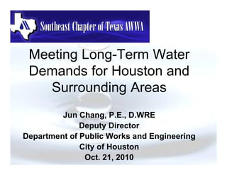
- 1. Meeting Long-Term Water Demands for Houston and Surrounding Areas Jun Chang, P.E., D.WRE Deputy Director Department of Public Works and Engineering City of Houston Oct. 21, 2010
- 2. First, a brief history…
- 3. Scenic Houston circa 1891
- 4. Houston Water Works • 1878: The Mayor and City Council franchised a private contractor to build a water system (Houston Water Works) taking water from Buffalo Bayou. • Private artesian wells were the alternative to bayou water. The Gulf Coast aquifer is Houston’s ground water source. This aquifer was estimated to be the third largest in the country, extending from Florida to Mexico. • Over the course of the next several decades Houston Water Works converted to artesian water. • 1906: The City purchased the Houston Water Works to improve water quality and citizen’s service.
- 5. Houston Water System • Early 1940’s Land Subsidence Benchmark re-leveling results Baytown Area had subsided 3.2 feet Texas City Area had subsided 1.6 feet • The Houston Chamber of Commerce in 1947 commissioned a systematic Regional Water Study to support Houston’s future growth • With the discovery that one of the major causes of land subsidence was excessive ground water pumping; plus anticipated population growth, Houston’s acquired surface water sources and constructed dams with River Authorities: Surface Water Reservoirs 1954 Lake Houston – dam on the San Jacinto River east fork 1969 Lake Livingston dam on Trinity River – southwest of Livingston 1973 Lake Conroe – dam on the San Jacinto River 2002 Land and water rights acquired for Allen’s Creek Reservoir
- 6. Houston Surface Water Supply - Reservoirs Lake Houston Allen’s Creek
- 7. Houston Water System • Houston has also invested in surface water treatment plants: - 1953 East Water Purification Plant I - 1985 East Water Purification Plant II - 1989 Southeast Water Purification Plant - Original - 2001 Southeast Water Purification Plant Expansion I - 2005 Northeast Water Purification Plant – Phase I - 2006 Northeast Water Purification Plant – Phase II - 2011? Southeast Water Purification Plant Expansion II • Regional Subsidence Districts established strict goals for three Houston counties to convert predominant water source of ground water to surface water – 1975 Harris-Galveston Subsidence District – 1989 Fort Bend Subsidence District • Surface Water Conversion – 1985 SWTP started
- 8. City of Houston Transmission Water Lines Constructed SWTP $740 million spent from 1985 to present
- 9. Houston Water System • Surface Water Treatment Facilities & Capacities – East Water Plant - 350 MGD – Southeast Water Purification Plant – 120 (200) MGD – Northeast Water Purification Plant – 80 MGD • 7 Distribution Re-pump Stations • Ground Water Facilities – 134 Water Wells – 58 Pumping Stations – 98 Storage Tanks
- 10. Houston Water System • Deliver annual (2009) average of 347 MGD of water (Max. 585 MGD) • Service 470,000 customer accounts 1,162,720 connections 2,940,000 residents • Maintain 7,480 miles of water lines • 54,000 Fire Hydrants • 150,000 Valves
- 11. Let’s plan for the future…
- 12. Long Range Planning Considerations Water Rights (Supply) Demands (Customers) Conveyance System (Raw Water) Treatment and Pressurizing Transmission and Distribution (Plants and Re-Pump Stations) (Treated Water)
- 13. What is the driving force?
- 14. Region H Water Planning Group S.B. 1, 75th Legislature, defined state water planning process Sixteen regions in state Region H: Parts or all of fifteen counties Require Regional Water Plan by January 2001 Regional Water Plans become State Water Plan 2002 Regional Water Plan updated regularly Current Planning Cycle (2007-2011) (2007- All projects requiring state approval or permits must be included in State Water Plan after 2002 Board consists of 23 members appointed by Texas Water Development Board (TWDB) representing eleven interests
- 15. Region H
- 17. Harris- Harris-Galveston Subsidence District Established in 1975 by 64th Legislature The Board has 19 members (Mayor of Houston appoints six members) Issues permits to withdraw groundwater in Harris / Galveston Counties Proponent of active water conservation programs Latest Regulatory Plan adopted April 14, 1999 Three Regulatory Areas
- 18. Subsidence in Feet 1906 - 1995 Data Source: National Geodetic Survey Contour Interpretations: HGCSD 1 2 3 4 5 6 7 6 9 6 10 3 4 5 8 9 1 2 7 6 5 4 4 3 6 2 1 HGCSD GWMP Map contoured in 1 Foot Intervals
- 19. Area 3 Predicted Subsidence 1995 - 2030 4 3 5 2 4 3 2 1 5 5 4 5 3 3 3 2 2 1 Data Source: Fugro-McClelland CSD96 Contour Interpretations: HGCSD
- 20. Harris-Galveston Subsidence District Surface Water Conversion Plan Conversion Requirements Area 3 • Area I 90% • Area II 80% • Area III – 30% by 2010 – 70% by 2020 Area 2 – 80% by 2030 Area 1 COH 2009 Surface Water Conversion Area I: 100% Area II: 87% Area III: 45%
- 21. City of Houston Surface Water Conversion
- 22. Who are our partners?
- 23. Strategic Suppliers, Resources & Alliances Trinity River Authority (Including Big 5) Lake Livingston Coastal Water San Jacinto River Authority Authority Conveyance canals, Lake Conroe pumps & pipes Galveston Bay Brazos River Fresh Water Inflows Authority Group (Allens Creek) Health of the Bay & Wastewater Reuse Texas Water Development Board Region H Planning & Financing
- 24. Who are our customers?
- 25. COH Treated & Untreated Water Customers Harris County MUDs Commercial SE Plant Industrial Co-Parts COH Strategic Houston Partners Water Citizens Water Resources Authorities Local Large Cities & Industrial Villages Local Cities Treated Water Customers Untreated Water Customers
- 26. Strategic Customers North Harris County Water Authority West Harris County Central Harris County Water Authority Water Authority Southeast WPP North Fort Bend County Co-Participants Regional Water Authority
- 27. What are the future demands?
- 28. Houston Water Master Plan Average Day Demand for City of Houston 1400 1200 1200 1080 Average Demand (MGD) 970 1000 840 800 715 646 600 400 200 0 1985 1990 2000 2010 2020 2030 Year Average Day Demand
- 29. Water Demand Forecast COH 1996 Study Water Demand Forecast 500 Demand using 9 - year regression TWDB Demand using 13 - year regression Montgomery Watson Actual Demand Modified TWDB 450 HGCSD/COH-UH Water Demand MGD 400 350 300 1984 1987 1990 1993 1996 1999 2002 2005 2008 2011 2014 2017 2020 Year
- 30. COH 2006 Updated Study ARC Regression Method Actual Historical Demand ARC Regression Line 450 430 410 390 Linear Regression Flow (MGD) 370 350 330 310 290 270 250 1980 1985 1990 1995 2000 2005 2010 Year Average Rate of Change (ARC) Method used for Regression Analysis City’s Pumpage Reports was used from 1983 through 2005 Growth Factor calculated from this analysis is 1.01
- 31. City of Houston and Water Authorities Water Demand Projections
- 32. Do we have enough water?
- 33. Houston Water Supply SURFACE WATER RIGHTS San Jacinto River Basin Lake Conroe 60 MGD Lake Houston 150 MGD + 12 MGD* + 36MGD* Trinity River Basin Lake Livingston 806 MGD Dayton Canal 34 MGD Wallisville 34 MGD Barbers Hill Canal 40 MGD Brazos River Allens Creek 62 MGD Total Permitted Water Rights 1,234 MGD Permit pending 143 MGD (Bayous) 519 MGD (Reuse) AVAILABLE GROUND WATER 235 MGD Per Subsidence Rules TOTAL WATER AVAILABLE 2,131 MGD *Recently Permitted
- 34. TOTAL Surface Water Supply & Demand Forecast 2000 PENDING #5827 reuse +519 MGD 1800 1600 PENDING #5826 bayous +143 MGD 1400 San Jacinto Run of River +36 MGD Million Gallons per Day 1200 Permitted Water Rights Lk Conroe, Lk Houston, Lk Livingston, Wallisville, 1000 Barber's Hill, Dayton Canal Pending Surface and Allens Creek. 1197 MGD Water Contracts 800 600 City of Houston 400 Surface Water Demand 200 0 2010 2020 2030 2040 2050
- 35. Surface Water Rights Approximately 1.2 Billion Gallons per Day
- 36. Allens Creek Reservoir • Location – 3000 feet upstream of Allens Creek – near Wallis (southern tip of Austin County) • History – planned and permitted cooling lake – Houston Lighting & Power in 1974 • Operation – capture yield of Allens Creek – diversions from the Brazos River of flood flows • Cost Estimates – depends on diversion site selected – current estimate $200 million without mitigation
- 37. Pertinent Information • Yield studies – diverts Brazos River flood flows – 99,650 Acre-feet per year (89MGD) with 2,200 cfs diversion – safe yield: 87,800 AF/Yr • Surface Area/Volume – 7,003 acres; 145,533 AF • Pool Elevation (normal) - 121 ft msl • Dam: earth-filled embankment, 23,000 feet; max height - 53 feet; elevation 134 ft msl
- 40. Allens Creek Reservoir • Authorized by 76(R) SB1593 (Sept 1999) Construction shall commerce no later than September 1, 2018 TCEQ may extend the deadline for good cause • BRA executes option with Reliant Energy (November 1999) • Site conveyed to BRA by Warranty Deed (January 2000) • TCEQ reissued original permit (Feb 2000) • BRA-Houston Agreement (April 2000) COH owns 70% of water rights (62MGD) and BRA owns 30% (27MGD) • TWDB financed the land acquisition and water rights permit amended (2002) • COH and BRA negotiate project terms/schedule (Nov. 2009 ~ ?)
- 41. Is our water at the right place?
- 42. COASTAL WATER Raw Water LEGEND: AUTHORITY Conveyance CANAL PIPELINE ROADWAY System COUNTY LINE INDUSTRIAL AREAS 90 TRINITY RIVER PUMP STATION N O ST U TR O IN H IT KE Y LA R IV ER LAKE HOUSTON 146 PUMP STATION LIBE HAR MAINTENANCE RTY SA FACILITY RIS N CO COU UN JA TY CIN NTY LIBERTY COUNTY CHAMBERS COUNTY TO R IVE R CH AM BE RS WALLISVILLE COUNTY 90 RESERVOIR OU 10 BAY 8 R 10 DA CE LYNCHBURG PUMP STATION 10 AND RESERVOIR 2354 EAST WATER SHIP CHANNEL CROSSING PURIFICATION PLANT HO US N SH TO BAYTOWN S TO IP N HOU C HA NN EL 146 SH 225 IP TRINITY DEER PARK CH AN NE BAY 225 L RED BLUFF WATER TREATMENT PLANT BAYPORT PUMP STATION PASADENA SOUTH EAST WATER PURIFICATION PLANT 146 COASTAL WATER AUTHORITY OF TEXAS Trinity River Pumping Station ELLINGTON FIELD File: Gen Vicinity Overview w Frame.dwg
- 43. 2020 Surface Water Supply and Demand Lake (in MGD) Conroe 60 Trinity NHCRWA/ 60? River CHCRWA 806 116 (82) 115 (35) 34 Lake NEWPP WHCRWA Houston 46 80 150+12+36=198 79(51) COH Raw Water 371 60 256(46) 23 200 327 28 EWPP NFBWA 20(1) 350 19 Co-Part 131 69 SEWPP 200
- 44. Luce Bayou Inter-Basin Transfer Project In Region H and State Water Plan Trinity River to Lake Houston (San Jacinto River) Diversion at Capers Ridge 3.6 miles of dual 108” pipeline 24 mile long canal Cost estimated at $294 million, including right-of-way, engineering and construction The project will be financed by TWDB deferred low interest loans All four Regional Water Authorities will share the cost proportion to their respective 2040 demand CWA is contracted with the City to implement the project Contractually guaranteed to be in service by June 2019 The project will be built to its ultimate capacity but pumps will be installed in phases
- 47. Estimated LBIBT Project Cost
- 48. Cost Sharing of Luce Bayou Project City of Houston 69.8% North Harris County Regional Water Authority 13.7% Central Harris County Regional Water Authority 0.5% West Harris County Regional Water Authority 9.5% North Fort Bend Water Authority 6.5% Total 100.0%
- 49. LBIBT Project Status Resolution of Take Point Completed June 2009 Complete property boundary surveying/acquisition 31-Dec-10 Complete environmental field work Feb-10 Joint Evaluation Meeting 10-Feb-10 Complete Preliminary Engineering in support of 404 Submittal 31-Mar-10 Submit 404 Application to USACOE 31-Mar-10 Receive/Respond to Agency Questions and Comments on 404 Application July 1, 2010 to receipt of permit Receive 404 Permit from USACOE April 2011 to March 2012 Complete Preliminary Engineering Report for CWA/COH/Co-Participant Approval Jul-10
- 50. What about treatment plants and transmission systems?
- 51. Northeast Water Purification Plant Expansion Current Capacity – 80 MGD Capacity After Expansion – 300 MGD Year Needed – No Later than June of 2019 Estimated Expansion Cost – $350 to $700 M Cost will be shared by Regional Water Authorities
- 53. City of Houston Transmission Water Lines Constructed and Proposed SWTP $93 million proposed FY 11 to 14
- 54. Questions?