CDP+++ Módulo2 Clase 2
•Descargar como PPT, PDF•
0 recomendaciones•1,275 vistas

Este documento describe varios tipos de mapas y representaciones gráficas que pueden usarse para diseñar en permacultura. Describe mapas conceptuales, de recursos, calendarios, herramientas de cartografía y zonas y sectores. Explica que los mapas ayudan a orientarse y comunicar información espacial de manera visual.
![Clase2.2 CDP+++ ¿Que tipos de mapas y representación gráfica tenemos a disposición para diseñar? ,[object Object],[object Object],[object Object],[object Object],[object Object],[object Object]](data:image/gif;base64,R0lGODlhAQABAIAAAAAAAP///yH5BAEAAAAALAAAAAABAAEAAAIBRAA7)
Recomendados
Más contenido relacionado
Similar a CDP+++ Módulo2 Clase 2
Similar a CDP+++ Módulo2 Clase 2 (20)
Más de Academia de Permacultura Integral
Más de Academia de Permacultura Integral (20)
Último
Último (11)
CDP+++ Módulo2 Clase 2
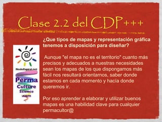
- 1. Clase 2.2 del CDP+++ ¿Que tipos de mapas y representación gráfica tenemos a disposición para diseñar? Aunque "el mapa no es el territorio" cuanto más precisos y adecuados a nuestras necesidades sean los mapas de los que dispongamos más fácil nos resultará orientarnos, saber donde estamos en cada momento y hacía donde queremos ir. Por eso aprender a elaborar y utilizar buenos mapas es una habilidad clave para cualquier permacultor@
- 4. Mapas “ el mapa no es el territorio” (es un modelo con pocas dimensiones ) cartografiar .. un proceso visual para comunicar información física y / o social particularmente útil cuando la información espacial es necesaria Los mapas o croquis hechos por los clientes dan mucha info adicional desarrollar croquis con símbolos y materiales personales
- 5. Diferentes perspectivas … PERO toda la información es correcta y relevante NIÑOS MUJERES HOMBRES Mapas de Lugar Entrevista al Cliente
- 7. Mapa Geográfica de China Mapa Administrativo
- 8. Solo zonas urbanas y carretteras
- 10. Mapas de Relieve o Topográficas
- 11. Varios tipos de Mapa
- 14. Flood Maps
- 15. Mapa de Climas
- 17. Las representaciones visuales pueden cambiar como vemos el mundo ayudarnos a ver desde otro punto de vista cuestionar nuestras suposiciones tener otro enfoque ver cosas que no habíamos visto antes
- 18. Mapas Conceptuales • Importantes para comunicar ideas • Ayudan a re-mapear (cambiar modelos mentales) • Quizás los más importantes • Usar tu imaginación!
- 20. Map of Humanity
- 21. Diseño - la ciencia de la mejor ubicación relativa de componentes (en espacio, en el tiempo, en la historia, en el océano de modelos mentales de nuestra cultura .. en TODAS dimensiones, todas clases de elementos) mapas de flujos diseñamos SISTEMAS, no LUGARES (incluye técnicas, estratégias y todas dimensiones)
- 22. EXEMPLO 4. CONCEPTO: “ORGANIZACIÓN INTERNA” GRUPO APRENDIZASE TRABAJO DE PROCESOS COMISIÓN DE PLANIFICACIÓN E COORDINACIÓN VISIÓN COMÚN CONS- TRUCCIÓN AGRI- CULTURA ADMINIS- TRACION COMISIÓNS TEMPORAIS
- 23. Pensar, debatir, reflexionar… sobre a nosa visión ideal de Chozas Compartir vivencias para chegar a sentir o que queremos DE DENTRO PARA FUERA DE FUERA PARA DENTRO
- 26. ©2000, The Chaordic Alliance Pueden ayudar a cambiar paradigmas! Ej. Antiguas Formas de Pensar y Diseñar Organizaciones
- 27. Nuevas Formas de Pensar y Diseñar Organizaciones ©2000, The Chaordic Alliance Transición al Pensamiento Sistémico (MUCHO liderazgo)
- 28. DOS sucesiones naturales seudocomunidad formando (forming) caos tempestad (storming) vacío normas (norming) comunidad verdadera grupo profesional / funcional (performing) ?
- 29. Jóvenes Proyectos y Proceso / Historia de Green Adventure Bosque Comestible Trueque Trasporte Bicicletas Brockwell Invernaderos Centro Comunitario Red de Trueque Bosque Comestible Café Sistema de Cajas
- 31. Un Curso de PermaCultura Formación sobre la Sostenibilidad Preparación Emprendedores Fuente de INSPIRACIÓN Grupo de Apoyo Puerta hacia una Comunidad Internacional / Apoyo Proyectos Seguimiento Aprendizaje en Acción -Diploma etc. Cambios de Vida Personal Mejora del Sitio / Tejer la Red Principio de Multi-funcionalidad (&’stacking’) ¡10!
- 33. Nodo Espiral: CONCEPTOS CLAVE
- 34. LOS MÓDULOS SON UNOS PASITOS
- 36. miles de tipos de formas gráficas de dar información Venn Diagrams
- 39. Mapa de Riego
- 40. Transect Map
- 41. Mapas de Sombra Solapamiento de Datos mapas de David: huerto de Vesta Esta técnica muestra de maneira bien clara donde hay mas y menos sol durante el dia. Despues es mucho más fácil de saber a donde plantar las lechugas y a donde plantar las tomates. técnicas de observación y organizar información
- 43. Congo áreas de grupos étnicos
- 45. Calendarios • Plantación > cosechas (Altibajos) • Eventos anuales • Chrondala • Mapas en el tiempo…usa tu imaginación!
- 48. Calendario e 13 lunas www.tortuga.com
- 49. PROPOSTA DE CRONOGRAMA PROPOSTA EXEMPLO mar abri mai xuñ xull ago set out nov dec caseto casa Bárbara baños duchas + water seco casa inacabada agricultura portas-ventás-contras auga árboles compra de fincas aprendizaxe resolución de conflictos casa do forno habilitar cociña vella
- 51. p&e: TU DISEÑO ¨ mapas de tu PROCESO de diseño
- 52. Mapa de Tiempo si Londres fuera el centro y cuidades fueran dibujadas en proximidad a Londres relativas al tiempo para llegar ahí usando el método más rápido de transporte muy interesante hacer representaciones gráficas del tiempo .. y otros componentes 'abstractos'
- 54. Bocetos juega! y suélta ...
- 55. Grupo de Desahogo INGREDIENTES: aceptación total, cariño, contradicción, realidad, jugar! TEMA: garabatéa tu casa, barrio y ciudad ... en 5 mins
- 56. Mapa Catastral
- 57. COMO CREAR UN MAPA BASE? 0) decide para que es, para quien, que uso, etc. 1) CROQUIS - de la imaginación (‘mapa libre’): tuya y de otros, no a escala, aproximado, ‘intuitivo’ 2) A ESCALA - creada por ti (x triangulación y medir) o copiada de mapa existente (escalar si hace falta) A P R O P I A D A a s u F U N C I Ó N
- 58. Google Earth Google Earth
- 60. Finca Luna Nueva www.finca-luna.com Como creamos este mapa
- 61. Mapa de Manutención + rotación tractor gallinas JUE VIE SÁB DOM LUN MAR MIE
- 62. tener MUY claro las Funciones de tus Mapas > Criterios Nelson Avelar en Portugal para visualizar y pensar opciones (modelos) para presentar (comunicar) - ¿a quien? para reunir y organizar información (observación)
- 63. - satisfagan sus necesidades - se usen sus productos DISEÑAR ES ... Colocar elementos - donde están mejor conectados
- 64. Técnicas de Diseño (Dibujo Técnico)
- 65. Vista Superior o Planta Perspectiva Vista de Alzado Vista Lateral Comunicación Gráfica
- 68. Perspectiva
- 69. Alzado
- 70. Planta
- 72. Grupo de Desahogo INGREDIENTES: aceptación total, cariño, contradicción, realidad, jugar! TEMA: perspectiva, planta y alzado de tu lugar
- 73. Inkscape Graficos vectoriales para planos se baja gratis x windows, mac y linux fácil
- 74. Sketch-up también se baja gratis en internet fácil a usar puedes rotar todo en 3D x windows y mac (no linux) el gallinero-compostero de Finca Luna con baño compost primera versión
- 76. Propuesta: cartografía las zonas y sectores de tu comunidad
- 77. 1º Piensa – escucha 3x3
- 78. Clase 2.2 del CDP+++ ¿Que tipos de mapas y representación gráfica tenemos a disposición para diseñar? Aunque "el mapa no es el territorio" cuanto más precisos y adecuados a nuestras necesidades sean los mapas de los que dispongamos más fácil nos resultará orientarnos, saber donde estamos en cada momento y hacía donde queremos ir. Por eso aprender a elaborar y utilizar buenos mapas es una habilidad clave para cualquier permacultor@
Notas del editor
- Mapping is a visual process in which people are given the chance to related physical and/or social information in a simple and easily understood format . It is especially useful where spatial information is required . Even people who have had access to formal education often cannot read professionally drawn plans, but most people can understand simple diagrams. And more so, if they develop the diagram using symbols and materials that have meaning relevance for them. Often this means the map will be drawn in the ground using sticks to make the lines and locally available materials as symbols (leaves, nuts, peddles..). To maintain a record of the information the facilitator needs to redraw the map on paper as accurately a possible - always show your version to the participants for checking and approval - remember the information is THIERS - the original stays with them - with their permission you can make a copy.
- Layout Maps - basic layout/plan of area, village, project (In this example it is interesting to note that the map drawn by the men, is different to that drawn by the women, which again different to that of the children - different perspectives/interests awareness BUT all the information IS correct and relevant)
- Although most commonly used to depict geography, maps may represent any space , real or imagined, without regard to conte xt or s cale ; e.g. Brain mapping , DN A mapping, an d extraterrestr ial mapping.
- http://www.uiweb.uidaho.edu/mining_school/zli/cn_map.htm 1-Beijing 6-Jilin 11-Fujian 16-Heilongjiang 21-Hainan 26-Shaanxi 31-Taiwan 2-Tianjin 7-Shanghai 12-Jiangxi 17-Hubei 22-Sichuan 27-Gansu 32-Chongqing 3-Hebei 8-Jiangsu 13-Shandong 18-Hunan 23-Guizhou 28-Qinghai 33-Hong Kong 4-Shanxi 9-Zhejing 14-Henan 19-Guangdong 24-Yunnan 29-Ningxia 34-Macau 5-Liaoning 10-Anhui 15-Inner Mongolia 20-Guangxi 25-Tibet 30-Xinjing Back
- estas son muuchas mapas - en solapación, solapadas?
- There is a great deal of information which is relate to time, and which is best and easiest presented as calendars. Again, these drawings will often be effected on the ground, with sticks, and possibly with locally found materials to represent aspects of the chart. For example to map planting calendars, the actual grain from the various crops could be used to show the time span of that crop, from planting to harvesting. Again, the information is by and for and of the people, so it should be drawn in terms that they use and that make sense to them, it is not necessary to map a whole year and to divide that year into 12 months of roughly the same time span - use the local system of time, and local names for periods and epochs. Possible uses of calendars includes crop rotations nutritional problems money availability/scarcity labor availability/scarcity religious holidays/celebrations
- Attention cartography geeks! NPR’s Robert Krulwich takes a looks at websites that let you superimpose maps on top of each other to compare the relative size of various things. For example, what would the dimensions of the gulf oil spill look like if it were superimposed on the US east coast? Or how many big countries could you fit into all of Africa? What I really like about this post is that I’ve tried to do map overlays manually in the past and it wasn’t very easy to do. Back in the ‘06 Israel-Lebanon war, I took a Google Map image of the war zone and superimposed it over New England . (Ha ifa to Beirut is about the same distance as Providence, RI to Lowell, MA, in case you’re wondering.) But it was really tough to do, especially given my limited tech skills. So if you’re a map nerd like I am, I hope you enjoy Robert’s post as much as I did. - @acarvin http://npr.tumblr.com/post /2133410550/m aps-on-maps
- http://2.bp.blogspot.com/_p2KqxkFzn6A/S_unWzqdawI/AAAAAAAAAI8/3GactgT1oXQ/s1600/map_of_humanity.jpg
- Estas éticas son muy idealistas, pero las ponemos en práctica a través de unas pautas de diseño de comprobado éxito, desde las más antiguas hasta las más modernas, muy bien definidas, y en continuo desarrollo. Se basan en una forma particular de pensar en la energía y los recursos de un sistema, y unas técnicas de diseño consciente que se aplican en cada fase y faceta del proceso de diseño en forma de aprendizaje acción. Es un proceso integrado, funcional y consciente. Es la ciencia de la mejor ubicación relativa de componentes en un plan o patrón cuya función principal es la de aumentar recursos, conservar energía y reducir o eliminar la polución y/o el desperdicio.
- Mapa de organización interna x una eco-aldea en formación
- un aparente ‘conflicto’ entre las personas que si tienen ideas claras de como lo quieren ... y otros que no, y que no se entusiasman nada en intentar forzar ese ‘compartir de visiones’
- Prof. Lietar - sistema de ‘deberes’ en Brazil - fomentando la auto-gestión de la educación
- ? se puede hacer algo ‘intermedio’? o sale un ‘ni carne ni pescado? Observo que la gente que NO tiene sus necesidades de ‘comunidad verdadera’ intenta crear una de cualquier grupo ... pero no siempre es apropiado. Rol del Facilitador: tener las ideas claras sobre QUE es realista en cada situación (que por no poder alcanzar una ‘comunidad verdadera’ tampoco llegamos trabajar en grupo de forma eficaz
- Respeto para los pueblos nativos ... patrones parecidos en todo el planeta: adaptados a su lugar, observación, cultura local JUGAR! Re-aprender a usar el aprendizaje en acción, nuestra forma natural de evolucionar: tiene que ser práctico, aplicada si no no se aprende nada ... acompañar a nuestro niño interior, re-discubrir el gozo y diviertimiento de ser científicos
- Es una de las 3 bases éticas de la PermaCultura ... pero ¿cómo llevarla a la práctica? Las personas somos, además del contexto, el aspecto sin duda más difícil a la hora de conseguir proyectos verdaderamente sostenibles. En este módulo exploramos de forma teórica y muy práctica también, las diferentes facetas de este contexto más amplio: la naturaleza de las personas, de los grupos y las relaciones; los modelos de investigación, el aprendizaje, la historia y el significado de la sostenibilidad .
- And finally, a map of how London’s Underground system would look if it was geographically correct, rather than stylistically simplified . This map was designed by Simon Clarke.
- English: Sources of dietary energy-consumption (%) following data of the Food and Agricultural Organisation of the United Nations ( FAO ) fo r the years 2001 to 2003. The graph differentiates between developed and developing countries. Following the copyrig ht policy of the FAO the use is free for any non-commercial and educational purposes. Español: Fuentes de consumo de energía diaria entre 2001 y 2003 según la FAO, comparando entre países desarrollados y países en vías de desarrollo. La fuente principal es http://faostat.fao.org/ Portals/_Faostat/documents/pdf/sources_of_dietary_energy_consumption.pdf . Según la propia págin a de la FAO ( http://www.fao.org/copyright_en.htm ), el uso de sus datos está totalmente permitido para uso educativo y/o no comercia l, algo que en ambos casos cumple W ikimedia.
- Resource Maps - maps can be drawn/developed which identify a specific feature, resource or use pattern. This map below right shows an existing irrigation system. While that below shows land-usage pattern Resource Maps may also be in the form of Venn diagrams, such as this example showing the sources of forest based products for a part of China Wealth Mapping - often it is important to identify wealth and influence in the village. (Note that the concept of wealth will vary according to culture - use a raking method to let the people determine their idea of wealth before mapping the story of the village.
- Transect Map - its actually a cross-section of a part of the landscape. It does not have to be in a straight line. It is useful as a way of getting to know the area, especially if an elder/knowledgeable person is asked to lead it.
- Transect Map - its actually a cross-section of a part of the landscape. It does not have to be in a straight line. It is useful as a way of getting to know the area, especially if an elder/knowledgeable person is asked to lead it.
- D. R. Congo, ethnic groups' areas
- There is a great deal of information which is relate to time, and which is best and easiest presented as calendars. Again, these drawings will often be effected on the ground, with sticks, and possibly with locally found materials to represent aspects of the chart. For example to map planting calendars, the actual grain from the various crops could be used to show the time span of that crop, from planting to harvesting. Again, the information is by and for and of the people, so it should be drawn in terms that they use and that make sense to them, it is not necessary to map a whole year and to divide that year into 12 months of roughly the same time span - use the local system of time, and local names for periods and epochs. Possible uses of calendars includes crop rotations nutritional problems money availability/scarcity labor availability/scarcity religious holidays/celebrations
- y luego las cosas más convencionales también ... son formas muy útiles de poner información compleja de forma fácil y visual
- This 1981 map looks at time, distance and transport. It illustrates how a section of the globe would look if London was at the centre and towns and cities were drawn in proximity to London relative to the time it takes to get there using the fastest mode of transport. We assume that this map takes Concorde into account, a mode of transport no longer in use.
- English: Sources of dietary energy-consumption (%) following data of the Food and Agricultural Organisation of the United Nations ( FAO ) fo r the years 2001 to 2003. The graph differentiates between developed and developing countries. Following the copyrig ht policy of the FAO the use is free for any non-commercial and educational purposes. Español: Fuentes de consumo de energía diaria entre 2001 y 2003 según la FAO, comparando entre países desarrollados y países en vías de desarrollo. La fuente principal es http://faostat.fao.org/ Portals/_Faostat/documents/pdf/sources_of_dietary_energy_consumption.pdf . Según la propia págin a de la FAO ( http://www.fao.org/copyright_en.htm ), el uso de sus datos está totalmente permitido para uso educativo y/o no comercial, algo que en ambos casos cumple Wikimedia.
- + mapa del cuerpo energético / espiritual de la Tierra + conector a otras dimensiones (calendario 13 lunas)