SlideShare ist ein Scribd-Unternehmen logo
1 von 16
Downloaden Sie, um offline zu lesen
A link between GIS and Storm
                                      Water Management Model


                                                                               University of Coimbra
                                                                                     Portugal


         RUI D.                             Nuno E.                            Alfeu Sá                      Joaquim O.
         PINA                               Simões                             Marques                         Sousa
3rd International MapWindow Open Source GIS Conference - Velp, The Netherlands, 25-28 June 2012   Rui Pina – rui.pina@uc.pt
SWMM
                    Storm Water Management Model
                    Recognized public domain software developed by the US-EPA:
                                                                                  - Dynamic rainfall-runoff
                                                                                  simulation model
                                                                                  - Dynamic 1D hydraulic flow
                                                                                  model for sewer systems and
                                                                                  open channels


                                                                                  Applicability: planning, analysis
                                                                                  and design of drainage systems

http://www.epa.gov/nrmrl/wswrd/wq/models/swmm/
3rd International MapWindow Open Source GIS Conference - Velp, The Netherlands, 25-28 June 2012   Rui Pina – rui.pina@uc.pt
GOAL


             FOSS4G                                                                               SWMM


3rd International MapWindow Open Source GIS Conference - Velp, The Netherlands, 25-28 June 2012   Rui Pina – rui.pina@uc.pt
inp .PINS

                                                                                              Aims of integration
                                                                                                GIS & SWMM:

                                                                                  •Take advantage on GIS complex
                                                                                  functions available
                                                                                  •Better characterize the model
                                                                                  and analyze modelling results
                                                                                  •Better data archive, access and
                                                                                  manipulation
                                                                                  •Better visualization
   http://www.mapwindow.org/
   https://sites.google.com/site/inppins/
3rd International MapWindow Open Source GIS Conference - Velp, The Netherlands, 25-28 June 2012   Rui Pina – rui.pina@uc.pt
P UT
                          GIS IN


3rd International MapWindow Open Source GIS Conference - Velp, The Netherlands, 25-28 June 2012   Rui Pina – rui.pina@uc.pt
inp.M AKER


3rd International MapWindow Open Source GIS Conference - Velp, The Netherlands, 25-28 June 2012   Rui Pina – rui.pina@uc.pt
MM R UN !
                          SW


3rd International MapWindow Open Source GIS Conference - Velp, The Netherlands, 25-28 June 2012   Rui Pina – rui.pina@uc.pt
inp.FLOOD


3rd International MapWindow Open Source GIS Conference - Velp, The Netherlands, 25-28 June 2012   Rui Pina – rui.pina@uc.pt
IS OU TPUT
                          G


                   Directive 2007/60/EC

             “(18) Member States should
             base their assessments, maps
             and plans on appropriate ‘best
             practice’ and ‘best available
             technologies’ not entailing
             excessive costs in the field of
             flood risk management.”


3rd International MapWindow Open Source GIS Conference - Velp, The Netherlands, 25-28 June 2012   Rui Pina – rui.pina@uc.pt
IVEMENTS
                          ACH


                                                                        Hy
                                                                                                     Flow coefficients


                                                                           d
                                                                                                 Depression storage


                                                                            rol
                  Floodplains                                                                 Infiltration parameters


                                                                               og
                                           MM


                                                                                  ic
                                                                                                     (Horton method)


                                                                                   al
                                                                                      ch
                                         SW


                                                                                        ara
                                                                                           ct e
                                                                                               riz
                                                                                                  ati
                                                                                                      on
                                              Physical characterization

                                               Area, Length, Width, Slope,
                                                       %IMP, XS

3rd International MapWindow Open Source GIS Conference - Velp, The Netherlands, 25-28 June 2012      Rui Pina – rui.pina@uc.pt
HELP
                          H OST &                                                  http://www.mapwindow.org/


                                                                                                  https://sites.google.
                                                                                                  com/site/inppins/

3rd International MapWindow Open Source GIS Conference - Velp, The Netherlands, 25-28 June 2012   Rui Pina – rui.pina@uc.pt
FOOS4G

                      FOSS advantages:
                               –        Tools adapted to users' needs
                               –        Reduced costs
                               –        Standards: interoperability
                               –        Cooperative work in progress


3rd International MapWindow Open Source GIS Conference - Velp, The Netherlands, 25-28 June 2012   Rui Pina – rui.pina@uc.pt
INS STATS
                          inp.P
                        Kick-off: October 2010
                        Help page visits: 1 473 from 75 countries/territories


3rd International MapWindow Open Source GIS Conference - Velp, The Netherlands, 25-28 June 2012   Rui Pina – rui.pina@uc.pt
ATIVE
                                                                           S CO OPER
                                                   inp.PIN

                                                      Sugestions & Bug Reports
                                  70

                                  60

                                                                                                                             COOPERATIVE
 Sugestions & Bug Reports (un)


                                  50

                                  40
                                                                                                                              TESTING &
                                  30

                                  20                                                                                        BRAINSTORMING
                                  10

                                   0
                                 01/10/2010   09/01/2011   19/04/2011   28/07/2011   05/11/2011   13/02/2012   23/05/2012

                                                                          Date


                                                                                            STABLE VERSION!

3rd International MapWindow Open Source GIS Conference - Velp, The Netherlands, 25-28 June 2012                               Rui Pina – rui.pina@uc.pt
FUTURE?

               1. Rebuild the application with DotSpatial library (instead of
               MapWinGIS.ocx).

               2. Do you think a MapWindow plugin version can be useful?

               3. Various:
                   - extend GIS files supported?
                   - add inp.Tools functions?
                   - ...

               4. Start a new Open Source Project of GIS and Hydraulic Modelling
               integration?

               5. Your involvement is welcome. Are you interested in helping us?


3rd International MapWindow Open Source GIS Conference - Velp, The Netherlands, 25-28 June 2012   Rui Pina – rui.pina@uc.pt
This work is licensed under the Creative Commons Attribution-
            ShareAlike 3.0 Unported License. To view a copy of this license, visit
            http://creativecommons.org/licenses/by-sa/3.0/ or send a letter to
            Creative Commons, 171 Second Street, Suite 300, San Francisco,
            California, 94105, USA.


            Rui Daniel Pina
            rui.pina@uc.pt
            http://pt.linkedin.com/in/ruidpina
3rd International MapWindow Open Source GIS Conference - Velp, The Netherlands, 25-28 June 2012   Rui Pina – rui.pina@uc.pt

Weitere ähnliche Inhalte

Was ist angesagt?

Site selection and Water harvesting suitability analysis in Badia of Jordan
Site selection and Water harvesting suitability analysis in   Badia of JordanSite selection and Water harvesting suitability analysis in   Badia of Jordan
Site selection and Water harvesting suitability analysis in Badia of JordanFAO
 
SWMM - Example 3 - Low Impact Development
SWMM - Example 3 - Low Impact DevelopmentSWMM - Example 3 - Low Impact Development
SWMM - Example 3 - Low Impact Development은성 정
 
SWMM Example 1 - Basic Example
SWMM Example 1 - Basic ExampleSWMM Example 1 - Basic Example
SWMM Example 1 - Basic Example은성 정
 
Advanced hydrology
Advanced hydrologyAdvanced hydrology
Advanced hydrologyJisha John
 
Reservoir capacity
Reservoir capacityReservoir capacity
Reservoir capacityonyx3
 
APPLICATIONS OF REMOTE SENSING AND GIS IN WATERSHED MANAGEMENT
APPLICATIONS OF REMOTE SENSING AND GIS IN WATERSHED MANAGEMENTAPPLICATIONS OF REMOTE SENSING AND GIS IN WATERSHED MANAGEMENT
APPLICATIONS OF REMOTE SENSING AND GIS IN WATERSHED MANAGEMENTSriram Chakravarthy
 
Stream flow by Arslan
Stream flow by ArslanStream flow by Arslan
Stream flow by ArslanZulfiqar Ali
 
Infiltration equations and index
Infiltration equations and indexInfiltration equations and index
Infiltration equations and indexTharun Reddy
 
CHARACTERISTICS OF RUNOFF.ppt
CHARACTERISTICS OF RUNOFF.pptCHARACTERISTICS OF RUNOFF.ppt
CHARACTERISTICS OF RUNOFF.ppteshitaakter2
 
Hydrology ( computation of average rainfall )
Hydrology ( computation of average rainfall )Hydrology ( computation of average rainfall )
Hydrology ( computation of average rainfall )Latif Hyder Wadho
 
Swmm quick start tutorial
Swmm quick start tutorialSwmm quick start tutorial
Swmm quick start tutorialDenny Helard
 
LECTURE 2- WATERSHED CLASSIFICATION AND MEASUREMENTS.pptx
LECTURE 2- WATERSHED CLASSIFICATION AND MEASUREMENTS.pptxLECTURE 2- WATERSHED CLASSIFICATION AND MEASUREMENTS.pptx
LECTURE 2- WATERSHED CLASSIFICATION AND MEASUREMENTS.pptxCHU DICKSON
 
Reservoir sedimentation
Reservoir sedimentationReservoir sedimentation
Reservoir sedimentationPramoda Raj
 
Class lecture on Hydrology by Rabindra Ranjan saha Lecture 10
Class lecture on Hydrology by Rabindra Ranjan saha Lecture 10Class lecture on Hydrology by Rabindra Ranjan saha Lecture 10
Class lecture on Hydrology by Rabindra Ranjan saha Lecture 10World University of Bangladesh
 

Was ist angesagt? (20)

Runoff & Flood Frequency Analysis
Runoff & Flood Frequency AnalysisRunoff & Flood Frequency Analysis
Runoff & Flood Frequency Analysis
 
Hydrograph
HydrographHydrograph
Hydrograph
 
Site selection and Water harvesting suitability analysis in Badia of Jordan
Site selection and Water harvesting suitability analysis in   Badia of JordanSite selection and Water harvesting suitability analysis in   Badia of Jordan
Site selection and Water harvesting suitability analysis in Badia of Jordan
 
SWMM - Example 3 - Low Impact Development
SWMM - Example 3 - Low Impact DevelopmentSWMM - Example 3 - Low Impact Development
SWMM - Example 3 - Low Impact Development
 
SWMM Example 1 - Basic Example
SWMM Example 1 - Basic ExampleSWMM Example 1 - Basic Example
SWMM Example 1 - Basic Example
 
Advanced hydrology
Advanced hydrologyAdvanced hydrology
Advanced hydrology
 
Reservoir capacity
Reservoir capacityReservoir capacity
Reservoir capacity
 
APPLICATIONS OF REMOTE SENSING AND GIS IN WATERSHED MANAGEMENT
APPLICATIONS OF REMOTE SENSING AND GIS IN WATERSHED MANAGEMENTAPPLICATIONS OF REMOTE SENSING AND GIS IN WATERSHED MANAGEMENT
APPLICATIONS OF REMOTE SENSING AND GIS IN WATERSHED MANAGEMENT
 
Stream flow by Arslan
Stream flow by ArslanStream flow by Arslan
Stream flow by Arslan
 
Watershed characteristics
Watershed characteristicsWatershed characteristics
Watershed characteristics
 
INFILTRATION PPT
INFILTRATION PPTINFILTRATION PPT
INFILTRATION PPT
 
Infiltration equations and index
Infiltration equations and indexInfiltration equations and index
Infiltration equations and index
 
CHARACTERISTICS OF RUNOFF.ppt
CHARACTERISTICS OF RUNOFF.pptCHARACTERISTICS OF RUNOFF.ppt
CHARACTERISTICS OF RUNOFF.ppt
 
Hydrology ( computation of average rainfall )
Hydrology ( computation of average rainfall )Hydrology ( computation of average rainfall )
Hydrology ( computation of average rainfall )
 
Swmm quick start tutorial
Swmm quick start tutorialSwmm quick start tutorial
Swmm quick start tutorial
 
Evapotranspiration
EvapotranspirationEvapotranspiration
Evapotranspiration
 
LECTURE 2- WATERSHED CLASSIFICATION AND MEASUREMENTS.pptx
LECTURE 2- WATERSHED CLASSIFICATION AND MEASUREMENTS.pptxLECTURE 2- WATERSHED CLASSIFICATION AND MEASUREMENTS.pptx
LECTURE 2- WATERSHED CLASSIFICATION AND MEASUREMENTS.pptx
 
Runoff
RunoffRunoff
Runoff
 
Reservoir sedimentation
Reservoir sedimentationReservoir sedimentation
Reservoir sedimentation
 
Class lecture on Hydrology by Rabindra Ranjan saha Lecture 10
Class lecture on Hydrology by Rabindra Ranjan saha Lecture 10Class lecture on Hydrology by Rabindra Ranjan saha Lecture 10
Class lecture on Hydrology by Rabindra Ranjan saha Lecture 10
 

Andere mochten auch

Policy paper - Bigdata skill building
Policy paper - Bigdata skill buildingPolicy paper - Bigdata skill building
Policy paper - Bigdata skill buildingRitesh Shrivastava
 
SWMM practice (basic)
SWMM practice (basic)SWMM practice (basic)
SWMM practice (basic)sjyeol84
 
UTM_SWMM_KAMAL
UTM_SWMM_KAMALUTM_SWMM_KAMAL
UTM_SWMM_KAMALsjyeol84
 
Zeroth review presentation(3)
Zeroth review presentation(3)Zeroth review presentation(3)
Zeroth review presentation(3)yash119
 
Design of a Minor Storm Water Management System Using XPSWMM for London, Onta...
Design of a Minor Storm Water Management System Using XPSWMM for London, Onta...Design of a Minor Storm Water Management System Using XPSWMM for London, Onta...
Design of a Minor Storm Water Management System Using XPSWMM for London, Onta...Rakibul Hasan,MEng,EIT
 
Planning & Design of Storm water Drainage system for Valsad city
Planning & Design of Storm water Drainage system for Valsad cityPlanning & Design of Storm water Drainage system for Valsad city
Planning & Design of Storm water Drainage system for Valsad cityMona Prajapati
 
Zeroth Review Model Slide
Zeroth Review Model SlideZeroth Review Model Slide
Zeroth Review Model Slideenggshankar
 
ultimate bearing capacity of shallow foundations: special cases
ultimate bearing capacity of shallow foundations: special casesultimate bearing capacity of shallow foundations: special cases
ultimate bearing capacity of shallow foundations: special casesMehmet Akin
 
Zeroth review presentation - eBay Turmeric / SMC
Zeroth review presentation - eBay Turmeric / SMCZeroth review presentation - eBay Turmeric / SMC
Zeroth review presentation - eBay Turmeric / SMCArvind Krishnaa
 
Ten Years of Coupled Hydrology and Hydraulic Modelling Supporting Storm Water...
Ten Years of Coupled Hydrology and Hydraulic Modelling Supporting Storm Water...Ten Years of Coupled Hydrology and Hydraulic Modelling Supporting Storm Water...
Ten Years of Coupled Hydrology and Hydraulic Modelling Supporting Storm Water...Stephen Flood
 
Smart Water nella Città del Futuro - Anders Lynggaard-Jensen: Real time sew...
 Smart Water nella Città del Futuro -  Anders Lynggaard-Jensen: Real time sew... Smart Water nella Città del Futuro -  Anders Lynggaard-Jensen: Real time sew...
Smart Water nella Città del Futuro - Anders Lynggaard-Jensen: Real time sew...Servizi a rete
 
Stormwater management presentation slides
Stormwater management presentation slidesStormwater management presentation slides
Stormwater management presentation slidesDoreen Yeo
 
Anna university-ug-pg-ppt-presentation-format
Anna university-ug-pg-ppt-presentation-formatAnna university-ug-pg-ppt-presentation-format
Anna university-ug-pg-ppt-presentation-formatVeera Victory
 
Bearing capacity of Soil
Bearing capacity of SoilBearing capacity of Soil
Bearing capacity of SoilPirpasha Ujede
 
Shirdi Foundation
Shirdi FoundationShirdi Foundation
Shirdi Foundationvrghorpade
 
First Review(Ppt)
First Review(Ppt)First Review(Ppt)
First Review(Ppt)smjagadish
 

Andere mochten auch (20)

Storm Water Utility Dev. and Master Plans
Storm Water Utility Dev. and Master PlansStorm Water Utility Dev. and Master Plans
Storm Water Utility Dev. and Master Plans
 
Policy paper - Bigdata skill building
Policy paper - Bigdata skill buildingPolicy paper - Bigdata skill building
Policy paper - Bigdata skill building
 
SWMM practice (basic)
SWMM practice (basic)SWMM practice (basic)
SWMM practice (basic)
 
UTM_SWMM_KAMAL
UTM_SWMM_KAMALUTM_SWMM_KAMAL
UTM_SWMM_KAMAL
 
Zeroth review presentation(3)
Zeroth review presentation(3)Zeroth review presentation(3)
Zeroth review presentation(3)
 
Design of a Minor Storm Water Management System Using XPSWMM for London, Onta...
Design of a Minor Storm Water Management System Using XPSWMM for London, Onta...Design of a Minor Storm Water Management System Using XPSWMM for London, Onta...
Design of a Minor Storm Water Management System Using XPSWMM for London, Onta...
 
Planning & Design of Storm water Drainage system for Valsad city
Planning & Design of Storm water Drainage system for Valsad cityPlanning & Design of Storm water Drainage system for Valsad city
Planning & Design of Storm water Drainage system for Valsad city
 
Zeroth Review Model Slide
Zeroth Review Model SlideZeroth Review Model Slide
Zeroth Review Model Slide
 
Project 0th Review
Project 0th ReviewProject 0th Review
Project 0th Review
 
Zeroth review presentation
Zeroth review presentationZeroth review presentation
Zeroth review presentation
 
ultimate bearing capacity of shallow foundations: special cases
ultimate bearing capacity of shallow foundations: special casesultimate bearing capacity of shallow foundations: special cases
ultimate bearing capacity of shallow foundations: special cases
 
Zeroth review presentation - eBay Turmeric / SMC
Zeroth review presentation - eBay Turmeric / SMCZeroth review presentation - eBay Turmeric / SMC
Zeroth review presentation - eBay Turmeric / SMC
 
Ten Years of Coupled Hydrology and Hydraulic Modelling Supporting Storm Water...
Ten Years of Coupled Hydrology and Hydraulic Modelling Supporting Storm Water...Ten Years of Coupled Hydrology and Hydraulic Modelling Supporting Storm Water...
Ten Years of Coupled Hydrology and Hydraulic Modelling Supporting Storm Water...
 
Smart Water nella Città del Futuro - Anders Lynggaard-Jensen: Real time sew...
 Smart Water nella Città del Futuro -  Anders Lynggaard-Jensen: Real time sew... Smart Water nella Città del Futuro -  Anders Lynggaard-Jensen: Real time sew...
Smart Water nella Città del Futuro - Anders Lynggaard-Jensen: Real time sew...
 
Stormwater management presentation slides
Stormwater management presentation slidesStormwater management presentation slides
Stormwater management presentation slides
 
Anna university-ug-pg-ppt-presentation-format
Anna university-ug-pg-ppt-presentation-formatAnna university-ug-pg-ppt-presentation-format
Anna university-ug-pg-ppt-presentation-format
 
Bearing capacity
Bearing capacityBearing capacity
Bearing capacity
 
Bearing capacity of Soil
Bearing capacity of SoilBearing capacity of Soil
Bearing capacity of Soil
 
Shirdi Foundation
Shirdi FoundationShirdi Foundation
Shirdi Foundation
 
First Review(Ppt)
First Review(Ppt)First Review(Ppt)
First Review(Ppt)
 

Ähnlich wie Linking GIS and Stormwater Models

FLOODS&FOSS
FLOODS&FOSSFLOODS&FOSS
FLOODS&FOSSRui Pina
 
Spider maps for location based services improvement
Spider maps for location based services improvementSpider maps for location based services improvement
Spider maps for location based services improvementIESS
 
Review Paper for floodplain mapping with applications of HEC-HMS, HEC-RAS and...
Review Paper for floodplain mapping with applications of HEC-HMS, HEC-RAS and...Review Paper for floodplain mapping with applications of HEC-HMS, HEC-RAS and...
Review Paper for floodplain mapping with applications of HEC-HMS, HEC-RAS and...IRJET Journal
 
DyGraph: A Dynamic Graph Generator and Benchmark Suite : NOTES
DyGraph: A Dynamic Graph Generator and Benchmark Suite : NOTESDyGraph: A Dynamic Graph Generator and Benchmark Suite : NOTES
DyGraph: A Dynamic Graph Generator and Benchmark Suite : NOTESSubhajit Sahu
 
Progetto INNO ed esempi di applicazioni nel campo della GEOMATICA - P.Cau
Progetto INNO ed esempi di applicazioni nel campo della GEOMATICA - P.CauProgetto INNO ed esempi di applicazioni nel campo della GEOMATICA - P.Cau
Progetto INNO ed esempi di applicazioni nel campo della GEOMATICA - P.CauSardegna Ricerche
 
GEO-MAHA: mobile and web platform for hazard notification and observation.
GEO-MAHA: mobile and web platform for hazard notification and observation.GEO-MAHA: mobile and web platform for hazard notification and observation.
GEO-MAHA: mobile and web platform for hazard notification and observation.Lyubomir Filipov
 
A Transfer Learning Approach to Traffic Sign Recognition
A Transfer Learning Approach to Traffic Sign RecognitionA Transfer Learning Approach to Traffic Sign Recognition
A Transfer Learning Approach to Traffic Sign RecognitionIRJET Journal
 
DSD-INT 2019 Benchmarking Models for River-Sea System Studies-Bellafiore
DSD-INT 2019 Benchmarking Models for River-Sea System Studies-BellafioreDSD-INT 2019 Benchmarking Models for River-Sea System Studies-Bellafiore
DSD-INT 2019 Benchmarking Models for River-Sea System Studies-BellafioreDeltares
 
BCS Geospatial SG - Usability of GIS and GI
BCS Geospatial SG - Usability of GIS and GIBCS Geospatial SG - Usability of GIS and GI
BCS Geospatial SG - Usability of GIS and GIMuki Haklay
 
SDSC Technology Forum: Increasing the Impact of High Resolution Topography Da...
SDSC Technology Forum: Increasing the Impact of High Resolution Topography Da...SDSC Technology Forum: Increasing the Impact of High Resolution Topography Da...
SDSC Technology Forum: Increasing the Impact of High Resolution Topography Da...OpenTopography Facility
 
ModelMap - Using ArcGIS to bring grounwdater models to life for a wider group...
ModelMap - Using ArcGIS to bring grounwdater models to life for a wider group...ModelMap - Using ArcGIS to bring grounwdater models to life for a wider group...
ModelMap - Using ArcGIS to bring grounwdater models to life for a wider group...John Faherty
 
IRJET- Estimation of Hydrological and Hydraulics Parameters for Bridge De...
IRJET-  	  Estimation of Hydrological and Hydraulics Parameters for Bridge De...IRJET-  	  Estimation of Hydrological and Hydraulics Parameters for Bridge De...
IRJET- Estimation of Hydrological and Hydraulics Parameters for Bridge De...IRJET Journal
 
EN - Visual Planning Brochure in English
EN - Visual Planning Brochure in EnglishEN - Visual Planning Brochure in English
EN - Visual Planning Brochure in EnglishVisual Planning
 
Real time Flood Simulation for Metro Manila and the Philippines
Real time Flood Simulation for Metro Manila and the PhilippinesReal time Flood Simulation for Metro Manila and the Philippines
Real time Flood Simulation for Metro Manila and the PhilippinesHeiko Joerg Schick
 
David.graham
David.grahamDavid.graham
David.grahamNASAPMC
 
Ectel nods v2
Ectel nods v2Ectel nods v2
Ectel nods v2nodenot
 
LAMPRE - User needs and communication approach to landslide hazards
LAMPRE - User needs and communication approach to landslide hazardsLAMPRE - User needs and communication approach to landslide hazards
LAMPRE - User needs and communication approach to landslide hazardsUmberto Pernice
 

Ähnlich wie Linking GIS and Stormwater Models (20)

FLOODS&FOSS
FLOODS&FOSSFLOODS&FOSS
FLOODS&FOSS
 
Spider maps for location based services improvement
Spider maps for location based services improvementSpider maps for location based services improvement
Spider maps for location based services improvement
 
Review Paper for floodplain mapping with applications of HEC-HMS, HEC-RAS and...
Review Paper for floodplain mapping with applications of HEC-HMS, HEC-RAS and...Review Paper for floodplain mapping with applications of HEC-HMS, HEC-RAS and...
Review Paper for floodplain mapping with applications of HEC-HMS, HEC-RAS and...
 
DyGraph: A Dynamic Graph Generator and Benchmark Suite : NOTES
DyGraph: A Dynamic Graph Generator and Benchmark Suite : NOTESDyGraph: A Dynamic Graph Generator and Benchmark Suite : NOTES
DyGraph: A Dynamic Graph Generator and Benchmark Suite : NOTES
 
Progetto INNO ed esempi di applicazioni nel campo della GEOMATICA - P.Cau
Progetto INNO ed esempi di applicazioni nel campo della GEOMATICA - P.CauProgetto INNO ed esempi di applicazioni nel campo della GEOMATICA - P.Cau
Progetto INNO ed esempi di applicazioni nel campo della GEOMATICA - P.Cau
 
GEO-MAHA: mobile and web platform for hazard notification and observation.
GEO-MAHA: mobile and web platform for hazard notification and observation.GEO-MAHA: mobile and web platform for hazard notification and observation.
GEO-MAHA: mobile and web platform for hazard notification and observation.
 
Environmental Projects
Environmental ProjectsEnvironmental Projects
Environmental Projects
 
A Transfer Learning Approach to Traffic Sign Recognition
A Transfer Learning Approach to Traffic Sign RecognitionA Transfer Learning Approach to Traffic Sign Recognition
A Transfer Learning Approach to Traffic Sign Recognition
 
DSD-INT 2019 Benchmarking Models for River-Sea System Studies-Bellafiore
DSD-INT 2019 Benchmarking Models for River-Sea System Studies-BellafioreDSD-INT 2019 Benchmarking Models for River-Sea System Studies-Bellafiore
DSD-INT 2019 Benchmarking Models for River-Sea System Studies-Bellafiore
 
BCS Geospatial SG - Usability of GIS and GI
BCS Geospatial SG - Usability of GIS and GIBCS Geospatial SG - Usability of GIS and GI
BCS Geospatial SG - Usability of GIS and GI
 
SDSC Technology Forum: Increasing the Impact of High Resolution Topography Da...
SDSC Technology Forum: Increasing the Impact of High Resolution Topography Da...SDSC Technology Forum: Increasing the Impact of High Resolution Topography Da...
SDSC Technology Forum: Increasing the Impact of High Resolution Topography Da...
 
ModelMap - Using ArcGIS to bring grounwdater models to life for a wider group...
ModelMap - Using ArcGIS to bring grounwdater models to life for a wider group...ModelMap - Using ArcGIS to bring grounwdater models to life for a wider group...
ModelMap - Using ArcGIS to bring grounwdater models to life for a wider group...
 
IRJET- Estimation of Hydrological and Hydraulics Parameters for Bridge De...
IRJET-  	  Estimation of Hydrological and Hydraulics Parameters for Bridge De...IRJET-  	  Estimation of Hydrological and Hydraulics Parameters for Bridge De...
IRJET- Estimation of Hydrological and Hydraulics Parameters for Bridge De...
 
EN - Visual Planning Brochure in English
EN - Visual Planning Brochure in EnglishEN - Visual Planning Brochure in English
EN - Visual Planning Brochure in English
 
Online Tv Music Channel
Online Tv Music ChannelOnline Tv Music Channel
Online Tv Music Channel
 
Real time Flood Simulation for Metro Manila and the Philippines
Real time Flood Simulation for Metro Manila and the PhilippinesReal time Flood Simulation for Metro Manila and the Philippines
Real time Flood Simulation for Metro Manila and the Philippines
 
David.graham
David.grahamDavid.graham
David.graham
 
Seismotech_2020_eng
Seismotech_2020_engSeismotech_2020_eng
Seismotech_2020_eng
 
Ectel nods v2
Ectel nods v2Ectel nods v2
Ectel nods v2
 
LAMPRE - User needs and communication approach to landslide hazards
LAMPRE - User needs and communication approach to landslide hazardsLAMPRE - User needs and communication approach to landslide hazards
LAMPRE - User needs and communication approach to landslide hazards
 

Mehr von MapWindow GIS

Python in geoinformatics
Python in geoinformaticsPython in geoinformatics
Python in geoinformaticsMapWindow GIS
 
Decision Support in Uncertain Real Estate Transactions
Decision Support in Uncertain Real Estate TransactionsDecision Support in Uncertain Real Estate Transactions
Decision Support in Uncertain Real Estate TransactionsMapWindow GIS
 
Comparative analysis of Székesfehérvár and Veszprém based on geoinformatic me...
Comparative analysis of Székesfehérvár and Veszprém based on geoinformatic me...Comparative analysis of Székesfehérvár and Veszprém based on geoinformatic me...
Comparative analysis of Székesfehérvár and Veszprém based on geoinformatic me...MapWindow GIS
 
Recent trends in the world of computers – Thought and facts
Recent trends in the world of computers – Thought and factsRecent trends in the world of computers – Thought and facts
Recent trends in the world of computers – Thought and factsMapWindow GIS
 
Hydrological investigations in the Rétköz, Hungary
Hydrological investigations in the Rétköz, HungaryHydrological investigations in the Rétköz, Hungary
Hydrological investigations in the Rétköz, HungaryMapWindow GIS
 
The multiresolution image format
The multiresolution image formatThe multiresolution image format
The multiresolution image formatMapWindow GIS
 
Guidelines for handling large amount of KML data
Guidelines for handling large amount of KML dataGuidelines for handling large amount of KML data
Guidelines for handling large amount of KML dataMapWindow GIS
 
GIS based sewer maintenance using MapWindow Open Source GIS
GIS based sewer maintenance using MapWindow Open Source GISGIS based sewer maintenance using MapWindow Open Source GIS
GIS based sewer maintenance using MapWindow Open Source GISMapWindow GIS
 
State of FOSS4G in Hungary
State of FOSS4G in HungaryState of FOSS4G in Hungary
State of FOSS4G in HungaryMapWindow GIS
 
Workshop: Community mapping and empowerment by Nagesh Kolagani
Workshop: Community mapping and empowerment by Nagesh KolaganiWorkshop: Community mapping and empowerment by Nagesh Kolagani
Workshop: Community mapping and empowerment by Nagesh KolaganiMapWindow GIS
 
Workshop: Community mapping and empowerment by Nagesh Kolagani
Workshop: Community mapping and empowerment by Nagesh KolaganiWorkshop: Community mapping and empowerment by Nagesh Kolagani
Workshop: Community mapping and empowerment by Nagesh KolaganiMapWindow GIS
 
Ease-of-use and Effectiveness of Participatory GIS in Empowering Rural Commun...
Ease-of-use and Effectiveness of Participatory GIS in Empowering Rural Commun...Ease-of-use and Effectiveness of Participatory GIS in Empowering Rural Commun...
Ease-of-use and Effectiveness of Participatory GIS in Empowering Rural Commun...MapWindow GIS
 
What's new in MapWindow v4.8 by Paul Meems
What's new in MapWindow v4.8 by Paul MeemsWhat's new in MapWindow v4.8 by Paul Meems
What's new in MapWindow v4.8 by Paul MeemsMapWindow GIS
 
Collaborative geoprocessing with GGL by Fernando González Cortes
Collaborative geoprocessing with GGL by Fernando González CortesCollaborative geoprocessing with GGL by Fernando González Cortes
Collaborative geoprocessing with GGL by Fernando González CortesMapWindow GIS
 
Ease-of-use and Effectiveness of Participatory GIS in Empowering Rural Commun...
Ease-of-use and Effectiveness of Participatory GIS in Empowering Rural Commun...Ease-of-use and Effectiveness of Participatory GIS in Empowering Rural Commun...
Ease-of-use and Effectiveness of Participatory GIS in Empowering Rural Commun...MapWindow GIS
 
Ktunaxa RMS, open source GIS for a first nation by Joachim Van der Auwera
Ktunaxa RMS, open source GIS for a first nation by Joachim Van der AuweraKtunaxa RMS, open source GIS for a first nation by Joachim Van der Auwera
Ktunaxa RMS, open source GIS for a first nation by Joachim Van der AuweraMapWindow GIS
 
Introducing the Geomajas Open Source framework for building spatial web appli...
Introducing the Geomajas Open Source framework for building spatial web appli...Introducing the Geomajas Open Source framework for building spatial web appli...
Introducing the Geomajas Open Source framework for building spatial web appli...MapWindow GIS
 
Data mining in big databases with geo reference and easy web publishing and s...
Data mining in big databases with geo reference and easy web publishing and s...Data mining in big databases with geo reference and easy web publishing and s...
Data mining in big databases with geo reference and easy web publishing and s...MapWindow GIS
 

Mehr von MapWindow GIS (20)

Python in geoinformatics
Python in geoinformaticsPython in geoinformatics
Python in geoinformatics
 
Decision Support in Uncertain Real Estate Transactions
Decision Support in Uncertain Real Estate TransactionsDecision Support in Uncertain Real Estate Transactions
Decision Support in Uncertain Real Estate Transactions
 
Comparative analysis of Székesfehérvár and Veszprém based on geoinformatic me...
Comparative analysis of Székesfehérvár and Veszprém based on geoinformatic me...Comparative analysis of Székesfehérvár and Veszprém based on geoinformatic me...
Comparative analysis of Székesfehérvár and Veszprém based on geoinformatic me...
 
Recent trends in the world of computers – Thought and facts
Recent trends in the world of computers – Thought and factsRecent trends in the world of computers – Thought and facts
Recent trends in the world of computers – Thought and facts
 
Hydrological investigations in the Rétköz, Hungary
Hydrological investigations in the Rétköz, HungaryHydrological investigations in the Rétköz, Hungary
Hydrological investigations in the Rétköz, Hungary
 
The multiresolution image format
The multiresolution image formatThe multiresolution image format
The multiresolution image format
 
Guidelines for handling large amount of KML data
Guidelines for handling large amount of KML dataGuidelines for handling large amount of KML data
Guidelines for handling large amount of KML data
 
GIS based sewer maintenance using MapWindow Open Source GIS
GIS based sewer maintenance using MapWindow Open Source GISGIS based sewer maintenance using MapWindow Open Source GIS
GIS based sewer maintenance using MapWindow Open Source GIS
 
State of FOSS4G in Hungary
State of FOSS4G in HungaryState of FOSS4G in Hungary
State of FOSS4G in Hungary
 
Gis in Bihor
Gis in BihorGis in Bihor
Gis in Bihor
 
Workshop: Community mapping and empowerment by Nagesh Kolagani
Workshop: Community mapping and empowerment by Nagesh KolaganiWorkshop: Community mapping and empowerment by Nagesh Kolagani
Workshop: Community mapping and empowerment by Nagesh Kolagani
 
Workshop: Community mapping and empowerment by Nagesh Kolagani
Workshop: Community mapping and empowerment by Nagesh KolaganiWorkshop: Community mapping and empowerment by Nagesh Kolagani
Workshop: Community mapping and empowerment by Nagesh Kolagani
 
Ease-of-use and Effectiveness of Participatory GIS in Empowering Rural Commun...
Ease-of-use and Effectiveness of Participatory GIS in Empowering Rural Commun...Ease-of-use and Effectiveness of Participatory GIS in Empowering Rural Commun...
Ease-of-use and Effectiveness of Participatory GIS in Empowering Rural Commun...
 
Ease-of-use and Effectiveness of Participatory GIS in Empowering Rural Commun...
Ease-of-use and Effectiveness of Participatory GIS in Empowering Rural Commun...Ease-of-use and Effectiveness of Participatory GIS in Empowering Rural Commun...
Ease-of-use and Effectiveness of Participatory GIS in Empowering Rural Commun...
 
What's new in MapWindow v4.8 by Paul Meems
What's new in MapWindow v4.8 by Paul MeemsWhat's new in MapWindow v4.8 by Paul Meems
What's new in MapWindow v4.8 by Paul Meems
 
Collaborative geoprocessing with GGL by Fernando González Cortes
Collaborative geoprocessing with GGL by Fernando González CortesCollaborative geoprocessing with GGL by Fernando González Cortes
Collaborative geoprocessing with GGL by Fernando González Cortes
 
Ease-of-use and Effectiveness of Participatory GIS in Empowering Rural Commun...
Ease-of-use and Effectiveness of Participatory GIS in Empowering Rural Commun...Ease-of-use and Effectiveness of Participatory GIS in Empowering Rural Commun...
Ease-of-use and Effectiveness of Participatory GIS in Empowering Rural Commun...
 
Ktunaxa RMS, open source GIS for a first nation by Joachim Van der Auwera
Ktunaxa RMS, open source GIS for a first nation by Joachim Van der AuweraKtunaxa RMS, open source GIS for a first nation by Joachim Van der Auwera
Ktunaxa RMS, open source GIS for a first nation by Joachim Van der Auwera
 
Introducing the Geomajas Open Source framework for building spatial web appli...
Introducing the Geomajas Open Source framework for building spatial web appli...Introducing the Geomajas Open Source framework for building spatial web appli...
Introducing the Geomajas Open Source framework for building spatial web appli...
 
Data mining in big databases with geo reference and easy web publishing and s...
Data mining in big databases with geo reference and easy web publishing and s...Data mining in big databases with geo reference and easy web publishing and s...
Data mining in big databases with geo reference and easy web publishing and s...
 

Kürzlich hochgeladen

"Subclassing and Composition – A Pythonic Tour of Trade-Offs", Hynek Schlawack
"Subclassing and Composition – A Pythonic Tour of Trade-Offs", Hynek Schlawack"Subclassing and Composition – A Pythonic Tour of Trade-Offs", Hynek Schlawack
"Subclassing and Composition – A Pythonic Tour of Trade-Offs", Hynek SchlawackFwdays
 
Leverage Zilliz Serverless - Up to 50X Saving for Your Vector Storage Cost
Leverage Zilliz Serverless - Up to 50X Saving for Your Vector Storage CostLeverage Zilliz Serverless - Up to 50X Saving for Your Vector Storage Cost
Leverage Zilliz Serverless - Up to 50X Saving for Your Vector Storage CostZilliz
 
Developer Data Modeling Mistakes: From Postgres to NoSQL
Developer Data Modeling Mistakes: From Postgres to NoSQLDeveloper Data Modeling Mistakes: From Postgres to NoSQL
Developer Data Modeling Mistakes: From Postgres to NoSQLScyllaDB
 
Vertex AI Gemini Prompt Engineering Tips
Vertex AI Gemini Prompt Engineering TipsVertex AI Gemini Prompt Engineering Tips
Vertex AI Gemini Prompt Engineering TipsMiki Katsuragi
 
Powerpoint exploring the locations used in television show Time Clash
Powerpoint exploring the locations used in television show Time ClashPowerpoint exploring the locations used in television show Time Clash
Powerpoint exploring the locations used in television show Time Clashcharlottematthew16
 
Unraveling Multimodality with Large Language Models.pdf
Unraveling Multimodality with Large Language Models.pdfUnraveling Multimodality with Large Language Models.pdf
Unraveling Multimodality with Large Language Models.pdfAlex Barbosa Coqueiro
 
New from BookNet Canada for 2024: BNC CataList - Tech Forum 2024
New from BookNet Canada for 2024: BNC CataList - Tech Forum 2024New from BookNet Canada for 2024: BNC CataList - Tech Forum 2024
New from BookNet Canada for 2024: BNC CataList - Tech Forum 2024BookNet Canada
 
DevEX - reference for building teams, processes, and platforms
DevEX - reference for building teams, processes, and platformsDevEX - reference for building teams, processes, and platforms
DevEX - reference for building teams, processes, and platformsSergiu Bodiu
 
Bun (KitWorks Team Study 노별마루 발표 2024.4.22)
Bun (KitWorks Team Study 노별마루 발표 2024.4.22)Bun (KitWorks Team Study 노별마루 발표 2024.4.22)
Bun (KitWorks Team Study 노별마루 발표 2024.4.22)Wonjun Hwang
 
"Debugging python applications inside k8s environment", Andrii Soldatenko
"Debugging python applications inside k8s environment", Andrii Soldatenko"Debugging python applications inside k8s environment", Andrii Soldatenko
"Debugging python applications inside k8s environment", Andrii SoldatenkoFwdays
 
The Future of Software Development - Devin AI Innovative Approach.pdf
The Future of Software Development - Devin AI Innovative Approach.pdfThe Future of Software Development - Devin AI Innovative Approach.pdf
The Future of Software Development - Devin AI Innovative Approach.pdfSeasiaInfotech2
 
Kotlin Multiplatform & Compose Multiplatform - Starter kit for pragmatics
Kotlin Multiplatform & Compose Multiplatform - Starter kit for pragmaticsKotlin Multiplatform & Compose Multiplatform - Starter kit for pragmatics
Kotlin Multiplatform & Compose Multiplatform - Starter kit for pragmaticscarlostorres15106
 
Anypoint Exchange: It’s Not Just a Repo!
Anypoint Exchange: It’s Not Just a Repo!Anypoint Exchange: It’s Not Just a Repo!
Anypoint Exchange: It’s Not Just a Repo!Manik S Magar
 
Unleash Your Potential - Namagunga Girls Coding Club
Unleash Your Potential - Namagunga Girls Coding ClubUnleash Your Potential - Namagunga Girls Coding Club
Unleash Your Potential - Namagunga Girls Coding ClubKalema Edgar
 
DevoxxFR 2024 Reproducible Builds with Apache Maven
DevoxxFR 2024 Reproducible Builds with Apache MavenDevoxxFR 2024 Reproducible Builds with Apache Maven
DevoxxFR 2024 Reproducible Builds with Apache MavenHervé Boutemy
 
Search Engine Optimization SEO PDF for 2024.pdf
Search Engine Optimization SEO PDF for 2024.pdfSearch Engine Optimization SEO PDF for 2024.pdf
Search Engine Optimization SEO PDF for 2024.pdfRankYa
 
"Federated learning: out of reach no matter how close",Oleksandr Lapshyn
"Federated learning: out of reach no matter how close",Oleksandr Lapshyn"Federated learning: out of reach no matter how close",Oleksandr Lapshyn
"Federated learning: out of reach no matter how close",Oleksandr LapshynFwdays
 
What's New in Teams Calling, Meetings and Devices March 2024
What's New in Teams Calling, Meetings and Devices March 2024What's New in Teams Calling, Meetings and Devices March 2024
What's New in Teams Calling, Meetings and Devices March 2024Stephanie Beckett
 
Dev Dives: Streamline document processing with UiPath Studio Web
Dev Dives: Streamline document processing with UiPath Studio WebDev Dives: Streamline document processing with UiPath Studio Web
Dev Dives: Streamline document processing with UiPath Studio WebUiPathCommunity
 

Kürzlich hochgeladen (20)

"Subclassing and Composition – A Pythonic Tour of Trade-Offs", Hynek Schlawack
"Subclassing and Composition – A Pythonic Tour of Trade-Offs", Hynek Schlawack"Subclassing and Composition – A Pythonic Tour of Trade-Offs", Hynek Schlawack
"Subclassing and Composition – A Pythonic Tour of Trade-Offs", Hynek Schlawack
 
Leverage Zilliz Serverless - Up to 50X Saving for Your Vector Storage Cost
Leverage Zilliz Serverless - Up to 50X Saving for Your Vector Storage CostLeverage Zilliz Serverless - Up to 50X Saving for Your Vector Storage Cost
Leverage Zilliz Serverless - Up to 50X Saving for Your Vector Storage Cost
 
Developer Data Modeling Mistakes: From Postgres to NoSQL
Developer Data Modeling Mistakes: From Postgres to NoSQLDeveloper Data Modeling Mistakes: From Postgres to NoSQL
Developer Data Modeling Mistakes: From Postgres to NoSQL
 
Vertex AI Gemini Prompt Engineering Tips
Vertex AI Gemini Prompt Engineering TipsVertex AI Gemini Prompt Engineering Tips
Vertex AI Gemini Prompt Engineering Tips
 
Powerpoint exploring the locations used in television show Time Clash
Powerpoint exploring the locations used in television show Time ClashPowerpoint exploring the locations used in television show Time Clash
Powerpoint exploring the locations used in television show Time Clash
 
Unraveling Multimodality with Large Language Models.pdf
Unraveling Multimodality with Large Language Models.pdfUnraveling Multimodality with Large Language Models.pdf
Unraveling Multimodality with Large Language Models.pdf
 
New from BookNet Canada for 2024: BNC CataList - Tech Forum 2024
New from BookNet Canada for 2024: BNC CataList - Tech Forum 2024New from BookNet Canada for 2024: BNC CataList - Tech Forum 2024
New from BookNet Canada for 2024: BNC CataList - Tech Forum 2024
 
DevEX - reference for building teams, processes, and platforms
DevEX - reference for building teams, processes, and platformsDevEX - reference for building teams, processes, and platforms
DevEX - reference for building teams, processes, and platforms
 
Bun (KitWorks Team Study 노별마루 발표 2024.4.22)
Bun (KitWorks Team Study 노별마루 발표 2024.4.22)Bun (KitWorks Team Study 노별마루 발표 2024.4.22)
Bun (KitWorks Team Study 노별마루 발표 2024.4.22)
 
"Debugging python applications inside k8s environment", Andrii Soldatenko
"Debugging python applications inside k8s environment", Andrii Soldatenko"Debugging python applications inside k8s environment", Andrii Soldatenko
"Debugging python applications inside k8s environment", Andrii Soldatenko
 
The Future of Software Development - Devin AI Innovative Approach.pdf
The Future of Software Development - Devin AI Innovative Approach.pdfThe Future of Software Development - Devin AI Innovative Approach.pdf
The Future of Software Development - Devin AI Innovative Approach.pdf
 
Kotlin Multiplatform & Compose Multiplatform - Starter kit for pragmatics
Kotlin Multiplatform & Compose Multiplatform - Starter kit for pragmaticsKotlin Multiplatform & Compose Multiplatform - Starter kit for pragmatics
Kotlin Multiplatform & Compose Multiplatform - Starter kit for pragmatics
 
Anypoint Exchange: It’s Not Just a Repo!
Anypoint Exchange: It’s Not Just a Repo!Anypoint Exchange: It’s Not Just a Repo!
Anypoint Exchange: It’s Not Just a Repo!
 
Unleash Your Potential - Namagunga Girls Coding Club
Unleash Your Potential - Namagunga Girls Coding ClubUnleash Your Potential - Namagunga Girls Coding Club
Unleash Your Potential - Namagunga Girls Coding Club
 
DMCC Future of Trade Web3 - Special Edition
DMCC Future of Trade Web3 - Special EditionDMCC Future of Trade Web3 - Special Edition
DMCC Future of Trade Web3 - Special Edition
 
DevoxxFR 2024 Reproducible Builds with Apache Maven
DevoxxFR 2024 Reproducible Builds with Apache MavenDevoxxFR 2024 Reproducible Builds with Apache Maven
DevoxxFR 2024 Reproducible Builds with Apache Maven
 
Search Engine Optimization SEO PDF for 2024.pdf
Search Engine Optimization SEO PDF for 2024.pdfSearch Engine Optimization SEO PDF for 2024.pdf
Search Engine Optimization SEO PDF for 2024.pdf
 
"Federated learning: out of reach no matter how close",Oleksandr Lapshyn
"Federated learning: out of reach no matter how close",Oleksandr Lapshyn"Federated learning: out of reach no matter how close",Oleksandr Lapshyn
"Federated learning: out of reach no matter how close",Oleksandr Lapshyn
 
What's New in Teams Calling, Meetings and Devices March 2024
What's New in Teams Calling, Meetings and Devices March 2024What's New in Teams Calling, Meetings and Devices March 2024
What's New in Teams Calling, Meetings and Devices March 2024
 
Dev Dives: Streamline document processing with UiPath Studio Web
Dev Dives: Streamline document processing with UiPath Studio WebDev Dives: Streamline document processing with UiPath Studio Web
Dev Dives: Streamline document processing with UiPath Studio Web
 

Linking GIS and Stormwater Models

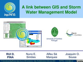
  • 1. A link between GIS and Storm Water Management Model University of Coimbra Portugal RUI D. Nuno E. Alfeu Sá Joaquim O. PINA Simões Marques Sousa 3rd International MapWindow Open Source GIS Conference - Velp, The Netherlands, 25-28 June 2012 Rui Pina – rui.pina@uc.pt
  • 2. SWMM Storm Water Management Model Recognized public domain software developed by the US-EPA: - Dynamic rainfall-runoff simulation model - Dynamic 1D hydraulic flow model for sewer systems and open channels Applicability: planning, analysis and design of drainage systems http://www.epa.gov/nrmrl/wswrd/wq/models/swmm/ 3rd International MapWindow Open Source GIS Conference - Velp, The Netherlands, 25-28 June 2012 Rui Pina – rui.pina@uc.pt
  • 3. GOAL FOSS4G SWMM 3rd International MapWindow Open Source GIS Conference - Velp, The Netherlands, 25-28 June 2012 Rui Pina – rui.pina@uc.pt
  • 4. inp .PINS Aims of integration GIS & SWMM: •Take advantage on GIS complex functions available •Better characterize the model and analyze modelling results •Better data archive, access and manipulation •Better visualization http://www.mapwindow.org/ https://sites.google.com/site/inppins/ 3rd International MapWindow Open Source GIS Conference - Velp, The Netherlands, 25-28 June 2012 Rui Pina – rui.pina@uc.pt
  • 5. P UT GIS IN 3rd International MapWindow Open Source GIS Conference - Velp, The Netherlands, 25-28 June 2012 Rui Pina – rui.pina@uc.pt
  • 6. inp.M AKER 3rd International MapWindow Open Source GIS Conference - Velp, The Netherlands, 25-28 June 2012 Rui Pina – rui.pina@uc.pt
  • 7. MM R UN ! SW 3rd International MapWindow Open Source GIS Conference - Velp, The Netherlands, 25-28 June 2012 Rui Pina – rui.pina@uc.pt
  • 8. inp.FLOOD 3rd International MapWindow Open Source GIS Conference - Velp, The Netherlands, 25-28 June 2012 Rui Pina – rui.pina@uc.pt
  • 9. IS OU TPUT G Directive 2007/60/EC “(18) Member States should base their assessments, maps and plans on appropriate ‘best practice’ and ‘best available technologies’ not entailing excessive costs in the field of flood risk management.” 3rd International MapWindow Open Source GIS Conference - Velp, The Netherlands, 25-28 June 2012 Rui Pina – rui.pina@uc.pt
  • 10. IVEMENTS ACH Hy Flow coefficients d Depression storage rol Floodplains Infiltration parameters og MM ic (Horton method) al ch SW ara ct e riz ati on Physical characterization Area, Length, Width, Slope, %IMP, XS 3rd International MapWindow Open Source GIS Conference - Velp, The Netherlands, 25-28 June 2012 Rui Pina – rui.pina@uc.pt
  • 11. HELP H OST & http://www.mapwindow.org/ https://sites.google. com/site/inppins/ 3rd International MapWindow Open Source GIS Conference - Velp, The Netherlands, 25-28 June 2012 Rui Pina – rui.pina@uc.pt
  • 12. FOOS4G FOSS advantages: – Tools adapted to users' needs – Reduced costs – Standards: interoperability – Cooperative work in progress 3rd International MapWindow Open Source GIS Conference - Velp, The Netherlands, 25-28 June 2012 Rui Pina – rui.pina@uc.pt
  • 13. INS STATS inp.P Kick-off: October 2010 Help page visits: 1 473 from 75 countries/territories 3rd International MapWindow Open Source GIS Conference - Velp, The Netherlands, 25-28 June 2012 Rui Pina – rui.pina@uc.pt
  • 14. ATIVE S CO OPER inp.PIN Sugestions & Bug Reports 70 60 COOPERATIVE Sugestions & Bug Reports (un) 50 40 TESTING & 30 20 BRAINSTORMING 10 0 01/10/2010 09/01/2011 19/04/2011 28/07/2011 05/11/2011 13/02/2012 23/05/2012 Date STABLE VERSION! 3rd International MapWindow Open Source GIS Conference - Velp, The Netherlands, 25-28 June 2012 Rui Pina – rui.pina@uc.pt
  • 15. FUTURE? 1. Rebuild the application with DotSpatial library (instead of MapWinGIS.ocx). 2. Do you think a MapWindow plugin version can be useful? 3. Various: - extend GIS files supported? - add inp.Tools functions? - ... 4. Start a new Open Source Project of GIS and Hydraulic Modelling integration? 5. Your involvement is welcome. Are you interested in helping us? 3rd International MapWindow Open Source GIS Conference - Velp, The Netherlands, 25-28 June 2012 Rui Pina – rui.pina@uc.pt
  • 16. This work is licensed under the Creative Commons Attribution- ShareAlike 3.0 Unported License. To view a copy of this license, visit http://creativecommons.org/licenses/by-sa/3.0/ or send a letter to Creative Commons, 171 Second Street, Suite 300, San Francisco, California, 94105, USA. Rui Daniel Pina rui.pina@uc.pt http://pt.linkedin.com/in/ruidpina 3rd International MapWindow Open Source GIS Conference - Velp, The Netherlands, 25-28 June 2012 Rui Pina – rui.pina@uc.pt