SlideShare ist ein Scribd-Unternehmen logo
1 von 44
Downloaden Sie, um offline zu lesen
GIS Best Practices

GIS in Africa

March 2009
Table of Contents
What Is GIS?

1

Global Dialogues: GIScience and Sustainable Development
in Africa

3

Cape Town's Emphasis on Systems Integration Exemplifies
"Smart City" Goals

7

Early Warning Planning for Mosquito-Borne Epidemics

13

Planning Education Projects in Rural Ethiopia Using GIS

17

Nigerian Voting System Modernized

21

Helping Elephants Across the African Continent with GIS

25

South African Educators Teach GIS—With or
Without Computers

31

Ghana Project Leverages GIS-Based Title Registration and
Microfinance to Alleviate Poverty

39

i
What Is GIS?
Making decisions based on geography is basic to human thinking. Where shall we go, what will it be
like, and what shall we do when we get there are applied to the simple event of going to the store or
to the major event of launching a bathysphere into the ocean's depths. By understanding geography
and people's relationship to location, we can make informed decisions about the way we live on our
planet. A geographic information system (GIS) is a technological tool for comprehending geography
and making intelligent decisions.
GIS organizes geographic data so that a person reading a map can select data necessary for a
specific project or task. A thematic map has a table of contents that allows the reader to add layers
of information to a basemap of real-world locations. For example, a social analyst might use the
basemap of Eugene, Oregon, and select datasets from the U.S. Census Bureau to add data layers
to a map that shows residents' education levels, ages, and employment status. With an ability to
combine a variety of datasets in an infinite number of ways, GIS is a useful tool for nearly every field
of knowledge from archaeology to zoology.
A good GIS program is able to process geographic data from a variety of sources and integrate
it into a map project. Many countries have an abundance of geographic data for analysis, and
governments often make GIS datasets publicly available. Map file databases often come included
with GIS packages; others can be obtained from both commercial vendors and government
agencies. Some data is gathered in the field by global positioning units that attach a location
coordinate (latitude and longitude) to a feature such as a pump station.
GIS maps are interactive. On the computer screen, map users can scan a GIS map in any direction,
zoom in or out, and change the nature of the information contained in the map. They can choose
whether to see the roads, how many roads to see, and how roads should be depicted. Then
they can select what other items they wish to view alongside these roads such as storm drains,
gas lines, rare plants, or hospitals. Some GIS programs are designed to perform sophisticated
calculations for tracking storms or predicting erosion patterns. GIS applications can be embedded
into common activities such as verifying an address.
From routinely performing work-related tasks to scientifically exploring the complexities of our world,
GIS gives people the geographic advantage to become more productive, more aware, and more
responsive citizens of planet Earth.

GIS BEST PRACTICES

1

WWW.ESRI.COM
Global Dialogues: GIScience and Sustainable
Development in Africa
"Crossing Borders"
A column by Doug Richardson,
Executive Director, Association of American Geographers
The Association of American Geographers recently had the
opportunity to participate with hundreds of African geographers,
GIScientists, and environmental scientists in a new dialogue around
the theme of Geospatial Science and Sustainable Development
in Africa. These discussions, which were initiated in March 2008
and have already generated several promising new areas of
research and educational collaboration, were sponsored by the U.S.
Department of State's Global Dialogues on Emerging Science and
Technology (GDEST) program. Follow-on activities and continuing
interactions resulting from these dialogues have the potential to
generate considerable ongoing and long-term cooperation among African and U.S. scientists
in geographic research, geographic information science (GIScience) education and GIS
applications, sustainability science, and many related fields.
Five other GDEST programs also have been undertaken, including dialogues in Japan (focusing
on nanotechnologies), China (biotechnology), and Germany (quantum computing). However,
the recent Africa GDEST program is the first to be initiated on a continental scale and the first to
address geography-related research fields, such as geospatial science and sustainability.
The Global Dialogues on Emerging Science and Technology program focusing on Geospatial
Science and Sustainable Development in Africa began in March 2008 with site visits to
universities, governmental ministries, and nongovernmental organizations in nine African
countries, followed by a conference on the same theme in Cape Town, South Africa.
The U.S. delegation was divided into two teams, East Africa and West Africa, and included
members from the U.S. Department of State Humanitarian Information Unit and its Bureau
of Oceans and International Environmental and Scientific Affairs, as well as representatives
GIS BEST PRACTICES

3

WWW.ESRI.COM
from other U.S. governmental agencies, several U.S. universities, the American Geographical
Society, the Association of American Geographers, and the United States Agency for
International Development (USAID) regional offices. The teams conducted more than 50 site
visits and met with hundreds of African experts in the fields of environmental remote-sensing
interpretation and modeling, GIS cartography and analysis, agriculture, education, health,
surveying, mining, climate, hydrology, population, urban systems, and information and
communication technology.
Care was taken to listen to and learn from our African colleagues, to identify needs rather
than prescribe solutions, to build upon existing regional capacity in geospatial science and
technology rather than duplicate or displace it, and to explore opportunities for collaboration
between U.S. and African scientists and institutions, as well as among African organizations and
networks, in ways identified as useful to scientists, educators, and governmental agencies from
the region.
It was clear from both the country visits and the conference that significant progress has been
achieved since the 2002 World Summit on Sustainable Development in terms of the diffusion
and sophistication of geospatial technologies, applications, and coordination, both regionally
and in individual countries, and their use in sustainable development planning and program
implementation. Despite progress, however, optimal use of geographic information science and
associated technologies is often constrained by a lack of resources, a lack of access to suitable
data, and a lack of coordination among users and data producers.
Among other topics, GDEST participants particularly sought to promote future dialogues that
would identify partners for collaboration on specific projects or programs; make better use
of collaboration among U.S. and African scientists and practitioners to create a sustainable
critical mass of African expertise; support regional and indigenous educational and institutional
infrastructures; and develop educational and research collaborative mechanisms, including
faculty and student exchange programs, online interactions, and better access to research and
curricular information.
The AAG currently is implementing some of the above resource sharing and online interactive
coordinative mechanisms through its new subsidized Developing Regions Membership Program
and through the existing AAG Center for Global Geography Education programs.
Also important to sustaining collaboration is supporting existing African networks of excellence
and platforms for dialogue, information sharing, and communication. For example, African
MARCH 2009

4

GIS IN AFRICA
networks of excellence, such as the African Association of Remote Sensing of the Environment
(AARSE), African Geo Information Research Network (AGIRN), African Reference Frame
(AFREF), Environmental Information Systems Africa (EIS-AFRICA), Mapping Africa for
Africa, and university networks (e.g., University Network for Disaster Risk Reduction in
Africa [UNEDRA]), are vital infrastructures of communication and coordination for research,
education, and applications collaboration. Descriptions of and linkages to these and many other
existing African networks can be accessed directly through the AAG Web site at www.aag.org/
developing.
The U.S. GDEST delegation representatives, both individually and in coordination with U.S.
embassies in the countries visited, are currently following up on contacts and acquaintances
made during the site visits and will be continuing discussions on specific projects for which
opportunities for partnerships and collaboration were identified. A report on the African GDEST
program's progress and findings is under development and will be made available in the near
future.
I would like to thank Lee Schwartz, director of the Office of the Geographer and Global Issues
at the U.S. Department of State, together with Nina Fedoroff and Andrew Reynolds of the Office
of the Science and Technology Adviser to the Secretary of State, for providing key leadership
and logistical support essential to the success of the African GDEST program. Most importantly,
on behalf of all of the participants, I would like to express our deep appreciation to our African
colleagues for the opportunity to learn from them during these dialogues and for their insight
and guidance on how to sustain ongoing interactions and useful collaborative activities in the
years ahead.
More information on African geography and GIS research, education, and sustainable
development activities, as well as collaborative needs and opportunities, is available and
updated regularly on the AAG Web site (www.aag.org).
(Reprinted from the Spring 2008 issue of ArcNews magazine)

GIS BEST PRACTICES

5

WWW.ESRI.COM
Cape Town's Emphasis on Systems Integration
Exemplifies "Smart City" Goals
Highlights
ERP and GIS optimize city's entire business processes through seamless IT integration.
System is recognized as one of the world's largest local government ERP systems.
City realizes substantial savings.
In 2001, seven neighboring local authorities were amalgamated into the City of Cape Town
in the Republic of South Africa with the intention of consolidating and streamlining municipal
services across the Cape Town metropolitan area. As a result of this massive restructuring
process, the City of Cape Town, with a population of approximately 3.2 million, immediately
became responsible for managing a number of antiquated, stand-alone information
management systems holding disparate data in at least seven different IT centers across the
new city.
Integrating its existing legacy systems into a seamless IT infrastructure became a top priority
for the city. Committing itself to a holistic and comprehensive "smart city" strategy, the IT
department initiated a number of projects to address the standardization of Information and
Communications Technology (ICT) architecture and connection of constituent parts to enable
a better flow of information among the departments and more efficient services for the city's
residents.
Key to the success of the smart city strategy was the implementation of the enterprise resource
planning (ERP) system, which saw approximately 113 legacy systems and 70 interfaces
replaced with a single functionally rich SAP solution designed to standardize and optimize the
city's entire business processes. Recognized as one of the world's largest ERP systems ever
implemented by a local government, it deploys SAP's Industry Solution for Utilities as the billing
system to help streamline the revenue process and integrate these into the ERP back-office and
CRM processes.

GIS BEST PRACTICES

7

WWW.ESRI.COM
SAP is linked to GIS to extract monthly maintenance costs of water bursts in the Khayelitsha service area.
Bursts have been captured with mobile GIS devices.

Next, the city integrated a GIS into the information system infrastructure. While GIS technology
was used throughout the various local councils prior to the amalgamation, it functioned primarily
as stand-alone systems with little standardization and limited compatibility. To reform this
particular legacy, Cape Town implemented an enterprise GIS based on the ArcGIS platform.
This allowed extensive functionality within a multiuser environment and provided an effective
spatial data management platform for its many users. Initially, the city concentrated on
consolidating electricity and property geodatabases into the GIS and subsequently added the
Water Services geodatabase to the GIS process. Since then, a number of other departments,
such as Planning and Valuations, have started implementing GIS technology. ArcGIS was
successfully implemented in participating departments as the city focused on integration issues,
such as user profiles, as well as standardized data capturing and maintenance of departmental
geodatabases.

MARCH 2009

8

GIS IN AFRICA
Cape Town's Water Services proved to be the ideal utility from which to continue its GIS
integration initiatives. South Africa is located in a semiarid region without significant perennial
rivers or lakes, and this reality requires extensive conservation and water control measures. The
City of Cape Town also experiences a 3 percent annual growth in its population, placing an even
greater strain on the city's limited water resources. Given these constraints, GIS provides one
of the best possible means to collect, analyze, and model spatial data for optimization of water
conservation and demand strategies.
The implementation of SAP enabled the city to establish an effective link between the system's
business information capabilities and its location-based asset information, such as pipes,
meters, reservoirs, treatment plants, and associated attribute data stored in GIS. By taking
advantage of this linkage, Cape Town is now able to extract the monthly maintenance costs for
incidents, such as burst pipes and sewer blockages, as well as to evaluate water consumption
patterns based on tariff structures.

This shows the percentage of capital budget allocation spent for 2006 per selected wards.
The data originates from SAP Business Warehouse.
GIS BEST PRACTICES

9

WWW.ESRI.COM
There is also a link to the asset register, which is a model that runs against the GIS
infrastructure geodatabase and is used to calculate solutions, such as the life span of the
various parts and components of the Water Services infrastructure. GIS can, therefore, be used
as a tool to plan medium- and long-term budgeting of infrastructure projects, such as replacing
pipe infrastructure due to increased population demands or end of life cycle redundancy.
Next, the city will apply the lessons learned from the Water Services implementation to the
development of a sewer and storm water geodatabase. Currently, the existing ArcEditor/ArcInfo
tools are utilized for multiuser editing in eight district offices, but the long-term vision is to
develop a customized editing tool within the ArcGIS Server environment.
By developing a common data model for GIS use throughout the city, the City of Cape Town has
realized substantial savings in its operations and developed a GIS that promotes data sharing
while minimizing data redundancy. The overall strategy is to implement a GIS completely
integrated with the city's enterprise-wide information architecture and infrastructure, providing
support to the city's private citizens and its local business community.
The Water Services Department has also implemented a Technical Operations Centre (TOC)
that interfaces with the Corporate Call Centre to initiate operational responses and manage
event tracking and logging. Currently, the Water Services Department is evaluating the available
technology and interfacing options to develop a fully automated, spatially enabled event
management system (EMS), defining an event as any operational activity requiring a response.
The EMS would be used to monitor and support the responsibilities of the city's employees to
increase their efficiency. For example, the EMS would automatically record the exact location
of an event occurring in the city and analyze it to determine its impact on the surrounding
area. Using location as a reference, the system would then identify assets the city has at any
particular location and dispatch work crews to respond to the event. Workflows developed within
the EMS will allow the city to define and manage its standard operating procedures to support
the EMS. The workflows would analyze the system's automated response to an event and
escalate the response to a higher level, demanding greater urgency, if required.
According to Pieta Le Roux, former GIS coordinator for the city's Water Services Department,
because events will be spatially referenced, engineers will be able to interpret trends and
patterns visually, which will allow them to be proactive in their response to events. In addition,
the TOC will coordinate responses to water/wastewater emergencies by integrating the
notification and work order processes of SAP with mobile GPS/GIS and communication
technologies. This integration will allow the city's supervisory control and data acquisition
MARCH 2009

10

GIS IN AFRICA
(SCADA) and telemetry systems' alarm components to be part of the central IT network and
information infrastructure for quicker response to any malfunctions or anomalies occurring within
the city's utility networks.
Le Roux further states that the City of Cape Town has a mature GIS, which is commonly
viewed as central to the city administration's plans for a tightly integrated and service-oriented
IT architecture, supported by a modern infrastructure, for seamless enterprise information
management capability. The GIS production and geodatabase server environments form a
major part of this integration process.
Commenting on the future, Le Roux says, "Cape Town will be implementing strategies and
processes toward the transactional integration of GIS and SAP to provide the necessary life
cycle views and real-time feedback of their asset maintenance environment."
(Reprinted from the Winter 2007/2008 issue of ArcNews magazine)

GIS BEST PRACTICES

11

WWW.ESRI.COM
Early Warning Planning for Mosquito-Borne Epidemics
GIS, High-Resolution Remote Sensing Help Evaluate Degrees of Risk in
Senegal
By Yves M. Tourre, Delphine Fontannaz, Cécile Vignolles, Jacques-André Ndione, Jean-Pierre
Lacaux, and Murielle Lafaye

Highlights
GIS tools and remote sensing were used to detect potential breeding ponds.
In situ observations validated the indexes.
Using ArcView, researchers calculated mosquito density and evaluated cross-potential risks
Fifty years of successful efforts in the prevention and control of infectious diseases and
epidemics have inspired confidence and optimism in modern medicine and technology.
Nevertheless, epidemics remain a conspicuous challenge to public health today. In the context
of climate change and rapidly increasing population, some epidemics are even reemerging.

A false-color composite of a 10 m SPOT 5 image (left) and ENVI 4.3 software were used to
obtain a new pond index (NDPI). From the NDPI, ponds (in blue) were precisely located (center
and right). The 500 m zone potentially occupied by mosquitoes (ZPOM) is shown in orange.

GIS BEST PRACTICES

13

WWW.ESRI.COM
For example, the Ferlo region in Senegal, Africa, became prone to Rift Valley fever (RVF) in
the late 1980s when virus-carrying mosquitoes Aedes vexans and Culex poicilipes appeared.
The latter species proliferate near temporary ponds and neighboring humid vegetation. RVF
epizootic outbreaks in livestock cause spontaneous abortions and perinatal mortality. So
far, human-related disease symptoms are often limited to flu-like syndromes but can include
more severe forms of encephalitis and hemorrhagic fevers. As a result, local socioeconomic
resources can be seriously affected.
Professor P. Sabatier at the University of Grenoble indicated that this growing threat created an
urgent need for a local early warning system (EWS) for RVF epidemics in Senegal. The goal
was to use specific GIS tools and remote-sensing images/data to detect potential breeding
ponds and evaluate RVF diffusion and areas with potential risks.

Project Description and
Preliminary Methods

MEDIAS-France implemented the RVF project in the Ferlo region under the auspices of the
French Spatial Agency (Centre National d'Etudes Spatiales). MEDIAS-France is a nonprofit
corporation that coordinates research groups studying global environmental issues in areas
including the Mediterranean Basin and subtropical Africa.
In the Ferlo region, the abundance of mosquitoes is linked to rainfall, ponds and their turbidity,
and the presence or absence of vegetation in ponds (e.g., water lilies, wild rice). Initially,
Environment for Visualizing Images (ENVI) 4.3 imagery processing software from ITT Visual
Information Solutions was used for spectral analysis of high-resolution (~10 m) SPOT 5 images
to locate the ponds. First, image registration tools were used to warp the images to match and
implement relative georeferencing for all SPOT 5 images collected, with further adjustment
to minimize spatial errors. Then, new indexes were obtained by using the classic Normalized
Difference Vegetation Index (NDVI) transform tool to allow the combination of different spectral
bands (such as the middle infrared [MIR] and the near infrared [NIR] red and green bands).
The Normalized Difference Pond Index (NDPI) allowed detection of all ponds; the Normalized
Difference Turbidity Index (NDTI) allowed the evaluation of water transparency or turbidity. In
situ observations by participants from the Center for Ecological Monitoring (Centre de Suivi
Ecologique) in nearby Dakar validated the indexes using GPS and GIS.

MARCH 2009

14

GIS IN AFRICA
Using these methods, small ponds were located with precision, making it further possible to
map RVF risks from zones potentially occupied by mosquitoes (ZPOM) following recent studies
from entomologists on flying ranges and spatial distribution of mosquitoes.

ArcView conversion, data management, and analysis tools enable the display of an
improved three-zone ZPOM for potential Rift Valley fever risks.
The very high-risk zones are red-hatched to identify underlying pond limits.

GIS Methods

GIS BEST PRACTICES

Further refinement and simplification were needed, however, because of the complexity of the
pond distribution and to develop an effective usage strategy for local health information
services. Researchers wanted to identify degrees of risk from isolated and/or clustered ponds,
calculate the target risk coverage area, and evaluate risk by mosquito density in overlapping
zones.

15

WWW.ESRI.COM
Because of researcher Delphine Fontannaz's GIS expertise and the availability of new detailed
information in the zones, the GIS approach became an obvious solution for the team. Using
ArcView software and tools (e.g., conversion and data management for spatial projection and
transformation, as well as overlay and proximity vector data analyses), maps obtained from
SPOT 5 10-meter multispectral resolution imagery were first transformed into appropriate
formats, then converted from raster to vector formats. The georeferencing accomplished
through universal transverse Mercator (UTM) WGS 1984 for zone 28N permitted further
comparison and processing.
The initial ZPOM was first divided into three bands chosen for defining risk levels for potential
virus transmission by Aedes vexans. Then, using ArcView software, researchers calculated
mosquito density and evaluated cross-potential risks. They noted that zones with very high and
high risks were inhabited by potential reservoirs, i.e., carriers (snakes, frogs, and toads), of the
RVF virus and produced an improved ZPOM.

Results

The analyses using GIS technology allowed researchers to see that risks increase when ponds
are close to each other. Using GIS technology, researchers created a new, more detailed, and
more useful ZPOM. GIS tools provided new products and information for use by local early
warning systems in the prevention of disease.

Future
Applications

This technique might be improved by adding digitized ecological zone layers. Multidisciplinary
users can benefit from this data by using it to choose strategic positioning of villages and parks
according to RVF risks. This new methodology is also being transferred to other teams in Africa
for varied types of mosquito vector research.

About the Authors

Tourre, Fontannaz, Vignolles, and Lacaux are affiliated with MEDIAS-France, Toulouse, France;
Ndione is affiliated with the Centre de Suivi Ecologique (CSE), Laboratoire de Physique de
l'Atmosphère et de l'Océan, Université Simon Fongang, Dakar, Senegal; and Lafaye is affiliated
with the Centre National d'Etudes Spatiales (CNES), Toulouse, France.
(Reprinted from the Spring 2008 issue of ArcNews magazine)

MARCH 2009

16

GIS IN AFRICA
Planning Education Projects in Rural Ethiopia
Using GIS
Highlights
GIS technology maximizes the number of children reached.
IRC Ethiopia has gained new insight into its development and relief programs.
Success with ArcView software has led IRC Ethiopia to expand GIS into almost every
project it undertakes.
Every day, millions of rural children in Ethiopia do not attend school. Instead, they work on
farms; dig in mines; or perform strenuous household tasks, such as gathering firewood or
fetching water, which together can take several hours each day. For them, education is out of
reach, both because poor families require the additional income and because many areas lack
elementary schooling altogether.
Beginning in 2005, the United States Department of Labor funded the International Rescue
Committee (IRC) to build schools and train teachers for community Alternative Basic
Education (ABE) schools, which would serve as institutions to transition children from the
labor force into more formal educational institutions, such as primary schools. Simultaneous
community awareness and education programs promoted the benefits of education and
encouraged families to send their children to school.
In implementing the project, IRC wished to use the funding as effectively as possible. The first
task was to locate each new ABE school within walking distance of as many out-of-school
children as possible. Second, because the ABE program is designed to prepare children
for more formal schooling, it was decided that each new ABE school should be within two
kilometers of a formal primary school so that graduates of the ABE program could easily transfer
to the formal school system. One further constraint on the program was that proposed school
sites should be relatively near main roads in order to facilitate the construction process and
program monitoring.

GIS BEST PRACTICES

17

WWW.ESRI.COM
Map of villages in Boke Woreda, Ethiopia, that displays the number of out-of-school children in each
village. Maps such as this were used to site new Alternative Basic Education schools/centers
near the most potential students and near extant primary schools in the area.
Based on this analysis, Qeelee was chosen as the site for a new school.

The Ethiopian Education Office lacks the infrastructure and funding to maintain information on
primary school locations, village school age populations, and distances between schools and
village populations. Low-level road maps are also not available for most rural districts. The IRC
Ethiopia program therefore had to build its geographic database from the ground up. Behar
Hussein, the IRC Ethiopia GIS coordinator, trained eight people in the use of Garmin eTrex Vista
GPS units to aid in the survey of 491 villages. The surveyors used Garmin eTrex Vista GPS for
the survey. While four of the eight surveyors gathered geographic data about village boundaries,
roads, health centers, water points, and primary school locations, the remaining four gathered
demographic data from each village: the number of households, number of children of each
MARCH 2009

18

GIS IN AFRICA
age, and number of children of each age attending formal schooling. The data took more than
50 days to collect and was cleaned and compiled at IRC's Addis Ababa office.
"It was much harder to obtain this data than downloading it," laughs Hussein, who performed the
analysis using the office's ArcView program. He focused on children aged 6 to 11 years of age
who were not enrolled in formal schools. First, he plotted the number of children not in school
in each village; that map displayed several obvious locations for ABE schools that would be in
close proximity to large numbers of out-of-school children. Of those locations, not all were within
the proposed two kilometers of the nearest primary school. Potential locations were further
narrowed down by their access to roads, which were extensively mapped out during the village
surveys.
IRC constructed ABE schools at 22 sites in each of the four selected rural districts, each site
chosen to be close to a large number of children not already enrolled in school. Each ABE
school was also within two kilometers of a government primary school, ensuring that the
program and its graduates were integrated into Ethiopia's educational institutions. The proximity
to usable roads meant that the construction could be carried out in a timely manner and that IRC
could easily monitor the progress and enrollment at each ABE site. Following the construction
of the 22 ABE schools and with continued funding from the U.S. Department of Labor, there
are currently 4,120 children enrolled in the Alternative Basic Education program and preparing
to enter more formal schooling. The program is currently expanding enrollment to vocational
training for older youth. By enabling these children to further their education instead of laboring,
the program improves their individual economic opportunities while simultaneously furthering
the development of Ethiopia as a whole.
The obvious utility of ArcView analysis in this project's success means that IRC Ethiopia has
expanded GIS into almost every project it undertakes, from developing project proposals to
coordinating activities with other international organizations and from planning the sites of health
centers to building new water points in refugee camps. IRC Ethiopia's extensive use of GIS has
given it new insight into how and where to implement its development and relief programs.
"I think this is just a great example of efficient planning during project implementation," says
David Murphy, the country director for IRC Ethiopia. "We used GIS tools to maximize the
number of children reached by our program, ultimately putting our funding to its best use."
(Reprinted from the Spring 2008 issue of ArcNews magazine)
GIS BEST PRACTICES

19

WWW.ESRI.COM
Nigerian Voting System Modernized
GIS Prevails Despite Unnavigable Terrain and Political Unrest
Highlights
120,000 polling locations are inventoried and spatially located.
System helps ensure free and fair elections in Nigeria.
GIS is used for map production and redistricting.
Nigeria, one-third larger than Texas in area and the most populous country in Africa, is located
on the Gulf of Guinea in West Africa. It is bordered by Niger and Chad to the north, Cameroon
to the east, and Benin to the west. The lower course of the Niger River flows south through the
western part of the country into the Gulf of Guinea. Swamps and mangrove forests border the
southern coast, while inland are hardwood forests.

The project was carried out in three phases: development of the data collection
application, field data collection and editing, and development of the
Polling Unit GIS application.
GIS BEST PRACTICES

21

WWW.ESRI.COM
The Independent National Electoral Commission (INEC) is a nonpartisan Nigerian government
agency charged with the conduct and supervision of elections. In the late 1990s, the agency
began modernizing its information technology infrastructure by migrating from an outdated
legacy voting system heavily dependent on inaccurate paper records and polling cards to the
newer Electronic Voting System (EVS). At the heart of EVS is the Electronic Voter Register
(EVR), which, by capturing the names of all eligible voters, eliminates duplication and thereby
minimizes discrepancies in the electoral process. As such, EVR is viewed as a means of
ensuring free and fair elections in Nigeria.
As part of the modernization process, INEC needed to inventory and spatially locate the
agency's 120,000 polling locations scattered around the country. These locations and their
attributes needed to be linked to EVR.

MARCH 2009

22

GIS IN AFRICA
GIS technology was identified as a potential solution to the problem, and TTi Limited (formerly
Adorbel Ltd.)—a consultant responsible for the field data collection and project management
for INEC—subcontracted to ESRI Business Partner Geo-Imaging Consulting of Washington,
D.C., to design and implement a Polling Unit (PU) GIS. Geo-Imaging proposed integrating GPS,
digital photography, and DBMS technologies to create a data collection tool capable of capturing
the x,y locations and images of existing polling units. Since the client's budget constraints
precluded the purchase of COTS GIS software, the use of an industry-standard development
environment to create an application with GIS/mapping capabilities was also proposed. The
application would then be linked to EVR.
The project was carried out in three phases: development of the data collection application, field
data collection and editing, and development of the Polling Unit GIS application.
The data collection equipment comprised 40 Dell laptops, Trimble Navigation GPS units, USB
drives, and digital cameras. Each laptop was preloaded with a Microsoft Access database
containing polling unit information from EVR. Using Trimble Software Development Kit, the GPS
unit was customized to interface with the Microsoft Access application, allowing for the capture
of each polling unit's x,y location and image directly into the Access database.
For the data collection exercise, the country was divided into four zones, each with a team of
10 trained field data collectors. At the end of each data collection day, USB drives were used
to transfer data from the field laptops to servers in each zone's headquarters, after which the
data was periodically transferred to the nation's capital, Abuja. Every week, the Abuja data was
consolidated and transferred to Geo-Imaging's Washington, D.C., office where ArcGIS Desktop
was used to convert and edit it. Mock registration areas (proposed third-level administrative
boundaries) were digitized based on certain attributes of the polling unit data.
The PU GIS, a MapObjects software-based application developed using Visual Basic, displayed
polling unit locations within two levels of administrative boundaries (state and local government
areas) and the proposed registration areas. Apart from displaying data, the application also
displays a given polling unit's image when it is identified. Users can also create simple GIS
queries using the application, which is a client to an ArcSDE 9.2/Oracle DBMS.

GIS BEST PRACTICES

23

WWW.ESRI.COM
During the course of the project, INEC commissioners visited Washington, D.C., for PU GIS
end user training, as well as introductory GIS courses from ESRI. The final training session was
carried out in Abuja after the testing and acceptance of the application. The audience at this
session comprised largely the proposed end users.
Nigeria's Information and Communications Technology (ICT) Department established a wellequipped GIS lab on INEC's LAN and now uses PU GIS for departmental map production and
future administrative boundaries redistricting decision support. The application is also used to
generate reports and carry out analysis on voter distribution. ICT offers day-to-day support for
end users of the application.
(Reprinted from the Summer 2007 issue of ArcNews magazine)

MARCH 2009

24

GIS IN AFRICA
Helping Elephants Across the African Continent with
GIS
With adults measuring up to four meters high and usually weighing more than six tons, African
elephants are the world's largest land mammals; yet in all their magnificence, their history is
tainted by a constant battle for survival. Poaching, the most recent of the species' troubles, is
estimated to have decreased the African elephant population from 1.3 million in 1970 to just
600,000 by 1989. However, research conducted at the University of Southampton, England, is
revealing a brighter future.

Elephant family group, Botswana, 1998 (photo courtesy: Martin Shipton).

GIS BEST PRACTICES

25

WWW.ESRI.COM
Over the last century, the human population on the African continent has dramatically
expanded and subsequently sprawled into previously uninhabited areas. This has
meant elephants and people have increasingly come into direct contact as their spheres
of influence overlap. Consequently, conflict between humans and elephants has also
increased as each species brings about land-cover changes undesirable to the other.
As such, environmentalists have long recognized the need to manage this developing
human–elephant interactivity. However, much of this management has focused on a local
or, at best, regional scale. While seemingly effective, it neglects the holistic dynamics of
the problem and often just transfers the trouble elsewhere.
A pioneering new approach
to resolve this predicament
is emerging from work
conducted over the past
year by Matthew Shipton, a
researcher at the University
of Southampton. The result
of this work is the Human–
Elephant Interaction
Model (HEIM) that predicts
the spatiality of human–
elephant conflict across the
entire African continent.
While the results do not
have the spatial resolution
of more local studies, they
have revealed previously
unknown trends that can be
Model prediction of combined human constraints.
directly traced back to land
management policies. The
model also acts as a decision
support system, leading those in authority to make decisions that will be effective on a
long-term basis. For example, HEIM can provide a list of the most suitable relocation sites
for specific problem herds, which can only be done with a model of significant geographic
scope since elephant ranges span up to 500 square miles.

MARCH 2009

26

GIS IN AFRICA
HEIM is constructed in ArcView since it requires a wide range of geostatistical and spatial
analytical tools to form the foundation of the spatial modeling and geoprocessing operations
that are at its core. The ArcGIS Spatial Analyst extension was used in the development of the
model, which is based on two datasets, both of which are primarily sourced from the American
Geological Institute's Global GIS Database: Africa CD-ROM. The first dataset is a series of
12 carefully selected variables that attempt to outline the environmental characteristics of
elephant ranges. This data ranges from remotely sensed normalized difference vegetation
index calculations to slope maps to those detailing the distance to the nearest permanent
water source. The second dataset is slightly larger (15 variables) and contains information on
the human constraints that are imposed on an area's environmental suitability for elephant
habitation. For example, this dataset includes data on human population density; land mine risk;
and the location of national parks, major roads, and various industrial activities, including data
on sustainable farming of both a pastoral and agricultural nature.
The variables in these datasets
are independently weighted
by a multiplicative matrix.
This accounts for the varying
magnitudes and intensities of the
variables' impacts on elephant
habitation. Moreover, because
the variables are not all from
the same source and the data
they contain is collaborated
in different ways, the matrix
also gives some weight with
regard to the accuracy, quality,
completeness, age, and longevity
of the data. Finally, the variables
are calibrated with data from the
African Elephant Status Report
(2002), which was provided by
Distance to permanent water.
the African Elephant Specialist
Group. Known as "model fitting," this
process emphasizes the importance of those variables that statistically best describe the actual
distribution of elephants across Africa.
GIS BEST PRACTICES

27

WWW.ESRI.COM
The two datasets are then separately combined with the raster calculator function in ArcView
using the ArcGIS Spatial Analyst extension to create two base images: one shows the suitability
of the African environment to elephant habitation and the other shows the severity of human
constraints that limit elephant habitation. These images are then overlaid, again using the raster
calculator, in a way that does not bias the greater number of variables in the human constraint
dataset, to create an image that predicts the spatial distribution of elephants across the whole
continent (assuming that elephants occupy the areas that have the most suitable physical
environment and the lowest level of human activity). This image is then correlated with the data
from the African Elephant Status Report on the actual distribution of elephants as a form of
model validation, giving an idea of the accuracy of the model's output.
Once this is found to be
acceptable, the severity of
human–elephant conflict
across Africa is calculated
within specific error margins.
This is done by again
combining the two base
images in ArcView but this time
with the human constraints
inversely scaled so the output
gives the highest values to
areas environmentally suitable
for elephants with high levels
of human activity. As a final
form of model validation,
ground control points were
chosen across this image.
These then had their relative
level of human–elephant
Model prediction of human-elephant conflict.
conflict confirmed or refuted
through field observations by the charitable organization Living With Elephants and the
Department of Geography and Environmental Sciences at the University of Zimbabwe.

MARCH 2009

28

GIS IN AFRICA
With the data collected, a final step was then taken to analyze the overall condition of the
African elephants' range. This was done by reclassifying the predicted elephant distribution
and actual distribution into 10 natural breaks. The raster calculator was then used to identify
where the predicted value exceeded the actual value (overpopulated), where it was beneath
the actual value (underpopulated), and where the two were equal (a population in equilibrium).
This provides a further tool for environmental managers, since knowing the degree to which an
environment is stressed has numerous significant consequences on the way it is managed.
The model has been extensively tested and compared to proven ground data. The wealth of
information contained within the model is now being analyzed so it can be used to further the
effectiveness of conventional management projects. This analysis will provide a basis from
which stakeholders can get a preliminary overview of the impact of specific management
decisions. Moreover, it is desired that the model's spatial predictions of human–elephant conflict
will be used as a foundation for national and intergovernmental strategic and tactical decisions
regarding preemptive management to quell potential conflict zones—ultimately leading to a
better life for African elephants.
(Reprinted from the Spring 2005 issue of ArcNews magazine)

GIS BEST PRACTICES

29

WWW.ESRI.COM
South African Educators Teach GIS—With or Without
Computers
Huge Differences Exist Between Urban and Rural Schools
Highlights
Department of Education includes GIS in secondary/senior school curriculum.
"Paper GIS" was developed for schools lacking computer resources.
ArcExplorer and ArcView are provided to schools with computer access.
The South African National
Department of Education included
GIS in the curriculum for the first
time in 2006. The introduction
of GIS is taking place as a
phased approach over the last
three years of secondary/senior
school. South Africa is divided
into nine provinces, each with
its own Provincial Department
of Education. The Provincial
Departments are overseen by
the National Department, which
is responsible for strategy and
implementation, as well as training
of senior curriculum advisors. It
The paper GIS targets those schools with no computer access at all.
is, however, up to the Provincial
Departments to ensure that all schools are introduced to GIS via the curriculum advisors in their
respective provinces. The inclusion of GIS was met with apprehension by the educators, as
most of them had not heard of GIS and there was a lack of skills for imparting this knowledge to
the students.

GIS BEST PRACTICES

31

WWW.ESRI.COM
Huge differences exist between schools in the rural and urban areas with rural schools lagging
behind in resources, such as well-qualified teachers and access to electricity, infrastructure, and
funding. These limitations needed to be addressed when material was being developed.

Day 2 introduced computers and ArcExplorer, and on day 3,
the curriculum advisors were trained to use ArcView.
MARCH 2009

32

GIS IN AFRICA
The government relied heavily on the private sector to facilitate the introduction of GIS. GIMS
(Pty) Ltd. (the ESRI distributor in South Africa) took the initiative to assist and approached
former geography teachers and other key people to guide the development of educational
material. Complete GIS materials were developed to address the full spectrum of GIS
educational needs in the Department of Education. The new GIS school materials include three
separate approaches corresponding to the fundamental steps for learning GIS: namely, paper
GIS, ArcExplorer, and ArcView.

Seasonal Rainfall in South Africa.

All materials are based on ESRI technology and terminology, as they provide the most
appropriate and cost-effective GIS software tools to deal with the various levels of resources
available to schools.
GIS BEST PRACTICES

33

WWW.ESRI.COM
Scenic visuals of tourist attractions in South Africa.

The paper GIS was developed in collaboration with the Department of Land Affairs and the
University of Pretoria. Paper GIS targets schools with no computer access. ArcExplorer satisfies
the needs of schools that have limited access to computers (a single computer in a school),
and ArcView addresses all GIS requirements that might be needed for schools with access to
computers. Included with all three is fundamental training, covering the basics of GIS theory and
relevant software knowledge.

MARCH 2009

34

GIS IN AFRICA
Three-Day Training
Course

At the beginning of the year, curriculum advisors countrywide were flown or driven to GIMS's
Midrand offices to attend a GIS training course. As curriculum advisors have schools with
different levels of computerization under their supervision, the National Department of Education
decided to expose curriculum advisors to all three—paper GIS, ArcExplorer, and ArcView.
Approximately 100 curriculum advisors attended the three-day training over a period of three
weeks.
Day 1 saw the facility transformed into a training center for schools with no GIS computer
facilities. Curriculum advisors were given a simple GIS task to complete with the aid of maps
(courtesy of the Department of Land Affairs), crayons, and tracing paper. The task involved
searching for the best location to evacuate residents in the event of a flood. This paper GIS
proved very important for teaching conceptual issues of GIS before moving to the computer.

Cross-section from George to Prince Albert, showing the relationship between elevation and rainfall.

"The most important thing I learned was how to help my poorer schools—those without
computers—to do GIS," says Ntobe Peter Ndima, senior education specialist, Nkangala region,
Mpumalanga. "I am happy they will not be left behind."

GIS BEST PRACTICES

35

WWW.ESRI.COM
Day 2 saw the introduction of the computer and ArcExplorer, and for some, this was their first
experience working on a computer. The lessons were basic enough to eliminate the fear of the
machine.
On day 3, the curriculum advisors were trained to use ArcView, helping them better teach
geography where there is computer support. ArcView allows students to design their own
research projects and to follow through with the investigation process, eventually producing
maps and answering spatial geographic questions.

View of Africa showing the plates and incidence of
Volcanoes and Earthquakes.

MARCH 2009

36

GIS IN AFRICA
Praise for the Program
"The instructor has assisted us a lot in enabling us to deal with the GIS concepts, which we
initially feared; especially the use of computers." —Mr. David Modisane Letlape, Curriculum
implementer, Nkangala Region—Mpumalanga
"Fears were allayed—there was no difficulty." —Mr. Lungile Silo, Curriculum advisor,
Confimvaba District—Eastern Cape
"Outstanding basic training. Most useful geographical workshop I've ever attended in my six
years as a Curriculum advisor." —Ms. Penelope Liknaitzky, Curriculum advisor, EMDC Central
Metropole—Western Cape
"First GIS course I enjoyed from day one until day three. The course kept my attention." —
Ms. Rozelle Smith, Curriculum advisor, Eden Karoo District—Western Cape
"The material prepared for us is excellent to keep one going as far as GIS in schools is
concerned." —Ms. Nomabhele Mzimba District, Subject head, Sisonke District—Mpumalanga
"The most important thing I learned was that GIS is not something beyond my and many
educators' reach. We can do it—given the time to train and practice." —Mr. Wessel Potgieter,
Subject advisor: Geography, Teaching and Learning Services, Vryheid—KwaZulu Natal

(Reprinted from the Spring 2008 issue of ArcNews magazine)

GIS BEST PRACTICES

37

WWW.ESRI.COM
Ghana Project Leverages GIS-Based Title Registration
and Microfinance to Alleviate Poverty
By Peter Rabley, International Land Systems, Inc.
Highlights
The project was presented to the United Nations Commission on the Legal Empowerment of
the Poor.
System incorporates ArcGIS functionality to link title information with the digital parcel map.
Title and parcel data for loan processing is batched and provided to the ministry.
This article is part one of a multipart series.
A pilot project under way in the African nation of Ghana seeks to demonstrate the vital role that
formalization of landownership can play in helping the poor take a crucial first step away from
poverty. Focused on one of the poorest areas in the capital city of Accra, the pilot is leveraging
the latest geospatial technologies to create a land titling process and GIS-based land records
system where neither existed in the past.
Impetus for the Ghana pilot comes from the Clinton Global Initiative (CGI), started by former
U.S. president Bill Clinton to challenge some of the world's leading organizations and individuals
to make commitments that positively impact global health, poverty, climate change, and
education. Accepting the CGI challenge to work toward alleviating poverty was First American
Corp., a major title insurance and real estate information provider based in Santa Ana,
California.

GIS BEST PRACTICES

39

WWW.ESRI.COM
Using ILS MultiCadastre, all surveyed schools can be viewed. The ILS document scanning system plug-in allows for
documents and images associated with each property to be examined as well.

With an extensive background in land titling, Craig DeRoy, then president of First American,
embraced the economic theories described by Dr. Hernando de Soto in his acclaimed book
The Mystery of Capital. The Peruvian economist is among the first to identify and describe the
relationship between the formal recognition of property rights and the fight against poverty.
DeRoy saw the CGI challenge as an opportunity to put de Soto's ideas into action.
With several partners, DeRoy presented the concept of a pilot project to the United Nations
Commission on the Legal Empowerment of the Poor, which seeks to "make legal protection
and economic opportunity not the privilege of the few but the right of all." The project received
immediate feedback and encouragement from the commission's cochairpersons, Madeleine
Albright and de Soto.

MARCH 2009

40

GIS IN AFRICA
"Government recognition of landownership [through land titling] gives the poor an identity, which
yields numerous benefits," says DeRoy. "The land title can ultimately be used as an asset to
leverage permanent change in their economic and financial futures."
According to de Soto, poor people almost everywhere in the world have one thing in common—
the only asset they have is the land they occupy. Unfortunately, very few of these people have
ever received any type of legal recognition that the land is theirs, especially in situations where
the ownership is informal or based on customary forms of tenure. Without a registered deed,
title, or lease, the owner cannot leverage the land as collateral to take out a loan that might be
used to start a business or improve the property.
From an economic perspective, this untitled land represents trapped capital that could be
accessed to stimulate the local financial market with microfinance loans and mortgages. But
gaining access to this hidden capital requires the landowners to have formal titles or deeds to
their properties.
De Soto's research revealed that the benefits of formal landownership extend beyond the
monetary value of loans and mortgages and provide another crucial stepping-stone out of the
hopelessness of poverty. A land title gives a person an address, often for the first time, which
dramatically improves that individual's sense of identity. As a result, the impoverished enjoy a
greater feeling of security that their land won't be taken away and that they can improve the
property. People with land titles are more likely to put their children in local schools and demand
basic services from the government.
Despite these benefits, land titling and registration are out of reach for most of the poor. The
process itself may be too daunting for governments to implement in poverty-stricken areas
where no property mapping has ever occurred. And even in countries where titles and deeds do
exist, the procedure may be too complicated, expensive, and time-consuming for low-income
people to consider. As a result, the capital remains locked in the land, the local economy suffers,
and the poor have no way out of their poverty.

GIS BEST PRACTICES

41

WWW.ESRI.COM
The ILS DSS system allows for the creation of a paralegal
title based on information gathered during the
interview process.

Assembling the Team

First American and CGI clearly understood the benefits of land titling and in 2006 agreed on a
commitment for the U.S. company to develop a template for cost-effective, in-country creation
and maintenance of a land record system that ensures a means for establishing and holding the
legal title to a property. To lead this project beyond the original commitment, DeRoy took early
retirement and formed a new company called Corporate Initiatives Development Group (CIDG).
"In creating the land record template, the challenge was not in developing it, but in actually
implementing it and making it practical," says DeRoy. "There had been much historic debate
on the effects of formalizing landownership for the poor, but little had been done to bring these

MARCH 2009

42

GIS IN AFRICA
theories to market. I believed it could be done if the right individuals and companies could be
engaged, leveraging years of experience and intelligence in land and technology issues to put
together a process that could be made simple."
He sought to extend the CGI commitment to include an in-country pilot implementation. To make
the pilot a reality, CIDG assembled a team consisting of International Land Systems, Inc. (ILS),
Opportunity International, Trimble Navigation, and ESRI. Each provides a capability vital to the
development of a practical land record system:
ILS, an ESRI Business Partner in Silver Spring, Maryland, is implementing its commercial
off-the-shelf GIS-based land recording and registration system, the key deliverable in the
pilot.
Opportunity International of San Diego, California, is a nonprofit microfinance lender already
active in Africa.
Trimble Navigation of Sunnyvale, California, is providing handheld mobile GPS devices that
are being used to map the parcels in the field.
ESRI is supplying core technology, in addition to managing the land surveying and mapping
activities to create a parcel map, for the land registry database through Sambus Company
Ltd., ESRI's international distributor in Ghana.
Selection of Opportunity International as a partner in the pilot highlights the important role that
microfinance can play in the alleviation of poverty through formalized land titling. Historically,
microfinance has focused on lending relatively small amounts of money—$50–$500—to
individuals for use in starting in-home businesses. A sewing machine, for instance, can allow a
woman to make and sell clothing in her neighborhood. Usually based on short-term paybacks,
these loans are often made in trust groups so that peer pressure, not collateral, is the incentive
for repayment. The result is a repayment rate of more than 95 percent on microfinance loans
worldwide.
"Microfinance brings capital to these emerging markets in a very responsible way," explains
DeRoy. "The creation of micro-entrepreneurs is a proven approach to the transformation
of entire communities. In our project, we move microfinance one step further by placing
Opportunity International, the microfinance lender, into the position of acting as a trusted broker
for its clients seeking land registration. This use of the private sector serves to initiate, simplify,

GIS BEST PRACTICES

43

WWW.ESRI.COM
and accelerate a process that is often stymied by overwhelming governmental procedures and
bureaucracy."
In recent years, microfinance lenders have been looking to expand their reach by loaning
larger amounts of money for a variety of uses beyond entrepreneurial business, but this type of
lending often requires an asset to be offered as collateral. More often than not, these lenders
experience the other side of the situation described by de Soto. They want to loan money to the
poor, but the only asset is untitled land, which can't be used to secure the transaction.
This oft-repeated scenario provided Opportunity International an incentive to facilitate land titling
as a means of growing the potential market for its microfinance product offerings.

Targeting Ghana's
Schools

In 2007, the participants chose a very poor area known as Ashaiman on the outskirts of Accra,
Ghana, as the pilot location. Ashaiman is home to about 400,000 people in a 40-squarekilometer region where most of the structures can best be described as shacks and shanties. It
was considered ideal for the pilot because Opportunity International is actively involved in
microfinance there and had already been considering developing loan programs for the
hundreds of private schools located in the area.
Operation of private schools is a growing business in Ghana, and the owners are seeking funds
to build additional facilities and accommodate more students. From a mapping perspective,
the schools were appealing for the pilot because the boundaries of their land are usually well
defined. The decision was made to target only private schools in the initial pilot, because they
presented the best opportunity to demonstrate the mutually beneficial link that can be made
between formalized land registration, microfinance, and poverty alleviation.
Although the Ashaiman pilot is being conducted in close cooperation with the Ghana Ministry of
Lands, Forestry and Mines, the project is relying solely on private funds. In this case, the fees
associated with land titling will be rolled into the cost of processing the loan, so there will be no
up-front transaction expense for the school operator to register a title. Economies of scale in
processing multiple titles are expected to reduce costs significantly as the land registry becomes
operational.

MARCH 2009

44

GIS IN AFRICA
Ghanaian surveyors perform a cadastral survey of the property boundaries
as described by the occupant, as well as neighbors.

Implementation of the pilot began in March 2008, and land titling had been completed for more
than half of the 51 private schools in the pilot zone by August. This adjudication process, which
will be described in technical detail in subsequent issues of ArcNews, involves surveying the
school property with GPS-based mobile GIS equipment, creating a legal description of the land,
and collecting property ownership information from the school operators and neighbors via
personal interviews conducted by members of the local team. Each school owner has sought to
become part of the land registration pilot and actively participated in the required procedures as
part of the loan processing.

GIS BEST PRACTICES

45

WWW.ESRI.COM
As the interviews and fieldwork are completed, ILS is uploading the data into its parcel-based
MultiCadastre package, an off-the-shelf product that incorporates ArcGIS functionality to link
the title information with the digital parcel map. This system is already managing the entire title
registration process and workflow in a fully automated environment. For the pilot phase, this
system will be maintained at the Sambus office and will generate paralegal land titles that will be
provided to the participating schools for use in securing private loans.
The term paralegal title is used to indicate that the titling process has been initiated for
acceptance by the private sector to jump-start microfinance activities. This commitment from the
private sector is designed to give the government of Ghana the confidence to use the paralegal
titles as the starting points for official title processing in the public land registry.
While the overall aim of the Ghanaian project is to continue to rely on private-sector entities to
perform the land surveying and title recording work in support of microfinance work, participants
are simultaneously assisting the government in modernizing its land titling and cadastral
capabilities with many of the same GIS-based systems being implemented in the pilot. All title
and parcel data collected for loan processing is batched and provided to the Ministry of Lands
for its own land registry, which the team believes will be among the world's most technologically
advanced.
According to DeRoy, this project demonstrates the true effect of what is called the "leapfrog
factor." Given the rapid pace of technology development, those who come to implement
a system of land registration today and are not burdened with existing infrastructure or
bureaucracy can gain the maximum benefit from streamlined and cost-effective new processes
while leveraging proven solutions.
"It is terrific that microfinance has matured to the point of being accepted as a traditional
banking solution for the emerging markets of the world," says DeRoy.

About the Author

Peter Rabley is president of International Land Systems, Inc., with more than 20 years of
experience designing and implementing land information systems around the world.
(Reprinted from the Fall 2008 issue of ArcNews magazine)

MARCH 2009

46

GIS IN AFRICA
Copyright © 2009 ESRI
All rights reserved.
Printed in the United States of America.
The information contained in this document is the exclusive property of ESRI. This work is protected under United States copyright law and other international copyright treaties and conventions. No part of this work may be reproduced or transmitted in any form or by any means, electronic or
mechanical, including photocopying and recording, or by any information storage or retrieval system, except as expressly permitted in writing by ESRI. All requests should be sent to Attention: Contracts and Legal Services Manager, ESRI, 380 New York Street, Redlands, CA 92373-8100, USA.
The information contained in this document is subject to change without notice.
U.S. GOVERNMENT RESTRICTED/LIMITED RIGHTS
Any software, documentation, and/or data delivered hereunder is subject to the terms of the License Agreement. In no event shall the U.S. Government acquire greater than RESTRICTED/LIMITED RIGHTS. At a minimum, use, duplication, or disclosure by the U.S. Government is subject to restrictions as set forth in FAR §52.227-14 Alternates I, II, and III (JUN 1987); FAR §52.227-19 (JUN 1987) and/or FAR §12.211/12.212 (Commercial Technical Data/Computer Software); and DFARS §252.227-7015 (NOV 1995) (Technical Data) and/or DFARS §227.7202 (Computer Software), as applicable.
Contractor/Manufacturer is ESRI, 380 New York Street, Redlands, CA 92373-8100, USA.
@esri.com, 3D Analyst, ACORN, ADF, AML, ArcAtlas, ArcCAD, ArcCatalog, ArcCOGO, ArcData, ArcDoc, ArcEdit, ArcEditor, ArcEurope, ArcExplorer, ArcExpress, ArcGIS, ArcGlobe, ArcGrid, ArcIMS, ARC/INFO, ArcInfo, ArcInfo Librarian, ArcInfo—Professional GIS, ArcInfo—The World’s GIS, ArcLocation,
ArcLogistics, ArcMap, ArcNetwork, ArcNews, ArcObjects, ArcOpen, ArcPad, ArcPlot, ArcPress, ArcQuest, ArcReader, ArcScan, ArcScene, ArcSchool, ArcSDE, ArcSdl, ArcSketch, ArcStorm, ArcSurvey, ArcTIN, ArcToolbox, ArcTools, ArcUSA, ArcUser, ArcView, ArcVoyager, ArcWatch, ArcWeb, ArcWorld,
ArcXML, Atlas GIS, AtlasWare, Avenue, Business Analyst Online, BusinessMAP, Community, CommunityInfo, Data Automation Kit, Database Integrator, DBI Kit, EDN, ESRI, ESRI—Team GIS, ESRI—The GIS Company, ESRI—The GIS People, ESRI—The GIS Software Leader, FormEdit, Geographic Design
System, ESRI BIS, Geography Matters, Geography Network, GIS by ESRI, GIS Day, GIS for Everyone, GISData Server, JTX, MapBeans, MapCafé, MapData, MapObjects, Maplex, MapStudio, ModelBuilder, MOLE, NetEngine, PC ARC/INFO, PC ARCPLOT, PC ARCSHELL, PC DATA CONVERSION, PC
STARTER KIT, PC TABLES, PC ARCEDIT, PC NETWORK, PC OVERLAY, PLTS, Rent-a-Tech, RouteMAP, SDE, Site·Reporter, SML, Sourcebook·America, Spatial Database Engine, StreetEditor, StreetMap, Tapestry, the ARC/INFO logo, the ArcAtlas logo, the ArcCAD logo, the ArcCAD WorkBench logo, the
ArcCOGO logo, the ArcData logo, the ArcData Online logo, the ArcEdit logo, the ArcEurope logo, the ArcExplorer logo, the ArcExpress logo, the ArcGIS logo, the ArcGIS Explorer logo, the ArcGrid logo, the ArcIMS logo, the ArcInfo logo, the ArcLogistics Route logo, the ArcNetwork logo, the ArcPad
logo, the ArcPlot logo, the ArcPress for ArcView logo, the ArcPress logo, the ArcScan logo, the ArcScene logo, the ArcSDE CAD Client logo, the ArcSDE logo, the ArcStorm logo, the ArcTIN logo, the ArcTools logo, the ArcUSA logo, the ArcView 3D Analyst logo, the ArcView Business Analyst logo,
the ArcView Data Publisher logo, the ArcView GIS logo, the ArcView Image Analysis logo, the ArcView Internet Map Server logo, the ArcView logo, the ArcView Network Analyst logo, the ArcView Spatial Analyst logo, the ArcView StreetMap 2000 logo, the ArcView StreetMap logo, the ArcView
Tracking Analyst logo, the ArcWorld logo, the Atlas GIS logo, the Avenue logo, the BusinessMAP logo, the Community logo, the Data Automation Kit logo, the Digital Chart of the World logo, the ESRI Data logo, the ESRI globe logo, the ESRI Press logo, the Geography Network logo, the MapCafé
logo, the MapObjects Internet Map Server logo, the MapObjects logo, the MOLE logo, the NetEngine logo, the PC ARC/INFO logo, the Production Line Tool Set logo, the RouteMAP IMS logo, the RouteMAP logo, the SDE logo, The World’s Leading Desktop GIS, Water Writes, www.esri.com, www.
esribis.com, www.geographynetwork.com, www.gis.com, www.gisday.com, and Your Personal Geographic Information System are trademarks, registered trademarks, or service marks of ESRI in the United States, the European Community, or certain other jurisdictions.
Other companies and products mentioned in the ESRI Web site may be trademarks or registered trademarks of their respective trademark owners.
G33871_mg
S

ince 1969, ESRI has been giving customers around
the world the power to think and plan geographically.

The market leader in geographic information system
(GIS) solutions, ESRI software is used in more than
300,000 organizations worldwide including each
of the 200 largest cities in the United States, most
national governments, more than two-thirds of Fortune
500 companies, and more than 5,000 colleges and
universities. ESRI applications, running on more than one
million desktops and thousands of Web and enterprise
servers, provide the backbone for the world’s mapping
and spatial analysis. ESRI is the only vendor that provides
complete technical solutions for desktop, mobile, server,
and Internet platforms. Visit us at www.esri.com.

ESRI • 380 New York Street • Redlands, CA 92373-8100 • 909-793-2853 • FAX 909-793-5953 • www.esri.com

Weitere ähnliche Inhalte

Was ist angesagt?

Combating Land Grabbing and Empowering Local Communities through Participator...
Combating Land Grabbing and Empowering Local Communities through Participator...Combating Land Grabbing and Empowering Local Communities through Participator...
Combating Land Grabbing and Empowering Local Communities through Participator...Dr. Juscar Ndjounguep
 
Status and Needs of Soil Information in Africa - Martin Yemefack
Status and Needs of Soil Information in Africa - Martin YemefackStatus and Needs of Soil Information in Africa - Martin Yemefack
Status and Needs of Soil Information in Africa - Martin YemefackFAO
 
Regional Geospatial Information and Services (ReGIS)
Regional Geospatial Information and Services (ReGIS)Regional Geospatial Information and Services (ReGIS)
Regional Geospatial Information and Services (ReGIS)Robert (Bob) Williams
 
Integrating Geotechnologies in European Education
Integrating Geotechnologies in European EducationIntegrating Geotechnologies in European Education
Integrating Geotechnologies in European EducationKarl Donert
 
Building Spatial Data Infrastructures for Spatial Planning in Africa: Lagos e...
Building Spatial Data Infrastructures for Spatial Planning in Africa: Lagos e...Building Spatial Data Infrastructures for Spatial Planning in Africa: Lagos e...
Building Spatial Data Infrastructures for Spatial Planning in Africa: Lagos e...Samuel Dekolo
 
Crop Production and Road Connectivity in Sub-Saharan Africa: A Spacial Analysis
Crop Production and Road Connectivity in Sub-Saharan Africa: A Spacial AnalysisCrop Production and Road Connectivity in Sub-Saharan Africa: A Spacial Analysis
Crop Production and Road Connectivity in Sub-Saharan Africa: A Spacial AnalysisDr Lendy Spires
 

Was ist angesagt? (7)

ps5-5
ps5-5ps5-5
ps5-5
 
Combating Land Grabbing and Empowering Local Communities through Participator...
Combating Land Grabbing and Empowering Local Communities through Participator...Combating Land Grabbing and Empowering Local Communities through Participator...
Combating Land Grabbing and Empowering Local Communities through Participator...
 
Status and Needs of Soil Information in Africa - Martin Yemefack
Status and Needs of Soil Information in Africa - Martin YemefackStatus and Needs of Soil Information in Africa - Martin Yemefack
Status and Needs of Soil Information in Africa - Martin Yemefack
 
Regional Geospatial Information and Services (ReGIS)
Regional Geospatial Information and Services (ReGIS)Regional Geospatial Information and Services (ReGIS)
Regional Geospatial Information and Services (ReGIS)
 
Integrating Geotechnologies in European Education
Integrating Geotechnologies in European EducationIntegrating Geotechnologies in European Education
Integrating Geotechnologies in European Education
 
Building Spatial Data Infrastructures for Spatial Planning in Africa: Lagos e...
Building Spatial Data Infrastructures for Spatial Planning in Africa: Lagos e...Building Spatial Data Infrastructures for Spatial Planning in Africa: Lagos e...
Building Spatial Data Infrastructures for Spatial Planning in Africa: Lagos e...
 
Crop Production and Road Connectivity in Sub-Saharan Africa: A Spacial Analysis
Crop Production and Road Connectivity in Sub-Saharan Africa: A Spacial AnalysisCrop Production and Road Connectivity in Sub-Saharan Africa: A Spacial Analysis
Crop Production and Road Connectivity in Sub-Saharan Africa: A Spacial Analysis
 

Andere mochten auch

Budget Allocation Assessment for Water Resources Project in Thailand Using GI...
Budget Allocation Assessment for Water Resources Project in Thailand Using GI...Budget Allocation Assessment for Water Resources Project in Thailand Using GI...
Budget Allocation Assessment for Water Resources Project in Thailand Using GI...drboon
 
1. srw csi business_meeting_aagw2010_05
1. srw csi business_meeting_aagw2010_051. srw csi business_meeting_aagw2010_05
1. srw csi business_meeting_aagw2010_05aagw2010
 
This is not your grandmother's online map: Advancing your mission with GIS tools
This is not your grandmother's online map: Advancing your mission with GIS toolsThis is not your grandmother's online map: Advancing your mission with GIS tools
This is not your grandmother's online map: Advancing your mission with GIS toolsChicago Technology Cooperative
 
[Day 2] Center Presentation: CIFOR
[Day 2] Center Presentation: CIFOR[Day 2] Center Presentation: CIFOR
[Day 2] Center Presentation: CIFORcsi2009
 
Neuralog Well Geodetics
Neuralog Well GeodeticsNeuralog Well Geodetics
Neuralog Well GeodeticsDean Mikkelsen
 
GIS for Development - 18 06 2015
GIS for Development - 18 06 2015GIS for Development - 18 06 2015
GIS for Development - 18 06 2015Benjamin Wielgosz
 
How to use GIS for Projects
How to use GIS for ProjectsHow to use GIS for Projects
How to use GIS for ProjectsPaula Richardson
 
Application of GIS in Post Flood Epidemics- A Case Study, Mumbai by Dr. Guru ...
Application of GIS in Post Flood Epidemics- A Case Study, Mumbai by Dr. Guru ...Application of GIS in Post Flood Epidemics- A Case Study, Mumbai by Dr. Guru ...
Application of GIS in Post Flood Epidemics- A Case Study, Mumbai by Dr. Guru ...Priyanka_vshukla
 
Geo-Spatial Mapping Initiative – Africa and Asia
Geo-Spatial Mapping Initiative – Africa and AsiaGeo-Spatial Mapping Initiative – Africa and Asia
Geo-Spatial Mapping Initiative – Africa and Asiainsight2impact i2i
 
Gis technology Application in Urban Planning in Kenya - Mathenge Mwehe
Gis technology Application in Urban Planning in Kenya - Mathenge MweheGis technology Application in Urban Planning in Kenya - Mathenge Mwehe
Gis technology Application in Urban Planning in Kenya - Mathenge MweheMathenge Mwehe
 

Andere mochten auch (16)

Budget Allocation Assessment for Water Resources Project in Thailand Using GI...
Budget Allocation Assessment for Water Resources Project in Thailand Using GI...Budget Allocation Assessment for Water Resources Project in Thailand Using GI...
Budget Allocation Assessment for Water Resources Project in Thailand Using GI...
 
1. srw csi business_meeting_aagw2010_05
1. srw csi business_meeting_aagw2010_051. srw csi business_meeting_aagw2010_05
1. srw csi business_meeting_aagw2010_05
 
This is not your grandmother's online map: Advancing your mission with GIS tools
This is not your grandmother's online map: Advancing your mission with GIS toolsThis is not your grandmother's online map: Advancing your mission with GIS tools
This is not your grandmother's online map: Advancing your mission with GIS tools
 
[Day 2] Center Presentation: CIFOR
[Day 2] Center Presentation: CIFOR[Day 2] Center Presentation: CIFOR
[Day 2] Center Presentation: CIFOR
 
Mapping for Change: Seizing Opportunity and Confronting Challenges Using Maps...
Mapping for Change: Seizing Opportunity and Confronting Challenges Using Maps...Mapping for Change: Seizing Opportunity and Confronting Challenges Using Maps...
Mapping for Change: Seizing Opportunity and Confronting Challenges Using Maps...
 
Opportunity Mapping: Geographic Information System (GIS), Advocacy And Social...
Opportunity Mapping: Geographic Information System (GIS), Advocacy And Social...Opportunity Mapping: Geographic Information System (GIS), Advocacy And Social...
Opportunity Mapping: Geographic Information System (GIS), Advocacy And Social...
 
Neuralog Well Geodetics
Neuralog Well GeodeticsNeuralog Well Geodetics
Neuralog Well Geodetics
 
Legal Aid Tech Baseline 2016
Legal Aid Tech Baseline 2016 Legal Aid Tech Baseline 2016
Legal Aid Tech Baseline 2016
 
Gis mapping webinar part 2 may 14 2014
Gis mapping webinar part 2 may 14 2014Gis mapping webinar part 2 may 14 2014
Gis mapping webinar part 2 may 14 2014
 
GIS Mapping Webinar Part 3
GIS Mapping Webinar Part 3  GIS Mapping Webinar Part 3
GIS Mapping Webinar Part 3
 
GIS for Development - 18 06 2015
GIS for Development - 18 06 2015GIS for Development - 18 06 2015
GIS for Development - 18 06 2015
 
How to use GIS for Projects
How to use GIS for ProjectsHow to use GIS for Projects
How to use GIS for Projects
 
Application of GIS in Post Flood Epidemics- A Case Study, Mumbai by Dr. Guru ...
Application of GIS in Post Flood Epidemics- A Case Study, Mumbai by Dr. Guru ...Application of GIS in Post Flood Epidemics- A Case Study, Mumbai by Dr. Guru ...
Application of GIS in Post Flood Epidemics- A Case Study, Mumbai by Dr. Guru ...
 
Geo-Spatial Mapping Initiative – Africa and Asia
Geo-Spatial Mapping Initiative – Africa and AsiaGeo-Spatial Mapping Initiative – Africa and Asia
Geo-Spatial Mapping Initiative – Africa and Asia
 
Intro to GIS Mapping Webinar
Intro to GIS Mapping Webinar Intro to GIS Mapping Webinar
Intro to GIS Mapping Webinar
 
Gis technology Application in Urban Planning in Kenya - Mathenge Mwehe
Gis technology Application in Urban Planning in Kenya - Mathenge MweheGis technology Application in Urban Planning in Kenya - Mathenge Mwehe
Gis technology Application in Urban Planning in Kenya - Mathenge Mwehe
 

Ähnlich wie Gis in-africa

GIS in Africa 2
GIS in Africa 2GIS in Africa 2
GIS in Africa 2Esri
 
Climate Change & Africa
Climate Change & AfricaClimate Change & Africa
Climate Change & AfricaEsri
 
Geographic Information Systems (GIS) in Egypt to support natural resource man...
Geographic Information Systems (GIS) in Egypt to support natural resource man...Geographic Information Systems (GIS) in Egypt to support natural resource man...
Geographic Information Systems (GIS) in Egypt to support natural resource man...Amira Sobeih
 
Skills-Building Workshop: Key Findings for Guiding Programming For MARPs In M...
Skills-Building Workshop: Key Findings for Guiding Programming For MARPs In M...Skills-Building Workshop: Key Findings for Guiding Programming For MARPs In M...
Skills-Building Workshop: Key Findings for Guiding Programming For MARPs In M...AIDSTAROne
 
Ramage GEO UNGGIM7 2017
Ramage GEO UNGGIM7 2017Ramage GEO UNGGIM7 2017
Ramage GEO UNGGIM7 2017Steven Ramage
 
Geo sumr oct update
Geo sumr oct updateGeo sumr oct update
Geo sumr oct updateict4dev
 
I have a discussion in class Please read and brief the foll.docx
I have a discussion in class  Please read and brief the foll.docxI have a discussion in class  Please read and brief the foll.docx
I have a discussion in class Please read and brief the foll.docxwilcockiris
 
Technical Support for Africa's Science and Technology Agenda: A Partners Meeting
Technical Support for Africa's Science and Technology Agenda: A Partners MeetingTechnical Support for Africa's Science and Technology Agenda: A Partners Meeting
Technical Support for Africa's Science and Technology Agenda: A Partners MeetingHillary Hanson
 
Remote sensing GIS and public policy
Remote sensing GIS and public policyRemote sensing GIS and public policy
Remote sensing GIS and public policyprasun_70
 
African Open Science Platform: Research Data Towards a Sustainable World/Ina ...
African Open Science Platform: Research Data Towards a Sustainable World/Ina ...African Open Science Platform: Research Data Towards a Sustainable World/Ina ...
African Open Science Platform: Research Data Towards a Sustainable World/Ina ...African Open Science Platform
 
Ramage EO4SDG keynote August 2019
Ramage EO4SDG keynote August 2019Ramage EO4SDG keynote August 2019
Ramage EO4SDG keynote August 2019Steven Ramage
 
Falcon sdi oct update
Falcon sdi oct updateFalcon sdi oct update
Falcon sdi oct updateict4dev
 
Doing the right thing at the right time in the right place: How geospatial da...
Doing the right thing at the right time in the right place: How geospatial da...Doing the right thing at the right time in the right place: How geospatial da...
Doing the right thing at the right time in the right place: How geospatial da...MEASURE Evaluation
 
2016 foss4 g track: why free and open source software for geospatial applic...
2016 foss4 g track: why  free and open source software for  geospatial applic...2016 foss4 g track: why  free and open source software for  geospatial applic...
2016 foss4 g track: why free and open source software for geospatial applic...GIS in the Rockies
 
Terms of reference for the consultant - scoping study(1)
Terms of reference for the consultant -  scoping study(1)Terms of reference for the consultant -  scoping study(1)
Terms of reference for the consultant - scoping study(1)Graciela Mariani
 
Spring 2013
Spring 2013Spring 2013
Spring 2013Esri
 
Introduction to GBIF for the African Open Science Platform/Melianie Raymond
Introduction to GBIF for the African Open Science Platform/Melianie RaymondIntroduction to GBIF for the African Open Science Platform/Melianie Raymond
Introduction to GBIF for the African Open Science Platform/Melianie RaymondAfrican Open Science Platform
 
BRAGMA Project 6th newsletter
BRAGMA Project 6th newsletterBRAGMA Project 6th newsletter
BRAGMA Project 6th newsletterNuno Cunha
 
Ramage Gi4DM Keynote March 2018
Ramage Gi4DM Keynote March 2018Ramage Gi4DM Keynote March 2018
Ramage Gi4DM Keynote March 2018Steven Ramage
 

Ähnlich wie Gis in-africa (20)

GIS in Africa 2
GIS in Africa 2GIS in Africa 2
GIS in Africa 2
 
Climate Change & Africa
Climate Change & AfricaClimate Change & Africa
Climate Change & Africa
 
Geographic Information Systems (GIS) in Egypt to support natural resource man...
Geographic Information Systems (GIS) in Egypt to support natural resource man...Geographic Information Systems (GIS) in Egypt to support natural resource man...
Geographic Information Systems (GIS) in Egypt to support natural resource man...
 
Skills-Building Workshop: Key Findings for Guiding Programming For MARPs In M...
Skills-Building Workshop: Key Findings for Guiding Programming For MARPs In M...Skills-Building Workshop: Key Findings for Guiding Programming For MARPs In M...
Skills-Building Workshop: Key Findings for Guiding Programming For MARPs In M...
 
Ramage GEO UNGGIM7 2017
Ramage GEO UNGGIM7 2017Ramage GEO UNGGIM7 2017
Ramage GEO UNGGIM7 2017
 
Geo sumr oct update
Geo sumr oct updateGeo sumr oct update
Geo sumr oct update
 
I have a discussion in class Please read and brief the foll.docx
I have a discussion in class  Please read and brief the foll.docxI have a discussion in class  Please read and brief the foll.docx
I have a discussion in class Please read and brief the foll.docx
 
Technical Support for Africa's Science and Technology Agenda: A Partners Meeting
Technical Support for Africa's Science and Technology Agenda: A Partners MeetingTechnical Support for Africa's Science and Technology Agenda: A Partners Meeting
Technical Support for Africa's Science and Technology Agenda: A Partners Meeting
 
Remote sensing GIS and public policy
Remote sensing GIS and public policyRemote sensing GIS and public policy
Remote sensing GIS and public policy
 
African Open Science Platform: Research Data Towards a Sustainable World/Ina ...
African Open Science Platform: Research Data Towards a Sustainable World/Ina ...African Open Science Platform: Research Data Towards a Sustainable World/Ina ...
African Open Science Platform: Research Data Towards a Sustainable World/Ina ...
 
Ramage EO4SDG keynote August 2019
Ramage EO4SDG keynote August 2019Ramage EO4SDG keynote August 2019
Ramage EO4SDG keynote August 2019
 
Falcon sdi oct update
Falcon sdi oct updateFalcon sdi oct update
Falcon sdi oct update
 
Learning and Sharing Science-Policy for Action Building Resilience to Climate...
Learning and Sharing Science-Policy for Action Building Resilience to Climate...Learning and Sharing Science-Policy for Action Building Resilience to Climate...
Learning and Sharing Science-Policy for Action Building Resilience to Climate...
 
Doing the right thing at the right time in the right place: How geospatial da...
Doing the right thing at the right time in the right place: How geospatial da...Doing the right thing at the right time in the right place: How geospatial da...
Doing the right thing at the right time in the right place: How geospatial da...
 
2016 foss4 g track: why free and open source software for geospatial applic...
2016 foss4 g track: why  free and open source software for  geospatial applic...2016 foss4 g track: why  free and open source software for  geospatial applic...
2016 foss4 g track: why free and open source software for geospatial applic...
 
Terms of reference for the consultant - scoping study(1)
Terms of reference for the consultant -  scoping study(1)Terms of reference for the consultant -  scoping study(1)
Terms of reference for the consultant - scoping study(1)
 
Spring 2013
Spring 2013Spring 2013
Spring 2013
 
Introduction to GBIF for the African Open Science Platform/Melianie Raymond
Introduction to GBIF for the African Open Science Platform/Melianie RaymondIntroduction to GBIF for the African Open Science Platform/Melianie Raymond
Introduction to GBIF for the African Open Science Platform/Melianie Raymond
 
BRAGMA Project 6th newsletter
BRAGMA Project 6th newsletterBRAGMA Project 6th newsletter
BRAGMA Project 6th newsletter
 
Ramage Gi4DM Keynote March 2018
Ramage Gi4DM Keynote March 2018Ramage Gi4DM Keynote March 2018
Ramage Gi4DM Keynote March 2018
 

Kürzlich hochgeladen

Moving Beyond Passwords: FIDO Paris Seminar.pdf
Moving Beyond Passwords: FIDO Paris Seminar.pdfMoving Beyond Passwords: FIDO Paris Seminar.pdf
Moving Beyond Passwords: FIDO Paris Seminar.pdfLoriGlavin3
 
Developer Data Modeling Mistakes: From Postgres to NoSQL
Developer Data Modeling Mistakes: From Postgres to NoSQLDeveloper Data Modeling Mistakes: From Postgres to NoSQL
Developer Data Modeling Mistakes: From Postgres to NoSQLScyllaDB
 
Unleash Your Potential - Namagunga Girls Coding Club
Unleash Your Potential - Namagunga Girls Coding ClubUnleash Your Potential - Namagunga Girls Coding Club
Unleash Your Potential - Namagunga Girls Coding ClubKalema Edgar
 
How to write a Business Continuity Plan
How to write a Business Continuity PlanHow to write a Business Continuity Plan
How to write a Business Continuity PlanDatabarracks
 
DevoxxFR 2024 Reproducible Builds with Apache Maven
DevoxxFR 2024 Reproducible Builds with Apache MavenDevoxxFR 2024 Reproducible Builds with Apache Maven
DevoxxFR 2024 Reproducible Builds with Apache MavenHervé Boutemy
 
Connect Wave/ connectwave Pitch Deck Presentation
Connect Wave/ connectwave Pitch Deck PresentationConnect Wave/ connectwave Pitch Deck Presentation
Connect Wave/ connectwave Pitch Deck PresentationSlibray Presentation
 
Transcript: New from BookNet Canada for 2024: Loan Stars - Tech Forum 2024
Transcript: New from BookNet Canada for 2024: Loan Stars - Tech Forum 2024Transcript: New from BookNet Canada for 2024: Loan Stars - Tech Forum 2024
Transcript: New from BookNet Canada for 2024: Loan Stars - Tech Forum 2024BookNet Canada
 
SALESFORCE EDUCATION CLOUD | FEXLE SERVICES
SALESFORCE EDUCATION CLOUD | FEXLE SERVICESSALESFORCE EDUCATION CLOUD | FEXLE SERVICES
SALESFORCE EDUCATION CLOUD | FEXLE SERVICESmohitsingh558521
 
Take control of your SAP testing with UiPath Test Suite
Take control of your SAP testing with UiPath Test SuiteTake control of your SAP testing with UiPath Test Suite
Take control of your SAP testing with UiPath Test SuiteDianaGray10
 
SAP Build Work Zone - Overview L2-L3.pptx
SAP Build Work Zone - Overview L2-L3.pptxSAP Build Work Zone - Overview L2-L3.pptx
SAP Build Work Zone - Overview L2-L3.pptxNavinnSomaal
 
Transcript: New from BookNet Canada for 2024: BNC CataList - Tech Forum 2024
Transcript: New from BookNet Canada for 2024: BNC CataList - Tech Forum 2024Transcript: New from BookNet Canada for 2024: BNC CataList - Tech Forum 2024
Transcript: New from BookNet Canada for 2024: BNC CataList - Tech Forum 2024BookNet Canada
 
Ensuring Technical Readiness For Copilot in Microsoft 365
Ensuring Technical Readiness For Copilot in Microsoft 365Ensuring Technical Readiness For Copilot in Microsoft 365
Ensuring Technical Readiness For Copilot in Microsoft 3652toLead Limited
 
The Role of FIDO in a Cyber Secure Netherlands: FIDO Paris Seminar.pptx
The Role of FIDO in a Cyber Secure Netherlands: FIDO Paris Seminar.pptxThe Role of FIDO in a Cyber Secure Netherlands: FIDO Paris Seminar.pptx
The Role of FIDO in a Cyber Secure Netherlands: FIDO Paris Seminar.pptxLoriGlavin3
 
Are Multi-Cloud and Serverless Good or Bad?
Are Multi-Cloud and Serverless Good or Bad?Are Multi-Cloud and Serverless Good or Bad?
Are Multi-Cloud and Serverless Good or Bad?Mattias Andersson
 
New from BookNet Canada for 2024: Loan Stars - Tech Forum 2024
New from BookNet Canada for 2024: Loan Stars - Tech Forum 2024New from BookNet Canada for 2024: Loan Stars - Tech Forum 2024
New from BookNet Canada for 2024: Loan Stars - Tech Forum 2024BookNet Canada
 
What's New in Teams Calling, Meetings and Devices March 2024
What's New in Teams Calling, Meetings and Devices March 2024What's New in Teams Calling, Meetings and Devices March 2024
What's New in Teams Calling, Meetings and Devices March 2024Stephanie Beckett
 
The Ultimate Guide to Choosing WordPress Pros and Cons
The Ultimate Guide to Choosing WordPress Pros and ConsThe Ultimate Guide to Choosing WordPress Pros and Cons
The Ultimate Guide to Choosing WordPress Pros and ConsPixlogix Infotech
 
A Deep Dive on Passkeys: FIDO Paris Seminar.pptx
A Deep Dive on Passkeys: FIDO Paris Seminar.pptxA Deep Dive on Passkeys: FIDO Paris Seminar.pptx
A Deep Dive on Passkeys: FIDO Paris Seminar.pptxLoriGlavin3
 
Hyperautomation and AI/ML: A Strategy for Digital Transformation Success.pdf
Hyperautomation and AI/ML: A Strategy for Digital Transformation Success.pdfHyperautomation and AI/ML: A Strategy for Digital Transformation Success.pdf
Hyperautomation and AI/ML: A Strategy for Digital Transformation Success.pdfPrecisely
 

Kürzlich hochgeladen (20)

Moving Beyond Passwords: FIDO Paris Seminar.pdf
Moving Beyond Passwords: FIDO Paris Seminar.pdfMoving Beyond Passwords: FIDO Paris Seminar.pdf
Moving Beyond Passwords: FIDO Paris Seminar.pdf
 
Developer Data Modeling Mistakes: From Postgres to NoSQL
Developer Data Modeling Mistakes: From Postgres to NoSQLDeveloper Data Modeling Mistakes: From Postgres to NoSQL
Developer Data Modeling Mistakes: From Postgres to NoSQL
 
Unleash Your Potential - Namagunga Girls Coding Club
Unleash Your Potential - Namagunga Girls Coding ClubUnleash Your Potential - Namagunga Girls Coding Club
Unleash Your Potential - Namagunga Girls Coding Club
 
How to write a Business Continuity Plan
How to write a Business Continuity PlanHow to write a Business Continuity Plan
How to write a Business Continuity Plan
 
DevoxxFR 2024 Reproducible Builds with Apache Maven
DevoxxFR 2024 Reproducible Builds with Apache MavenDevoxxFR 2024 Reproducible Builds with Apache Maven
DevoxxFR 2024 Reproducible Builds with Apache Maven
 
Connect Wave/ connectwave Pitch Deck Presentation
Connect Wave/ connectwave Pitch Deck PresentationConnect Wave/ connectwave Pitch Deck Presentation
Connect Wave/ connectwave Pitch Deck Presentation
 
Transcript: New from BookNet Canada for 2024: Loan Stars - Tech Forum 2024
Transcript: New from BookNet Canada for 2024: Loan Stars - Tech Forum 2024Transcript: New from BookNet Canada for 2024: Loan Stars - Tech Forum 2024
Transcript: New from BookNet Canada for 2024: Loan Stars - Tech Forum 2024
 
SALESFORCE EDUCATION CLOUD | FEXLE SERVICES
SALESFORCE EDUCATION CLOUD | FEXLE SERVICESSALESFORCE EDUCATION CLOUD | FEXLE SERVICES
SALESFORCE EDUCATION CLOUD | FEXLE SERVICES
 
Take control of your SAP testing with UiPath Test Suite
Take control of your SAP testing with UiPath Test SuiteTake control of your SAP testing with UiPath Test Suite
Take control of your SAP testing with UiPath Test Suite
 
SAP Build Work Zone - Overview L2-L3.pptx
SAP Build Work Zone - Overview L2-L3.pptxSAP Build Work Zone - Overview L2-L3.pptx
SAP Build Work Zone - Overview L2-L3.pptx
 
Transcript: New from BookNet Canada for 2024: BNC CataList - Tech Forum 2024
Transcript: New from BookNet Canada for 2024: BNC CataList - Tech Forum 2024Transcript: New from BookNet Canada for 2024: BNC CataList - Tech Forum 2024
Transcript: New from BookNet Canada for 2024: BNC CataList - Tech Forum 2024
 
Ensuring Technical Readiness For Copilot in Microsoft 365
Ensuring Technical Readiness For Copilot in Microsoft 365Ensuring Technical Readiness For Copilot in Microsoft 365
Ensuring Technical Readiness For Copilot in Microsoft 365
 
The Role of FIDO in a Cyber Secure Netherlands: FIDO Paris Seminar.pptx
The Role of FIDO in a Cyber Secure Netherlands: FIDO Paris Seminar.pptxThe Role of FIDO in a Cyber Secure Netherlands: FIDO Paris Seminar.pptx
The Role of FIDO in a Cyber Secure Netherlands: FIDO Paris Seminar.pptx
 
Are Multi-Cloud and Serverless Good or Bad?
Are Multi-Cloud and Serverless Good or Bad?Are Multi-Cloud and Serverless Good or Bad?
Are Multi-Cloud and Serverless Good or Bad?
 
New from BookNet Canada for 2024: Loan Stars - Tech Forum 2024
New from BookNet Canada for 2024: Loan Stars - Tech Forum 2024New from BookNet Canada for 2024: Loan Stars - Tech Forum 2024
New from BookNet Canada for 2024: Loan Stars - Tech Forum 2024
 
What's New in Teams Calling, Meetings and Devices March 2024
What's New in Teams Calling, Meetings and Devices March 2024What's New in Teams Calling, Meetings and Devices March 2024
What's New in Teams Calling, Meetings and Devices March 2024
 
DMCC Future of Trade Web3 - Special Edition
DMCC Future of Trade Web3 - Special EditionDMCC Future of Trade Web3 - Special Edition
DMCC Future of Trade Web3 - Special Edition
 
The Ultimate Guide to Choosing WordPress Pros and Cons
The Ultimate Guide to Choosing WordPress Pros and ConsThe Ultimate Guide to Choosing WordPress Pros and Cons
The Ultimate Guide to Choosing WordPress Pros and Cons
 
A Deep Dive on Passkeys: FIDO Paris Seminar.pptx
A Deep Dive on Passkeys: FIDO Paris Seminar.pptxA Deep Dive on Passkeys: FIDO Paris Seminar.pptx
A Deep Dive on Passkeys: FIDO Paris Seminar.pptx
 
Hyperautomation and AI/ML: A Strategy for Digital Transformation Success.pdf
Hyperautomation and AI/ML: A Strategy for Digital Transformation Success.pdfHyperautomation and AI/ML: A Strategy for Digital Transformation Success.pdf
Hyperautomation and AI/ML: A Strategy for Digital Transformation Success.pdf
 

Gis in-africa

  • 1. GIS Best Practices GIS in Africa March 2009
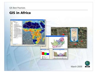
  • 2. Table of Contents What Is GIS? 1 Global Dialogues: GIScience and Sustainable Development in Africa 3 Cape Town's Emphasis on Systems Integration Exemplifies "Smart City" Goals 7 Early Warning Planning for Mosquito-Borne Epidemics 13 Planning Education Projects in Rural Ethiopia Using GIS 17 Nigerian Voting System Modernized 21 Helping Elephants Across the African Continent with GIS 25 South African Educators Teach GIS—With or Without Computers 31 Ghana Project Leverages GIS-Based Title Registration and Microfinance to Alleviate Poverty 39 i
  • 3. What Is GIS? Making decisions based on geography is basic to human thinking. Where shall we go, what will it be like, and what shall we do when we get there are applied to the simple event of going to the store or to the major event of launching a bathysphere into the ocean's depths. By understanding geography and people's relationship to location, we can make informed decisions about the way we live on our planet. A geographic information system (GIS) is a technological tool for comprehending geography and making intelligent decisions. GIS organizes geographic data so that a person reading a map can select data necessary for a specific project or task. A thematic map has a table of contents that allows the reader to add layers of information to a basemap of real-world locations. For example, a social analyst might use the basemap of Eugene, Oregon, and select datasets from the U.S. Census Bureau to add data layers to a map that shows residents' education levels, ages, and employment status. With an ability to combine a variety of datasets in an infinite number of ways, GIS is a useful tool for nearly every field of knowledge from archaeology to zoology. A good GIS program is able to process geographic data from a variety of sources and integrate it into a map project. Many countries have an abundance of geographic data for analysis, and governments often make GIS datasets publicly available. Map file databases often come included with GIS packages; others can be obtained from both commercial vendors and government agencies. Some data is gathered in the field by global positioning units that attach a location coordinate (latitude and longitude) to a feature such as a pump station. GIS maps are interactive. On the computer screen, map users can scan a GIS map in any direction, zoom in or out, and change the nature of the information contained in the map. They can choose whether to see the roads, how many roads to see, and how roads should be depicted. Then they can select what other items they wish to view alongside these roads such as storm drains, gas lines, rare plants, or hospitals. Some GIS programs are designed to perform sophisticated calculations for tracking storms or predicting erosion patterns. GIS applications can be embedded into common activities such as verifying an address. From routinely performing work-related tasks to scientifically exploring the complexities of our world, GIS gives people the geographic advantage to become more productive, more aware, and more responsive citizens of planet Earth. GIS BEST PRACTICES 1 WWW.ESRI.COM
  • 4. Global Dialogues: GIScience and Sustainable Development in Africa "Crossing Borders" A column by Doug Richardson, Executive Director, Association of American Geographers The Association of American Geographers recently had the opportunity to participate with hundreds of African geographers, GIScientists, and environmental scientists in a new dialogue around the theme of Geospatial Science and Sustainable Development in Africa. These discussions, which were initiated in March 2008 and have already generated several promising new areas of research and educational collaboration, were sponsored by the U.S. Department of State's Global Dialogues on Emerging Science and Technology (GDEST) program. Follow-on activities and continuing interactions resulting from these dialogues have the potential to generate considerable ongoing and long-term cooperation among African and U.S. scientists in geographic research, geographic information science (GIScience) education and GIS applications, sustainability science, and many related fields. Five other GDEST programs also have been undertaken, including dialogues in Japan (focusing on nanotechnologies), China (biotechnology), and Germany (quantum computing). However, the recent Africa GDEST program is the first to be initiated on a continental scale and the first to address geography-related research fields, such as geospatial science and sustainability. The Global Dialogues on Emerging Science and Technology program focusing on Geospatial Science and Sustainable Development in Africa began in March 2008 with site visits to universities, governmental ministries, and nongovernmental organizations in nine African countries, followed by a conference on the same theme in Cape Town, South Africa. The U.S. delegation was divided into two teams, East Africa and West Africa, and included members from the U.S. Department of State Humanitarian Information Unit and its Bureau of Oceans and International Environmental and Scientific Affairs, as well as representatives GIS BEST PRACTICES 3 WWW.ESRI.COM
  • 5. from other U.S. governmental agencies, several U.S. universities, the American Geographical Society, the Association of American Geographers, and the United States Agency for International Development (USAID) regional offices. The teams conducted more than 50 site visits and met with hundreds of African experts in the fields of environmental remote-sensing interpretation and modeling, GIS cartography and analysis, agriculture, education, health, surveying, mining, climate, hydrology, population, urban systems, and information and communication technology. Care was taken to listen to and learn from our African colleagues, to identify needs rather than prescribe solutions, to build upon existing regional capacity in geospatial science and technology rather than duplicate or displace it, and to explore opportunities for collaboration between U.S. and African scientists and institutions, as well as among African organizations and networks, in ways identified as useful to scientists, educators, and governmental agencies from the region. It was clear from both the country visits and the conference that significant progress has been achieved since the 2002 World Summit on Sustainable Development in terms of the diffusion and sophistication of geospatial technologies, applications, and coordination, both regionally and in individual countries, and their use in sustainable development planning and program implementation. Despite progress, however, optimal use of geographic information science and associated technologies is often constrained by a lack of resources, a lack of access to suitable data, and a lack of coordination among users and data producers. Among other topics, GDEST participants particularly sought to promote future dialogues that would identify partners for collaboration on specific projects or programs; make better use of collaboration among U.S. and African scientists and practitioners to create a sustainable critical mass of African expertise; support regional and indigenous educational and institutional infrastructures; and develop educational and research collaborative mechanisms, including faculty and student exchange programs, online interactions, and better access to research and curricular information. The AAG currently is implementing some of the above resource sharing and online interactive coordinative mechanisms through its new subsidized Developing Regions Membership Program and through the existing AAG Center for Global Geography Education programs. Also important to sustaining collaboration is supporting existing African networks of excellence and platforms for dialogue, information sharing, and communication. For example, African MARCH 2009 4 GIS IN AFRICA
  • 6. networks of excellence, such as the African Association of Remote Sensing of the Environment (AARSE), African Geo Information Research Network (AGIRN), African Reference Frame (AFREF), Environmental Information Systems Africa (EIS-AFRICA), Mapping Africa for Africa, and university networks (e.g., University Network for Disaster Risk Reduction in Africa [UNEDRA]), are vital infrastructures of communication and coordination for research, education, and applications collaboration. Descriptions of and linkages to these and many other existing African networks can be accessed directly through the AAG Web site at www.aag.org/ developing. The U.S. GDEST delegation representatives, both individually and in coordination with U.S. embassies in the countries visited, are currently following up on contacts and acquaintances made during the site visits and will be continuing discussions on specific projects for which opportunities for partnerships and collaboration were identified. A report on the African GDEST program's progress and findings is under development and will be made available in the near future. I would like to thank Lee Schwartz, director of the Office of the Geographer and Global Issues at the U.S. Department of State, together with Nina Fedoroff and Andrew Reynolds of the Office of the Science and Technology Adviser to the Secretary of State, for providing key leadership and logistical support essential to the success of the African GDEST program. Most importantly, on behalf of all of the participants, I would like to express our deep appreciation to our African colleagues for the opportunity to learn from them during these dialogues and for their insight and guidance on how to sustain ongoing interactions and useful collaborative activities in the years ahead. More information on African geography and GIS research, education, and sustainable development activities, as well as collaborative needs and opportunities, is available and updated regularly on the AAG Web site (www.aag.org). (Reprinted from the Spring 2008 issue of ArcNews magazine) GIS BEST PRACTICES 5 WWW.ESRI.COM
  • 7. Cape Town's Emphasis on Systems Integration Exemplifies "Smart City" Goals Highlights ERP and GIS optimize city's entire business processes through seamless IT integration. System is recognized as one of the world's largest local government ERP systems. City realizes substantial savings. In 2001, seven neighboring local authorities were amalgamated into the City of Cape Town in the Republic of South Africa with the intention of consolidating and streamlining municipal services across the Cape Town metropolitan area. As a result of this massive restructuring process, the City of Cape Town, with a population of approximately 3.2 million, immediately became responsible for managing a number of antiquated, stand-alone information management systems holding disparate data in at least seven different IT centers across the new city. Integrating its existing legacy systems into a seamless IT infrastructure became a top priority for the city. Committing itself to a holistic and comprehensive "smart city" strategy, the IT department initiated a number of projects to address the standardization of Information and Communications Technology (ICT) architecture and connection of constituent parts to enable a better flow of information among the departments and more efficient services for the city's residents. Key to the success of the smart city strategy was the implementation of the enterprise resource planning (ERP) system, which saw approximately 113 legacy systems and 70 interfaces replaced with a single functionally rich SAP solution designed to standardize and optimize the city's entire business processes. Recognized as one of the world's largest ERP systems ever implemented by a local government, it deploys SAP's Industry Solution for Utilities as the billing system to help streamline the revenue process and integrate these into the ERP back-office and CRM processes. GIS BEST PRACTICES 7 WWW.ESRI.COM
  • 8. SAP is linked to GIS to extract monthly maintenance costs of water bursts in the Khayelitsha service area. Bursts have been captured with mobile GIS devices. Next, the city integrated a GIS into the information system infrastructure. While GIS technology was used throughout the various local councils prior to the amalgamation, it functioned primarily as stand-alone systems with little standardization and limited compatibility. To reform this particular legacy, Cape Town implemented an enterprise GIS based on the ArcGIS platform. This allowed extensive functionality within a multiuser environment and provided an effective spatial data management platform for its many users. Initially, the city concentrated on consolidating electricity and property geodatabases into the GIS and subsequently added the Water Services geodatabase to the GIS process. Since then, a number of other departments, such as Planning and Valuations, have started implementing GIS technology. ArcGIS was successfully implemented in participating departments as the city focused on integration issues, such as user profiles, as well as standardized data capturing and maintenance of departmental geodatabases. MARCH 2009 8 GIS IN AFRICA
  • 9. Cape Town's Water Services proved to be the ideal utility from which to continue its GIS integration initiatives. South Africa is located in a semiarid region without significant perennial rivers or lakes, and this reality requires extensive conservation and water control measures. The City of Cape Town also experiences a 3 percent annual growth in its population, placing an even greater strain on the city's limited water resources. Given these constraints, GIS provides one of the best possible means to collect, analyze, and model spatial data for optimization of water conservation and demand strategies. The implementation of SAP enabled the city to establish an effective link between the system's business information capabilities and its location-based asset information, such as pipes, meters, reservoirs, treatment plants, and associated attribute data stored in GIS. By taking advantage of this linkage, Cape Town is now able to extract the monthly maintenance costs for incidents, such as burst pipes and sewer blockages, as well as to evaluate water consumption patterns based on tariff structures. This shows the percentage of capital budget allocation spent for 2006 per selected wards. The data originates from SAP Business Warehouse. GIS BEST PRACTICES 9 WWW.ESRI.COM
  • 10. There is also a link to the asset register, which is a model that runs against the GIS infrastructure geodatabase and is used to calculate solutions, such as the life span of the various parts and components of the Water Services infrastructure. GIS can, therefore, be used as a tool to plan medium- and long-term budgeting of infrastructure projects, such as replacing pipe infrastructure due to increased population demands or end of life cycle redundancy. Next, the city will apply the lessons learned from the Water Services implementation to the development of a sewer and storm water geodatabase. Currently, the existing ArcEditor/ArcInfo tools are utilized for multiuser editing in eight district offices, but the long-term vision is to develop a customized editing tool within the ArcGIS Server environment. By developing a common data model for GIS use throughout the city, the City of Cape Town has realized substantial savings in its operations and developed a GIS that promotes data sharing while minimizing data redundancy. The overall strategy is to implement a GIS completely integrated with the city's enterprise-wide information architecture and infrastructure, providing support to the city's private citizens and its local business community. The Water Services Department has also implemented a Technical Operations Centre (TOC) that interfaces with the Corporate Call Centre to initiate operational responses and manage event tracking and logging. Currently, the Water Services Department is evaluating the available technology and interfacing options to develop a fully automated, spatially enabled event management system (EMS), defining an event as any operational activity requiring a response. The EMS would be used to monitor and support the responsibilities of the city's employees to increase their efficiency. For example, the EMS would automatically record the exact location of an event occurring in the city and analyze it to determine its impact on the surrounding area. Using location as a reference, the system would then identify assets the city has at any particular location and dispatch work crews to respond to the event. Workflows developed within the EMS will allow the city to define and manage its standard operating procedures to support the EMS. The workflows would analyze the system's automated response to an event and escalate the response to a higher level, demanding greater urgency, if required. According to Pieta Le Roux, former GIS coordinator for the city's Water Services Department, because events will be spatially referenced, engineers will be able to interpret trends and patterns visually, which will allow them to be proactive in their response to events. In addition, the TOC will coordinate responses to water/wastewater emergencies by integrating the notification and work order processes of SAP with mobile GPS/GIS and communication technologies. This integration will allow the city's supervisory control and data acquisition MARCH 2009 10 GIS IN AFRICA
  • 11. (SCADA) and telemetry systems' alarm components to be part of the central IT network and information infrastructure for quicker response to any malfunctions or anomalies occurring within the city's utility networks. Le Roux further states that the City of Cape Town has a mature GIS, which is commonly viewed as central to the city administration's plans for a tightly integrated and service-oriented IT architecture, supported by a modern infrastructure, for seamless enterprise information management capability. The GIS production and geodatabase server environments form a major part of this integration process. Commenting on the future, Le Roux says, "Cape Town will be implementing strategies and processes toward the transactional integration of GIS and SAP to provide the necessary life cycle views and real-time feedback of their asset maintenance environment." (Reprinted from the Winter 2007/2008 issue of ArcNews magazine) GIS BEST PRACTICES 11 WWW.ESRI.COM
  • 12. Early Warning Planning for Mosquito-Borne Epidemics GIS, High-Resolution Remote Sensing Help Evaluate Degrees of Risk in Senegal By Yves M. Tourre, Delphine Fontannaz, Cécile Vignolles, Jacques-André Ndione, Jean-Pierre Lacaux, and Murielle Lafaye Highlights GIS tools and remote sensing were used to detect potential breeding ponds. In situ observations validated the indexes. Using ArcView, researchers calculated mosquito density and evaluated cross-potential risks Fifty years of successful efforts in the prevention and control of infectious diseases and epidemics have inspired confidence and optimism in modern medicine and technology. Nevertheless, epidemics remain a conspicuous challenge to public health today. In the context of climate change and rapidly increasing population, some epidemics are even reemerging. A false-color composite of a 10 m SPOT 5 image (left) and ENVI 4.3 software were used to obtain a new pond index (NDPI). From the NDPI, ponds (in blue) were precisely located (center and right). The 500 m zone potentially occupied by mosquitoes (ZPOM) is shown in orange. GIS BEST PRACTICES 13 WWW.ESRI.COM
  • 13. For example, the Ferlo region in Senegal, Africa, became prone to Rift Valley fever (RVF) in the late 1980s when virus-carrying mosquitoes Aedes vexans and Culex poicilipes appeared. The latter species proliferate near temporary ponds and neighboring humid vegetation. RVF epizootic outbreaks in livestock cause spontaneous abortions and perinatal mortality. So far, human-related disease symptoms are often limited to flu-like syndromes but can include more severe forms of encephalitis and hemorrhagic fevers. As a result, local socioeconomic resources can be seriously affected. Professor P. Sabatier at the University of Grenoble indicated that this growing threat created an urgent need for a local early warning system (EWS) for RVF epidemics in Senegal. The goal was to use specific GIS tools and remote-sensing images/data to detect potential breeding ponds and evaluate RVF diffusion and areas with potential risks. Project Description and Preliminary Methods MEDIAS-France implemented the RVF project in the Ferlo region under the auspices of the French Spatial Agency (Centre National d'Etudes Spatiales). MEDIAS-France is a nonprofit corporation that coordinates research groups studying global environmental issues in areas including the Mediterranean Basin and subtropical Africa. In the Ferlo region, the abundance of mosquitoes is linked to rainfall, ponds and their turbidity, and the presence or absence of vegetation in ponds (e.g., water lilies, wild rice). Initially, Environment for Visualizing Images (ENVI) 4.3 imagery processing software from ITT Visual Information Solutions was used for spectral analysis of high-resolution (~10 m) SPOT 5 images to locate the ponds. First, image registration tools were used to warp the images to match and implement relative georeferencing for all SPOT 5 images collected, with further adjustment to minimize spatial errors. Then, new indexes were obtained by using the classic Normalized Difference Vegetation Index (NDVI) transform tool to allow the combination of different spectral bands (such as the middle infrared [MIR] and the near infrared [NIR] red and green bands). The Normalized Difference Pond Index (NDPI) allowed detection of all ponds; the Normalized Difference Turbidity Index (NDTI) allowed the evaluation of water transparency or turbidity. In situ observations by participants from the Center for Ecological Monitoring (Centre de Suivi Ecologique) in nearby Dakar validated the indexes using GPS and GIS. MARCH 2009 14 GIS IN AFRICA
  • 14. Using these methods, small ponds were located with precision, making it further possible to map RVF risks from zones potentially occupied by mosquitoes (ZPOM) following recent studies from entomologists on flying ranges and spatial distribution of mosquitoes. ArcView conversion, data management, and analysis tools enable the display of an improved three-zone ZPOM for potential Rift Valley fever risks. The very high-risk zones are red-hatched to identify underlying pond limits. GIS Methods GIS BEST PRACTICES Further refinement and simplification were needed, however, because of the complexity of the pond distribution and to develop an effective usage strategy for local health information services. Researchers wanted to identify degrees of risk from isolated and/or clustered ponds, calculate the target risk coverage area, and evaluate risk by mosquito density in overlapping zones. 15 WWW.ESRI.COM
  • 15. Because of researcher Delphine Fontannaz's GIS expertise and the availability of new detailed information in the zones, the GIS approach became an obvious solution for the team. Using ArcView software and tools (e.g., conversion and data management for spatial projection and transformation, as well as overlay and proximity vector data analyses), maps obtained from SPOT 5 10-meter multispectral resolution imagery were first transformed into appropriate formats, then converted from raster to vector formats. The georeferencing accomplished through universal transverse Mercator (UTM) WGS 1984 for zone 28N permitted further comparison and processing. The initial ZPOM was first divided into three bands chosen for defining risk levels for potential virus transmission by Aedes vexans. Then, using ArcView software, researchers calculated mosquito density and evaluated cross-potential risks. They noted that zones with very high and high risks were inhabited by potential reservoirs, i.e., carriers (snakes, frogs, and toads), of the RVF virus and produced an improved ZPOM. Results The analyses using GIS technology allowed researchers to see that risks increase when ponds are close to each other. Using GIS technology, researchers created a new, more detailed, and more useful ZPOM. GIS tools provided new products and information for use by local early warning systems in the prevention of disease. Future Applications This technique might be improved by adding digitized ecological zone layers. Multidisciplinary users can benefit from this data by using it to choose strategic positioning of villages and parks according to RVF risks. This new methodology is also being transferred to other teams in Africa for varied types of mosquito vector research. About the Authors Tourre, Fontannaz, Vignolles, and Lacaux are affiliated with MEDIAS-France, Toulouse, France; Ndione is affiliated with the Centre de Suivi Ecologique (CSE), Laboratoire de Physique de l'Atmosphère et de l'Océan, Université Simon Fongang, Dakar, Senegal; and Lafaye is affiliated with the Centre National d'Etudes Spatiales (CNES), Toulouse, France. (Reprinted from the Spring 2008 issue of ArcNews magazine) MARCH 2009 16 GIS IN AFRICA
  • 16. Planning Education Projects in Rural Ethiopia Using GIS Highlights GIS technology maximizes the number of children reached. IRC Ethiopia has gained new insight into its development and relief programs. Success with ArcView software has led IRC Ethiopia to expand GIS into almost every project it undertakes. Every day, millions of rural children in Ethiopia do not attend school. Instead, they work on farms; dig in mines; or perform strenuous household tasks, such as gathering firewood or fetching water, which together can take several hours each day. For them, education is out of reach, both because poor families require the additional income and because many areas lack elementary schooling altogether. Beginning in 2005, the United States Department of Labor funded the International Rescue Committee (IRC) to build schools and train teachers for community Alternative Basic Education (ABE) schools, which would serve as institutions to transition children from the labor force into more formal educational institutions, such as primary schools. Simultaneous community awareness and education programs promoted the benefits of education and encouraged families to send their children to school. In implementing the project, IRC wished to use the funding as effectively as possible. The first task was to locate each new ABE school within walking distance of as many out-of-school children as possible. Second, because the ABE program is designed to prepare children for more formal schooling, it was decided that each new ABE school should be within two kilometers of a formal primary school so that graduates of the ABE program could easily transfer to the formal school system. One further constraint on the program was that proposed school sites should be relatively near main roads in order to facilitate the construction process and program monitoring. GIS BEST PRACTICES 17 WWW.ESRI.COM
  • 17. Map of villages in Boke Woreda, Ethiopia, that displays the number of out-of-school children in each village. Maps such as this were used to site new Alternative Basic Education schools/centers near the most potential students and near extant primary schools in the area. Based on this analysis, Qeelee was chosen as the site for a new school. The Ethiopian Education Office lacks the infrastructure and funding to maintain information on primary school locations, village school age populations, and distances between schools and village populations. Low-level road maps are also not available for most rural districts. The IRC Ethiopia program therefore had to build its geographic database from the ground up. Behar Hussein, the IRC Ethiopia GIS coordinator, trained eight people in the use of Garmin eTrex Vista GPS units to aid in the survey of 491 villages. The surveyors used Garmin eTrex Vista GPS for the survey. While four of the eight surveyors gathered geographic data about village boundaries, roads, health centers, water points, and primary school locations, the remaining four gathered demographic data from each village: the number of households, number of children of each MARCH 2009 18 GIS IN AFRICA
  • 18. age, and number of children of each age attending formal schooling. The data took more than 50 days to collect and was cleaned and compiled at IRC's Addis Ababa office. "It was much harder to obtain this data than downloading it," laughs Hussein, who performed the analysis using the office's ArcView program. He focused on children aged 6 to 11 years of age who were not enrolled in formal schools. First, he plotted the number of children not in school in each village; that map displayed several obvious locations for ABE schools that would be in close proximity to large numbers of out-of-school children. Of those locations, not all were within the proposed two kilometers of the nearest primary school. Potential locations were further narrowed down by their access to roads, which were extensively mapped out during the village surveys. IRC constructed ABE schools at 22 sites in each of the four selected rural districts, each site chosen to be close to a large number of children not already enrolled in school. Each ABE school was also within two kilometers of a government primary school, ensuring that the program and its graduates were integrated into Ethiopia's educational institutions. The proximity to usable roads meant that the construction could be carried out in a timely manner and that IRC could easily monitor the progress and enrollment at each ABE site. Following the construction of the 22 ABE schools and with continued funding from the U.S. Department of Labor, there are currently 4,120 children enrolled in the Alternative Basic Education program and preparing to enter more formal schooling. The program is currently expanding enrollment to vocational training for older youth. By enabling these children to further their education instead of laboring, the program improves their individual economic opportunities while simultaneously furthering the development of Ethiopia as a whole. The obvious utility of ArcView analysis in this project's success means that IRC Ethiopia has expanded GIS into almost every project it undertakes, from developing project proposals to coordinating activities with other international organizations and from planning the sites of health centers to building new water points in refugee camps. IRC Ethiopia's extensive use of GIS has given it new insight into how and where to implement its development and relief programs. "I think this is just a great example of efficient planning during project implementation," says David Murphy, the country director for IRC Ethiopia. "We used GIS tools to maximize the number of children reached by our program, ultimately putting our funding to its best use." (Reprinted from the Spring 2008 issue of ArcNews magazine) GIS BEST PRACTICES 19 WWW.ESRI.COM
  • 19. Nigerian Voting System Modernized GIS Prevails Despite Unnavigable Terrain and Political Unrest Highlights 120,000 polling locations are inventoried and spatially located. System helps ensure free and fair elections in Nigeria. GIS is used for map production and redistricting. Nigeria, one-third larger than Texas in area and the most populous country in Africa, is located on the Gulf of Guinea in West Africa. It is bordered by Niger and Chad to the north, Cameroon to the east, and Benin to the west. The lower course of the Niger River flows south through the western part of the country into the Gulf of Guinea. Swamps and mangrove forests border the southern coast, while inland are hardwood forests. The project was carried out in three phases: development of the data collection application, field data collection and editing, and development of the Polling Unit GIS application. GIS BEST PRACTICES 21 WWW.ESRI.COM
  • 20. The Independent National Electoral Commission (INEC) is a nonpartisan Nigerian government agency charged with the conduct and supervision of elections. In the late 1990s, the agency began modernizing its information technology infrastructure by migrating from an outdated legacy voting system heavily dependent on inaccurate paper records and polling cards to the newer Electronic Voting System (EVS). At the heart of EVS is the Electronic Voter Register (EVR), which, by capturing the names of all eligible voters, eliminates duplication and thereby minimizes discrepancies in the electoral process. As such, EVR is viewed as a means of ensuring free and fair elections in Nigeria. As part of the modernization process, INEC needed to inventory and spatially locate the agency's 120,000 polling locations scattered around the country. These locations and their attributes needed to be linked to EVR. MARCH 2009 22 GIS IN AFRICA
  • 21. GIS technology was identified as a potential solution to the problem, and TTi Limited (formerly Adorbel Ltd.)—a consultant responsible for the field data collection and project management for INEC—subcontracted to ESRI Business Partner Geo-Imaging Consulting of Washington, D.C., to design and implement a Polling Unit (PU) GIS. Geo-Imaging proposed integrating GPS, digital photography, and DBMS technologies to create a data collection tool capable of capturing the x,y locations and images of existing polling units. Since the client's budget constraints precluded the purchase of COTS GIS software, the use of an industry-standard development environment to create an application with GIS/mapping capabilities was also proposed. The application would then be linked to EVR. The project was carried out in three phases: development of the data collection application, field data collection and editing, and development of the Polling Unit GIS application. The data collection equipment comprised 40 Dell laptops, Trimble Navigation GPS units, USB drives, and digital cameras. Each laptop was preloaded with a Microsoft Access database containing polling unit information from EVR. Using Trimble Software Development Kit, the GPS unit was customized to interface with the Microsoft Access application, allowing for the capture of each polling unit's x,y location and image directly into the Access database. For the data collection exercise, the country was divided into four zones, each with a team of 10 trained field data collectors. At the end of each data collection day, USB drives were used to transfer data from the field laptops to servers in each zone's headquarters, after which the data was periodically transferred to the nation's capital, Abuja. Every week, the Abuja data was consolidated and transferred to Geo-Imaging's Washington, D.C., office where ArcGIS Desktop was used to convert and edit it. Mock registration areas (proposed third-level administrative boundaries) were digitized based on certain attributes of the polling unit data. The PU GIS, a MapObjects software-based application developed using Visual Basic, displayed polling unit locations within two levels of administrative boundaries (state and local government areas) and the proposed registration areas. Apart from displaying data, the application also displays a given polling unit's image when it is identified. Users can also create simple GIS queries using the application, which is a client to an ArcSDE 9.2/Oracle DBMS. GIS BEST PRACTICES 23 WWW.ESRI.COM
  • 22. During the course of the project, INEC commissioners visited Washington, D.C., for PU GIS end user training, as well as introductory GIS courses from ESRI. The final training session was carried out in Abuja after the testing and acceptance of the application. The audience at this session comprised largely the proposed end users. Nigeria's Information and Communications Technology (ICT) Department established a wellequipped GIS lab on INEC's LAN and now uses PU GIS for departmental map production and future administrative boundaries redistricting decision support. The application is also used to generate reports and carry out analysis on voter distribution. ICT offers day-to-day support for end users of the application. (Reprinted from the Summer 2007 issue of ArcNews magazine) MARCH 2009 24 GIS IN AFRICA
  • 23. Helping Elephants Across the African Continent with GIS With adults measuring up to four meters high and usually weighing more than six tons, African elephants are the world's largest land mammals; yet in all their magnificence, their history is tainted by a constant battle for survival. Poaching, the most recent of the species' troubles, is estimated to have decreased the African elephant population from 1.3 million in 1970 to just 600,000 by 1989. However, research conducted at the University of Southampton, England, is revealing a brighter future. Elephant family group, Botswana, 1998 (photo courtesy: Martin Shipton). GIS BEST PRACTICES 25 WWW.ESRI.COM
  • 24. Over the last century, the human population on the African continent has dramatically expanded and subsequently sprawled into previously uninhabited areas. This has meant elephants and people have increasingly come into direct contact as their spheres of influence overlap. Consequently, conflict between humans and elephants has also increased as each species brings about land-cover changes undesirable to the other. As such, environmentalists have long recognized the need to manage this developing human–elephant interactivity. However, much of this management has focused on a local or, at best, regional scale. While seemingly effective, it neglects the holistic dynamics of the problem and often just transfers the trouble elsewhere. A pioneering new approach to resolve this predicament is emerging from work conducted over the past year by Matthew Shipton, a researcher at the University of Southampton. The result of this work is the Human– Elephant Interaction Model (HEIM) that predicts the spatiality of human– elephant conflict across the entire African continent. While the results do not have the spatial resolution of more local studies, they have revealed previously unknown trends that can be Model prediction of combined human constraints. directly traced back to land management policies. The model also acts as a decision support system, leading those in authority to make decisions that will be effective on a long-term basis. For example, HEIM can provide a list of the most suitable relocation sites for specific problem herds, which can only be done with a model of significant geographic scope since elephant ranges span up to 500 square miles. MARCH 2009 26 GIS IN AFRICA
  • 25. HEIM is constructed in ArcView since it requires a wide range of geostatistical and spatial analytical tools to form the foundation of the spatial modeling and geoprocessing operations that are at its core. The ArcGIS Spatial Analyst extension was used in the development of the model, which is based on two datasets, both of which are primarily sourced from the American Geological Institute's Global GIS Database: Africa CD-ROM. The first dataset is a series of 12 carefully selected variables that attempt to outline the environmental characteristics of elephant ranges. This data ranges from remotely sensed normalized difference vegetation index calculations to slope maps to those detailing the distance to the nearest permanent water source. The second dataset is slightly larger (15 variables) and contains information on the human constraints that are imposed on an area's environmental suitability for elephant habitation. For example, this dataset includes data on human population density; land mine risk; and the location of national parks, major roads, and various industrial activities, including data on sustainable farming of both a pastoral and agricultural nature. The variables in these datasets are independently weighted by a multiplicative matrix. This accounts for the varying magnitudes and intensities of the variables' impacts on elephant habitation. Moreover, because the variables are not all from the same source and the data they contain is collaborated in different ways, the matrix also gives some weight with regard to the accuracy, quality, completeness, age, and longevity of the data. Finally, the variables are calibrated with data from the African Elephant Status Report (2002), which was provided by Distance to permanent water. the African Elephant Specialist Group. Known as "model fitting," this process emphasizes the importance of those variables that statistically best describe the actual distribution of elephants across Africa. GIS BEST PRACTICES 27 WWW.ESRI.COM
  • 26. The two datasets are then separately combined with the raster calculator function in ArcView using the ArcGIS Spatial Analyst extension to create two base images: one shows the suitability of the African environment to elephant habitation and the other shows the severity of human constraints that limit elephant habitation. These images are then overlaid, again using the raster calculator, in a way that does not bias the greater number of variables in the human constraint dataset, to create an image that predicts the spatial distribution of elephants across the whole continent (assuming that elephants occupy the areas that have the most suitable physical environment and the lowest level of human activity). This image is then correlated with the data from the African Elephant Status Report on the actual distribution of elephants as a form of model validation, giving an idea of the accuracy of the model's output. Once this is found to be acceptable, the severity of human–elephant conflict across Africa is calculated within specific error margins. This is done by again combining the two base images in ArcView but this time with the human constraints inversely scaled so the output gives the highest values to areas environmentally suitable for elephants with high levels of human activity. As a final form of model validation, ground control points were chosen across this image. These then had their relative level of human–elephant Model prediction of human-elephant conflict. conflict confirmed or refuted through field observations by the charitable organization Living With Elephants and the Department of Geography and Environmental Sciences at the University of Zimbabwe. MARCH 2009 28 GIS IN AFRICA
  • 27. With the data collected, a final step was then taken to analyze the overall condition of the African elephants' range. This was done by reclassifying the predicted elephant distribution and actual distribution into 10 natural breaks. The raster calculator was then used to identify where the predicted value exceeded the actual value (overpopulated), where it was beneath the actual value (underpopulated), and where the two were equal (a population in equilibrium). This provides a further tool for environmental managers, since knowing the degree to which an environment is stressed has numerous significant consequences on the way it is managed. The model has been extensively tested and compared to proven ground data. The wealth of information contained within the model is now being analyzed so it can be used to further the effectiveness of conventional management projects. This analysis will provide a basis from which stakeholders can get a preliminary overview of the impact of specific management decisions. Moreover, it is desired that the model's spatial predictions of human–elephant conflict will be used as a foundation for national and intergovernmental strategic and tactical decisions regarding preemptive management to quell potential conflict zones—ultimately leading to a better life for African elephants. (Reprinted from the Spring 2005 issue of ArcNews magazine) GIS BEST PRACTICES 29 WWW.ESRI.COM
  • 28. South African Educators Teach GIS—With or Without Computers Huge Differences Exist Between Urban and Rural Schools Highlights Department of Education includes GIS in secondary/senior school curriculum. "Paper GIS" was developed for schools lacking computer resources. ArcExplorer and ArcView are provided to schools with computer access. The South African National Department of Education included GIS in the curriculum for the first time in 2006. The introduction of GIS is taking place as a phased approach over the last three years of secondary/senior school. South Africa is divided into nine provinces, each with its own Provincial Department of Education. The Provincial Departments are overseen by the National Department, which is responsible for strategy and implementation, as well as training of senior curriculum advisors. It The paper GIS targets those schools with no computer access at all. is, however, up to the Provincial Departments to ensure that all schools are introduced to GIS via the curriculum advisors in their respective provinces. The inclusion of GIS was met with apprehension by the educators, as most of them had not heard of GIS and there was a lack of skills for imparting this knowledge to the students. GIS BEST PRACTICES 31 WWW.ESRI.COM
  • 29. Huge differences exist between schools in the rural and urban areas with rural schools lagging behind in resources, such as well-qualified teachers and access to electricity, infrastructure, and funding. These limitations needed to be addressed when material was being developed. Day 2 introduced computers and ArcExplorer, and on day 3, the curriculum advisors were trained to use ArcView. MARCH 2009 32 GIS IN AFRICA
  • 30. The government relied heavily on the private sector to facilitate the introduction of GIS. GIMS (Pty) Ltd. (the ESRI distributor in South Africa) took the initiative to assist and approached former geography teachers and other key people to guide the development of educational material. Complete GIS materials were developed to address the full spectrum of GIS educational needs in the Department of Education. The new GIS school materials include three separate approaches corresponding to the fundamental steps for learning GIS: namely, paper GIS, ArcExplorer, and ArcView. Seasonal Rainfall in South Africa. All materials are based on ESRI technology and terminology, as they provide the most appropriate and cost-effective GIS software tools to deal with the various levels of resources available to schools. GIS BEST PRACTICES 33 WWW.ESRI.COM
  • 31. Scenic visuals of tourist attractions in South Africa. The paper GIS was developed in collaboration with the Department of Land Affairs and the University of Pretoria. Paper GIS targets schools with no computer access. ArcExplorer satisfies the needs of schools that have limited access to computers (a single computer in a school), and ArcView addresses all GIS requirements that might be needed for schools with access to computers. Included with all three is fundamental training, covering the basics of GIS theory and relevant software knowledge. MARCH 2009 34 GIS IN AFRICA
  • 32. Three-Day Training Course At the beginning of the year, curriculum advisors countrywide were flown or driven to GIMS's Midrand offices to attend a GIS training course. As curriculum advisors have schools with different levels of computerization under their supervision, the National Department of Education decided to expose curriculum advisors to all three—paper GIS, ArcExplorer, and ArcView. Approximately 100 curriculum advisors attended the three-day training over a period of three weeks. Day 1 saw the facility transformed into a training center for schools with no GIS computer facilities. Curriculum advisors were given a simple GIS task to complete with the aid of maps (courtesy of the Department of Land Affairs), crayons, and tracing paper. The task involved searching for the best location to evacuate residents in the event of a flood. This paper GIS proved very important for teaching conceptual issues of GIS before moving to the computer. Cross-section from George to Prince Albert, showing the relationship between elevation and rainfall. "The most important thing I learned was how to help my poorer schools—those without computers—to do GIS," says Ntobe Peter Ndima, senior education specialist, Nkangala region, Mpumalanga. "I am happy they will not be left behind." GIS BEST PRACTICES 35 WWW.ESRI.COM
  • 33. Day 2 saw the introduction of the computer and ArcExplorer, and for some, this was their first experience working on a computer. The lessons were basic enough to eliminate the fear of the machine. On day 3, the curriculum advisors were trained to use ArcView, helping them better teach geography where there is computer support. ArcView allows students to design their own research projects and to follow through with the investigation process, eventually producing maps and answering spatial geographic questions. View of Africa showing the plates and incidence of Volcanoes and Earthquakes. MARCH 2009 36 GIS IN AFRICA
  • 34. Praise for the Program "The instructor has assisted us a lot in enabling us to deal with the GIS concepts, which we initially feared; especially the use of computers." —Mr. David Modisane Letlape, Curriculum implementer, Nkangala Region—Mpumalanga "Fears were allayed—there was no difficulty." —Mr. Lungile Silo, Curriculum advisor, Confimvaba District—Eastern Cape "Outstanding basic training. Most useful geographical workshop I've ever attended in my six years as a Curriculum advisor." —Ms. Penelope Liknaitzky, Curriculum advisor, EMDC Central Metropole—Western Cape "First GIS course I enjoyed from day one until day three. The course kept my attention." — Ms. Rozelle Smith, Curriculum advisor, Eden Karoo District—Western Cape "The material prepared for us is excellent to keep one going as far as GIS in schools is concerned." —Ms. Nomabhele Mzimba District, Subject head, Sisonke District—Mpumalanga "The most important thing I learned was that GIS is not something beyond my and many educators' reach. We can do it—given the time to train and practice." —Mr. Wessel Potgieter, Subject advisor: Geography, Teaching and Learning Services, Vryheid—KwaZulu Natal (Reprinted from the Spring 2008 issue of ArcNews magazine) GIS BEST PRACTICES 37 WWW.ESRI.COM
  • 35. Ghana Project Leverages GIS-Based Title Registration and Microfinance to Alleviate Poverty By Peter Rabley, International Land Systems, Inc. Highlights The project was presented to the United Nations Commission on the Legal Empowerment of the Poor. System incorporates ArcGIS functionality to link title information with the digital parcel map. Title and parcel data for loan processing is batched and provided to the ministry. This article is part one of a multipart series. A pilot project under way in the African nation of Ghana seeks to demonstrate the vital role that formalization of landownership can play in helping the poor take a crucial first step away from poverty. Focused on one of the poorest areas in the capital city of Accra, the pilot is leveraging the latest geospatial technologies to create a land titling process and GIS-based land records system where neither existed in the past. Impetus for the Ghana pilot comes from the Clinton Global Initiative (CGI), started by former U.S. president Bill Clinton to challenge some of the world's leading organizations and individuals to make commitments that positively impact global health, poverty, climate change, and education. Accepting the CGI challenge to work toward alleviating poverty was First American Corp., a major title insurance and real estate information provider based in Santa Ana, California. GIS BEST PRACTICES 39 WWW.ESRI.COM
  • 36. Using ILS MultiCadastre, all surveyed schools can be viewed. The ILS document scanning system plug-in allows for documents and images associated with each property to be examined as well. With an extensive background in land titling, Craig DeRoy, then president of First American, embraced the economic theories described by Dr. Hernando de Soto in his acclaimed book The Mystery of Capital. The Peruvian economist is among the first to identify and describe the relationship between the formal recognition of property rights and the fight against poverty. DeRoy saw the CGI challenge as an opportunity to put de Soto's ideas into action. With several partners, DeRoy presented the concept of a pilot project to the United Nations Commission on the Legal Empowerment of the Poor, which seeks to "make legal protection and economic opportunity not the privilege of the few but the right of all." The project received immediate feedback and encouragement from the commission's cochairpersons, Madeleine Albright and de Soto. MARCH 2009 40 GIS IN AFRICA
  • 37. "Government recognition of landownership [through land titling] gives the poor an identity, which yields numerous benefits," says DeRoy. "The land title can ultimately be used as an asset to leverage permanent change in their economic and financial futures." According to de Soto, poor people almost everywhere in the world have one thing in common— the only asset they have is the land they occupy. Unfortunately, very few of these people have ever received any type of legal recognition that the land is theirs, especially in situations where the ownership is informal or based on customary forms of tenure. Without a registered deed, title, or lease, the owner cannot leverage the land as collateral to take out a loan that might be used to start a business or improve the property. From an economic perspective, this untitled land represents trapped capital that could be accessed to stimulate the local financial market with microfinance loans and mortgages. But gaining access to this hidden capital requires the landowners to have formal titles or deeds to their properties. De Soto's research revealed that the benefits of formal landownership extend beyond the monetary value of loans and mortgages and provide another crucial stepping-stone out of the hopelessness of poverty. A land title gives a person an address, often for the first time, which dramatically improves that individual's sense of identity. As a result, the impoverished enjoy a greater feeling of security that their land won't be taken away and that they can improve the property. People with land titles are more likely to put their children in local schools and demand basic services from the government. Despite these benefits, land titling and registration are out of reach for most of the poor. The process itself may be too daunting for governments to implement in poverty-stricken areas where no property mapping has ever occurred. And even in countries where titles and deeds do exist, the procedure may be too complicated, expensive, and time-consuming for low-income people to consider. As a result, the capital remains locked in the land, the local economy suffers, and the poor have no way out of their poverty. GIS BEST PRACTICES 41 WWW.ESRI.COM
  • 38. The ILS DSS system allows for the creation of a paralegal title based on information gathered during the interview process. Assembling the Team First American and CGI clearly understood the benefits of land titling and in 2006 agreed on a commitment for the U.S. company to develop a template for cost-effective, in-country creation and maintenance of a land record system that ensures a means for establishing and holding the legal title to a property. To lead this project beyond the original commitment, DeRoy took early retirement and formed a new company called Corporate Initiatives Development Group (CIDG). "In creating the land record template, the challenge was not in developing it, but in actually implementing it and making it practical," says DeRoy. "There had been much historic debate on the effects of formalizing landownership for the poor, but little had been done to bring these MARCH 2009 42 GIS IN AFRICA
  • 39. theories to market. I believed it could be done if the right individuals and companies could be engaged, leveraging years of experience and intelligence in land and technology issues to put together a process that could be made simple." He sought to extend the CGI commitment to include an in-country pilot implementation. To make the pilot a reality, CIDG assembled a team consisting of International Land Systems, Inc. (ILS), Opportunity International, Trimble Navigation, and ESRI. Each provides a capability vital to the development of a practical land record system: ILS, an ESRI Business Partner in Silver Spring, Maryland, is implementing its commercial off-the-shelf GIS-based land recording and registration system, the key deliverable in the pilot. Opportunity International of San Diego, California, is a nonprofit microfinance lender already active in Africa. Trimble Navigation of Sunnyvale, California, is providing handheld mobile GPS devices that are being used to map the parcels in the field. ESRI is supplying core technology, in addition to managing the land surveying and mapping activities to create a parcel map, for the land registry database through Sambus Company Ltd., ESRI's international distributor in Ghana. Selection of Opportunity International as a partner in the pilot highlights the important role that microfinance can play in the alleviation of poverty through formalized land titling. Historically, microfinance has focused on lending relatively small amounts of money—$50–$500—to individuals for use in starting in-home businesses. A sewing machine, for instance, can allow a woman to make and sell clothing in her neighborhood. Usually based on short-term paybacks, these loans are often made in trust groups so that peer pressure, not collateral, is the incentive for repayment. The result is a repayment rate of more than 95 percent on microfinance loans worldwide. "Microfinance brings capital to these emerging markets in a very responsible way," explains DeRoy. "The creation of micro-entrepreneurs is a proven approach to the transformation of entire communities. In our project, we move microfinance one step further by placing Opportunity International, the microfinance lender, into the position of acting as a trusted broker for its clients seeking land registration. This use of the private sector serves to initiate, simplify, GIS BEST PRACTICES 43 WWW.ESRI.COM
  • 40. and accelerate a process that is often stymied by overwhelming governmental procedures and bureaucracy." In recent years, microfinance lenders have been looking to expand their reach by loaning larger amounts of money for a variety of uses beyond entrepreneurial business, but this type of lending often requires an asset to be offered as collateral. More often than not, these lenders experience the other side of the situation described by de Soto. They want to loan money to the poor, but the only asset is untitled land, which can't be used to secure the transaction. This oft-repeated scenario provided Opportunity International an incentive to facilitate land titling as a means of growing the potential market for its microfinance product offerings. Targeting Ghana's Schools In 2007, the participants chose a very poor area known as Ashaiman on the outskirts of Accra, Ghana, as the pilot location. Ashaiman is home to about 400,000 people in a 40-squarekilometer region where most of the structures can best be described as shacks and shanties. It was considered ideal for the pilot because Opportunity International is actively involved in microfinance there and had already been considering developing loan programs for the hundreds of private schools located in the area. Operation of private schools is a growing business in Ghana, and the owners are seeking funds to build additional facilities and accommodate more students. From a mapping perspective, the schools were appealing for the pilot because the boundaries of their land are usually well defined. The decision was made to target only private schools in the initial pilot, because they presented the best opportunity to demonstrate the mutually beneficial link that can be made between formalized land registration, microfinance, and poverty alleviation. Although the Ashaiman pilot is being conducted in close cooperation with the Ghana Ministry of Lands, Forestry and Mines, the project is relying solely on private funds. In this case, the fees associated with land titling will be rolled into the cost of processing the loan, so there will be no up-front transaction expense for the school operator to register a title. Economies of scale in processing multiple titles are expected to reduce costs significantly as the land registry becomes operational. MARCH 2009 44 GIS IN AFRICA
  • 41. Ghanaian surveyors perform a cadastral survey of the property boundaries as described by the occupant, as well as neighbors. Implementation of the pilot began in March 2008, and land titling had been completed for more than half of the 51 private schools in the pilot zone by August. This adjudication process, which will be described in technical detail in subsequent issues of ArcNews, involves surveying the school property with GPS-based mobile GIS equipment, creating a legal description of the land, and collecting property ownership information from the school operators and neighbors via personal interviews conducted by members of the local team. Each school owner has sought to become part of the land registration pilot and actively participated in the required procedures as part of the loan processing. GIS BEST PRACTICES 45 WWW.ESRI.COM
  • 42. As the interviews and fieldwork are completed, ILS is uploading the data into its parcel-based MultiCadastre package, an off-the-shelf product that incorporates ArcGIS functionality to link the title information with the digital parcel map. This system is already managing the entire title registration process and workflow in a fully automated environment. For the pilot phase, this system will be maintained at the Sambus office and will generate paralegal land titles that will be provided to the participating schools for use in securing private loans. The term paralegal title is used to indicate that the titling process has been initiated for acceptance by the private sector to jump-start microfinance activities. This commitment from the private sector is designed to give the government of Ghana the confidence to use the paralegal titles as the starting points for official title processing in the public land registry. While the overall aim of the Ghanaian project is to continue to rely on private-sector entities to perform the land surveying and title recording work in support of microfinance work, participants are simultaneously assisting the government in modernizing its land titling and cadastral capabilities with many of the same GIS-based systems being implemented in the pilot. All title and parcel data collected for loan processing is batched and provided to the Ministry of Lands for its own land registry, which the team believes will be among the world's most technologically advanced. According to DeRoy, this project demonstrates the true effect of what is called the "leapfrog factor." Given the rapid pace of technology development, those who come to implement a system of land registration today and are not burdened with existing infrastructure or bureaucracy can gain the maximum benefit from streamlined and cost-effective new processes while leveraging proven solutions. "It is terrific that microfinance has matured to the point of being accepted as a traditional banking solution for the emerging markets of the world," says DeRoy. About the Author Peter Rabley is president of International Land Systems, Inc., with more than 20 years of experience designing and implementing land information systems around the world. (Reprinted from the Fall 2008 issue of ArcNews magazine) MARCH 2009 46 GIS IN AFRICA
  • 43. Copyright © 2009 ESRI All rights reserved. Printed in the United States of America. The information contained in this document is the exclusive property of ESRI. This work is protected under United States copyright law and other international copyright treaties and conventions. No part of this work may be reproduced or transmitted in any form or by any means, electronic or mechanical, including photocopying and recording, or by any information storage or retrieval system, except as expressly permitted in writing by ESRI. All requests should be sent to Attention: Contracts and Legal Services Manager, ESRI, 380 New York Street, Redlands, CA 92373-8100, USA. The information contained in this document is subject to change without notice. U.S. GOVERNMENT RESTRICTED/LIMITED RIGHTS Any software, documentation, and/or data delivered hereunder is subject to the terms of the License Agreement. In no event shall the U.S. Government acquire greater than RESTRICTED/LIMITED RIGHTS. At a minimum, use, duplication, or disclosure by the U.S. Government is subject to restrictions as set forth in FAR §52.227-14 Alternates I, II, and III (JUN 1987); FAR §52.227-19 (JUN 1987) and/or FAR §12.211/12.212 (Commercial Technical Data/Computer Software); and DFARS §252.227-7015 (NOV 1995) (Technical Data) and/or DFARS §227.7202 (Computer Software), as applicable. Contractor/Manufacturer is ESRI, 380 New York Street, Redlands, CA 92373-8100, USA. @esri.com, 3D Analyst, ACORN, ADF, AML, ArcAtlas, ArcCAD, ArcCatalog, ArcCOGO, ArcData, ArcDoc, ArcEdit, ArcEditor, ArcEurope, ArcExplorer, ArcExpress, ArcGIS, ArcGlobe, ArcGrid, ArcIMS, ARC/INFO, ArcInfo, ArcInfo Librarian, ArcInfo—Professional GIS, ArcInfo—The World’s GIS, ArcLocation, ArcLogistics, ArcMap, ArcNetwork, ArcNews, ArcObjects, ArcOpen, ArcPad, ArcPlot, ArcPress, ArcQuest, ArcReader, ArcScan, ArcScene, ArcSchool, ArcSDE, ArcSdl, ArcSketch, ArcStorm, ArcSurvey, ArcTIN, ArcToolbox, ArcTools, ArcUSA, ArcUser, ArcView, ArcVoyager, ArcWatch, ArcWeb, ArcWorld, ArcXML, Atlas GIS, AtlasWare, Avenue, Business Analyst Online, BusinessMAP, Community, CommunityInfo, Data Automation Kit, Database Integrator, DBI Kit, EDN, ESRI, ESRI—Team GIS, ESRI—The GIS Company, ESRI—The GIS People, ESRI—The GIS Software Leader, FormEdit, Geographic Design System, ESRI BIS, Geography Matters, Geography Network, GIS by ESRI, GIS Day, GIS for Everyone, GISData Server, JTX, MapBeans, MapCafé, MapData, MapObjects, Maplex, MapStudio, ModelBuilder, MOLE, NetEngine, PC ARC/INFO, PC ARCPLOT, PC ARCSHELL, PC DATA CONVERSION, PC STARTER KIT, PC TABLES, PC ARCEDIT, PC NETWORK, PC OVERLAY, PLTS, Rent-a-Tech, RouteMAP, SDE, Site·Reporter, SML, Sourcebook·America, Spatial Database Engine, StreetEditor, StreetMap, Tapestry, the ARC/INFO logo, the ArcAtlas logo, the ArcCAD logo, the ArcCAD WorkBench logo, the ArcCOGO logo, the ArcData logo, the ArcData Online logo, the ArcEdit logo, the ArcEurope logo, the ArcExplorer logo, the ArcExpress logo, the ArcGIS logo, the ArcGIS Explorer logo, the ArcGrid logo, the ArcIMS logo, the ArcInfo logo, the ArcLogistics Route logo, the ArcNetwork logo, the ArcPad logo, the ArcPlot logo, the ArcPress for ArcView logo, the ArcPress logo, the ArcScan logo, the ArcScene logo, the ArcSDE CAD Client logo, the ArcSDE logo, the ArcStorm logo, the ArcTIN logo, the ArcTools logo, the ArcUSA logo, the ArcView 3D Analyst logo, the ArcView Business Analyst logo, the ArcView Data Publisher logo, the ArcView GIS logo, the ArcView Image Analysis logo, the ArcView Internet Map Server logo, the ArcView logo, the ArcView Network Analyst logo, the ArcView Spatial Analyst logo, the ArcView StreetMap 2000 logo, the ArcView StreetMap logo, the ArcView Tracking Analyst logo, the ArcWorld logo, the Atlas GIS logo, the Avenue logo, the BusinessMAP logo, the Community logo, the Data Automation Kit logo, the Digital Chart of the World logo, the ESRI Data logo, the ESRI globe logo, the ESRI Press logo, the Geography Network logo, the MapCafé logo, the MapObjects Internet Map Server logo, the MapObjects logo, the MOLE logo, the NetEngine logo, the PC ARC/INFO logo, the Production Line Tool Set logo, the RouteMAP IMS logo, the RouteMAP logo, the SDE logo, The World’s Leading Desktop GIS, Water Writes, www.esri.com, www. esribis.com, www.geographynetwork.com, www.gis.com, www.gisday.com, and Your Personal Geographic Information System are trademarks, registered trademarks, or service marks of ESRI in the United States, the European Community, or certain other jurisdictions. Other companies and products mentioned in the ESRI Web site may be trademarks or registered trademarks of their respective trademark owners. G33871_mg
  • 44. S ince 1969, ESRI has been giving customers around the world the power to think and plan geographically. The market leader in geographic information system (GIS) solutions, ESRI software is used in more than 300,000 organizations worldwide including each of the 200 largest cities in the United States, most national governments, more than two-thirds of Fortune 500 companies, and more than 5,000 colleges and universities. ESRI applications, running on more than one million desktops and thousands of Web and enterprise servers, provide the backbone for the world’s mapping and spatial analysis. ESRI is the only vendor that provides complete technical solutions for desktop, mobile, server, and Internet platforms. Visit us at www.esri.com. ESRI • 380 New York Street • Redlands, CA 92373-8100 • 909-793-2853 • FAX 909-793-5953 • www.esri.com