
Empfohlen
Weitere ähnliche Inhalte
Was ist angesagt?
Was ist angesagt? (18)
Ähnlich wie Review 8 landscapes_sc
Ähnlich wie Review 8 landscapes_sc (20)
Mehr von Lexume1
Mehr von Lexume1 (20)
Kürzlich hochgeladen
Kürzlich hochgeladen (20)
Review 8 landscapes_sc
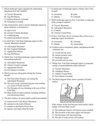
- 1. A) Taconic Mountains B) Tug Hill Plateau C) Hudson-Mohawk Lowlands D) Champlain Lowlands 1. Which landscape region separates the Adirondack Mountains from the Catskills? A) type of soil B) amount of stream discharge C) weathering rate D) underlying bedrock structure 2. One characteristic used to classify landscape regions as plains, plateaus, or mountains is A) Adirondack Mountains B) New England Highlands C) Appalachian Plateau D) Tug Hill Plateau 3. In which New York State landscape region are the Taconic Mountains located? A) Adirondack Mountains B) Atlantic Coastal Lowlands C) Appalachian Plateau D) Erie-Ontario Lowlands 4. Which New York State landscape region contains mostly Precambrian bedrock? A) The Grenvillian Orogeny was raising the Adirondack Mountains. B) The most recent continental glaciers were melting over much of North America. C) The Palisades sill was intruding in the area of New York State. D) Many kinds of marine animals, including trilobites, were becoming extinct. 5. Which event was taking place during the Triassic Period? A) marine fossils in the Rocky Mountains B) sediment in the Gulf of Mexico C) trenches in the Pacific Ocean floor D) igneous rock deep within the Earth 6. The best evidence of crustal uplift would be provided by A) mountains B) plain C) plateau D) lowlands 7. In which type of landscape region is Elmira, New York, located? A) Taconic Mountains B) Adirondack Mountains C) Catskills D) Atlantic Coastal Plain 8. Which landscape region in New York State is composed of the youngest material? A) mountains B) lowlands C) plateau D) coastal plain 9. In New York State, the St. Lawrence River flows over a landscape region classified as A) crustal activity zones B) natural resource zones C) landscape regions D) erosional activity areas 10. Features such as mountains, plains, and plateaus divide continents into A) Taconic Mountains B) Allegheny Plateau C) Atlantic Coastal Plain D) Erie-Ontario Lowlands 11. Which New York State landscape region is composed mainly of metamorphosed surface bedrock? 12. The block diagram below shows a portion of Earth’s surface. A) The landscape features will become more rounded. B) The elevation of the entire region will increase. C) The limestone will stop dissolving. D) The rate of wind erosion will increase. If the climate in this area becomes more humid, which change will most likely occur?
- 2. A) residual soil covering a large area B) coastal sand dunes C) V-shaped valleys D) parallel hills of unsorted sediments 13. Which landscape characteristic indicates a landscape has been formed primarily by streams? 14. The diagram below represents a section of the Earth's crust. A) folding of the crust B) sinking of rock layers C) erosion by valley glaciers D) deposition of stream sediments This surface landscape was most likely caused by A) lowlands B) mountains C) highlands D) plateaus 15. The Mohawk River and the Hudson River both flow primarily over a landscape region classified as 16. Base your answer to the following question on the Earth Science Reference Tables and the block diagram below. The diagram represents a geologic cross section of a portion of the Earth's crust. Line XY represents a fault. The rock layers in area B have not been overturned. A) steep slopes, moderate elevations, and horizontal rock structure B) many changes in slope, high elevations, and tilted rock structure C) very low elevations, and the bedrock is igneous D) very low elevations, and the bedrock is folded and faulted Area B is considered a plateau landscape because it has A) fossils and rock age B) latitude and climate C) elevation and bedrock structure D) soil composition and particle size 17. Landscape regions are best identified by their A) B) C) D) 18. Which diagram represents a plateau landscape? A) nearness to continental boundaries B) nearness to major mountain ranges C) climatic conditions D) surface bedrock characteristics 19. The generalized landscape regions of New York State are identified chiefly on the basis of
- 3. A) V-shaped valleys B) jagged hilltops C) horizontal bedrock structure D) folded metamorphic rock 20. The Catskills landscape region is classified as a plateau primarily because the region has A) bedrock structure and elevation B) bedrock type and index fossils C) latitude and longitude D) climate and topography 21. The generalized landscape regions of New York State are classified according to A) stream action B) wind erosion C) uplifting D) glaciation 22. A landscape is characterized by much transported soil, scratched rock surfaces, and wide U-shaped valleys. The development of this landscape is probably the result of A) Variations in climate have little effect on landscape development. B) Hillslopes in dry climates appear similar to hillslopes in humid climates. C) Arid and humid regions contain evidence of differences in landscape development. D) Stream development is independent of climate. 23. Which statement most accurately describes the influence of climate factors upon landscape development? A) few lakes B) deposits of well-sorted sediments C) residual soil covering large areas D) polished and scratched surface bedrock 24. Which landscape characteristic best indicates the action of glaciers? A) ground water B) wind C) glaciation D) human activities 25. Over the past 2 million years, which erosional agent has been most responsible for producing the present landscape surface features of New York State? A) the area south of the Finger Lakes B) the area around Mt. Marcy C) the area between Syracuse and Rochester D) the area east of Albany 26. Which area of New York State has the youngest bedrock?
- 4. 27. Base your answer to the following question on map below, which shows areas where certain minerals were mined in significant amounts during 1989. A) making talcum powder B) vulcanizing rubber C) polishing jewelry D) melting ice What is a common use for the mineral that is mined at the southern end of the two largest Finger Lakes? A) running water B) ocean currents C) wind D) glacial ice 28. Which agent of erosion formed the long U-shaped valleys now occupied by the Finger Lakes in central New York State? A) The lake surfaces are above sea level. B) The lakes fill long, narrow U-shaped valleys. C) The lakes are partially filled with sorted beds of sediment. D) The lakes are surrounded by sharp, jagged peaks and ridges. 29. Which statement provides the best evidence that New York State’s Finger Lakes formed as a result of continental glaciation? A) wind B) landslides C) meandering streams D) continental glaciers 30. Which agent of erosion was primarily responsible for forming the long, narrow, U-shaped valleys in the Finger Lakes region of New York State? A) B) C) D) 31. Which stream drainage pattern would most likely develop on the surface of a volcano?
- 5. 32. Base your answer to the following question on the Earth Science Reference Tables and the diagram below. The diagram shows two volcanoes with lava flows. A) B) C) D) Which map best represents the stream drainage pattern of these volcanic mountains? A) B) C) D) 33. Which map shows the stream drainage pattern that usually develops on the surface of horizontal rock layers? 34. Base your answer to the following question on the diagram below. The diagram represents a geologic cross section in which no overturning has occurred. The letters identify specific regions in the cross section. A) B) C) D) Which stream drainage pattern would most likely be found on the surface in region C?
- 6. 35. The diagram below represents a landscape area. A) B) C) D) Which map represents the stream drainage pattern that has most likely developed within this area? A) B) C) D) 36. Which stream-drainage pattern most likely developed on the surface of a newly formed volcanic mountain?
- 7. 37. The block diagram below represents a deeply eroded dome. A) B) C) D) Which map shows the stream drainage pattern that would most likely develop on this deeply eroded dome? 38. The cross section below shows the rock structure of a deeply eroded, domed mountain region. A) B) C) D) Which map shows the stream drainage pattern that will most likely develop as the bedrock is weathered and eroded from this igneous dome?
- 8. 39. Base your answer to the following question on The block diagram below shows a landscape region. A) B) C) D) Which stream drainage pattern would most likely develop at the surface of this region?
- 9. 40. The diagram below represents a surface stream drainage pattern. A) B) C) D) Which geologic cross section represents a landscape region most likely to produce this drainage pattern?
- 10. 41. The map below shows a stream drainage pattern. Arrows show the direction of stream flow. A) B) C) D) On which landscape region did this drainage pattern most likely develop?