SlideShare ist ein Scribd-Unternehmen logo
1 von 13
Session 2:
                    Harmonization of Land Classification
                         and Mapping Standards


             Rural Land Use Planning Experience Sharing – Lessons Learned – Workshop
     1
                                 Vientiane, 4th – 5th October 2012
15.10.2012
WHY harmonise land classifications and mapping?

             • If different agencies and project use different classes and map
               standards > then different maps are produced in the same
               districts – and these maps/datasets cannot be merged/joined.
             • Using the same classes/standards and data models is necessary for
               information exchange – meaning better collaboration and coherent
               planning
             • Specific land use systems in the uplands (eg rotational cultivation,
               fallow and forest types) need to be incorporated in the classification
               scheme – to plan for upland land and natural resources
               management.
             • Land use planning and mapping is a precondition for land
               registration and REDD – and we need to present “standard data
               sets” to the agencies responsible for LR/T and REDD.
              This will all contribution to the national targets on land use
               planning, sustainable land zoning and management
     2

15.10.2012
HOW to harmonize land classifications and mapping?

             • Joint development and consultation processes between MONRE
               ( GIZ) and MAF ( TABI) over the last 14 months.

             • Existing classification schemes and guidelines used as a
               reference:
                 •   Land Law and Forest Law (but interpreted)
                 •   NLMA / LNRRIC and DLUPD: 8+ land classes for land zoning
                 •   NLMA and MAF and various Project field experience
                 •   MTPW legal framework for roads, rivers,
                 •   etc

             • Based on state-of-the-art GIS mapping tools and international
               colouring codes and standards


     3

15.10.2012
BASIC PRINCIPLE of harmonized land classification and
             mapping

             3 Level Hierarchical Land Classification

                  Level 1: 8 Land Types (according to land law)

                  Level 2: Main Land Categories (38 Categories)

                  Level 3: Sub Land Categories (> 80 Sub-categories)

              2 Levels or types of Mapping Objectives:
                     1.) Current Land Use Data/Maps
                     2.) Future Management Plan Data/Maps


     4

15.10.2012
TECHNICAL IMPLEMENTATION: from Classification
             Scheme to Data Model


     5

15.10.2012
TECHNICAL IMPLEMENTATION of proposed
             harmonized land classification and mapping

                                            Table 1: Current land use   Table 2: Future Mgt
                                                      Map                 Zonation Map
                                               Main          sub-         Main       sub-
              Land types
                                             Category      Category     Category   Category
              1   F: Forest                      4            13           5          16
                  P: Plantation                  1             6           -           -
              2   A: Agriculture land           11            30          10          29
                  V: other vegetated land        1             3           0           0
                  U: unvegetated land            1             3           0           0
              3   W: Water areas                 4            10           4          10
              4   B: Settlement                  4             9           4           9
              5   I: Industrial                  3             3           4           4
              6   R: Roads                       6             6           6           6
              7   C: Cultural                    3             5           3           5
              8   D: Defense                     2             2           2           2


     6

15.10.2012
TABI experience with use of harmonized land
              classification systems and mapping

             • Need a special colour for paddy fields in
               the uplands, as often very small areas.
               In the lowlands use ‚yellow‘ colour as
               background for paddy, but in highlands
               propose to use pink.


     7

15.10.2012
Current Land Use Map: Example 1: Ban Donsai, Ponsai


     8

15.10.2012
Land Use Planning / Zonation Map: Example 1, Ban Donsai


     9

15.10.2012
Current Land Use Map: Example 2: Ban Phungman, Phoukoudt


   10

15.10.2012
Land Use Planning / Zonation Map: Example 2: Ban Phungman


   11

15.10.2012
Conclusions

             • The 3 level systematic and hierarchical Land Classification
               System (for both Current Land Use and Future Management
               zones), allows for flexibility in terms of degree of detail.
             • The system has tested and enhanced where necessary in
               MONRE (GIZ) and MAF (TABI) over the last 12 month.
             • The system enhances data retention and usability in the
               future.
             • It is the basis for a enhanced data and information exchange
               which can lead to more efficient and coherent planning
               between sectors (e.g. MAF & MONRE, and projects).
             • Technically all necessary tools are available (e.g. colour &
               symbol files).
             • Standardized map production and online mapping are greatly
               facilitated if the community uses same classification/data
   12          model (e.g. LUP- platform website)
15.10.2012
Next steps


             • Discussion on land classification/data model
               for Current Land Use and Future Management
               Zones.
             • Possible changes and enhancements of
               proposed land classification/data model.
             • Formal agreement of MAF and MONRE to use
               this land classification/data model.


   13

15.10.2012

Weitere ähnliche Inhalte

Was ist angesagt?

The Harmonized World Soil Database (HWSD), A Global Soil Information System, ...
The Harmonized World Soil Database (HWSD), A Global Soil Information System, ...The Harmonized World Soil Database (HWSD), A Global Soil Information System, ...
The Harmonized World Soil Database (HWSD), A Global Soil Information System, ...FAO
 
Activity report of the ITPS
Activity report of the ITPSActivity report of the ITPS
Activity report of the ITPSExternalEvents
 
GSP updates
GSP updatesGSP updates
GSP updatesFAO
 
GSP Pillar 4 Implementation Plan (GLOSIS) - Yusuf Yigini
GSP Pillar 4 Implementation Plan (GLOSIS) - Yusuf YiginiGSP Pillar 4 Implementation Plan (GLOSIS) - Yusuf Yigini
GSP Pillar 4 Implementation Plan (GLOSIS) - Yusuf YiginiExternalEvents
 
Heritage properties
Heritage propertiesHeritage properties
Heritage propertiesgardinerps
 
Gismap_AEZ_Methodology
Gismap_AEZ_MethodologyGismap_AEZ_Methodology
Gismap_AEZ_MethodologyFranco Bazzani
 
GSP Pillar 5
GSP Pillar 5GSP Pillar 5
GSP Pillar 5FAO
 
ESP work progress on Pillar 2
ESP work progress on Pillar 2ESP work progress on Pillar 2
ESP work progress on Pillar 2ExternalEvents
 
Landuse landcover mapping
Landuse landcover mappingLanduse landcover mapping
Landuse landcover mappingAditya Kushwaha
 
GSP Pillar 2
GSP Pillar 2GSP Pillar 2
GSP Pillar 2FAO
 
ITEM 3 - Global Soil Partnership updates
ITEM 3 - Global Soil Partnership updatesITEM 3 - Global Soil Partnership updates
ITEM 3 - Global Soil Partnership updatesSoils FAO-GSP
 
Pillar 4 Information and Data
Pillar 4 Information and DataPillar 4 Information and Data
Pillar 4 Information and DataStankovic G
 
Global Soil Organic Carbon Map GSOC : develop a global SOC by 5th Dec 2017
Global Soil Organic Carbon Map GSOC : develop a global SOC by 5th Dec 2017Global Soil Organic Carbon Map GSOC : develop a global SOC by 5th Dec 2017
Global Soil Organic Carbon Map GSOC : develop a global SOC by 5th Dec 2017FAO
 
Data preparation for Digital Soil Mapping
Data preparation for Digital Soil MappingData preparation for Digital Soil Mapping
Data preparation for Digital Soil MappingExternalEvents
 
Geo-spatial analysis for effective technology targeting
Geo-spatial analysis for effective technology targetingGeo-spatial analysis for effective technology targeting
Geo-spatial analysis for effective technology targetingICRISAT
 

Was ist angesagt? (20)

The Harmonized World Soil Database (HWSD), A Global Soil Information System, ...
The Harmonized World Soil Database (HWSD), A Global Soil Information System, ...The Harmonized World Soil Database (HWSD), A Global Soil Information System, ...
The Harmonized World Soil Database (HWSD), A Global Soil Information System, ...
 
Activity report of the ITPS
Activity report of the ITPSActivity report of the ITPS
Activity report of the ITPS
 
GSP updates
GSP updatesGSP updates
GSP updates
 
GSP Pillar 4 Implementation Plan (GLOSIS) - Yusuf Yigini
GSP Pillar 4 Implementation Plan (GLOSIS) - Yusuf YiginiGSP Pillar 4 Implementation Plan (GLOSIS) - Yusuf Yigini
GSP Pillar 4 Implementation Plan (GLOSIS) - Yusuf Yigini
 
Heritage properties
Heritage propertiesHeritage properties
Heritage properties
 
Gismap_AEZ_Methodology
Gismap_AEZ_MethodologyGismap_AEZ_Methodology
Gismap_AEZ_Methodology
 
GSP Pillar 5
GSP Pillar 5GSP Pillar 5
GSP Pillar 5
 
ITEM 7 - Pillar 3
ITEM 7 - Pillar 3ITEM 7 - Pillar 3
ITEM 7 - Pillar 3
 
ESP work progress on Pillar 2
ESP work progress on Pillar 2ESP work progress on Pillar 2
ESP work progress on Pillar 2
 
ITEM 7 - Pillar 4
ITEM 7 - Pillar 4ITEM 7 - Pillar 4
ITEM 7 - Pillar 4
 
Landuse landcover mapping
Landuse landcover mappingLanduse landcover mapping
Landuse landcover mapping
 
GSP Pillar 2
GSP Pillar 2GSP Pillar 2
GSP Pillar 2
 
DG ENV
DG ENVDG ENV
DG ENV
 
ITEM 3 - Global Soil Partnership updates
ITEM 3 - Global Soil Partnership updatesITEM 3 - Global Soil Partnership updates
ITEM 3 - Global Soil Partnership updates
 
ITEM 7 - Pillar 1
ITEM 7 - Pillar 1ITEM 7 - Pillar 1
ITEM 7 - Pillar 1
 
Pillar 4 Information and Data
Pillar 4 Information and DataPillar 4 Information and Data
Pillar 4 Information and Data
 
Global Soil Organic Carbon Map GSOC : develop a global SOC by 5th Dec 2017
Global Soil Organic Carbon Map GSOC : develop a global SOC by 5th Dec 2017Global Soil Organic Carbon Map GSOC : develop a global SOC by 5th Dec 2017
Global Soil Organic Carbon Map GSOC : develop a global SOC by 5th Dec 2017
 
Data preparation for Digital Soil Mapping
Data preparation for Digital Soil MappingData preparation for Digital Soil Mapping
Data preparation for Digital Soil Mapping
 
Land cover and Land Use
Land cover and Land UseLand cover and Land Use
Land cover and Land Use
 
Geo-spatial analysis for effective technology targeting
Geo-spatial analysis for effective technology targetingGeo-spatial analysis for effective technology targeting
Geo-spatial analysis for effective technology targeting
 

Andere mochten auch

Landslide_Mapping_Sri lanka
Landslide_Mapping_Sri lankaLandslide_Mapping_Sri lanka
Landslide_Mapping_Sri lankaRASHID JAVED
 
Image texture analysis techniques survey-1
Image texture analysis techniques  survey-1Image texture analysis techniques  survey-1
Image texture analysis techniques survey-1anitadixitjoshi
 
Texture in image processing
Texture in image processing Texture in image processing
Texture in image processing Anna Aquarian
 
Image Texture Analysis
Image Texture AnalysisImage Texture Analysis
Image Texture Analysislalitxp
 
Introduction to Digital Image Processing Using MATLAB
Introduction to Digital Image Processing Using MATLABIntroduction to Digital Image Processing Using MATLAB
Introduction to Digital Image Processing Using MATLABRay Phan
 
Master plan and land use
Master plan and land useMaster plan and land use
Master plan and land useShourya Puri
 
Land use planning
Land use planningLand use planning
Land use planningTin Lagman
 
Pixel Perfect: Strategies for Overcoming Perfectionism
Pixel Perfect: Strategies for Overcoming PerfectionismPixel Perfect: Strategies for Overcoming Perfectionism
Pixel Perfect: Strategies for Overcoming PerfectionismBrian Sullivan
 

Andere mochten auch (9)

Landslide_Mapping_Sri lanka
Landslide_Mapping_Sri lankaLandslide_Mapping_Sri lanka
Landslide_Mapping_Sri lanka
 
Image texture analysis techniques survey-1
Image texture analysis techniques  survey-1Image texture analysis techniques  survey-1
Image texture analysis techniques survey-1
 
Texture in image processing
Texture in image processing Texture in image processing
Texture in image processing
 
Image Texture Analysis
Image Texture AnalysisImage Texture Analysis
Image Texture Analysis
 
What is spatial Resolution
What is spatial ResolutionWhat is spatial Resolution
What is spatial Resolution
 
Introduction to Digital Image Processing Using MATLAB
Introduction to Digital Image Processing Using MATLABIntroduction to Digital Image Processing Using MATLAB
Introduction to Digital Image Processing Using MATLAB
 
Master plan and land use
Master plan and land useMaster plan and land use
Master plan and land use
 
Land use planning
Land use planningLand use planning
Land use planning
 
Pixel Perfect: Strategies for Overcoming Perfectionism
Pixel Perfect: Strategies for Overcoming PerfectionismPixel Perfect: Strategies for Overcoming Perfectionism
Pixel Perfect: Strategies for Overcoming Perfectionism
 

Ähnlich wie Lupws session 2_land classes_TABI_eng

PARTICIPATE ON LAND USE PLAN PREPARATION LEVEL III by RETA.pptx
PARTICIPATE ON LAND USE PLAN PREPARATION LEVEL III by RETA.pptxPARTICIPATE ON LAND USE PLAN PREPARATION LEVEL III by RETA.pptx
PARTICIPATE ON LAND USE PLAN PREPARATION LEVEL III by RETA.pptxMoaMoti
 
Forest change detection using RS and GIS.pptx
Forest change detection using RS and GIS.pptxForest change detection using RS and GIS.pptx
Forest change detection using RS and GIS.pptxsahl_2fast
 
Elements of an Implementation - Orientated Planning Process
Elements of an Implementation - Orientated Planning ProcessElements of an Implementation - Orientated Planning Process
Elements of an Implementation - Orientated Planning ProcessYazid Hamoda
 
Land use Land Cover Highlight for Jibia Local Government, Nigeria
Land use Land Cover Highlight for Jibia Local Government, NigeriaLand use Land Cover Highlight for Jibia Local Government, Nigeria
Land use Land Cover Highlight for Jibia Local Government, Nigeriaijtsrd
 
Vc - GloSIS T1 - T2 Soil Profile Database Technical Specifications
Vc - GloSIS T1 - T2 Soil Profile Database Technical SpecificationsVc - GloSIS T1 - T2 Soil Profile Database Technical Specifications
Vc - GloSIS T1 - T2 Soil Profile Database Technical SpecificationsSoils FAO-GSP
 
Sector planning presentation by Jim Sellen, Mike McDaniel, David Powell & Dav...
Sector planning presentation by Jim Sellen, Mike McDaniel, David Powell & Dav...Sector planning presentation by Jim Sellen, Mike McDaniel, David Powell & Dav...
Sector planning presentation by Jim Sellen, Mike McDaniel, David Powell & Dav...APA Florida
 
Monitoring Land Use and Land Cover through Remote Sensing and GIS
Monitoring Land Use and Land Cover through Remote Sensing and GISMonitoring Land Use and Land Cover through Remote Sensing and GIS
Monitoring Land Use and Land Cover through Remote Sensing and GISPritam Kumar Barman
 
SDI-Initiatives-in-Nepal (1).pptx
SDI-Initiatives-in-Nepal (1).pptxSDI-Initiatives-in-Nepal (1).pptx
SDI-Initiatives-in-Nepal (1).pptxFareLessmotiVation
 
WP 4.2. Policy Scenario building - UFMG & CIT
WP 4.2. Policy Scenario building - UFMG & CITWP 4.2. Policy Scenario building - UFMG & CIT
WP 4.2. Policy Scenario building - UFMG & CITCIFOR-ICRAF
 
Applications of RS and GIS in Urban Planning by Rakshith m murthy
Applications of RS and GIS in Urban Planning by Rakshith m murthyApplications of RS and GIS in Urban Planning by Rakshith m murthy
Applications of RS and GIS in Urban Planning by Rakshith m murthys0l0m0n7
 
Analysis of Land Use Land Cover Change and Relative Growth in Social Amenitie...
Analysis of Land Use Land Cover Change and Relative Growth in Social Amenitie...Analysis of Land Use Land Cover Change and Relative Growth in Social Amenitie...
Analysis of Land Use Land Cover Change and Relative Growth in Social Amenitie...IRJET Journal
 
Iannucci, Congedo & Munafò - input2012
Iannucci, Congedo & Munafò - input2012Iannucci, Congedo & Munafò - input2012
Iannucci, Congedo & Munafò - input2012INPUT 2012
 
IRJET- Landuse, Landcover and Urban Development of Coimbatore North Zone for ...
IRJET- Landuse, Landcover and Urban Development of Coimbatore North Zone for ...IRJET- Landuse, Landcover and Urban Development of Coimbatore North Zone for ...
IRJET- Landuse, Landcover and Urban Development of Coimbatore North Zone for ...IRJET Journal
 
Global soil information: building an enduring and authoritative system to mon...
Global soil information: building an enduring and authoritative system to mon...Global soil information: building an enduring and authoritative system to mon...
Global soil information: building an enduring and authoritative system to mon...FAO
 
ASSESSMENT OF URBAN DYNAMICS IN LAND USE AND DEMOGRPAHY USING GIS TECHNIQUES
ASSESSMENT OF URBAN DYNAMICS IN LAND USE AND DEMOGRPAHY USING GIS TECHNIQUESASSESSMENT OF URBAN DYNAMICS IN LAND USE AND DEMOGRPAHY USING GIS TECHNIQUES
ASSESSMENT OF URBAN DYNAMICS IN LAND USE AND DEMOGRPAHY USING GIS TECHNIQUESIRJET Journal
 
XIIa - Sudan Soil Information System (SUSIS)
XIIa - Sudan Soil Information System (SUSIS)XIIa - Sudan Soil Information System (SUSIS)
XIIa - Sudan Soil Information System (SUSIS)Soils FAO-GSP
 
Spatial-Temporal Analysis of Land Use: Coimbatore Corporation, Tamil Nadu
Spatial-Temporal Analysis of Land Use: Coimbatore Corporation, Tamil NaduSpatial-Temporal Analysis of Land Use: Coimbatore Corporation, Tamil Nadu
Spatial-Temporal Analysis of Land Use: Coimbatore Corporation, Tamil NaduIRJET Journal
 

Ähnlich wie Lupws session 2_land classes_TABI_eng (20)

PARTICIPATE ON LAND USE PLAN PREPARATION LEVEL III by RETA.pptx
PARTICIPATE ON LAND USE PLAN PREPARATION LEVEL III by RETA.pptxPARTICIPATE ON LAND USE PLAN PREPARATION LEVEL III by RETA.pptx
PARTICIPATE ON LAND USE PLAN PREPARATION LEVEL III by RETA.pptx
 
Forest change detection using RS and GIS.pptx
Forest change detection using RS and GIS.pptxForest change detection using RS and GIS.pptx
Forest change detection using RS and GIS.pptx
 
Elements of an Implementation - Orientated Planning Process
Elements of an Implementation - Orientated Planning ProcessElements of an Implementation - Orientated Planning Process
Elements of an Implementation - Orientated Planning Process
 
Land use Land Cover Highlight for Jibia Local Government, Nigeria
Land use Land Cover Highlight for Jibia Local Government, NigeriaLand use Land Cover Highlight for Jibia Local Government, Nigeria
Land use Land Cover Highlight for Jibia Local Government, Nigeria
 
Vc - GloSIS T1 - T2 Soil Profile Database Technical Specifications
Vc - GloSIS T1 - T2 Soil Profile Database Technical SpecificationsVc - GloSIS T1 - T2 Soil Profile Database Technical Specifications
Vc - GloSIS T1 - T2 Soil Profile Database Technical Specifications
 
Sector planning presentation by Jim Sellen, Mike McDaniel, David Powell & Dav...
Sector planning presentation by Jim Sellen, Mike McDaniel, David Powell & Dav...Sector planning presentation by Jim Sellen, Mike McDaniel, David Powell & Dav...
Sector planning presentation by Jim Sellen, Mike McDaniel, David Powell & Dav...
 
Gis in urban
Gis in urbanGis in urban
Gis in urban
 
Monitoring Land Use and Land Cover through Remote Sensing and GIS
Monitoring Land Use and Land Cover through Remote Sensing and GISMonitoring Land Use and Land Cover through Remote Sensing and GIS
Monitoring Land Use and Land Cover through Remote Sensing and GIS
 
SDI-Initiatives-in-Nepal (1).pptx
SDI-Initiatives-in-Nepal (1).pptxSDI-Initiatives-in-Nepal (1).pptx
SDI-Initiatives-in-Nepal (1).pptx
 
WP 4.2. Policy Scenario building - UFMG & CIT
WP 4.2. Policy Scenario building - UFMG & CITWP 4.2. Policy Scenario building - UFMG & CIT
WP 4.2. Policy Scenario building - UFMG & CIT
 
Applications of RS and GIS in Urban Planning by Rakshith m murthy
Applications of RS and GIS in Urban Planning by Rakshith m murthyApplications of RS and GIS in Urban Planning by Rakshith m murthy
Applications of RS and GIS in Urban Planning by Rakshith m murthy
 
Analysis of Land Use Land Cover Change and Relative Growth in Social Amenitie...
Analysis of Land Use Land Cover Change and Relative Growth in Social Amenitie...Analysis of Land Use Land Cover Change and Relative Growth in Social Amenitie...
Analysis of Land Use Land Cover Change and Relative Growth in Social Amenitie...
 
Iannucci, Congedo & Munafò - input2012
Iannucci, Congedo & Munafò - input2012Iannucci, Congedo & Munafò - input2012
Iannucci, Congedo & Munafò - input2012
 
Development of Integrated Technological Systems to Support Land Management Pr...
Development of Integrated Technological Systems to Support Land Management Pr...Development of Integrated Technological Systems to Support Land Management Pr...
Development of Integrated Technological Systems to Support Land Management Pr...
 
IRJET- Landuse, Landcover and Urban Development of Coimbatore North Zone for ...
IRJET- Landuse, Landcover and Urban Development of Coimbatore North Zone for ...IRJET- Landuse, Landcover and Urban Development of Coimbatore North Zone for ...
IRJET- Landuse, Landcover and Urban Development of Coimbatore North Zone for ...
 
Global soil information: building an enduring and authoritative system to mon...
Global soil information: building an enduring and authoritative system to mon...Global soil information: building an enduring and authoritative system to mon...
Global soil information: building an enduring and authoritative system to mon...
 
ASSESSMENT OF URBAN DYNAMICS IN LAND USE AND DEMOGRPAHY USING GIS TECHNIQUES
ASSESSMENT OF URBAN DYNAMICS IN LAND USE AND DEMOGRPAHY USING GIS TECHNIQUESASSESSMENT OF URBAN DYNAMICS IN LAND USE AND DEMOGRPAHY USING GIS TECHNIQUES
ASSESSMENT OF URBAN DYNAMICS IN LAND USE AND DEMOGRPAHY USING GIS TECHNIQUES
 
GIS
  GIS  GIS
GIS
 
XIIa - Sudan Soil Information System (SUSIS)
XIIa - Sudan Soil Information System (SUSIS)XIIa - Sudan Soil Information System (SUSIS)
XIIa - Sudan Soil Information System (SUSIS)
 
Spatial-Temporal Analysis of Land Use: Coimbatore Corporation, Tamil Nadu
Spatial-Temporal Analysis of Land Use: Coimbatore Corporation, Tamil NaduSpatial-Temporal Analysis of Land Use: Coimbatore Corporation, Tamil Nadu
Spatial-Temporal Analysis of Land Use: Coimbatore Corporation, Tamil Nadu
 

Mehr von LUP_Lao

Tabi input _upland_strategy_web
Tabi input _upland_strategy_webTabi input _upland_strategy_web
Tabi input _upland_strategy_webLUP_Lao
 
Lupws land tenure security GIZ LM-RED_oct2012_eng
Lupws land tenure security GIZ LM-RED_oct2012_engLupws land tenure security GIZ LM-RED_oct2012_eng
Lupws land tenure security GIZ LM-RED_oct2012_engLUP_Lao
 
Lupws session 5 zonation_NT2 rmu
Lupws session 5 zonation_NT2 rmuLupws session 5 zonation_NT2 rmu
Lupws session 5 zonation_NT2 rmuLUP_Lao
 
Lupws session 5 zonation_MEKONG WATCH_eng
Lupws session 5 zonation_MEKONG WATCH_engLupws session 5 zonation_MEKONG WATCH_eng
Lupws session 5 zonation_MEKONG WATCH_engLUP_Lao
 
Lupws session 5 zonation_JVC
Lupws session 5 zonation_JVCLupws session 5 zonation_JVC
Lupws session 5 zonation_JVCLUP_Lao
 
Lupws session 5 land zonation_planning_TABI_lao
Lupws session 5 land zonation_planning_TABI_laoLupws session 5 land zonation_planning_TABI_lao
Lupws session 5 land zonation_planning_TABI_laoLUP_Lao
 
Lupws session 4 se_clu_forest cover_TABI_ lao
Lupws session 4 se_clu_forest cover_TABI_ laoLupws session 4 se_clu_forest cover_TABI_ lao
Lupws session 4 se_clu_forest cover_TABI_ laoLUP_Lao
 
Lupws session 4 se_clu_forest cover_TABI_eng
Lupws session 4 se_clu_forest cover_TABI_engLupws session 4 se_clu_forest cover_TABI_eng
Lupws session 4 se_clu_forest cover_TABI_engLUP_Lao
 
Lupws session 3 village boundary_TABI_lao
Lupws session 3 village boundary_TABI_laoLupws session 3 village boundary_TABI_lao
Lupws session 3 village boundary_TABI_laoLUP_Lao
 
Lupws session 3 village boundary_TABI_eng
Lupws session 3 village boundary_TABI_engLupws session 3 village boundary_TABI_eng
Lupws session 3 village boundary_TABI_engLUP_Lao
 
Lupws session 2 land classes_GIZ LM_RED_eng
Lupws session 2 land classes_GIZ LM_RED_engLupws session 2 land classes_GIZ LM_RED_eng
Lupws session 2 land classes_GIZ LM_RED_engLUP_Lao
 
Lupws session 2 _land classes_TABI_lao
Lupws session 2 _land classes_TABI_laoLupws session 2 _land classes_TABI_lao
Lupws session 2 _land classes_TABI_laoLUP_Lao
 
Lupws session 1 progress NU_IRP_GIZ_lao
Lupws session 1 progress NU_IRP_GIZ_laoLupws session 1 progress NU_IRP_GIZ_lao
Lupws session 1 progress NU_IRP_GIZ_laoLUP_Lao
 
Lupws session 1 progress a_TABI_lao
Lupws session 1 progress a_TABI_laoLupws session 1 progress a_TABI_lao
Lupws session 1 progress a_TABI_laoLUP_Lao
 
Lupws session 1 progress NGD FINNMAP_short_oct2012_eng only
Lupws session 1 progress NGD FINNMAP_short_oct2012_eng onlyLupws session 1 progress NGD FINNMAP_short_oct2012_eng only
Lupws session 1 progress NGD FINNMAP_short_oct2012_eng onlyLUP_Lao
 
Lupws session 1 progress a_TABI_eng
Lupws session 1 progress a_TABI_engLupws session 1 progress a_TABI_eng
Lupws session 1 progress a_TABI_engLUP_Lao
 

Mehr von LUP_Lao (16)

Tabi input _upland_strategy_web
Tabi input _upland_strategy_webTabi input _upland_strategy_web
Tabi input _upland_strategy_web
 
Lupws land tenure security GIZ LM-RED_oct2012_eng
Lupws land tenure security GIZ LM-RED_oct2012_engLupws land tenure security GIZ LM-RED_oct2012_eng
Lupws land tenure security GIZ LM-RED_oct2012_eng
 
Lupws session 5 zonation_NT2 rmu
Lupws session 5 zonation_NT2 rmuLupws session 5 zonation_NT2 rmu
Lupws session 5 zonation_NT2 rmu
 
Lupws session 5 zonation_MEKONG WATCH_eng
Lupws session 5 zonation_MEKONG WATCH_engLupws session 5 zonation_MEKONG WATCH_eng
Lupws session 5 zonation_MEKONG WATCH_eng
 
Lupws session 5 zonation_JVC
Lupws session 5 zonation_JVCLupws session 5 zonation_JVC
Lupws session 5 zonation_JVC
 
Lupws session 5 land zonation_planning_TABI_lao
Lupws session 5 land zonation_planning_TABI_laoLupws session 5 land zonation_planning_TABI_lao
Lupws session 5 land zonation_planning_TABI_lao
 
Lupws session 4 se_clu_forest cover_TABI_ lao
Lupws session 4 se_clu_forest cover_TABI_ laoLupws session 4 se_clu_forest cover_TABI_ lao
Lupws session 4 se_clu_forest cover_TABI_ lao
 
Lupws session 4 se_clu_forest cover_TABI_eng
Lupws session 4 se_clu_forest cover_TABI_engLupws session 4 se_clu_forest cover_TABI_eng
Lupws session 4 se_clu_forest cover_TABI_eng
 
Lupws session 3 village boundary_TABI_lao
Lupws session 3 village boundary_TABI_laoLupws session 3 village boundary_TABI_lao
Lupws session 3 village boundary_TABI_lao
 
Lupws session 3 village boundary_TABI_eng
Lupws session 3 village boundary_TABI_engLupws session 3 village boundary_TABI_eng
Lupws session 3 village boundary_TABI_eng
 
Lupws session 2 land classes_GIZ LM_RED_eng
Lupws session 2 land classes_GIZ LM_RED_engLupws session 2 land classes_GIZ LM_RED_eng
Lupws session 2 land classes_GIZ LM_RED_eng
 
Lupws session 2 _land classes_TABI_lao
Lupws session 2 _land classes_TABI_laoLupws session 2 _land classes_TABI_lao
Lupws session 2 _land classes_TABI_lao
 
Lupws session 1 progress NU_IRP_GIZ_lao
Lupws session 1 progress NU_IRP_GIZ_laoLupws session 1 progress NU_IRP_GIZ_lao
Lupws session 1 progress NU_IRP_GIZ_lao
 
Lupws session 1 progress a_TABI_lao
Lupws session 1 progress a_TABI_laoLupws session 1 progress a_TABI_lao
Lupws session 1 progress a_TABI_lao
 
Lupws session 1 progress NGD FINNMAP_short_oct2012_eng only
Lupws session 1 progress NGD FINNMAP_short_oct2012_eng onlyLupws session 1 progress NGD FINNMAP_short_oct2012_eng only
Lupws session 1 progress NGD FINNMAP_short_oct2012_eng only
 
Lupws session 1 progress a_TABI_eng
Lupws session 1 progress a_TABI_engLupws session 1 progress a_TABI_eng
Lupws session 1 progress a_TABI_eng
 

Lupws session 2_land classes_TABI_eng

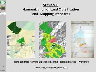
  • 1. Session 2: Harmonization of Land Classification and Mapping Standards Rural Land Use Planning Experience Sharing – Lessons Learned – Workshop 1 Vientiane, 4th – 5th October 2012 15.10.2012
  • 2. WHY harmonise land classifications and mapping? • If different agencies and project use different classes and map standards > then different maps are produced in the same districts – and these maps/datasets cannot be merged/joined. • Using the same classes/standards and data models is necessary for information exchange – meaning better collaboration and coherent planning • Specific land use systems in the uplands (eg rotational cultivation, fallow and forest types) need to be incorporated in the classification scheme – to plan for upland land and natural resources management. • Land use planning and mapping is a precondition for land registration and REDD – and we need to present “standard data sets” to the agencies responsible for LR/T and REDD.  This will all contribution to the national targets on land use planning, sustainable land zoning and management 2 15.10.2012
  • 3. HOW to harmonize land classifications and mapping? • Joint development and consultation processes between MONRE ( GIZ) and MAF ( TABI) over the last 14 months. • Existing classification schemes and guidelines used as a reference: • Land Law and Forest Law (but interpreted) • NLMA / LNRRIC and DLUPD: 8+ land classes for land zoning • NLMA and MAF and various Project field experience • MTPW legal framework for roads, rivers, • etc • Based on state-of-the-art GIS mapping tools and international colouring codes and standards 3 15.10.2012
  • 4. BASIC PRINCIPLE of harmonized land classification and mapping 3 Level Hierarchical Land Classification Level 1: 8 Land Types (according to land law) Level 2: Main Land Categories (38 Categories) Level 3: Sub Land Categories (> 80 Sub-categories) 2 Levels or types of Mapping Objectives: 1.) Current Land Use Data/Maps 2.) Future Management Plan Data/Maps 4 15.10.2012
  • 5. TECHNICAL IMPLEMENTATION: from Classification Scheme to Data Model 5 15.10.2012
  • 6. TECHNICAL IMPLEMENTATION of proposed harmonized land classification and mapping Table 1: Current land use Table 2: Future Mgt Map Zonation Map Main sub- Main sub- Land types Category Category Category Category 1 F: Forest 4 13 5 16 P: Plantation 1 6 - - 2 A: Agriculture land 11 30 10 29 V: other vegetated land 1 3 0 0 U: unvegetated land 1 3 0 0 3 W: Water areas 4 10 4 10 4 B: Settlement 4 9 4 9 5 I: Industrial 3 3 4 4 6 R: Roads 6 6 6 6 7 C: Cultural 3 5 3 5 8 D: Defense 2 2 2 2 6 15.10.2012
  • 7. TABI experience with use of harmonized land classification systems and mapping • Need a special colour for paddy fields in the uplands, as often very small areas. In the lowlands use ‚yellow‘ colour as background for paddy, but in highlands propose to use pink. 7 15.10.2012
  • 8. Current Land Use Map: Example 1: Ban Donsai, Ponsai 8 15.10.2012
  • 9. Land Use Planning / Zonation Map: Example 1, Ban Donsai 9 15.10.2012
  • 10. Current Land Use Map: Example 2: Ban Phungman, Phoukoudt 10 15.10.2012
  • 11. Land Use Planning / Zonation Map: Example 2: Ban Phungman 11 15.10.2012
  • 12. Conclusions • The 3 level systematic and hierarchical Land Classification System (for both Current Land Use and Future Management zones), allows for flexibility in terms of degree of detail. • The system has tested and enhanced where necessary in MONRE (GIZ) and MAF (TABI) over the last 12 month. • The system enhances data retention and usability in the future. • It is the basis for a enhanced data and information exchange which can lead to more efficient and coherent planning between sectors (e.g. MAF & MONRE, and projects). • Technically all necessary tools are available (e.g. colour & symbol files). • Standardized map production and online mapping are greatly facilitated if the community uses same classification/data 12 model (e.g. LUP- platform website) 15.10.2012
  • 13. Next steps • Discussion on land classification/data model for Current Land Use and Future Management Zones. • Possible changes and enhancements of proposed land classification/data model. • Formal agreement of MAF and MONRE to use this land classification/data model. 13 15.10.2012