
Empfohlen
Empfohlen
Weitere ähnliche Inhalte
Was ist angesagt?
Was ist angesagt? (20)
Ähnlich wie Lupws session 1 progress NGD FINNMAP_short_oct2012_eng only
Ähnlich wie Lupws session 1 progress NGD FINNMAP_short_oct2012_eng only (20)
Mehr von LUP_Lao
Mehr von LUP_Lao (16)
Lupws session 1 progress NGD FINNMAP_short_oct2012_eng only
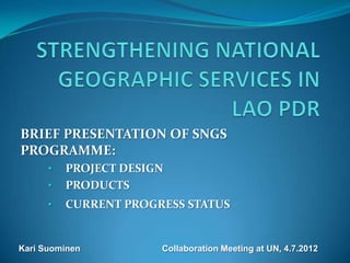
- 1. BRIEF PRESENTATION OF SNGS PROGRAMME: • PROJECT DESIGN • PRODUCTS • CURRENT PROGRESS STATUS Kari Suominen Collaboration Meeting at UN, 4.7.2012
- 2. PROGRAMME Bilateral Development Co-operation Programme Total budget 6.5 MEUR, GOF 6 MEUR, GOL 0.5 MEUR Approach is Institutional Development and Capacity Building Duration of the programme is 4 years, from August 2010 to July 2014 Mapping area for this phase covers southern part of the Lao PDR covering 1/3 of the country.
- 3. OUTPUT PRODUCTS Geodetic Horizontal and Vertical Network Aerial Photographs Digital Elevation Model Ortophotos Vector data Seamless Geodatabase 1:50,000 Topographic Base Maps 1:5,000 Orthophoto Maps 1:5,000 Topographic Maps in big cities
- 4. AERIAL PHOTOGRAPHY PROJECT AREA Southern part of Laos Savannakhet, Saravan, Champasak, Xekong, Attapu and southern part of the Khammouan province Approx. 71,000 km² (1/3 of the country) Photography completed between November 2010 and January 2011
- 5. AERIAL PHOTOGRAPHY EQUIPMENT VEXCEL UltraCam Xp large format digital camera 17310 x 11310 pixels = 200 Megapixels Tracker GPS navigation system AEROControl GPS/IMU registration Piper Cheyenne II Turboprop
- 9. PROGRESS STATUS RGB Orthophotos 100% competed 2D digitizing well in progress 3D DEM editing well in progress 98% of Procurement programme completed 70% of Training programme completed ICT infrastructure 95% completed Client survey in good state and will continue Financially on right track; about 50% of budget is used now.
- 10. NEW AERIAL PHOTOGRAPHY NEW AREA Approx. 90,000 km² (1/3 of the country) Photography will be completed during this dry season