
Empfohlen
Weitere ähnliche Inhalte
Was ist angesagt?
Was ist angesagt? (20)
Ähnlich wie Geology
Ähnlich wie Geology (20)
Kürzlich hochgeladen
Kürzlich hochgeladen (20)
Geology
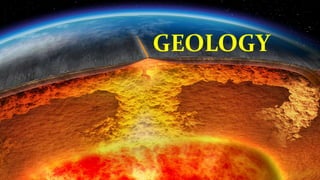
- 1. GEOLOGY
- 2. What is Geology? EARTH STUDY OF DISCOURSE gē -logiaGreek word is an earth science comprising the study of solid Earth, the rocks of which it is composed, and the processes by which they change. Earth science or geoscience is an all- encompassing term that refers to the fields of science dealing with planet Earth.
- 3. Why Study the Earth? • We're part of it. Dust to Dust. Humans have the capability to make rapid changes. All construction from houses to roads to dams are effected by the Earth, and thus require some geologic knowledge. All life depends on the Earth for food and nourishment. The Earth is there everyday of our lives. • Energy and Mineral resources that we depend on for our lifestyle come from the Earth. At present no other source is available. • Geologic Hazards -- Earthquakes, volcanic eruptions, hurricanes, landslides, could affect us at any time. A better understanding of the Earth is necessary to prepare for these eventualities. • Curiosity-- We have a better understanding of things happening around us. Science in general. I'll try to relate geology (and science in general) to our everyday lives.
- 4. • The Earth -- What is it? • Density, (mass/volume), Temperature, and Pressure increase with depth. Earth has layered structure. Layering can be viewed in two different ways: 1. Layers of different chemical composition 2. Layers of differing physical properties. WHAT ARE THE LAYERS OF THE EARTH?
- 5. 1. Compositional Layering Crust - variable thickness and composition • Continental 10 - 70 km thick - "granitic" (made mostly of Oxygen and Silicon) in composition • Oceanic 2 - 10 km thick - "basaltic" (less Silicon than in continental crust, more Magnesium) Mantle - 3488 km thick, made up of a rock called peridotite. Solid but can deform so that it confects (moves in response to temperature differences). Core - 2883 km radius, made up of Iron (Fe) and small amount of Nickel (Ni)
- 6. 2. Layers of Differing Physical Properties Lithosphere - about 100 km thick (deeper beneath continents) Asthenosphere - about 250 km thick to depth of 350 km - solid rock, but soft andflows easily. Mesosphere - about 2500 km thick, solid rock, but still capable of flowing. Outer Core - 2250 km thick, Fe and Ni, liquid Inner core - 1230 km radius, Fe and Ni, solid
- 7. Composition of the Earth • The bulk chemical composition of the Earth is mostly Iron (Fe, 34.6%), Oxygen (O2, 29.5%), Silicon (Si, 15.2%), and Magnesium (Mg, 12.7%), with other elements making up the other 8%. These elements are distributed unevenly due to the layering, with Fe being concentrated in the core, Si, O2, and Mg being concentrated in the mantle, and Si, O2, and the other elements being concentrated in the thin veneer of the crust.
- 8. GOING BACK TO THE BASIC diameter of the earth at the equator- 7,926.41 miles (12,756.32 kilometers) Diameter of the earth at the poles- 7,901 miles (12,715.43 kilometers) Thus; -the earth is a tad wider 41kilometers than it’s tall. -diameter taken in poles is a bit shorter than diameter taken in its equator.
- 9. Rock Cycle
- 10. Igneous rock Intrusive (plutonic rocks) Extrusive (volcanic rocks) - are rocks formed when magma cools and solidifies below the earth's surface -The term originated from Pluto, the classical god of the underworld -are rocks formed when lava cools and solidifies on the earth's surface. DIFFERENCES -crystals of volcanic rocks are so small that you can only see them with a microscope. -When lava meets the cooler temperatures of the atmosphere, it cools rapidly and solid crystals form -because of the rapid cooling this crystallization happens too fast for the crystals to grow very big. -plutonic rocks cool much slower and under higher pressure because they are in the ground. -their crystals have the right conditions to grow large. -plutonic rocks have coarse- grained crystals. -Because magma is under high pressure and takes a long time to cool, it allows time for the formation of large crystals.
- 11. Extrusive volcanic Igneous rocks
- 12. Intrusive Plutonic rocks The most common rock types in plutons are granite, granodiorite, tonalite,monzonite, and quartz diorite. Generally light colored, coarse-grained plutons of these compositions are referred to as granitoids. granodiorite tonalite monzonite Quartz diorite
- 13. What is pluton? a pluton is a body of intrusive igneous rock (called a plutonic rock) that is crystallized from magma slowly cooling below the surface of the Earth. Plutons include batholiths, stocks, dikes, sills, laccoliths, lopoliths, and other igneous bodies. In practice, "pluton" usually refers to a distinctive mass of igneous rock, typically several kilometers in dimension, without a tabular shape like those of dikes and sills. Batholiths commonly are aggregations of plutons. What is Batholith? A batholith (from Greek bathos, depth + lithos, rock) is a large emplacement of igneous intrusive (also called plutonic) rock that forms from cooled magma deep in the Earth's crust. Batholiths are almost always made mostly of felsic or intermediate rock-types, such as granite, quartz monzonite, or diorite
- 14. SILL VS DIKE -Sills parallel beds (layers) and foliations in the surrounding country rock. They can be originally emplaced in a horizontal orientation, although tectonic processes may cause subsequent rotation of horizontal sills into near vertical orientations. -Sills are fed by dikes, except in unusual locations where they form in nearly vertical beds attached directly to a magma source. -A dike or dyke in geological usage is a sheet of rock that formed in a fracture in a pre- existing rock body -vertical in appearance
- 15. But what is laccolith? A laccolith is a sheet intrusion (or concordant pluton) that has been injected between two layers of sedimentary rock. The pressure of the magma is high enough that the overlying strata are forced upward, giving the laccolith a dome or mushroom-like form with a generally planar base. Laccoliths tend to form at relatively shallow depths and are typically formed by relatively viscous magmas, such as those that crystallize to diorite, granodiorite, and granite. Cooling underground takes place slowly, giving time for larger crystals to form in the cooling magma. The surface rock above laccoliths often erodes away completely, leaving the core mound of igneous rock. The term was first applied as laccolite by Grove Karl Gilbert after his study of intrusions of diorite in the Henry Mountains of Utah in about 1875 (see image below)
- 16. How about the lopolith? A lopolith is a large igneous intrusion which is lenticular in shape with a depressed central region. Lopoliths are generally concordant with the intruded strata with dike or funnel-shaped feeder bodies below the body. LOPOLITH VS LACCOLITH
- 17. Convection current Mantle convection is the slow creeping motion of Earth's rocky mantle caused by convection currents carrying heat from the interior of the earth to the surface. Convection is one of the three main types of heat transfer, the other two being conduction and radiation. Unlike the other two, convection can only happen in fluids -- liquids and gases. This is because the molecules have to be free to move.
- 19. Tectonic plates/Plate tectonics (from the Late Latin tectonicus, from the Greek:τεκτονικός "pertaining to building") Tectonic plates are pieces of Earth's crust and uppermost mantle, together referred to as the lithosphere. The plates are around 100 km (62 mi) thick and consist of two principal types of material: oceanic crust (also called sima from silicon and magnesiu m) and continental crust (sial from silicon and aluminium). PLATES
- 20. How many plate tectonics do we have? Actually there are about 63 and still counting, but for the purpose of the list, let me divide the plates into three. The major, minor, and microplates.
- 21. TECTONIC PLATES MAJOR OR PRIMARY PLATES MINOR OR SECONDARY PLATES MICROPLATES OR TERTIARY PLATES a major plate is any plate with an area greater than 10 million km2. a minor plate is any plate with an area less than 10 million km2 but greater than 1 million km2. a microplate is any plate with an area less than 1 million km2 Nazca Plate – 5,500,000 km2 Philippine Sea Plate – 5,500,000 km2 Arabian Plate – 5,000,000 km2 Caribbean Plate – 3,300,000 km2 Cocos Plate – 2,900,000 km2 Caroline Plate – 1,700,000 km2 Scotia Plate – 1,600,000 km2 Burma Plate – 1,100,000 km2 New Hebrides Plate – 1,100,000 km2 Pacific Plate – 103,300,000 km2 North American Plate – 75,900,000 km2 Eurasian Plate – 67,800,000 km2 African Plate – 61,300,000 km2 Antarctic Plate – 60,900,000 km2 Indo-Australian Plate – 58,000,000 km2 South American Plate – 43,600,000 km2 Philippine Sea Plate Mariana Plate Philippine Microplate
- 22. PLATE BOUNDARIES 1. Transform 2. Divergent 3. Convergent
- 25. FAULTS!
- 37. LANDSLIDE