The Alps under Review: Land use change

Presentation made by Giacomo Luciani, EURAC According to the GLOCHAMORE strategy (2005), which is a joint project of the Mountain Research Initiative (MRI), UNESCO/MAB and IHP, and the EU Framework Programme 6 the ten most pressing issues which need research and monitoring are: - Climate - Land Use Change - The Cryosphere - Water Systems - Ecosystem Function and Services - Biodiversity - Hazards - Health - Mountain Economies - Society and Global Change But how to set-up a proper monitoring approach for hot topics like land-use change to “review” mountain regions? First, we have to understand the Requirements, which might be defined by users like regional or national authorities or trans-national authorities or even by the research community. Second, we have to select appropriate measures for monitoring. Today, we have a huge range of techniques such as field work (including natural and social science surveys), remote sensing and satellite data intepretation, which provides an up-to-date and area wide overwiew, modelling, which allows us to look into the unknown and to project future developments, Database surveys, like analysing statistical data or even face-to-face expert interview. But colleting data and analyisng data is not enough. In the end data need to be integrated, interpreted and assessed with respect to the objectives set for the monitoring task. EURAC is working in all scales, from pilot scale to mountain ranges.

Empfohlen
Empfohlen
Weitere ähnliche Inhalte
Mehr von InfoAndina CONDESAN
Mehr von InfoAndina CONDESAN (20)
Kürzlich hochgeladen
Kürzlich hochgeladen (20)
The Alps under Review: Land use change
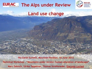
- 1. The Alps under Review Land use change Remote Sensing of Mountain Environment – Sate of the Art and Outlook. Rio Earth Summit, Mountain Pavilion, 16 June 2012 Technical Workshop : “Mountains under review: human alteration of landscape” Marc Zebisch, Ulrike Tappeiner, Thomas Streifeneder, Giacomo Luciani
- 2. Hot topics for mountain regions • Climate • Land Use Change • The Cryosphere • Water Systems • Ecosystem Function and Services • Biodiversity • Hazards • Health • Mountain Economies • Society and Global Change
- 3. Integrated Monitoring and Assessment Require- ments User requirements Research requirements Analysis Remote Database Expert Field Work Sensing Modeling surveys Interviews Synthesis Assessment Reports + User WebGis Consultancy
- 4. The Alps are … • a biodiversity hotspot in Europe • the water tower of large parts of Europe • warming twice as fast as the global average • densely populated and cut by transit routes from Northern to Southern Europe • under pressure by land-use change, tourism and transport • socioeconomically strongly interrelated with the non- Alpine regions Strong demand for monitoring natural, social and economic changes
- 5. EURAC is … • a center for interdisciplinary mountain research • situated in the heart of the Alps • focusing on monitoring and assessing the interaction of environment and society in mountain regions • working on strategies of sustainability in the Alps and other mountain areas
- 6. Research Area EURAC Mountains
- 7. Scales of Monitoring Pilot scale Landscape scale Mountain range scale Upscaling Downscaling
- 8. Tracking land-use changes Past Presence Future Change detection, Scenarios time series analysis
- 9. Tracking land-use changes 12% Land abandonment since 1865 34% abandoned 80% 52% agriculturally used
- 10. Monitoring Habitats Habitat Habitat Map Satellite Data Conservation Status
- 11. Forest damage assessment with Remote Sensing • 27.08.2010 in Mühlwald in Pustertal • 21.06.2011 in Brixen & Bruneck Foto: FF Mühlwald Foto: Roland Volgger/STOL (Südtirol News 28.08.2010) (Südtirol Online 22.06.2011)
- 12. Windthrow events – satellite data Rapideye 2011 2009
- 13. Automatic Change Detection Mask with damaged forest
- 14. Field Work: Manipulative experiments to predict Climate Change impacts grassland transplantation and… … artificial sheltering… 2000m a.s.l. +3.3 K 1500m a.s.l. …to assess future water and energy budget +3.3 K 1000m a.s.l.
- 15. Scales of Monitoring Plot scale Landscape scale Mountain range scale Upscaling Downscaling
- 17. Climate Change Spring Summer Autumn Winter T incrase 2071-2100 (CLM A1B) 0 0.5 1 1.5 2 2.5 3 3.5 4 4.5 5 5.5 6°C
- 18. Snow Cover from Satellite Beginning of May 2012
- 19. Snow Cover from Satellite End of May 2012
- 20. Sustainability Analysis Economy Society Environment
- 21. Other Mountains: Italian Mountains
- 23. EURAC outputs: Reports Reports on regional Contribution Atlas Alps climate change to international Reports Atlas Carpathians Report Carpathians
- 25. Conclusion: A review of mountains demands for…. • Bottom-up approaches (from local to mountain regions) • Interdisciplinary approaches • A demand driven approach and stakeholder involvement • Regular updates • Open access to the results (WebGIS, Reports, …) • Know-How Transfer and platforms for exchange of professional experiences
- 26. Thank you for your attention! marc.zebisch@eurac.edu www.eurac.edu
Hinweis der Redaktion
- Picture: BolzanoGood example of congested area in the heart of the Alps, surrounded by high mountains with sensitive habtiats, ...Goodimpression of urban-rural relationship
- According to the GLOCHAMORE strategy (2005), which is a joint project of the Mountain Research Initiative (MRI), UNESCO/MABand IHP, and the EU Framework Programme 6 the ten most pressing issues which need research and monitoring are: ClimateLand Use ChangeThe CryosphereWater SystemsEcosystem Function and ServicesBiodiversityHazardsHealthMountain EconomiesSociety and Global ChangeWhile land use and land-use change, is one of the most obvious indicators of human activities also all the other topics are actualy related to or affected by human activities….
- But how to set-up a proper monitoring approach for hot topics like land-use change to “review” mountain regions?First, we have to understand the Requirements, which might be defined by users like regional or national authorities or trans-national authorities or even by the research community. Second, we have to select appropriate measures for monitoring. Today, we have a huge range of techniques such as field work (including natural and social science surveys), remote sensing and satellite data intepretation, which provides an up-to-date and area wide overwiew, modelling, which allows us to look into the unknown and to project future developments, Database surveys, like analysing statistical data or even face-to-face expert interview. But colleting data and analyisng data is not enough. In the end data need to be integrated, interpreted and assessed with respect to the objectives set for the monitoring task. And, finally, data needs to be made accessible by compiling comprehensive report or Web-Gis and to be discussed with the user. Only a direct and permanent contact to the stakeholder guarantees, that monitoring activities have an impact!
- So far about the general need for monitoring in mountain regions and the opportunities with modern techniques. In the following we would like to present you some examples from the Alps. The alps are…
- All the following examples have been conducted by EURAC …
- Can be hidden, if you want
- EURAC is working in all scales, from pilot scale to mountain ranges. First: Examples of local scale research and applications
- Land-use changes are tracked back more than 150 years for many community in the Alps. Method: Comparison of historic maps, old and recent aerial photographyIn addition: Modelling potential future land-use Upper model: Land-use in the future according to results from a stakeholder workshopLower model: future land-use according to results from a agro-economic modelAll results: EURAC Mountains
- Example of results of Land-use analyis: % of Land abandonment since 1865. In close vicinity areas with a low rate of abandonment and areas with a high rate of abadonment. Results have been archived with the method shown before: Analysis of historical maps and arial photography, ….All results achieved by EURAC montains
- Example: Mapping and monitoring sensitive habitats with satellite data. Threatened by land-use activities, tourism, etc…Data have been classified using automates approaches from high resolution satellite images, which is cost effective and can be repeated with a relatively high update rate (e.g. every year). This allows to track a degradation of habitat conservation status e.g. due to too intensive grasing.When but in a information system for local authorities, such data helps to develop adapted management plans for nature conservation…
- Climate ChangeField experiments to understand the impacts of climate change on vegetation and productivity. Large samples of vegetation and soil are transferred to lower areas to simulate a warming effect. By tranfering bricks of grass including soil to lower areas, which are 3,3°C warmer, we can simulate the potential impact of climate change on vegetation. Important from a scientific point of view, but also to understand the impact of climate change on land-use. Could for instance help farmers to come up with strategies how to prepare to climate changeReference: EURAC Mountains
- Now some examples for the larger scale: Monitoring the full Alps!
- Result of a study which analyzed the decay of agriculture in the Alps . The map shows the change in number of farms which give an indication that in the last 20 years, in particular in the italian and french part of the alps a lot of famers gave up. The Monitoring activities based on statistical data refer to the most detailed level, the municipality level. For that large harmonization work has to be done as the Alps cover seven countries with different approachesData is based on statistical surveys which haven been harmonized from national surveys. Data analyis: EURAC Mountains
- Results from a project on climate change:Temperature increase in the Alps until the next century. ( we say “projection” not forecast!)Result show a clearly pronounced warming trend for the Alps, which is stronger than in the surrounding areas. The warming is particular pronunced in summer with more than +5 °C in summer in the central part of the AlpsData is based on results of the Regional Climate Models CLM, Scenario A1B. Analysis: EURAC Mountains
- Snow cover from satellite: At EURAC we have our own receiving station for moderate resolution Satellite data (Sensor MODIS mounted on two satellites AQUA and TERRA)We produce several daily products for the Alps in a fully operational and automatic way. Here you can see Snow Cover of the Alps in beginning of May this year. The data is directly delivered to regional authorities which use it for avanlanche warning as well as flood warning (particular in spring, snow melt can produce floods)
- Same image but 14 days after (End of May). Here you can clearly see, how snow cover is reduced due to intensive snow melt….
- Results from an Alpine wide study on Sustainability. Indicator based study covering all three aspects of Sustainability: Environment, Society and Economy. Example Economy: Beds (for Tourims) per inhabitant. More Tourism in the central alpsSociety: Change in populationEnviroment: % of semi-natural and natural areaData is based on a survey of statistical data from various regional and national sources, which have been harmonised….Reference: EURAC Mountains.
- EURAC is not only studying the Alps!Example: Mountain regions of Italy– change agriculture since 1990 (decline in most mountain regions in Italy)Monitoring activities have been extended to the whole Italian national mountain area. The aim is also here to monitor developments on municipality level. It is intended to coordinate the mountain research activities in Italy. Data is based on a survey of statistical data from various regional, which have been harmonised….Reference: EURAC Mountains.
- Example: Carpathians!Poulation by Ethnic groupsEurac research activities are not limited to the Alps. Since many years various studies have been made in close collaboration with the Carpathin Convention, UNEP and Carpathian institutions. Examples are the Carpathian Project and BioregioData is based on a survey of statistical data from various regional and national sources, which have been harmonised….Reference: EURAC Mountains.
- To study and analyze is one thing. Other thing is to make the results accessible to decision makers and the peopleEURAC is compiling comprehensible reports on their monitoring activities at all scales and for various user groupsPresenting results in openly accessible databases and WebGIS
- To Presenting results in openly accessible databases and WebGIS