SlideShare ist ein Scribd-Unternehmen logo
1 von 33
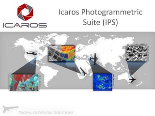
Icaros Photogrammetric
Suite (IPS)
About Us
Established 2004, Metro Washington DC
Developed advanced remote sensing software, solutions, and
services
Dedicated R&D and production facilities
Esri Silver Partner
Global reach through unique collection techniques
Customers and Partners
Remote Sensing Lifecycle
Digital Mapping h/w
Mission Planning s/w
Mission Management s/w
Mission Data Developer s/w
Camera Calibration s/w

Collect

Process

Collection
Suite
(ICS)

Analyze
DSM Change Detection
3D City Model data

Oblique viewer
Oblique analyst

Analytics
Suite
(IAS)

Photogrammetric Suite
(auto triangulation,
ortho, etc.)

Photogrammetric
Suite
(IPS)

Visualize

Derive
Dense DSM s/w
3D point cloud (LAS) s/w
Introduction to IPS
Aerial image data processing software
Designed on remote sensing and collection expertise
Compatible with any frame-based sensor (Platform
agnostic)
Creates high-resolution topographic products
Orthomosaics
Digital Terrain/Digital Surface Maps
3D models from raw image data
Oblique/Thermal processing

Training, support and installation services
Value Proposition
Comprehensive, global-reach aerial imagery
collection
Rapid-deployment flexible platform
Adds support for new sensors (UAS/UAV,
thermal, oblique)
Comprehensive photogrammetric processing
software completely within ArcGIS
Deriving 3D data (DSM, Point Cloud, Model,
Parametric) for ArcGIS
Aerial Triangulation (AT)
Intelligent tie-point management engine for strong
connectivity and uniform distribution
No extra data required (e.g. position, rotation, scale)
Minimal outliers
Correlates images with different resolutions (GSDs)
Indifferent to misleading regions (clouds, lakes)
GPU-enabled for expedited processing capabilities
(high performance-value in designated workstations)
Enables Incremental workflow
1
8643 tie-points

1
14
Solution Manager
3 Concurrent synchronized views of the data:
Alpha-numeric
Multi-Image presentation
Geographic

Uses most advanced numerical optimization methods
Compatible with a large number of images per
photogrammetric block
Adaptive weighting function
Robust bundle option for high-accuracy, low RMS Aerialtriangulation in a ground-controlled project
Exports to all standard industry formats (PAT-B, SUP, etc)
Elevation Extraction (EL)
2 Options:
DTM Sparse – Fast production of general elevation
layer (<10 minutes for large blocks)
DTM Dense – High density and detail elevation
extraction, 2-3X GSD production density

Produces Dense Surface Models (DSM), then uses
high density data to produce a lower density
Terrain Model, with limited additional processing
Extracts Point Clouds from Stereo Imagery,
including color values in LAS format
Dense Digital Surface Model and Terrain Model

Dense Surface Model

Digital Terrain Model
Dense Surface Elevation Extraction in Urban
Settings

Overlaid Rectified Imagery to Recreate 3-D Model
Orthorectification and Production
Fast and automated Orthorectification
Compatible with multiple formats
Geotif, ASCII, DEM, etc.

Simple integration with LiDAR data
Runs directly on LAS files

Incorporates breaklines for bridges or extreme
terrain rectification
Compression and overview creation
Converts multiple bit and band combinations
Orthorectification and Production

Final Orthorectified Image
Automatic Seamline Extraction
Icaros Smart Seamlines – automatic optimal
seamline extraction
Multiple-image color adjustment and balancing
Automatic brightness profiling and dodging for
uniformity
Advanced feathering algorithm
Multi-core and GPU architecture for performance
enhancement
Enables incremental workflow
Automatic Seamline Extraction
Seamlines are automated to follow natural passes and roadways, as well avoid
cutting through structures
Interactive Seamline Editor
User-friendly and comfortable seamline editing environment and tools
Interactive Seamline Editor
Select a seamline, shift it and view the new mosaic created from the edited seamline
in real time
Advanced Feathering
Advanced feathering allows for a seamless blend between all images in the
mosaic, as shown in this mosaic scene
Automatic Dodging and Profiling
Modeling illumination affect and vignetting by fitting a
surface.

After

Before
Color Balancing
Advanced Editing (ED)
Patch Mosaic – Replace any area in a final
mosaic with alternative orthorectified data
Correct small artifacts in the orthomosaic
Replace unwanted building lean, sun glare on
rooftops or water surfaces

Super Tile – Combine over 100 tiles into a
single editable tile, in any Graphic
Manipulation Software, then apply general
tweaks to the entire project
Clouds cover an entire area of the image
Clouds patched using alternate image
Large Project Color Profile using Super Tile
Natural Tint in Final Imagery
Yellow
Original Images

Mosaic composed of
multiple 1+ GB tiles,
processed as an Icaros
Super Tile
Large Project Color Profile with Super Tile
Additional Capabilities
Deriving and visualizing 3D data
DSMs
Point Clouds
Models
Parametric
2.5D Webscene
Oblique Viewer
UAV and Image Processing
Point of contact:
www.icaros.us
Richard Baumgartner
+1 703-338-6771
rbaumgartner@icaros.us
Skype: richard.baumgartner6
www.linkedin.com/in/rickbaumgartner

Weitere Àhnliche Inhalte

Was ist angesagt?

2013 Vendor Track, LiDAR Processing and Terrain Analysis in Global Mapper by ...
2013 Vendor Track, LiDAR Processing and Terrain Analysis in Global Mapper by ...2013 Vendor Track, LiDAR Processing and Terrain Analysis in Global Mapper by ...
2013 Vendor Track, LiDAR Processing and Terrain Analysis in Global Mapper by ...GIS in the Rockies
 
VizDyn and spatial utility Dec 2014
VizDyn and spatial utility Dec 2014VizDyn and spatial utility Dec 2014
VizDyn and spatial utility Dec 2014Jim Head
 
3D laser scanning
3D laser scanning 3D laser scanning
3D laser scanning sharma230399
 
Imagery and beyond - BK 2016
Imagery and beyond - BK 2016Imagery and beyond - BK 2016
Imagery and beyond - BK 2016Geodata AS
 
Detecting Buildings in AHN2 LiDAR data with ArcGIS - Grontmij
Detecting Buildings in AHN2 LiDAR data with ArcGIS - GrontmijDetecting Buildings in AHN2 LiDAR data with ArcGIS - Grontmij
Detecting Buildings in AHN2 LiDAR data with ArcGIS - GrontmijXander Bakker
 
Global mapper tutorial Jimma University Ethiopia
Global mapper tutorial Jimma University EthiopiaGlobal mapper tutorial Jimma University Ethiopia
Global mapper tutorial Jimma University Ethiopiachala hailu
 
The 'right' choices in GIS - Grontmij
The 'right' choices in GIS - GrontmijThe 'right' choices in GIS - Grontmij
The 'right' choices in GIS - GrontmijXander Bakker
 
3D Scanning & Printing
3D Scanning & Printing3D Scanning & Printing
3D Scanning & PrintingFab Lab LIMA
 
3D feature collection for ArcGIS
3D feature collection for ArcGIS3D feature collection for ArcGIS
3D feature collection for ArcGISAldoFacchin
 
FARO Reality techsheet
FARO Reality techsheetFARO Reality techsheet
FARO Reality techsheetUlises Uscanga
 
Field Activity Planner - A cloud based digital energy platform
Field Activity Planner - A cloud based digital energy platformField Activity Planner - A cloud based digital energy platform
Field Activity Planner - A cloud based digital energy platformFutureOn
 
DSM Generation Using High Resolution UAV Images
DSM Generation Using High Resolution UAV ImagesDSM Generation Using High Resolution UAV Images
DSM Generation Using High Resolution UAV ImagesBiplov Bhandari
 
3d scanning techniques
3d scanning techniques3d scanning techniques
3d scanning techniquesFrederic Kaplan
 
Overview of 3D GIS Capabilties
Overview of 3D GIS CapabiltiesOverview of 3D GIS Capabilties
Overview of 3D GIS CapabiltiesErik Van Der Zee
 
IWMW Campus Maps Workshop
IWMW Campus Maps WorkshopIWMW Campus Maps Workshop
IWMW Campus Maps WorkshopAddy Pope
 
Basics of 3D scanning and how structured light scanning works
Basics of 3D scanning and how structured light scanning worksBasics of 3D scanning and how structured light scanning works
Basics of 3D scanning and how structured light scanning worksSowmiya Siva
 
Zivaro Geospatial Services - UAS Data Processing
Zivaro Geospatial Services - UAS Data ProcessingZivaro Geospatial Services - UAS Data Processing
Zivaro Geospatial Services - UAS Data ProcessingGregPeters46
 

Was ist angesagt? (20)

2013 Vendor Track, LiDAR Processing and Terrain Analysis in Global Mapper by ...
2013 Vendor Track, LiDAR Processing and Terrain Analysis in Global Mapper by ...2013 Vendor Track, LiDAR Processing and Terrain Analysis in Global Mapper by ...
2013 Vendor Track, LiDAR Processing and Terrain Analysis in Global Mapper by ...
 
VizDyn and spatial utility Dec 2014
VizDyn and spatial utility Dec 2014VizDyn and spatial utility Dec 2014
VizDyn and spatial utility Dec 2014
 
3D laser scanning
3D laser scanning 3D laser scanning
3D laser scanning
 
Imagery and beyond - BK 2016
Imagery and beyond - BK 2016Imagery and beyond - BK 2016
Imagery and beyond - BK 2016
 
Mobile Options for ArcGIS – Selecting Your Solution
Mobile Options for ArcGIS – Selecting Your SolutionMobile Options for ArcGIS – Selecting Your Solution
Mobile Options for ArcGIS – Selecting Your Solution
 
ERDAS IMAGINE
ERDAS IMAGINEERDAS IMAGINE
ERDAS IMAGINE
 
Detecting Buildings in AHN2 LiDAR data with ArcGIS - Grontmij
Detecting Buildings in AHN2 LiDAR data with ArcGIS - GrontmijDetecting Buildings in AHN2 LiDAR data with ArcGIS - Grontmij
Detecting Buildings in AHN2 LiDAR data with ArcGIS - Grontmij
 
3D Laser Scanning
3D Laser Scanning 3D Laser Scanning
3D Laser Scanning
 
Global mapper tutorial Jimma University Ethiopia
Global mapper tutorial Jimma University EthiopiaGlobal mapper tutorial Jimma University Ethiopia
Global mapper tutorial Jimma University Ethiopia
 
The 'right' choices in GIS - Grontmij
The 'right' choices in GIS - GrontmijThe 'right' choices in GIS - Grontmij
The 'right' choices in GIS - Grontmij
 
3D Scanning & Printing
3D Scanning & Printing3D Scanning & Printing
3D Scanning & Printing
 
3D feature collection for ArcGIS
3D feature collection for ArcGIS3D feature collection for ArcGIS
3D feature collection for ArcGIS
 
FARO Reality techsheet
FARO Reality techsheetFARO Reality techsheet
FARO Reality techsheet
 
Field Activity Planner - A cloud based digital energy platform
Field Activity Planner - A cloud based digital energy platformField Activity Planner - A cloud based digital energy platform
Field Activity Planner - A cloud based digital energy platform
 
DSM Generation Using High Resolution UAV Images
DSM Generation Using High Resolution UAV ImagesDSM Generation Using High Resolution UAV Images
DSM Generation Using High Resolution UAV Images
 
3d scanning techniques
3d scanning techniques3d scanning techniques
3d scanning techniques
 
Overview of 3D GIS Capabilties
Overview of 3D GIS CapabiltiesOverview of 3D GIS Capabilties
Overview of 3D GIS Capabilties
 
IWMW Campus Maps Workshop
IWMW Campus Maps WorkshopIWMW Campus Maps Workshop
IWMW Campus Maps Workshop
 
Basics of 3D scanning and how structured light scanning works
Basics of 3D scanning and how structured light scanning worksBasics of 3D scanning and how structured light scanning works
Basics of 3D scanning and how structured light scanning works
 
Zivaro Geospatial Services - UAS Data Processing
Zivaro Geospatial Services - UAS Data ProcessingZivaro Geospatial Services - UAS Data Processing
Zivaro Geospatial Services - UAS Data Processing
 

Andere mochten auch

Mapping Santa Catarina, Brazil with SPOT 5 HRS and HRG by ENGEMAP
Mapping Santa Catarina, Brazil with SPOT 5 HRS and HRG by ENGEMAPMapping Santa Catarina, Brazil with SPOT 5 HRS and HRG by ENGEMAP
Mapping Santa Catarina, Brazil with SPOT 5 HRS and HRG by ENGEMAPSpot Image
 
Unmanned Aerial Vehicles as Mobile Multi-sensor Platforms
Unmanned Aerial Vehicles as Mobile Multi-sensor PlatformsUnmanned Aerial Vehicles as Mobile Multi-sensor Platforms
Unmanned Aerial Vehicles as Mobile Multi-sensor PlatformsMatthes Rieke
 
Accuracy Assessment Of An eBee UAS Survey
Accuracy Assessment Of An eBee UAS SurveyAccuracy Assessment Of An eBee UAS Survey
Accuracy Assessment Of An eBee UAS SurveysenseFly
 
Generation of High Resolution DSM Using UAV Images.
Generation of High Resolution DSM Using UAV Images.Generation of High Resolution DSM Using UAV Images.
Generation of High Resolution DSM Using UAV Images.Niroj Panta
 
1 Aerial View - Drone Snapshot2
1 Aerial View - Drone Snapshot21 Aerial View - Drone Snapshot2
1 Aerial View - Drone Snapshot2Garth Torasadhewa
 
Remote sensing
Remote sensingRemote sensing
Remote sensingMohamed Salah
 
Photogrammetry 1.
Photogrammetry 1.Photogrammetry 1.
Photogrammetry 1.Naveen Kumar
 
Introduction to aerial photography and photogrammetry.ppt
Introduction to aerial photography and photogrammetry.pptIntroduction to aerial photography and photogrammetry.ppt
Introduction to aerial photography and photogrammetry.pptsrinivas2036
 
Photogrammetry - areaotriangulation
Photogrammetry - areaotriangulationPhotogrammetry - areaotriangulation
Photogrammetry - areaotriangulationjayan_sri
 

Andere mochten auch (11)

Mapping Santa Catarina, Brazil with SPOT 5 HRS and HRG by ENGEMAP
Mapping Santa Catarina, Brazil with SPOT 5 HRS and HRG by ENGEMAPMapping Santa Catarina, Brazil with SPOT 5 HRS and HRG by ENGEMAP
Mapping Santa Catarina, Brazil with SPOT 5 HRS and HRG by ENGEMAP
 
Unmanned Aerial Vehicles as Mobile Multi-sensor Platforms
Unmanned Aerial Vehicles as Mobile Multi-sensor PlatformsUnmanned Aerial Vehicles as Mobile Multi-sensor Platforms
Unmanned Aerial Vehicles as Mobile Multi-sensor Platforms
 
Accuracy Assessment Of An eBee UAS Survey
Accuracy Assessment Of An eBee UAS SurveyAccuracy Assessment Of An eBee UAS Survey
Accuracy Assessment Of An eBee UAS Survey
 
Generation of High Resolution DSM Using UAV Images.
Generation of High Resolution DSM Using UAV Images.Generation of High Resolution DSM Using UAV Images.
Generation of High Resolution DSM Using UAV Images.
 
Photogrammetry
PhotogrammetryPhotogrammetry
Photogrammetry
 
1 Aerial View - Drone Snapshot2
1 Aerial View - Drone Snapshot21 Aerial View - Drone Snapshot2
1 Aerial View - Drone Snapshot2
 
Hawk-Eye
Hawk-EyeHawk-Eye
Hawk-Eye
 
Remote sensing
Remote sensingRemote sensing
Remote sensing
 
Photogrammetry 1.
Photogrammetry 1.Photogrammetry 1.
Photogrammetry 1.
 
Introduction to aerial photography and photogrammetry.ppt
Introduction to aerial photography and photogrammetry.pptIntroduction to aerial photography and photogrammetry.ppt
Introduction to aerial photography and photogrammetry.ppt
 
Photogrammetry - areaotriangulation
Photogrammetry - areaotriangulationPhotogrammetry - areaotriangulation
Photogrammetry - areaotriangulation
 

Ähnlich wie Icaros Photogrammetric Suite (IPS) Module Overview

Aerial Services, Inc
Aerial Services, IncAerial Services, Inc
Aerial Services, IncAerial Services
 
Desktop Softwares for Unmanned Aerial Systems(UAS))
Desktop Softwares for Unmanned Aerial Systems(UAS))Desktop Softwares for Unmanned Aerial Systems(UAS))
Desktop Softwares for Unmanned Aerial Systems(UAS))Kamal Shahi
 
Rolta Photogrammetry Suite
Rolta Photogrammetry SuiteRolta Photogrammetry Suite
Rolta Photogrammetry SuiteRolta
 
"High-resolution 3D Reconstruction on a Mobile Processor," a Presentation fro...
"High-resolution 3D Reconstruction on a Mobile Processor," a Presentation fro..."High-resolution 3D Reconstruction on a Mobile Processor," a Presentation fro...
"High-resolution 3D Reconstruction on a Mobile Processor," a Presentation fro...Edge AI and Vision Alliance
 
Combining 3D Imagery and Lidar with ArcGIS in Aerial and Mobile Applications
Combining 3D Imagery and Lidar with ArcGIS in Aerial and Mobile ApplicationsCombining 3D Imagery and Lidar with ArcGIS in Aerial and Mobile Applications
Combining 3D Imagery and Lidar with ArcGIS in Aerial and Mobile ApplicationsEsri
 
Remote Sensing Field Camp 2016
Remote Sensing Field Camp 2016 Remote Sensing Field Camp 2016
Remote Sensing Field Camp 2016 COGS Presentations
 
Arindam batabyal literature reviewpresentation
Arindam batabyal literature reviewpresentationArindam batabyal literature reviewpresentation
Arindam batabyal literature reviewpresentationArindam Batabyal
 
UC Fast Visualisaion
UC Fast VisualisaionUC Fast Visualisaion
UC Fast Visualisaioncircus3d
 
UC Fast Visualisaion
UC Fast VisualisaionUC Fast Visualisaion
UC Fast Visualisaioncircus3d
 
Poster Presentation "Generation of High Resolution DSM Usin UAV Images"
Poster Presentation "Generation of High Resolution DSM Usin UAV Images"Poster Presentation "Generation of High Resolution DSM Usin UAV Images"
Poster Presentation "Generation of High Resolution DSM Usin UAV Images"Nepal Flying Labs
 
MDT7
MDT7MDT7
MDT7aplitop
 
What's new in Hexagon-Geospatial Power Portfolio 2016
What's new in Hexagon-Geospatial Power Portfolio 2016What's new in Hexagon-Geospatial Power Portfolio 2016
What's new in Hexagon-Geospatial Power Portfolio 2016Planetek Italia Srl
 
FME User Stories from Around the World
FME User Stories from Around the WorldFME User Stories from Around the World
FME User Stories from Around the WorldSafe Software
 
Spar 2010 Presetation
Spar 2010 PresetationSpar 2010 Presetation
Spar 2010 Presetationcformeller
 
GWT 2014: Energy Conference - 02 Le soluzioni Geospaziali per il mondo energy
GWT 2014: Energy Conference - 02 Le soluzioni Geospaziali per il mondo energyGWT 2014: Energy Conference - 02 Le soluzioni Geospaziali per il mondo energy
GWT 2014: Energy Conference - 02 Le soluzioni Geospaziali per il mondo energyPlanetek Italia Srl
 
Engineering Art at Autodesk University 2013
Engineering Art at Autodesk University 2013 Engineering Art at Autodesk University 2013
Engineering Art at Autodesk University 2013 TheDewberryWay
 
3D Visualization in ArcGIS Pro
3D Visualization in ArcGIS Pro3D Visualization in ArcGIS Pro
3D Visualization in ArcGIS Prothangqd
 
AvisMap GIS Products Overview
AvisMap GIS Products OverviewAvisMap GIS Products Overview
AvisMap GIS Products Overviewavismapsoftware
 
Unmanned Aerial Systems (UAS) Data Quality and Accuracy Realities
Unmanned Aerial Systems (UAS) Data Quality and Accuracy RealitiesUnmanned Aerial Systems (UAS) Data Quality and Accuracy Realities
Unmanned Aerial Systems (UAS) Data Quality and Accuracy RealitiesUAS Colorado
 
FME World Tour 2015 - Around the World - Ken Bragg
FME World Tour 2015 - Around the World - Ken BraggFME World Tour 2015 - Around the World - Ken Bragg
FME World Tour 2015 - Around the World - Ken BraggIMGS
 

Ähnlich wie Icaros Photogrammetric Suite (IPS) Module Overview (20)

Aerial Services, Inc
Aerial Services, IncAerial Services, Inc
Aerial Services, Inc
 
Desktop Softwares for Unmanned Aerial Systems(UAS))
Desktop Softwares for Unmanned Aerial Systems(UAS))Desktop Softwares for Unmanned Aerial Systems(UAS))
Desktop Softwares for Unmanned Aerial Systems(UAS))
 
Rolta Photogrammetry Suite
Rolta Photogrammetry SuiteRolta Photogrammetry Suite
Rolta Photogrammetry Suite
 
"High-resolution 3D Reconstruction on a Mobile Processor," a Presentation fro...
"High-resolution 3D Reconstruction on a Mobile Processor," a Presentation fro..."High-resolution 3D Reconstruction on a Mobile Processor," a Presentation fro...
"High-resolution 3D Reconstruction on a Mobile Processor," a Presentation fro...
 
Combining 3D Imagery and Lidar with ArcGIS in Aerial and Mobile Applications
Combining 3D Imagery and Lidar with ArcGIS in Aerial and Mobile ApplicationsCombining 3D Imagery and Lidar with ArcGIS in Aerial and Mobile Applications
Combining 3D Imagery and Lidar with ArcGIS in Aerial and Mobile Applications
 
Remote Sensing Field Camp 2016
Remote Sensing Field Camp 2016 Remote Sensing Field Camp 2016
Remote Sensing Field Camp 2016
 
Arindam batabyal literature reviewpresentation
Arindam batabyal literature reviewpresentationArindam batabyal literature reviewpresentation
Arindam batabyal literature reviewpresentation
 
UC Fast Visualisaion
UC Fast VisualisaionUC Fast Visualisaion
UC Fast Visualisaion
 
UC Fast Visualisaion
UC Fast VisualisaionUC Fast Visualisaion
UC Fast Visualisaion
 
Poster Presentation "Generation of High Resolution DSM Usin UAV Images"
Poster Presentation "Generation of High Resolution DSM Usin UAV Images"Poster Presentation "Generation of High Resolution DSM Usin UAV Images"
Poster Presentation "Generation of High Resolution DSM Usin UAV Images"
 
MDT7
MDT7MDT7
MDT7
 
What's new in Hexagon-Geospatial Power Portfolio 2016
What's new in Hexagon-Geospatial Power Portfolio 2016What's new in Hexagon-Geospatial Power Portfolio 2016
What's new in Hexagon-Geospatial Power Portfolio 2016
 
FME User Stories from Around the World
FME User Stories from Around the WorldFME User Stories from Around the World
FME User Stories from Around the World
 
Spar 2010 Presetation
Spar 2010 PresetationSpar 2010 Presetation
Spar 2010 Presetation
 
GWT 2014: Energy Conference - 02 Le soluzioni Geospaziali per il mondo energy
GWT 2014: Energy Conference - 02 Le soluzioni Geospaziali per il mondo energyGWT 2014: Energy Conference - 02 Le soluzioni Geospaziali per il mondo energy
GWT 2014: Energy Conference - 02 Le soluzioni Geospaziali per il mondo energy
 
Engineering Art at Autodesk University 2013
Engineering Art at Autodesk University 2013 Engineering Art at Autodesk University 2013
Engineering Art at Autodesk University 2013
 
3D Visualization in ArcGIS Pro
3D Visualization in ArcGIS Pro3D Visualization in ArcGIS Pro
3D Visualization in ArcGIS Pro
 
AvisMap GIS Products Overview
AvisMap GIS Products OverviewAvisMap GIS Products Overview
AvisMap GIS Products Overview
 
Unmanned Aerial Systems (UAS) Data Quality and Accuracy Realities
Unmanned Aerial Systems (UAS) Data Quality and Accuracy RealitiesUnmanned Aerial Systems (UAS) Data Quality and Accuracy Realities
Unmanned Aerial Systems (UAS) Data Quality and Accuracy Realities
 
FME World Tour 2015 - Around the World - Ken Bragg
FME World Tour 2015 - Around the World - Ken BraggFME World Tour 2015 - Around the World - Ken Bragg
FME World Tour 2015 - Around the World - Ken Bragg
 

KĂŒrzlich hochgeladen

Salesforce Community Group Quito, Salesforce 101
Salesforce Community Group Quito, Salesforce 101Salesforce Community Group Quito, Salesforce 101
Salesforce Community Group Quito, Salesforce 101Paola De la Torre
 
Mastering MySQL Database Architecture: Deep Dive into MySQL Shell and MySQL R...
Mastering MySQL Database Architecture: Deep Dive into MySQL Shell and MySQL R...Mastering MySQL Database Architecture: Deep Dive into MySQL Shell and MySQL R...
Mastering MySQL Database Architecture: Deep Dive into MySQL Shell and MySQL R...Miguel AraĂșjo
 
Exploring the Future Potential of AI-Enabled Smartphone Processors
Exploring the Future Potential of AI-Enabled Smartphone ProcessorsExploring the Future Potential of AI-Enabled Smartphone Processors
Exploring the Future Potential of AI-Enabled Smartphone Processorsdebabhi2
 
From Event to Action: Accelerate Your Decision Making with Real-Time Automation
From Event to Action: Accelerate Your Decision Making with Real-Time AutomationFrom Event to Action: Accelerate Your Decision Making with Real-Time Automation
From Event to Action: Accelerate Your Decision Making with Real-Time AutomationSafe Software
 
Partners Life - Insurer Innovation Award 2024
Partners Life - Insurer Innovation Award 2024Partners Life - Insurer Innovation Award 2024
Partners Life - Insurer Innovation Award 2024The Digital Insurer
 
A Call to Action for Generative AI in 2024
A Call to Action for Generative AI in 2024A Call to Action for Generative AI in 2024
A Call to Action for Generative AI in 2024Results
 
The 7 Things I Know About Cyber Security After 25 Years | April 2024
The 7 Things I Know About Cyber Security After 25 Years | April 2024The 7 Things I Know About Cyber Security After 25 Years | April 2024
The 7 Things I Know About Cyber Security After 25 Years | April 2024Rafal Los
 
Unblocking The Main Thread Solving ANRs and Frozen Frames
Unblocking The Main Thread Solving ANRs and Frozen FramesUnblocking The Main Thread Solving ANRs and Frozen Frames
Unblocking The Main Thread Solving ANRs and Frozen FramesSinan KOZAK
 
04-2024-HHUG-Sales-and-Marketing-Alignment.pptx
04-2024-HHUG-Sales-and-Marketing-Alignment.pptx04-2024-HHUG-Sales-and-Marketing-Alignment.pptx
04-2024-HHUG-Sales-and-Marketing-Alignment.pptxHampshireHUG
 
IAC 2024 - IA Fast Track to Search Focused AI Solutions
IAC 2024 - IA Fast Track to Search Focused AI SolutionsIAC 2024 - IA Fast Track to Search Focused AI Solutions
IAC 2024 - IA Fast Track to Search Focused AI SolutionsEnterprise Knowledge
 
Slack Application Development 101 Slides
Slack Application Development 101 SlidesSlack Application Development 101 Slides
Slack Application Development 101 Slidespraypatel2
 
Workshop - Best of Both Worlds_ Combine KG and Vector search for enhanced R...
Workshop - Best of Both Worlds_ Combine  KG and Vector search for  enhanced R...Workshop - Best of Both Worlds_ Combine  KG and Vector search for  enhanced R...
Workshop - Best of Both Worlds_ Combine KG and Vector search for enhanced R...Neo4j
 
🐬 The future of MySQL is Postgres 🐘
🐬  The future of MySQL is Postgres   🐘🐬  The future of MySQL is Postgres   🐘
🐬 The future of MySQL is Postgres 🐘RTylerCroy
 
08448380779 Call Girls In Greater Kailash - I Women Seeking Men
08448380779 Call Girls In Greater Kailash - I Women Seeking Men08448380779 Call Girls In Greater Kailash - I Women Seeking Men
08448380779 Call Girls In Greater Kailash - I Women Seeking MenDelhi Call girls
 
08448380779 Call Girls In Civil Lines Women Seeking Men
08448380779 Call Girls In Civil Lines Women Seeking Men08448380779 Call Girls In Civil Lines Women Seeking Men
08448380779 Call Girls In Civil Lines Women Seeking MenDelhi Call girls
 
Tata AIG General Insurance Company - Insurer Innovation Award 2024
Tata AIG General Insurance Company - Insurer Innovation Award 2024Tata AIG General Insurance Company - Insurer Innovation Award 2024
Tata AIG General Insurance Company - Insurer Innovation Award 2024The Digital Insurer
 
Neo4j - How KGs are shaping the future of Generative AI at AWS Summit London ...
Neo4j - How KGs are shaping the future of Generative AI at AWS Summit London ...Neo4j - How KGs are shaping the future of Generative AI at AWS Summit London ...
Neo4j - How KGs are shaping the future of Generative AI at AWS Summit London ...Neo4j
 
Top 5 Benefits OF Using Muvi Live Paywall For Live Streams
Top 5 Benefits OF Using Muvi Live Paywall For Live StreamsTop 5 Benefits OF Using Muvi Live Paywall For Live Streams
Top 5 Benefits OF Using Muvi Live Paywall For Live StreamsRoshan Dwivedi
 
Driving Behavioral Change for Information Management through Data-Driven Gree...
Driving Behavioral Change for Information Management through Data-Driven Gree...Driving Behavioral Change for Information Management through Data-Driven Gree...
Driving Behavioral Change for Information Management through Data-Driven Gree...Enterprise Knowledge
 
The Codex of Business Writing Software for Real-World Solutions 2.pptx
The Codex of Business Writing Software for Real-World Solutions 2.pptxThe Codex of Business Writing Software for Real-World Solutions 2.pptx
The Codex of Business Writing Software for Real-World Solutions 2.pptxMalak Abu Hammad
 

KĂŒrzlich hochgeladen (20)

Salesforce Community Group Quito, Salesforce 101
Salesforce Community Group Quito, Salesforce 101Salesforce Community Group Quito, Salesforce 101
Salesforce Community Group Quito, Salesforce 101
 
Mastering MySQL Database Architecture: Deep Dive into MySQL Shell and MySQL R...
Mastering MySQL Database Architecture: Deep Dive into MySQL Shell and MySQL R...Mastering MySQL Database Architecture: Deep Dive into MySQL Shell and MySQL R...
Mastering MySQL Database Architecture: Deep Dive into MySQL Shell and MySQL R...
 
Exploring the Future Potential of AI-Enabled Smartphone Processors
Exploring the Future Potential of AI-Enabled Smartphone ProcessorsExploring the Future Potential of AI-Enabled Smartphone Processors
Exploring the Future Potential of AI-Enabled Smartphone Processors
 
From Event to Action: Accelerate Your Decision Making with Real-Time Automation
From Event to Action: Accelerate Your Decision Making with Real-Time AutomationFrom Event to Action: Accelerate Your Decision Making with Real-Time Automation
From Event to Action: Accelerate Your Decision Making with Real-Time Automation
 
Partners Life - Insurer Innovation Award 2024
Partners Life - Insurer Innovation Award 2024Partners Life - Insurer Innovation Award 2024
Partners Life - Insurer Innovation Award 2024
 
A Call to Action for Generative AI in 2024
A Call to Action for Generative AI in 2024A Call to Action for Generative AI in 2024
A Call to Action for Generative AI in 2024
 
The 7 Things I Know About Cyber Security After 25 Years | April 2024
The 7 Things I Know About Cyber Security After 25 Years | April 2024The 7 Things I Know About Cyber Security After 25 Years | April 2024
The 7 Things I Know About Cyber Security After 25 Years | April 2024
 
Unblocking The Main Thread Solving ANRs and Frozen Frames
Unblocking The Main Thread Solving ANRs and Frozen FramesUnblocking The Main Thread Solving ANRs and Frozen Frames
Unblocking The Main Thread Solving ANRs and Frozen Frames
 
04-2024-HHUG-Sales-and-Marketing-Alignment.pptx
04-2024-HHUG-Sales-and-Marketing-Alignment.pptx04-2024-HHUG-Sales-and-Marketing-Alignment.pptx
04-2024-HHUG-Sales-and-Marketing-Alignment.pptx
 
IAC 2024 - IA Fast Track to Search Focused AI Solutions
IAC 2024 - IA Fast Track to Search Focused AI SolutionsIAC 2024 - IA Fast Track to Search Focused AI Solutions
IAC 2024 - IA Fast Track to Search Focused AI Solutions
 
Slack Application Development 101 Slides
Slack Application Development 101 SlidesSlack Application Development 101 Slides
Slack Application Development 101 Slides
 
Workshop - Best of Both Worlds_ Combine KG and Vector search for enhanced R...
Workshop - Best of Both Worlds_ Combine  KG and Vector search for  enhanced R...Workshop - Best of Both Worlds_ Combine  KG and Vector search for  enhanced R...
Workshop - Best of Both Worlds_ Combine KG and Vector search for enhanced R...
 
🐬 The future of MySQL is Postgres 🐘
🐬  The future of MySQL is Postgres   🐘🐬  The future of MySQL is Postgres   🐘
🐬 The future of MySQL is Postgres 🐘
 
08448380779 Call Girls In Greater Kailash - I Women Seeking Men
08448380779 Call Girls In Greater Kailash - I Women Seeking Men08448380779 Call Girls In Greater Kailash - I Women Seeking Men
08448380779 Call Girls In Greater Kailash - I Women Seeking Men
 
08448380779 Call Girls In Civil Lines Women Seeking Men
08448380779 Call Girls In Civil Lines Women Seeking Men08448380779 Call Girls In Civil Lines Women Seeking Men
08448380779 Call Girls In Civil Lines Women Seeking Men
 
Tata AIG General Insurance Company - Insurer Innovation Award 2024
Tata AIG General Insurance Company - Insurer Innovation Award 2024Tata AIG General Insurance Company - Insurer Innovation Award 2024
Tata AIG General Insurance Company - Insurer Innovation Award 2024
 
Neo4j - How KGs are shaping the future of Generative AI at AWS Summit London ...
Neo4j - How KGs are shaping the future of Generative AI at AWS Summit London ...Neo4j - How KGs are shaping the future of Generative AI at AWS Summit London ...
Neo4j - How KGs are shaping the future of Generative AI at AWS Summit London ...
 
Top 5 Benefits OF Using Muvi Live Paywall For Live Streams
Top 5 Benefits OF Using Muvi Live Paywall For Live StreamsTop 5 Benefits OF Using Muvi Live Paywall For Live Streams
Top 5 Benefits OF Using Muvi Live Paywall For Live Streams
 
Driving Behavioral Change for Information Management through Data-Driven Gree...
Driving Behavioral Change for Information Management through Data-Driven Gree...Driving Behavioral Change for Information Management through Data-Driven Gree...
Driving Behavioral Change for Information Management through Data-Driven Gree...
 
The Codex of Business Writing Software for Real-World Solutions 2.pptx
The Codex of Business Writing Software for Real-World Solutions 2.pptxThe Codex of Business Writing Software for Real-World Solutions 2.pptx
The Codex of Business Writing Software for Real-World Solutions 2.pptx
 

Icaros Photogrammetric Suite (IPS) Module Overview

  • 2. About Us Established 2004, Metro Washington DC Developed advanced remote sensing software, solutions, and services Dedicated R&D and production facilities Esri Silver Partner Global reach through unique collection techniques
  • 4. Remote Sensing Lifecycle Digital Mapping h/w Mission Planning s/w Mission Management s/w Mission Data Developer s/w Camera Calibration s/w Collect Process Collection Suite (ICS) Analyze DSM Change Detection 3D City Model data Oblique viewer Oblique analyst Analytics Suite (IAS) Photogrammetric Suite (auto triangulation, ortho, etc.) Photogrammetric Suite (IPS) Visualize Derive Dense DSM s/w 3D point cloud (LAS) s/w
  • 5. Introduction to IPS Aerial image data processing software Designed on remote sensing and collection expertise Compatible with any frame-based sensor (Platform agnostic) Creates high-resolution topographic products Orthomosaics Digital Terrain/Digital Surface Maps 3D models from raw image data Oblique/Thermal processing Training, support and installation services
  • 6. Value Proposition Comprehensive, global-reach aerial imagery collection Rapid-deployment flexible platform Adds support for new sensors (UAS/UAV, thermal, oblique) Comprehensive photogrammetric processing software completely within ArcGIS Deriving 3D data (DSM, Point Cloud, Model, Parametric) for ArcGIS
  • 7. Aerial Triangulation (AT) Intelligent tie-point management engine for strong connectivity and uniform distribution No extra data required (e.g. position, rotation, scale) Minimal outliers Correlates images with different resolutions (GSDs) Indifferent to misleading regions (clouds, lakes) GPU-enabled for expedited processing capabilities (high performance-value in designated workstations) Enables Incremental workflow
  • 9. Solution Manager 3 Concurrent synchronized views of the data: Alpha-numeric Multi-Image presentation Geographic Uses most advanced numerical optimization methods Compatible with a large number of images per photogrammetric block Adaptive weighting function Robust bundle option for high-accuracy, low RMS Aerialtriangulation in a ground-controlled project Exports to all standard industry formats (PAT-B, SUP, etc)
  • 10.
  • 11.
  • 12. Elevation Extraction (EL) 2 Options: DTM Sparse – Fast production of general elevation layer (<10 minutes for large blocks) DTM Dense – High density and detail elevation extraction, 2-3X GSD production density Produces Dense Surface Models (DSM), then uses high density data to produce a lower density Terrain Model, with limited additional processing Extracts Point Clouds from Stereo Imagery, including color values in LAS format
  • 13. Dense Digital Surface Model and Terrain Model Dense Surface Model Digital Terrain Model
  • 14. Dense Surface Elevation Extraction in Urban Settings Overlaid Rectified Imagery to Recreate 3-D Model
  • 15. Orthorectification and Production Fast and automated Orthorectification Compatible with multiple formats Geotif, ASCII, DEM, etc. Simple integration with LiDAR data Runs directly on LAS files Incorporates breaklines for bridges or extreme terrain rectification Compression and overview creation Converts multiple bit and band combinations
  • 17. Automatic Seamline Extraction Icaros Smart Seamlines – automatic optimal seamline extraction Multiple-image color adjustment and balancing Automatic brightness profiling and dodging for uniformity Advanced feathering algorithm Multi-core and GPU architecture for performance enhancement Enables incremental workflow
  • 18. Automatic Seamline Extraction Seamlines are automated to follow natural passes and roadways, as well avoid cutting through structures
  • 19. Interactive Seamline Editor User-friendly and comfortable seamline editing environment and tools
  • 20. Interactive Seamline Editor Select a seamline, shift it and view the new mosaic created from the edited seamline in real time
  • 21. Advanced Feathering Advanced feathering allows for a seamless blend between all images in the mosaic, as shown in this mosaic scene
  • 22. Automatic Dodging and Profiling Modeling illumination affect and vignetting by fitting a surface. After Before
  • 24. Advanced Editing (ED) Patch Mosaic – Replace any area in a final mosaic with alternative orthorectified data Correct small artifacts in the orthomosaic Replace unwanted building lean, sun glare on rooftops or water surfaces Super Tile – Combine over 100 tiles into a single editable tile, in any Graphic Manipulation Software, then apply general tweaks to the entire project
  • 25. Clouds cover an entire area of the image
  • 26. Clouds patched using alternate image
  • 27. Large Project Color Profile using Super Tile Natural Tint in Final Imagery Yellow Original Images Mosaic composed of multiple 1+ GB tiles, processed as an Icaros Super Tile
  • 28. Large Project Color Profile with Super Tile
  • 29. Additional Capabilities Deriving and visualizing 3D data DSMs Point Clouds Models Parametric
  • 32. UAV and Image Processing
  • 33. Point of contact: www.icaros.us Richard Baumgartner +1 703-338-6771 rbaumgartner@icaros.us Skype: richard.baumgartner6 www.linkedin.com/in/rickbaumgartner

Hinweis der Redaktion

  1. Experience with large-frame AT solutions (very large geographic areas) – automatic processingPhotogrammetric suite informed by our collection and services experience
  2. Talk about server – processing as a service within the next 6 months