SlideShare ist ein Scribd-Unternehmen logo
1 von 36
Sensing Data and Flood Hazard
Modeling in Index-based Flood
Insurance (IBFI) for the Rural Farmers in
South Asia
Giriraj Amarnath, Ph.D.
Senior Researcher and Project Lead - IBFI
International Water Management Institute (IWMI),
Colombo
PRESENTATION OUTLINE
• Human cost of natural disasters and its impact
• Flood situation in Bihar
• Linking Disaster Management and Index Insurance
• IBFI Concept, Implementation Strategy
• Project Progress and Updates from team members
• Pilot area selection
• Flood hazard modeling
• Implementation process
• Business model and institutional framework
• Communication and IP
• Partnership for Implementation
HUMAN COST OF NATURAL DISASTERS AND ITS IMPACTS
Number of disasters and affected
people reported per country (1994-
2013)
IND
819m
PK
50m
BGL
127m
Global Assessment by natural disasters
BIG FACTS ON FLOODING
• Bihar is India’s most flood-prone state.
• 73% of the total geographical area is annually flooded.
• 76% of the population in North Bihar is at risk of flooding.
• Major flood events have occurred in 1987, 1995, 1998, 2002, 2004 and 2007.
• Approx. 15million people are affected by flooding
• Approx. 300,000 metric tons of rice production damaged by floods
• For example Muzaffarpur District, alone, incurred losses of over USD 3 million
per year from 2001 to 2012 due to floods.
• Recent report by UNISDR about 800 million people are currently living in flood-prone
areas, and 70 million are experiencing floods each year.
• Global flood losses in 2011 >$100 billion with major losses from Thailand, Australia and
Hurricane Irene
• Recent Overseas Development Institute (ODI), UK estimates to over $450 billion by 2030
• In 2007, floods killed 3,200 people in India and Bangladesh alone. In 2010, flooding killed
2,200 people in Pakistan and another 1,900 in China, while in 2013, an exceptionally high
number of 6,500 people died due to floods in India.
Bihar
Global to Regional
HISTORICAL FLOOD TRENDS IN GANGES BASIN
Flood Frequency Flood Duration
Flood Seasonality Flood Extent
RECENT FLOOD DISASTERS IN BIHAR
Photo credit: Amit Kumar
OBSERVING FLOOD DISASTERS FROM SPACE
1988 TO 2014 HISTORICAL IMAGES
THE ROLE OF DISASTER MANAGEMENT
Short-term
emergency assistance
Emergency
Response
Recovery Reconstruction &
Rehabilitation
Long-term infrastructure &
sustainable development
assistance
Liquidity Gap
X
Catastrophe
Time
http://www.wmo.int/pages/prog/drr/events/Barbados/Pres/4-CCRIF.pdf
PROMOTING PREPAREDNESS AND INCREASING RESILIENCE
The Tradeoff
Significant amount of money locked in disaster relief funds
The Tradeoff
Insurance can help unlock the money that is kept for relief and use it for climate
change adaptation and mitigation
RoleofInsurance
www.iwmi.org
Water for a food-secure world
REDUCING THE FLOOD RISK
Source: Jha et al, (2011) adapted from Ranger
and Garbett-Shiels (2011)
Cost-Benefit-Ratio
Robustness to Uncertainties
Structural Non-Structural
PORTFOLIO OF FLOOD MANAGEMENT
OPTIONS
Investment
Effectiveness
Acceptable risk level
IBFI
Levee
Storages
Diversions
Earlywarning
Reseroir
Opn.
MULTIPLE BARRIER PROTECTION
www.iwmi.org
Water for a food-secure world
2013 2013-142011-12
SHORT HISTORY OF IBFI
2015-18
CCAFS CRP
Refresh
Phase
Flood
Risk SA
ACTIVITY
IBFI Concept
Initiated and
Approved
Multi-
hazard
Mapping
SA
www.iwmi.org
Water for a food-secure world
PROJECT SUMMARY
CCAFS Project ID: P41-F2-SA-IWMI
Period: 2015 to 2018
Budget: USD 1.0 Million (approx.)
Target Countries: India & Bangladesh
Research Partners:
CGIAR: IWMI (HQ, ND), IFPRI-New Delhi
International: UoB, MCII, GlobalAgRisk, UNOOSA ++
India: ICAR-IIWM, NIH, FMISC, CWC + +
Bangladesh: IWM, MoDM, BWDB, UoD + +
Implementing/Co-sponsoring Partners:
AIC, eeMausam, BajajAllianz, SwissRe, DOA-BH, NABARD ++
Knowledge Sharing Partners:
FMISC, BSDMA, CWC, DoA-Bihar ++
Partners
CGIAR Partners + Donors
Knowledge Partner
Govt. + Technical Partner + Insurer
Communication, Media Partner
INDIA BANGLADESH
www.iwmi.org
Water for a food-secure world
RESEARCH OBJECTIVES
1. Setting up pilot-scale trials to demonstrate
that positive verifiable impacts emerge from
IBFI in terms of agriculture resilience and
improving productivity, and household
incomes, locally and at the broader scale
2. Developing tools and strategies that support
IBFI development and upscaling, integrated
with existing and future flood control
measures.
Flood index design
Flood hazard module
Flood loss module
Crop
Yield
loss
Economic loss
Water
level
Flood Extent
Flood Duration
Crop Damage
Rainfall
Insurance payout
Structure/Scheme
Government
Insurance
agencies
Development
banks
Farmers
(from 50,000
to 1 million
farmers
would be
benefitted by
the scheme)
Remote Sensing Data for
Inundated Crop Area
IBFI CONCEPT
CONCEPT: INDEX BASED FLOOD INSURANCE
Peoples Participation
Flood map
Scaled for
Depth
Scaled for
Duration
Final Index
Map
Flood Indexing Concept
Flood Hazard Model
Flood Loss Model
Flood Insurance Policy
Partner: IWM
1. Proof-of-concept on IBFI coupled with the flood hazard model and remote sensing
(RS) data in selected districts of South Asian countries.
2. Digital flood mapping tool to monitor and quantify the impact of floods on crops, and
its application in insurance schemes.
3. Design and pilot test a set of farmer-friendly flood insurance contracts for at least
three districts with a considerable number of marginalized female farmers/poor
people to ensure contracts are not gender biased.
4. Obtaining feedback and develop community of practice from officials/staff of
insurance regulatory authorities in countries, operating insurance companies,
meteorological agencies, agricultural research institutions, micro-finance institutions
or NGOs, and relevant government agencies (e.g., ministries involved with disaster
management, water resources, and agriculture).
5. Policy and institutional guidelines translated into business models for the
implementation of flood insurance product.
6. Comparative analysis of the cost-effectiveness of RS-based index insurance compared
to traditional methods, and estimating the potential in other parts of the target
countries.
7. Research papers and reports, planning guidelines, policy/investment briefs and other
communications material including websites, brochures and videos.
MAJOR DELIVERABLES
Inception Workshop on “Enhancing the benefits of Remote Sensing Data and Flood
Hazard Modeling in Index-based Flood Insurance (IBFI)”
1 – 2 August 2015,
Hotel Gargee Grand
Patna, Bihar (India)
www.iwmi.org
Water for a food-secure world
COMPONENTS METHODS
IBFI system planning,
design, implementation
and evaluation
site characterization, design, pilot-scale
implementation, baseline data,
performance monitoring and testing,
hydrologic/hydraulic modeling, flood
parameters, and scenario analysis/
forecasting, training & capacity building
Institutional, economic and
gender analysis
baseline socio-economic data, gender/social
disaggregated analysis, social/institutional/
policy arrangements, cost-benefit analysis
Technical guidelines and
business case development
synthesis; cross-country comparisons,
IBFI vs alternative mitigation approaches
Strategy development and
dissemination
knowledge exchange meetings/dialogues/
regional workshops for key stakeholders and
potential investors, investment support
tools; risk management framework
Site Prioritization Analysis: Hydrological Data
Flood frequency
• Analyzed long-term historical rainfall
data from IMD in different districts of
Bihar
• Prepared inundation map from
MODIS and calculated flood extent,
duration, frequency and compared
with data from FMIS, BDMA and
other reports
• River flow information from altimeter
and in-situ measurements
Rainfall
Exposure of Floods
Potential Insurance Demand
Identification of Pilot Location
PILOT STUDY AREA
MUZAFFARPUR DISTRICT
(BIHAR, INDIA)
SIRAJGANJ DISTRICT
(BANGLADESH)
1. To provide operational rainfall-runoff model from MISDc and hydraulic model using MIKE 11 in the process of flood
forecasting;
2. To integrate past, current and future weather information to provide probability of flood levels in early warning process
and its application in flood insurance;
3. To provide geospatial products including flood extent, flood depth and flood duration and possible provide composite
flood index map;
4. To provide tools and models with detail technical report and possibly a research paper in 2016.
DELIVERABLES
Operational flood forecasting system
Input observations
Rainfall-Runoff Modelling (MISDc)
Rainfall and temperature time series, in near real-rime, by in situ
stations, remote sensing, numerical weather prediction modelling (for
future prediction, 2-5 days ahead)
Soil (geological) and land use maps
Hydrodynamic modelling (MIKE 11)
Cross section geometry
Infrastructure (bridge, reservoir, storaging structure)
Digital Elevation Model (DEM)
Field information (pictures)
Calibration and testing of modelling system
Discharge/flow data (by in situ stations)
Flood maps (by field surveys or remote sensing)
The system needs hydrometeorological data (rainfall and air temperature) as input.
The soil/land use/topographic information are used for the determination of
hydrologic/hydraulic model parameter values.
Finally, discharge data and flood maps are required for model testing and
validation.
Operational In-situ Water level for Pilot Districts
• Data Provided by Central Water
Commission – Daily water level,
rainfall
• 35 stations are operational for
2015 flood seasons
40
45
50
55
60
65
Elevation(m)msl
Daily Water Level Danger Level
Buxar Station
38
39
40
41
42
43
44
45
46
47
Elevation(m)MSL
Daily Water Level Danger Level
Hayaghat Station
Flood mapping
Every day, the flood forecasting system will provide
flood inundation maps for the region of interest from
which the water depth, flow velocity, and flood
duration for each location (e.g., village) will be
automatically extracted.
Index Based Flood Insurance
Design Index Based Flood Insurance
Framework of Designing IBFI
Implementation Process
• Opportunity AssessmentActivity 1
• Contract DesignActivity 2
• Contract PricingActivity 3
• Development of Contract Administration Tool KitActivity 4
• Client EducationActivity 5
• Farmer EnrolmentActivity 6
• Risk TransferActivity 7
• Contract MonitoringActivity 8
• Claim ProcessingActivity 9
IBFI
Impact Pathway
Innovation – IBFI product
Validation-Dissemination
Adoption-Adaptation
IMPACT
Farmers and
their families
Market, Private
Insurance firms
Government
(Disaster mgmt,
Agri, water )
Indicators
Potential effectiveness of
flood thresholds and loss
estimation
Adoption Rate
CommunicationandUptakeActivities
Engage
Educate
Exemplify
Actual effectiveness of flood
thresholds and loss estimation
And
Change in knowledge,
attitude, skills and practice in
users
Baseline analysis of the context and issues
Pilot implementation
And Strength of Intermediaries
IBFI Pilot Implementation
Increasing Agriculture
Resilience
Reducing Risk
to Livelihoods
A
C
T
O
R
S
Business models &
Scaling Up
Gender Dimension Flood Index Design
Scale up to other flood –
prone states and adopted
by more players
Feed into National and
State Policy dialogues
IBFI – The Big Picture
Policy Analysis &
Investment options
Contextual Factors
- Socio-economic,
political, technological
- Existing policies,
practices, beliefs
- Influencing networks,
policy & practice,
power relations
- Capacity of target
groups to respond and
use research
Thank You !!

Weitere ähnliche Inhalte

Andere mochten auch

Come funziona il CHECK su PrezziPazzi (Super semplice)
Come funziona il CHECK su PrezziPazzi (Super semplice)Come funziona il CHECK su PrezziPazzi (Super semplice)
Come funziona il CHECK su PrezziPazzi (Super semplice)prezzipazzi
 
to grab a busy persons\' attention
to grab a busy persons\' attentionto grab a busy persons\' attention
to grab a busy persons\' attentionHollyHowell
 
Peace Corps, Congo, and Polio
Peace Corps, Congo, and PolioPeace Corps, Congo, and Polio
Peace Corps, Congo, and PolioJoe Fahs
 
Application of gis in natural disaster management
Application of gis in natural disaster managementApplication of gis in natural disaster management
Application of gis in natural disaster managementMuhammad Sajjad
 
Lesbian and gay cinema intro to film studies
Lesbian and gay cinema intro to film studiesLesbian and gay cinema intro to film studies
Lesbian and gay cinema intro to film studiesSouth Sefton College
 
Projeto de Cabeamento - sub-sistemas
Projeto de Cabeamento - sub-sistemasProjeto de Cabeamento - sub-sistemas
Projeto de Cabeamento - sub-sistemasCarlos Melo
 
Remote sensing in Disaster management
Remote sensing in Disaster managementRemote sensing in Disaster management
Remote sensing in Disaster managementDebasis Ray
 
Application of remote sensing
Application of remote sensingApplication of remote sensing
Application of remote sensingAnurag Kumar
 
Disaster management using Remote sensing and GIS
Disaster management using Remote sensing and GISDisaster management using Remote sensing and GIS
Disaster management using Remote sensing and GISHarsh Singh
 
Application of Remote Sensing in Agriculture
Application of Remote Sensing in AgricultureApplication of Remote Sensing in Agriculture
Application of Remote Sensing in AgricultureUTTAM KUMAR
 
Application of gis and remote sensing in agriculture
Application of gis and remote sensing in agricultureApplication of gis and remote sensing in agriculture
Application of gis and remote sensing in agricultureRehana Qureshi
 

Andere mochten auch (20)

Aport. individual beatriz
Aport. individual beatrizAport. individual beatriz
Aport. individual beatriz
 
tle31050528.1
tle31050528.1tle31050528.1
tle31050528.1
 
Come funziona il CHECK su PrezziPazzi (Super semplice)
Come funziona il CHECK su PrezziPazzi (Super semplice)Come funziona il CHECK su PrezziPazzi (Super semplice)
Come funziona il CHECK su PrezziPazzi (Super semplice)
 
to grab a busy persons\' attention
to grab a busy persons\' attentionto grab a busy persons\' attention
to grab a busy persons\' attention
 
CIO Open Forum
CIO Open ForumCIO Open Forum
CIO Open Forum
 
Putri's Portfolio
Putri's PortfolioPutri's Portfolio
Putri's Portfolio
 
Peace Corps, Congo, and Polio
Peace Corps, Congo, and PolioPeace Corps, Congo, and Polio
Peace Corps, Congo, and Polio
 
Vantagens da Nova Certificação Cisco
Vantagens da Nova Certificação CiscoVantagens da Nova Certificação Cisco
Vantagens da Nova Certificação Cisco
 
Water Users’ Associations (WUAs/BCWUAs) - Meet Yazid Area
Water Users’ Associations (WUAs/BCWUAs) - Meet Yazid AreaWater Users’ Associations (WUAs/BCWUAs) - Meet Yazid Area
Water Users’ Associations (WUAs/BCWUAs) - Meet Yazid Area
 
Applications of remote sensing and modelling in flood risk analysis and irrig...
Applications of remote sensing and modelling in flood risk analysis and irrig...Applications of remote sensing and modelling in flood risk analysis and irrig...
Applications of remote sensing and modelling in flood risk analysis and irrig...
 
Check sum
Check sumCheck sum
Check sum
 
GIS IN DISASTER MANAGEMENT
GIS IN DISASTER MANAGEMENTGIS IN DISASTER MANAGEMENT
GIS IN DISASTER MANAGEMENT
 
Application of gis in natural disaster management
Application of gis in natural disaster managementApplication of gis in natural disaster management
Application of gis in natural disaster management
 
Lesbian and gay cinema intro to film studies
Lesbian and gay cinema intro to film studiesLesbian and gay cinema intro to film studies
Lesbian and gay cinema intro to film studies
 
Projeto de Cabeamento - sub-sistemas
Projeto de Cabeamento - sub-sistemasProjeto de Cabeamento - sub-sistemas
Projeto de Cabeamento - sub-sistemas
 
Remote sensing in Disaster management
Remote sensing in Disaster managementRemote sensing in Disaster management
Remote sensing in Disaster management
 
Application of remote sensing
Application of remote sensingApplication of remote sensing
Application of remote sensing
 
Disaster management using Remote sensing and GIS
Disaster management using Remote sensing and GISDisaster management using Remote sensing and GIS
Disaster management using Remote sensing and GIS
 
Application of Remote Sensing in Agriculture
Application of Remote Sensing in AgricultureApplication of Remote Sensing in Agriculture
Application of Remote Sensing in Agriculture
 
Application of gis and remote sensing in agriculture
Application of gis and remote sensing in agricultureApplication of gis and remote sensing in agriculture
Application of gis and remote sensing in agriculture
 

Ähnlich wie Enhancing the benefits of Remote Sensing Data and Flood Hazard Modeling in Index-based Flood Insurance (IBFI) for the rural farmers in South Asia

2018 DRR Financing 5.8 Margaretta Ayoung
2018 DRR Financing 5.8 Margaretta Ayoung2018 DRR Financing 5.8 Margaretta Ayoung
2018 DRR Financing 5.8 Margaretta AyoungUNDP Eurasia
 
Engaging Private Sector for Financing the National Adaptation Plan
Engaging Private Sector for Financing the National Adaptation PlanEngaging Private Sector for Financing the National Adaptation Plan
Engaging Private Sector for Financing the National Adaptation PlanNAP Global Network
 
How are we building weather and climate resilience for the next decade?
How are we building weather and climate resilience for the next decade?How are we building weather and climate resilience for the next decade?
How are we building weather and climate resilience for the next decade?Water, Land and Ecosystems (WLE)
 
Climate Information for Resilient Development and Adaptation (CIRDA) and its ...
Climate Information for Resilient Development and Adaptation (CIRDA) and its ...Climate Information for Resilient Development and Adaptation (CIRDA) and its ...
Climate Information for Resilient Development and Adaptation (CIRDA) and its ...NAP Events
 
Busting the Myth that Pilots Never Scale: Unpacking the USAID Climate Service...
Busting the Myth that Pilots Never Scale:Unpacking the USAID Climate Service...Busting the Myth that Pilots Never Scale:Unpacking the USAID Climate Service...
Busting the Myth that Pilots Never Scale: Unpacking the USAID Climate Service...Decision and Policy Analysis Program
 
Comprehensive Risk Management
Comprehensive Risk ManagementComprehensive Risk Management
Comprehensive Risk ManagementUNDP Climate
 
BRACED PRESENCES Final Evaluation
BRACED PRESENCES Final EvaluationBRACED PRESENCES Final Evaluation
BRACED PRESENCES Final EvaluationNicola Giordano
 
Case study on Mainstreaming DRR
Case study on Mainstreaming DRRCase study on Mainstreaming DRR
Case study on Mainstreaming DRRDhanya Pravin
 
GIS Applications for Smart Agriculture-Case Studies & Research Prospects.
GIS Applications for Smart Agriculture-Case Studies & Research Prospects.GIS Applications for Smart Agriculture-Case Studies & Research Prospects.
GIS Applications for Smart Agriculture-Case Studies & Research Prospects.AdityaAllamraju1
 
Global Centre for Disaster Statistics Yuichi ONO
Global Centre for Disaster Statistics  Yuichi ONOGlobal Centre for Disaster Statistics  Yuichi ONO
Global Centre for Disaster Statistics Yuichi ONOGlobal Risk Forum GRFDavos
 
WB_CAP_Watershed Management Summary Report_ES_03-09-15
WB_CAP_Watershed Management Summary Report_ES_03-09-15WB_CAP_Watershed Management Summary Report_ES_03-09-15
WB_CAP_Watershed Management Summary Report_ES_03-09-15David Gandhi
 
Lecture – People, Planet, Profit – A Revolution In Integrating Global And Loc...
Lecture – People, Planet, Profit – A Revolution In Integrating Global And Loc...Lecture – People, Planet, Profit – A Revolution In Integrating Global And Loc...
Lecture – People, Planet, Profit – A Revolution In Integrating Global And Loc...Ecological Sequestration Trust
 
Predicting Flood Impacts: Analyzing Flood Dataset using Machine Learning Algo...
Predicting Flood Impacts: Analyzing Flood Dataset using Machine Learning Algo...Predicting Flood Impacts: Analyzing Flood Dataset using Machine Learning Algo...
Predicting Flood Impacts: Analyzing Flood Dataset using Machine Learning Algo...IRJET Journal
 
CONNECTKaro 2015 - Session 7A - GPC - Green Growth Planning and Implementation
CONNECTKaro 2015 - Session 7A - GPC - Green Growth Planning and ImplementationCONNECTKaro 2015 - Session 7A - GPC - Green Growth Planning and Implementation
CONNECTKaro 2015 - Session 7A - GPC - Green Growth Planning and ImplementationWRI Ross Center for Sustainable Cities
 
National Strategy for Disaster Risk Reduction, Rwanda
National Strategy for Disaster Risk Reduction, RwandaNational Strategy for Disaster Risk Reduction, Rwanda
National Strategy for Disaster Risk Reduction, RwandaBibhuti Bhusan Gadanayak
 

Ähnlich wie Enhancing the benefits of Remote Sensing Data and Flood Hazard Modeling in Index-based Flood Insurance (IBFI) for the rural farmers in South Asia (20)

Modern Data and Tools
Modern Data and Tools Modern Data and Tools
Modern Data and Tools
 
2018 DRR Financing 5.8 Margaretta Ayoung
2018 DRR Financing 5.8 Margaretta Ayoung2018 DRR Financing 5.8 Margaretta Ayoung
2018 DRR Financing 5.8 Margaretta Ayoung
 
Water-related Disaster Risk Management
Water-related Disaster Risk ManagementWater-related Disaster Risk Management
Water-related Disaster Risk Management
 
Engaging Private Sector for Financing the National Adaptation Plan
Engaging Private Sector for Financing the National Adaptation PlanEngaging Private Sector for Financing the National Adaptation Plan
Engaging Private Sector for Financing the National Adaptation Plan
 
How are we building weather and climate resilience for the next decade?
How are we building weather and climate resilience for the next decade?How are we building weather and climate resilience for the next decade?
How are we building weather and climate resilience for the next decade?
 
Climate Information for Resilient Development and Adaptation (CIRDA) and its ...
Climate Information for Resilient Development and Adaptation (CIRDA) and its ...Climate Information for Resilient Development and Adaptation (CIRDA) and its ...
Climate Information for Resilient Development and Adaptation (CIRDA) and its ...
 
Busting the myth that pilots never scale: Unpacking the USAID climate service...
Busting the myth that pilots never scale: Unpacking the USAID climate service...Busting the myth that pilots never scale: Unpacking the USAID climate service...
Busting the myth that pilots never scale: Unpacking the USAID climate service...
 
Busting the Myth that Pilots Never Scale: Unpacking the USAID Climate Service...
Busting the Myth that Pilots Never Scale:Unpacking the USAID Climate Service...Busting the Myth that Pilots Never Scale:Unpacking the USAID Climate Service...
Busting the Myth that Pilots Never Scale: Unpacking the USAID Climate Service...
 
Comprehensive Risk Management
Comprehensive Risk ManagementComprehensive Risk Management
Comprehensive Risk Management
 
BRACED PRESENCES Final Evaluation
BRACED PRESENCES Final EvaluationBRACED PRESENCES Final Evaluation
BRACED PRESENCES Final Evaluation
 
Case study on Mainstreaming DRR
Case study on Mainstreaming DRRCase study on Mainstreaming DRR
Case study on Mainstreaming DRR
 
GIS Applications for Smart Agriculture-Case Studies & Research Prospects.
GIS Applications for Smart Agriculture-Case Studies & Research Prospects.GIS Applications for Smart Agriculture-Case Studies & Research Prospects.
GIS Applications for Smart Agriculture-Case Studies & Research Prospects.
 
Global Centre for Disaster Statistics Yuichi ONO
Global Centre for Disaster Statistics  Yuichi ONOGlobal Centre for Disaster Statistics  Yuichi ONO
Global Centre for Disaster Statistics Yuichi ONO
 
WB_CAP_Watershed Management Summary Report_ES_03-09-15
WB_CAP_Watershed Management Summary Report_ES_03-09-15WB_CAP_Watershed Management Summary Report_ES_03-09-15
WB_CAP_Watershed Management Summary Report_ES_03-09-15
 
Lecture – People, Planet, Profit – A Revolution In Integrating Global And Loc...
Lecture – People, Planet, Profit – A Revolution In Integrating Global And Loc...Lecture – People, Planet, Profit – A Revolution In Integrating Global And Loc...
Lecture – People, Planet, Profit – A Revolution In Integrating Global And Loc...
 
Predicting Flood Impacts: Analyzing Flood Dataset using Machine Learning Algo...
Predicting Flood Impacts: Analyzing Flood Dataset using Machine Learning Algo...Predicting Flood Impacts: Analyzing Flood Dataset using Machine Learning Algo...
Predicting Flood Impacts: Analyzing Flood Dataset using Machine Learning Algo...
 
Cv of zahidul islam
Cv of zahidul islamCv of zahidul islam
Cv of zahidul islam
 
CONNECTKaro 2015 - Session 7A - GPC - Green Growth Planning and Implementation
CONNECTKaro 2015 - Session 7A - GPC - Green Growth Planning and ImplementationCONNECTKaro 2015 - Session 7A - GPC - Green Growth Planning and Implementation
CONNECTKaro 2015 - Session 7A - GPC - Green Growth Planning and Implementation
 
Flood Evaluation, Livelihood Implications and Adaptation Measures in Sri Lanka
Flood Evaluation, Livelihood Implications and Adaptation Measures in Sri LankaFlood Evaluation, Livelihood Implications and Adaptation Measures in Sri Lanka
Flood Evaluation, Livelihood Implications and Adaptation Measures in Sri Lanka
 
National Strategy for Disaster Risk Reduction, Rwanda
National Strategy for Disaster Risk Reduction, RwandaNational Strategy for Disaster Risk Reduction, Rwanda
National Strategy for Disaster Risk Reduction, Rwanda
 

Mehr von International Water Management Institute (IWMI)

Mehr von International Water Management Institute (IWMI) (20)

ACDI VOCA: Experience with bundling innovations and services in ADVANCE I & I...
ACDI VOCA: Experience with bundling innovations and services in ADVANCE I & I...ACDI VOCA: Experience with bundling innovations and services in ADVANCE I & I...
ACDI VOCA: Experience with bundling innovations and services in ADVANCE I & I...
 
A compilation of presentations made at the 7th Small Scale Irrigation Multi-S...
A compilation of presentations made at the 7th Small Scale Irrigation Multi-S...A compilation of presentations made at the 7th Small Scale Irrigation Multi-S...
A compilation of presentations made at the 7th Small Scale Irrigation Multi-S...
 
ClimBeR – Governance for Resilience (G4R) - French version
ClimBeR – Governance for Resilience (G4R) - French versionClimBeR – Governance for Resilience (G4R) - French version
ClimBeR – Governance for Resilience (G4R) - French version
 
ClimBeR – Governance for Resilience (G4R)
ClimBeR – Governance for Resilience (G4R)ClimBeR – Governance for Resilience (G4R)
ClimBeR – Governance for Resilience (G4R)
 
Groundwater irrigation for building climate resilience in West Africa_ IWMI-E...
Groundwater irrigation for building climate resilience in West Africa_ IWMI-E...Groundwater irrigation for building climate resilience in West Africa_ IWMI-E...
Groundwater irrigation for building climate resilience in West Africa_ IWMI-E...
 
Systemic, adaptive approach for scaling groundwater irrigation in West Africa
Systemic, adaptive approach  for scaling groundwater  irrigation in West AfricaSystemic, adaptive approach  for scaling groundwater  irrigation in West Africa
Systemic, adaptive approach for scaling groundwater irrigation in West Africa
 
Groundwater and the Untapped Potential for Building Climate Resilience in W...
Groundwater and the Untapped  Potential for Building Climate  Resilience in W...Groundwater and the Untapped  Potential for Building Climate  Resilience in W...
Groundwater and the Untapped Potential for Building Climate Resilience in W...
 
Operationalizing farmer led irrigation development at scale
Operationalizing farmer led irrigation development at scaleOperationalizing farmer led irrigation development at scale
Operationalizing farmer led irrigation development at scale
 
Application of the water-energy-food (WEF) nexus concept to transboundary riv...
Application of the water-energy-food (WEF) nexus concept to transboundary riv...Application of the water-energy-food (WEF) nexus concept to transboundary riv...
Application of the water-energy-food (WEF) nexus concept to transboundary riv...
 
Develop and implement an incremental improvement plan: Module Five
Develop and implement an incremental improvement plan: Module Five Develop and implement an incremental improvement plan: Module Five
Develop and implement an incremental improvement plan: Module Five
 
Identify hazards, assess existing control measures, and assess exposure risks...
Identify hazards, assess existing control measures, and assess exposure risks...Identify hazards, assess existing control measures, and assess exposure risks...
Identify hazards, assess existing control measures, and assess exposure risks...
 
Identify hazards, assess existing control measures, and assess exposure risk...
Identify hazards, assess existing control measures, and assess  exposure risk...Identify hazards, assess existing control measures, and assess  exposure risk...
Identify hazards, assess existing control measures, and assess exposure risk...
 
Describe the existing sanitation system - Module Three of Governance and Reus...
Describe the existing sanitation system - Module Three of Governance and Reus...Describe the existing sanitation system - Module Three of Governance and Reus...
Describe the existing sanitation system - Module Three of Governance and Reus...
 
Prepare for Reuse/Sanitation Safety Plan - Module Two of Governance and Reuse...
Prepare for Reuse/Sanitation Safety Plan - Module Two of Governance and Reuse...Prepare for Reuse/Sanitation Safety Plan - Module Two of Governance and Reuse...
Prepare for Reuse/Sanitation Safety Plan - Module Two of Governance and Reuse...
 
Introduction to Reuse/Sanitation Safety Planning and Governance System - Modu...
Introduction to Reuse/Sanitation Safety Planning and Governance System - Modu...Introduction to Reuse/Sanitation Safety Planning and Governance System - Modu...
Introduction to Reuse/Sanitation Safety Planning and Governance System - Modu...
 
Water reuse in MENA: Status, prospects and challenges
Water reuse in MENA: Status, prospects and challenges Water reuse in MENA: Status, prospects and challenges
Water reuse in MENA: Status, prospects and challenges
 
Integration of circular economy approach into sanitation service delivery for...
Integration of circular economy approach into sanitation service delivery for...Integration of circular economy approach into sanitation service delivery for...
Integration of circular economy approach into sanitation service delivery for...
 
Irrigation development and agricultural water management in Africa: transitio...
Irrigation development and agricultural water management in Africa: transitio...Irrigation development and agricultural water management in Africa: transitio...
Irrigation development and agricultural water management in Africa: transitio...
 
Drought Challenges: Policy Options for Developing Countries
Drought Challenges: Policy Options for Developing CountriesDrought Challenges: Policy Options for Developing Countries
Drought Challenges: Policy Options for Developing Countries
 
Institutionalizing Water Accounting - Overview
Institutionalizing Water Accounting - Overview Institutionalizing Water Accounting - Overview
Institutionalizing Water Accounting - Overview
 

Kürzlich hochgeladen

See How do animals kill their prey for food
See How do animals kill their prey for foodSee How do animals kill their prey for food
See How do animals kill their prey for fooddrsk203
 
5 Wondrous Places You Should Visit at Least Once in Your Lifetime (1).pdf
5 Wondrous Places You Should Visit at Least Once in Your Lifetime (1).pdf5 Wondrous Places You Should Visit at Least Once in Your Lifetime (1).pdf
5 Wondrous Places You Should Visit at Least Once in Your Lifetime (1).pdfsrivastavaakshat51
 
办理(Victoria毕业证书)维多利亚大学毕业证成绩单原版一比一
办理(Victoria毕业证书)维多利亚大学毕业证成绩单原版一比一办理(Victoria毕业证书)维多利亚大学毕业证成绩单原版一比一
办理(Victoria毕业证书)维多利亚大学毕业证成绩单原版一比一z xss
 
原版定制copy澳洲詹姆斯库克大学毕业证JCU毕业证成绩单留信学历认证保障质量
原版定制copy澳洲詹姆斯库克大学毕业证JCU毕业证成绩单留信学历认证保障质量原版定制copy澳洲詹姆斯库克大学毕业证JCU毕业证成绩单留信学历认证保障质量
原版定制copy澳洲詹姆斯库克大学毕业证JCU毕业证成绩单留信学历认证保障质量sehgh15heh
 
LESSON 1- Eyong Pantahanan at Pangkabuhayan.pptx
LESSON 1- Eyong Pantahanan at Pangkabuhayan.pptxLESSON 1- Eyong Pantahanan at Pangkabuhayan.pptx
LESSON 1- Eyong Pantahanan at Pangkabuhayan.pptxPascualJaniceC
 
Düsseldorf U学位证,杜塞尔多夫大学毕业证书1:1制作
Düsseldorf U学位证,杜塞尔多夫大学毕业证书1:1制作Düsseldorf U学位证,杜塞尔多夫大学毕业证书1:1制作
Düsseldorf U学位证,杜塞尔多夫大学毕业证书1:1制作f3774p8b
 
Hi FI Call Girl Ahmedabad 7397865700 Independent Call Girls
Hi FI Call Girl Ahmedabad 7397865700 Independent Call GirlsHi FI Call Girl Ahmedabad 7397865700 Independent Call Girls
Hi FI Call Girl Ahmedabad 7397865700 Independent Call Girlsssuser7cb4ff
 
INSIDER THREAT PREVENTION IN THE US BANKING SYSTEM
INSIDER THREAT PREVENTION IN THE US BANKING SYSTEMINSIDER THREAT PREVENTION IN THE US BANKING SYSTEM
INSIDER THREAT PREVENTION IN THE US BANKING SYSTEMijsc
 
NO1 Certified Rohani Amil In Islamabad Amil Baba in Rawalpindi Kala Jadu Amil...
NO1 Certified Rohani Amil In Islamabad Amil Baba in Rawalpindi Kala Jadu Amil...NO1 Certified Rohani Amil In Islamabad Amil Baba in Rawalpindi Kala Jadu Amil...
NO1 Certified Rohani Amil In Islamabad Amil Baba in Rawalpindi Kala Jadu Amil...Amil baba
 
التغيرات المناخية وتاثيرها على القطاع الزراعي المصري
التغيرات المناخية وتاثيرها على القطاع الزراعي المصريالتغيرات المناخية وتاثيرها على القطاع الزراعي المصري
التغيرات المناخية وتاثيرها على القطاع الزراعي المصريRawhyaShaheen
 
Species composition, diversity and community structure of mangroves in Barang...
Species composition, diversity and community structure of mangroves in Barang...Species composition, diversity and community structure of mangroves in Barang...
Species composition, diversity and community structure of mangroves in Barang...Open Access Research Paper
 
办理德州理工大学毕业证书TTU文凭学位证书
办理德州理工大学毕业证书TTU文凭学位证书办理德州理工大学毕业证书TTU文凭学位证书
办理德州理工大学毕业证书TTU文凭学位证书zdzoqco
 
Along the Lakefront, "Menacing Unknown"s
Along the Lakefront, "Menacing Unknown"sAlong the Lakefront, "Menacing Unknown"s
Along the Lakefront, "Menacing Unknown"syalehistoricalreview
 
'Upcycling Research' presentation for SNU GSES
'Upcycling Research' presentation for SNU GSES'Upcycling Research' presentation for SNU GSES
'Upcycling Research' presentation for SNU GSESKyungeun Sung
 
Uae-NO1 Black Magic Specialist Expert In Bahawalpur, Sargodha, Sialkot, Sheik...
Uae-NO1 Black Magic Specialist Expert In Bahawalpur, Sargodha, Sialkot, Sheik...Uae-NO1 Black Magic Specialist Expert In Bahawalpur, Sargodha, Sialkot, Sheik...
Uae-NO1 Black Magic Specialist Expert In Bahawalpur, Sargodha, Sialkot, Sheik...Amil baba
 
Call Girls Sarovar Portico Naraina Hotel, New Delhi 9873777170
Call Girls Sarovar Portico Naraina Hotel, New Delhi 9873777170Call Girls Sarovar Portico Naraina Hotel, New Delhi 9873777170
Call Girls Sarovar Portico Naraina Hotel, New Delhi 9873777170simranguptaxx69
 
Limnology and Wetland Management 2023 NaRM.pptx
Limnology and Wetland Management 2023 NaRM.pptxLimnology and Wetland Management 2023 NaRM.pptx
Limnology and Wetland Management 2023 NaRM.pptxTesfahunTesema
 

Kürzlich hochgeladen (20)

See How do animals kill their prey for food
See How do animals kill their prey for foodSee How do animals kill their prey for food
See How do animals kill their prey for food
 
5 Wondrous Places You Should Visit at Least Once in Your Lifetime (1).pdf
5 Wondrous Places You Should Visit at Least Once in Your Lifetime (1).pdf5 Wondrous Places You Should Visit at Least Once in Your Lifetime (1).pdf
5 Wondrous Places You Should Visit at Least Once in Your Lifetime (1).pdf
 
办理(Victoria毕业证书)维多利亚大学毕业证成绩单原版一比一
办理(Victoria毕业证书)维多利亚大学毕业证成绩单原版一比一办理(Victoria毕业证书)维多利亚大学毕业证成绩单原版一比一
办理(Victoria毕业证书)维多利亚大学毕业证成绩单原版一比一
 
原版定制copy澳洲詹姆斯库克大学毕业证JCU毕业证成绩单留信学历认证保障质量
原版定制copy澳洲詹姆斯库克大学毕业证JCU毕业证成绩单留信学历认证保障质量原版定制copy澳洲詹姆斯库克大学毕业证JCU毕业证成绩单留信学历认证保障质量
原版定制copy澳洲詹姆斯库克大学毕业证JCU毕业证成绩单留信学历认证保障质量
 
LESSON 1- Eyong Pantahanan at Pangkabuhayan.pptx
LESSON 1- Eyong Pantahanan at Pangkabuhayan.pptxLESSON 1- Eyong Pantahanan at Pangkabuhayan.pptx
LESSON 1- Eyong Pantahanan at Pangkabuhayan.pptx
 
Düsseldorf U学位证,杜塞尔多夫大学毕业证书1:1制作
Düsseldorf U学位证,杜塞尔多夫大学毕业证书1:1制作Düsseldorf U学位证,杜塞尔多夫大学毕业证书1:1制作
Düsseldorf U学位证,杜塞尔多夫大学毕业证书1:1制作
 
Hi FI Call Girl Ahmedabad 7397865700 Independent Call Girls
Hi FI Call Girl Ahmedabad 7397865700 Independent Call GirlsHi FI Call Girl Ahmedabad 7397865700 Independent Call Girls
Hi FI Call Girl Ahmedabad 7397865700 Independent Call Girls
 
INSIDER THREAT PREVENTION IN THE US BANKING SYSTEM
INSIDER THREAT PREVENTION IN THE US BANKING SYSTEMINSIDER THREAT PREVENTION IN THE US BANKING SYSTEM
INSIDER THREAT PREVENTION IN THE US BANKING SYSTEM
 
NO1 Certified Rohani Amil In Islamabad Amil Baba in Rawalpindi Kala Jadu Amil...
NO1 Certified Rohani Amil In Islamabad Amil Baba in Rawalpindi Kala Jadu Amil...NO1 Certified Rohani Amil In Islamabad Amil Baba in Rawalpindi Kala Jadu Amil...
NO1 Certified Rohani Amil In Islamabad Amil Baba in Rawalpindi Kala Jadu Amil...
 
التغيرات المناخية وتاثيرها على القطاع الزراعي المصري
التغيرات المناخية وتاثيرها على القطاع الزراعي المصريالتغيرات المناخية وتاثيرها على القطاع الزراعي المصري
التغيرات المناخية وتاثيرها على القطاع الزراعي المصري
 
Species composition, diversity and community structure of mangroves in Barang...
Species composition, diversity and community structure of mangroves in Barang...Species composition, diversity and community structure of mangroves in Barang...
Species composition, diversity and community structure of mangroves in Barang...
 
PLANTILLAS DE MEMORAMA CIENCIAS NATURALES
PLANTILLAS DE MEMORAMA CIENCIAS NATURALESPLANTILLAS DE MEMORAMA CIENCIAS NATURALES
PLANTILLAS DE MEMORAMA CIENCIAS NATURALES
 
young call girls in Janakpuri🔝 9953056974 🔝 escort Service
young call girls in Janakpuri🔝 9953056974 🔝 escort Serviceyoung call girls in Janakpuri🔝 9953056974 🔝 escort Service
young call girls in Janakpuri🔝 9953056974 🔝 escort Service
 
办理德州理工大学毕业证书TTU文凭学位证书
办理德州理工大学毕业证书TTU文凭学位证书办理德州理工大学毕业证书TTU文凭学位证书
办理德州理工大学毕业证书TTU文凭学位证书
 
Along the Lakefront, "Menacing Unknown"s
Along the Lakefront, "Menacing Unknown"sAlong the Lakefront, "Menacing Unknown"s
Along the Lakefront, "Menacing Unknown"s
 
'Upcycling Research' presentation for SNU GSES
'Upcycling Research' presentation for SNU GSES'Upcycling Research' presentation for SNU GSES
'Upcycling Research' presentation for SNU GSES
 
Sexy Call Girls Patel Nagar New Delhi +918448380779 Call Girls Service in Del...
Sexy Call Girls Patel Nagar New Delhi +918448380779 Call Girls Service in Del...Sexy Call Girls Patel Nagar New Delhi +918448380779 Call Girls Service in Del...
Sexy Call Girls Patel Nagar New Delhi +918448380779 Call Girls Service in Del...
 
Uae-NO1 Black Magic Specialist Expert In Bahawalpur, Sargodha, Sialkot, Sheik...
Uae-NO1 Black Magic Specialist Expert In Bahawalpur, Sargodha, Sialkot, Sheik...Uae-NO1 Black Magic Specialist Expert In Bahawalpur, Sargodha, Sialkot, Sheik...
Uae-NO1 Black Magic Specialist Expert In Bahawalpur, Sargodha, Sialkot, Sheik...
 
Call Girls Sarovar Portico Naraina Hotel, New Delhi 9873777170
Call Girls Sarovar Portico Naraina Hotel, New Delhi 9873777170Call Girls Sarovar Portico Naraina Hotel, New Delhi 9873777170
Call Girls Sarovar Portico Naraina Hotel, New Delhi 9873777170
 
Limnology and Wetland Management 2023 NaRM.pptx
Limnology and Wetland Management 2023 NaRM.pptxLimnology and Wetland Management 2023 NaRM.pptx
Limnology and Wetland Management 2023 NaRM.pptx
 

Enhancing the benefits of Remote Sensing Data and Flood Hazard Modeling in Index-based Flood Insurance (IBFI) for the rural farmers in South Asia

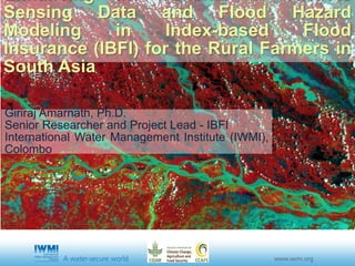
  • 1. Sensing Data and Flood Hazard Modeling in Index-based Flood Insurance (IBFI) for the Rural Farmers in South Asia Giriraj Amarnath, Ph.D. Senior Researcher and Project Lead - IBFI International Water Management Institute (IWMI), Colombo
  • 2. PRESENTATION OUTLINE • Human cost of natural disasters and its impact • Flood situation in Bihar • Linking Disaster Management and Index Insurance • IBFI Concept, Implementation Strategy • Project Progress and Updates from team members • Pilot area selection • Flood hazard modeling • Implementation process • Business model and institutional framework • Communication and IP • Partnership for Implementation
  • 3. HUMAN COST OF NATURAL DISASTERS AND ITS IMPACTS Number of disasters and affected people reported per country (1994- 2013) IND 819m PK 50m BGL 127m Global Assessment by natural disasters
  • 4. BIG FACTS ON FLOODING • Bihar is India’s most flood-prone state. • 73% of the total geographical area is annually flooded. • 76% of the population in North Bihar is at risk of flooding. • Major flood events have occurred in 1987, 1995, 1998, 2002, 2004 and 2007. • Approx. 15million people are affected by flooding • Approx. 300,000 metric tons of rice production damaged by floods • For example Muzaffarpur District, alone, incurred losses of over USD 3 million per year from 2001 to 2012 due to floods. • Recent report by UNISDR about 800 million people are currently living in flood-prone areas, and 70 million are experiencing floods each year. • Global flood losses in 2011 >$100 billion with major losses from Thailand, Australia and Hurricane Irene • Recent Overseas Development Institute (ODI), UK estimates to over $450 billion by 2030 • In 2007, floods killed 3,200 people in India and Bangladesh alone. In 2010, flooding killed 2,200 people in Pakistan and another 1,900 in China, while in 2013, an exceptionally high number of 6,500 people died due to floods in India. Bihar Global to Regional
  • 5. HISTORICAL FLOOD TRENDS IN GANGES BASIN Flood Frequency Flood Duration Flood Seasonality Flood Extent
  • 6. RECENT FLOOD DISASTERS IN BIHAR Photo credit: Amit Kumar
  • 7. OBSERVING FLOOD DISASTERS FROM SPACE 1988 TO 2014 HISTORICAL IMAGES
  • 8. THE ROLE OF DISASTER MANAGEMENT Short-term emergency assistance Emergency Response Recovery Reconstruction & Rehabilitation Long-term infrastructure & sustainable development assistance Liquidity Gap X Catastrophe Time http://www.wmo.int/pages/prog/drr/events/Barbados/Pres/4-CCRIF.pdf
  • 9. PROMOTING PREPAREDNESS AND INCREASING RESILIENCE The Tradeoff Significant amount of money locked in disaster relief funds The Tradeoff Insurance can help unlock the money that is kept for relief and use it for climate change adaptation and mitigation RoleofInsurance
  • 10. www.iwmi.org Water for a food-secure world REDUCING THE FLOOD RISK Source: Jha et al, (2011) adapted from Ranger and Garbett-Shiels (2011) Cost-Benefit-Ratio Robustness to Uncertainties Structural Non-Structural PORTFOLIO OF FLOOD MANAGEMENT OPTIONS Investment Effectiveness Acceptable risk level IBFI Levee Storages Diversions Earlywarning Reseroir Opn. MULTIPLE BARRIER PROTECTION
  • 11. www.iwmi.org Water for a food-secure world 2013 2013-142011-12 SHORT HISTORY OF IBFI 2015-18 CCAFS CRP Refresh Phase Flood Risk SA ACTIVITY IBFI Concept Initiated and Approved Multi- hazard Mapping SA
  • 12. www.iwmi.org Water for a food-secure world PROJECT SUMMARY CCAFS Project ID: P41-F2-SA-IWMI Period: 2015 to 2018 Budget: USD 1.0 Million (approx.) Target Countries: India & Bangladesh Research Partners: CGIAR: IWMI (HQ, ND), IFPRI-New Delhi International: UoB, MCII, GlobalAgRisk, UNOOSA ++ India: ICAR-IIWM, NIH, FMISC, CWC + + Bangladesh: IWM, MoDM, BWDB, UoD + + Implementing/Co-sponsoring Partners: AIC, eeMausam, BajajAllianz, SwissRe, DOA-BH, NABARD ++ Knowledge Sharing Partners: FMISC, BSDMA, CWC, DoA-Bihar ++
  • 13. Partners CGIAR Partners + Donors Knowledge Partner Govt. + Technical Partner + Insurer Communication, Media Partner INDIA BANGLADESH
  • 14. www.iwmi.org Water for a food-secure world RESEARCH OBJECTIVES 1. Setting up pilot-scale trials to demonstrate that positive verifiable impacts emerge from IBFI in terms of agriculture resilience and improving productivity, and household incomes, locally and at the broader scale 2. Developing tools and strategies that support IBFI development and upscaling, integrated with existing and future flood control measures.
  • 15. Flood index design Flood hazard module Flood loss module Crop Yield loss Economic loss Water level Flood Extent Flood Duration Crop Damage Rainfall Insurance payout Structure/Scheme Government Insurance agencies Development banks Farmers (from 50,000 to 1 million farmers would be benefitted by the scheme) Remote Sensing Data for Inundated Crop Area IBFI CONCEPT
  • 16. CONCEPT: INDEX BASED FLOOD INSURANCE Peoples Participation Flood map Scaled for Depth Scaled for Duration Final Index Map Flood Indexing Concept Flood Hazard Model Flood Loss Model Flood Insurance Policy Partner: IWM
  • 17. 1. Proof-of-concept on IBFI coupled with the flood hazard model and remote sensing (RS) data in selected districts of South Asian countries. 2. Digital flood mapping tool to monitor and quantify the impact of floods on crops, and its application in insurance schemes. 3. Design and pilot test a set of farmer-friendly flood insurance contracts for at least three districts with a considerable number of marginalized female farmers/poor people to ensure contracts are not gender biased. 4. Obtaining feedback and develop community of practice from officials/staff of insurance regulatory authorities in countries, operating insurance companies, meteorological agencies, agricultural research institutions, micro-finance institutions or NGOs, and relevant government agencies (e.g., ministries involved with disaster management, water resources, and agriculture). 5. Policy and institutional guidelines translated into business models for the implementation of flood insurance product. 6. Comparative analysis of the cost-effectiveness of RS-based index insurance compared to traditional methods, and estimating the potential in other parts of the target countries. 7. Research papers and reports, planning guidelines, policy/investment briefs and other communications material including websites, brochures and videos. MAJOR DELIVERABLES
  • 18. Inception Workshop on “Enhancing the benefits of Remote Sensing Data and Flood Hazard Modeling in Index-based Flood Insurance (IBFI)” 1 – 2 August 2015, Hotel Gargee Grand Patna, Bihar (India)
  • 19. www.iwmi.org Water for a food-secure world COMPONENTS METHODS IBFI system planning, design, implementation and evaluation site characterization, design, pilot-scale implementation, baseline data, performance monitoring and testing, hydrologic/hydraulic modeling, flood parameters, and scenario analysis/ forecasting, training & capacity building Institutional, economic and gender analysis baseline socio-economic data, gender/social disaggregated analysis, social/institutional/ policy arrangements, cost-benefit analysis Technical guidelines and business case development synthesis; cross-country comparisons, IBFI vs alternative mitigation approaches Strategy development and dissemination knowledge exchange meetings/dialogues/ regional workshops for key stakeholders and potential investors, investment support tools; risk management framework
  • 20. Site Prioritization Analysis: Hydrological Data Flood frequency • Analyzed long-term historical rainfall data from IMD in different districts of Bihar • Prepared inundation map from MODIS and calculated flood extent, duration, frequency and compared with data from FMIS, BDMA and other reports • River flow information from altimeter and in-situ measurements Rainfall
  • 25. PILOT STUDY AREA MUZAFFARPUR DISTRICT (BIHAR, INDIA) SIRAJGANJ DISTRICT (BANGLADESH)
  • 26. 1. To provide operational rainfall-runoff model from MISDc and hydraulic model using MIKE 11 in the process of flood forecasting; 2. To integrate past, current and future weather information to provide probability of flood levels in early warning process and its application in flood insurance; 3. To provide geospatial products including flood extent, flood depth and flood duration and possible provide composite flood index map; 4. To provide tools and models with detail technical report and possibly a research paper in 2016. DELIVERABLES Operational flood forecasting system
  • 27. Input observations Rainfall-Runoff Modelling (MISDc) Rainfall and temperature time series, in near real-rime, by in situ stations, remote sensing, numerical weather prediction modelling (for future prediction, 2-5 days ahead) Soil (geological) and land use maps Hydrodynamic modelling (MIKE 11) Cross section geometry Infrastructure (bridge, reservoir, storaging structure) Digital Elevation Model (DEM) Field information (pictures) Calibration and testing of modelling system Discharge/flow data (by in situ stations) Flood maps (by field surveys or remote sensing) The system needs hydrometeorological data (rainfall and air temperature) as input. The soil/land use/topographic information are used for the determination of hydrologic/hydraulic model parameter values. Finally, discharge data and flood maps are required for model testing and validation.
  • 28. Operational In-situ Water level for Pilot Districts • Data Provided by Central Water Commission – Daily water level, rainfall • 35 stations are operational for 2015 flood seasons 40 45 50 55 60 65 Elevation(m)msl Daily Water Level Danger Level Buxar Station 38 39 40 41 42 43 44 45 46 47 Elevation(m)MSL Daily Water Level Danger Level Hayaghat Station
  • 29. Flood mapping Every day, the flood forecasting system will provide flood inundation maps for the region of interest from which the water depth, flow velocity, and flood duration for each location (e.g., village) will be automatically extracted.
  • 30. Index Based Flood Insurance
  • 31. Design Index Based Flood Insurance
  • 33. Implementation Process • Opportunity AssessmentActivity 1 • Contract DesignActivity 2 • Contract PricingActivity 3 • Development of Contract Administration Tool KitActivity 4 • Client EducationActivity 5 • Farmer EnrolmentActivity 6 • Risk TransferActivity 7 • Contract MonitoringActivity 8 • Claim ProcessingActivity 9
  • 34. IBFI Impact Pathway Innovation – IBFI product Validation-Dissemination Adoption-Adaptation IMPACT Farmers and their families Market, Private Insurance firms Government (Disaster mgmt, Agri, water ) Indicators Potential effectiveness of flood thresholds and loss estimation Adoption Rate CommunicationandUptakeActivities Engage Educate Exemplify Actual effectiveness of flood thresholds and loss estimation And Change in knowledge, attitude, skills and practice in users Baseline analysis of the context and issues Pilot implementation And Strength of Intermediaries
  • 35. IBFI Pilot Implementation Increasing Agriculture Resilience Reducing Risk to Livelihoods A C T O R S Business models & Scaling Up Gender Dimension Flood Index Design Scale up to other flood – prone states and adopted by more players Feed into National and State Policy dialogues IBFI – The Big Picture Policy Analysis & Investment options Contextual Factors - Socio-economic, political, technological - Existing policies, practices, beliefs - Influencing networks, policy & practice, power relations - Capacity of target groups to respond and use research

Hinweis der Redaktion

  1. Source: EMDAT (2015)
  2. Goals are essentially: Develop a strong proof of concept of UTFI: technical, economic & institutional Facilitate opportunities for scaling up in the most prospective regions