
Empfohlen
Empfohlen
Weitere ähnliche Inhalte
Was ist angesagt?
Was ist angesagt? (15)
Andere mochten auch
Andere mochten auch (10)
Ähnlich wie OER World Map Prototypes
Ähnlich wie OER World Map Prototypes (20)
Mehr von ISKME
Mehr von ISKME (11)
Kürzlich hochgeladen
Kürzlich hochgeladen (20)
OER World Map Prototypes
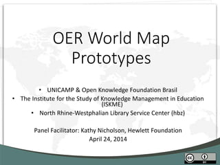
- 1. OER World Map Prototypes • UNICAMP & Open Knowledge Foundation Brasil • The Institute for the Study of Knowledge Management in Education (ISKME) • North Rhine-Westphalian Library Service Center (hbz) Panel Facilitator: Kathy Nicholson, Hewlett Foundation April 24, 2014
- 2. Project Background • Extensive online discussion re: OER mapping • Need for seeing & connecting OER projects • Experiment: Open RFP, 3 awards of $25k each • Today: OER community comments and feedback • To inform next open RFP, to be issued in Q3 2014
- 3. Please comment by April 30! • #oermap • hfknicholson@gmail.com
- 5. RATIONALE Content K-12 Latin America Portuguese/ Spanish Sources OER experts Literature Sites Analyses OER maps Mapping systems System Open-source Open-map Open-content Distributed
- 6. DATA SOURCES 70+ specialists, 30% return rate (so far) and growing Latin America (especially) but also beyond Publications and sites (Gov’t/Ministries) Previous inventories (OER Brazil, EdAberta) Well-known resources (TEMOA, RELPE, OEI, Dictalia) Academic publications and reports (UNESCO, COL)
- 7. PLATFORM OpenStreetMaps | tiles Leaflet | library JEO | interface CouchDB | federation Wordpress | cms User Developer
- 8. TOP FEATURES Facile open source throughout Replicate content and system, decentralization Complex searches Among the whole scheme of metadata Navigate through text searches or countries Multilingual Support for multiple languages in interface and content User interaction Complete user form for suggestions, easy comments and demonstration of user- created collections Novel content LatAm, and especially K-12 were an area of limited exposure in OER
- 12. SCALABILITY Steal this map! All data is downloadable through a simple link in standard JSON format Resource-based data Interface already permits resource-metadata content Extensible system CMS-based system allows for multiple new apps and widgets Data inclusion Easily include new data through user recommendations and admin interface Standards defined Metadata standard shared among projects (eMundus/POERUP) and aligned with Dublin Core
- 13. NEXT STEPS Expand the scope of the initiatives Expand on the decentralization scheme Expand the application interface to incorporate harvested resource-metadata Make use of linked data/URIs Disconnect the system from its Wordpress- dependency Dynamically organize and present content and allow interaction with users
- 14. www.mira.org.br Tel Amiel UNICAMP/Brasil Everton Alvarenga Open Knowledge - Brasil Priscila Gonsales IED/Brasil Xavier Ochoa ESPOL/Ecuador Tiago Soares Carlos Villavicencio Andre Deak Felipe Lavignatti Gabriel Fedel
- 15. OER World Map Project: Approach, Design, and Next Steps Kate Katz, Product Manager, ISKME Hewlett OER Grantee Meeting 2014 April 24, 2014 ISKME 2014:
- 16. Rationale and Approach • The OER landscape is comprised of a multiplicity of stakeholders, with varied and overlapping needs • There are limited spaces for these stakeholders to come together, share, and gather information about their activities • Providing such a space for OER-related data, in conjunction with key education indicators, can support stakeholders in identifying opportunities and developing partnerships toward improved practice and strategic decision making Develop an interactive, dynamic map that supports knowledge sharing, illustrates connections between community members, and situates OER initiatives within the context of educational opportunity more broadly
- 17. User Groups OER End Users Teachers, Learners, Parents, School Administrators OER Providers OER Aggregators, Institutions, Creators, Service Providers OER Advocates Foundations, Government Offices, Policy Advisory Committees • What is their role in the OER Community? • What did they come to the map to learn? • What information do they have to share? • What language do they speak? • What type of device(s) are they using? • What is their level of technical proficiency?
- 18. Data Sources Category Source Description Resources OER Commons Resource metadata (language, grade level, etc.) and evaluations Providers OLnet Evidence Hub OER Commons Provider name, contact information, goals, description, primary language, page views by region OER Policy TAACCCT Information about institutions supported by TAACCCT policy funding Education Indicators World Bank UNESCO Multiple education indicators by country/year, including enrollment rates by school level, by education program and institution, literacy rates, expenditure per student, etc.
- 19. Features Multi-Dimensional View Use multiple layers and distinct icons to create a single view of data across several parameters Share My Map Share a direct link to a version of the map Easy-to-Use Filters Filter the map by resource language, institution type, educational indicator, etc. Timeline Tool View changes over time across specific map parameters Data Export Tool Download education data, resource data, and OER policy data
- 20. Example Use Case OER Advocate | Partnerships User: Program officer at a foundation Goal: Identify new geographic areas for K- 12 OER investment in the MENA region
- 21. Example Use Case Provider | Collaboration User: OER Provider in Brazil creating college- level social science resources in Portuguese Goal: Expand its user base to all of South America by partnering with organizations with a significant number of users in the region, and who can help translate its resources from Portuguese to Spanish
- 22. Next Steps: Building Scale Conduct outreach and build community Expand API integrations Enable user-generated reports Develop new input and output features Develop mechanisms to capture user input Develop direct record creation and editing interface Iterate on and improve the interface Gather user feedback Conduct user tests
- 23. kate@iskme.org Institute for the Study of Knowledge Management in Education
- 24. Developing an OER World Map prototype OER Grantees Meeting. Sausalito, 24.04.2014. Felix Ostrowski & Adrian Pohl
- 25. Rationale 2 A map is only one of many possible expositions of data Possibly not even the best one in some cases It’s all about the data! That is why we built the OER Data Hub... … and the OER World Map on top of it. Ostrowski/Pohl: OER World Map Prototype
- 26. Data Sources 3 OCWC membership data Global list of OER initiatives from UNESCO`s WSIS Knowledge Communities … and a handful of manual entries Ostrowski/Pohl: OER World Map Prototype
- 27. Technology 4 Data Hub Play: “The High Velocity Web Framework For Java and Scala” Elasticsearch: “a flexible and powerful open source, distributed, real-time search and analytics engine” World Map Drupal: “an open source content management platform” Leaflet.js: “a modern open-source JavaScript library for mobile-friendly interactive maps” Ostrowski/Pohl: OER World Map Prototype
- 28. Features 5 Interactive map (filter by type & location) Editing & linking environment Data available via read/write API Customizable data model Integration of external (linked) data Ostrowski/Pohl: OER World Map Prototype
- 29. Data Model
- 30. OER World Map
- 31. Creating a new entry
- 32. Entry web page
- 33. Entry details on World Map
- 34. Entry details in the Data Hub
- 37. Links yield additional data
- 38. Scalability 15 The approach of a decoupled frontend & backend scales well organisationally (many stakeholders can use the Data Hub) and technically (additional hardware & software components can be added as the dataset & its use grows). Ostrowski/Pohl: OER World Map Prototype
- 39. Next Steps – Technical 16 Improve world map presentation & interaction possibilities Validate data based on application profile Refine data model & application profile Improve resource presentation & web form Add provenance, administrative metadata and versioning Ostrowski/Pohl: OER World Map Prototype
- 40. Next Steps – Organisational 17 Motivate community to participate Initiate cooperations with other data curators Discuss and implement editorial process Enrich data (add missing information, subject classification etc.) Ostrowski/Pohl: OER World Map Prototype
- 41. Take a look! 18 http://oerworldmap.org http://api.lobid.org/oer Ostrowski/Pohl: OER World Map Prototype
- 42. Thanks for your attention! These slides are licensed under a CC-BY 4.0 license.