SlideShare ist ein Scribd-Unternehmen logo
1 von 18
Downloaden Sie, um offline zu lesen
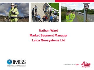
Nathan Ward
Market Segment Manager
Leica Geosystems Ltd
Hexagon is a leading global provider of design, measurement and visualisation technologies.
Our customers can design, measure and position objects, and process and present data to stay
one step ahead of a changing world.
Leica Geosystems

200 years of experience, pioneering solutions to
measure the world
Decades of innovation
dedicated to quality
2011

Leica ALS70 – the first airborne laser scanner with 500 KHz puls rate

2010

Leica Viva TS15 – the fastest Imaging Total Station
Leica RCD30 – the first multispectral 60MP airborne camera

2009

Leica Viva – the most versatile surveying system
Leica ScanStation C10 – the All-in-One 3D Laser Scanner
First High-Precision Total Station Leica TS30 with Piezo drives

2008
2006
2005
2004
1993
1991

First future proof GNSS-System – Leica GPS1200+
Leica Builder construction theodolite
World’s first total station with integrated GPS - Leica SmartStation
First universal GPS/TPS surveying system and mobile coordinate
measurement technology system - Leica T-Probe and Leica T-Scan
World’s first handheld laser distance meter
First industrial laser tracker

1984
1969

First GPS for surveying
First infrared-based distancer

1925

First aerial photography camera

1921


World’s first portable opto-mechanical theodolite

In total, Leica Geosystems holds more than 1’000
patents, many of them registered in the past decade
Today’s technologies
for fast, efficient data capture
 One point

 Millions of points

 Image-based

Aircraft-based

TPS

Laser Scanning

Remote sensing

GNSS

Point Cloud Management

DISTOTM

Photogrammetry
Asset Collection & Management Market Segment
The measurement of positions & associated information of items of economic
value that are owned by an individual, the public or an organisation

Features

Attributes

Images

Information
Focus on client outcomes

Our Purpose: “to provide affordable and fully
integrated asset collection solutions, ensuring that our
clients have access to the best, most accurate and
richest data available, enabling them to unlock the
value and power from their investment in GIS”
Leica Zeno GIS Series
Hardware

Software

Services
Leica Zeno GIS Series Hardware
Ruggedised hardware optimised for GIS asset
collection and engineered to operate in the most
demanding environments

 Precise

1cm

 Rugged
 All day battery life
Leica SmartNet Ireland
http://www.smartnet-eu.com
Leica CS25 GNSS
A high-accuracy tablet computer
 Integrated 120 channel GNSS board
 Scalable
 Choice of real-time accuracy
 1m (EGNOS)
 0.5m (SmartNet DGNSS)
 10cm (SmartNet RTK)
 1cm (SmartNet RTK ext antenna)
 Windows 7 operating system
Leica Zeno 5
An entry-level handheld
y

All you need – in your pocket
y
 Choice of real-time accuracy
 1m (EGNOS)
 0.5m (SmartNet DGNSS)
 1cm (SmartNet RTK)
Leica Zeno GG03
GNSS SmartAntenna
Leica Zeno GIS Series Hardware
Ruggedised hardware optimised for GIS asset
collection and engineered to operate in the most
demanding environments

 Precise

1cm

 Rugged
 All day battery life
IMGS 2013

For further information please contact:
Nathan Ward BSc MRICS
Leica Geosystems Ltd
Market Segment Manager
Mobile: 0777 1517416
Email: nathan.ward@leica-geosystems.com
www.leica-geosystems.co.uk
Click the following link to watch the Asset Collection & Management video
http://www.youtube.com/watch?v=1m3WpWdPFbM&feature=plcp

Weitere ähnliche Inhalte

Was ist angesagt?

OGC SensorThings API for Location Aware Sensing System (LASS) 2017 User Confe...
OGC SensorThings API for Location Aware Sensing System (LASS) 2017 User Confe...OGC SensorThings API for Location Aware Sensing System (LASS) 2017 User Confe...
OGC SensorThings API for Location Aware Sensing System (LASS) 2017 User Confe...SensorUp
 
Arctic Web Map, PolarMap.js, Arctic Sensor Web, and Arctic Citizen Sensors
Arctic Web Map, PolarMap.js, Arctic Sensor Web, and Arctic Citizen SensorsArctic Web Map, PolarMap.js, Arctic Sensor Web, and Arctic Citizen Sensors
Arctic Web Map, PolarMap.js, Arctic Sensor Web, and Arctic Citizen SensorsSensorUp
 
Mike Schaaf -- Synapse ANSYS HFSS Antenna Design
Mike Schaaf -- Synapse ANSYS HFSS Antenna DesignMike Schaaf -- Synapse ANSYS HFSS Antenna Design
Mike Schaaf -- Synapse ANSYS HFSS Antenna DesignSynapse Product Development
 
Connected vehicle and autonomous driving concepts, Игорь Таненков
Connected vehicle and autonomous driving concepts, Игорь ТаненковConnected vehicle and autonomous driving concepts, Игорь Таненков
Connected vehicle and autonomous driving concepts, Игорь ТаненковSigma Software
 
Locata Keynote PPT, ChinterGeo, Oct 27, 2014 (English)
Locata Keynote PPT, ChinterGeo, Oct 27, 2014 (English)Locata Keynote PPT, ChinterGeo, Oct 27, 2014 (English)
Locata Keynote PPT, ChinterGeo, Oct 27, 2014 (English)ben_cardillo
 
Sneak Peek: Designing Tracked Objects for Steam VR
Sneak Peek: Designing Tracked Objects for Steam VRSneak Peek: Designing Tracked Objects for Steam VR
Sneak Peek: Designing Tracked Objects for Steam VRMorgan Denno
 
Actionable Insights from Multi-sensor IoT Systems using the OGC SensorThings ...
Actionable Insights from Multi-sensor IoT Systems using the OGC SensorThings ...Actionable Insights from Multi-sensor IoT Systems using the OGC SensorThings ...
Actionable Insights from Multi-sensor IoT Systems using the OGC SensorThings ...SensorUp
 
Locata's Presentation to the US PNT Advisory Board, Washington DC (June 3, 20...
Locata's Presentation to the US PNT Advisory Board, Washington DC (June 3, 20...Locata's Presentation to the US PNT Advisory Board, Washington DC (June 3, 20...
Locata's Presentation to the US PNT Advisory Board, Washington DC (June 3, 20...Locatacorp
 
MQTT and SensorThings API MQTT Extension
MQTT and SensorThings API MQTT ExtensionMQTT and SensorThings API MQTT Extension
MQTT and SensorThings API MQTT ExtensionSensorUp
 
Leveraging the Kinect SDK to Control a Remote Device
Leveraging the Kinect SDK to Control a Remote DeviceLeveraging the Kinect SDK to Control a Remote Device
Leveraging the Kinect SDK to Control a Remote DeviceAkhil Acharya
 
20150223_Infoday H2020_Espacio_Francisco Gutiérrez
20150223_Infoday H2020_Espacio_Francisco Gutiérrez20150223_Infoday H2020_Espacio_Francisco Gutiérrez
20150223_Infoday H2020_Espacio_Francisco GutiérrezElena Cortés Ventura
 
Imagemaps ultramag titan lidar
Imagemaps   ultramag titan lidarImagemaps   ultramag titan lidar
Imagemaps ultramag titan lidarBrett Johnson
 
Navigation success story, 15 years in the Vanguard of Galileo & GNSS Receiver...
Navigation success story, 15 years in the Vanguard of Galileo & GNSS Receiver...Navigation success story, 15 years in the Vanguard of Galileo & GNSS Receiver...
Navigation success story, 15 years in the Vanguard of Galileo & GNSS Receiver...Space-Applications
 
Eclipse Internet of Things in Action EclipseCON 2014
Eclipse Internet of Things in Action EclipseCON 2014Eclipse Internet of Things in Action EclipseCON 2014
Eclipse Internet of Things in Action EclipseCON 2014Eurotech
 

Was ist angesagt? (15)

OGC SensorThings API for Location Aware Sensing System (LASS) 2017 User Confe...
OGC SensorThings API for Location Aware Sensing System (LASS) 2017 User Confe...OGC SensorThings API for Location Aware Sensing System (LASS) 2017 User Confe...
OGC SensorThings API for Location Aware Sensing System (LASS) 2017 User Confe...
 
Arctic Web Map, PolarMap.js, Arctic Sensor Web, and Arctic Citizen Sensors
Arctic Web Map, PolarMap.js, Arctic Sensor Web, and Arctic Citizen SensorsArctic Web Map, PolarMap.js, Arctic Sensor Web, and Arctic Citizen Sensors
Arctic Web Map, PolarMap.js, Arctic Sensor Web, and Arctic Citizen Sensors
 
Mike Schaaf -- Synapse ANSYS HFSS Antenna Design
Mike Schaaf -- Synapse ANSYS HFSS Antenna DesignMike Schaaf -- Synapse ANSYS HFSS Antenna Design
Mike Schaaf -- Synapse ANSYS HFSS Antenna Design
 
Connected vehicle and autonomous driving concepts, Игорь Таненков
Connected vehicle and autonomous driving concepts, Игорь ТаненковConnected vehicle and autonomous driving concepts, Игорь Таненков
Connected vehicle and autonomous driving concepts, Игорь Таненков
 
Locata Keynote PPT, ChinterGeo, Oct 27, 2014 (English)
Locata Keynote PPT, ChinterGeo, Oct 27, 2014 (English)Locata Keynote PPT, ChinterGeo, Oct 27, 2014 (English)
Locata Keynote PPT, ChinterGeo, Oct 27, 2014 (English)
 
Sneak Peek: Designing Tracked Objects for Steam VR
Sneak Peek: Designing Tracked Objects for Steam VRSneak Peek: Designing Tracked Objects for Steam VR
Sneak Peek: Designing Tracked Objects for Steam VR
 
Actionable Insights from Multi-sensor IoT Systems using the OGC SensorThings ...
Actionable Insights from Multi-sensor IoT Systems using the OGC SensorThings ...Actionable Insights from Multi-sensor IoT Systems using the OGC SensorThings ...
Actionable Insights from Multi-sensor IoT Systems using the OGC SensorThings ...
 
Locata's Presentation to the US PNT Advisory Board, Washington DC (June 3, 20...
Locata's Presentation to the US PNT Advisory Board, Washington DC (June 3, 20...Locata's Presentation to the US PNT Advisory Board, Washington DC (June 3, 20...
Locata's Presentation to the US PNT Advisory Board, Washington DC (June 3, 20...
 
MQTT and SensorThings API MQTT Extension
MQTT and SensorThings API MQTT ExtensionMQTT and SensorThings API MQTT Extension
MQTT and SensorThings API MQTT Extension
 
Leveraging the Kinect SDK to Control a Remote Device
Leveraging the Kinect SDK to Control a Remote DeviceLeveraging the Kinect SDK to Control a Remote Device
Leveraging the Kinect SDK to Control a Remote Device
 
20150223_Infoday H2020_Espacio_Francisco Gutiérrez
20150223_Infoday H2020_Espacio_Francisco Gutiérrez20150223_Infoday H2020_Espacio_Francisco Gutiérrez
20150223_Infoday H2020_Espacio_Francisco Gutiérrez
 
Imagemaps ultramag titan lidar
Imagemaps   ultramag titan lidarImagemaps   ultramag titan lidar
Imagemaps ultramag titan lidar
 
Navigation success story, 15 years in the Vanguard of Galileo & GNSS Receiver...
Navigation success story, 15 years in the Vanguard of Galileo & GNSS Receiver...Navigation success story, 15 years in the Vanguard of Galileo & GNSS Receiver...
Navigation success story, 15 years in the Vanguard of Galileo & GNSS Receiver...
 
Eclipse Internet of Things in Action EclipseCON 2014
Eclipse Internet of Things in Action EclipseCON 2014Eclipse Internet of Things in Action EclipseCON 2014
Eclipse Internet of Things in Action EclipseCON 2014
 
Open source industrial IoT
Open source industrial IoTOpen source industrial IoT
Open source industrial IoT
 

Ähnlich wie Leica Geosystems Mobile Asset Collection Overview_Nathan Ward - IMGS 2013

GWT 2014: Emergency Conference - 01 Introduzione
GWT 2014: Emergency Conference - 01 IntroduzioneGWT 2014: Emergency Conference - 01 Introduzione
GWT 2014: Emergency Conference - 01 IntroduzionePlanetek Italia Srl
 
GWT 2014: Energy Conference - 01 Introduzione
GWT 2014: Energy Conference - 01 IntroduzioneGWT 2014: Energy Conference - 01 Introduzione
GWT 2014: Energy Conference - 01 IntroduzionePlanetek Italia Srl
 
Leica GS18 T Spec Sheet.pdf
Leica GS18 T Spec Sheet.pdfLeica GS18 T Spec Sheet.pdf
Leica GS18 T Spec Sheet.pdfStephenKim86
 
2020-07-07 Stargate RTK for service information
2020-07-07 Stargate RTK for service information2020-07-07 Stargate RTK for service information
2020-07-07 Stargate RTK for service informationSimon Litvinov
 
Presentazione Wireless Forum 08
Presentazione Wireless Forum 08Presentazione Wireless Forum 08
Presentazione Wireless Forum 08Roberto Navoni
 
Pro mark 220
Pro mark 220Pro mark 220
Pro mark 220Budi anto
 
Laser Navigation product - Introduction -
Laser Navigation product - Introduction -Laser Navigation product - Introduction -
Laser Navigation product - Introduction -Roberto Navoni
 
Companies which attended Fundamental Elements Info Day
Companies which attended Fundamental Elements Info DayCompanies which attended Fundamental Elements Info Day
Companies which attended Fundamental Elements Info DayThe European GNSS Agency (GSA)
 
Mobile Laser Scanning Workshop
Mobile Laser Scanning WorkshopMobile Laser Scanning Workshop
Mobile Laser Scanning WorkshopNasr Khashoggi
 
Precision and Productivity for Utilities/Energy Field GPS/GIS Data Collection...
Precision and Productivity for Utilities/Energy Field GPS/GIS Data Collection...Precision and Productivity for Utilities/Energy Field GPS/GIS Data Collection...
Precision and Productivity for Utilities/Energy Field GPS/GIS Data Collection...Esri
 
IoT support for .NET (Core/5/6)
IoT support for .NET (Core/5/6)IoT support for .NET (Core/5/6)
IoT support for .NET (Core/5/6)Mirco Vanini
 
Sp80 GNSS Receiver
Sp80 GNSS ReceiverSp80 GNSS Receiver
Sp80 GNSS ReceiverBudi anto
 
Brochure | Leica Geovid Pro 32 | Optics Trade
 Brochure | Leica Geovid Pro 32 | Optics Trade Brochure | Leica Geovid Pro 32 | Optics Trade
Brochure | Leica Geovid Pro 32 | Optics TradeOptics-Trade
 
IoT support for .NET Core
IoT support for .NET CoreIoT support for .NET Core
IoT support for .NET CoreMirco Vanini
 
Jual GPS Spectra SP20 Call / wa 082119953499
Jual GPS Spectra SP20 Call / wa 082119953499Jual GPS Spectra SP20 Call / wa 082119953499
Jual GPS Spectra SP20 Call / wa 082119953499Budi anto
 

Ähnlich wie Leica Geosystems Mobile Asset Collection Overview_Nathan Ward - IMGS 2013 (20)

GWT 2014: Emergency Conference - 01 Introduzione
GWT 2014: Emergency Conference - 01 IntroduzioneGWT 2014: Emergency Conference - 01 Introduzione
GWT 2014: Emergency Conference - 01 Introduzione
 
GWT 2014: Energy Conference - 01 Introduzione
GWT 2014: Energy Conference - 01 IntroduzioneGWT 2014: Energy Conference - 01 Introduzione
GWT 2014: Energy Conference - 01 Introduzione
 
CHSurvey introduce
CHSurvey introduceCHSurvey introduce
CHSurvey introduce
 
Leica GS18 T Spec Sheet.pdf
Leica GS18 T Spec Sheet.pdfLeica GS18 T Spec Sheet.pdf
Leica GS18 T Spec Sheet.pdf
 
2020-07-07 Stargate RTK for service information
2020-07-07 Stargate RTK for service information2020-07-07 Stargate RTK for service information
2020-07-07 Stargate RTK for service information
 
Presentazione Wireless Forum 08
Presentazione Wireless Forum 08Presentazione Wireless Forum 08
Presentazione Wireless Forum 08
 
Pro mark 220
Pro mark 220Pro mark 220
Pro mark 220
 
Laser Navigation product - Introduction -
Laser Navigation product - Introduction -Laser Navigation product - Introduction -
Laser Navigation product - Introduction -
 
Companies which attended Fundamental Elements Info Day
Companies which attended Fundamental Elements Info DayCompanies which attended Fundamental Elements Info Day
Companies which attended Fundamental Elements Info Day
 
Mobile Laser Scanning Workshop
Mobile Laser Scanning WorkshopMobile Laser Scanning Workshop
Mobile Laser Scanning Workshop
 
Precision and Productivity for Utilities/Energy Field GPS/GIS Data Collection...
Precision and Productivity for Utilities/Energy Field GPS/GIS Data Collection...Precision and Productivity for Utilities/Energy Field GPS/GIS Data Collection...
Precision and Productivity for Utilities/Energy Field GPS/GIS Data Collection...
 
IoT support for .NET (Core/5/6)
IoT support for .NET (Core/5/6)IoT support for .NET (Core/5/6)
IoT support for .NET (Core/5/6)
 
Sp80
Sp80Sp80
Sp80
 
Sp80 GNSS Receiver
Sp80 GNSS ReceiverSp80 GNSS Receiver
Sp80 GNSS Receiver
 
Sp80
Sp80Sp80
Sp80
 
Leica-Jfleet-FMSAUv1.01single
Leica-Jfleet-FMSAUv1.01singleLeica-Jfleet-FMSAUv1.01single
Leica-Jfleet-FMSAUv1.01single
 
Overblik over trådløs teknologi og designovervejelser
Overblik over trådløs teknologi og designovervejelserOverblik over trådløs teknologi og designovervejelser
Overblik over trådløs teknologi og designovervejelser
 
Brochure | Leica Geovid Pro 32 | Optics Trade
 Brochure | Leica Geovid Pro 32 | Optics Trade Brochure | Leica Geovid Pro 32 | Optics Trade
Brochure | Leica Geovid Pro 32 | Optics Trade
 
IoT support for .NET Core
IoT support for .NET CoreIoT support for .NET Core
IoT support for .NET Core
 
Jual GPS Spectra SP20 Call / wa 082119953499
Jual GPS Spectra SP20 Call / wa 082119953499Jual GPS Spectra SP20 Call / wa 082119953499
Jual GPS Spectra SP20 Call / wa 082119953499
 

Mehr von IMGS

FME World Tour 2015 Dublin - Waterford City and County Council - Jon Hawkins
FME World Tour 2015 Dublin - Waterford City and County Council - Jon HawkinsFME World Tour 2015 Dublin - Waterford City and County Council - Jon Hawkins
FME World Tour 2015 Dublin - Waterford City and County Council - Jon HawkinsIMGS
 
FME World Tour 2015 Belfast - Donegal County Council - Daragh McDonough
FME World Tour 2015 Belfast - Donegal County Council - Daragh McDonoughFME World Tour 2015 Belfast - Donegal County Council - Daragh McDonough
FME World Tour 2015 Belfast - Donegal County Council - Daragh McDonoughIMGS
 
FME World Tour 2015 Belfast - Introduction to FME - Ciaran Kirk
FME World Tour 2015 Belfast - Introduction to FME - Ciaran KirkFME World Tour 2015 Belfast - Introduction to FME - Ciaran Kirk
FME World Tour 2015 Belfast - Introduction to FME - Ciaran KirkIMGS
 
FME World Tour 2015 - FME & LIDAR - Glen Bambrick
FME World Tour 2015 -  FME & LIDAR - Glen BambrickFME World Tour 2015 -  FME & LIDAR - Glen Bambrick
FME World Tour 2015 - FME & LIDAR - Glen BambrickIMGS
 
FME World Tour 2015 - Around the World - Ken Bragg
FME World Tour 2015 - Around the World - Ken BraggFME World Tour 2015 - Around the World - Ken Bragg
FME World Tour 2015 - Around the World - Ken BraggIMGS
 
FME World Tour 2015 Dublin - FME Overview - Ciaran Kirk
FME World Tour 2015 Dublin - FME Overview - Ciaran KirkFME World Tour 2015 Dublin - FME Overview - Ciaran Kirk
FME World Tour 2015 Dublin - FME Overview - Ciaran KirkIMGS
 
FME World Tour 2015 Dublin - Ordnance Survey Ireland - Bronagh McGann
FME World Tour 2015 Dublin - Ordnance Survey Ireland - Bronagh McGannFME World Tour 2015 Dublin - Ordnance Survey Ireland - Bronagh McGann
FME World Tour 2015 Dublin - Ordnance Survey Ireland - Bronagh McGannIMGS
 
FME World Tour 2015 Dublin - Galway County Council - Mark Conroy
FME World Tour 2015 Dublin - Galway County Council - Mark ConroyFME World Tour 2015 Dublin - Galway County Council - Mark Conroy
FME World Tour 2015 Dublin - Galway County Council - Mark ConroyIMGS
 
FME World Tour 2015 Dublin - Ordnance Survey Ireland - Martin Creaton
FME World Tour 2015 Dublin - Ordnance Survey Ireland - Martin CreatonFME World Tour 2015 Dublin - Ordnance Survey Ireland - Martin Creaton
FME World Tour 2015 Dublin - Ordnance Survey Ireland - Martin CreatonIMGS
 
FME World Tour 2015 - FME & Data Migration Simon McCabe
FME World Tour 2015 -  FME & Data Migration Simon McCabeFME World Tour 2015 -  FME & Data Migration Simon McCabe
FME World Tour 2015 - FME & Data Migration Simon McCabeIMGS
 
IMGS 2015 - Implementing Leica Zeno for the Rural Payments Agency - Alex MacD...
IMGS 2015 - Implementing Leica Zeno for the Rural Payments Agency - Alex MacD...IMGS 2015 - Implementing Leica Zeno for the Rural Payments Agency - Alex MacD...
IMGS 2015 - Implementing Leica Zeno for the Rural Payments Agency - Alex MacD...IMGS
 
IMGS 2015 - Using eircode with imgs solutions - ciaran kirk
IMGS 2015 - Using eircode with imgs solutions - ciaran kirkIMGS 2015 - Using eircode with imgs solutions - ciaran kirk
IMGS 2015 - Using eircode with imgs solutions - ciaran kirkIMGS
 
IMGS 2015 - Ordnance Survey Ireland - Hugh Mangan
IMGS 2015 - Ordnance Survey Ireland - Hugh ManganIMGS 2015 - Ordnance Survey Ireland - Hugh Mangan
IMGS 2015 - Ordnance Survey Ireland - Hugh ManganIMGS
 
IMGS 2015 - Transport for London - Alun Pearsey
IMGS 2015 - Transport for London - Alun PearseyIMGS 2015 - Transport for London - Alun Pearsey
IMGS 2015 - Transport for London - Alun PearseyIMGS
 
IMGS 2015 - IMGS Technology Update - Ciaran Kirk
IMGS 2015 - IMGS Technology Update - Ciaran KirkIMGS 2015 - IMGS Technology Update - Ciaran Kirk
IMGS 2015 - IMGS Technology Update - Ciaran KirkIMGS
 
IMGS 2015 - IMGS Highlights - Ciaran Kirk
IMGS 2015 - IMGS Highlights - Ciaran KirkIMGS 2015 - IMGS Highlights - Ciaran Kirk
IMGS 2015 - IMGS Highlights - Ciaran KirkIMGS
 
National Map Production with Mapnik Rasteriser FME
National Map Production with Mapnik Rasteriser FMENational Map Production with Mapnik Rasteriser FME
National Map Production with Mapnik Rasteriser FMEIMGS
 
IMGS Geospatial User Group 2014 - GeoMedia WebMap 2014
IMGS Geospatial User Group 2014 - GeoMedia WebMap 2014IMGS Geospatial User Group 2014 - GeoMedia WebMap 2014
IMGS Geospatial User Group 2014 - GeoMedia WebMap 2014IMGS
 
IMGS Geospatial User Group 2014 - GeoMedia Smart Client Planning Workflows
IMGS Geospatial User Group 2014 - GeoMedia Smart Client Planning WorkflowsIMGS Geospatial User Group 2014 - GeoMedia Smart Client Planning Workflows
IMGS Geospatial User Group 2014 - GeoMedia Smart Client Planning WorkflowsIMGS
 
IMGS Geospatial User Group 2014 - Big data management with Apollo
IMGS Geospatial User Group 2014 - Big data management with ApolloIMGS Geospatial User Group 2014 - Big data management with Apollo
IMGS Geospatial User Group 2014 - Big data management with ApolloIMGS
 

Mehr von IMGS (20)

FME World Tour 2015 Dublin - Waterford City and County Council - Jon Hawkins
FME World Tour 2015 Dublin - Waterford City and County Council - Jon HawkinsFME World Tour 2015 Dublin - Waterford City and County Council - Jon Hawkins
FME World Tour 2015 Dublin - Waterford City and County Council - Jon Hawkins
 
FME World Tour 2015 Belfast - Donegal County Council - Daragh McDonough
FME World Tour 2015 Belfast - Donegal County Council - Daragh McDonoughFME World Tour 2015 Belfast - Donegal County Council - Daragh McDonough
FME World Tour 2015 Belfast - Donegal County Council - Daragh McDonough
 
FME World Tour 2015 Belfast - Introduction to FME - Ciaran Kirk
FME World Tour 2015 Belfast - Introduction to FME - Ciaran KirkFME World Tour 2015 Belfast - Introduction to FME - Ciaran Kirk
FME World Tour 2015 Belfast - Introduction to FME - Ciaran Kirk
 
FME World Tour 2015 - FME & LIDAR - Glen Bambrick
FME World Tour 2015 -  FME & LIDAR - Glen BambrickFME World Tour 2015 -  FME & LIDAR - Glen Bambrick
FME World Tour 2015 - FME & LIDAR - Glen Bambrick
 
FME World Tour 2015 - Around the World - Ken Bragg
FME World Tour 2015 - Around the World - Ken BraggFME World Tour 2015 - Around the World - Ken Bragg
FME World Tour 2015 - Around the World - Ken Bragg
 
FME World Tour 2015 Dublin - FME Overview - Ciaran Kirk
FME World Tour 2015 Dublin - FME Overview - Ciaran KirkFME World Tour 2015 Dublin - FME Overview - Ciaran Kirk
FME World Tour 2015 Dublin - FME Overview - Ciaran Kirk
 
FME World Tour 2015 Dublin - Ordnance Survey Ireland - Bronagh McGann
FME World Tour 2015 Dublin - Ordnance Survey Ireland - Bronagh McGannFME World Tour 2015 Dublin - Ordnance Survey Ireland - Bronagh McGann
FME World Tour 2015 Dublin - Ordnance Survey Ireland - Bronagh McGann
 
FME World Tour 2015 Dublin - Galway County Council - Mark Conroy
FME World Tour 2015 Dublin - Galway County Council - Mark ConroyFME World Tour 2015 Dublin - Galway County Council - Mark Conroy
FME World Tour 2015 Dublin - Galway County Council - Mark Conroy
 
FME World Tour 2015 Dublin - Ordnance Survey Ireland - Martin Creaton
FME World Tour 2015 Dublin - Ordnance Survey Ireland - Martin CreatonFME World Tour 2015 Dublin - Ordnance Survey Ireland - Martin Creaton
FME World Tour 2015 Dublin - Ordnance Survey Ireland - Martin Creaton
 
FME World Tour 2015 - FME & Data Migration Simon McCabe
FME World Tour 2015 -  FME & Data Migration Simon McCabeFME World Tour 2015 -  FME & Data Migration Simon McCabe
FME World Tour 2015 - FME & Data Migration Simon McCabe
 
IMGS 2015 - Implementing Leica Zeno for the Rural Payments Agency - Alex MacD...
IMGS 2015 - Implementing Leica Zeno for the Rural Payments Agency - Alex MacD...IMGS 2015 - Implementing Leica Zeno for the Rural Payments Agency - Alex MacD...
IMGS 2015 - Implementing Leica Zeno for the Rural Payments Agency - Alex MacD...
 
IMGS 2015 - Using eircode with imgs solutions - ciaran kirk
IMGS 2015 - Using eircode with imgs solutions - ciaran kirkIMGS 2015 - Using eircode with imgs solutions - ciaran kirk
IMGS 2015 - Using eircode with imgs solutions - ciaran kirk
 
IMGS 2015 - Ordnance Survey Ireland - Hugh Mangan
IMGS 2015 - Ordnance Survey Ireland - Hugh ManganIMGS 2015 - Ordnance Survey Ireland - Hugh Mangan
IMGS 2015 - Ordnance Survey Ireland - Hugh Mangan
 
IMGS 2015 - Transport for London - Alun Pearsey
IMGS 2015 - Transport for London - Alun PearseyIMGS 2015 - Transport for London - Alun Pearsey
IMGS 2015 - Transport for London - Alun Pearsey
 
IMGS 2015 - IMGS Technology Update - Ciaran Kirk
IMGS 2015 - IMGS Technology Update - Ciaran KirkIMGS 2015 - IMGS Technology Update - Ciaran Kirk
IMGS 2015 - IMGS Technology Update - Ciaran Kirk
 
IMGS 2015 - IMGS Highlights - Ciaran Kirk
IMGS 2015 - IMGS Highlights - Ciaran KirkIMGS 2015 - IMGS Highlights - Ciaran Kirk
IMGS 2015 - IMGS Highlights - Ciaran Kirk
 
National Map Production with Mapnik Rasteriser FME
National Map Production with Mapnik Rasteriser FMENational Map Production with Mapnik Rasteriser FME
National Map Production with Mapnik Rasteriser FME
 
IMGS Geospatial User Group 2014 - GeoMedia WebMap 2014
IMGS Geospatial User Group 2014 - GeoMedia WebMap 2014IMGS Geospatial User Group 2014 - GeoMedia WebMap 2014
IMGS Geospatial User Group 2014 - GeoMedia WebMap 2014
 
IMGS Geospatial User Group 2014 - GeoMedia Smart Client Planning Workflows
IMGS Geospatial User Group 2014 - GeoMedia Smart Client Planning WorkflowsIMGS Geospatial User Group 2014 - GeoMedia Smart Client Planning Workflows
IMGS Geospatial User Group 2014 - GeoMedia Smart Client Planning Workflows
 
IMGS Geospatial User Group 2014 - Big data management with Apollo
IMGS Geospatial User Group 2014 - Big data management with ApolloIMGS Geospatial User Group 2014 - Big data management with Apollo
IMGS Geospatial User Group 2014 - Big data management with Apollo
 

Kürzlich hochgeladen

A Deep Dive on Passkeys: FIDO Paris Seminar.pptx
A Deep Dive on Passkeys: FIDO Paris Seminar.pptxA Deep Dive on Passkeys: FIDO Paris Seminar.pptx
A Deep Dive on Passkeys: FIDO Paris Seminar.pptxLoriGlavin3
 
So einfach geht modernes Roaming fuer Notes und Nomad.pdf
So einfach geht modernes Roaming fuer Notes und Nomad.pdfSo einfach geht modernes Roaming fuer Notes und Nomad.pdf
So einfach geht modernes Roaming fuer Notes und Nomad.pdfpanagenda
 
Why device, WIFI, and ISP insights are crucial to supporting remote Microsoft...
Why device, WIFI, and ISP insights are crucial to supporting remote Microsoft...Why device, WIFI, and ISP insights are crucial to supporting remote Microsoft...
Why device, WIFI, and ISP insights are crucial to supporting remote Microsoft...panagenda
 
A Journey Into the Emotions of Software Developers
A Journey Into the Emotions of Software DevelopersA Journey Into the Emotions of Software Developers
A Journey Into the Emotions of Software DevelopersNicole Novielli
 
From Family Reminiscence to Scholarly Archive .
From Family Reminiscence to Scholarly Archive .From Family Reminiscence to Scholarly Archive .
From Family Reminiscence to Scholarly Archive .Alan Dix
 
TeamStation AI System Report LATAM IT Salaries 2024
TeamStation AI System Report LATAM IT Salaries 2024TeamStation AI System Report LATAM IT Salaries 2024
TeamStation AI System Report LATAM IT Salaries 2024Lonnie McRorey
 
Time Series Foundation Models - current state and future directions
Time Series Foundation Models - current state and future directionsTime Series Foundation Models - current state and future directions
Time Series Foundation Models - current state and future directionsNathaniel Shimoni
 
Generative AI for Technical Writer or Information Developers
Generative AI for Technical Writer or Information DevelopersGenerative AI for Technical Writer or Information Developers
Generative AI for Technical Writer or Information DevelopersRaghuram Pandurangan
 
Genislab builds better products and faster go-to-market with Lean project man...
Genislab builds better products and faster go-to-market with Lean project man...Genislab builds better products and faster go-to-market with Lean project man...
Genislab builds better products and faster go-to-market with Lean project man...Farhan Tariq
 
A Framework for Development in the AI Age
A Framework for Development in the AI AgeA Framework for Development in the AI Age
A Framework for Development in the AI AgeCprime
 
Moving Beyond Passwords: FIDO Paris Seminar.pdf
Moving Beyond Passwords: FIDO Paris Seminar.pdfMoving Beyond Passwords: FIDO Paris Seminar.pdf
Moving Beyond Passwords: FIDO Paris Seminar.pdfLoriGlavin3
 
Merck Moving Beyond Passwords: FIDO Paris Seminar.pptx
Merck Moving Beyond Passwords: FIDO Paris Seminar.pptxMerck Moving Beyond Passwords: FIDO Paris Seminar.pptx
Merck Moving Beyond Passwords: FIDO Paris Seminar.pptxLoriGlavin3
 
Enhancing User Experience - Exploring the Latest Features of Tallyman Axis Lo...
Enhancing User Experience - Exploring the Latest Features of Tallyman Axis Lo...Enhancing User Experience - Exploring the Latest Features of Tallyman Axis Lo...
Enhancing User Experience - Exploring the Latest Features of Tallyman Axis Lo...Scott Andery
 
Generative Artificial Intelligence: How generative AI works.pdf
Generative Artificial Intelligence: How generative AI works.pdfGenerative Artificial Intelligence: How generative AI works.pdf
Generative Artificial Intelligence: How generative AI works.pdfIngrid Airi González
 
Data governance with Unity Catalog Presentation
Data governance with Unity Catalog PresentationData governance with Unity Catalog Presentation
Data governance with Unity Catalog PresentationKnoldus Inc.
 
(How to Program) Paul Deitel, Harvey Deitel-Java How to Program, Early Object...
(How to Program) Paul Deitel, Harvey Deitel-Java How to Program, Early Object...(How to Program) Paul Deitel, Harvey Deitel-Java How to Program, Early Object...
(How to Program) Paul Deitel, Harvey Deitel-Java How to Program, Early Object...AliaaTarek5
 
Decarbonising Buildings: Making a net-zero built environment a reality
Decarbonising Buildings: Making a net-zero built environment a realityDecarbonising Buildings: Making a net-zero built environment a reality
Decarbonising Buildings: Making a net-zero built environment a realityIES VE
 
Connecting the Dots for Information Discovery.pdf
Connecting the Dots for Information Discovery.pdfConnecting the Dots for Information Discovery.pdf
Connecting the Dots for Information Discovery.pdfNeo4j
 
Arizona Broadband Policy Past, Present, and Future Presentation 3/25/24
Arizona Broadband Policy Past, Present, and Future Presentation 3/25/24Arizona Broadband Policy Past, Present, and Future Presentation 3/25/24
Arizona Broadband Policy Past, Present, and Future Presentation 3/25/24Mark Goldstein
 
Digital Identity is Under Attack: FIDO Paris Seminar.pptx
Digital Identity is Under Attack: FIDO Paris Seminar.pptxDigital Identity is Under Attack: FIDO Paris Seminar.pptx
Digital Identity is Under Attack: FIDO Paris Seminar.pptxLoriGlavin3
 

Kürzlich hochgeladen (20)

A Deep Dive on Passkeys: FIDO Paris Seminar.pptx
A Deep Dive on Passkeys: FIDO Paris Seminar.pptxA Deep Dive on Passkeys: FIDO Paris Seminar.pptx
A Deep Dive on Passkeys: FIDO Paris Seminar.pptx
 
So einfach geht modernes Roaming fuer Notes und Nomad.pdf
So einfach geht modernes Roaming fuer Notes und Nomad.pdfSo einfach geht modernes Roaming fuer Notes und Nomad.pdf
So einfach geht modernes Roaming fuer Notes und Nomad.pdf
 
Why device, WIFI, and ISP insights are crucial to supporting remote Microsoft...
Why device, WIFI, and ISP insights are crucial to supporting remote Microsoft...Why device, WIFI, and ISP insights are crucial to supporting remote Microsoft...
Why device, WIFI, and ISP insights are crucial to supporting remote Microsoft...
 
A Journey Into the Emotions of Software Developers
A Journey Into the Emotions of Software DevelopersA Journey Into the Emotions of Software Developers
A Journey Into the Emotions of Software Developers
 
From Family Reminiscence to Scholarly Archive .
From Family Reminiscence to Scholarly Archive .From Family Reminiscence to Scholarly Archive .
From Family Reminiscence to Scholarly Archive .
 
TeamStation AI System Report LATAM IT Salaries 2024
TeamStation AI System Report LATAM IT Salaries 2024TeamStation AI System Report LATAM IT Salaries 2024
TeamStation AI System Report LATAM IT Salaries 2024
 
Time Series Foundation Models - current state and future directions
Time Series Foundation Models - current state and future directionsTime Series Foundation Models - current state and future directions
Time Series Foundation Models - current state and future directions
 
Generative AI for Technical Writer or Information Developers
Generative AI for Technical Writer or Information DevelopersGenerative AI for Technical Writer or Information Developers
Generative AI for Technical Writer or Information Developers
 
Genislab builds better products and faster go-to-market with Lean project man...
Genislab builds better products and faster go-to-market with Lean project man...Genislab builds better products and faster go-to-market with Lean project man...
Genislab builds better products and faster go-to-market with Lean project man...
 
A Framework for Development in the AI Age
A Framework for Development in the AI AgeA Framework for Development in the AI Age
A Framework for Development in the AI Age
 
Moving Beyond Passwords: FIDO Paris Seminar.pdf
Moving Beyond Passwords: FIDO Paris Seminar.pdfMoving Beyond Passwords: FIDO Paris Seminar.pdf
Moving Beyond Passwords: FIDO Paris Seminar.pdf
 
Merck Moving Beyond Passwords: FIDO Paris Seminar.pptx
Merck Moving Beyond Passwords: FIDO Paris Seminar.pptxMerck Moving Beyond Passwords: FIDO Paris Seminar.pptx
Merck Moving Beyond Passwords: FIDO Paris Seminar.pptx
 
Enhancing User Experience - Exploring the Latest Features of Tallyman Axis Lo...
Enhancing User Experience - Exploring the Latest Features of Tallyman Axis Lo...Enhancing User Experience - Exploring the Latest Features of Tallyman Axis Lo...
Enhancing User Experience - Exploring the Latest Features of Tallyman Axis Lo...
 
Generative Artificial Intelligence: How generative AI works.pdf
Generative Artificial Intelligence: How generative AI works.pdfGenerative Artificial Intelligence: How generative AI works.pdf
Generative Artificial Intelligence: How generative AI works.pdf
 
Data governance with Unity Catalog Presentation
Data governance with Unity Catalog PresentationData governance with Unity Catalog Presentation
Data governance with Unity Catalog Presentation
 
(How to Program) Paul Deitel, Harvey Deitel-Java How to Program, Early Object...
(How to Program) Paul Deitel, Harvey Deitel-Java How to Program, Early Object...(How to Program) Paul Deitel, Harvey Deitel-Java How to Program, Early Object...
(How to Program) Paul Deitel, Harvey Deitel-Java How to Program, Early Object...
 
Decarbonising Buildings: Making a net-zero built environment a reality
Decarbonising Buildings: Making a net-zero built environment a realityDecarbonising Buildings: Making a net-zero built environment a reality
Decarbonising Buildings: Making a net-zero built environment a reality
 
Connecting the Dots for Information Discovery.pdf
Connecting the Dots for Information Discovery.pdfConnecting the Dots for Information Discovery.pdf
Connecting the Dots for Information Discovery.pdf
 
Arizona Broadband Policy Past, Present, and Future Presentation 3/25/24
Arizona Broadband Policy Past, Present, and Future Presentation 3/25/24Arizona Broadband Policy Past, Present, and Future Presentation 3/25/24
Arizona Broadband Policy Past, Present, and Future Presentation 3/25/24
 
Digital Identity is Under Attack: FIDO Paris Seminar.pptx
Digital Identity is Under Attack: FIDO Paris Seminar.pptxDigital Identity is Under Attack: FIDO Paris Seminar.pptx
Digital Identity is Under Attack: FIDO Paris Seminar.pptx
 

Leica Geosystems Mobile Asset Collection Overview_Nathan Ward - IMGS 2013

  • 1. Nathan Ward Market Segment Manager Leica Geosystems Ltd
  • 2. Hexagon is a leading global provider of design, measurement and visualisation technologies. Our customers can design, measure and position objects, and process and present data to stay one step ahead of a changing world.
  • 3. Leica Geosystems 200 years of experience, pioneering solutions to measure the world
  • 4.
  • 5. Decades of innovation dedicated to quality 2011 Leica ALS70 – the first airborne laser scanner with 500 KHz puls rate 2010 Leica Viva TS15 – the fastest Imaging Total Station Leica RCD30 – the first multispectral 60MP airborne camera 2009 Leica Viva – the most versatile surveying system Leica ScanStation C10 – the All-in-One 3D Laser Scanner First High-Precision Total Station Leica TS30 with Piezo drives 2008 2006 2005 2004 1993 1991 First future proof GNSS-System – Leica GPS1200+ Leica Builder construction theodolite World’s first total station with integrated GPS - Leica SmartStation First universal GPS/TPS surveying system and mobile coordinate measurement technology system - Leica T-Probe and Leica T-Scan World’s first handheld laser distance meter First industrial laser tracker 1984 1969 First GPS for surveying First infrared-based distancer 1925 First aerial photography camera 1921  World’s first portable opto-mechanical theodolite In total, Leica Geosystems holds more than 1’000 patents, many of them registered in the past decade
  • 6. Today’s technologies for fast, efficient data capture  One point  Millions of points  Image-based Aircraft-based TPS Laser Scanning Remote sensing GNSS Point Cloud Management DISTOTM Photogrammetry
  • 7. Asset Collection & Management Market Segment The measurement of positions & associated information of items of economic value that are owned by an individual, the public or an organisation Features Attributes Images Information
  • 8. Focus on client outcomes Our Purpose: “to provide affordable and fully integrated asset collection solutions, ensuring that our clients have access to the best, most accurate and richest data available, enabling them to unlock the value and power from their investment in GIS”
  • 9. Leica Zeno GIS Series Hardware Software Services
  • 10. Leica Zeno GIS Series Hardware Ruggedised hardware optimised for GIS asset collection and engineered to operate in the most demanding environments  Precise 1cm  Rugged  All day battery life
  • 12. Leica CS25 GNSS A high-accuracy tablet computer  Integrated 120 channel GNSS board  Scalable  Choice of real-time accuracy  1m (EGNOS)  0.5m (SmartNet DGNSS)  10cm (SmartNet RTK)  1cm (SmartNet RTK ext antenna)  Windows 7 operating system
  • 13. Leica Zeno 5 An entry-level handheld y All you need – in your pocket
  • 14. y
  • 15.  Choice of real-time accuracy  1m (EGNOS)  0.5m (SmartNet DGNSS)  1cm (SmartNet RTK)
  • 16. Leica Zeno GG03 GNSS SmartAntenna
  • 17. Leica Zeno GIS Series Hardware Ruggedised hardware optimised for GIS asset collection and engineered to operate in the most demanding environments  Precise 1cm  Rugged  All day battery life
  • 18. IMGS 2013 For further information please contact: Nathan Ward BSc MRICS Leica Geosystems Ltd Market Segment Manager Mobile: 0777 1517416 Email: nathan.ward@leica-geosystems.com www.leica-geosystems.co.uk Click the following link to watch the Asset Collection & Management video http://www.youtube.com/watch?v=1m3WpWdPFbM&feature=plcp