SlideShare ist ein Scribd-Unternehmen logo
1 von 43
Downloaden Sie, um offline zu lesen
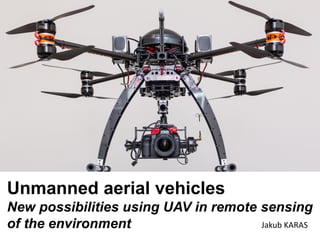
Unmanned aerial vehicles
New possibilities using UAV in remote sensing
of the environment Jakub KARAS
RPAS - remotely piloted aircraft system
UAS - unmanned aerial system
UAV - unmanned aerial vehicle
...is an aircraft without a human pilot aboard. Its flight is
controlled either autonomously by onboard computers or by
the remote control of a pilot on the ground or in another
vehicle
ADVANTAGES:
• significantly cheaper to operate (compared to
usage piloted machines)
• easy handling and mobility
• high flexibility for the use of machines in action
• possible to use (takeoffs and landings)
even in hard-to-reach areas
• low noise operation
• resistance - extremely dangerous locations
• high resolution images and videos
• other potential benefits of the acquisition
specific data in connection with the physical
microsensors
How to choose right UAS
Each Unmanned Aerial System has its own specifics
with which we calculate and adjust the selection of
the purpose for which it is acquired ...
RPAS/UAS – specifications
Copter x wing types
Copter
- variability of different sensors, limited weight
- the use of mapping, through monitoring, after shooting
- vertical take-off and landing (some even from hand)
- online video transmission from the sensor
- manual x automatic flight
Wing (Plane)
- limited to mapping a predetermined sensor
- take-off from the hand or from the ramp
- landing automatic (manual)
WING UAV
take-off from the hand or from the ramp
SENSORS
• RGB camera
• Multispectral camera
• Hyperspectral camera
• Thermal camera
• Laser scanner
• Specific sensors (gas sensors etc.)
USING UAS IN ENVIRONMENT
FORESTRY
WATER
MANAGEMENT
AGRICULTURE
ACTUAL
MAPPING
ENVIRONMENT
GREEN
DOCUMENTATION
ENERGY
NATURE
INCIDENTS
CURRENTNESS x SPEED x ACCESS
AREAS OF USE
FORESTRY, WATER MANAGEMENT,
AGRICULTURE
ACTUAL ORTHOPHOTOMAPS
Current orthophoto, flying the next day depending on the weather, in a short period...
* Mokrá quarry
ACTUAL ORTHOPHOTOMAPS
Actual orthophotomaps in very high image resolution for small areas
* Timber depot in image resolution 7 mm/pixel
Orthophotos according to specific requirements
* Průhonice park – orthophoto
3 cm/pixel
Current orthophotomaps according to
specific customer requirements
(different compared to a conventional
orthophotos - WMS). Mapping during
the low clouds (without shadows),
flying the next day depending on the
weather conditions, in a short period..
Google
ORTOPHOTOMAPS NIR, NDVI, Thermal
actual orthophoto in the NIR, NDVI, thermal imaging, for vegetation indIces, precision farming,
application maps for clever agriculture machines * breeding wheat field
ACTUAL MAPPING AND AERIAL MONITORING
• Mapping the exact extent of damage in the
fields after wildlife
IDENTIFICATION ANIMALS BEFORE HARVEST
* Monitoring of wildlife and their position in the agricultural fields the day before harvest
ACTUAL MONITORING NATURE
INCIDENTS
EROSION x LANDSLIDES x FLOODINGS x FOREST CALAMITY x
WATERLOGGING x GEOLOGICAL ...
MONITORING EROSION INCIDENT
Orthophotomap erosion incident in Postupice in image resolution 1 cm/pixel
MONITORING EROSION EVENT
Orthophotomap erosion event in Postupice in image resolution 1 cm/pixel
MONITORING EROSION INCIDENT
Digital terrain model
detail digital map grooves in dimensions 10 - 20 cm
MONITORING NATURE INCIDENTS
* D8 highway landslide, textured point cloud
Mapping possible immediately after the incident. Visualization of the extent of
damage on the basis of the chosen strategy, progress and possible risks.
From one flight RPAS - aerial photography, orthophotos, high-resolution point cloud
3D model visualization ... Further options videodocumentation, aerial photos.
MONITORING NATURE INCIDENTS
* D8 highway landslide, ortophotomap in 5 cm/px
MONITORING NATURE INCIDENTS
* drainage water, waterlogging
MONITORING NATURE INCIDENTS
* geological structures
ACTUAL MAPPPING AND MONITORING
* Prague floods in 2013 from UAV
PASPORTIZATION / INVENTORY
Forest extraction
INVENTORY FROM ACTUAL ORTHOPHOTOMAP
* forest – Holýšov, 2 cm/pixel
INVENTORY
* detail stumps
IDENTIFICATIONS DRAINAGE
SYSTEMS
The possibility of using remote sensing to identify
drainage systems
• direct identification of lines of drains, fragments until comprehensive drainage systems
(DS) using different means and acquisition of various types of data
• accurate topologies and determine their actual position
• in the field (correction of the project documentation)
• Using different outputs and sensors from UAV during different weather conditions
IDENTIFICATIONS DRAINAGE SYSTEMS
Mapping in different time period
IDENTIFICATIONS DRAINAGE SYSTEMS
combination with thermal mapping
IDENTIFICATIONS DRAINAGE SYSTEMS
combination with digital surface model
IDENTIFICATIONS DRAINAGE SYSTEMS
VOLUME MEASURING / MAPPING OF
THE CURRENT SITUATION
VOLUME
MEASURING
Calculations volumes
of landfill materials
and their monitoring
changes over time -
in sandpits, quarries
and mines, if we
knowing the digital
terrain model of the
original plane.
After several testing at
landfills coal mines Tušimice
the measurement accuracy
of the resulting volumes of
0.2% over the conventional
method of stereo/
photogrammetry.
* decimated point cloud
VOLUME MEASURING/MAPPING OF THE CURRENT SITUATION
VOLUME MEASURING / MAPPING OF THE CURRENT
SITUATION
Calculations volumes of landfill
materials and their monitoring
changes over time - in sandpits,
quarries and mines, if we
knowing the digital terrain
model of the original plane.
* Wood dump– orthophotomap 6 mm/pixel
* 3D model
VOLUME MEASURING
OUTPUTS
• Actual orthophotomaps and mapping (high image resolution
1 – 25 cm/pixel) in RGB or NIR
• Digital surface/terrain models (point clouds)
• Oblique and vertical aerial images, photoplans
• Spherical images and aerial virtual travels
• Aerial videodocumentations
• Aerial monitoring, pasportization
• 3D models
• Volume measuring
LEGISLATION
• registration requirement unmanned aerial means to the Civil
Aviation Authority, the allocation of a registration number
• need permits for aerial work (commercial use)
• UAV pilot exams (theoretical and practical)
• insurance UAV
Thank you…JAKUB KARAS
jakub.karas@upvision.cz
M +420 601 373 937

Weitere ähnliche Inhalte

Andere mochten auch

Military Robots
Military RobotsMilitary Robots
Military Robotsnsapre
 
GI2010 symposium-klosa (explorers pal-amateurvermessungstechnik_osm)
GI2010 symposium-klosa (explorers pal-amateurvermessungstechnik_osm)GI2010 symposium-klosa (explorers pal-amateurvermessungstechnik_osm)
GI2010 symposium-klosa (explorers pal-amateurvermessungstechnik_osm)IGN Vorstand
 
Brazil legal guide
Brazil legal guideBrazil legal guide
Brazil legal guidelvillela
 
International plan one approach 11172010
International plan one approach 11172010International plan one approach 11172010
International plan one approach 11172010Globe Trotters
 
6 Questions to Ponder When Planning Your New Website w/ Sara Isenberg
6 Questions to Ponder When Planning Your New Website w/ Sara Isenberg6 Questions to Ponder When Planning Your New Website w/ Sara Isenberg
6 Questions to Ponder When Planning Your New Website w/ Sara IsenbergSara Isenberg
 
GI2010 symposium-vohnout (nn+metaschool)
GI2010 symposium-vohnout (nn+metaschool)GI2010 symposium-vohnout (nn+metaschool)
GI2010 symposium-vohnout (nn+metaschool)IGN Vorstand
 
Care4One_Investors_Brief_02Jun10
Care4One_Investors_Brief_02Jun10Care4One_Investors_Brief_02Jun10
Care4One_Investors_Brief_02Jun10Chinmay Singh
 
GI2014 programme+proceedings final
GI2014 programme+proceedings finalGI2014 programme+proceedings final
GI2014 programme+proceedings finalIGN Vorstand
 
GI2010 symposium-stark (tele-addr)
GI2010 symposium-stark (tele-addr)GI2010 symposium-stark (tele-addr)
GI2010 symposium-stark (tele-addr)IGN Vorstand
 
GI2010 symposium-kliment (inspire-md-tests)
GI2010 symposium-kliment (inspire-md-tests)GI2010 symposium-kliment (inspire-md-tests)
GI2010 symposium-kliment (inspire-md-tests)IGN Vorstand
 
Cognition. amy watkins. 20065485
Cognition. amy watkins. 20065485Cognition. amy watkins. 20065485
Cognition. amy watkins. 20065485Amy Watkins
 
GI2012 buono-cnr-geo-platform
GI2012 buono-cnr-geo-platformGI2012 buono-cnr-geo-platform
GI2012 buono-cnr-geo-platformIGN Vorstand
 
Www.unlock pdf.com dc-tmd protocol - 2014-06_02
Www.unlock pdf.com dc-tmd protocol - 2014-06_02Www.unlock pdf.com dc-tmd protocol - 2014-06_02
Www.unlock pdf.com dc-tmd protocol - 2014-06_02Marcelo Mascarenhas
 
Berzins raitis ppt_gi2011_biz_biz_final
Berzins raitis ppt_gi2011_biz_biz_finalBerzins raitis ppt_gi2011_biz_biz_final
Berzins raitis ppt_gi2011_biz_biz_finalIGN Vorstand
 
Presentacion de Coqui comun
Presentacion de Coqui comunPresentacion de Coqui comun
Presentacion de Coqui comunNahir328
 
Blachowski ppt gi2011_jacobs_way_final
Blachowski ppt gi2011_jacobs_way_finalBlachowski ppt gi2011_jacobs_way_final
Blachowski ppt gi2011_jacobs_way_finalIGN Vorstand
 
Ancillary product research
Ancillary product researchAncillary product research
Ancillary product researchharrietmedia
 

Andere mochten auch (19)

Military Robots
Military RobotsMilitary Robots
Military Robots
 
Flying robot
Flying robot Flying robot
Flying robot
 
GI2010 symposium-klosa (explorers pal-amateurvermessungstechnik_osm)
GI2010 symposium-klosa (explorers pal-amateurvermessungstechnik_osm)GI2010 symposium-klosa (explorers pal-amateurvermessungstechnik_osm)
GI2010 symposium-klosa (explorers pal-amateurvermessungstechnik_osm)
 
Brazil legal guide
Brazil legal guideBrazil legal guide
Brazil legal guide
 
International plan one approach 11172010
International plan one approach 11172010International plan one approach 11172010
International plan one approach 11172010
 
6 Questions to Ponder When Planning Your New Website w/ Sara Isenberg
6 Questions to Ponder When Planning Your New Website w/ Sara Isenberg6 Questions to Ponder When Planning Your New Website w/ Sara Isenberg
6 Questions to Ponder When Planning Your New Website w/ Sara Isenberg
 
GI2010 symposium-vohnout (nn+metaschool)
GI2010 symposium-vohnout (nn+metaschool)GI2010 symposium-vohnout (nn+metaschool)
GI2010 symposium-vohnout (nn+metaschool)
 
Care4One_Investors_Brief_02Jun10
Care4One_Investors_Brief_02Jun10Care4One_Investors_Brief_02Jun10
Care4One_Investors_Brief_02Jun10
 
GI2014 programme+proceedings final
GI2014 programme+proceedings finalGI2014 programme+proceedings final
GI2014 programme+proceedings final
 
GI2010 symposium-stark (tele-addr)
GI2010 symposium-stark (tele-addr)GI2010 symposium-stark (tele-addr)
GI2010 symposium-stark (tele-addr)
 
Anjan b'day ppt
Anjan b'day pptAnjan b'day ppt
Anjan b'day ppt
 
GI2010 symposium-kliment (inspire-md-tests)
GI2010 symposium-kliment (inspire-md-tests)GI2010 symposium-kliment (inspire-md-tests)
GI2010 symposium-kliment (inspire-md-tests)
 
Cognition. amy watkins. 20065485
Cognition. amy watkins. 20065485Cognition. amy watkins. 20065485
Cognition. amy watkins. 20065485
 
GI2012 buono-cnr-geo-platform
GI2012 buono-cnr-geo-platformGI2012 buono-cnr-geo-platform
GI2012 buono-cnr-geo-platform
 
Www.unlock pdf.com dc-tmd protocol - 2014-06_02
Www.unlock pdf.com dc-tmd protocol - 2014-06_02Www.unlock pdf.com dc-tmd protocol - 2014-06_02
Www.unlock pdf.com dc-tmd protocol - 2014-06_02
 
Berzins raitis ppt_gi2011_biz_biz_final
Berzins raitis ppt_gi2011_biz_biz_finalBerzins raitis ppt_gi2011_biz_biz_final
Berzins raitis ppt_gi2011_biz_biz_final
 
Presentacion de Coqui comun
Presentacion de Coqui comunPresentacion de Coqui comun
Presentacion de Coqui comun
 
Blachowski ppt gi2011_jacobs_way_final
Blachowski ppt gi2011_jacobs_way_finalBlachowski ppt gi2011_jacobs_way_final
Blachowski ppt gi2011_jacobs_way_final
 
Ancillary product research
Ancillary product researchAncillary product research
Ancillary product research
 

Ähnlich wie GI2015 ppt karas dresden j.karas

Surveying Innovations in Quarrying
Surveying Innovations in QuarryingSurveying Innovations in Quarrying
Surveying Innovations in QuarryingErik Birzulis
 
Necessity of GPS-based 'Proximity Warning System' in mining industry – a tool...
Necessity of GPS-based 'Proximity Warning System' in mining industry – a tool...Necessity of GPS-based 'Proximity Warning System' in mining industry – a tool...
Necessity of GPS-based 'Proximity Warning System' in mining industry – a tool...Roshan Kumar Patel
 
Unmanned Aerial Vehicle Application
Unmanned Aerial Vehicle ApplicationUnmanned Aerial Vehicle Application
Unmanned Aerial Vehicle ApplicationNopphawanTamkuan
 
1 Aerial View - Drone Snapshot2
1 Aerial View - Drone Snapshot21 Aerial View - Drone Snapshot2
1 Aerial View - Drone Snapshot2Garth Torasadhewa
 
Technical Paper ppt.pptx
Technical Paper ppt.pptxTechnical Paper ppt.pptx
Technical Paper ppt.pptxSudeepgowda16
 
Teamnet International Expertise in UAV Systems
Teamnet International Expertise in UAV Systems Teamnet International Expertise in UAV Systems
Teamnet International Expertise in UAV Systems Teamnet International
 
Unmanned Aerial Systems for Precision Mapping
Unmanned Aerial Systems for Precision MappingUnmanned Aerial Systems for Precision Mapping
Unmanned Aerial Systems for Precision MappingUAS Colorado
 
Pipeline surveillance-presentation
Pipeline surveillance-presentationPipeline surveillance-presentation
Pipeline surveillance-presentationkashif afridi
 
remote sensing ppt.pptx
remote sensing ppt.pptxremote sensing ppt.pptx
remote sensing ppt.pptxswarnrajsingh1
 
PhotogrammetryArcGIS_V202108.pdf
PhotogrammetryArcGIS_V202108.pdfPhotogrammetryArcGIS_V202108.pdf
PhotogrammetryArcGIS_V202108.pdfRobertoReinoVargas
 
NACCDCA9P08 (1).pdf
NACCDCA9P08 (1).pdfNACCDCA9P08 (1).pdf
NACCDCA9P08 (1).pdfssuser2714fe
 
MAIA - the multispectral camera
MAIA - the multispectral cameraMAIA - the multispectral camera
MAIA - the multispectral cameraGiacomo Uguccioni
 

Ähnlich wie GI2015 ppt karas dresden j.karas (20)

4 emergenze meteo_-_uni_ge_-_caviglia
4 emergenze meteo_-_uni_ge_-_caviglia4 emergenze meteo_-_uni_ge_-_caviglia
4 emergenze meteo_-_uni_ge_-_caviglia
 
Surveying Innovations in Quarrying
Surveying Innovations in QuarryingSurveying Innovations in Quarrying
Surveying Innovations in Quarrying
 
Necessity of GPS-based 'Proximity Warning System' in mining industry – a tool...
Necessity of GPS-based 'Proximity Warning System' in mining industry – a tool...Necessity of GPS-based 'Proximity Warning System' in mining industry – a tool...
Necessity of GPS-based 'Proximity Warning System' in mining industry – a tool...
 
Unmanned Aerial Vehicle Application
Unmanned Aerial Vehicle ApplicationUnmanned Aerial Vehicle Application
Unmanned Aerial Vehicle Application
 
1 Aerial View - Drone Snapshot2
1 Aerial View - Drone Snapshot21 Aerial View - Drone Snapshot2
1 Aerial View - Drone Snapshot2
 
Altm (1)
Altm (1)Altm (1)
Altm (1)
 
Technical Paper ppt.pptx
Technical Paper ppt.pptxTechnical Paper ppt.pptx
Technical Paper ppt.pptx
 
Teamnet International Expertise in UAV Systems
Teamnet International Expertise in UAV Systems Teamnet International Expertise in UAV Systems
Teamnet International Expertise in UAV Systems
 
Unmanned Aerial Systems for Precision Mapping
Unmanned Aerial Systems for Precision MappingUnmanned Aerial Systems for Precision Mapping
Unmanned Aerial Systems for Precision Mapping
 
Pipeline surveillance-presentation
Pipeline surveillance-presentationPipeline surveillance-presentation
Pipeline surveillance-presentation
 
Remote sensing
Remote sensingRemote sensing
Remote sensing
 
Aerophysx Brochure
Aerophysx BrochureAerophysx Brochure
Aerophysx Brochure
 
In sar 1-1-2011
In sar 1-1-2011In sar 1-1-2011
In sar 1-1-2011
 
remote sensing ppt.pptx
remote sensing ppt.pptxremote sensing ppt.pptx
remote sensing ppt.pptx
 
PhotogrammetryArcGIS_V202108.pdf
PhotogrammetryArcGIS_V202108.pdfPhotogrammetryArcGIS_V202108.pdf
PhotogrammetryArcGIS_V202108.pdf
 
NACCDCA9P08 (1).pdf
NACCDCA9P08 (1).pdfNACCDCA9P08 (1).pdf
NACCDCA9P08 (1).pdf
 
Caldwell uas
Caldwell uasCaldwell uas
Caldwell uas
 
Umb E 2009 2010
Umb E 2009 2010Umb E 2009 2010
Umb E 2009 2010
 
MAIA - the multispectral camera
MAIA - the multispectral cameraMAIA - the multispectral camera
MAIA - the multispectral camera
 
SPAR2015
SPAR2015SPAR2015
SPAR2015
 

Mehr von IGN Vorstand

GI2016 final programm & proceedings of abstracts & summaries
GI2016 final programm & proceedings of abstracts & summariesGI2016 final programm & proceedings of abstracts & summaries
GI2016 final programm & proceedings of abstracts & summariesIGN Vorstand
 
GI2016 ppt hoffmann address+history from_gi2000_to_gi2016
GI2016 ppt hoffmann address+history from_gi2000_to_gi2016GI2016 ppt hoffmann address+history from_gi2000_to_gi2016
GI2016 ppt hoffmann address+history from_gi2000_to_gi2016IGN Vorstand
 
GI2016 ppt böhm saxonian_gdi_1_grenze_hi_hedo
GI2016 ppt böhm saxonian_gdi_1_grenze_hi_hedoGI2016 ppt böhm saxonian_gdi_1_grenze_hi_hedo
GI2016 ppt böhm saxonian_gdi_1_grenze_hi_hedoIGN Vorstand
 
GI2016 ppt böhm saxonian_gdi_2_eine_bwk_entsteht
GI2016 ppt böhm saxonian_gdi_2_eine_bwk_entstehtGI2016 ppt böhm saxonian_gdi_2_eine_bwk_entsteht
GI2016 ppt böhm saxonian_gdi_2_eine_bwk_entstehtIGN Vorstand
 
GI2016 ppt böhm saxonian_gdi_3_vimage
GI2016 ppt böhm saxonian_gdi_3_vimageGI2016 ppt böhm saxonian_gdi_3_vimage
GI2016 ppt böhm saxonian_gdi_3_vimageIGN Vorstand
 
GI2016 ppt charvat senslog api as tools for collection of big vgi data
GI2016 ppt charvat senslog api as tools for collection of big vgi dataGI2016 ppt charvat senslog api as tools for collection of big vgi data
GI2016 ppt charvat senslog api as tools for collection of big vgi dataIGN Vorstand
 
GI2016 ppt charvat workshop geoss & conference inspire2016
GI2016 ppt charvat workshop geoss & conference inspire2016GI2016 ppt charvat workshop geoss & conference inspire2016
GI2016 ppt charvat workshop geoss & conference inspire2016IGN Vorstand
 
GI2016 ppt mayer copernicus_dresden
GI2016 ppt mayer copernicus_dresdenGI2016 ppt mayer copernicus_dresden
GI2016 ppt mayer copernicus_dresdenIGN Vorstand
 
GI2016 ppt schiller dbd-bauprofessor & zuse-dualsemantik
GI2016 ppt schiller dbd-bauprofessor & zuse-dualsemantikGI2016 ppt schiller dbd-bauprofessor & zuse-dualsemantik
GI2016 ppt schiller dbd-bauprofessor & zuse-dualsemantikIGN Vorstand
 
GI2016 ppt schiller kostenkalkül
GI2016 ppt schiller kostenkalkülGI2016 ppt schiller kostenkalkül
GI2016 ppt schiller kostenkalkülIGN Vorstand
 
GI2016 ppt shi (automatic interaction and seamless integration of big data hu...
GI2016 ppt shi (automatic interaction and seamless integration of big data hu...GI2016 ppt shi (automatic interaction and seamless integration of big data hu...
GI2016 ppt shi (automatic interaction and seamless integration of big data hu...IGN Vorstand
 
GI2016 ppt shi (big data analytics on the internet)
GI2016 ppt shi (big data analytics on the internet)GI2016 ppt shi (big data analytics on the internet)
GI2016 ppt shi (big data analytics on the internet)IGN Vorstand
 
GI2016 ppt shi (cartography and communication)
GI2016 ppt shi (cartography and communication)GI2016 ppt shi (cartography and communication)
GI2016 ppt shi (cartography and communication)IGN Vorstand
 
GI2016 Open Call for Presentations
GI2016 Open Call for PresentationsGI2016 Open Call for Presentations
GI2016 Open Call for PresentationsIGN Vorstand
 
GI2015 ppt hoffmann_address_intro
GI2015 ppt hoffmann_address_introGI2015 ppt hoffmann_address_intro
GI2015 ppt hoffmann_address_introIGN Vorstand
 
GI2015 programme+proceedings
GI2015 programme+proceedingsGI2015 programme+proceedings
GI2015 programme+proceedingsIGN Vorstand
 
CoO + GI2015 ppt_charvat ict for a sustainable agriculture – public support n...
CoO + GI2015 ppt_charvat ict for a sustainable agriculture – public support n...CoO + GI2015 ppt_charvat ict for a sustainable agriculture – public support n...
CoO + GI2015 ppt_charvat ict for a sustainable agriculture – public support n...IGN Vorstand
 
CoO + GI2015 ppt_mayer ict for a sustainable agriculture - status and missing
CoO + GI2015 ppt_mayer ict for a sustainable agriculture - status and missingCoO + GI2015 ppt_mayer ict for a sustainable agriculture - status and missing
CoO + GI2015 ppt_mayer ict for a sustainable agriculture - status and missingIGN Vorstand
 
GI2015 ppt hladikova copernicus_agriculture_forestry_lh
GI2015 ppt hladikova copernicus_agriculture_forestry_lhGI2015 ppt hladikova copernicus_agriculture_forestry_lh
GI2015 ppt hladikova copernicus_agriculture_forestry_lhIGN Vorstand
 
GI2015 ppt fiore eurisy_presentation
GI2015 ppt fiore eurisy_presentationGI2015 ppt fiore eurisy_presentation
GI2015 ppt fiore eurisy_presentationIGN Vorstand
 

Mehr von IGN Vorstand (20)

GI2016 final programm & proceedings of abstracts & summaries
GI2016 final programm & proceedings of abstracts & summariesGI2016 final programm & proceedings of abstracts & summaries
GI2016 final programm & proceedings of abstracts & summaries
 
GI2016 ppt hoffmann address+history from_gi2000_to_gi2016
GI2016 ppt hoffmann address+history from_gi2000_to_gi2016GI2016 ppt hoffmann address+history from_gi2000_to_gi2016
GI2016 ppt hoffmann address+history from_gi2000_to_gi2016
 
GI2016 ppt böhm saxonian_gdi_1_grenze_hi_hedo
GI2016 ppt böhm saxonian_gdi_1_grenze_hi_hedoGI2016 ppt böhm saxonian_gdi_1_grenze_hi_hedo
GI2016 ppt böhm saxonian_gdi_1_grenze_hi_hedo
 
GI2016 ppt böhm saxonian_gdi_2_eine_bwk_entsteht
GI2016 ppt böhm saxonian_gdi_2_eine_bwk_entstehtGI2016 ppt böhm saxonian_gdi_2_eine_bwk_entsteht
GI2016 ppt böhm saxonian_gdi_2_eine_bwk_entsteht
 
GI2016 ppt böhm saxonian_gdi_3_vimage
GI2016 ppt böhm saxonian_gdi_3_vimageGI2016 ppt böhm saxonian_gdi_3_vimage
GI2016 ppt böhm saxonian_gdi_3_vimage
 
GI2016 ppt charvat senslog api as tools for collection of big vgi data
GI2016 ppt charvat senslog api as tools for collection of big vgi dataGI2016 ppt charvat senslog api as tools for collection of big vgi data
GI2016 ppt charvat senslog api as tools for collection of big vgi data
 
GI2016 ppt charvat workshop geoss & conference inspire2016
GI2016 ppt charvat workshop geoss & conference inspire2016GI2016 ppt charvat workshop geoss & conference inspire2016
GI2016 ppt charvat workshop geoss & conference inspire2016
 
GI2016 ppt mayer copernicus_dresden
GI2016 ppt mayer copernicus_dresdenGI2016 ppt mayer copernicus_dresden
GI2016 ppt mayer copernicus_dresden
 
GI2016 ppt schiller dbd-bauprofessor & zuse-dualsemantik
GI2016 ppt schiller dbd-bauprofessor & zuse-dualsemantikGI2016 ppt schiller dbd-bauprofessor & zuse-dualsemantik
GI2016 ppt schiller dbd-bauprofessor & zuse-dualsemantik
 
GI2016 ppt schiller kostenkalkül
GI2016 ppt schiller kostenkalkülGI2016 ppt schiller kostenkalkül
GI2016 ppt schiller kostenkalkül
 
GI2016 ppt shi (automatic interaction and seamless integration of big data hu...
GI2016 ppt shi (automatic interaction and seamless integration of big data hu...GI2016 ppt shi (automatic interaction and seamless integration of big data hu...
GI2016 ppt shi (automatic interaction and seamless integration of big data hu...
 
GI2016 ppt shi (big data analytics on the internet)
GI2016 ppt shi (big data analytics on the internet)GI2016 ppt shi (big data analytics on the internet)
GI2016 ppt shi (big data analytics on the internet)
 
GI2016 ppt shi (cartography and communication)
GI2016 ppt shi (cartography and communication)GI2016 ppt shi (cartography and communication)
GI2016 ppt shi (cartography and communication)
 
GI2016 Open Call for Presentations
GI2016 Open Call for PresentationsGI2016 Open Call for Presentations
GI2016 Open Call for Presentations
 
GI2015 ppt hoffmann_address_intro
GI2015 ppt hoffmann_address_introGI2015 ppt hoffmann_address_intro
GI2015 ppt hoffmann_address_intro
 
GI2015 programme+proceedings
GI2015 programme+proceedingsGI2015 programme+proceedings
GI2015 programme+proceedings
 
CoO + GI2015 ppt_charvat ict for a sustainable agriculture – public support n...
CoO + GI2015 ppt_charvat ict for a sustainable agriculture – public support n...CoO + GI2015 ppt_charvat ict for a sustainable agriculture – public support n...
CoO + GI2015 ppt_charvat ict for a sustainable agriculture – public support n...
 
CoO + GI2015 ppt_mayer ict for a sustainable agriculture - status and missing
CoO + GI2015 ppt_mayer ict for a sustainable agriculture - status and missingCoO + GI2015 ppt_mayer ict for a sustainable agriculture - status and missing
CoO + GI2015 ppt_mayer ict for a sustainable agriculture - status and missing
 
GI2015 ppt hladikova copernicus_agriculture_forestry_lh
GI2015 ppt hladikova copernicus_agriculture_forestry_lhGI2015 ppt hladikova copernicus_agriculture_forestry_lh
GI2015 ppt hladikova copernicus_agriculture_forestry_lh
 
GI2015 ppt fiore eurisy_presentation
GI2015 ppt fiore eurisy_presentationGI2015 ppt fiore eurisy_presentation
GI2015 ppt fiore eurisy_presentation
 

Kürzlich hochgeladen

The 3rd Intl. Workshop on NL-based Software Engineering
The 3rd Intl. Workshop on NL-based Software EngineeringThe 3rd Intl. Workshop on NL-based Software Engineering
The 3rd Intl. Workshop on NL-based Software EngineeringSebastiano Panichella
 
Exploring protein-protein interactions by Weak Affinity Chromatography (WAC) ...
Exploring protein-protein interactions by Weak Affinity Chromatography (WAC) ...Exploring protein-protein interactions by Weak Affinity Chromatography (WAC) ...
Exploring protein-protein interactions by Weak Affinity Chromatography (WAC) ...Salam Al-Karadaghi
 
Open Source Camp Kubernetes 2024 | Running WebAssembly on Kubernetes by Alex ...
Open Source Camp Kubernetes 2024 | Running WebAssembly on Kubernetes by Alex ...Open Source Camp Kubernetes 2024 | Running WebAssembly on Kubernetes by Alex ...
Open Source Camp Kubernetes 2024 | Running WebAssembly on Kubernetes by Alex ...NETWAYS
 
The Ten Facts About People With Autism Presentation
The Ten Facts About People With Autism PresentationThe Ten Facts About People With Autism Presentation
The Ten Facts About People With Autism PresentationNathan Young
 
Call Girls In Aerocity 🤳 Call Us +919599264170
Call Girls In Aerocity 🤳 Call Us +919599264170Call Girls In Aerocity 🤳 Call Us +919599264170
Call Girls In Aerocity 🤳 Call Us +919599264170Escort Service
 
OSCamp Kubernetes 2024 | SRE Challenges in Monolith to Microservices Shift at...
OSCamp Kubernetes 2024 | SRE Challenges in Monolith to Microservices Shift at...OSCamp Kubernetes 2024 | SRE Challenges in Monolith to Microservices Shift at...
OSCamp Kubernetes 2024 | SRE Challenges in Monolith to Microservices Shift at...NETWAYS
 
NATIONAL ANTHEMS OF AFRICA (National Anthems of Africa)
NATIONAL ANTHEMS OF AFRICA (National Anthems of Africa)NATIONAL ANTHEMS OF AFRICA (National Anthems of Africa)
NATIONAL ANTHEMS OF AFRICA (National Anthems of Africa)Basil Achie
 
Genesis part 2 Isaiah Scudder 04-24-2024.pptx
Genesis part 2 Isaiah Scudder 04-24-2024.pptxGenesis part 2 Isaiah Scudder 04-24-2024.pptx
Genesis part 2 Isaiah Scudder 04-24-2024.pptxFamilyWorshipCenterD
 
SBFT Tool Competition 2024 -- Python Test Case Generation Track
SBFT Tool Competition 2024 -- Python Test Case Generation TrackSBFT Tool Competition 2024 -- Python Test Case Generation Track
SBFT Tool Competition 2024 -- Python Test Case Generation TrackSebastiano Panichella
 
Open Source Camp Kubernetes 2024 | Monitoring Kubernetes With Icinga by Eric ...
Open Source Camp Kubernetes 2024 | Monitoring Kubernetes With Icinga by Eric ...Open Source Camp Kubernetes 2024 | Monitoring Kubernetes With Icinga by Eric ...
Open Source Camp Kubernetes 2024 | Monitoring Kubernetes With Icinga by Eric ...NETWAYS
 
Presentation for the Strategic Dialogue on the Future of Agriculture, Brussel...
Presentation for the Strategic Dialogue on the Future of Agriculture, Brussel...Presentation for the Strategic Dialogue on the Future of Agriculture, Brussel...
Presentation for the Strategic Dialogue on the Future of Agriculture, Brussel...Krijn Poppe
 
Anne Frank A Beacon of Hope amidst darkness ppt.pptx
Anne Frank A Beacon of Hope amidst darkness ppt.pptxAnne Frank A Beacon of Hope amidst darkness ppt.pptx
Anne Frank A Beacon of Hope amidst darkness ppt.pptxnoorehahmad
 
Work Remotely with Confluence ACE 2.pptx
Work Remotely with Confluence ACE 2.pptxWork Remotely with Confluence ACE 2.pptx
Work Remotely with Confluence ACE 2.pptxmavinoikein
 
James Joyce, Dubliners and Ulysses.ppt !
James Joyce, Dubliners and Ulysses.ppt !James Joyce, Dubliners and Ulysses.ppt !
James Joyce, Dubliners and Ulysses.ppt !risocarla2016
 
Mathan flower ppt.pptx slide orchids ✨🌸
Mathan flower ppt.pptx slide orchids ✨🌸Mathan flower ppt.pptx slide orchids ✨🌸
Mathan flower ppt.pptx slide orchids ✨🌸mathanramanathan2005
 
Philippine History cavite Mutiny Report.ppt
Philippine History cavite Mutiny Report.pptPhilippine History cavite Mutiny Report.ppt
Philippine History cavite Mutiny Report.pptssuser319dad
 
Gaps, Issues and Challenges in the Implementation of Mother Tongue Based-Mult...
Gaps, Issues and Challenges in the Implementation of Mother Tongue Based-Mult...Gaps, Issues and Challenges in the Implementation of Mother Tongue Based-Mult...
Gaps, Issues and Challenges in the Implementation of Mother Tongue Based-Mult...marjmae69
 
PHYSICS PROJECT BY MSC - NANOTECHNOLOGY
PHYSICS PROJECT BY MSC  - NANOTECHNOLOGYPHYSICS PROJECT BY MSC  - NANOTECHNOLOGY
PHYSICS PROJECT BY MSC - NANOTECHNOLOGYpruthirajnayak525
 
Call Girls in Rohini Delhi 💯Call Us 🔝8264348440🔝
Call Girls in Rohini Delhi 💯Call Us 🔝8264348440🔝Call Girls in Rohini Delhi 💯Call Us 🔝8264348440🔝
Call Girls in Rohini Delhi 💯Call Us 🔝8264348440🔝soniya singh
 
Open Source Strategy in Logistics 2015_Henrik Hankedvz-d-nl-log-conference.pdf
Open Source Strategy in Logistics 2015_Henrik Hankedvz-d-nl-log-conference.pdfOpen Source Strategy in Logistics 2015_Henrik Hankedvz-d-nl-log-conference.pdf
Open Source Strategy in Logistics 2015_Henrik Hankedvz-d-nl-log-conference.pdfhenrik385807
 

Kürzlich hochgeladen (20)

The 3rd Intl. Workshop on NL-based Software Engineering
The 3rd Intl. Workshop on NL-based Software EngineeringThe 3rd Intl. Workshop on NL-based Software Engineering
The 3rd Intl. Workshop on NL-based Software Engineering
 
Exploring protein-protein interactions by Weak Affinity Chromatography (WAC) ...
Exploring protein-protein interactions by Weak Affinity Chromatography (WAC) ...Exploring protein-protein interactions by Weak Affinity Chromatography (WAC) ...
Exploring protein-protein interactions by Weak Affinity Chromatography (WAC) ...
 
Open Source Camp Kubernetes 2024 | Running WebAssembly on Kubernetes by Alex ...
Open Source Camp Kubernetes 2024 | Running WebAssembly on Kubernetes by Alex ...Open Source Camp Kubernetes 2024 | Running WebAssembly on Kubernetes by Alex ...
Open Source Camp Kubernetes 2024 | Running WebAssembly on Kubernetes by Alex ...
 
The Ten Facts About People With Autism Presentation
The Ten Facts About People With Autism PresentationThe Ten Facts About People With Autism Presentation
The Ten Facts About People With Autism Presentation
 
Call Girls In Aerocity 🤳 Call Us +919599264170
Call Girls In Aerocity 🤳 Call Us +919599264170Call Girls In Aerocity 🤳 Call Us +919599264170
Call Girls In Aerocity 🤳 Call Us +919599264170
 
OSCamp Kubernetes 2024 | SRE Challenges in Monolith to Microservices Shift at...
OSCamp Kubernetes 2024 | SRE Challenges in Monolith to Microservices Shift at...OSCamp Kubernetes 2024 | SRE Challenges in Monolith to Microservices Shift at...
OSCamp Kubernetes 2024 | SRE Challenges in Monolith to Microservices Shift at...
 
NATIONAL ANTHEMS OF AFRICA (National Anthems of Africa)
NATIONAL ANTHEMS OF AFRICA (National Anthems of Africa)NATIONAL ANTHEMS OF AFRICA (National Anthems of Africa)
NATIONAL ANTHEMS OF AFRICA (National Anthems of Africa)
 
Genesis part 2 Isaiah Scudder 04-24-2024.pptx
Genesis part 2 Isaiah Scudder 04-24-2024.pptxGenesis part 2 Isaiah Scudder 04-24-2024.pptx
Genesis part 2 Isaiah Scudder 04-24-2024.pptx
 
SBFT Tool Competition 2024 -- Python Test Case Generation Track
SBFT Tool Competition 2024 -- Python Test Case Generation TrackSBFT Tool Competition 2024 -- Python Test Case Generation Track
SBFT Tool Competition 2024 -- Python Test Case Generation Track
 
Open Source Camp Kubernetes 2024 | Monitoring Kubernetes With Icinga by Eric ...
Open Source Camp Kubernetes 2024 | Monitoring Kubernetes With Icinga by Eric ...Open Source Camp Kubernetes 2024 | Monitoring Kubernetes With Icinga by Eric ...
Open Source Camp Kubernetes 2024 | Monitoring Kubernetes With Icinga by Eric ...
 
Presentation for the Strategic Dialogue on the Future of Agriculture, Brussel...
Presentation for the Strategic Dialogue on the Future of Agriculture, Brussel...Presentation for the Strategic Dialogue on the Future of Agriculture, Brussel...
Presentation for the Strategic Dialogue on the Future of Agriculture, Brussel...
 
Anne Frank A Beacon of Hope amidst darkness ppt.pptx
Anne Frank A Beacon of Hope amidst darkness ppt.pptxAnne Frank A Beacon of Hope amidst darkness ppt.pptx
Anne Frank A Beacon of Hope amidst darkness ppt.pptx
 
Work Remotely with Confluence ACE 2.pptx
Work Remotely with Confluence ACE 2.pptxWork Remotely with Confluence ACE 2.pptx
Work Remotely with Confluence ACE 2.pptx
 
James Joyce, Dubliners and Ulysses.ppt !
James Joyce, Dubliners and Ulysses.ppt !James Joyce, Dubliners and Ulysses.ppt !
James Joyce, Dubliners and Ulysses.ppt !
 
Mathan flower ppt.pptx slide orchids ✨🌸
Mathan flower ppt.pptx slide orchids ✨🌸Mathan flower ppt.pptx slide orchids ✨🌸
Mathan flower ppt.pptx slide orchids ✨🌸
 
Philippine History cavite Mutiny Report.ppt
Philippine History cavite Mutiny Report.pptPhilippine History cavite Mutiny Report.ppt
Philippine History cavite Mutiny Report.ppt
 
Gaps, Issues and Challenges in the Implementation of Mother Tongue Based-Mult...
Gaps, Issues and Challenges in the Implementation of Mother Tongue Based-Mult...Gaps, Issues and Challenges in the Implementation of Mother Tongue Based-Mult...
Gaps, Issues and Challenges in the Implementation of Mother Tongue Based-Mult...
 
PHYSICS PROJECT BY MSC - NANOTECHNOLOGY
PHYSICS PROJECT BY MSC  - NANOTECHNOLOGYPHYSICS PROJECT BY MSC  - NANOTECHNOLOGY
PHYSICS PROJECT BY MSC - NANOTECHNOLOGY
 
Call Girls in Rohini Delhi 💯Call Us 🔝8264348440🔝
Call Girls in Rohini Delhi 💯Call Us 🔝8264348440🔝Call Girls in Rohini Delhi 💯Call Us 🔝8264348440🔝
Call Girls in Rohini Delhi 💯Call Us 🔝8264348440🔝
 
Open Source Strategy in Logistics 2015_Henrik Hankedvz-d-nl-log-conference.pdf
Open Source Strategy in Logistics 2015_Henrik Hankedvz-d-nl-log-conference.pdfOpen Source Strategy in Logistics 2015_Henrik Hankedvz-d-nl-log-conference.pdf
Open Source Strategy in Logistics 2015_Henrik Hankedvz-d-nl-log-conference.pdf
 

GI2015 ppt karas dresden j.karas

  • 1. Unmanned aerial vehicles New possibilities using UAV in remote sensing of the environment Jakub KARAS
  • 2. RPAS - remotely piloted aircraft system UAS - unmanned aerial system UAV - unmanned aerial vehicle ...is an aircraft without a human pilot aboard. Its flight is controlled either autonomously by onboard computers or by the remote control of a pilot on the ground or in another vehicle
  • 3. ADVANTAGES: • significantly cheaper to operate (compared to usage piloted machines) • easy handling and mobility • high flexibility for the use of machines in action • possible to use (takeoffs and landings) even in hard-to-reach areas • low noise operation • resistance - extremely dangerous locations • high resolution images and videos • other potential benefits of the acquisition specific data in connection with the physical microsensors
  • 4. How to choose right UAS Each Unmanned Aerial System has its own specifics with which we calculate and adjust the selection of the purpose for which it is acquired ...
  • 5. RPAS/UAS – specifications Copter x wing types Copter - variability of different sensors, limited weight - the use of mapping, through monitoring, after shooting - vertical take-off and landing (some even from hand) - online video transmission from the sensor - manual x automatic flight Wing (Plane) - limited to mapping a predetermined sensor - take-off from the hand or from the ramp - landing automatic (manual)
  • 6. WING UAV take-off from the hand or from the ramp
  • 7. SENSORS • RGB camera • Multispectral camera • Hyperspectral camera • Thermal camera • Laser scanner • Specific sensors (gas sensors etc.)
  • 8. USING UAS IN ENVIRONMENT FORESTRY WATER MANAGEMENT AGRICULTURE ACTUAL MAPPING ENVIRONMENT GREEN DOCUMENTATION ENERGY NATURE INCIDENTS CURRENTNESS x SPEED x ACCESS
  • 9. AREAS OF USE FORESTRY, WATER MANAGEMENT, AGRICULTURE
  • 10. ACTUAL ORTHOPHOTOMAPS Current orthophoto, flying the next day depending on the weather, in a short period... * Mokrá quarry
  • 11. ACTUAL ORTHOPHOTOMAPS Actual orthophotomaps in very high image resolution for small areas * Timber depot in image resolution 7 mm/pixel
  • 12. Orthophotos according to specific requirements * Průhonice park – orthophoto 3 cm/pixel Current orthophotomaps according to specific customer requirements (different compared to a conventional orthophotos - WMS). Mapping during the low clouds (without shadows), flying the next day depending on the weather conditions, in a short period.. Google
  • 13. ORTOPHOTOMAPS NIR, NDVI, Thermal actual orthophoto in the NIR, NDVI, thermal imaging, for vegetation indIces, precision farming, application maps for clever agriculture machines * breeding wheat field
  • 14. ACTUAL MAPPING AND AERIAL MONITORING • Mapping the exact extent of damage in the fields after wildlife
  • 15. IDENTIFICATION ANIMALS BEFORE HARVEST * Monitoring of wildlife and their position in the agricultural fields the day before harvest
  • 16. ACTUAL MONITORING NATURE INCIDENTS EROSION x LANDSLIDES x FLOODINGS x FOREST CALAMITY x WATERLOGGING x GEOLOGICAL ...
  • 17. MONITORING EROSION INCIDENT Orthophotomap erosion incident in Postupice in image resolution 1 cm/pixel
  • 18. MONITORING EROSION EVENT Orthophotomap erosion event in Postupice in image resolution 1 cm/pixel
  • 19. MONITORING EROSION INCIDENT Digital terrain model detail digital map grooves in dimensions 10 - 20 cm
  • 20. MONITORING NATURE INCIDENTS * D8 highway landslide, textured point cloud Mapping possible immediately after the incident. Visualization of the extent of damage on the basis of the chosen strategy, progress and possible risks. From one flight RPAS - aerial photography, orthophotos, high-resolution point cloud 3D model visualization ... Further options videodocumentation, aerial photos.
  • 21. MONITORING NATURE INCIDENTS * D8 highway landslide, ortophotomap in 5 cm/px
  • 22. MONITORING NATURE INCIDENTS * drainage water, waterlogging
  • 23. MONITORING NATURE INCIDENTS * geological structures
  • 24. ACTUAL MAPPPING AND MONITORING * Prague floods in 2013 from UAV
  • 26. INVENTORY FROM ACTUAL ORTHOPHOTOMAP * forest – Holýšov, 2 cm/pixel
  • 29. The possibility of using remote sensing to identify drainage systems • direct identification of lines of drains, fragments until comprehensive drainage systems (DS) using different means and acquisition of various types of data • accurate topologies and determine their actual position • in the field (correction of the project documentation) • Using different outputs and sensors from UAV during different weather conditions
  • 33. Mapping in different time period IDENTIFICATIONS DRAINAGE SYSTEMS
  • 34. combination with thermal mapping IDENTIFICATIONS DRAINAGE SYSTEMS
  • 35. combination with digital surface model IDENTIFICATIONS DRAINAGE SYSTEMS
  • 36. VOLUME MEASURING / MAPPING OF THE CURRENT SITUATION
  • 37. VOLUME MEASURING Calculations volumes of landfill materials and their monitoring changes over time - in sandpits, quarries and mines, if we knowing the digital terrain model of the original plane.
  • 38. After several testing at landfills coal mines Tušimice the measurement accuracy of the resulting volumes of 0.2% over the conventional method of stereo/ photogrammetry. * decimated point cloud VOLUME MEASURING/MAPPING OF THE CURRENT SITUATION
  • 39. VOLUME MEASURING / MAPPING OF THE CURRENT SITUATION
  • 40. Calculations volumes of landfill materials and their monitoring changes over time - in sandpits, quarries and mines, if we knowing the digital terrain model of the original plane. * Wood dump– orthophotomap 6 mm/pixel * 3D model VOLUME MEASURING
  • 41. OUTPUTS • Actual orthophotomaps and mapping (high image resolution 1 – 25 cm/pixel) in RGB or NIR • Digital surface/terrain models (point clouds) • Oblique and vertical aerial images, photoplans • Spherical images and aerial virtual travels • Aerial videodocumentations • Aerial monitoring, pasportization • 3D models • Volume measuring
  • 42. LEGISLATION • registration requirement unmanned aerial means to the Civil Aviation Authority, the allocation of a registration number • need permits for aerial work (commercial use) • UAV pilot exams (theoretical and practical) • insurance UAV