Integrate & Analyse Spatial Planning Data
•
1 gefällt mir•1,362 views

GI2013-GI/GIS/GDI-Interoperability-Forum, Dresden: 29./30.04.2013

Empfohlen
Empfohlen
Weitere ähnliche Inhalte
Was ist angesagt?
Was ist angesagt? (20)
Andere mochten auch
Andere mochten auch (20)
Ähnlich wie Integrate & Analyse Spatial Planning Data
Ähnlich wie Integrate & Analyse Spatial Planning Data (20)
Mehr von IGN Vorstand
Mehr von IGN Vorstand (20)
Kürzlich hochgeladen
Kürzlich hochgeladen (20)
Integrate & Analyse Spatial Planning Data
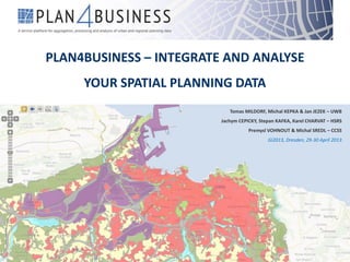
- 1. PLAN4BUSINESS – INTEGRATE AND ANALYSE YOUR SPATIAL PLANNING DATA Tomas MILDORF, Michal KEPKA & Jan JEZEK – UWB Jachym CEPICKY, Stepan KAFKA, Karel CHARVAT – HSRS Premysl VOHNOUT & Michal SREDL – CCSS GI2013, Dresden, 29-30 April 2013
- 2. plan4business objective plan4business is an EU-funded FP7 project developing a service platform for integration and analysis of spatial planning data. INTEGRATION ANALYSIS
- 3. plan4business service platform INTEGRATION STORAGEANALYSES Heterogeneous data sources USERS - access to spatial planning data and spatial analysis
- 4. spatial planning data • land use data as defined by the INSPIRE Directive, • statistical and economic data (EUROSTAT), • Open Street Map – reference topography • flood areas, • protected sites, • transport network, • cadastral parcels. “the territory characterised according to its current and future planned functional dimension or socio- economic purpose (e.g. residential, industrial, commercial, agricultural, forestry, recreational).” (European Commission 2010)
- 5. plan4business at a glance Full title: A service platform for aggregation, processing and analysis of urban and regional planning data Duration: 24 Months 1st of April 2012 – 31st of March 2014 Funding: FP7-ICT-2011-SME-DCL Budget 2.4 million EUR Consortium: 6 partners (Coordinator Fraunhofer IGD) plan4business is a project co-funded by the 7th Framework Programme of the European Commission.
- 7. demonstration of the platform prototype http://whatstheplan.eu/
- 8. dynamic search & map viewer
- 10. analysis – planned roads and flood area
- 11. combining spatial and non-spatial data
- 12. protected areas
- 13. EEA urban atlas