
Empfohlen
Weitere ähnliche Inhalte
Was ist angesagt?
Was ist angesagt? (20)
Ähnlich wie Aquifer mapping pilot programme outcome of pilot areas geo hydrological view
Ähnlich wie Aquifer mapping pilot programme outcome of pilot areas geo hydrological view (20)
Mehr von HydrologyWebsite
Mehr von HydrologyWebsite (7)
Kürzlich hochgeladen
Kürzlich hochgeladen (20)
Aquifer mapping pilot programme outcome of pilot areas geo hydrological view
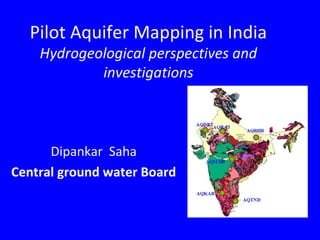
- 1. Pilot Aquifer Mapping in India Hydrogeological perspectives and investigations Dipankar Saha Central ground water Board
- 2. We should have a detailed understanding of the aquifers to answer everybody's queries and satisfaction Aquifers are of multifarious use •Store house of ground water, irrigating croplands, catering industries •Conduit of flow from recharge to discharge areas •Can store a part of runoff water in the event of excessive rainfall •Maintain aquatic environment in rivers/wetlands by contribution as base flow •Potable, pathogen free drinking water to thousand of villages Aquifer-is defined as a formation that contains sufficient saturated permeable material to yield significant quantities of water to wells and springs
- 3. Un-informed and unsustainable uses of aquifer may render- •Depletion of resource over time •Deterioration of chemical quality of ground water •Sea water intrusion through aquifer in coastal area •Conflict between the users and geographical boundaries •Land subsidence •Anthropogenic pollution of aquifers and may trigger geogenic pollution •Adverse effect on aquatic ecology in wet lands and rivers etc……..
- 4. We should have a holistic understanding of the aquifer 1.Aquifer geometry 2.Aquifer-aquitard hydraulic parameters 3.Aquifer yield potential 4.Ground water flow regime 5.Recharge and discharge components 6.Hydrogeochemistry
- 5. India is geologically diverse country, with wide variation in climate Accordingly the hydrogeological domains also vary widely Six pilot projects has been taken up in India
- 6. • Area : 376 sq.km • Major part is under shallow weathered pediplain and valley fill • General elevation – 850 m (S.part) – 720 m (N.part) • Residual hill, Inselbergs, Pediments ,Valley fills, Plain land Normal Rainfall of study area- 680 mm • Located on the surface water divide of Kaveri and Krishna basins. • Major area is under agriculture Tiptur -Chikkanayakanahalli Taluks, Tumkur district, Karnataka
- 7. Drainage map Major area is under shallow weathered pediplain and valley fill
- 8. Aquifer system • Phreatic aquifer which exists mostly in the northern parts remains dry for most part of the year. • Semi-confined to locally confined aquifer system in the deep fractured formations Water level behavior Southern part represents the water divide between the two basins. Water levels are as deep as 100 m bgl. A decades back the level was <20 m bgl Northern part –water level at present > 40 mbgl. A decade back <10 m bgl Stage of GW dev-158 %
- 9. Ground water flow direction is from SW to NE Sharply declining water levels Depth to water level below ground, May 2013 water level contour , above msl
- 10. Exploratory drilling at 14 locations reveals wide variation in yield- 0.22-4.36 lps Water level varies from 13.4 to 80.10 m bgl Depth of fracture model However it needs detailed interpretation of data considering the heterogeneity of the fractures Discharge in lps
- 11. The top layer remains dry during most of the period and the second layer act as the principal aquifer . There is no out flow of water from the water shed. The flow lines indicates ground water troughs at heavy draft areas.
- 12. Findings so far • The area is over-exploited and water levels are generally in the range of 40 to 60 mbgl. Deeper water levels are also observed in isolated patches. • Ground water exploration has potential fractures in 60-80 m, 100-120m. Deeper fractures are also observed at 180 – 200 m depth. • Shallow fractures at few locations are observed to be dry due to over- exploitation. • Water quality is mostly good for both domestic and irrigation purposes. However at certain isolated tiny areas high concentration of nitrate is noticed • Surface and ground water resources in the area is being fully utilized. • There is no surplus run-off in the watershed.
- 13. Baswa-Bandikui Watershed, Dausa district, Rajasthan • Area : ~600 Sq.Km • Physiography: Part of Eastern Rajasthan Upland, open undulating plain; badland topography at places. • Rainfall: av. – 652 mm/yr. • Water Resources sector scenario – Main source – GW SW – Banganga river & its tributaries – Sanwan and Palasan streamsi • GW - Less to Moderate availability. Quality suffers from fluoride, salinity.
- 14. Badland topography Major part- vally-fill with badland topography along the Sarwan River course, Isolated hills in the northern and north-western part
- 15. •The major part is covered by Quaternary alluvium. In the northern border of the project area, hard rocks are exposed. •In general depth to bedrock varies from 50-60m bgl. Alluvium depth increases east ward. •Ground water generally occurs under water table and semi-confined conditions in Quaternary sediments & weathered and fractured zones of hard rocks. •Ground water is contaminated in some places with fluoride. •Drilling by CGWB-Yield varies from 0.7-14 lps & drawdown 3-15 m. •Transmissivity varies from 7-397 m2 / day.
- 16. GW Potential Zone-wise Resources Net GW Availability Draft SOD Category Majority of the wells show declining ground water level trend Stage of groundwater development is 173% (Bandikui Block). WL declining
- 17. •The water level varies from about 15 m in west & north-west to > 60 m in patches along the axial part of the area Ground water flow, both during the pre- and post- monsoon seasons, towards east with minor local variations, controlled by the topography
- 18. Isopach map of aquifers- Alluvial deposits Isopach map of weathered and fractured hard rocks below the allvium deposits •based on the results of Exploratory drilling of 14 wells Thickness of the Alluvium –– 40 to 60 m Thickness of the Second aquifer (Weathered hard rock) – 3 to 30 m
- 19. Conceptual model – present understanding • Phreatic Alluvial aquifer, below weathered and fractured rocks followed by hard rock • Saucer-shaped basin – thickness of alluvium increasing towards east Identification of de-saturated/ unsaturated aquifers and suitable artificial recharge plan Optimal utilization of water – water use efficiency measures Devising pragmatic groundwater regulation programme Issues to be addressed
- 20. Lower Vellar watershed Cuddalore district, Tamil Nadu •Area : 428 km2 •Rainfall annual average-1400 mm •Drained by Paravanar and Uppanar rivers •The terrain ranges from sedimentary upland to coastal Plain
- 21. • Groundwater pumping for mining, irrigation • Groundwater abstraction by state agencies for drinking water supplies (for Chennai Metropolitan water supply). • Sea water Ingress threat along the coast. • Two to three decades back the area was marked with autoflow condition, presently the Pz surface has gone down • Stage of devlopment of the phreatic aquifer is <50%
- 22. Recent alluvium Sand/sandstones Mio-pliocene sandstones Eocene sandstones Eocene sandstones (Aquifer 4/Confined) (Aquifer 3/Confined) (Aquifer 2/Confined) (Aquifer 1/unconfined) clay clay lignite clay A” A Eocene SST (Aquifer III Four aquifer system has been identified within a depth of 400 m The top aquifer is unconfined. The aquifers below are under semi- confined to confined condition Quality is fit for drinking and agriculture use
- 23. Regional Conceptualization of Model area (AQTND) Mio-pliocene sandstone Recent alluvium and sst... 5 – 50 m 40 - 110 m 110 – 210 m 210 – ? m Depth of Occurrence Multi-layered aquifer system Seven Layer model Layer – 1 (sand/sandstone) Layer – 2 (clay- discontinuous) Layer- 3 (Sandstone) Layer – 4 (Clay/lignite – discontinuous) Layer – 5 (Sandstone) Layer – 6 (Clay – discontinuous) Layer – 7 (Sandstone) Depressurization for mining activity/Abstraction for drinking to Chennai city User aquifer for Irrigation. Abstraction for Domestic & Irrigation Less pumping activity Explored depth : 400 m Q (10 – 45 lps) Q (8 – 40 lps) Q (10 – 40 lps) Q (5 – 15 lps)
- 24. Maner Khagaul area, Bihar •Located in Sone-Ganga interfluve area. •In Middle Gangetic plains, fringe area of Sone fan •Thick (~500 m) Quaternary deposit overlying Precambrine crystalline and Sedimentaries NIR Image •Area 521 km2 •Terrain- Flat •Mean annual rainfall – 1100 mm •Elevation- 46 to 62 m above msl
- 25. Geology of the area The area belongs to Flood plain in the interfluve of Kosi and Ganga, marked with flood plain, natural levee, paleo channel
- 26. Hydrogeology of the area •Multilayered aquifer system within the Quaternary sediments. •Aquifers are potential, catering the entire demand for irrigation, domestic and industries. •Water level is shallow, < 7m bgl, with pre- and post- monsoon fluctuation as 2 to 3 m. •No water quality problem is reported except arsenic contamination of in the northern part of the area. • Western part of Patna urban area covers the north eastern part of the pilot area, experiencing heavy ground water extraction from deeper aquifer. •Stage of Development 61%
- 27. From South to North in western part From SW to NE PANEL DIAGRAM Two aquifer system identified in the area
- 28. May-13 AQUIFER-I May-13 AQUIFER-II Water level is shallow, and flow direction for both the aquifers is towards ENE
- 29. A three aquifer system exists beneath the top aquitard layer, within 300 m bgl. The lateral extension of 3rd aquifer yet to be ascertained. The clay layers between 1st and 2nd is thinner than between 2nd and 3rd .
- 30. First aquifer is exploited in rural areas whereas the second aquifer is mainly exploited in urban areas. The potentiality of the aquifers is considerable, T value for first aquifer is 4900 to 12,000 m2/day, for second aquifer, which is thicher than the upper one, has a T value of 5800- 15000 m2/day. Findings.. The main recharge of the first aquifer is from south. Isotope character and flow direction indicates recharge through paleo channels of Sone.
- 31. •Area under paleo channels, which is hydraulically conductive between surface and first aquifer (demarcated) can be used for recharge •Arsenic contamination is confined within the Active flood plain affecting the top part of the first aquifer. The second aquifer can be exploited for community supply safely. •No significant decline of water level in spite of heavy extraction in Patna urban area (<4.0 m in last two decades) •In rural areas ground water extraction is limited to 60 m bgl in general Findings….
- 32. Chandrabhaga Watershed Chandrabhaga watershed, Nagpur District Area- 360 Km2 Average normal rainfall- 915 mm Elevation- 310 to 509 m amsl Drained by tributary of Chandrabhaga river Major land use is agriculture
- 33. •The major part of the area is occupied by Deccan trap basalt (313 sq. km), remaining 47 sq.km is occupied by Gondwana formation. •Basaltic terrain is underlain by Gondwana formation almost in entire basin. •Ground water occurs under phreatic conditions in the exposed lava flows and in semi-confined to confined state in the subsurface flows. The same situation is observed in Gondwanas •In basalt, the thickness of phreatic aquifer ranges from 6-21 mbgl., while in Gondwanas is between 8 -19 m bgl. •Stage of ground water development is 89% but the long term water level trend is marginally rising leading to safe category
- 34. • Long dry spells during monsoon season • Limited thickness of unconfined aquifer • Drying up of aquifer particularly in basalt • Failure of dugwells/borewells due to unscientific selection of sites • Industrial & Agriculture Pollution CHALLENGES IN TERMS OF AQUIFER GEOMETRY • Delineation of Basalt and Gondwana contacts • Vertical disposition of deeper fractured aquifers • Refinement of aquifer geometry including fracture density ISSUES
- 35. Depth of weathering on the basis of lithologs the entire area of watershed comes under plateau with sporadic denudational hills located in the northern part of the watershed.
- 36. Depth to Water Level Pre (May 2013) Electrical Conductivity (Nov.2012) Lithological Cross Sections Shallow Aquifer using Rockworks
- 37. Parameters Layer-I Layer-II Formation Zone-I Basalt (Deccan Trap) Zone-II Sandstone (Gondwana) Zone-III Basalt (Deccan Trap) and parts Sandstone (Gondwana) Zone-I Basalt (Deccan Trap) Zone-II Sandstone (Gondwana) Zone-III Basalt (Deccan Trap) covered Sandstone (Gondwana) Zone-IV Basalt (Deccan Trap) underlain by Gneisses (Archaean) Layer Type Unconfined, Type-1 Semi-confined to Confined, Type-2 Layer thickness (m) 20 (GL to 20 m bgl) 180 (20 mbgl to 200 m bgl)
- 38. Findings •Considering the elevation, above the msl, the water level ranges from 294 m to 510 m above msl. The ground water flows towards ENE following the topography. •The drilling data indicates that the thickness (other than areas where Gondwanas are exposed) of basalt varies from 27 m to 200 m and more. •3-5 flows has been identified in Basalt area, thickness of each flow ranges from 15-40. •The vesicular zones at deeper level are not found to be very potential. However when they are fractured they are of good potentiality. •Sustainability of aquifers in basaltic terrain is challenging because of its low storage potential •Aquifer parameters; 1.Gondwanas- Shallow , yield, 2-5lps, T-4-12 m2/day Deep, 1.37-10 lps, T- 122m2/day 2. Basalt- Shallow, yield 1-14 lps, The- 1-72 m2/day. Deep 2-14 lps, T- 6-226
- 39. Ramgarh area, Jaisalmir Dist, Rajasthan • Study area - 675 sq.km, around Ramgarh town • Lies in arid tract of Thar desert characterised by extremes of hot and cold weather • Rainfall - less than 200 mm, occurrence of frequent drought • Major part of the study area is predominantly covered with flat, limestone terrain. • Sand dunes are observed about 10 km north of Ramgarh town • IGNP branch canal flows north of Ramgarh town.
- 40. Age Formation and Lithology Quaternary (Pl. to Recent) Aeolian sand & alluvium, gravel sand , silt, kankar & clay Tertiary Sanu sandstone, Bandha and Khuiala limestone Mesozoic Lathi, Jaisalmer, Baisakhi, Bhadesar, Parewar, Abur formation - Sandstone, shales with intercalated limestone, siltstone, clay stone Proterozoic (Post Delhi) Granite
- 41. HYDROGEOLOGY •Aquifers zones - 45 to 70 m ; 125 to 160 m •Unconfined to semi-confined conditions •ground water is fresh to saline – EC -1500-9500 µmhos/cm •fresh-Saline water interface (based on Geophysical studies) - 80 to 270 m bgl •Ground water level : around Ramgarh area ~ 30 to 40 m bgl; south of Ramgarh - beyond 100 m bgl at places. Stage of Ground water development for the Sam Block, in which the study area falls is 60%
- 42. The long term trend of water level in the area does not show any significant rise and decline
- 43. •Mesozoic formations (Pariwar sandstone) upper part- compact and fine to medium grained, lower part- partly consolidated and fine to coarse grained. The yield of tubewells ranges from 330 to 500 litre/min. EC varies from 2000 to 6000 microsiemens/cm. •Tertiary group of sedimentary rocks are calcerous-argillaceous- arenaceous assemblage. The yield varies from 500 to 1000 litre/min. However, quality of water is saline. • Alluvial formations occurring at the northern part exhibits yield of 4-5 lps the quality is fresh to brackish GROUND WATER LEVEL •Ground water level around Ramgarh area is about 30 to 40 m bgl. However, in the area lying south of Ramgarh, water level goes deeper even goes beyond 100 m bgl at places.. •Water level trend both rising and falling
- 44. GROUND WATER MANAGEMENT OPTIONS Identification of fresh water zones/ pockets and their sustainable use Estimation of fresh water resources in different formations Conjunctive use of surface and ground water in canal command area Identification of de-saturated/ unsaturated aquifers and suitable artificial recharge plan
- 45. THANK YOU