Zeb1 caving paper
•Als PPTX, PDF herunterladen•
2 gefällt mir•7,982 views

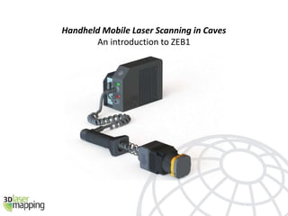
ZEB1 is an innovative handheld mobile mapping system - which creates an accurate 3D point clouds without the need for GPS. This makes it ideal for buildings, mines and caves.

Empfohlen
Empfohlen
Weitere ähnliche Inhalte
Was ist angesagt?
Was ist angesagt? (20)
Ähnlich wie Zeb1 caving paper
Ähnlich wie Zeb1 caving paper (20)
Kürzlich hochgeladen
Kürzlich hochgeladen (20)
Zeb1 caving paper
- 1. Handheld Mobile Laser Scanning in Caves An introduction to ZEB1
- 2. The problem How to scan a cave network? > Tripod-based scanner > Slow > Cumbersome – lots of equipment to move around > High capital cost > Fragile > Large datasets take considerable time to process > Vehicle-mounted scanner > Prohibitive capital cost > Impossible to access small tunnels > No GPS to give position > Long processing time Many of the issues with cave mapping are also experienced when scanning building internals (apart from the mud).
- 3. Solution – ZEB1 and GeoSLAM Originally designed by CSIRO for scanning cave systems, but suitable for any area where there is no GPS – caves, tunnels, buildings, forests Simple hardware: > Small 2D, 30m range laser – motion gives third dimension > Solid state inertial measurement unit > Very compact > Highly portable (no tripod) > No need to be stationary or level (not the normal survey practice) > Low cost > Rugged > Easy to operate > Rapid capture – scans as fast as you can walk through the area > Can be mounted to remote vehicles for unsafe areas Once capture is complete, the raw data (points, trajectory and timing info) is uploaded to the secure GeoSLAM server for automatic processing – normally taking an equal time to process as to capture.
- 4. How ZEB1 works - GeoSLAM During capture, the trajectory of the laser head is recorded Each wobble of the head produces a 3D sweep of points The unique GeoSLAM algorithm puts everything together to produce a complete 3D point cloud. What is GeoSLAM? • GeoSLAM is an algorithm using 3D SLAM technology from the robotics industry • SLAM = Simultaneous Localisation and Mapping • GeoSLAM uses the raw trajectory to roughly calculate the surface normals and potential constraints within a single sweep of the scanner • Each sweep is matched to the next using the combined trajectory and constraints • It is an iterative process which relies on geometric objects and features within the scans Final outputs are in laz, las, ply, pts, and ptg
- 5. Example – Cave Scan (under 3 minutes to capture)
- 6. Example – Cave Scan (under 3 minutes to capture)
- 7. Tests in Wookey Hole Riegl VZ-400 ZEB1
- 8. Wookey Hole Cave, UK
- 10. Riegl VZ-400 Scan data
- 11. Riegl VZ-400 Scan data
- 12. Riegl VZ-400 Scan data 100m tunnel (2.4m wide) 28 scans (4 mins per scan) 2 hours data capture
- 13. ZEB1 Scan data
- 15. Wookey Hole – captured in 30 minutes with ZEB1
Hinweis der Redaktion
- ZEB1 designed for rapid capture in areas with no GPS – eg. Mining, tunnels, buildings, forests etc. Low cost and high speeds, with simple robust hardware.
- ZEB1 designed for rapid capture in areas with no GPS – eg. Mining, tunnels, buildings, forests etc. Low cost and high speeds, with simple robust hardware.
- ZEB1 designed for rapid capture in areas with no GPS – eg. Mining, tunnels, buildings, forests etc. Low cost and high speeds, with simple robust hardware.
- This is a short section of a cave scan. The trajectory has been coloured by time, and took less than 3 minutes to cover – this is part of a 200m long tunnel
- The sample shown is a 9% sample cloud – for cave and mine applications, this is more than enough. The scans can be georeferenced using 150mm sphere targets and known tie points within the data.