
Empfohlen
Weitere ähnliche Inhalte
Ähnlich wie GeoInt Conference Agenda
Ähnlich wie GeoInt Conference Agenda (20)
Kürzlich hochgeladen
Kürzlich hochgeladen (20)
GeoInt Conference Agenda
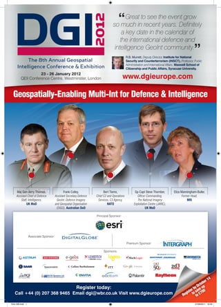
- 1. “ Greatintorecentthe event grow so much see years. Definitely a key date in the calendar of the international defence and intelligence GeoInt community. ” R.B. Murrett, Deputy Director, Institute for National Security and Counterterrorism (INSCT), Professor, Public Administration and International Affairs, Maxwell School of Citizenship and Public Affairs, Syracuse University. 23 - 26 January 2012 QEII Conference Centre, Westminster, London www.dgieurope.com Geospatially-Enabling Multi-Int for Defence & Intelligence Maj Gen Jerry Thomas, Frank Colley, Bert Tiems, Gp Capt Steve Thornber, Eliza Manningham-Buller, Assistant Chief of Defence Assistant Secretary Defence Chief C2 and Operations Officer Commanding, Former Head, Staff, Intelligence, GeoInt, Defence Imagery Services, C3 Agency, The National Imagery MI5 UK MoD and Geospatial Organisation NATO Exploitation Centre (JARIC), (DIGO), Australian DoD UK MoD Principal Sponsor: Associate Sponsor: Premium Sponsor: Sponsors: Enterprise 4 r1 tobe Oc Register today: r by ve up ste sa 00 Call +44 (0) 207 368 9465 Email dgi@wbr.co.uk Visit www.dgieurope.com Regi to to £7 7542 AW.indd 1 27/09/2011 16:34
- 2. The meeting place for the geospatial intelligence community What is DGI? 650 ATTENDEES Defence Geospatial Intelligence (DGI) is Europe’s largest and most international annual gathering dedicated to the discussion of the major challenges of the use of geospatial intelligence in defence, intelligence and national security operations. 400 DEFENCE ORGANISATIONS DGI brings together heads of geospatial intelligence, remote sensing, GIS data & mapping, satellite imagery and analysis within the military, governmental, and 42 NATIONS IN ATTENDANCE intelligence sectors. It provides a unique forum for the use of intelligence in defence where the most senior members of the GeoInt community debate the development of geospatial intelligence capabilities across the globe. 18 HOURS OF TECHNOLOGY DEMONSTRATIONS Addressing the use of geospatial information in scenarios such as international conflicts, defence operations, C4ISR, humanitarian disasters, crime, national security, border control, arms treaty monitoring and global climate change, the 36 HOURS OF NETWORKING fundamental objective of DGI is to help organisations understand how to build the necessary infrastructure and architecture to take advantage of geospatial ONE UNIQUE EVENT intelligence capabilities. What makes DGI the must-attend geospatial intelligence event in Europe? Learn from your colleagues: • Find out about the latest developments in GeoInt strategies of 45+ defence and government organisations including: USA, UK, France, Canada, Australia, Israel, Norway, Denmark, Chile, Brazil, Saudi Arabia, Oman, United Arab Emirates, Spain, The Netherlands and many others • Hear about the latest success stories and challenges of using GeoInt in-theatre, including several case studies from Afghanistan, Libya, Iraq • Build your C2 GeoInt strategy based on the knowledge and experience of the largest and most sophisticated systems architects in NATO • Find out how implementing interoperable IT systems will help you and your colleagues effectively share and disseminate GeoInt applications and knowledge • Hear from the experts on the latest uses of human geography in-theatre and in HQ • Get up to date with the GeoInt strategies and plans for the London 2012 Olympic Games • Get to grips with the new concepts of Maps to Apps – find out how you can make them a reality in your organisation Network : • Meet with over 650 GeoInt officers from 45 countries, representing defence forces, police and security organisations as well as government and non-government institutions • Benefit 36 hours of unparalleled networking: this is your chance to catch up with old friends and see colleagues from the other side of the world. • Test and explore the latest solutions offered by over 50 sponsors and exhibitors • Find out which nations are developing programmes to integrate defence and intelligence operations to share data, information and analysis • Find out how GeoInt is used in police and security operations in UK and USA Don’t just take our word for it the last “DGI continues as the prem ce Conference has evolved over ier geospatial intelligence “The Defence Geospatial Intelligen ing global even t. It has provided a platform conference in Europe providing great opportunities to learn seven years to now become a lead Defence and each year provides more about the issues, opportuni for a com munity that touches every area of best providers and consumers of Geo ties and technology facing ers and industry to demonstrate both Int. The balance of formal a different focus, allowing practition tracks and themes presentations and focus days, com . The use of different bined with great networking practice and recent developments interest or gain a broader among leading government, acad allows attendees to better understand their areas of emic and industry executives, has makes this a compelling event. 2011 duction of an Advisory Panel for the 2011 was the best yet. WBR understanding in others. The intro whole.” provided a world class event.” speakers and the event as a only helped enhance the quality of rt, Lt. Col. Neil Marks, National Expe John Day, Director of Defence Council of the Euro pean Union Business Development, Esri Register by October 14 to save up to £700. Visit www.dgieurope.com 7542 AW.indd 2 27/09/2011 16:35
- 3. Speaker line-up Unmissable sessions Vanessa Lawrence, CEO, Ordnance Survey Frank Colley, Assistant Secretary Defence GeoInt, Defence Imagery and Geospatial Organisation (DIGO), Australian DoD Creating A Unified Intelligence Environment To Help Commanders & Lt Col Pat Fryer, Section Head Geospatial Policy & Operations, Soldiers: The Role Of GeoInt & Multi-Int In-Theatre & In C2 SHAPE, NATO Maj Gen Jerry Thomas, Assistant Chief of Defence Staff, Intelligence, UK MOD Brig Jim Hockenhull, D ISTAR, Head Information Superiority Land As Assistant Chief of Defence Staff, Intelligence, Major General Thomas is responsible for Forces UK MOD the provision of specialised intelligence, targeting and geo support and joint intelligence & Richard Herrmann, US Army Geospatial Center, security training at the UK MOD. He has command of 3700 staff involved in providing support Army Geospatial Center to Intelligence Collection and wider ISTAR. Join this presentation to hear about the current Maj Gen Jerry Thomas, Assistant Chief of Defence Staff, challenges and future developments of Multi-Int support to defence forces in-theatre and C2. Intelligence, UK MOD Bert Tiems, Chief C2 and Operations Services, C3 Agency, Empowering The Users To Access Data & Make Decisions – The Role Of NATO Gp Capt Steve Thornber, Officer Commanding, The National Online On-Demand Access To Multi-Int Knowledge Imagery Exploitation Centre (JARIC), UK MOD Frank Colley, Assistant Secretary Defence GeoInt, Defence Imagery and Geospatial Captain RN, Martin Jones, Head, Joint Geospatial Intelligence Organisation (DIGO), Australian DoD Branch, UK MOD Lt Col Pat Fryer, Section Head Geospatial Policy & Operations, SHAPE, Andy Watson, Director Of The Security, Standards & Architecture, NATO Directorate of Information, Met Police Captain RN, Martin Jones, Head, Joint Geospatial Intelligence Branch, Miss Manal Alshamlan, Head of GIS Development Section, GIS UK MOD Department, Dubai Municipality Andy Watson, Director Of The Security, Standards & Architecture, Directorate of Eliza Manningham-Buller, Former Head, Information, Met Police MI5 Vanessa Lawrence, CB Director General and Chief Executive, Radm Kenneth Pugh, Director Naval Intelligence, Ordnance Survey Chilean Navy Jim Dolan, Vice President – International Integrated Solutions, Textron Systems, Overwatch Jim R. Hill, Director, Geospatial Intelligence Directorate, Marine Corps Intelligence Activity, USA Senior officers and executives responsible for shaping the strategies for their organisations Amber McCuistion, Branch Chief, USCENTCOM Afg-Pak Center, will give you their views on the changing role of geo and multi-int in defence and in national Human Terrain Analysis Branch, US DoD security. They will discuss and debate the impact and opportunity presented by online on- demand access to information, focusing on the challenges and issues you are likely to face Captain Charlie I Reid, FLEET OPS-DACOS NI, UK MoD in the future. Join this high powered panel discussion to learn how GeoInt is likely to change and what it means to you and your team. Douglas Bancroft, Director General, Centre for Remote Sensing, Government of Canada Major (Armement) Frédérick Herpers, Defence Procurement Strategic Approach To Using GeoInt In Intelligence Operations: The Past Agency (DGA), Engineering Projects Directorate, C3I Engineering & The Future UNIT, MOD France Eliza Manningham-Buller, Former Head, MI5 Captain Kjetil Utne, Director, Military Geographic Service, Norwegian MOD Baroness Eliza Baroness Manningham-Buller, Former Head, MI5 is joining DGI 2012 to give you some strategies and ideas for making decisions in challenging times and for winning in John Teufert, NC3A Geo-Officer NATO C3 Agency every operation and project that you undertake. Dame Manningham-Buller has been privy to some of the country’s most carefully guarded secrets and held the lives of spies and double Capt. Sean Malinowski, Commanding Officer Foothill Patrol Division, LAPD agents in her hands. Since taking over the MI5 reins, her working life was dominated by the threat from al-Qaeda. Find out how at MI5 they use GeoInt, how they analyse and disseminate Brig. General (ret) Amnon Sofrin, Head of The Intelligence information, and how decisions are made based on this vital information. Directorate Israeli Intelligence Service (ISIS) Robert B. Murrett, Deputy Director, Institute for National Security and Counterterrorism (INSCT) Australian Delegation To Give Programme Updates & Join Panel Discussions Ayman Al-Wadi, Group Head of GIS, Royal Jordanian Led by Frank Colley, Assistant Secretary Defence GeoInt, Defence Imagery and Geospatial Geographic Centre Organisation (DIGO), Australian DoD Marlene Meyer, Chief Geospatial Branch, A senior delegation from the DIGO, Australian DOD is joining DGI to discuss and debate the Denmark role of online, on-demand access to multi-int knowledge. They will show you the practical implications of moving away from linear or cycle based intelligence product development processes to a much more interactive and iterative knowledge development and access model. They will also join a panel on the understanding the cultural context, dynamics and people movement in-theatre. New for 2012 The Critical Role Of Geographical Information Systems (GIS) In NATO Coalition Operations • Maps to Apps – presentations and panel discussions focused on bringing GeoInt to the fighter in-theatre Bert Tiems, Chief C2 and Operations Services, C3 Agency, NATO • Architecture Focus – a special conference stream designed This presentation will give you a chance to learn about the latest strategies and plans for to give you the latest strategies in implementing and developing the NATO GeoInt systems and capabilities. Bert Tiems started his current post effectively exploiting new GeoInt architecture solutions 1 October 2010 and is now leading 80-100 staff responsible for producing the majority of • Middle East & Africa Focus Day – join an entire day to find NATO C2ISR capabilities. out about the latest developments in the GeoInt community in the region Global Insecurity: Using GeoInt To Develop & Broaden The Analytic • Data Sharing & Exploitation Focus Day – a day dedicated Expertise Of Intelligence to learning the latest strategies, techniques and finding Robert B. Murrett, Deputy Director, Institute for National Security and effective solutions to sharing data and analysis across Counterterrorism (INSCT); Former Head of NGA organisations and governments • 75% of speakers are new to DGI 2012 – truly new case Vice Admiral Murrett served as the Director of the National Geospatial-Intelligence Agency studies, new faces, new experiences to learn from and new from 2006 until 2010. Prior to his appointment to NGA, Vice Admiral Murrett served as the contacts for you Director of Naval Intelligence from 2005 until 2006, and as the Vice Director for Intelligence on the Joint Staff from 2002-2005. Join Robert Murrett to hear his views on the current and • Newly designed exhibition floor – with a product future role of GeoInt in the war on terror and in the development of intelligence capabilities demonstration area, where you will be able to test the latest the world over. solutions and ideas from the industry 7542 AW.indd 3 27/09/2011 16:35
- 4. Three Focus Days Designed To Address Your Current Challenges Pre-Conference Focus Day Post-Conference Focus Day Post-conference Focus Day, January 23rd January 26th January 26th Innovation & New Information Sharing Middle East & North Africa Technology & Exploitation 8:30 Chair’s Opening Remarks 8:30 Chair’s Welcome Address 8:00 Chair’s Welcome Address-The important role of 8:45 Overview Of The Latest 8:45 Effectively Exploiting & Sharing Geospatial Intelligence to the Strategically Important Trends In Technology Data: Strategy & Policy Middle East and North Africa Developments & Their Impact Senior Executive, Colonel (ret) Neil Thompson, Managing Director, WC Group On Future Requirements & UK Government 8:15 Opening Guest Address: Geospatial Intelligence, Opportunities 9:15 Development Of Information the Growth in Government, Academic, and Military Geoff Twentyman, Multi-Int Exploitation Superiority: Providing Data & Sectors- An International Perspective Leader, ISTAR Group, DSTL, UK MoD Analysis To The War-fighter Vice Admiral Robert B. Murrett (ret), Deputy Director, Institute for 9:15 New Sources, Tools & Brig Jim Hockenhull, D ISTAR, UK MoD National Security and Counterterrorism Collection Methods For 9:45 Implementing An Effective Data 8:45 Keynote Guest Address: Strategic Role of Fully Satellite & Other Imagery Sharing Environment In The Integrated & Interoperable GIS in the Middle East – Moderated by: Lt. Col. Babis Allied Forces & Across Europe Challenges, Opportunities & Future Plans Paraschou, Chief Geospatial Officer, Dr. Omer Al-Eman, Arab Science & Technology Foundation NATO Deployment Corps, Greece Senior Executive, NATO Technology Presentations Include: DigitalGlobe, 10:15 Networking Coffee 10:30 Panel Discussion: Achieving True Interoperability – e-Geos Integrating All National Databases and Procedures 11:00 Developing A Dynamic & to Give Full GIS Support to Policy Makers and In 10:15 Morning Coffee Mission Management Approach Operations 10:45 Strategies & Effective To Sharing & Exploiting Data: Dr. Omer Al-Eman, Solutions For Storing Australian Case Study Arab Science & Technology Foundation Imagery & Data: The Future Senior Executive, Australian Defence John Knight, Principal, Royal School of Military, Of The Cloud Organisation UK MOD Moderated by: Michael W. Powers, 11:30 Using Data Unification Dr. Ali Aldosari Secretary General Technical Director, Geospatial Research and Engineering, US ARMY Strategies vs Data Saudi Geographer Society Integration Strategies For Steven Ramage Executive Director, Marketing and Communications, Open 11:45 Using UAVs As Part Of Your Intelligence Organisations Geospatial Consortium (OGC) Multi-Int Strategy: Strategy Susanne Yoakum-Stover, Executive 11:15 Developing A Strategy For Using GIS In Saudi & Practical Applications Director, Institute For Modern Arabia: Case Studies GIS modeling in public health Moderated by: Col (ret) Neil Thompson, Intelligence including RVF disease in Saudi Arabia and using Managing Director, WC Group 12:00 LEARN FROM ANOTHER GIS and remote sensing for change detection in Technology Presentations Include: Elta Systems INDUSTRY! Creating A agriculture. 13:15 Networking Lunch, New Centre Of Data Management Dr. Ali Aldosari Secretary General Saudi Geographer Society Product Demonstrations Excellence: How Does It YOUR CHANCE TO LEARN, 11:45 Developing a Strategy for Using Multi-temporal land Change The Efficiency Of TEST AND EVALUATE THE and sea surface temperature (LST/SST) imagery Your Organisation & The NEW TECHNOLOGY AT WORK! standardization as a tool for assisting thermal target Quality Of Decision-Making? recognition and monitoring and environmental 14:15 Analysing Data: Tools, New Lorraine Waters, Global Head of terrain analysis. Solutions & Successful Case Reference Data Management, RBS GBM Dr. George Ch. Miliaresis Remote Sensing and GIS Center, Sultan Qaboos Studies 12:30 Networking Lunch University, Sultanate of Oman Moderated by: John Teufert, NC3A 14:00 Using Common Standards 12:30 Networking Lunch Geo-Officer, NATO C3 Agency For Synchronising Data On & Technology Presentations Include: Intergraph, 13:30 Supporting the Jordanian Forces & Government Off Line Saab Technologies Organisation with Effective GIS: Future Plans, Steven Ramage, Executive Director, Networking Coffee Marketing and Communications, Requirements & Challenges 15:15 Delivering The Right Open Geospatial Consortium (OGC) Ayman Al-Wadi, Group Head of GIS, Royal Jordanian Geographic Centre Intelligence To The Right 14:40 New Tools For Complex 14:00 Earth Observation and Maritime security –The User On Time: From Maps Systems Modelling: Predicting contribution to the Gulf of Aden and Arabian Gulf To Apps The Future By Using security from space based Systems Moderated by: Ric Diaz, Chief, Geospatial & Other Data Mr Guy Thomas U.S. Coast Guard Science and Technology Advisor Geospatial-Intelligence, GG-14, DIA, Intelligence Fusion Centre (IFC), In Jonathan Chetwynd, Complex Data 15:15 Latest State-Of-The-Art Strategies for Using GeoInt Modelling Expert, Peepo Support of NATO in Policing Technology Presentations Include: Esri 15:20 Networking Coffee Captain Sean Malinowski, Commanding Officer, Foothill Patrol Division, 16:00 Sharing Data In-Theatre – LAPD 16:15 Using Crowd Sourcing Techniques In Your GeoInt Case Study From Afghanistan 15:45 Establishing a Collaborative Relationship between Capability: Giving The User A Ric Diaz, GeoInt Team Leader, the Gulf Cooperation States and NATO to allow Broader Operational Picture Intelligence Fusion Centre, RAF closer Operational Planning Molesworth, UK MoD Moderated by: Amber McCuistion, Tom Last President and CEO ImStrat Corporation Branch Chief, USCENTCOM Afg-Pak Center, 16:40 Dealing With Data Governance 16:15 Panel Discussion: Establishing a Collaborative Human Terrain Analysis Branch, US DoD In A Multi-National Relationship between the Middle Eastern and North 17:00 Building Your Strategy Based Environment: Effective African and the Western GeoInt Communities On Effective & Efficient Use Collaborative Approaches Dr. Ali Aldosari Of Mobile Devices Oliver Rajan, Head of Brussels Office, Secretary General Saudi Geographer Society European Union Satellite Centre Moderated by: Geoff Twentyman, Steven Ramage Executive Director, Marketing and Communications, Open Multi-Int Exploitation Leader, ISTAR 17:20 Sharing Data Across The Geospatial Consortium (OGC) Group, DSTL, UK MoD Government Organisations Lt. Col. Babis Paraschou, Chief Geospatial Officer, NATO Deployment Jim R. Hill, Director, Geospatial Corps Intelligence Directorate, Marine Corps Ayman Al-Wadi, Group Head of GIS, Royal Jordanian Geographic Intelligence Activity, USA Centre For the full comprehensive agenda and speaker information visit www.dgieurope.com 7542 AW.indd 4 27/09/2011 16:35
- 5. Empowering Decisions Through Online On-Demand Access To Multi-Int Knowledge & Analysis Main Conference Day 1, January 24th 8.00 Networking Coffee & Registration Frank Colley, Assistant Secretary Defence GeoInt, Defence Imagery and Geospatial Organisation (DIGO), Australian DoD 8:30 Chair’s Opening Remarks Lt Col Pat Fryer, Section Head Geospatial Policy & Operations, SHAPE, Brig Jim Hockenhull, D ISTAR, NATO Head Information Superiority Land Forces UK MoD Captain RN, Martin Jones, Head, Joint Geospatial Intelligence Branch, 9:00 Creating A Unified Intelligence Environment To Help Commanders UK MoD & Soldiers: The Role Of GeoInt & Multi-Int In-Theatre & In C2 Andy Watson, Director Of The Security, Standards & Architecture, Directorate of Information, Maj Gen Jerry Thomas, Assistant Chief of Defence Staff, Intelligence, UK MoD Met Police 9:45 Cloud-Enabled GeoInt – the Opportunities and Realities for Vanessa Lawrence, CB Director General and Chief Executive, Ordnance Survey National Security, John Day, Director, Global Defence Business Development, Esri 12:00 Customer Case Study by DigitalGlobe 10:15 Networking & Morning Coffee 12:30 Strategic Approach To Using GeoInt In Intelligence Operations: The Past & The Future 11:00 PANEL DISCUSSION: Empowering The Users To Access Data & Eliza Manningham-Buller, Former Head, MI5 Make Decisions - The Role Of Online On-Demand Access To Multi- Int Knowledge 13:15 Networking Lunch Jim Dolan, Vice President – International Integrated Solutions, Textron Systems, Overwatch STREAM A STREAM B STREAM C STREAM D Seamless Integration of In-Theatre Operations: Creating New Value Through Strategy & Policy GeoInt with C2 & All Parts of Empowering the War fighter Effective Use of Multi-Int Your Organisation 14:15 The Role Of Geography And GeoInt Using Satellite AIS In The South Using GeoInt To Effectively Project Update: Recent Changes In In Developing Understanding And Pacific To Support Operations & Understand And Enable Decision- NATO’s In Procedures & Concepts Informing Decision-Making Effective Decision-Making Making In The Age Of Uncertainty: For GeoInt Support & Mission Paul Hancock, Director, Defence Radm Kenneth Pugh, Director Naval Requirements & Plans For Management Geographic Centre, Intelligence Intelligence, Chilean Navy International Collaboration Lt Col Pat Fryer, Section Head Collection Group, UK MoD Jim R. Hill, Director, Geospatial Geospatial Policy & Operations, Intelligence Directorate, Marine Corps SHAPE, NATO Intelligence Activity, USA 14:45 Developing A Truly Interoperable Empowering Your Organisation To Networking & Coffee in the Exhibition Enterprise GIS For The Warfighter – GeoInt Strategy To Support Make Effective & Efficient Decisions Join solution providers, partners and peers for quality A Live Demonstration Of Capability Operations Across Defence & Senior Executive, Marklogic face-to-face time Chris Dorman, European Defence Government Organisations Business Coordinator Frank Colley, Assistant Secretary Kerry Phelps, Senior Technical Defence GeoInt, Defence Imagery Advisor, European Defence Team, Esri and Geospatial Organisation (DIGO), Australian DoD 15:15 Emerging Multi-Source Intelligence Networking & Coffee in the Exhibition Using A Collaborative Approach Using GeoInt As Integral Part Of Data Management Challenges Join solution providers, partners and peers for quality to Developing the Foundation for Security Operations: London 2012 Stuart Blundell, Vice President – face-to-face time Building Understanding Olympic Update Product Engineering, Overwatch Jean Smith, Head Human GeoInt Andy Watson, Director Of The Systems, Ltd Branch, DGC, ICG, UK MoD Security, Standards & Architecture, Directorate of Information, Met Police 15:45 Networking & Coffee in the Exhibition Meeting the Commander’s Panel Discussion: Understanding The Using Innovation To Overcome Key Join solution providers, partners and peers for quality Requirement for GeoInt: Practical Cultural Context, Dynamics & People Challenges In Providing Effective face-to-face time Delivery in the Royal Navy Movement In-Theatre: The Role & GeoInt Capabilities Across Your Captain Charlie I Reid, FLEET OPS- Future Of Human Geography Organisation DACOS NI, UK MoD Frank Colley, Assistant Secretary Senior Executive, Logica Defence GeoInt, Defence Imagery and Geospatial Organisation (DIGO), Australian DoD Ian Spencer (Head of Research, DGC, ICG, UK MoD Jean Smith, Head Human GeoInt Branch, DGC, ICG, UK MoD Amber McCuistion, Branch Chief, USCENTCOM Afg-Pak Center, Human Terrain 16:15 Civil And Military Emergency Case Study From Afghanistan: Networking & Coffee in the Exhibition Networking & Coffee in the Exhibition Geospatial Services - Recent Operational Picture & The Role Of Join solution providers, partners and peers for quality Join solution providers, partners and peers for quality Canadian Experiences, Planned GeoInt face-to-face time face-to-face time Developments And Potential Future Ric Diaz, Chief, Geospatial- Courses Of Action Intelligence, GG-14, DIA, Intelligence Douglas Bancroft, Director Fusion Centre (IFC), In Support of General, Centre for Remote Sensing, NATO Government of Canada Serving Military and Government – register for two focus days for the price of one! Enquire today on dgi@wbr.co.uk 7542 AW.indd 5 27/09/2011 16:35
- 6. STREAM A STREAM B STREAM C STREAM D Seamless Integration of In-Theatre Operations: Creating New Value Through Strategy & Policy GeoInt with C2 & All Parts of Empowering the War fighter Effective Use of Multi-Int Your Organisation 17:15 Improving Tactical Level Project Update: Developing & Using Spatial And Human Geography NATO’s Recent Organisational & Interoperability In GeoInt Through Implementing A New Deployable Data Analysis Tools From LA Criminal Policy Changes: Architecture, IT & Effective Collaboration: Future GIS Service – Giving The User New And Gang Behaviour In War And Operational Requirements Developments & Requirements Capabilities Counter Insurgency Operations John Teufert, NC3A Geo-Officer, Major (Armement) Frédérick Captain Kjetil Utne, Director, Military George E. Tita, Associate Professor NATO C3 Agency Herpers, Defence Procurement Geographic Service, Norwegian of Criminology, Law & Society and Agency (DGA), Engineering Projects MOD Planning, Policy & Design, University Directorate, C3I Engineering UNIT, Of California Irvine MOD France 17:45 Project Update: Overview Of Key Examining The Increasing Role Of Panel Discussion: Integrating GeoInt UK MoD Spatial Data Infrastructure Challenges & Strategies For Working GeoInt In Targeting Into Intelligence & Police Work: The Project Update: Policy & Strategy Within A Truly International European Maj Barry MacDonald, Geo Int Multi-Int Approach Defence Intelligence Lead For UK Environment Expert, Intelligence Branch, Canadian Geoff Twentyman, Multi-Int Expert, MoD Spatial Data Project, UK MoD Oliver Rajan, Head of Brussels Office, Forces DSTL, UK MoD European Union Satellite Centre George E. Tita, Associate Professor of Criminology, Law & Society and Planning, Policy & Design, University Of California Irvine Capt. Sean Malinowski, Commanding Officer Foothill Patrol Division, LAPD Brig. General (ret) Amnon Sofrin, Head of The Intelligence Directorate Israeli Intelligence Service (ISIS) 18:15 Networking Drinks Reception Demonstrate your expertise to over 650 decision makers by exhibiting at DGI 2012 Buffet Station Buffet Station Live Product ADDRESS SENIOR Private Demos DECISION MAKERS Meeting Area LAUNCH NEW PRODUCTS AND SERVICES Catering EXPO DGI “Café” ENTER NEW MARKETS 33 ENGAGE IN STRATEGIC PARTNERSHIPS REINFORCE YOUR BRAND AND THOUGHT LEADERSHIP POSITION One to One One to One Private Meeting One to One Private One to One Private NGA Private One to One Private BRING FUTURE Area Meeting Area Meeting Area Meeting Area Meeting Area TECHNOLOGIES AND SOLUTIONS RESERVED RESERVED AVAILABLE RESERVED AVAILABLE TO THE MARKET Sponsorship and Exhibition opportunities are selling out fast. Contact Christopher Murphy, Commercial Director today. Tel: +44 (0) 207 368 9537 Email: Christopher.Murphy@wbr.co.uk Web: www.dgieurope.com 7542 AW.indd 6 27/09/2011 16:35
- 7. Empowering Decisions Through Online On-Demand Access To Multi-Int Knowledge & Analysis Main Conference Day 2, January 25th 8:00 Networking Coffee & Registration 11:00 Panel Discussion: Looking Into The Future Imagery Requirements 8:25 Chair’s Opening Remarks & Challenges Col. John Kedar, Chief of Staff Headquarters Engineer in Chief (Army), Moderated by Marcello Maranesi, CEO, e-Geos UK MoD 11:30 Using GeoInt To Win The Confidence Of The People On The 8:30 Project Update: Using GeoInt As The Basis For Providing A Multi- Ground In Helmand: Challenges, Requirements & Future Needs Int On Demand Capability & Analysis During the London 2012 Major Matthew H Jones, MOD Operations Directorate – Afghan CCT, UK MoD Olympic Games 12:00 Leveraging Full Motion Video for Enhanced Multi-INT Exploitation Vanessa Lawrence, CEO, Ordnance Survey Senior Executive, Integraph 9:00 Bringing The Engineering & Intelligence Communities Together: 12:30 PANEL DISCUSSION: Looking Into The Future Requirements & Update On The Latest Changes At The US Army Geospatial Centre Growth Of Multi-Int – Collaborating With Industry To Integrate Richard Herrmann, Deputy Director, Army Geospatial Center GeoInt Into The Wider ISR Environment & Bring Users Powerful 9:30 Strategic Update On NATO’s Progress In Using Geo and Multi-Int GeoInt & Analytic Expertise To Achieve Common Operational Picture: Empowering The Soldier Brig Jim Hockenhull, D ISTAR, & The Commander In Battle UK MoD Bert Tiems, Chief C2 and Operations Services, C3 Agency, NATO Lt. Col. Neil Marks, NATO 10:00 Global Insecurity: Using Geo Int To Develop & Broaden The Major (Armement) Frédérick Herpers, Defence Procurement Agency (DGA), Engineering Analytic Expertise Of Intelligence Projects Directorate, C3I Engineering UNIT, MOD France Robert B. Murrett, Deputy Director, Institute for National Security and Counterterrorism Bert Tiems, Chief C2 and Operations Services, C3 Agency, (INSCT) NATO 10:30 Networking & Morning Coffee Richard Herrmann, Deputy Director, Army Geospatial Center STREAM A STREAM B STREAM C STREAM D Seamless Integration of In-Theatre Operations: Creating New Value Through Strategy & Policy GeoInt with C2 & All Parts of Empowering the War fighter Effective Use of Multi-Int Your Organisation 14:15 Implementing New Organisational Delivering Online On Demand GeoInt Ensuring Full Interoperability Of Maritime Update: Plans & Structure In the Danish Geospatial Services To War fighters In Libya and Agency Multi-Int Support To The Requirements For Further Integration Organisation: Goals, Progress & Helmand London 2012 Olympic Games: Of GeoInt Into All Parts Of Naval Future Requirements Col. Mark Burrows, Commander, Challenges, Requirements & Operations Marlene Meyer, Chief Geospatial JAGO, UK MoD Progress Captain RN, Martin Jones, Head, Branch, Denmark Richard Smith, Force Information Joint Geospatial Intelligence Branch, Manager, British Transport Police UK MoD Cmdr Stein Hagalid, Branch Head, NATO Shipping Centre Dr Steve Ablett, DSTL Nick Davis, Merchant Maritime Warfare Centre, MMWC 15:15 Strategy & Programme Update: Latest Update On The Use Of GeoInt as a key component of Multi- Effectively Integrating & Using DIGO’s Current Capability Geospatial Information In Ice Flow Int and Multi Agency Collaboration: Geospatial Analysis Tools In Defence Requirements For Major Projects Monitoring: Projects, Programmes Potential Conceptual Implications Estates & Facilities Management Under Development Delivery To and Plans Gp Capt Steve Thornber, Officer Martin Meggs, Senior Geospatial Enhance Multi-Int Capability And The David Jackson, Director, Ice Service, Commanding, The National Imagery Officer (North) Catterick Garrison, Management Weather and Environmental Prediction Exploitation Centre (JARIC), UK MoD Hard Facilities Management, Defence Senior Executive, Defence Imagery & Services Meteorological Service, Infrastructure Organisation, UK MoD – and Geospatial Organisation (DIGO), Canada pending confirmation Australian DoD 15:45 Afternoon Coffee & Networking 16:45 Developing An Interoperable and Adapting GeoInt Support To Soldiers Using Location Intelligence To Using Common Standards For Fully Flexible Strategy For Using In A Wide Range Of Different Provide The User With On Time On Synchronising Data On & Off Line GeoInt In Day To Day Operations Situations Demand Tools For Effective Decisions Steven Ramage Executive Director, Mark Storti, Senior Executive, Border John Knight, Principal, Royal School Andy Marles, Chief Fire Officer, Marketing and Communications, Force - National Intelligence, UK of Military, UK MoD South Wales Fire & Rescue Open Geospatial Consortium Border Agency (OGC) 17:15 Networking Drinks Reception Attending as a group? Contact us today to find out special rates for your organisation on dgi@wbr.co.uk 7542 AW.indd 7 27/09/2011 16:35
- 8. 650 International Speakers and Attendees Representing 45 Nations JOIN THE GEOINT COMMUNITY AT DGI TODAY EARLY BIRD SAVINGS AVAILABLE! Book and pay before Book and pay before Full Price Friday 21 October Friday 18 November Serving Military & Government GOLD PACKAGE: Save £300 Save £150 Main Conference + 2 Focus Days £1,399 (Buy one get one free) £1,099 £1,249 SILVER PACKAGE: Save £300 Save £150 £999 Main Conference Only £699 £849 Solution Providers GOLD PACKAGE: Save £700 Save £400 £3,749 Main Conference + 2 Focus Days £3,049 £3,349 SILVER PACKAGE: Save £600 Save £300 £3,049 Main Conference + 1 Focus Day £2,449 £2,749 Save £600 Save £300 Main Conference Only £2,299 £1,699 £1,999 Interactive CD-ROM Serving Military & Government £299 Solution Providers £439 Prices subject to 20% UK VAT Serving Military & Government: Attending in a group? Register three or more colleagues for the main conference days for as little as £499 each (saving you as much as £1,500) Register for two focus days for the price of one (for a limited time only). Register today: Call +44 (0) 207 368 9465 Email dgi@wbr.co.uk Visit www.dgieurope.com Media Partners: 7542 AW.indd 8 27/09/2011 16:36