Glacial Lake Mapping with Very High Resolution Space-borne SAR
•
3 gefällt mir•1,205 views

Glacial Lake Mapping with Very High Resolution Space-borne SAR
![ESA DUE GLOF (ESRIN 22140/08/I-EC) Objectives and Scope of the Project ,[object Object],[object Object],[object Object],[object Object],[object Object],[object Object]](data:image/gif;base64,R0lGODlhAQABAIAAAAAAAP///yH5BAEAAAAALAAAAAABAAEAAAIBRAA7)
Empfohlen
Weitere ähnliche Inhalte
Was ist angesagt?
Was ist angesagt? (20)
Andere mochten auch
Andere mochten auch (19)
Ähnlich wie Glacial Lake Mapping with Very High Resolution Space-borne SAR
Ähnlich wie Glacial Lake Mapping with Very High Resolution Space-borne SAR (20)
Mehr von Global Risk Forum GRFDavos
Mehr von Global Risk Forum GRFDavos (20)
Kürzlich hochgeladen
Kürzlich hochgeladen (20)
Glacial Lake Mapping with Very High Resolution Space-borne SAR
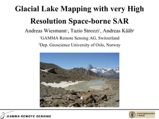
- 1. Glacial Lake Mapping with very High Resolution Space-borne SAR Andreas Wiesmann 1 , Tazio Strozzi 1 , Andreas Kääb 2 1 GAMMA Remote Sensing AG, Switzerland 2 Dep. Geoscience University of Oslo, Norway
- 4. GLOF in the context of High Alpine Risks Lake Blockage - Dam - Moraine - Landslide - Topography Glacier - runoff - melt - change Timely Occurance Spatially Event - Glacier ice breakoff - Dam break - Landslide - Mass balance change Hazard Change
- 5. ESA DUE GLOF (ESRIN 22140/08/I-EC) Users
- 8. Potential hazardous glacier lakes in CH
- 9. Glacier lake mapping with TerraSAR-X
- 10. DEMs for terrain-corrected geocoding Use SRTM4 for terrain-corrected geocoding of satellite SAR images if any other high-quality DEM (e.g. ~30 m posting and 3 m vertical accuracy) derived from 1:25’000 topographic maps is not available
- 11. Area of interest in Nepal
- 12. Satellite SAR Data in Nepal
- 13. Glacier lake mapping with TerraSAR-X 07.05.2003 21.02.2005
- 14. Glacier lake mapping with TerraSAR-X 21.02.2005 03.03.2004
- 15. Imja Tsho lake ERS-1/2 SAR May 1992 ERS-1/2 SAR Apr. 1996 ERS-1/2 SAR Jul. 2001 TerraSAR-X Apr. 2009 TerraSAR-X Oct. 2009 Google Earth May 2003 ALOS PALSAR Nov. 2007 ALOS PALSAR May 2008 ALOS PALSAR Nov. 2009
- 16. Lower Barun lake ERS-1/2 SAR May 1992 ERS-1/2 SAR Apr. 1996 ERS-1/2 SAR Jul. 2001 TerraSAR-X Apr. 2009 TerraSAR-X Oct. 2009 Google Earth Mar. 2004 ALOS PALSAR Nov. 2007 ALOS PALSAR May 2008 ALOS PALSAR Nov. 2009
- 17. Lumding Tsho lake ERS-1/2 SAR May 1992 ERS-1/2 SAR Apr. 1996 ERS-1/2 SAR Jul. 2001 TerraSAR-X Apr. 2009 TerraSAR-X Oct. 2009 Google Earth Feb. 2005 ALOS PALSAR Nov. 2007 ALOS PALSAR May 2008 ALOS PALSAR Nov. 2009
- 18. Tsho Rolpa lake ERS-1/2 SAR May 1992 ERS-1/2 SAR Apr. 1996 ERS-1/2 SAR Jul. 2001 TerraSAR-X Apr. 2009 TerraSAR-X Oct. 2009 Google Earth Feb. 2005 ALOS PALSAR Nov. 2007 ALOS PALSAR May 2008 ALOS PALSAR Nov. 2009
- 20. Imja Tsho lake TerraSAR-X Apr. 2009 Field survey May 2009 TerraSAR-X Oct. 2009
- 21. FOCUS requirements (based on BOKU work TajHaz)
- 22. Satellite SAR Data in Tajikistan
- 23. Glacier lake mapping in Tajikistan
- 24. Glacier lake mapping in Tajikistan