2013 Education Track, Building a Spatially Literate, Spatially Savvy and Spatially Active Student by Esther Worker
•
0 gefällt mir•384 views

GIS professionals can take an active role in developing the next generation of spatially aware citizens. Learn what you can do to help children in your family, students & youth in your community, and potential GIS professionals experience the excitement of GIS and geospatial technologies. You too can open the door to inquiring minds becoming practicing spatial thinkers!! You’ll learn about GIS technology available through statewide K-12 school licenses, what youth programs are doing (www.4-H.org/NYSD), GIS Day, and what we as a GIS community can do individually or as a group to make a difference in the future of the GIS industry.

Empfohlen
Empfohlen
Weitere ähnliche Inhalte
Ähnlich wie 2013 Education Track, Building a Spatially Literate, Spatially Savvy and Spatially Active Student by Esther Worker
Ähnlich wie 2013 Education Track, Building a Spatially Literate, Spatially Savvy and Spatially Active Student by Esther Worker (20)
Mehr von GIS in the Rockies
Mehr von GIS in the Rockies (20)
Kürzlich hochgeladen
Kürzlich hochgeladen (20)
2013 Education Track, Building a Spatially Literate, Spatially Savvy and Spatially Active Student by Esther Worker
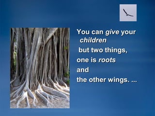
- 1. You can give your children but two things, one is roots and the other wings. ...
- 2. Spatial Literacy for the Common Kid And Beyond
- 3. Or How to Be An Explorer of the World
- 4. How to BE AN Explorer of the World Always be LOOKING. (Notice the ground beneath your feet) Consider Everything ALIVE & ANIMATE. EVERYTHING is INTERESTING. Look closer ALTER your Course OFTEN OBSERVE for Long Durations (and short ones)
- 5. Notice the stories going on around you. Notice PATTERNS, Make CONNECTIONS. DOCUMENT your findings (field notes) in a variety of ways. Incorporate Indeterminacy. Observe Movement
- 6. How to be an EXPLORER OF THE WORLD. Create a Personal DIALOGUE with your Environment. Talk with it. Listen to it. Trace things BACK to their Origins. Use. ALL of the senses in your investigations
- 7. Commonality of Artists, Scientists and Explorers OBSERVE COLLECT ANALYZE COMPARE NOTICE PATTERNS
- 8. Spatial literacy advantages •Recognize connections •Ask questions •Critical Thinker •Strategic planner and thinker •Analytical Thinker •Problem solver!
- 10. Celebrate Spatialness! Associate people, experiences and memories to a map location , prominently and permanently part of life, encourage children to update frequently– Family, vacations, school trips
- 11. Travel experiences grow Explorers! The traveler was active; he went strenuously in search of people, of adventure, of experience. The tourist is passive; he expects interesting things to happen to him. He goes "sight-seeing." ~Daniel J. Boorstin
- 12. Spatial literacy in education • Non-formal education –4-H, Scouts, Boys and Girls Clubs –After school clubs: Geography, Science, Robitics • Formal education –Standard classroom –Environmental education –Science –Geography –Social Studies –Computer Science & literacy –And more
- 13. Colorado Esri K-12 Statewide license •www.eNetColorado.org •Sponsored by Colorado BOCES •Supported by eNet Colorado •Access to GIS at no charge for schools and youth serving organizations.
- 14. Spatial literacy for high school and college students •(CTE) Career and Technical Education •STE 2+2+2 continuous learning concept •High School •Community College •University
- 15. Esri Education Community http://edcommunity.esri.com • Ready to go curriculum • Software – ArcGIS Explorer – ArcGIS Explorer online – ArcGIS Desktop • ArcLessons – over 300 free lessons • Workshops, trainings, and conferences
- 17. How can GIS professionals contribute to the spatial literacy of your community? •Walk your talk –With your family –Mentor in the classroom –Lead an after school group –Donate curriculum to your school –Share your passion – GIS Day –Allow children to soar!
- 18. Make a Map In the dirt Sketch on Paper ArcGIS online public/personal account Www.arcgis.com With your school: ArcGIS Online Subscription
- 19. Enjoy what you do! Celebrate Life! Celebrate Exploring, Creativity and Innovation!
- 20. Thank you
- 21. Thank you. •www.eNetColorado.org •www.geomentor.org •www.gisday.org •www.esri.com/4-H •http://edcommunity.esri.com Esther Worker, ESRI Denver Education Manager
- 22. • • • • References: www.gisday.com look for resources and activities http://www.kidsoutside.info/ Book: How to Be an Explorer of the World: Portable Life Museum by Keri Smith • Book: Leave No Child Inside by Richard Louv • Book: Learning to Think Spatially, available from The National Academies Press. www.nap.edu • Our World GIS Education 4 book series (w/ Esri software for the classroom). www.esri.com/ourworldgiseducation • ArcLessons – free ready to go GIS lessons http://edcommunity.esri.com/arclessons