
Empfohlen
Weitere ähnliche Inhalte
Was ist angesagt?
Was ist angesagt? (19)
Andere mochten auch
Ähnlich wie Landscaping Guidelines and Plant Palettes - Los Angeles, California
Ähnlich wie Landscaping Guidelines and Plant Palettes - Los Angeles, California (20)
Mehr von Farica46m
Mehr von Farica46m (20)
Kürzlich hochgeladen
Kürzlich hochgeladen (20)
Landscaping Guidelines and Plant Palettes - Los Angeles, California
- 1. LOS ANGELES RIVER MASTER PLAN LANDSCAPING GUIDELINES AND PLANT PALETTES January 2004
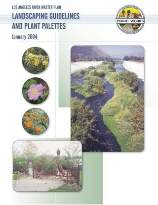
- 3. LOS ANGELES RIVER MASTER PLAN LANDSCAPING GUIDELINES AND PLANT PALETTES A County of Los Angeles Department of Public Works resource that provides a framework for public recreation and non-motorized transportation, creates an indigenous native plant landscape, implements watershed management BMPs, utilizes sustainable forms of energy and materials, and creates an identity for the Los Angeles River. January 2004 Prepared for: County of Los Angeles Department of Public Works Cover photos of native plants by Barbara Eisenstein © Copyright 2004, County of Los Angeles, All Rights Reserved
- 5. LARMP Landscape Guidelines - Jan 2004 CONTENTS Purpose ..............................................................................................................................vii Part I Los Angeles River Landscape Design Considerations 1.0 Introduction .................................................................................................................. 2 2.0 Goals and Objectives ................................................................................................... 4 3.0 Los Angeles River Master Plan Coordination ............................................................ 10 4.0 Existing Conditions .....................................................................................................11 5.0 Land Use and Maintenance Standards ...................................................................... 14 Flood Control Maintenance Jurisdictions ............................................................ 14 Los Angeles County Flood Control District Maintenance Standards ................... 15 Auxiliary Functions and Maintenance Requirements .......................................... 16 6.0 Opportunities for Landscape and Planting ................................................................. 19 Part II Los Angeles River Planting Guidelines Landscape Goal ................................................................................................................ 22 7.0 Site Characterization .................................................................................................. 23 Historic Vegetation ............................................................................................... 23 Sustainable Landscapes ..................................................................................... 23 Soil Testing .......................................................................................................... 23 8.0 Design Guidelines ...................................................................................................... 24 Design Guideline 1 - Design Following Soil Characterization ............................. 24 Design Guideline 2 - Design with Native Plants: The Plant Lists ........................ 24 Short List of Plants for the Los Angeles River System ............................................................28 Design Guideline 3 - Planting Patterns, Density, and Setback Guidelines .......... 30 Design Guideline 4 - Species and Structural Diversity ........................................ 37 Design Guideline 5 - Existing Landscape Plants ................................................. 37 Design Guideline 6 - Gateways ........................................................................... 37 Design Guideline 7 - Plants That Should Never Be Planted Along The River ..... 38 Hardscape Elements - An Overview .................................................................... 39 9.0 Site Preparation Guidelines ....................................................................................... 42 Site Preparation Guideline 1 - Capture and Infiltration of Rainfall ....................... 42 Site Preparation Guideline 2 - Weed Abatement ................................................. 42 Site Preparation Guideline 3 - Soil Amendment .................................................. 42 i
- 6. LARMP Landscape Guidelines - Jan 2004 10.0 Landscape Planting Guidelines ................................................................................ 45 Planting Guideline 1 - Contract Collecting and Growing ..................................... 45 Planting Guideline 2 - Container Plant Sizes and Installation Guidelines ........... 45 Planting Guideline 3 - Installation Schedule ........................................................ 45 Planting Guideline 4 - Seed Planting ................................................................... 45 11.0 Landscape Maintenance Guidelines ......................................................................... 48 Maintenance Guideline 1 - Supplemental Irrigation ............................................ 48 Maintenance Guideline 2 - Extended Maintenance Program .............................. 48 Maintenance Guideline 3 - Pruning and Removal of Plants ................................ 48 Maintenance Guideline 4 - Weeding and Supplemental Mulching ...................... 48 Acknowledgements ........................................................................................................... 51 Appendix A Supplemental Planning Information 12.0 The Permit Process for Project Implementation........................................................ 55 13.0 Supplemental Project Specifications For Contractors ............................................... 57 Planting and Irrigation Materials .......................................................................... 57 Installation Guidelines.......................................................................................... 60 12 Months Maintenance Program ....................................................................... 64 3 Year Monitoring and Maintenance Program ..................................................... 65 14.0 Catalog of Hardscape Elements/Selected Amentities .............................................. 67 Fences and Gates ............................................................................................... 67 Fence, Tubular Steel ...............................................................................................................68 Gates, Tubular Steel ................................................................................................................69 Gates, Welded Wire .................................................................................................................71 Fence, Chain Link ...................................................................................................................72 Gates, Chain Link ...................................................................................................................73 Fence, Custom Alternatives ....................................................................................................74 Gate, Custom Alternatives ......................................................................................................75 Fence, Alternative (Trail or Function Divider)...........................................................................76 Gates, Steel Tube Swing Barricade Fence .............................................................................77 Lighting ................................................................................................................ 78 Lighting, Basic Standard Luminaire (Shoebox)........................................................................79 Lighting, Bike Path Luminaire ..................................................................................................80 Lighting, Arm Mounted Luminaire Alternatives ........................................................................81 Poles, Straight Round Steel ....................................................................................................82 Poles, Concrete Square and Octagonal ..................................................................................83 Site Amenities - General Guidelines .................................................................... 85 Amenities, Welded Steel Bench ..............................................................................................86 Amenities, Welded Steel Strap Bench ....................................................................................87 Amenities, Retaining Seatwall ................................................................................................88 Amenities, Seatwall (Non-Retaining) .......................................................................................89 Amenities, Trash Receptacle ..................................................................................................90 Amenities, Trash Receptacle ..................................................................................................91 ii
- 7. LARMP Landscape Guidelines - Jan 2004 Amenities, Bicycle Rack ..........................................................................................................92 Amenities, Bicycle Rack Alternative ........................................................................................93 Amenities, Drinking Fountain ..................................................................................................94 Trails and Paths .................................................................................................. 95 Trails, Class I Bike Path ..........................................................................................................96 Trails, Decomposed Granite Service Road or Path ................................................................97 Trails, Permeable Paving Alternatives .....................................................................................98 Signs ................................................................................................................... 99 Signs, Directional, Regulatory Standard ...............................................................................100 Signs, Interpretive Standard ..................................................................................................101 Signs, Custom Alternatives ....................................................................................................102 Signs, Banners/Flags, Pole Mounted ....................................................................................103 Appendix B Plant Communities Preface ........................................................................................................................... 106 15.0 Plant Community Descriptions ................................................................................ 107 16.0 Plant Palette Abbreviations ..................................................................................... 109 17.0 Plant Community Lists .............................................................................................110 Alluvial Fan Sage Scrub ........................................................................................................ 111 Chaparral ............................................................................................................................... 114 Southern Coast Live Oak Riparian Forest ............................................................................. 117 Coast Live Oak Woodland .....................................................................................................120 Coastal Sage Scrub ...............................................................................................................123 Southern Cottonwood-Willow Riparian Forest .......................................................................126 Southern Sycamore Riparian Woodland ...............................................................................128 Valley Oak Woodland ............................................................................................................131 California Walnut Woodland ..................................................................................................132 18.0 Other Helpful Plant Lists ......................................................................................... 134 Native Vines ..........................................................................................................................135 Compiled List of all Los Angeles River Plants and Communities ..........................................136 Appendix C Sources 19.0 Sources for Planting Materials and Resources ....................................................... 146 20.0 Sources for Selected Amenities .............................................................................. 147 Listing Form .................................................................................................................... 153 Glossary .............................................................................................................................. 155 Bibliography ..................................................................................................................... 159 iii
- 8. LARMP Landscape Guidelines - Jan 2004 LISTS & FIGURES Short List of Plants for the Los Angeles River System ......................................................................................28 Plant Community Lists Alluvial Fan Sage Scrub ................................................................................................................ 111 Chaparral ........................................................................................................................................ 114 Southern Coast Live Oak Riparian Forest ...................................................................................... 117 Coast Live Oak Woodland ..............................................................................................................120 Coastal Sage Scrub........................................................................................................................123 Southern Cottonwood-Willow Riparian Forest................................................................................126 Southern Sycamore Riparian Woodland .......................................................................................128 Valley Oak Woodland ....................................................................................................................131 California Walnut Woodland ..........................................................................................................132 Other Helpful Plant Lists Native Vines ...................................................................................................................................135 Compiled List of all Los Angeles River Plants and Communities ..................................................136 Figure A. Flood damage in the Burbank/Studio City area, 1920s ................................................................... vii Figure B. Flood protection channel and multi-use trail in the Burbank/Studio City area ................................. vii Figure 1.1 Guadalupe River multi-use path, San Jose, CA ................................................................................2 Figure 1.2 Woonasquatucket River Water Park, Providence, RI .........................................................................2 Figure 1.3 Soft bottom portion of Los Angeles River at Willow Street, Long Beach ............................................2 Figure 1.4 Tujunga Wash looking south from San Fernando Road .....................................................................3 Figure 2.1 Existing condition at Studio City ..........................................................................................................4 Figure 2.2 Proposed metal archway at Studio City ..............................................................................................4 Figure 2.3 Existing conditions between Whitsett Avenue and Laurel Canyon Blvd. ............................................5 Figure 2.4 Proposed artistic panels for area between Whitsett Ave and Laurel Canyon Blvd. ...........................5 Figure 2.5 Existing conditions on Tujunga Wash .................................................................................................6 Figure 2.6 Proposed changes at Tujunga Wash ..................................................................................................6 Figure 2.7 Street end planting example ..............................................................................................................6 Figure 2.8 Example of entry point signage .........................................................................................................7 Figure 2.9 Previous conditions along the river in Long Beach .............................................................................7 Figure 2.10 Improvements from the Los Angeles County Drainage Area project ..................................................7 Figure 2.11 Grove of California sycamores (Platanus racemosa) .........................................................................8 Figure 2.12 California sycamore (Platanus racemosa) - leaves and fruits ............................................................8 Figure 2.13 Proposed water management in public easement .............................................................................9 Figure 3.1 Los Angeles River Reaches as identified by the Master Plan ..........................................................10 Figure 4.1 Rectangular channel condition at the confluence of Bell and Calabasas Creeks ............................ 11 Figure 4.2 Entrenched trapezoidal condition at Fourth St. Bridge ..................................................................... 11 Figure 4.3 Soft bottom and trapezoidal condition at Glendale Hyperion Bridge ................................................11 Figure 4.4 Channel: Rectangular Entrenched Existing Conditions Diagram .....................................................12 Figure 4.5 Channel: Trapezoid Entrenched Existing Conditions Diagram .........................................................12 Figure 4.6 Channel: Trapezoid Leveed Existing Conditions Diagram ...............................................................12 Figure 4.7 Leveed trapezoidal condition in Long Beach ....................................................................................13 Figure 5.1 Maintenance Jurisdictions ................................................................................................................14 Figure 5.2 Diagram of Setbacks and Guidelines for Public ROW in Entrenched Channels ..............................15 iv
- 9. LARMP Landscape Guidelines - Jan 2004 Figure 5.3 Utilities: Powerline Clearance Diagram .............................................................................................16 Figure 5.4 Los Angeles River Bike Path, no fencing on trapezoidal channel ......................................................17 Figure 5.5 City of Los Angeles Bike Path, west bank, fencing on trapezoidal channel ......................................17 Figure 5.6 Bike path entry area off of Los Feliz Blvd., west bank .......................................................................17 Figure 5.7 Horse rental/equestrian center equestrian bridge .............................................................................17 Figure 5.8 Burbank multi-use trail used by Equestrian Center ...........................................................................18 Figure 5.9 Gate concept - equestrian trail requirements ....................................................................................18 Figure 5.10 Reseda Park - existing fence against the river ..................................................................................18 Figure 6.1 Egret Park ..........................................................................................................................................19 Figure 6.2 Rattlesnake Park ...............................................................................................................................19 Figure 6.3 Steelhead Park ..................................................................................................................................19 Figure C. Toyon (Heteromeles arbutifolia)..........................................................................................................22 Figure D. California walnut (Juglans californica var. californica) .......................................................................22 Figure E. Mexican elderberry (Sambucus mexicana) ........................................................................................22 Figure 7.1 Pitcher sage (Salvia spathacea) ........................................................................................................23 Figure 8.1 Fuchsia-flowered gooseberry (Ribes speciosum) ..............................................................................25 Figure 8.2 California buckwheat (Eriogonum fasciculatum var. foliolosum) ........................................................25 Figure 8.3 Morning glory (Calystegia macrostegia).............................................................................................26 Figure 8.4 California fuchsia (Epilobium canum).................................................................................................26 Figure 8.5 Desert grape (Vitis girdiana) ..............................................................................................................27 Figure 8.6 Bladderpod (Isomeris arborea) ..........................................................................................................27 Figure 8.7 Sugar bush (Rhus ovata) ...................................................................................................................30 Figure 8.8 Golden currant (Ribes aureum var. gracillimum) ...............................................................................30 Figure 8.9 Mexican elderberry (Sambucus mexicana) .......................................................................................30 Design Guideline 3: Figure 8.10 Planting Patterns and Setbacks w/ Planting Pockets - Trap. & Rect. Entrenched ...........................31 Figure 8.11 Planting Patterns and Setbacks Along Trap. & Rect. Entrenched ...................................................32 Figure 8.12 Planting Patterns and Setbacks Along Trap. & Rect. Entrenched (Cross-Section View).................33 Figure 8.13 2:1 Levee Slope Planting (Cross-Section View) ............................................................................34 Figure 8.14 3:1 Levee Slope Planting (Cross-Section View) ..........................................................................35 Figure 8.15 4:1 Levee Slope Planting (Cross-Section View) .............................................................................36 Figure 8.16 California wild rose (Rosa californica) ................................................................................................37 Figure 8.17 Laurel sumac (Malosma laurina) ........................................................................................................37 Figure 8.18 California walnut (Juglans californica var. californica)........................................................................38 Figure 8.19 Decorative tubular steel fence along the Los Angeles River in Studio City........................................39 Figure 8.20 River rock edging between decomposed granite path and raised planting bed on the LA River .......39 Figure 8.21 Outdoor classroom amphitheatre along the river in Studio City .........................................................39 Figure 8.22 Example of stone boulder bollard, stone header, and other appropriate materials in Egret Park ......40 Figure 8.23 Stone steps with metal railing on the Los Angeles River at Rattlesnake Park ...................................40 Figure 8.24 Curved steel bench and river rock wall on the Los Angeles River .....................................................41 Figure 8.25 Concrete, textured parapet wall along the Los Angeles River in Long Beach ...................................41 Figure 8.26 Broken concrete seatwall at Los Angeles Riverwalk at Los Feliz Boulevard .....................................41 Figure 9.1 Proposed water management in public easement ............................................................................42 Site Preparation Guidelines 1-3: Figure 9.2 Swale (Cross-Section View) ............................................................................................................43 Figure 9.3 Slope (Cross-Section View) ............................................................................................................44 Planting Guidelines 1 & 2: Figure 10.1 Plant Communities of California Native Species..............................................................................46 Figure 10.2 Individual Container Plants ..............................................................................................................47 v
- 10. LARMP Landscape Guidelines - Jan 2004 Figure 14.1 Heron Gate located at Rattlesnake Park in Silver Lake ....................................................................67 Figure 14.2 Tubular steel fence application with arroyo stone accents ...............................................................68 Figure 14.3 Tubular steel fence ...........................................................................................................................68 Figure 14.4 Custom wrought iron gate used in conjunction with tubular steel fence ...........................................69 Figure 14.5 Tubular steel gate .............................................................................................................................69 Figure 14.6 Welded steel wire mesh fence ..........................................................................................................70 Figure 14.7 Welded wire mesh gate ....................................................................................................................71 Figure 14.8 Chain link fence ................................................................................................................................72 Figure 14.9 Maintenance gate alternative ............................................................................................................73 Figure 14.10 Chain link gate ..................................................................................................................................73 Figure 14.11 Custom fencing at Union Station ......................................................................................................74 Figure 14.12 Cut steel panel over a tubular steel fence ........................................................................................74 Figure 14.13 Custom gate .....................................................................................................................................75 Figure 14.14 Gate on the Los Angeles River Walk at Los Feliz Boulevard ...........................................................75 Figure 14.15 Two rail simulated wood concrete fence at Los Angeles Riverwalk .................................................76 Figure 14.16 Simulated wood concrete fence .......................................................................................................76 Figure 14.17 Custom steel swing gate ..................................................................................................................77 Figure 14.18 Steel barrier gate ..............................................................................................................................77 Figure 14.19 Test lighting along the bike path near Griffith Park ...........................................................................78 Figure 14.20 Shoebox luminaire ............................................................................................................................79 Figure 14.21 Shoebox luminaire at MetroLink Station, Pomona ...........................................................................79 Figure 14.22 Shoebox luminaire at MetroLink Station, Pomona ...........................................................................80 Figure 14.23 Selected luminaire on bike path near Griffith Park ...........................................................................80 Figure 14.24 ELA L-8820 Lighting .........................................................................................................................81 Figure 14.25 K204 Viscount Lighting .....................................................................................................................81 Figure 14.26 Straight Round Steel Pole ................................................................................................................82 Figure 14.27 Straight Square Concrete Pole .........................................................................................................83 Figure 14.28 Octagonal Pole .................................................................................................................................83 Figure 14.29 Site amenities at Egret Park .............................................................................................................85 Figure 14.30 Curved steel bench with custom back ..............................................................................................86 Figure 14.31 Curved steel bench ...........................................................................................................................86 Figure 14.32 Steel strap bench provided for the public in Glendale.......................................................................87 Figure 14.33 Steel bench .......................................................................................................................................87 Figure 14.34 Broken concrete seatwall at Los Angeles Riverwalk ........................................................................88 Figure 14.35 Seatwall with weepholes ..................................................................................................................88 Figure 14.36 Freestanding stone seatwall at Egret Park .......................................................................................89 Figure 14.37 Seatwall ............................................................................................................................................89 Figure 14.39 Trash receptacle ...............................................................................................................................90 Figure 14.38 Trash receptacle amenity in La Canada/Flintridge ...........................................................................90 Figure 14.40 Trash receptacle street amenity in Glendale ....................................................................................91 Figure 14.41 Recyclables receptacle alternative ...................................................................................................91 Figure 14.42 Bicycle rack, bollard ..........................................................................................................................92 Figure 14.43 Bicycle rack at Zanja Madre Park .....................................................................................................93 Figure 14.44 Steel bike rack ..................................................................................................................................93 Figure 14.46 Drinking fountain ...............................................................................................................................94 Figure 14.45 River rock clad drinking fountain at Egret Park ................................................................................94 Figure 14.47 Class I Bike Trail, City of Los Angeles ..............................................................................................95 Figure 14.48 Class I Bike Path with fence at Glendale Narrows ...........................................................................96 Figure 14.49 Class I bike path typical section ........................................................................................................96 Figure 14.50 Decomposed granite paths at Los Angeles Riverwalk Yoga Park ....................................................97 Figure 14.51 Decomposed granite paving .............................................................................................................97 Figure 14.52 Broken concrete paving ....................................................................................................................98 Figure 14.53 Cellular block with aggregate fill........................................................................................................98 Figure 14.54 Juan Bautista de Anza National Historic Trail markers .....................................................................99 vi
- 11. LARMP Landscape Guidelines - Jan 2004 Figure 14.55 Proposed directional bike path sign ................................................................................................100 Figure 14.56 Bicycle dismount sign mounted on light pole at Los Feliz Boulevard .............................................100 Figure 14.57 Interpretive sign details ...................................................................................................................101 Figure 14.58 National Park Service Anza Trail interpretive sign ..........................................................................101 Figure 14.59 Stone wall sign detail ......................................................................................................................102 Figure 14.60 Stone entry marker with granite plaque in Atwater Village .............................................................102 Figure 14.61 Octagonal pole with accessories ....................................................................................................103 vii
- 13. LARMP Landscape Guidelines - Jan 2004 Purpose The Los Angeles River Master Plan produced by the County of Los Angeles Department of Public Works, Parks and Recreation and Regional Plan- ning, the National Park Service and the Master Plan Advisory Committee, articulates the vision for the development of a continuous natural sce- nic and recreational corridor enhancement of the existing flood control channel. Adherence to the Master Plan will ultimately promote and increase the value of the river, aesthetically, economically, and ecologically. The importance of the Master Plan is far reaching. Figure A. Flood Damage in the Burbank/Studio City area, 1920s. Photo by Lakeside Golf Course Archives The County as the leading agency has established greening as a clear priority, and mandates for the first time since channelization a shift in public policy that redefines the function of this watercourse from single to multi- purpose uses. With a commitment to reclaiming the river heritage, this 51 mile cor- ridor of the Los Angles River, and 9 mile corridor of the Tujunga Wash can not only serve the purpose of flood protection (Fig. A), but can help meet the public’s open space needs (Fig. B). Once imple- mented, public use of the river corridor will provide a strong sense of regional pride and identity that will join communities presently separated by these channels. The Landscaping Guidelines and Plant Palettes Figure B. Flood Protection Channel and multi-use trail in the for the Los Angeles River and Tujunga Wash pro- Burbank/Studio City area vides County approved guidelines and procedures for project proponents to implement projects that public open space along the Los Angeles River. demonstrate best management practices (BMPs) for watershed protection, and acceptable amenities and The Landscaping Guidelines are specifically for plant materials for public use between the top of the the public ROW adjacent to the Los Angeles River channel and the right-of-way (ROW) limits. Plant system. It is hoped that the Guidelines will be useful setbacks and site amenities, materials, and appli- to other watershed groups that wish to incorporate cation standards can be used as a reference to aid in the ecological approach followed in this document. future development plans. This document also con- These Guidelines and Plant Community Lists may stitutes one of several County resources available to be cautiously extrapolated to other tributaries within agencies, planners, engineers, architects, landscape the Los Angeles River watershed including Arroyo architects, property owners, and community groups Seco, Compton Creek, Rio Hondo, and all the interested in preparing plans for the development of tributaries in the San Fernando Valley. However, ix
- 14. LARMP Landscape Guidelines - Jan 2004 the plant lists for the Los Angeles River watershed necessary, to reflect consensus-based recommenda- were derived from historic resources (Abrams 1904), tions derived by the Los Angeles River Master Plan Rancho Santa Ana Botanic Garden, and other docu- Advisory Committee. ments. These resources will need to be consulted for the compilation of plant lists specific to other The Guidelines are divided into two parts: Design watersheds. Considerations and Planting Guidelines. The De- sign Considerations outline the goals and approach These Guidelines incorporate concepts of sustain- to revegetation of the public ROW. The Planting ability, creative design, and sound ecological con- Guidelines are specific to the process of planning cepts and are based on the conditions presented by and planting the ROWs. The Appendices provide the various sites along the Los Angeles River. How- additional information for the process (Appendix ever, since the Los Angeles River development is an A), the plant community descriptions and lists (Ap- on-going effort, information in these Guidelines is pendix B), sources for materials (Appendix C)*, a subject to change. The Guidelines will be updated as glossary and a bibliography. * DISCLAIMER - This list is a small representation of the resources currently available on the market. It is neither comprehensive, nor does the listing of any product and/or vendor in the Guidelines constitute a recommendation or endorsement by the Los Angeles County Department of Public Works (LACDPW). If you are a vendor for any of the products listed within the Guidelines and would like your product in this guide, please fill out the form on page 153 of the Guidelines and return it to the Department of Public Works. x
- 15. LARMP Landscape Guidelines - Jan 2004 Part I Los Angeles River Landscape Design Considerations 1
- 16. LARMP Landscape Guidelines - Jan 2004 1.0 Introduction Within the State of California and throughout the United States, wonderful examples of urban river treatments provide inspiration and guidance for those involved in the Los Angeles River recreation and greenway corridor planning and implementation process. Each project represents successful recre- ational utilization of a river through a metropolitan area. Although every river condition differs, the growing demand from the public to maximize their particular waterway as an amenity leads to similar design applications. Planning and design solutions Figure 1.1 Guadalupe River multi-use path, San Jose, CA common to each successful river project include: 1) Public access to the water at various locations, 2) A myriad of pedestrian scale site amenities, trees, and open spaces along the entire urban waterfront, and 3) A high priority placed on providing a qual- ity environment along the river as an asset to the community. The Guadalupe River in San Jose, California is unique in that the implementation of public design elements became the flood control solution for the Army Corps of Engineers. New parks and open spaces provide flood protection by widening the river corridor and allowing a riparian forest to be Figure 1.2 Woonasquatucket River Water Park, Providence, RI restored at the river’s edge (Fig 1.1). The City of Providence, Rhode Island incorporated its river into the downtown core as a public water park plaza (Fig 1.2). Implementation of watershed management solutions are necessary for the Los Angeles River to evolve to similar value and benefit to the public. Its existing charm lies in its soft bottom areas, historic bridges, landscape variations from Long Beach to Calabasas, and in the dozens of neighborhoods lining its banks (Fig 1.3). Tujunga Wash is a tributary and part of the greater watershed contributing stormwater flow into the Los Angeles River. Tujunga Wash below Hansen Dam Figure 1.3 Soft bottom portion of Los Angeles River at Willow Street, Long Beach is also channelized (Fig 1.4), and many areas along Part I - LAR Landscape Design Considerations 2
- 17. LARMP Landscape Guidelines - Jan 2004 the nine miles are documented in the Master Plan as being prime habitat restoration sites due to the relative abundance of open space and ground water recharge basins. Unique to the character of Tujunga Wash is the gravel, dry alluvial wash landscape still evident behind Hansen Dam. The Dam itself is a local landmark, a popular recreation area, and a vi- able habitat site. Figure 1.4 Tujunga Wash looking south from San Fernando Road Why Native Plant Associations for the Los Angeles River? These naturalistic native plant associations emulate the historic landscapes of the Los Angeles Basin, helping to restore a special “sense of place” and visual identity to the river environment. Moreover, they can provide habitat for indigenous and migratory wildlife. Successful establishment of these native associations along the river can expand vital habitat opportuni- ties for wildlife species, as well as provide them with potential corridors for movement between natural areas adjacent to the river. Expansion of these wildlife habitats and historic landscapes will help reconnect the human population with our natural heritage. (Photos by Barbara Eisenstein) Quercus engelmannii Berberis (Mahonia) nevinii Eschscholzia californica Mimulus aurantiacus (M. longiflorus) Encelia californica Mimulus aurantiacus (M. longiflorus) 3 1.0 Introduction
- 18. LARMP Landscape Guidelines - Jan 2004 2.0 Goals and Objectives The goals of the landscape and plant palette guide- lines listed below establish base-line criteria for creating a new identity for these urban river chan- nels. Some are planning goals and objectives based on the goals of the Master Plan that extend beyond the scope of this document, yet are considered important for project proponents and their local jurisdictions to consider in the development of site specific programs. Other objectives specifically relate to channel interface in an approach that rede- Figure 2.1 Existing condition at Studio City fines a channelized riparian character and promotes (Photo by Nuvis Landscape Architects) consistency in installation. Each city is encour- aged to apply a vernacular approach to the design and development of these areas that is reflective of that community’s unique character (Fig 2.1-2.2). All signage should be accomplished in accordance with the LARMP (Los Angeles River Master Plan) Sign Guidelines (Aug 2003). The objectives are as follows: A. Create a River Identity B. Provide a Framework for Public Recreation and Non-motorized Transportation C. Create an Indigenous Native Plant Land- Figure 2.2 Proposed Metal Archway at Studio City (Illustration by Nuvis Landscape Architects) scape D. Implement Watershed Management Best Management Practices (BMPs) and Utilize channels and future floodplain areas for ripar- Sustainable Forms of Energy and Materials ian zones previously eliminated by channeliza- tion. A. Create a River Identity 4) Provide a comfortable human experience by planting large native shade trees in all locations Objective A-1. Develop a riparian character along possible within the standards. the river system. Objective A-2. Strengthen the role of the river as a 1) Establish a primary plant palette consisting of positive recreational amenity that is inviting, safe, indigenous L.A. River watershed native and, and uses available lands to the best advantage pos- where possible, riparian plants. sible while providing a river-related vocabulary for 2) Express the river’s continuity and linearity structures and design. through regular plantings of tall native trees, shrubs, grasses, wildflowers, and groundcov- 1) Design winding pedestrian trails with tree ers. cover, where possible, to soften hard channel 3) Encourage the long range planning of diversion character. Part I - LAR Landscape Design Considerations 4
- 19. LARMP Landscape Guidelines - Jan 2004 Objective A-3. Establish a sense of orientation to the river within each city. 1) Create a strong urban design interface with the riparian/recreational corridor. Design solu- tions to accentuate major gateways to the river the use of gates, artwork and other amenities, to be designed specifically to the preferences of each community (Fig 2.3-2.4). 2) Encourage adjacent land uses to provide com- patible native planting, landscape elements, and on-site stormwater management. Figure 2.3 Existing conditions between Whitsett Avenue and Laurel Canyon Blvd. (Photo by Nuvis Landscape Architects) 3) Re-orient existing public and private develop- ment toward the river. 4) Emphasize historic bridges, historic sites, and vista points through design. 5) All signage should be accomplished in accor- dance with the LARMP Sign Guidelines (Aug 2003). B. Provide a Framework for Public Recreation and Non-motorized Trans- portation Objective B-1. Optimize opportunities for use of the river as a transportation and recreation link/ Figure 2.4 Proposed artistic panels with poetic phrasing for area between Whitsett Avenue and Laurel Canyon Blvd. spine. (Illustration by Nuvis Landscape Architects) 1) Assume the implementation of a continuous trail 2) Develop a materials palette for hardscape and system, both paved (where appropriate) and un- site furnishings to establish a specific character paved with amenities and recreational elements on the river right-of-way. along the entire river and Tujunga Wash on both 3) Incorporate materials including artwork which sides. Paved trails should be restricted to vehicle suggest and enhance riparian aesthetic (i.e. de- access ramps, Class 1 bikeways, and at ADA composed granite trails, boulders, arroyo and (Americans with Disabilities Act) accessible river stone, local stone, undulating and organic entryway ramps (Fig 2.5-2.6). shapes). 2) Promote the construction of a Caltrans Class I 4) Reduce or eliminate concrete and asphalt wher- Bike Path along the entire river length (detail ever possible, to be replaced with a variety of p.96). treatments that evoke different experiences of 3) Pedestrian amenities to meet ADA standards the river or wash and to reflect the character of where possible, or like access provided. adjacent areas. 4) Eliminate stepovers and use bollards, gates, and 5) Use low reflectivity surfaces to return to a more signage to direct appropriate uses. natural state and to counteract the glare of the 5) Maximize ingress and egress opportunities at concrete channel. all street ends, where possible, and from major 5 2.0 Goals and Objectives
- 20. LARMP Landscape Guidelines - Jan 2004 arterials to guarantee accessibility to each open space amenity as it develops (Fig 2.7). Objective B-2. Plan for public oriented activities in key locations along a continuous pedestrian path. 1) Provide recreation-supporting amenities such as benches, lights, water fountains, trash recep- tacles, and trail markers to invite use of river as urban open space. 2) Ensure adequate space separating the sights and Figure 2.5 Existing conditions on Tujunga Wash sounds of recreational use from residential areas including screening and buffering and barrier plantings where necessary. 3) Design interpretive sites to maximize river potential as an outdoor classroom. Design recreational areas to provide educational op- portunities as well as a variety of experiences for the public. Objective B-3. Implement Los Angeles River Sign Guidelines (Aug 2003) to promote public use and understanding of river open space and natural re- sources. Examples may include: 1) Provide access identification, warning signage, and traffic signals at significant entry points. (Fig Figure 2.6 Proposed changes at Tujunga Wash 2.8) Access Street Street Tree Planting To Match Existing Neighborhood Character River Marker Color/Special Planting at Entrance Point Limits of Neighborhood Vernacular Planting River Identity Planting Public Right of Way (Varies) 5' Native Trees and Shrubs 12' min. Trail ADA Accessible • Oak (DG with Polypave) 12' • Sycamore • Willow varies Planting Pocket (Typ.) River Channel Figure 2.7 Street End Planting Example Part I - LAR Landscape Design Considerations 6
- 21. LARMP Landscape Guidelines - Jan 2004 2) Install a directional system to optimize accessi- bility to the river. 3) Install informative and interpretive signage to educate the public and promote the awareness of existing and future recreational and landscape developments along the river. 4) Provide signage that depicts the various biologi- cal resources indigenous to Southern California riparian areas that may be encountered along this route. C. Create an Indigenous Native Plant Landscape Objective C-1. Design landscapes comprising California native species, indigenous to the Los Figure 2.8 Example of entry point signage Angeles River Watershed, and that will survive within the natural rainfall and that can adapt to the microclimate, drainage and soil conditions of each site (Fig 2.9-2.10). 1) Implement design and planting actions that emulate the principles and processes of natural landscapes. 2) Where possible, establish planting areas with sufficient size to enable a diverse association of plants to grow and adapt in a self-sustaining manner. 3) Implement soil remediation and management practices that achieve viable levels of biological Figure 2.9 Previous conditions along the river in Long Beach activity. Objective C-2. Provide project proponents with readily available native plant materials and re- sources to support local efforts (see Appendix C). 1) Establish a network of nurseries and support systems that specifically collect and propagate indigenous native plant species for planting along the river corridor. 2) To maintain and support the integrity of local genetic resources/biodiversity, it is required that all seeds and vegetative propagules are collected Figure 2.10 Improvements from the Los Angeles County Drainage from verified appropriate plant populations Area project within the Los Angeles River watershed. 7 2.0 Goals and Objectives
- 22. LARMP Landscape Guidelines - Jan 2004 3) Prepare a Los Angeles River resource guide to identify resources available to project design- ers. 4) Where necessary, work with local nurseries to implement a mycorrhizal inoculation program for container plants, and manufacture supplies of inoculum for use in site rehabilitation and planting. Objective C-3. Use existing remnants of natural wildlife habitats as templates for habitat restoration and rehabilitation. 1) Achieve healthy soil biology, not just chemistry, by providing the critical foundation for each stage of succession that will ultimately host a sound ecological system. 2) Provide successional development of plantings into communities of plants that are ultimately best suited to the conditions of their envi- ronment. Objective C-4. Provide a continuous native tree Figure 2.11 Grove of California sycamores (Platanus racemosa) and plant corridor along the river with linkages to riparian habitat and upland areas in close proximity to the river (Fig 2.11-2.12). 1) Promote land purchases of valuable habitat for preservation along the river. 2) Provide a diversity of cover and food sources for other riparian wildlife species that range between riparian and upland areas. 3) Provide interpretive signage regarding possible wildlife encounters along a river corridor. 4) Adhere to open space zoning and provide habitat areas in future open space development. Objective C-5. Increase locally native biologic diversity of the river corridor. 1) Eliminate exotics that provide little or no habitat value and eradicate invasive exotics. 2) Protect existing areas and create new areas that provide suitable habitat for native species. Figure 2.12 California sycamore (Platanus racemosa) - leaves and 3) Provide areas along the river as “islands” for fruits (Photo by Barbara Eisenstein) Part I - LAR Landscape Design Considerations 8
- 23. LARMP Landscape Guidelines - Jan 2004 wildlife where human disturbance is mini- Public Right of Way Private Property mized. 4) With community support, phase out non-native ornamental plants adjacent to the river. Multi-use Trail/ Service Road Planting D. Implement Watershed Management Area H2o H2o Best Management Practices and Utilize River Channel Sustainable Energy and Materials Perforated Root Pipe Barrier - 24" Setback Planting Objective D-1. Implement alternatives for storm- Varies water management and water quality improvement Figure 2.13 Proposed water management in public easement ap- where appropriate (Fig 2.13).* plying the landscape and plant palette standards with participation from adjacent land owners. 1) Encourage use of permeable paving solutions, filtration and percolation of rainwater, on site water retention/detention to mitigate/eliminate water pollution and to reduce runoff. 2) Utilize the landscaped easement to accommo- date a variety of stormwater management solu- tions for water quality improvements. 3) Devise creative solutions to reduce surface water pollutants, including ways of maximizing exist- ing open space for this purpose. 4) As a long-term goal, expand land available to ac- cept controlled, temporary flooding to improve flood control capacity of the river. Objective D-2. Utilize sustainable forms of energy and materials. 1) Use solar powered light fixtures and irrigation controllers along the river wherever possible. 2) Implement large tree plantings against buildings abutting the easement to decrease energy costs for air conditioning units where applicable. 3) Promote use of light colored materials to keep surface temperatures down, where applicable. 4) Use recycled content materials whenever pos- sible. 5) If applicable, provide Electric Vehicle (EV) hook-ups at access point so that people can * CASQA, Stormwater Best Management Practice Hand- drive electric vehicles to recreational facilities. books, June 2003. 9 2.0 Goals and Objectives
- 24. LARMP Landscape Guidelines - Jan 2004 3.0 Los Angeles River Master site amenities provide many more opportunities for unique site specific relationships and customized de- Plan Coordination tailing, based on local agency directives and County or Corps of Engineers permit approval. The Los Angeles River Master Plan divides the Los Angeles River system into six distinct reaches The plant palette guidelines provide opportunities relating to topographic features and city boundaries. for distinctive design applications depending on the Graphic icons are used in the Master Plan document native palettes chosen by project proponents on a to identify a variety of opportunities supporting pub- site by site basis. Plant palette selection is heavily lic use of the river system within the six reaches (Fig dependent on the existing conditions of channeliza- 3.1). Trail locations along the river are referenced in tion (entrenched or leveed), native or imported soil both the Master Plan and in this document as either conditions, access to water, sun exposure amount of west bank or east bank. shade, rights-of-way width variations and adjacent land uses. Habitat revegetation throughout the vari- Continuous paths and trails defined by the setbacks ous reaches is also a goal of the Master Plan and sites and design guidelines are consistent recreational ele- are clearly indicated by a graphic icon used through- ments throughout the reaches. The design and loca- out the Master Plan Document. The restoration of tion of paths and trails are affected mainly by several a riparian forest environment by application of the considerations: 1) the channel configurations, 2) the standards presented in this document is more eas- US Army Corps of Engineers, City of Los Angeles ily attainable wherever a source of water combined or County rights-of-way widths, 3) maintenance with open space is available. An example would be requirements of flood control and auxiliary uses, and the settling ponds and percolation basin areas along 4) utility easements. The landscape elements such as Tujunga Wash and in Burbank. 1. Southern Cities Long Beach Carson 2. Mid-Cities Paramount Compton Lynwood South Gate Cudahy Bell Gardens Maywood Commerce Bell Vernon 3. Downtown Los Angeles 4. Glendale Narrows Los Angeles Glendale Burbank 5. San Fernando Valley 6. Tujunga Wash Figure 3.1 Los Angeles River Reaches as identified by the Master Plan (N.T.S) Part I - LAR Landscape Design Considerations 10
- 25. LARMP Landscape Guidelines - Jan 2004 4.0 Existing Conditions Channel Configurations Widths and heights of the Los Angeles River sys- tem flood control channels vary. Two basic channel designs exist: 1) the rectangular configuration seen in Figures 4.1 & 4.4 with vertical sides, and 2) the trapezoidal configuration as seen in Figures 4.2, 4.3, 4.5, & 4.6 with sloping sides that typically vary from a 2.25:1 to 3:1 slope ratio. The public ROW includes the channel and adjacent Figure 4.1 Rectangular channel condition at the confluence of Bell and Calabasas Creeks. land with width variations from five to 20 feet, with some areas providing even wider widths ideal for planting opportunities. The ROW widths allow flood control maintenance personnel and vehicles to access the channels. Service roads are gener- ally compacted earth, asphalt, or concrete (Fig 4.1 through 4.7) There are also two channel bottom configurations: a) hard bottom; reinforced con- crete or grouted stone (Fig 4.2), and b) soft bottom; vegetated areas in river (Fig 4.3). These vegetated riparian areas in the Los Angeles River support a range of riparian plant species, provide valuable bird habitat, and provide a river aesthetic of increasing value to neighboring communities participating in the river greenway corridor project. Figure 4.2 Entrenched trapezoidal condition at Fourth St. Bridge. Figure 4.3 Soft bottom and trapezoidal condition at Glendale Hyperion Bridge. 11 4.0 Existing Conditions
- 26. LARMP Landscape Guidelines - Jan 2004 Multi-Use Private Opportunities Property Fence Public ROW Multi-Use Multi-Use Trail/ Trail/ Service Service Road Road River Channel Figure 4.4 Channel: Rectangular Entrenched Existing Conditions Diagram Multi-Use Private Opportunities Property Public ROW Multi-Use Multi-Use Trail/ Trail/ Service Service Road River Road 2.25 - 3 Channel 1 Figure 4.5 Channel: Trapezoid Entrenched Existing Conditions Diagram Multi-Use Private Opportunities Property LACDA Parapet Wall Public ROW Multi-Use Trail/ River Service Channel Road 2.25 - 3 1 Figure 4.6 Channel: Trapezoid Leveed Existing Conditions Diagram Part I - LAR Landscape Design Considerations 12
- 27. LARMP Landscape Guidelines - Jan 2004 Additionally, the Los Angeles River is maintained in either an “entrenched channel” condition or a “leveed channel” condition. The upper Los Ange- les River from its headwaters down to the City of Vernon, as well as the Tujunga Wash are considered entrenched channels. Soil conditions around the entrenched channels are anticipated to be predomi- nantly disturbed and compacted native soils. Imported soils and rubble are typical components of the levee structure, extending from Vernon to Long Beach. Soil contamination due to use of herbicides, pesticides, industrial uses, and dumping is a prob- Figure 4.7 Leveed trapezoidal condition in Long Beach able condition to be found in both entrenched and leveed conditions. While no channel modification is part of this docu- ment, the channel profiles provide varying oppor- tunities with regard to recreational use, safety con- siderations, planting criteria, and future stormwater management capabilities. 13 4.0 Existing Conditions
- 28. LARMP Landscape Guidelines - Jan 2004 5.0 Land Use and Maintenance Flood Control Maintenance Jurisdictions Standards The Los Angeles County Department of Public A total of 13 municipal jurisdictions have authority Works, and the United States Army Corps of En- over land adjacent to their section of the river with gineers maintain various segments of the River and regard to services and land use policy. In addition, Wash channels (Figure 5.1). Service roads (paved and there are a number of federal, state and county ju- unpaved) along the top of the channels are used by risdictions that have an interest in activities on the County and Corps flood control crews to: inspect the river, as well as utility districts, adjacent railroads, concrete panel expansion joints occurring every 100 and private ownerships that create a network of over- feet continuously and channel structural integrity; lapping easements, ownerships and responsibilities. clean out weir structures on an annual basis at vari- Several agencies have specific safety and mainte- ous locations; and respond to emergency situations. nance requirements affecting the implementation Along some sections of the river, the service road of public amenities and planting along the river. runs along both banks and in some sections on one The various requirements and standards of existing bank. Through the industrial parts of downtown Los functions already in place along the river and wash Angeles, no room is currently provided for service will affect the implementation of landscaping and roads (see Figure 4.2). planting. Figure 5.1 Maintenance Jurisdictions Part I - LAR Landscape Design Considerations 14
- 29. LARMP Landscape Guidelines - Jan 2004 Los Angeles County Flood Control to the required setbacks for shrub plantings (see District Maintenance Standards Fig 8.10 on page 31). 4. Trees should not be pruned during their estab- Although some existing conditions providing for lishment period. When the tree trunk reaches maintenance along the top of the channels may a 2" diameter at breast height (dbh), those trees not comply with the stated requirements below that overhang the service road may then be (Fig 5.2), all proposed new development shall com- pruned up to 8' (from the ground) to provide ply with these agency's Guidelines and any other clear vehicle access. requirements. Any variance shall be reviewed and 5. Planting areas (optional) against the channel approved by the appropriate jurisdiction. walls may be located between expansion joints but not directly behind one. Edge of planting 1. Twelve (12) foot minimum service road width. areas should be 5' from expansion joint. In areas with no service road, Caltrans standards 6. Planting areas against the channel walls may be for a Class I bike path (12 ft width) shall be used planted with low shrubs (18" or less), ground (see detail page 96). cover, and grasses (no trees or large woody 2. Five (5) foot clear area continuous behind ser- shrubs). vice road for emergency crane equipment. 7. All access points to be gated. 3. Trees should be set back 5-8 ft from the edge 8. Forty (40) foot centerline turning radius for truck of the pavement. This setback distance can be ingress and egress from arterial streets. halved if a 24" root barrier is installed imme- 9. Setback from sidewalk of all trees and tall shrubs diately next to the pavement. Under no condi- adjacent to vehicular ingress/egress from arterial tions will trees be allowed to be planted within streets to meet local jurisdictional codes. For the Limited Management Landscape Zone, 17' projects within the City of Los Angeles, consult from the channel wall. There are no exceptions Municipal Code Section 62.200. In the absence 100' o.c. Expansion Joints Alternating Expansion and (To Remain Clear of Planting Areas) Cold Joints Occurring Every 50' o.c. for Rectangular Limited Management Channels 5' 5' Landscape Zone Cold Joint Channel Wall River Channel @100' o.c. Typ. Expansion Joint @ 100' o.c. Typ. Channel Wall 3' - 5' 12' Multi-use Trail/Service Road 17' 12' 5' varies R/W Low Shrubs, Planting Areas: Medium Shrub Ground Covers, Mixed Low Shrubs, Trees (ex: western Planting and Grasses Ground Covers, and sycamore) Grasses Figure 5.2 Diagram of Setbacks and Guidelines for public ROW in Entrenched Channels 15 5.0 Land Use and Maintenance Standards
- 30. LARMP Landscape Guidelines - Jan 2004 of criteria from the local agency of jurisdiction, vegetation over eighteen (18) inches in height. a minimum four (4) foot setback shall be used. 3. Vegetation height limitation of twenty-five (25) 10. All maintenance vehicles must have ingress/ feet under power lines. egress clearance at all times. 4. Existing pavement greater than twelve (12) feet 11. Any alteration/design of service roads must meet wide to remain undisturbed under tower bases. with County approval. 5. Tree planting variance within the 50' adjacent to 12. Vehicular access gates are to be setback twenty power lines to be reviewed and approved on a (20) feet from the arterial street curb when avail- tower by tower basis. able and feasible. 6. Project proponents should contact the utility companies directly to confirm current require- Auxiliary Functions and Maintenance ments. These agencies will separately check and Requirements approve planting plans within their easements. Utilities: Swift Water Rescue: Two utilities, The City of Los Angeles Department In-channel rescues during flood conditions are of Water and Power (DWP) and Southern Califor- performed by City and County Fire Departments. nia Edison maintain power lines and transmission Rescue anchors located adjacent to major arterials towers located on the service road or adjacent to the in 100 sites throughout Los Angeles County are channel (Fig 5.3). DWP requirements include but imbedded into the concrete panels along both sides are not limited to: of the river for use in emergency situations. County Flood Control District Maintenance Standards for 1. All auxiliary functions and maintenance require- both maintenance and emergency vehicle ingress ments are in addition to, and must comply with and egress apply in current and future locations (see LA County Flood Control District Maintenance previous page). Planting guidelines are the same Standards. as in the previous page. Project proponents should 2. Tower base clearance of fifty (50) foot radius of take these swift water anchor rescue locations into account when planning projects. 25' Height Tree and Tall Shrub Limit, Taller Trees Planting Requiring Require Variance Approval Opportunity for Tall Tree Variance Approval Planting Outside of Powerline Within 50' Radius Corridor Arte r ia l Multi-use Trail/ Tower Service Road 12' Base Planting Area Plant height Varies River Channel Powerline limited to 18" Wall Corridor within 50' radius of tower base. River Channel Figure 5.3 Utilities: Powerline Clearance Diagram Part I - LAR Landscape Design Considerations 16