Environment Institute Seminar Series 5 Martin Williams
•
1 gefällt mir•536 views

Emeritus Professor Martin Williams presents ‘A tale of three rivers: The Nile, the Darling and the Son’.

Empfohlen
Weitere ähnliche Inhalte
Was ist angesagt?
Was ist angesagt? (18)
Andere mochten auch
Andere mochten auch (8)
Ähnlich wie Environment Institute Seminar Series 5 Martin Williams
Ähnlich wie Environment Institute Seminar Series 5 Martin Williams (20)
Mehr von University of Adelaide
Mehr von University of Adelaide (20)
Kürzlich hochgeladen
Kürzlich hochgeladen (20)
Environment Institute Seminar Series 5 Martin Williams
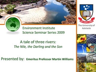
- 1. Environment Institute Science Seminar Series 2009 A tale of three rivers: The Nile, the Darling and the Son Presented by: Emeritus Professor Martin Williams
- 2. Ganga sunset A tale of three rivers: the Nile, the Darling and the Son MARTIN WILLIAMS University of Adelaide
- 3. OUTLINE River response to climate change: a 300 000 year flood history of the Nile Historic floods and droughts in India, the Nile basin and the Darling: the global importance of sea surface temperature anomalies Global warming and possible future hydrological changes in Australia
- 4. Blue Nile, Khartoum River response to climate change: a 300 000 year flood history of the Nile
- 5. At the present time the White Nile provides a steady flow to the Nile Valley, while the tributaries from the Ethiopian Highlands produce a large but highly seasonal contribution. x10 6 cm 3
- 6. Semien Mountains BLUE NILE HEADWATERS
- 7. THE NILE BASIN WHITE NILE PALAEOLAKE
- 8. Satellite photos WHITE NILE LAKE
- 9. Location of Esh Shawal
- 10. AMS 14 C and OSL dates at Esh Shawal 14 C dates on shells: correspond within error limits to OSL dates on sediments immediately overlying and underlying the shell bed. Interpreted as representing resumption of flow from equatorial headwaters of White Nile. 14 C dates on microcrystalline carbonate: much younger than OSL dates in sedimentary quartz. OSL dates interpreted as White Nile flood deposits and pre-White Nile lake. 14 C dates interpreted as representing phase of aridity culminating in LGM (Williams et al., Geology 2003,31, 1001-4).
- 11. Conclusions Our work has extended the demonstrated age of the White Nile from 15,000 yr to well over 250,000 yr The White Nile flows across the floor of an ancient lake that extended from the southern marshes of Sudan almost to the Blue Nile confluence some 400,000 yr ago The carbonates in the lower core represent the final phase of aridity which culminated in the Last Glacial Maximum; the OSL dates represent times of alluvial sedimentation.
- 12. During the Last Glacial Maximum (LGM: 24-18 ka) the Nile valley was more arid than it is today, with desert dunes active as far south as latitude 12°N.
- 13. During the LGM flow into the Nile from its equatorial headwaters ceased - Lakes Victoria and Albert were closed basins. Our work has enabled more precise limits to be put on the date at which flow resumed.
- 14. Blue Nile at 21ka THE BLUE NILE AT 21 KA: A HIGHLY SEASONAL BED-LOAD RIVER DRYING OUT IN WINTER
- 15. River and dune
- 16. THE BLUE NILE AT 21 ka Less summer rainfall Winters 4ºC cooler; glaciers above 4 200 m Slopes unstable down to 3 000 m, resulting in coarse debris Treeline 1 000 m lower in headwaters High seasonal runoff, resulting in high peak flows but reduced annual discharge Winter deflation of channel sands, resulting in source-bordering dunes
- 17. Overflow from White Nile headwaters ~ 15 ka Evidence from White Nile flood deposits Strontium isotope ratios in Nile gastropod shells (Talbot, Williams and Adamson, Geology 2000, v.28, no 4, 343-6). Strontium isotope ratios in Lake Albert sediment core (Williams, Talbot et al., QSR 2006)
- 18. Bujagali Falls
- 19. Lake Albert Strontium values: Lake Albert km 87 Sr/ 86 Sr values > 0.7123 occur when L.Albert is isolated from L.Victoria and L.Edward. Values > 0.7123 show hydrologic connection between the basins Low early Holocene 87 Sr/ 86 Sr values suggest abundant inflow from L. Edward. 0 20 40
- 20. The sudden overflow of Lake Victoria in the Ugandan headwaters of the Nile ~ 15 ka caused extensive flooding in the Nile valley. Gastropod shells and associated sediments from the highest flood level have been dated by AMS 14 C and OSL to 15-16 ka. This mega -flood event marks the abrupt return of the summer monsoon.
- 21. Distinct break in slope at 382m above sea level (about 6m above present maximum flood level of White Nile). The shell layer is not present beyond this break in slope, and represents a recessional flood line.
- 22. Salt in cotton
- 24. 9000 BP Blue Nile THE BLUE NILE AT 9 KA: A PERENNIAL SUSPENDED-LOAD CHANNEL
- 25. THE BLUE NILE AT 9 Ka High summer rainfall; longer wet season Winters 4º C warmer; treeline 900m higher Slopes vegetated and stable above 3 000m Expansion of lowland savanna into former semi-desert Weathering and soil formation. Higher annual discharge and greater base-flow, resulting in attenuated flood peaks Perennial flow and widespread flooding by sinuous suspension load channels
- 26. Nubian sst 2
- 28. Lake relics 2
- 30. HIGH NILE FLOODS WHITE NILE BLUE NILE 1.2 - 1.0 ka 1.1 - 0.9 ka 3.4 - 2.3 ka ? 5.5 - 4.8 ka ? 6.4 - 5.9 ka 6.5 - 5.9 ka 8.2 - 7.6 ka 7.9 - 7.6 ka 9.5 - 8.4 ka ? 10.7 - 8.7 ka ? 15.4 - 12.1 ka 15.4 - 13.1 ka
- 32. Meroe
- 33. Merowe sites
- 34. Meroitic sites Meroe was the iron-smelting centre of this part of Africa. Acacia groves provided wood for charcoal. Runoff was stored in large earth dams. Runoff in the Butana desert today is not enough to fill these dams, nor to sustain much settlement
- 35. Merowe pillars
- 36. Meroe
- 37. Red Sea Hills The mollusc and ostracod assemblages from Erkowit plateau in the Red Sea Hills is consistent with perennial water c. 2000 years ago. The land was more densely vegetated than today, with swampy meadows in the valley bottoms flanking mixed-load streams that were actively aggrading their channels with sandy or silty muds.
- 38. Dune ripples THEY REPORTED THEIR WAY BLOCKED BY VAST SWAMPS SURROUNDING TWO ROCKY HILLS… THESE HILLS [JEBEL AHMED AGHA] ARE NOW 200 KM NORTH OF ANY SWAMPS… IN ca.A.D 60 NERO SENT TWO CENTURIONS TO DISCOVER THE SOURCES OF THE NILE…
- 39. Near Guli
- 40. Sponge spicules
- 41. Jebels Historic floods and droughts in India, the Nile basin and the Darling: the global importance of sea surface temperature anomalies
- 42. Satellite images
- 45. Area of monsoon
- 46. Nile floods
- 48. SON FERRY
- 49. SON TERRACES
- 50. Toba tephra localities Localities of Toba tephra in India, Indian Ocean, North Sumatra and Malaysia
- 51. Areas in China sensitive to ENSO
- 52. JAVA NILE LINKS
- 54. Floods and droughts: Africa and Asia Floods and droughts reflect sea surface temperature anomalies.
- 56. DROUGHT AND OCEAN TEMPERATURES During the past 80 years, dry phases (including the Sahel drought) coincide with a warmer ocean surface south of the Equator and in the North Indian Ocean, and cooling of the North Atlantic and the North Pacific. (Folland, Palmer & Parker, 1980) The net effect of this SST anomaly pattern was a reduction of moisture flux into the Sahel zone. (Rainer Zahn, 1994)
- 57. ENSO variations, Ecuador (After Moy et al., 2002) The frequency of ENSO events has varied in the last 12 000 years, with fewer events in the last 1 200 years.
- 58. TEMP LAST 1000 YRS
- 59. Surveying desert expanse Where are we going?
- 60. Simpson desert Time present and time past Are both perhaps present in time future And time future contained in time past T.S.Eliot More severe and prolonged droughts in central, S and E Australia
- 61. Jebels THE END
- 62. Environment Institute Science Seminar Series 2009 Are river red gums being pushed to the edge? Presented by: Dr Anne Jensen