Esri News for Health & Human Services -- Summer 2012
•
1 gefällt mir•1,016 views

Esri News for Health & Human Services keeps you informed with software news, events, and user stories showing how GIS brings the geographic advantage to health organizations worldwide. Stories in this issue showcase how agencies use GIS for vector control and disease monitoring, promoting and ensuring access to healthcare, and managing epidemic outbreaks.

Empfohlen
Weitere ähnliche Inhalte
Andere mochten auch
Ähnlich wie Esri News for Health & Human Services -- Summer 2012
Ähnlich wie Esri News for Health & Human Services -- Summer 2012 (11)
Mehr von Esri
Mehr von Esri (20)
Esri News for Health & Human Services -- Summer 2012
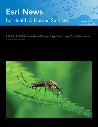
- 1. Esri News for Health & Human Services Summer 2012 Bug Wars A Mobile ArcGIS Software-Based Geospatial Application Helps Control Mosquitoes By Mike Schwartz, Esri Writer Mosquito-borne diseases pose an ongoing threat to people’s health. mosquito-control methods, including those that use Esri ArcGIS Worldwide, more than 1 million people die and 700 million more are in- technology, to reduce the number of disease outbreaks or aid in an fected each year by some type of disease that mosquitoes carry. Many emergency response should an outbreak occur. of these same illnesses, such as West Nile virus, already exist in the Eddie Lucchesi, assistant manager of the San Joaquin County United States, and others may be winging their way stateside aboard Mosquito and Vector Control District in California’s Central Valley, the next arriving airliner. recalls the days before GIS when mosquito control field technicians Consequently, city, state, and federal public health officials and their supervisors worked mostly with pencil and paper, hard-copy are constantly on the lookout for the most effective and efficient map books, and spreadsheets to meet operational and regulatory
- 2. Contents Summer 2012 Cover 1 Bug Wars Esri News 3 Geographic Information Systems: A Way of Life 4 Esri on the Road 4 Save the Date Esri News for Health & Human Services is a publication of 4 New Manager Joins Health and Human Services the Health & Human Services Solutions Group of Esri. Marketing Team To contact the Esri Desktop Order Center, call 1-800-447-9778 Case Study within the United States or 909-793-2853, extension 1-1235, outside the United States. 8 Envisioning a Community of Health, Hope, and Purpose Visit the Esri website at esri.com. 11 ArcGIS in Scan—How We Did It View Esri News for Health & Human Services online at esri.com/health or scan the code below with your smartphone. 12 Scientists Use GIS to Thwart Epidemic Threats 16 Opening Up Health Reform Advertise with Us E-mail ads@esri.com. Event Submit Content 18 Christina’s Conference Corner To submit articles for publication in Esri News for Health & Human Book Review Services, contact Michael Schwartz at mschwartz@esri.com. Manage Your Subscription 19 GIS Tutorial for Health, Fourth Edition, by Kristen S. Kurland and Wilpen L. Gorr To update your mailing address or subscribe or unsubscribe to Esri publications, visit esri.com/manageyoursubscription. International customers should contact an Esri distributor to manage their subscriptions. For a directory of distributors, visit esri.com/distributors. Circulation Services For back issues, missed issues, and other circulation services, e-mail requests@esri.com; call 909-793-2853, extension 2778; or fax 909-798-0560. Copyright © 2012 Esri. All rights reserved. Printed in the United States of America. The information contained in this work is the exclusive property of Esri or its licensors. This work is protected under United States copyright law and other international copyright treaties and conventions. No part of this work may be reproduced or transmitted in any form or by any means, electronic or mechanical, including photocopying and recording, or by any information storage or retrieval system, except as expressly permitted in writing by Esri. All requests should be sent to Attention: Contracts and Legal Services Manager, Esri, 380 New York Street, Redlands, CA 92373-8100 usa. The information contained in this work is subject to change without notice. Esri, the Esri globe logo, ArcGIS, ArcPad, @esri.com, and esri.com are trademarks, service marks, or registered marks of Esri in the United States, the European Community, or certain other jurisdictions. Other companies and products or services mentioned herein may be trademarks, service marks, or registered marks of their respective mark owners. 2 Esri News for Health & Human Services Summer 2012 QR code generated on http://qrcode.littleidiot.be
- 3. Esri News Geographic Information Systems: A Way of Life From My View . . . Bill Davenhall, Global Manager, Esri Health and Human Services The term GIS means many different things, response. GIS has become the glue that and human services sector, such as reducing depending on what you actually do with it. makes the information we get useful and service gaps, predicting human need, pre- Most GIS practitioners know GIS as an infor- actionable. How we use the information that venting fraud, predicting service utilization, mation technology that integrates geographic is generated by a GIS now takes center stage. and ensuring service accountability. The best data (or data that is geographically relevant). What a doctor is to disease, GIS is to the and highest use of GIS is yet to come. Like many other types of information technol- context of our lives. Making sure that the GIS This is the last column I will author in my ogy, GIS requires specialized terminology, is delivering contextually rich information— role as the health and human services industry methodologies, and techniques. If you’re a useful to problem solving, setting health and manager at Esri, as I will retire in January 2013, consumer of information that is generated social policy, making decisions, and increasing allowing more time for pursuing special by a GIS, then you probably know very little the overall value of life—is now the challenge. projects such as geomedicine and three about how it works, how maps are made, or But some things never change. GIS changes grandchildren. Christina Bivona-Tellez, RN, how geographic analysis is done. Of course, lives—from children who learn about the tech- MPH (featured on page 8), is currently colead- around the world, there are many more con- nology and decide to make GIS a career to ing our team in preparation for this transition. sumers of GIS products and services than GIS entire communities of people who are warned Please welcome her and seek her participa- practitioners—maybe something like one GIS in advance of an approaching storm. The list tion in your GIS journeys, as she will certainly practitioner to 100 million consumers. is long because it’s a technology that invades bring a new perspective to helping all of us While the use of GIS across all sectors of our thinking about problem solving and feeds realize the great promise of GIS to health and the health and human services market has our curiosity about the world around us. In human services. steadily increased over the past decade, much 2012, we have seen the four billionth smart- I have appreciated your second opinions of it has been to support research projects phone sold and the 25 billionth Apple Store over the years. and scientific inquiries about the relation- application downloaded. And amid the ships between various factors associated with tsunami of new information that these smart- identifying disparities, measuring variation phones have delivered, the most frequently in health and social outcomes, and tracking used information is geographic—ranging disease vectors associated with the spread of from getting maps and directions and locat- infectious disease. The use of GIS in this sense ing stores and hospitals to tracking changing has contributed a great deal to understand- weather conditions and managing health and ing problems, identifying challenges, and social outcomes. informing policy decisions. Not too shabby a This is why I like to say that GIS is a way contribution, I would say! of life and not simply another information “Making sure that the GIS But the challenges are changing, and so is technology. GIS has the intrinsic power to geospatial technology itself. GIS is becoming change the way we think and act about the is delivering contextually just another part of the larger process— world around us as well as help us live better rich information—useful whether it’s research, service planning, lo- and more meaningful lives. There are many gistic analytics, policy making, or emergency great GIS challenges yet to tackle in the health to problem solving, setting health and social policy, making decisions, and increasing the overall value of life—is now the challenge.” Bill Davenhall Summer 2012 esri.com/health 3
- 4. Esri News Esri on the Road New Manager Joins Association of State and Territorial Health Officials Health and Human Services (ASTHO) Annual Meeting and Policy Summit September 11–14, 2012 Marketing Team Austin, Texas USA By Bill Davenhall www.astho.org Please help me welcome Christina Bivona-Tellez to Esri. American Public Health Association (APHA) Christina is the newest member of the health and human 140th Annual Meeting & Exposition services marketing team, joining our staff as manager and October 27–31, 2012 health team lead. Onboard since early January 2012, San Francisco, California USA Christina already has begun to ramp up and strengthen our www.apha.org/meetings/highlights team and accelerate our marketing efforts. As many of you already know, I will step out of my role in January 2013 and will be transitioning my team duties and relationships to Christina Christina over the next several months. Bivona-Tellez, Christina joins us after a stunning 20-year career as a RN, MPH Save the Date health care professional with roles in nursing administration and public health and, most recently, having acted as regional vice president of the Hospital Association of Southern California. She is experienced across many areas including hospital operations, in both for-profit and not-for-profit sectors; Healthy Communities by Design Summit nursing administration; community development; government and public rela- When October 1–2, 2012 tions; and public and behavioral health. She also has experience in many areas Host Loma Linda University School of critical to our future growth, such as health information exchange, electronic Public Health medical records, quality performance, outcome measurement, and workflow Where Loma Linda University Centennial management. Christina’s extensive experience in the health industry equips her to work effectively with our customers and prospects—physicians, hospital Complex (4th floor), 24760 Stewart directors, community public health organizations, academic medical center Street, Loma Linda, CA 92354 managers, social services, and not-for-profit organizations. She is a leader in an Web www.llu.edu/public-health/hcbd industry that continues to grow. Highlights Sponsored by Loma Linda University Christina earned her nursing degree (BSN) from Alfred University, New York, School of Public Health, the third and holds a dual master of public health degree in maternal and child health and annual Healthy Communities by public health nursing administration (with a concentration in international and Design Summit will bring together a global health) from the University of North Carolina, Chapel Hill. unique cross section of key leader- Before moving to Redlands, California, in 1990, Christina had lived and worked ship in policy, industry, and aca- in New York City; Macon, Georgia; Vienna, Austria; Quito and Colta, Ecuador; demia. Experts in the fields of health Vicksburg, Mississippi; and Charlotte and Chapel Hill, North Carolina. Christina promotion, preventive medicine, resides with her husband, Norb; their two children; and two rescue Labrador environmental health, community retrievers, Molly and Sadie. planning and design, and policy will discuss the built environment and Christina can be reached at health. Key outcomes will include CBivona-Tellez@esri.com discussions on ways to improve existing initiatives and the future of or 909-793-2853, ext. 7940. building healthy communities. Keynotes Dr. Richard Jackson, MD, MPH, Chair of the Environmental Health Sciences Department, UCLA Inquiries Call 909-558-8072, ext. 88072, or e-mail swiafe@llu.edu. 4 Esri News for Health & Human Services Summer 2012
- 5. Scalable GIS Software Solutions Adulticide • Larvicide • Surveillance • Service Request Field Solutions For Our Introducing Software Small to Large Enterprise Operations tion Electronic Data Solutions New Genera provides complete solutions for recording, mapping, managing, and reporting data for all sizes of mosquito Esri ArcGIS for Server, ArcGIS for Mobile and web applications. control operations. Powerful. Ready-to-use Applications based on Esri ArcGIS for applications Desktop and ArcPad ® Software. built on core Esri® ArcGIS® platform leveraging advances in web, mobile computing, and cloud technology. Dedicated. We’ve been supplying and supporting field data collection solutions for over 25 years. Proven. Our software is used at over 250 mosquito control agencies in the U. S. and Canada. 208-324-8006 | Call for a demo today! | www.elecdata.com In partnership with: Juniper Systems® Inc., Field Computers, Esri® GIS Software and Trimble ® GPS Receivers Sentinel GIS Sales Representatives: Univar USA and Clarke - FieldSeeker GIS Sales Representative: Clarke Copyright 2012 © by Field Data Solutions, Inc. All rights reserved worldwide. DataPlus, FIELDBRIDGE, HydroPlus, VCMS, Vector Control Management System and Electronic Data Solutions are registered trademarks of Field Data Solutions, Inc. DataLink, Everglade and FieldSeeker are recognized trademarks for Field Data Solutions, Inc. Trademarks provided under license from Esri. All other trademarks are registered or recognized trademarks of their respective owners.
- 6. Bug Wars continued from page 1 requirements for keeping track of how much chemical pesticide was Modules can be added when an agency is ready to implement new disbursed in different areas and exactly where. control methods. All four applications use a similar process to prepare, “Of course it was all transcribed into a computer program, which collect, and report mosquito control data. meant job security for some, but it was much more laborious,” Lucchesi said. Less Paper, More Accuracy Needed The federal Clean Water Act of 1972, passed to restore and maintain More Precise Alternative the chemical, physical, and biologic integrity of the nation’s waters, About five years ago, San Joaquin County Mosquito and Vector spurred the development of safer, integrated pest management Control District joined many other abatement agencies nationwide programs that include information systems such as Sentinel GIS. that had discovered an innovative, time-saving, and more precise Authorized by this law, the National Pollutant Discharge Elimination technology for combating mosquitoes. System (NPDES) permit program called for ever-more stringent Electronic Data Solutions (Elecdata), a distributor and system reporting to the Environmental Protection Agency and other govern- integrator of field data collection instruments, has heeded the call ment bodies of where, when, and how much of these chemicals are for better mosquito control methods. Founded in 1986, the Jerome, disbursed. Idaho-based company already had been specializing in field data col- By using Sentinel GIS and GPS coordinates corresponding with lection solutions for mosquito abatement since 2004. property ownership boundaries, the county can easily identify exactly Sentinel GIS, a system from Elecdata that is based on Esri’s ArcGIS, where that [spraying] material goes according to Lucchesi. “This meant provides state-of-the-art technology to public health agencies that technicians not only could better comply with federal and state nationwide, mainly mosquito and vector control districts charged with reporting regulations but also save on chemicals,” he said. getting rid of these dangerous, disease-carrying pests. Elecdata conceived the Sentinel GIS system as a “complete solution Sentinel GIS allows control personnel to take GIS information seam- for recording and managing data critical for controlling mosquitoes,” lessly into and from the field via four application modules: said Linda Dean, Elecdata’s co-owner and vice president of marketing • Larviciding or spraying of standing water bodies with mosquito and sales. “Everything you need is included in an easy-to-use mobile larvae or pupae present—Field inspectors download previous GIS software package that allows you to streamline your mosquito inspections, maps, and GIS layers into handheld units, then navigate management program, whether your operation is small or large.” to water bodies needing inspection. The module allows users to map a site, recording spraying applications along with efficacy dates, Choice of Modules and Mobile Devices which they can later use to schedule follow-up visits. Sentinel GIS’s specialized functions and toolbars are embedded within • Adulticiding, used to control adult mosquitoes with ultralow dose ArcGIS and ArcPad. Maps and GIS databases are immediately updated spraying—The application manages treatment activities to efficient- with information related to the four software modules. ly schedule personnel and equipment while minimizing chemical “We use everything they have with regard to larviciding and adulti- usage and costs. ciding,” Lucchesi said. • Surveillance for collecting data on adult mosquitoes—A mosquito disease distribution map layer displayed in Esri ArcGIS helps manag- ers prioritize and schedule mosquito control activities. • Service Request—This web-based desktop application is used for creating, tracking, and reporting incoming complaints and calls for action about mosquito activity. “Sentinel GIS has allowed us to avoid duplicating what’s done in the field. We now could download the work of the technician versus having to go through another data entry person back in the office.” San Joaquin County mosquito control technician Richard Capuccini Eddie Lucchesi, Assistant Manager, San Joaquin County sprays mosquito larvae in a dairy pond, a process called larviciding. Mosquito and Vector Control District 6 Esri News for Health & Human Services Summer 2012
- 7. Cover Story “ArcGIS Supervisory Tools help the supervi- sor create and manage the forms that field technicians use on mobile GPS devices. The field forms are simple to fill out, yet the power of the ArcPad mobile GIS software remains behind the scenes,” said Chad Minteer, Elecdata’s mobile GIS software solutions manager. What’s more, a handheld GPS with naviga- tional features allows technicians to easily take maps into the field and get to the right loca- tion. Transferring the data to and from ArcGIS is streamlined by the automated functions for transferring and merging data provided by DataLink GIS. Back at the office, maps and GIS databases are immediately updated, reports are quickly generated, and important analyses are performed. San Joaquin County mosquito control supervisor Brian Heine collects mosquito larvae A key feature of the system is its ability to samples from a lagoon that abuts a subdivision. Obtaining a larval count from water samples is tell the technician where not to spray, Minteer part of surveillance work. said. “These can be areas off-limits due to regulations, organic farms, beehives, or people who just opt out,” For more information, contact Linda Minteer said. A mobile device can give a technician—sometimes on foot but most often in a vehicle—an automatic warning to shut off the Dean at Linda@elecdata.com or visit sprayer. www.elecdata.com/sentinel/sentinel.html. When a larval treatment is necessary, the mobile software has a built-in calculator to assist the field technician in applying the proper amount of product according to the EPA label. Mosquito breeding sites in part of San Joaquin County, California. Map indicates mosquito breeding sites in Stockton, California, that need to be inspected or treated. The map is used to plan activities and to visually assess workload, priorities, and resource allocation. Summer 2012 esri.com/health 7
- 8. Envisioning a Community of Health, Hope, and Purpose Civic leaders from Washington, DC, to San Bernardino, the 99th largest city in the younger than the average of 73 in California. California face a worsening health crisis United States with a population of 220,000, Preventable disease and injury are the key is ground zero in the battle for improving culprits. Compared to statewide averages, the publicized by the White House but public health in California. In recent times, San city’s heart disease rate is 70 percent higher, manifested locally—one spotlighted Bernardino has been challenged with tackling lung disease is 90 percent higher, diabetes is by a growing epidemic of prevent- high levels of unemployment, violent crime, 100 percent higher, and homicide is able health conditions linked to how lack of parks, poor food options, and air pollu- 150 percent higher. Surveys of San Bernardino we build our cities. Here’s how San tion. These issues have contributed in part to school-age children also reveal predictive Bernardino, California, is facing the poor health markers that rival or exceed many markers of poor health: a large percentage of other communities in California. They have overweight students and inferior performance problem, aided by GIS. also led to growing efforts among civic lead- on physical fitness tests. ers to address underlying social and physical Although lifestyle choices and socioeco- determinants of health. nomic factors influence health outcomes, The challenge is daunting. Mortality rates equally important is the quality of the in San Bernardino far exceed those in other environment—in other words, how we cities in San Bernardino County and the build our cities contributes to the problem, state of California. The average age of death according to Mark Hoffman, senior planner in San Bernardino is 65 years, fully 8 years for The Planning Center|DC&E, an Orange
- 9. Case Study “We knew there were pressing health conditions facing the city [of San Bernardino]. And County, California-based urban planning and availability of parks, the food and alcohol we suspected that the environmental firm that recently completed a environment, and violent crime. study of San Bernardino’s health issues using In response to Hoffman’s study, in 2010 environment was a strong Esri ArcGIS. the San Bernardino Mayor’s Office and the contributing factor. But “We heard complaints of violent crime, lack Latino Health Collaborative spearheaded of healthy food, liquor stores, and not enough an innovative coalition called the Healthy the data needed to be parks. Yet the larger question was whether the San Bernardino Coalition (HSBC) with seed connected in a coherent poor health outcomes among city residents funding from the County of San Bernardino were related to the quality of the built environ- Healthy Communities Program. HSBC and compelling manner.” ment in San Bernardino,” said Hoffman, princi- adopted a vision of San Bernardino as an Mark Hoffman, Senior Planner, pal author of the study, City of San Bernardino active, engaged, and prosperous community The Planning Center|DC&E Environmental Scan: A Model for Building with green and safe public spaces supporting Communities That Support Healthy Eating healthy lifestyles. and Active Living. Working with Claremont, California-based According to Hoffman, not until The professional facilitators Cynthia Luna and Max Planning Center|DC&E moved these issues Freund, HSBC provided the impetus for a out of the realm of the anecdotal and came growing and cohesive coalition of community up with measurable geospatial data was the organizations, schools, faith-based groups, City of San Bernardino able to correlate poor residents, hospitals, and other partners. examines the underlying aspects of the envi- health outcomes to the quality of the city’s Within a year, HSBC grew into a broad coali- ronment that influence the health of residents. built environment. tion of 75 organizations—all determined to However, the scan goes a step further and “Using Esri ArcGIS allowed our team to collaborate on ways to address the environ- proposes innovative solutions as well. connect the pieces, tell the story, and visually mental barriers to health and wellness in San From the beginning, said Hoffman, it was communicate in a compelling manner to deci- Bernardino. apparent how the conditions of the built and sion makers,” said Hoffman. “Our goal was to natural environment, health care access, and present a clear and compelling portrait of San Community Environmental Scan social factors had contributed over time to Bernardino’s challenges that could motivate Commissioned create negative health consequences. HSBC civic leaders to make bold changes in policy, As a first order of business, HSBC commis- mapped out a course of action to address four systems, and the environment.” sioned the community environmental scan key factors as part of its environmental scan. “This is the first time in San Bernardino from The Planning Center|DC&E to document “We asked ourselves, ‘How can we use this County that a community used geographic existing health conditions in San Bernardino document, the mapping, and the charts [see information systems not only to map the envi- and help define its agenda. Hoffman likens sidebar on page 11] to really illustrate what the ronment but also to analyze what was contrib- the scan to an MRI or other diagnostic tool—it problems are, citywide?’” Hoffman recalled. uting to the health—or lack of health—of its “We also wanted to demonstrate in a very residents, said Angelica Baltazar, former field compelling way the issues on a neighborhood representative to chairwoman Josie Gonzales scale. If we could get a consensus about the (San Bernardino County Board of Supervisors, issues and disparities the city faces, it would Fifth District) and current health and human lend more power and cohesiveness to HSBC services industry support specialist at Esri. as its members formed [its] health agenda.” To that end, the environmental scan had New Direction Needed three purposes: San Bernardino residents, businesses, health • Help civic leaders understand the health care providers, organizations, and other crisis facing the city of San Bernardino stakeholders, had long known the city faced a • Identify features of the city’s environment crisis, said Hoffman. Lower quality of life and that influence health significantly increased health care costs also • Propose evidence-based strategies known detracted from economic competitiveness. to improve the environment and residents’ San Bernardino sorely needed public policies health directed at the built environment and social In just one year, HSBC has achieved tremen- Framing a Healthy San Bernardino determinants of health. These included the dous success at raising awareness in Summer 2012 esri.com/health 9
- 10. Envisioning a Community of Health, Hope, and Purpose continued from page 9 San Bernardino and effecting policy, sys- Communities Program, stated, “The Planning food environments of this sprawling inland tems, and environmental changes, including Center|DC&E has demonstrated exceptional city. All the mapping data was obtained and/ the following milestones: knowledge and leadership in the Southern or analyzed with the aid of Esri geospatial • Creation of two new community gardens California healthy communities movement, technology (see sidebar). Future phases of in underserved neighborhoods, including which exemplifies the multisectorial analysis this report will include topics such as public one dedicated to training and rehabilitating and collaboration needed to transform com- safety, transportation access, and air and disabled veterans munities into places where residents can be water quality. • Adoption of city policies supporting com- healthy and safe.” munity gardens, regulation of retail alcohol Park and Recreation Environment outlets, and other ordinances Major Findings of the Scan Residents living at the base of the San • Speaking engagements at multiple health The following updated excerpt from the City Bernardino Mountains have access to broad and planning conferences, both regional of San Bernardino Environmental Scan report, regional park and open space amenities. and national authored by senior planner Mark Hoffman of Yet within urban parts of San Bernardino, Evelyn Trevino, public health coordina- The Planning Center|DC&E, summarizes key the experience is altogether different. San tor for San Bernardino County’s Healthy findings regarding the park, recreational, and Bernardino’s system of about 40 parks provides about 447 usable acres of parkland, or 2.2 acres per 1,000 residents. However, this is less than half the city’s standard of 5 acres per 1,000 residents and below the minimum 3-acre standard in California law. Meeting the state standard will require 185 additional acres of parkland. Because of the current shortage of parks, 8 in 10 residents do not have access to 3 acres of parkland within walking distance (1 mile). Access to Bike Routes San Bernardino has one of the smallest numbers of linear miles of bicycle trails in the county. The city’s network encompasses 80 miles of planned bicycle routes, yet only 10 percent of the routes are built. Although walking can be an alternative to bicycling along the streets, many neighborhoods either have no sidewalks or the sidewalks are in need of substantial repairs, rehabilitation, or replacement. Retail Food Environment San Bernardino’s retail food environment has long been a source of concern. Although home to many fast-food eateries, the city lacks complementary grocery stores, produce mar- kets, and so forth. With nine unhealthy-food outlets (e.g., convenience stores, fast food) for each full-service grocery or other healthy-food outlet, San Bernardino has one of the most unhealthy food environments in California. This ratio is conservative; it does not include the city’s many donut stores, gas stations, and liquor stores. Still, this is double the statewide San Bernardino has nine unhealthy-food stores for every one healthy-food store. This is average and four times worse than healthier double the statewide average and four times higher than healthier communities. communities. 10 Esri News for Health & Human Services Summer 2012
- 11. Case Study ArcGIS in Scan—How We Did It Forging a Health Agenda The Environmental Scan documents the Esri News for Health answer to a simple yet profound question— & Human Services Does San Bernardino’s environment affect asked The Planning the health of the community? The answer is a Center|DC&E to resounding yes. explain the basic This study found that the city’s mortality techniques em- rates for heart disease, diabetes, liver disease, ployed in bringing and other preventable diseases are signifi- ArcGIS into the City cantly higher than those for the county and of San Bernardino the state. Environmental Scan HSBC is actively working with the San project. GIS analyst Bernardino Mayor’s Office through its policy Robert Mazur and subcommittee to change policies, systems, cartographer Kim and the environment to improve health. Five Herkewitz collabo- principles for action guide this effort: rated on the effort 1. Pursue evidence-based strategies. HSBC and discuss mapping is addressing all sectors—parks and park acres per 1,000 recreation, active transportation, food people: environment, and air and water quality— The idea of with evidence-based strategies to achieve calculating park acres environmental change. per unit of population 2. Prioritize initiatives. HSBC is targeting is a well-established administrative and financial resources method for measur- to prioritize initiatives consistent with its ing the adequacy and San Bernardino Park Availability Map vision and make the necessary long-term availability of parks investments to achieve desired change. in a community. The 3. Advance health equity. HSBC is focusing original park ratio methodology was derived from early studies of the National Recreation on improving the health of all residents. and Parks Association [NRPA] as refined by communities across the country. This may require reducing health dispari- Certainly, it is a simple exercise to calculate park acres per 1,000 people for a city as a ties in some neighborhoods, while in other whole, but showing which neighborhoods are underserved is another story. Mapping this cases it will involve improving the health of population-to-park-acres ratio is most appropriate for communities with good park cover- everyone. age (every resident is at least one to two miles from a park). For communities with poor park 4. Focus on policy change. To ensure maxi- coverage, a more generalized analysis may suffice. mum impact, HSBC is focusing on chang- The mapping process requires detailed park area boundaries and acreage calculations. ing system-wide policies that drive local Having this data is the key to using GIS analysis to clearly illustrate health issues that can decisions and priorities wherever possible inform and drive policy, systems, and environmental change. ArcGIS Network Analyst and to affect the greatest number of people. ArcGIS for Desktop Advanced tools are used to run detailed analysis and calculations to 5. Maximize collaboration. HSBC is continu- obtain park-acres-per-1,000-people values for any given location within the study area. In ing to collaborate with residents, busi- addition to the park’s polygon database, a detailed road/walking network and census block ness leaders, and other stakeholders to population data are needed. collectively solve the challenges facing the Network Analyst is used to create driving/walking distance buffers around each park, San Bernardino community. and the park acreage values are migrated to each buffer. Typically, the buffer distance values vary based on park size, purpose, and available recreational amenities. For instance, community parks that draw visitors from a larger area have a larger buffer than pocket parks serving smaller areas. Once created, buffers are intersected using the ArcGIS Union tool, and acreage values are summed for overlap areas. This creates a park access analysis area showing total park acres available from any given location within a community. Areas outside the buffers are considered unserved. Once these steps are complete, the park access analysis area is intersected with census block population, and a dissolve is run to sum total population with specific areas. There are multiple steps in this process, but the end result paints a comprehensive picture of park access for any given location within the study area. Summer 2012 esri.com/health 11
- 12. Scientists Use GIS to Thwart Epidemic Threats Application Supports Preparedness at Global Events Including Olympics With more than two billion passengers flowing through Public health experts warn that mass gatherings such as the Olympics the global airline transportation network every year, once- present potential health risks from communicable diseases not only to the host nation but also to the countries from which visiting athletes, localized infectious disease threats can now rapidly trans- spectators, and other travelers originate. form into worldwide epidemics, compromising global health, For instance, measles, one of the most highly contagious infectious security, and prosperity. An innovative research team based diseases, was a notable risk at the UEFA, European Football at St. Michael’s Hospital in Toronto, Ontario, Canada, is striv- Championships this year, as vaccination rates have dropped across ing to prevent infectious disease outbreaks using a novel Europe. In 2012 alone, more than 6,000 cases of measles have been software platform—Bio.Diaspora—designed to assist in the reported in the Ukraine, a host country for the quadrennial soccer tourna- ment. A measles outbreak after the Vancouver Olympics in February 2010 rapid analysis of worldwide human population movement resulted in 82 confirmed cases, according to the British Columbia through commercial air travel and its association with the in- Center for Disease Control. Suboptimal vaccination coverage in the ternational spread of infectious diseases. Employing ArcGIS, province contributed to transmission, the center reported at the time. this high-tech risk assessment platform has aided public One public health expert who is vigilant in tracking the resurgence health experts in countries around the world and was used of infectious diseases is Dr. Kamran Khan of St. Michael’s Hospital in to enhance public health preparedness for the 2012 Summer Toronto, Canada. A practicing infectious disease physician and expert in globalization and infectious diseases, Khan and his research team Olympic Games in London, England. developed and refined Bio.Diaspora, a first-of-its-kind interdisciplinary software system for rapidly generating evidence to support public
- 13. Case Study health decision making for emergent global infectious disease threats. Combined with HealthMap, an online global disease mapping and tracking tool cofounded by Dr. John S. Brownstein of Boston Children’s Hospital, Bio.Diaspora at last gives researchers a real-time system to support and enhance emergency preparedness and response capabilities during large-scale international events such as sporting competitions, religious pilgrimages, economic summits, and global expositions. The system integrates and synthesizes information across a number of scientific disciplines, among them the ability to understand how humans—and, The global airline transportation network is illustrated by the flight pathways of all commercial flights worldwide. This image shows the interconnectivity between cities and consequently, human infectious diseases—move how easy it is for people—and diseases—to get from point A to point B in a matter of hours. worldwide. St. Michael’s Hospital medical geographer/cartographer David Kossowsky used Python, ArcGIS, and Photoshop to create the image. Urgent Need Born of Disaster After Khan moved to Toronto in 2003, the local outbreak of SARS global infectious disease threats with numerous complementary data inspired him and his colleagues to develop new tools to improve sources, including worldwide air traffic patterns. This capability allows pandemic preparedness and response capabilities on a global scale. countries to anticipate future events and subsequently adopt proac- Despite the inevitability of future epidemics and pandemics like tive measures to prepare for an outbreak before it occurs. SARS and H1N1, research into the role of commercial air travel as a Research findings from Bio.Diaspora’s first report in 2009 were conduit for the spread of infectious disease has been limited. Most compiled into a 122-page document for the Public Health Agency of national and international pandemic influenza plans do not explicitly Canada entitled An Analysis of Canada’s Vulnerability to Emerging account for global patterns of air traffic and their implications on Infectious Disease Threats via the Global Airline Transportation emergency preparedness and response strategies. Network. Literally meaning “scattering of life,” Bio.Diaspora studies how St. Michael’s Hospital was selected as a 2011 laureate for innova- infectious diseases are increasingly able to be dispersed worldwide tion by the International Data Group’s (IDG) Computerworld Honors through the movements of international travelers. A central feature of Program. The annual award program honors visionary applications Bio.Diaspora involves understanding the global airline transportation of information technology promoting positive social, economic, network and leveraging knowledge of this complex “living” system to and educational change. Bio.Diaspora was selected from over 1,000 better prepare for—and respond to—infectious disease threats. To international entries, joining more than 250 others from 23 countries as understand the interaction between global population mobility and winners in the 2011 program. infectious disease activity, Khan realized that GIS would be needed. “Bio.Diaspora exemplifies the highest goal of GIS, which is to benefit society,” said Alex Miller, president, Esri Canada Limited, of Early Successes Rewarded the accomplishment. “The system helps protect the health of the Success came quickly. Bio.Diaspora accurately predicted how the entire global community by allowing countries to get ahead of the H1N1 swine flu virus would spread worldwide via an analysis of more curve in detecting and preventing disease outbreaks before they even than 2.3 million international passenger departures from Mexico in reach an airport. We commend St. Michael’s Hospital for its innovation early 2009. Published in the New England Journal of Medicine, the in using GIS to advance overall human health. We’re proud to have findings demonstrated that the international destinations of air travel- provided the hospital with the technology to enable its vision.” ers leaving Mexico were highly predictive of where cases of H1N1 first As a winner, the Bio.Diaspora case study will become part of the showed up around the world. Computerworld Honors International Program archive, which is Bio.Diaspora was also used to assess global infectious disease available to researchers, students, and scholars via cwhonors.org threats during the 2010 Vancouver Winter Games, the World Cup, and and through digital records housed in national archives in over the Hajj (the annual worldwide pilgrimage of millions of Muslims to 350 universities, museums, and research institutions worldwide. Mecca), as well as infectious diseases around the world. Khan said he was honored by the recognition but quickly noted that What is significant about this project is that it has led to the creation the hospital’s goal—in collaboration with partners at Ryerson University of a system that can rapidly integrate and analyze information about and Harvard Medical School—has been to leverage GIS technology Summer 2012 esri.com/health 13
- 14. Scientists Use GIS to Thwart Epidemic Threats continued from page 13 “Real-time integration of web-based to offer real-time global situational awareness of infectious disease threats, strengthening public health security throughout the world. infectious disease surveillance, “The Bio.Diaspora architecture enables us to quickly produce maps combined with knowledge of and put them on the web to seamlessly communicate our research findings,” he explained. “We continue to move toward web mapping worldwide patterns of commercial as a powerful vehicle to communicate our findings around the globe, air traffic, could significantly enhance helping to promote awareness, preparedness, and prevention of infec- tious disease threats.” global situational awareness of infectious disease threats.” Integrated Web-Based System The Bio.Diaspora architecture consists of three key software compo- Dr. Kamran Khan, St. Michael’s Hospital, Toronto, Canada nents: SAS business analytics software, which integrates and manages data for tasks such as determining passenger flow volumes, identify- ing routes and transit points used most frequently by international passengers coming to Canada, and examining traffic trends over time; International air traffic patterns into Vancouver leading up to the 2010 Winter Olympic Games were combined with HealthMap to reveal potential global infectious disease threats during the Winter Olympic Games. 14 Esri News for Health & Human Services Summer 2012
- 15. Case Study MATLAB technical computing software, which is used for data analysis of spreading from person to person through respiratory transmission and numeric computation; and ArcGIS software, which brings data to or direct contact; infections that contained dangerous, drug-resistant life through a range of compelling web maps. pathogens; and threats that could be an act of bioterrorism. For example, ArcGIS provides a way to create heat maps, contour “Real-time integration of web-based infectious disease surveillance, maps, and simulations that could answer key questions such as, Where combined with knowledge of worldwide patterns of commercial air are the vulnerable points of entry in this province? What is the prob- traffic, could significantly enhance global situational awareness of ability of the spread of infectious disease based on a defined set of infectious disease threats,” explained Khan. criteria? How many international passengers arrived in a particular city This same conceptual model was applied to monitor infectious dis- in 2012? ease threats in South Africa for the FIFA World Cup. The team created Data sources are combined with data on worldwide passenger ticket a map that showed the high concentration of passengers traveling from sales, global flight schedules, and real-time flight status information. 15 different cities, the time it would take those passengers to travel to Bio.Diaspora facilitates an understanding of how people travel via com- South Africa, and the infectious disease threats that were present in mercial airlines and uses it as a way to predict how infectious diseases those cities. For example, the map revealed that hand, foot, and mouth are most likely to spread around the world. disease was present in Singapore; measles was present in Harare, To enhance the application’s capability to predict the spread of Zimbabwe; mumps was present in London, England; and tuberculosis infectious disease at mass gatherings, the Bio.Diaspora team joined was present in Dakar, Senegal. forces with the researchers at Harvard University who developed In the end, no major infectious disease threats were associated with HealthMap, an online infectious disease surveillance system that uses either the 2010 Winter Olympics or the FIFA World Cup. However, if a ArcGIS for Server and monitors reports and warnings of outbreaks serious threat had been identified, health officials from the host coun- on the web at a local or regional level. An automated text-processing try would have known the country where the threat was first identified system evaluates more than 30,000 sources for disease outbreaks and and therefore which health officials to contact. Health authorities and their associated locations and maps the information on an interactive the public at the site of the gathering could have also been alerted to display. facilitate early detection of new cases. The current Bio.Diaspora application has an integrated live stream of global epidemic intelligence from HealthMap and is capable of provid- Preventing Future Catastrophes ing end users with valuable insights into where dangerous infectious Information gleaned from the Bio.Diaspora and HealthMap conceptual disease threats are emerging in the world and where they are most model is now being used to interact with policy makers to improve likely to spread. global preparedness and response strategies. Khan and Brownstein Together, Bio.Diaspora and HealthMap created a conceptual currently have an advisory role with the World Health Organization model that was applied to popular events including the 2010 Olympic (WHO). Winter Games in Vancouver and the 2010 Fedération Internationale de In July 2012, when the Summer Olympic Games began in London, Football Association (FIFA) World Cup. plans called for using Bio.Diaspora to assist public health officials For the 2010 Winter Olympics, the team members focused their in the United Kingdom by linking information on global infectious infectious disease surveillance on the 25 cities where the majority of disease outbreaks with knowledge of patterns of travel to London. This the travelers were predicted to originate. They also performed analyses integration would help health officials better understand what global to estimate the size of any potential surges in international air traffic outbreaks they needed to pay greatest attention to and subsequently that might coincide with the Winter Olympics. They accomplished this anticipate and prepare for in case any threats were to spread to by analyzing historical trends in international air traffic over the past London. This collaboration represents the first time that such informa- decade, including how global air traffic patterns changed during the tion will have been used in an operational manner to facilitate near previous Winter Olympics in Torino, Italy. Finally, they used data from real-time risk assessments of global infectious disease. flight schedules and network analysis to calculate the time required to travel from all commercial airports worldwide to Vancouver at the time of the opening ceremonies in February 2010. For pathogens with known For more information, contact incubation periods, information on travel times and travel routes to Dr. Kamran Khan at KhanK@smh.ca or Vancouver could then have been used to assess the public health value of screening travelers upon arrival at Vancouver International Airport. visit www.biodiaspora.com. HealthMap was then leveraged to monitor disease outbreaks in the 25 cities of interest from which the majority of passengers traveled. The team took advantage of Really Simple Syndication (RSS) feeds to construct a dataset of news stories about infectious diseases that would be updated automatically. The analysis was performed on an hourly basis leading up to—and during—the Winter Olympics and identified three specific types of threats: infections with high capability Summer 2012 esri.com/health 15
- 16. Opening Up Health Reform Riverside County’s Public Health Department Takes a New Look at Grant Applications “It is our vision that the Staff at the Epidemiology and Program care,” explains Wendy Betancourt, public Evaluation branch of Riverside County, health program chief of Epidemiology county’s residents will California, Department of Public Health and Program Evaluation, Riverside County engage in active, healthy understand the power of a map. This branch Department of Public Health. “This can be performs most of the data profiling for anyone achieved through a high level of public and lifestyles; enjoy good who needs map-level data at the department. environmental health services and mental physical and mental The maps are used to promote and protect health programs where these services are the health of county residents and visitors as most needed.” health; and have access well as ensure that services promoting the To target these areas and manage a finite to appropriate and cost- well-being of the community are available. arsenal of resources and government funds, From grant work for funding health programs Riverside County Department of Public Health effective preventive, to ensuring that people across the county turned to GIS. The department has been a user primary, specialty, and have fair and equitable access to emergency of ArcGIS for Server and ArcGIS for Desktop medical services, maps provide insight like no for about eight years. It uses ArcGIS to share emergency care.” other tool. data easily with other Riverside County Riverside County Department of Public departments and the federal government, Wendy Betancourt, Public Health Health oversees the health of almost two whose staff are also trained on the software. Program Chief of Epidemiology and million people located in more than two Program Evaluation, Riverside County Department of Public Health dozen cities. Issues the department faces in Easy Drive-Time Analysis for this culturally diverse population include high Health Reform Law rates of cardiovascular disease, obesity, and Staff at the Epidemiology and Program physical inactivity. Evaluation branch found out about a new “It is our vision that the county’s residents software solution—Esri Community Analyst— will engage in active, healthy lifestyles; enjoy through a list service and decided to explore good physical and mental health; and have its possibilities. Epidemiologist Kevin Meconis access to appropriate and cost-effective and research specialist Wayne Harris have preventive, primary, specialty, and emergency put the web-based mapping and reporting solution to work analyzing data. They are specifically using the solution to help the county adhere to a new health care reform law that requires the county to ensure that its clinic system serves low-income community members and the uninsured. The federal health reform act includes $11 billion for nationwide expansion of community clinics, and California is gearing up to receive $1 billion of that money. Riverside County is looking forward to securing some of this funding for its community clinics. The law will take effect in 2014, but Meconis and Harris are using Community Analyst to research a preparatory grant application that, in essence, gives them a head start to this process. The grant application requires a map product displaying a 60-minute drive time of the catchment area surrounding each clinic; Meconis was able to easily mark on the map the exact locations of the clinics based on Riverside County, California, is using Community Analyst to apply for grants for low-income their addresses and then calculate drive times community clinics, analyzing how long it takes for members of these communities to travel to for each clinic. the clinics. 16 Esri News for Health & Human Services Summer 2012
- 17. Case Study Ñ This ArcGIS analysis allowed branch staff to make sure ambulance services were in compliance with county regulations for response times to incidents. “There was no other way to do to look elsewhere for information on race, this that was as convenient,” says ethnicity, age structure, economic indicators, Meconis. “I don’t think we would and other information,” says Meconis. have been able to perform this function any other way.” Managing Workflows for And even though this particular Greater Efficiency feature of the software was new Community Analyst integrates well into the to Meconis, in less than a day, he workflow of the branch staff members. They understood how to use the software support more than 10 departments in the and created a customized drive-time analysis cumbersome, and while Meconis says that he Riverside County Department of Public Health on a dynamic map. This analysis was then and his colleagues are pretty good at hunting using ArcGIS in many different capacities. easily output in the format he needed to for data, the time it takes to find it could Currently, branch staff members are submit for the grant. certainly be used on more valuable efforts. working on a grant program for the Healthy All this information became available to Homes Initiative funding that helps people The Latest Data at Users’ them. From ACS data contained in one-, remediate older houses that might contain Fingertips three-, and five-year databases to data from dangerous substances, such as mold, insects, The ability to generate profiles was the 2010, 2000, and 1990 censuses, Esri offers or lead paint. GIS is used to find and identify another feature of this GIS solution that the current-year demographic estimates that are locations for at-risk housing across the county epidemiologists and researchers appreciated. included in the licensing of the solution. to help target services. Since this information Before using this solution, staff members Geographies not supplied by the Census is all available from the county databases— would have to find the area on a map that they Bureau are available through Community which are maintained in geodatabases— were interested in and then ferret out tabular Analyst and include ZIP codes, designated ArcGIS can be used to easily find and analyze data from multiple sources, such as the market areas, rings, drive times, and hand- the information, such as identifying older American Community Survey (ACS) and the drawn areas. Data for states, counties, tracts, neighborhoods and specific homeowners. federal finance and population estimates. block groups, places, core based statistical GIS is also helpful for supporting the Once the raw data is found, it must be areas, congressional districts, and county emergency medical services program. By put into the proper format to be seen and subdivisions is also provided. looking at ambulance service areas on a searched through a mapping interface. “One of the requests we always get is to map, branch staff are able to ensure that That process could be drawn-out and find the latest data that is available,” says ambulance companies are in compliance Meconis. “Before, the most up-to-date data with county regulations for response times to we had to work from was usually several years incidents. out-of-date; now, we have the 2010 estimates “Anytime there is an issue with a provider “One of the requests right at our fingertips.” about where a call is located and whether it is we always get is to find Branch staff help with several grant inside a particular boundary or not, maps are applications each year. Sometimes, used to resolve the dispute,” says Meconis. the latest data that is depending on the nature of the grant, The county also works with schools and law available. Before, the most the department must also apply for many enforcement to obtain grants for education certifications for federally qualified health programs promoting safe walking to and from up-to-date data we had centers. This means the county routinely school. Detailed maps show the community to work from was usually has to provide documentation to its funding where schools with high pedestrian traffic are sources that it does indeed serve the located, as well as areas that have had incidents, several years out-of-date; communities it claims it’s serving. and help residents plan routes that are safer. now, we have the 2010 Part of this process requires the ability to create custom profiles from more than one estimates right at our ZIP code and aggregating the data. Now, the For more information, fingertips.” staff members select the appropriate areas contact Wendy Betancourt, around each of these clinics as well as parse Kevin Meconis, Epidemiologist, the included data with their own. Riverside County Department Epidemiology and Program Evaluation Branch, Riverside County Department of “This is incredibly convenient because all of Public Health, at the data is in one place, and we don’t have Public Health wbetanco@rivcocha.org. Summer 2012 esri.com/health 17
- 18. Event Christina’s Conference Corner Esri’s new health and human services manager, Christina The panel discussed how—in a time of world economic downturn Bivona-Tellez, has been globe-trotting in recent months to and resource scarcity—to make better use of GIS, thus empowering decision makers to more effectively use public health investments to participate in key conferences that will inevitably impact health reduce inequities, understand the resources available to them, and care and human services (HHS) not only in the United States communicate and share the impacts of these investments and their but worldwide. Esri News for Health & Human Services hopes decisions more broadly. Steketee talked about implementing malaria to offer highlights of meetings attended by Bivona-Tellez and control programs using tents, mosquito netting, and indoor spraying other Esri HHS team members in future issues. Here are notes and how GIS could show the program’s impact on surrounding and impressions of several meetings she attended last spring: households. “I’m sure that in those [mosquito infested] parts of the world, anything that would help would be considered a breakthrough and Dates April 3–5, 2012 very exciting,” Bivona-Tellez said. Title GIS for the United Nations and the International Community Conference www.gisfortheun.com Dates April 10–13, 2012 Organizers Esri, United Nations Institute for Training and Title TEDMED Research (UNITAR), and United Nations Operational www.tedmed.com Satellite Applications Programme (UNOSAT) Organizers TED Conferences, LLC, for which sponsors have Venue World Meteorological Organization (WMO) included General Electric, Cleveland Clinic, Johnson Headquarters, Geneva, Switzerland & Johnson, Siemens, Panasonic, and Esri Venue The John F. Kennedy Center for the Performing Arts, The conference was organized to bring GIS professionals together Washington, DC to realize the potential of working and capitalizing on the synergy they are able to achieve on global issues—whether they are in an Bivona-Tellez joined nearly 2,000 adventurous pioneers, thought office in Geneva or a refugee camp in Africa. These issues may range leaders, and achievers from 300 medical and nonmedical fields for a from natural disasters and climate change to development planning four-day interdisciplinary brainstorming and networking celebration. and humanitarian assistance. GIS facilitates better collaboration and They explored the issues, challenges, and innovations that will help visualization, as well as rapid dissemination of critical information when shape the future of health and medicine for millions of Americans and and where it’s needed most. Empowering action in territorial planning the world. TEDMED’s audience included people from every realm and response operations calls for a true geographic understanding of of science, business, technology, government, religion, law, military, the complex challenges being faced. media, and the arts. The meeting’s workshops focused on several goals: “All are interested in newer ways for us to move ahead and improve • Understanding how to make critical information more accessible and the health of humanity—whether it’s looking at organic foods, how we actionable slow down the use of antibiotics, or how we educate future health care • Developing and directing strategies on how to best apply geo- providers,” Bivona-Tellez said. “We need to have the richness, diversity, graphic information science to devise better responses to regional and creativity to keep us thinking bigger and more broadly to bring in and global challenges new ideas to deal with old problems. And people are very interested in • Discovering how to better organize and manage information, how a geospatial, analytical approach will facilitate this.” resources, and people through improved visibility, communication, The conference had no breakout sessions but rather consisted of and collaboration nearly 70 brief talks that combined the very cutting edge of health • Participating in building a community to expand capacity and under- information and technology, gripping personal stories, and tantalizing standing at all levels peeks into the future of health care. • Developing cross-agency geohealth collaborations and envisioning This year’s topics included the following: a common data-sharing policy for health planning • From Discovery to Health: Does It Have to Be a Long and Winding Bivona-Tellez moderated the seminar GIS—Improving the Impact Road? of Global Health Investments. Panelists included Richard W. Steketee, • Do Cells Have a Midlife Crisis? MD, MPH, science director, Malaria Control Program, PATH (Seattle, • Want a DocBot at Home? Washington); Nicholas Bidault, team leader, Monitoring and Evaluation, • Can We Treat Alzheimer’s 20 Years Early? Global Fund to Fight AIDS, TB, and Malaria (Geneva, Switzerland); and • Is the Disease Model Sick or Just Exhausted? Swiss GIS expert Steeve Ebener, a project manager with the World Health Organization (WHO) e-health team. 18 Esri News for Health & Human Services Summer 2012