SlideShare ist ein Scribd-Unternehmen logo
1 von 2
Downloaden Sie, um offline zu lesen
Portal for ArcGIS
Enabling Web GIS in Your Infrastructure
Portal for ArcGIS is a mapcentric content
management system that provides a framework to
easily manage and secure geographic assets within
your organization. It is an ArcGIS for Server extension
that extends the reach of GIS to everyone in an
organization, enabling better decision making.
For organizations that have highly specialized security
requirements, such as satisfying regulations that
require data to be stored on servers within national
boundaries or working in a completely disconnected
(i.e., no Internet) environment, they can use Portal
for ArcGIS®
to implement web GIS in their own
infrastructure (on-premises or in the cloud).
Web GIS is a new pattern for delivering GIS
capabilities: a key concept is that all members of an
organization can easily access and leverage spatial
information in a collaborative environment. ArcGIS
SM
Online is Esri’s cloud solution for enabling web GIS.
Many organizations use a combination of on-premises
(Portal for ArcGIS) and cloud (ArcGIS Online) for their
web GIS implementations.
At ArcGIS 10.3, Portal for ArcGIS will be included with
ArcGIS for Server Standard and Advanced.
Copyright © 2014 Esri. All rights reserved. Esri, the Esri globe logo, ArcGIS, and esri.com are trademarks, service marks, or registered
marks of Esri in the United States, the European Community, or certain other jurisdictions. Other companies and products or services
mentioned herein may be trademarks, service marks, or registered marks of their respective mark owners.
142543
ESRI6/14rk/sp
For more information about
Portal for ArcGIS, visit
esri.com/portal.
Organize Your GIS Resources . . .
Enable Discovery
Portal for ArcGIS provides a user-friendly experience
to search, discover, and work with your GIS assets
and resources, such as web services, maps, and apps.
It can leverage your existing GIS investments and
make them discoverable and more accessible. Portal
for ArcGIS provides a platform for integrating GIS
with other business systems and promotes cross-
organizational collaboration.
Empower People to Use and Create Maps
Portal for ArcGIS includes a map viewer that enables
a self-service mapping user experience. Portal users
can easily find and compile GIS assets to create
their own web maps, save them in Portal for ArcGIS,
and share with others. In this way, Portal for ArcGIS
promotes the collaboration of spatial content in your
organization based on maps.
Extend Your Reach With Apps
Portal for ArcGIS also includes access to Collector for
ArcGIS, Esri Maps for Office, Esri Maps for SharePoint,
and Operations Dashboard for ArcGIS. These client
applications are designed to work with Portal for
ArcGIS and help to further extend the reach of your
organization’s GIS assets to a broader user base.

Weitere ähnliche Inhalte

Was ist angesagt?

Esri Ireland "ArcGIS - The Platform Story" Roadmap Session - Eamonn Doyle, Es...
Esri Ireland "ArcGIS - The Platform Story" Roadmap Session - Eamonn Doyle, Es...Esri Ireland "ArcGIS - The Platform Story" Roadmap Session - Eamonn Doyle, Es...
Esri Ireland "ArcGIS - The Platform Story" Roadmap Session - Eamonn Doyle, Es...Esri Ireland
 
Esri Scotland Conf 2016 Web AppBuilder
Esri Scotland Conf 2016   Web AppBuilderEsri Scotland Conf 2016   Web AppBuilder
Esri Scotland Conf 2016 Web AppBuilderEsri UK
 
ArcGIS Online seminar: Bringing GIS to a wider audience
ArcGIS Online seminar: Bringing GIS to a wider audienceArcGIS Online seminar: Bringing GIS to a wider audience
ArcGIS Online seminar: Bringing GIS to a wider audienceGeodata AS
 
Esri South Africa ArcGIS 10.2 Rollout
Esri South Africa ArcGIS 10.2 Rollout Esri South Africa ArcGIS 10.2 Rollout
Esri South Africa ArcGIS 10.2 Rollout Esri South Africa
 
Esri Scotland Conf 2016 Glasgow City Council
Esri Scotland Conf 2016   Glasgow City CouncilEsri Scotland Conf 2016   Glasgow City Council
Esri Scotland Conf 2016 Glasgow City CouncilEsri UK
 
ArcGIS for Server, Portal for ArcGIS and the Road Ahead - Esri norsk BK 2014
ArcGIS for Server, Portal for ArcGIS and the Road Ahead - Esri norsk BK 2014ArcGIS for Server, Portal for ArcGIS and the Road Ahead - Esri norsk BK 2014
ArcGIS for Server, Portal for ArcGIS and the Road Ahead - Esri norsk BK 2014Geodata AS
 
NDGISUC2017 - Introducing ArcGIS Pro
NDGISUC2017 - Introducing ArcGIS ProNDGISUC2017 - Introducing ArcGIS Pro
NDGISUC2017 - Introducing ArcGIS ProNorth Dakota GIS Hub
 
Esri 2016 User Conference - ArcGIS Online steps for success
Esri 2016 User Conference - ArcGIS Online steps for successEsri 2016 User Conference - ArcGIS Online steps for success
Esri 2016 User Conference - ArcGIS Online steps for successBern Szukalski
 
ArcGIS JavaScript API (build a web layer-based map application with html5 and...
ArcGIS JavaScript API (build a web layer-based map application with html5 and...ArcGIS JavaScript API (build a web layer-based map application with html5 and...
ArcGIS JavaScript API (build a web layer-based map application with html5 and...Stefano Marchisio
 
Day1 concurrent fellows
Day1 concurrent fellowsDay1 concurrent fellows
Day1 concurrent fellowstoptrails
 
NDGeospatialSummit2019 - ArcGIS Pro – Next-Generation Desktop GIS
NDGeospatialSummit2019 - ArcGIS Pro – Next-Generation Desktop GISNDGeospatialSummit2019 - ArcGIS Pro – Next-Generation Desktop GIS
NDGeospatialSummit2019 - ArcGIS Pro – Next-Generation Desktop GISNorth Dakota GIS Hub
 
GeoCollector for ArcGIS for Windows Mobile
GeoCollector for ArcGIS for Windows MobileGeoCollector for ArcGIS for Windows Mobile
GeoCollector for ArcGIS for Windows MobileEsri
 
Sweet - Esri UK
Sweet - Esri UKSweet - Esri UK
Sweet - Esri UKEsri UK
 
Building ArcGIS Mobile Solutions in the Cloud
Building ArcGIS Mobile Solutions in the CloudBuilding ArcGIS Mobile Solutions in the Cloud
Building ArcGIS Mobile Solutions in the CloudAllan Laframboise
 
NDGeospatialSummit2019 - ArcGIS Enterprise – Power Your Location Intelligence
NDGeospatialSummit2019 - ArcGIS Enterprise – Power Your Location IntelligenceNDGeospatialSummit2019 - ArcGIS Enterprise – Power Your Location Intelligence
NDGeospatialSummit2019 - ArcGIS Enterprise – Power Your Location IntelligenceNorth Dakota GIS Hub
 
NDGeospatialSummit2019 - What’s New with ArcGIS – Highlights From the 2019 UC
NDGeospatialSummit2019 - What’s New with ArcGIS – Highlights From the 2019 UC NDGeospatialSummit2019 - What’s New with ArcGIS – Highlights From the 2019 UC
NDGeospatialSummit2019 - What’s New with ArcGIS – Highlights From the 2019 UC North Dakota GIS Hub
 
Esri Geoportal Server
Esri Geoportal ServerEsri Geoportal Server
Esri Geoportal ServerEsri
 
Navteq Developer Days - ArcGIS + POI
Navteq Developer Days - ArcGIS + POINavteq Developer Days - ArcGIS + POI
Navteq Developer Days - ArcGIS + POIAllan Laframboise
 

Was ist angesagt? (20)

Esri Ireland "ArcGIS - The Platform Story" Roadmap Session - Eamonn Doyle, Es...
Esri Ireland "ArcGIS - The Platform Story" Roadmap Session - Eamonn Doyle, Es...Esri Ireland "ArcGIS - The Platform Story" Roadmap Session - Eamonn Doyle, Es...
Esri Ireland "ArcGIS - The Platform Story" Roadmap Session - Eamonn Doyle, Es...
 
Esri Scotland Conf 2016 Web AppBuilder
Esri Scotland Conf 2016   Web AppBuilderEsri Scotland Conf 2016   Web AppBuilder
Esri Scotland Conf 2016 Web AppBuilder
 
ArcGIS Online seminar: Bringing GIS to a wider audience
ArcGIS Online seminar: Bringing GIS to a wider audienceArcGIS Online seminar: Bringing GIS to a wider audience
ArcGIS Online seminar: Bringing GIS to a wider audience
 
Esri South Africa ArcGIS 10.2 Rollout
Esri South Africa ArcGIS 10.2 Rollout Esri South Africa ArcGIS 10.2 Rollout
Esri South Africa ArcGIS 10.2 Rollout
 
Esri Scotland Conf 2016 Glasgow City Council
Esri Scotland Conf 2016   Glasgow City CouncilEsri Scotland Conf 2016   Glasgow City Council
Esri Scotland Conf 2016 Glasgow City Council
 
ArcGIS for Server, Portal for ArcGIS and the Road Ahead - Esri norsk BK 2014
ArcGIS for Server, Portal for ArcGIS and the Road Ahead - Esri norsk BK 2014ArcGIS for Server, Portal for ArcGIS and the Road Ahead - Esri norsk BK 2014
ArcGIS for Server, Portal for ArcGIS and the Road Ahead - Esri norsk BK 2014
 
NDGISUC2017 - Introducing ArcGIS Pro
NDGISUC2017 - Introducing ArcGIS ProNDGISUC2017 - Introducing ArcGIS Pro
NDGISUC2017 - Introducing ArcGIS Pro
 
Esri 2016 User Conference - ArcGIS Online steps for success
Esri 2016 User Conference - ArcGIS Online steps for successEsri 2016 User Conference - ArcGIS Online steps for success
Esri 2016 User Conference - ArcGIS Online steps for success
 
ArcGIS JavaScript API (build a web layer-based map application with html5 and...
ArcGIS JavaScript API (build a web layer-based map application with html5 and...ArcGIS JavaScript API (build a web layer-based map application with html5 and...
ArcGIS JavaScript API (build a web layer-based map application with html5 and...
 
Day1 concurrent fellows
Day1 concurrent fellowsDay1 concurrent fellows
Day1 concurrent fellows
 
NDGeospatialSummit2019 - ArcGIS Pro – Next-Generation Desktop GIS
NDGeospatialSummit2019 - ArcGIS Pro – Next-Generation Desktop GISNDGeospatialSummit2019 - ArcGIS Pro – Next-Generation Desktop GIS
NDGeospatialSummit2019 - ArcGIS Pro – Next-Generation Desktop GIS
 
GeoCollector for ArcGIS for Windows Mobile
GeoCollector for ArcGIS for Windows MobileGeoCollector for ArcGIS for Windows Mobile
GeoCollector for ArcGIS for Windows Mobile
 
Sweet - Esri UK
Sweet - Esri UKSweet - Esri UK
Sweet - Esri UK
 
Building ArcGIS Mobile Solutions in the Cloud
Building ArcGIS Mobile Solutions in the CloudBuilding ArcGIS Mobile Solutions in the Cloud
Building ArcGIS Mobile Solutions in the Cloud
 
NDGeospatialSummit2019 - ArcGIS Enterprise – Power Your Location Intelligence
NDGeospatialSummit2019 - ArcGIS Enterprise – Power Your Location IntelligenceNDGeospatialSummit2019 - ArcGIS Enterprise – Power Your Location Intelligence
NDGeospatialSummit2019 - ArcGIS Enterprise – Power Your Location Intelligence
 
NDGeospatialSummit2019 - What’s New with ArcGIS – Highlights From the 2019 UC
NDGeospatialSummit2019 - What’s New with ArcGIS – Highlights From the 2019 UC NDGeospatialSummit2019 - What’s New with ArcGIS – Highlights From the 2019 UC
NDGeospatialSummit2019 - What’s New with ArcGIS – Highlights From the 2019 UC
 
Collector for ArcGIS
Collector for ArcGISCollector for ArcGIS
Collector for ArcGIS
 
Esri Geoportal Server
Esri Geoportal ServerEsri Geoportal Server
Esri Geoportal Server
 
Esri Map App Builders
Esri Map App BuildersEsri Map App Builders
Esri Map App Builders
 
Navteq Developer Days - ArcGIS + POI
Navteq Developer Days - ArcGIS + POINavteq Developer Days - ArcGIS + POI
Navteq Developer Days - ArcGIS + POI
 

Andere mochten auch

Esri Deploying Portal for ArcGIS
Esri Deploying Portal for ArcGISEsri Deploying Portal for ArcGIS
Esri Deploying Portal for ArcGISMichelle House
 
How to Become a Superstar for Your Utility in 2 Weeks
How to Become a Superstar for Your Utility in 2 WeeksHow to Become a Superstar for Your Utility in 2 Weeks
How to Become a Superstar for Your Utility in 2 WeeksSSP Innovations
 
Portal for ArcGIS – beste praksis - BK2016
Portal for ArcGIS – beste praksis - BK2016Portal for ArcGIS – beste praksis - BK2016
Portal for ArcGIS – beste praksis - BK2016Geodata AS
 
Introduction to gis and arc gis
Introduction to gis and arc gis Introduction to gis and arc gis
Introduction to gis and arc gis Saad Raja
 
Gis arc map& georeferencing-arcgis
Gis arc map& georeferencing-arcgisGis arc map& georeferencing-arcgis
Gis arc map& georeferencing-arcgisAshok Peddi
 
Network Analysis in ArcGIS
Network Analysis in ArcGISNetwork Analysis in ArcGIS
Network Analysis in ArcGISJohn Reiser
 

Andere mochten auch (6)

Esri Deploying Portal for ArcGIS
Esri Deploying Portal for ArcGISEsri Deploying Portal for ArcGIS
Esri Deploying Portal for ArcGIS
 
How to Become a Superstar for Your Utility in 2 Weeks
How to Become a Superstar for Your Utility in 2 WeeksHow to Become a Superstar for Your Utility in 2 Weeks
How to Become a Superstar for Your Utility in 2 Weeks
 
Portal for ArcGIS – beste praksis - BK2016
Portal for ArcGIS – beste praksis - BK2016Portal for ArcGIS – beste praksis - BK2016
Portal for ArcGIS – beste praksis - BK2016
 
Introduction to gis and arc gis
Introduction to gis and arc gis Introduction to gis and arc gis
Introduction to gis and arc gis
 
Gis arc map& georeferencing-arcgis
Gis arc map& georeferencing-arcgisGis arc map& georeferencing-arcgis
Gis arc map& georeferencing-arcgis
 
Network Analysis in ArcGIS
Network Analysis in ArcGISNetwork Analysis in ArcGIS
Network Analysis in ArcGIS
 

Ähnlich wie Portal for ArcGIS

ArcGIS Online
ArcGIS OnlineArcGIS Online
ArcGIS OnlineEsri
 
A New Pattern for GIS
A New Pattern for GISA New Pattern for GIS
A New Pattern for GISEsri
 
Esri Location Analytics: Four Implementation Models
Esri Location Analytics: Four Implementation ModelsEsri Location Analytics: Four Implementation Models
Esri Location Analytics: Four Implementation ModelsEsri
 
Azlina5 road ahead
Azlina5 road aheadAzlina5 road ahead
Azlina5 road aheadAzlina Mahad
 
GIS software
GIS softwareGIS software
GIS softwareSwetha A
 
ArcGIS
ArcGISArcGIS
ArcGISEsri
 
ArcGIS for Desktop
ArcGIS for DesktopArcGIS for Desktop
ArcGIS for DesktopEsri
 
ArcGIS
ArcGISArcGIS
ArcGISEsri
 
Esri-Supported OGC/ISO Standards
Esri-Supported OGC/ISO StandardsEsri-Supported OGC/ISO Standards
Esri-Supported OGC/ISO StandardsEsri
 
ArcGIS for Transportation Analytics
ArcGIS for Transportation AnalyticsArcGIS for Transportation Analytics
ArcGIS for Transportation AnalyticsEsri
 
ArcGIS Progress and Road Map - Esri Ireland Tech Update 2019
ArcGIS Progress and Road Map - Esri Ireland Tech Update 2019ArcGIS Progress and Road Map - Esri Ireland Tech Update 2019
ArcGIS Progress and Road Map - Esri Ireland Tech Update 2019Esri Ireland
 
webgis architecture and practices patterns
webgis architecture and practices patternswebgis architecture and practices patterns
webgis architecture and practices patternsNguyenVanTuan33
 
ArcGIS 10.1 for Server Functionality Matrix
ArcGIS 10.1 for Server Functionality MatrixArcGIS 10.1 for Server Functionality Matrix
ArcGIS 10.1 for Server Functionality MatrixEsri
 
Gtkwebgis third ch_one_reduced
Gtkwebgis third ch_one_reducedGtkwebgis third ch_one_reduced
Gtkwebgis third ch_one_reducedKhadijaKhan52
 
Foss4G-2010-Esri
Foss4G-2010-EsriFoss4G-2010-Esri
Foss4G-2010-EsriMike Gould
 
ArcGIS por
ArcGIS porArcGIS por
ArcGIS porWizoAli
 
Portal vs. ArcGIS Online
Portal vs. ArcGIS OnlinePortal vs. ArcGIS Online
Portal vs. ArcGIS OnlineSSP Innovations
 
Argis manual gratuito
Argis manual gratuitoArgis manual gratuito
Argis manual gratuitoluismate
 
ArcGIS - A Platform for Developers & Startups
ArcGIS - A Platform for Developers & StartupsArcGIS - A Platform for Developers & Startups
ArcGIS - A Platform for Developers & StartupsEsri Ireland
 

Ähnlich wie Portal for ArcGIS (20)

ArcGIS Online
ArcGIS OnlineArcGIS Online
ArcGIS Online
 
A New Pattern for GIS
A New Pattern for GISA New Pattern for GIS
A New Pattern for GIS
 
Esri Location Analytics: Four Implementation Models
Esri Location Analytics: Four Implementation ModelsEsri Location Analytics: Four Implementation Models
Esri Location Analytics: Four Implementation Models
 
Azlina5 road ahead
Azlina5 road aheadAzlina5 road ahead
Azlina5 road ahead
 
GIS software
GIS softwareGIS software
GIS software
 
ArcGIS
ArcGISArcGIS
ArcGIS
 
ArcGIS for Desktop
ArcGIS for DesktopArcGIS for Desktop
ArcGIS for Desktop
 
ArcGIS
ArcGISArcGIS
ArcGIS
 
Esri-Supported OGC/ISO Standards
Esri-Supported OGC/ISO StandardsEsri-Supported OGC/ISO Standards
Esri-Supported OGC/ISO Standards
 
ArcGIS for Transportation Analytics
ArcGIS for Transportation AnalyticsArcGIS for Transportation Analytics
ArcGIS for Transportation Analytics
 
ArcGIS Progress and Road Map - Esri Ireland Tech Update 2019
ArcGIS Progress and Road Map - Esri Ireland Tech Update 2019ArcGIS Progress and Road Map - Esri Ireland Tech Update 2019
ArcGIS Progress and Road Map - Esri Ireland Tech Update 2019
 
webgis architecture and practices patterns
webgis architecture and practices patternswebgis architecture and practices patterns
webgis architecture and practices patterns
 
ArcGIS 10.1 for Server Functionality Matrix
ArcGIS 10.1 for Server Functionality MatrixArcGIS 10.1 for Server Functionality Matrix
ArcGIS 10.1 for Server Functionality Matrix
 
Gtkwebgis third ch_one_reduced
Gtkwebgis third ch_one_reducedGtkwebgis third ch_one_reduced
Gtkwebgis third ch_one_reduced
 
Foss4G-2010-Esri
Foss4G-2010-EsriFoss4G-2010-Esri
Foss4G-2010-Esri
 
ArcGIS por
ArcGIS porArcGIS por
ArcGIS por
 
Portal vs. ArcGIS Online
Portal vs. ArcGIS OnlinePortal vs. ArcGIS Online
Portal vs. ArcGIS Online
 
Argis manual gratuito
Argis manual gratuitoArgis manual gratuito
Argis manual gratuito
 
Argis manual gratuito
Argis manual gratuitoArgis manual gratuito
Argis manual gratuito
 
ArcGIS - A Platform for Developers & Startups
ArcGIS - A Platform for Developers & StartupsArcGIS - A Platform for Developers & Startups
ArcGIS - A Platform for Developers & Startups
 

Mehr von Esri

INIA- CISA: Análisis de las amenazas en la fauna silvestre
INIA- CISA: Análisis de las amenazas en la fauna silvestreINIA- CISA: Análisis de las amenazas en la fauna silvestre
INIA- CISA: Análisis de las amenazas en la fauna silvestreEsri
 
Aena Aeropuerto Adolfo Suárez-Barajas crea potentes aplicaciones para sus cli...
Aena Aeropuerto Adolfo Suárez-Barajas crea potentes aplicaciones para sus cli...Aena Aeropuerto Adolfo Suárez-Barajas crea potentes aplicaciones para sus cli...
Aena Aeropuerto Adolfo Suárez-Barajas crea potentes aplicaciones para sus cli...Esri
 
Plataforma Smart City de Móstoles
Plataforma Smart City de MóstolesPlataforma Smart City de Móstoles
Plataforma Smart City de MóstolesEsri
 
ArcGIS Online para Organizaciones
ArcGIS Online para OrganizacionesArcGIS Online para Organizaciones
ArcGIS Online para OrganizacionesEsri
 
Molina de Segura se convierte en una smart city
Molina de Segura se convierte en una smart cityMolina de Segura se convierte en una smart city
Molina de Segura se convierte en una smart cityEsri
 
GIS-Based Web Services Provide Rapid Analysis and Dissemination of Maritime Data
GIS-Based Web Services Provide Rapid Analysis and Dissemination of Maritime DataGIS-Based Web Services Provide Rapid Analysis and Dissemination of Maritime Data
GIS-Based Web Services Provide Rapid Analysis and Dissemination of Maritime DataEsri
 
An Effective Tool for Drinking Water Protection
An Effective Tool for Drinking Water ProtectionAn Effective Tool for Drinking Water Protection
An Effective Tool for Drinking Water ProtectionEsri
 
Data Appliance for ArcGIS
Data Appliance for ArcGISData Appliance for ArcGIS
Data Appliance for ArcGISEsri
 
Esri and BlackBridge
Esri and BlackBridgeEsri and BlackBridge
Esri and BlackBridgeEsri
 
GeoPlanner for ArcGIS
GeoPlanner for ArcGISGeoPlanner for ArcGIS
GeoPlanner for ArcGISEsri
 
Esri and AccuWeather
Esri and AccuWeatherEsri and AccuWeather
Esri and AccuWeatherEsri
 
Esri and Airbus Defense & Space
Esri and Airbus Defense & SpaceEsri and Airbus Defense & Space
Esri and Airbus Defense & SpaceEsri
 
Esri US Data Fact Sheet
Esri US Data Fact SheetEsri US Data Fact Sheet
Esri US Data Fact SheetEsri
 
ArcGIS for Server on Microsoft Azure Jumpstart
ArcGIS for Server on Microsoft Azure JumpstartArcGIS for Server on Microsoft Azure Jumpstart
ArcGIS for Server on Microsoft Azure JumpstartEsri
 
ArcGIS for the Military--Maritime Operations
ArcGIS for the Military--Maritime OperationsArcGIS for the Military--Maritime Operations
ArcGIS for the Military--Maritime OperationsEsri
 
ArcGIS GeoEvent Extension for Server
ArcGIS GeoEvent Extension for ServerArcGIS GeoEvent Extension for Server
ArcGIS GeoEvent Extension for ServerEsri
 
The NATO Core Geographic Services System
The NATO Core Geographic Services SystemThe NATO Core Geographic Services System
The NATO Core Geographic Services SystemEsri
 
ArcGIS for Desktop Tips and Shortcuts
ArcGIS for Desktop Tips and ShortcutsArcGIS for Desktop Tips and Shortcuts
ArcGIS for Desktop Tips and ShortcutsEsri
 
ArcGIS: A Platform for Intelligent 3D Imagery
ArcGIS: A Platform for Intelligent 3D ImageryArcGIS: A Platform for Intelligent 3D Imagery
ArcGIS: A Platform for Intelligent 3D ImageryEsri
 
Location Analytics for Banking
Location Analytics for BankingLocation Analytics for Banking
Location Analytics for BankingEsri
 

Mehr von Esri (20)

INIA- CISA: Análisis de las amenazas en la fauna silvestre
INIA- CISA: Análisis de las amenazas en la fauna silvestreINIA- CISA: Análisis de las amenazas en la fauna silvestre
INIA- CISA: Análisis de las amenazas en la fauna silvestre
 
Aena Aeropuerto Adolfo Suárez-Barajas crea potentes aplicaciones para sus cli...
Aena Aeropuerto Adolfo Suárez-Barajas crea potentes aplicaciones para sus cli...Aena Aeropuerto Adolfo Suárez-Barajas crea potentes aplicaciones para sus cli...
Aena Aeropuerto Adolfo Suárez-Barajas crea potentes aplicaciones para sus cli...
 
Plataforma Smart City de Móstoles
Plataforma Smart City de MóstolesPlataforma Smart City de Móstoles
Plataforma Smart City de Móstoles
 
ArcGIS Online para Organizaciones
ArcGIS Online para OrganizacionesArcGIS Online para Organizaciones
ArcGIS Online para Organizaciones
 
Molina de Segura se convierte en una smart city
Molina de Segura se convierte en una smart cityMolina de Segura se convierte en una smart city
Molina de Segura se convierte en una smart city
 
GIS-Based Web Services Provide Rapid Analysis and Dissemination of Maritime Data
GIS-Based Web Services Provide Rapid Analysis and Dissemination of Maritime DataGIS-Based Web Services Provide Rapid Analysis and Dissemination of Maritime Data
GIS-Based Web Services Provide Rapid Analysis and Dissemination of Maritime Data
 
An Effective Tool for Drinking Water Protection
An Effective Tool for Drinking Water ProtectionAn Effective Tool for Drinking Water Protection
An Effective Tool for Drinking Water Protection
 
Data Appliance for ArcGIS
Data Appliance for ArcGISData Appliance for ArcGIS
Data Appliance for ArcGIS
 
Esri and BlackBridge
Esri and BlackBridgeEsri and BlackBridge
Esri and BlackBridge
 
GeoPlanner for ArcGIS
GeoPlanner for ArcGISGeoPlanner for ArcGIS
GeoPlanner for ArcGIS
 
Esri and AccuWeather
Esri and AccuWeatherEsri and AccuWeather
Esri and AccuWeather
 
Esri and Airbus Defense & Space
Esri and Airbus Defense & SpaceEsri and Airbus Defense & Space
Esri and Airbus Defense & Space
 
Esri US Data Fact Sheet
Esri US Data Fact SheetEsri US Data Fact Sheet
Esri US Data Fact Sheet
 
ArcGIS for Server on Microsoft Azure Jumpstart
ArcGIS for Server on Microsoft Azure JumpstartArcGIS for Server on Microsoft Azure Jumpstart
ArcGIS for Server on Microsoft Azure Jumpstart
 
ArcGIS for the Military--Maritime Operations
ArcGIS for the Military--Maritime OperationsArcGIS for the Military--Maritime Operations
ArcGIS for the Military--Maritime Operations
 
ArcGIS GeoEvent Extension for Server
ArcGIS GeoEvent Extension for ServerArcGIS GeoEvent Extension for Server
ArcGIS GeoEvent Extension for Server
 
The NATO Core Geographic Services System
The NATO Core Geographic Services SystemThe NATO Core Geographic Services System
The NATO Core Geographic Services System
 
ArcGIS for Desktop Tips and Shortcuts
ArcGIS for Desktop Tips and ShortcutsArcGIS for Desktop Tips and Shortcuts
ArcGIS for Desktop Tips and Shortcuts
 
ArcGIS: A Platform for Intelligent 3D Imagery
ArcGIS: A Platform for Intelligent 3D ImageryArcGIS: A Platform for Intelligent 3D Imagery
ArcGIS: A Platform for Intelligent 3D Imagery
 
Location Analytics for Banking
Location Analytics for BankingLocation Analytics for Banking
Location Analytics for Banking
 

Kürzlich hochgeladen

Designing IA for AI - Information Architecture Conference 2024
Designing IA for AI - Information Architecture Conference 2024Designing IA for AI - Information Architecture Conference 2024
Designing IA for AI - Information Architecture Conference 2024Enterprise Knowledge
 
Human Factors of XR: Using Human Factors to Design XR Systems
Human Factors of XR: Using Human Factors to Design XR SystemsHuman Factors of XR: Using Human Factors to Design XR Systems
Human Factors of XR: Using Human Factors to Design XR SystemsMark Billinghurst
 
The Future of Software Development - Devin AI Innovative Approach.pdf
The Future of Software Development - Devin AI Innovative Approach.pdfThe Future of Software Development - Devin AI Innovative Approach.pdf
The Future of Software Development - Devin AI Innovative Approach.pdfSeasiaInfotech2
 
Install Stable Diffusion in windows machine
Install Stable Diffusion in windows machineInstall Stable Diffusion in windows machine
Install Stable Diffusion in windows machinePadma Pradeep
 
Gen AI in Business - Global Trends Report 2024.pdf
Gen AI in Business - Global Trends Report 2024.pdfGen AI in Business - Global Trends Report 2024.pdf
Gen AI in Business - Global Trends Report 2024.pdfAddepto
 
Anypoint Exchange: It’s Not Just a Repo!
Anypoint Exchange: It’s Not Just a Repo!Anypoint Exchange: It’s Not Just a Repo!
Anypoint Exchange: It’s Not Just a Repo!Manik S Magar
 
Vector Databases 101 - An introduction to the world of Vector Databases
Vector Databases 101 - An introduction to the world of Vector DatabasesVector Databases 101 - An introduction to the world of Vector Databases
Vector Databases 101 - An introduction to the world of Vector DatabasesZilliz
 
Scanning the Internet for External Cloud Exposures via SSL Certs
Scanning the Internet for External Cloud Exposures via SSL CertsScanning the Internet for External Cloud Exposures via SSL Certs
Scanning the Internet for External Cloud Exposures via SSL CertsRizwan Syed
 
"Federated learning: out of reach no matter how close",Oleksandr Lapshyn
"Federated learning: out of reach no matter how close",Oleksandr Lapshyn"Federated learning: out of reach no matter how close",Oleksandr Lapshyn
"Federated learning: out of reach no matter how close",Oleksandr LapshynFwdays
 
Integration and Automation in Practice: CI/CD in Mule Integration and Automat...
Integration and Automation in Practice: CI/CD in Mule Integration and Automat...Integration and Automation in Practice: CI/CD in Mule Integration and Automat...
Integration and Automation in Practice: CI/CD in Mule Integration and Automat...Patryk Bandurski
 
Dev Dives: Streamline document processing with UiPath Studio Web
Dev Dives: Streamline document processing with UiPath Studio WebDev Dives: Streamline document processing with UiPath Studio Web
Dev Dives: Streamline document processing with UiPath Studio WebUiPathCommunity
 
WordPress Websites for Engineers: Elevate Your Brand
WordPress Websites for Engineers: Elevate Your BrandWordPress Websites for Engineers: Elevate Your Brand
WordPress Websites for Engineers: Elevate Your Brandgvaughan
 
"LLMs for Python Engineers: Advanced Data Analysis and Semantic Kernel",Oleks...
"LLMs for Python Engineers: Advanced Data Analysis and Semantic Kernel",Oleks..."LLMs for Python Engineers: Advanced Data Analysis and Semantic Kernel",Oleks...
"LLMs for Python Engineers: Advanced Data Analysis and Semantic Kernel",Oleks...Fwdays
 
Artificial intelligence in cctv survelliance.pptx
Artificial intelligence in cctv survelliance.pptxArtificial intelligence in cctv survelliance.pptx
Artificial intelligence in cctv survelliance.pptxhariprasad279825
 
Story boards and shot lists for my a level piece
Story boards and shot lists for my a level pieceStory boards and shot lists for my a level piece
Story boards and shot lists for my a level piececharlottematthew16
 
Streamlining Python Development: A Guide to a Modern Project Setup
Streamlining Python Development: A Guide to a Modern Project SetupStreamlining Python Development: A Guide to a Modern Project Setup
Streamlining Python Development: A Guide to a Modern Project SetupFlorian Wilhelm
 
CloudStudio User manual (basic edition):
CloudStudio User manual (basic edition):CloudStudio User manual (basic edition):
CloudStudio User manual (basic edition):comworks
 
Vertex AI Gemini Prompt Engineering Tips
Vertex AI Gemini Prompt Engineering TipsVertex AI Gemini Prompt Engineering Tips
Vertex AI Gemini Prompt Engineering TipsMiki Katsuragi
 
SIP trunking in Janus @ Kamailio World 2024
SIP trunking in Janus @ Kamailio World 2024SIP trunking in Janus @ Kamailio World 2024
SIP trunking in Janus @ Kamailio World 2024Lorenzo Miniero
 
Leverage Zilliz Serverless - Up to 50X Saving for Your Vector Storage Cost
Leverage Zilliz Serverless - Up to 50X Saving for Your Vector Storage CostLeverage Zilliz Serverless - Up to 50X Saving for Your Vector Storage Cost
Leverage Zilliz Serverless - Up to 50X Saving for Your Vector Storage CostZilliz
 

Kürzlich hochgeladen (20)

Designing IA for AI - Information Architecture Conference 2024
Designing IA for AI - Information Architecture Conference 2024Designing IA for AI - Information Architecture Conference 2024
Designing IA for AI - Information Architecture Conference 2024
 
Human Factors of XR: Using Human Factors to Design XR Systems
Human Factors of XR: Using Human Factors to Design XR SystemsHuman Factors of XR: Using Human Factors to Design XR Systems
Human Factors of XR: Using Human Factors to Design XR Systems
 
The Future of Software Development - Devin AI Innovative Approach.pdf
The Future of Software Development - Devin AI Innovative Approach.pdfThe Future of Software Development - Devin AI Innovative Approach.pdf
The Future of Software Development - Devin AI Innovative Approach.pdf
 
Install Stable Diffusion in windows machine
Install Stable Diffusion in windows machineInstall Stable Diffusion in windows machine
Install Stable Diffusion in windows machine
 
Gen AI in Business - Global Trends Report 2024.pdf
Gen AI in Business - Global Trends Report 2024.pdfGen AI in Business - Global Trends Report 2024.pdf
Gen AI in Business - Global Trends Report 2024.pdf
 
Anypoint Exchange: It’s Not Just a Repo!
Anypoint Exchange: It’s Not Just a Repo!Anypoint Exchange: It’s Not Just a Repo!
Anypoint Exchange: It’s Not Just a Repo!
 
Vector Databases 101 - An introduction to the world of Vector Databases
Vector Databases 101 - An introduction to the world of Vector DatabasesVector Databases 101 - An introduction to the world of Vector Databases
Vector Databases 101 - An introduction to the world of Vector Databases
 
Scanning the Internet for External Cloud Exposures via SSL Certs
Scanning the Internet for External Cloud Exposures via SSL CertsScanning the Internet for External Cloud Exposures via SSL Certs
Scanning the Internet for External Cloud Exposures via SSL Certs
 
"Federated learning: out of reach no matter how close",Oleksandr Lapshyn
"Federated learning: out of reach no matter how close",Oleksandr Lapshyn"Federated learning: out of reach no matter how close",Oleksandr Lapshyn
"Federated learning: out of reach no matter how close",Oleksandr Lapshyn
 
Integration and Automation in Practice: CI/CD in Mule Integration and Automat...
Integration and Automation in Practice: CI/CD in Mule Integration and Automat...Integration and Automation in Practice: CI/CD in Mule Integration and Automat...
Integration and Automation in Practice: CI/CD in Mule Integration and Automat...
 
Dev Dives: Streamline document processing with UiPath Studio Web
Dev Dives: Streamline document processing with UiPath Studio WebDev Dives: Streamline document processing with UiPath Studio Web
Dev Dives: Streamline document processing with UiPath Studio Web
 
WordPress Websites for Engineers: Elevate Your Brand
WordPress Websites for Engineers: Elevate Your BrandWordPress Websites for Engineers: Elevate Your Brand
WordPress Websites for Engineers: Elevate Your Brand
 
"LLMs for Python Engineers: Advanced Data Analysis and Semantic Kernel",Oleks...
"LLMs for Python Engineers: Advanced Data Analysis and Semantic Kernel",Oleks..."LLMs for Python Engineers: Advanced Data Analysis and Semantic Kernel",Oleks...
"LLMs for Python Engineers: Advanced Data Analysis and Semantic Kernel",Oleks...
 
Artificial intelligence in cctv survelliance.pptx
Artificial intelligence in cctv survelliance.pptxArtificial intelligence in cctv survelliance.pptx
Artificial intelligence in cctv survelliance.pptx
 
Story boards and shot lists for my a level piece
Story boards and shot lists for my a level pieceStory boards and shot lists for my a level piece
Story boards and shot lists for my a level piece
 
Streamlining Python Development: A Guide to a Modern Project Setup
Streamlining Python Development: A Guide to a Modern Project SetupStreamlining Python Development: A Guide to a Modern Project Setup
Streamlining Python Development: A Guide to a Modern Project Setup
 
CloudStudio User manual (basic edition):
CloudStudio User manual (basic edition):CloudStudio User manual (basic edition):
CloudStudio User manual (basic edition):
 
Vertex AI Gemini Prompt Engineering Tips
Vertex AI Gemini Prompt Engineering TipsVertex AI Gemini Prompt Engineering Tips
Vertex AI Gemini Prompt Engineering Tips
 
SIP trunking in Janus @ Kamailio World 2024
SIP trunking in Janus @ Kamailio World 2024SIP trunking in Janus @ Kamailio World 2024
SIP trunking in Janus @ Kamailio World 2024
 
Leverage Zilliz Serverless - Up to 50X Saving for Your Vector Storage Cost
Leverage Zilliz Serverless - Up to 50X Saving for Your Vector Storage CostLeverage Zilliz Serverless - Up to 50X Saving for Your Vector Storage Cost
Leverage Zilliz Serverless - Up to 50X Saving for Your Vector Storage Cost
 

Portal for ArcGIS

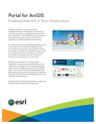
  • 1. Portal for ArcGIS Enabling Web GIS in Your Infrastructure Portal for ArcGIS is a mapcentric content management system that provides a framework to easily manage and secure geographic assets within your organization. It is an ArcGIS for Server extension that extends the reach of GIS to everyone in an organization, enabling better decision making. For organizations that have highly specialized security requirements, such as satisfying regulations that require data to be stored on servers within national boundaries or working in a completely disconnected (i.e., no Internet) environment, they can use Portal for ArcGIS® to implement web GIS in their own infrastructure (on-premises or in the cloud). Web GIS is a new pattern for delivering GIS capabilities: a key concept is that all members of an organization can easily access and leverage spatial information in a collaborative environment. ArcGIS SM Online is Esri’s cloud solution for enabling web GIS. Many organizations use a combination of on-premises (Portal for ArcGIS) and cloud (ArcGIS Online) for their web GIS implementations. At ArcGIS 10.3, Portal for ArcGIS will be included with ArcGIS for Server Standard and Advanced.
  • 2. Copyright © 2014 Esri. All rights reserved. Esri, the Esri globe logo, ArcGIS, and esri.com are trademarks, service marks, or registered marks of Esri in the United States, the European Community, or certain other jurisdictions. Other companies and products or services mentioned herein may be trademarks, service marks, or registered marks of their respective mark owners. 142543 ESRI6/14rk/sp For more information about Portal for ArcGIS, visit esri.com/portal. Organize Your GIS Resources . . . Enable Discovery Portal for ArcGIS provides a user-friendly experience to search, discover, and work with your GIS assets and resources, such as web services, maps, and apps. It can leverage your existing GIS investments and make them discoverable and more accessible. Portal for ArcGIS provides a platform for integrating GIS with other business systems and promotes cross- organizational collaboration. Empower People to Use and Create Maps Portal for ArcGIS includes a map viewer that enables a self-service mapping user experience. Portal users can easily find and compile GIS assets to create their own web maps, save them in Portal for ArcGIS, and share with others. In this way, Portal for ArcGIS promotes the collaboration of spatial content in your organization based on maps. Extend Your Reach With Apps Portal for ArcGIS also includes access to Collector for ArcGIS, Esri Maps for Office, Esri Maps for SharePoint, and Operations Dashboard for ArcGIS. These client applications are designed to work with Portal for ArcGIS and help to further extend the reach of your organization’s GIS assets to a broader user base.