SlideShare ist ein Scribd-Unternehmen logo
1 von 6
Downloaden Sie, um offline zu lesen
Esri®
Technology for National Intelligence
The Geospatial Platform for Multi-Intelligence Analysis
Turn Data into Actionable Intelligence
With ArcGIS, you can manage, analyze, and
visualize data from your Multi-INT sources and
bring it together into an easy-to-understand
geographic picture. Seemingly unrelated data from
satellite imagery, full-motion video, sensors, human
intelligence, social media, and other sources
is transformed to help determine options, set
priorities, and develop orders.
You can use ArcGIS server, portal, desktop,
mobile, and cloud software, templates, and
services with your workflows to do the following:
•	View assets and resources as you task, plan,
and direct intelligence activities
•	Collect, store, manage, and discover imagery
and other geospatial information
•	Process imagery and terrain data
•	Exploit, analyze, and fuse multiple data types
•	Disseminate and share data, products,
and services
National intelligence today involves monitoring a complex set of global threats, from cyberattacks
to political and social uprisings. Esri®
ArcGIS®
software, the complete geospatial technology
platform, works with all your multiple intelligence (Multi-INT) sources to produce timely, accurate,
and actionable intelligence for responding to those threats.
Use templates to improve workflows for analyzing incidents and patterns.
Better Source Management
Manage data from a variety of sources. Collect, catalog, and share multiple data types including video,
imagery, location information, and social media. Use tools and templates to maintain accurate, up-to-
date information that you can search for, find, and quickly add to your maps, apps, and presentations.
Powerful Analysis and Fusion
Analyze patterns, examine relationships, and determine probabilities using tools and templates. Fuse
data from multiple sources to create change detection, incident analyses, and other intelligence
information and products.
Create powerful image analysis products such as change detection.
Use web apps to find and edit imagery and other data.
esri.com/intelligence
Relevant Situational Awareness
Track assets, monitor indicators and warnings, and assess battle damage. View information in a
dashboard using an operational picture defined to fit your specific mission, with data synchronized in
near real time to help you make faster and smarter decisions.
Easy Information Sharing
Use secure web services; dashboards; office suite tools; and apps, such as story maps and mobile
briefing books, to share maps and other intelligence information in daily briefs, threat analysis reports,
and mission plans.
View events and other information in near
real time by using Operations Dashboard
for ArcGIS.
View and publish full-motion video within your map.
Share your information using interactive story maps.
Printed in USA
Contact Esri
380 New York Street
Redlands, California 92373-8100  usa
1 800 447 9778
t  909 793 2853
f  909 793 5953
info@esri.com
esri.com
Offices worldwide
esri.com/locations
Esri inspires and enables people to positively impact their
future through a deeper, geographic understanding of the
changing world around them.
Governments, industry leaders, academics, and nongovernmental
organizations trust us to connect them with the analytic knowledge
they need to make the critical decisions that shape the planet. For
more than 40 years, Esri has cultivated collaborative relationships
with partners who share our commitment to solving earth’s most
pressing challenges with geographic expertise and rational resolve.
Today, we believe that geography is at the heart of a more resilient
and sustainable future. Creating responsible products and solutions
drives our passion for improving quality of life everywhere.
Copyright © 2013 Esri. All rights reserved. Esri, the Esri globe logo, ArcGIS, @esri.com, and esri.com are
trademarks, service marks, or registered marks of Esri in the United States, the European Community, or certain
other jurisdictions. Other companies and products or services mentioned herein may be trademarks, service
marks, or registered marks of their respective mark owners.
135638
CRWN5M9/13sp

Weitere ähnliche Inhalte

Was ist angesagt?

ArcGIS: Better Aeronautical Data Management
ArcGIS: Better Aeronautical Data ManagementArcGIS: Better Aeronautical Data Management
ArcGIS: Better Aeronautical Data ManagementEsri
 
GIS in Africa 2
GIS in Africa 2GIS in Africa 2
GIS in Africa 2Esri
 
Improving Citizen Engagement: Gov 2.0
Improving Citizen Engagement: Gov 2.0Improving Citizen Engagement: Gov 2.0
Improving Citizen Engagement: Gov 2.0Esri
 
ArcGIS: A Platform for Intelligent 3D Imagery
ArcGIS: A Platform for Intelligent 3D ImageryArcGIS: A Platform for Intelligent 3D Imagery
ArcGIS: A Platform for Intelligent 3D ImageryEsri
 
ArcGIS for Local Government
ArcGIS for Local GovernmentArcGIS for Local Government
ArcGIS for Local GovernmentEsri
 
Esri Technology for Homeland Security
Esri Technology for Homeland SecurityEsri Technology for Homeland Security
Esri Technology for Homeland SecurityEsri
 
Esri News for State and Local Government Winter 2012/2013 issue
Esri News for State and Local Government Winter 2012/2013 issueEsri News for State and Local Government Winter 2012/2013 issue
Esri News for State and Local Government Winter 2012/2013 issueEsri
 
Esri Course Catalog 2014
Esri Course Catalog 2014Esri Course Catalog 2014
Esri Course Catalog 2014Esri
 
Spring 2013
Spring 2013Spring 2013
Spring 2013Esri
 
GIS for Facilities Overview
GIS for Facilities OverviewGIS for Facilities Overview
GIS for Facilities OverviewEsri
 
Spring 2013
Spring 2013Spring 2013
Spring 2013Esri
 
GIS for Everyone
GIS for EveryoneGIS for Everyone
GIS for EveryoneEsri
 
Esri News for Petroleum Winter 2012/2013 newsletter
Esri News for Petroleum Winter 2012/2013 newsletterEsri News for Petroleum Winter 2012/2013 newsletter
Esri News for Petroleum Winter 2012/2013 newsletterEsri
 
Esri News for Facilities Winter 2012/2013 newsletter
Esri News for Facilities Winter 2012/2013 newsletterEsri News for Facilities Winter 2012/2013 newsletter
Esri News for Facilities Winter 2012/2013 newsletterEsri
 
The NATO Core Geographic Services System
The NATO Core Geographic Services SystemThe NATO Core Geographic Services System
The NATO Core Geographic Services SystemEsri
 
MODERN trends of GIS
MODERN trends of GISMODERN trends of GIS
MODERN trends of GISVAISHALI JAIN
 
Future of GIS, Moving to the Enterprise Platform
Future of GIS, Moving to the Enterprise PlatformFuture of GIS, Moving to the Enterprise Platform
Future of GIS, Moving to the Enterprise PlatformSSP Innovations
 
Esri CityEngine
Esri CityEngineEsri CityEngine
Esri CityEngineEsri
 
Esri Location Analytics
Esri Location AnalyticsEsri Location Analytics
Esri Location AnalyticsEsri
 
What's New with the NCES SDDS and Web Mapping Tools - Blue Raster and Sanamet...
What's New with the NCES SDDS and Web Mapping Tools - Blue Raster and Sanamet...What's New with the NCES SDDS and Web Mapping Tools - Blue Raster and Sanamet...
What's New with the NCES SDDS and Web Mapping Tools - Blue Raster and Sanamet...Blue Raster
 

Was ist angesagt? (20)

ArcGIS: Better Aeronautical Data Management
ArcGIS: Better Aeronautical Data ManagementArcGIS: Better Aeronautical Data Management
ArcGIS: Better Aeronautical Data Management
 
GIS in Africa 2
GIS in Africa 2GIS in Africa 2
GIS in Africa 2
 
Improving Citizen Engagement: Gov 2.0
Improving Citizen Engagement: Gov 2.0Improving Citizen Engagement: Gov 2.0
Improving Citizen Engagement: Gov 2.0
 
ArcGIS: A Platform for Intelligent 3D Imagery
ArcGIS: A Platform for Intelligent 3D ImageryArcGIS: A Platform for Intelligent 3D Imagery
ArcGIS: A Platform for Intelligent 3D Imagery
 
ArcGIS for Local Government
ArcGIS for Local GovernmentArcGIS for Local Government
ArcGIS for Local Government
 
Esri Technology for Homeland Security
Esri Technology for Homeland SecurityEsri Technology for Homeland Security
Esri Technology for Homeland Security
 
Esri News for State and Local Government Winter 2012/2013 issue
Esri News for State and Local Government Winter 2012/2013 issueEsri News for State and Local Government Winter 2012/2013 issue
Esri News for State and Local Government Winter 2012/2013 issue
 
Esri Course Catalog 2014
Esri Course Catalog 2014Esri Course Catalog 2014
Esri Course Catalog 2014
 
Spring 2013
Spring 2013Spring 2013
Spring 2013
 
GIS for Facilities Overview
GIS for Facilities OverviewGIS for Facilities Overview
GIS for Facilities Overview
 
Spring 2013
Spring 2013Spring 2013
Spring 2013
 
GIS for Everyone
GIS for EveryoneGIS for Everyone
GIS for Everyone
 
Esri News for Petroleum Winter 2012/2013 newsletter
Esri News for Petroleum Winter 2012/2013 newsletterEsri News for Petroleum Winter 2012/2013 newsletter
Esri News for Petroleum Winter 2012/2013 newsletter
 
Esri News for Facilities Winter 2012/2013 newsletter
Esri News for Facilities Winter 2012/2013 newsletterEsri News for Facilities Winter 2012/2013 newsletter
Esri News for Facilities Winter 2012/2013 newsletter
 
The NATO Core Geographic Services System
The NATO Core Geographic Services SystemThe NATO Core Geographic Services System
The NATO Core Geographic Services System
 
MODERN trends of GIS
MODERN trends of GISMODERN trends of GIS
MODERN trends of GIS
 
Future of GIS, Moving to the Enterprise Platform
Future of GIS, Moving to the Enterprise PlatformFuture of GIS, Moving to the Enterprise Platform
Future of GIS, Moving to the Enterprise Platform
 
Esri CityEngine
Esri CityEngineEsri CityEngine
Esri CityEngine
 
Esri Location Analytics
Esri Location AnalyticsEsri Location Analytics
Esri Location Analytics
 
What's New with the NCES SDDS and Web Mapping Tools - Blue Raster and Sanamet...
What's New with the NCES SDDS and Web Mapping Tools - Blue Raster and Sanamet...What's New with the NCES SDDS and Web Mapping Tools - Blue Raster and Sanamet...
What's New with the NCES SDDS and Web Mapping Tools - Blue Raster and Sanamet...
 

Ähnlich wie Esri Technology for National Intelligence

GIS Platform for National Security
GIS Platform for National SecurityGIS Platform for National Security
GIS Platform for National SecurityEsri
 
Complete water system management with Esri
Complete water system management with EsriComplete water system management with Esri
Complete water system management with EsriEsri
 
Esri Maps for MicroStrategy
Esri Maps for MicroStrategyEsri Maps for MicroStrategy
Esri Maps for MicroStrategyEsri
 
Boost Mining Profits with Esri
Boost Mining Profits with EsriBoost Mining Profits with Esri
Boost Mining Profits with EsriEsri
 
ArcGIS Online
ArcGIS OnlineArcGIS Online
ArcGIS OnlineEsri
 
ArcGIS for National GIS Data Sharing
ArcGIS for National GIS Data SharingArcGIS for National GIS Data Sharing
ArcGIS for National GIS Data SharingEsri
 
Gis for Electric Distribution
Gis for Electric DistributionGis for Electric Distribution
Gis for Electric DistributionEsri
 
Richard Leadbeater - Technology Solutions for Improved Service Delivery - GCS16
Richard Leadbeater - Technology Solutions for Improved Service Delivery - GCS16Richard Leadbeater - Technology Solutions for Improved Service Delivery - GCS16
Richard Leadbeater - Technology Solutions for Improved Service Delivery - GCS16KC Digital Drive
 
GIS for Smart Grid
GIS for Smart GridGIS for Smart Grid
GIS for Smart GridEsri
 
ArcGIS
ArcGISArcGIS
ArcGISEsri
 
Esri Solutions for Water Resources Management
Esri Solutions for Water Resources ManagementEsri Solutions for Water Resources Management
Esri Solutions for Water Resources ManagementEsri
 
GIS for Electric Transmission
GIS for Electric TransmissionGIS for Electric Transmission
GIS for Electric TransmissionEsri
 
ArcGIS for Desktop
ArcGIS for DesktopArcGIS for Desktop
ArcGIS for DesktopEsri
 
Esri Maps for Office
Esri Maps for OfficeEsri Maps for Office
Esri Maps for OfficeEsri
 
Forest Management with Esri
Forest Management with EsriForest Management with Esri
Forest Management with EsriEsri
 
Arc news - Fall-2015
Arc news - Fall-2015Arc news - Fall-2015
Arc news - Fall-2015what3words
 
GIS for the Fire Service
GIS for the Fire ServiceGIS for the Fire Service
GIS for the Fire ServiceEsri
 

Ähnlich wie Esri Technology for National Intelligence (20)

GIS Platform for National Security
GIS Platform for National SecurityGIS Platform for National Security
GIS Platform for National Security
 
Complete water system management with Esri
Complete water system management with EsriComplete water system management with Esri
Complete water system management with Esri
 
Esri Maps for MicroStrategy
Esri Maps for MicroStrategyEsri Maps for MicroStrategy
Esri Maps for MicroStrategy
 
Boost Mining Profits with Esri
Boost Mining Profits with EsriBoost Mining Profits with Esri
Boost Mining Profits with Esri
 
Situational awareness
Situational awarenessSituational awareness
Situational awareness
 
ArcGIS Online
ArcGIS OnlineArcGIS Online
ArcGIS Online
 
ArcGIS for National GIS Data Sharing
ArcGIS for National GIS Data SharingArcGIS for National GIS Data Sharing
ArcGIS for National GIS Data Sharing
 
Gis for Electric Distribution
Gis for Electric DistributionGis for Electric Distribution
Gis for Electric Distribution
 
Richard Leadbeater - Technology Solutions for Improved Service Delivery - GCS16
Richard Leadbeater - Technology Solutions for Improved Service Delivery - GCS16Richard Leadbeater - Technology Solutions for Improved Service Delivery - GCS16
Richard Leadbeater - Technology Solutions for Improved Service Delivery - GCS16
 
GIS for Smart Grid
GIS for Smart GridGIS for Smart Grid
GIS for Smart Grid
 
ArcGIS
ArcGISArcGIS
ArcGIS
 
Esri Solutions for Water Resources Management
Esri Solutions for Water Resources ManagementEsri Solutions for Water Resources Management
Esri Solutions for Water Resources Management
 
GIS for Electric Transmission
GIS for Electric TransmissionGIS for Electric Transmission
GIS for Electric Transmission
 
ArcGIS for Desktop
ArcGIS for DesktopArcGIS for Desktop
ArcGIS for Desktop
 
Esri Maps for Office
Esri Maps for OfficeEsri Maps for Office
Esri Maps for Office
 
Gis
GisGis
Gis
 
EENA 2018 - Mapping Emergencies & Disasters
EENA 2018 - Mapping Emergencies & DisastersEENA 2018 - Mapping Emergencies & Disasters
EENA 2018 - Mapping Emergencies & Disasters
 
Forest Management with Esri
Forest Management with EsriForest Management with Esri
Forest Management with Esri
 
Arc news - Fall-2015
Arc news - Fall-2015Arc news - Fall-2015
Arc news - Fall-2015
 
GIS for the Fire Service
GIS for the Fire ServiceGIS for the Fire Service
GIS for the Fire Service
 

Mehr von Esri

INIA- CISA: Análisis de las amenazas en la fauna silvestre
INIA- CISA: Análisis de las amenazas en la fauna silvestreINIA- CISA: Análisis de las amenazas en la fauna silvestre
INIA- CISA: Análisis de las amenazas en la fauna silvestreEsri
 
Aena Aeropuerto Adolfo Suárez-Barajas crea potentes aplicaciones para sus cli...
Aena Aeropuerto Adolfo Suárez-Barajas crea potentes aplicaciones para sus cli...Aena Aeropuerto Adolfo Suárez-Barajas crea potentes aplicaciones para sus cli...
Aena Aeropuerto Adolfo Suárez-Barajas crea potentes aplicaciones para sus cli...Esri
 
Plataforma Smart City de Móstoles
Plataforma Smart City de MóstolesPlataforma Smart City de Móstoles
Plataforma Smart City de MóstolesEsri
 
ArcGIS Online para Organizaciones
ArcGIS Online para OrganizacionesArcGIS Online para Organizaciones
ArcGIS Online para OrganizacionesEsri
 
Molina de Segura se convierte en una smart city
Molina de Segura se convierte en una smart cityMolina de Segura se convierte en una smart city
Molina de Segura se convierte en una smart cityEsri
 
Portal for ArcGIS
Portal for ArcGISPortal for ArcGIS
Portal for ArcGISEsri
 
GIS-Based Web Services Provide Rapid Analysis and Dissemination of Maritime Data
GIS-Based Web Services Provide Rapid Analysis and Dissemination of Maritime DataGIS-Based Web Services Provide Rapid Analysis and Dissemination of Maritime Data
GIS-Based Web Services Provide Rapid Analysis and Dissemination of Maritime DataEsri
 
An Effective Tool for Drinking Water Protection
An Effective Tool for Drinking Water ProtectionAn Effective Tool for Drinking Water Protection
An Effective Tool for Drinking Water ProtectionEsri
 
GeoCollector for ArcPad
GeoCollector for ArcPadGeoCollector for ArcPad
GeoCollector for ArcPadEsri
 
GeoCollector for ArcGIS for Windows Mobile
GeoCollector for ArcGIS for Windows MobileGeoCollector for ArcGIS for Windows Mobile
GeoCollector for ArcGIS for Windows MobileEsri
 
Data Appliance for ArcGIS
Data Appliance for ArcGISData Appliance for ArcGIS
Data Appliance for ArcGISEsri
 
Esri and BlackBridge
Esri and BlackBridgeEsri and BlackBridge
Esri and BlackBridgeEsri
 
GeoPlanner for ArcGIS
GeoPlanner for ArcGISGeoPlanner for ArcGIS
GeoPlanner for ArcGISEsri
 
Esri and AccuWeather
Esri and AccuWeatherEsri and AccuWeather
Esri and AccuWeatherEsri
 
Esri and Airbus Defense & Space
Esri and Airbus Defense & SpaceEsri and Airbus Defense & Space
Esri and Airbus Defense & SpaceEsri
 
Esri US Data Fact Sheet
Esri US Data Fact SheetEsri US Data Fact Sheet
Esri US Data Fact SheetEsri
 
ArcGIS for Server on Microsoft Azure Jumpstart
ArcGIS for Server on Microsoft Azure JumpstartArcGIS for Server on Microsoft Azure Jumpstart
ArcGIS for Server on Microsoft Azure JumpstartEsri
 
ArcGIS for the Military--Maritime Operations
ArcGIS for the Military--Maritime OperationsArcGIS for the Military--Maritime Operations
ArcGIS for the Military--Maritime OperationsEsri
 
Esri Geoportal Server
Esri Geoportal ServerEsri Geoportal Server
Esri Geoportal ServerEsri
 
ArcGIS GeoEvent Extension for Server
ArcGIS GeoEvent Extension for ServerArcGIS GeoEvent Extension for Server
ArcGIS GeoEvent Extension for ServerEsri
 

Mehr von Esri (20)

INIA- CISA: Análisis de las amenazas en la fauna silvestre
INIA- CISA: Análisis de las amenazas en la fauna silvestreINIA- CISA: Análisis de las amenazas en la fauna silvestre
INIA- CISA: Análisis de las amenazas en la fauna silvestre
 
Aena Aeropuerto Adolfo Suárez-Barajas crea potentes aplicaciones para sus cli...
Aena Aeropuerto Adolfo Suárez-Barajas crea potentes aplicaciones para sus cli...Aena Aeropuerto Adolfo Suárez-Barajas crea potentes aplicaciones para sus cli...
Aena Aeropuerto Adolfo Suárez-Barajas crea potentes aplicaciones para sus cli...
 
Plataforma Smart City de Móstoles
Plataforma Smart City de MóstolesPlataforma Smart City de Móstoles
Plataforma Smart City de Móstoles
 
ArcGIS Online para Organizaciones
ArcGIS Online para OrganizacionesArcGIS Online para Organizaciones
ArcGIS Online para Organizaciones
 
Molina de Segura se convierte en una smart city
Molina de Segura se convierte en una smart cityMolina de Segura se convierte en una smart city
Molina de Segura se convierte en una smart city
 
Portal for ArcGIS
Portal for ArcGISPortal for ArcGIS
Portal for ArcGIS
 
GIS-Based Web Services Provide Rapid Analysis and Dissemination of Maritime Data
GIS-Based Web Services Provide Rapid Analysis and Dissemination of Maritime DataGIS-Based Web Services Provide Rapid Analysis and Dissemination of Maritime Data
GIS-Based Web Services Provide Rapid Analysis and Dissemination of Maritime Data
 
An Effective Tool for Drinking Water Protection
An Effective Tool for Drinking Water ProtectionAn Effective Tool for Drinking Water Protection
An Effective Tool for Drinking Water Protection
 
GeoCollector for ArcPad
GeoCollector for ArcPadGeoCollector for ArcPad
GeoCollector for ArcPad
 
GeoCollector for ArcGIS for Windows Mobile
GeoCollector for ArcGIS for Windows MobileGeoCollector for ArcGIS for Windows Mobile
GeoCollector for ArcGIS for Windows Mobile
 
Data Appliance for ArcGIS
Data Appliance for ArcGISData Appliance for ArcGIS
Data Appliance for ArcGIS
 
Esri and BlackBridge
Esri and BlackBridgeEsri and BlackBridge
Esri and BlackBridge
 
GeoPlanner for ArcGIS
GeoPlanner for ArcGISGeoPlanner for ArcGIS
GeoPlanner for ArcGIS
 
Esri and AccuWeather
Esri and AccuWeatherEsri and AccuWeather
Esri and AccuWeather
 
Esri and Airbus Defense & Space
Esri and Airbus Defense & SpaceEsri and Airbus Defense & Space
Esri and Airbus Defense & Space
 
Esri US Data Fact Sheet
Esri US Data Fact SheetEsri US Data Fact Sheet
Esri US Data Fact Sheet
 
ArcGIS for Server on Microsoft Azure Jumpstart
ArcGIS for Server on Microsoft Azure JumpstartArcGIS for Server on Microsoft Azure Jumpstart
ArcGIS for Server on Microsoft Azure Jumpstart
 
ArcGIS for the Military--Maritime Operations
ArcGIS for the Military--Maritime OperationsArcGIS for the Military--Maritime Operations
ArcGIS for the Military--Maritime Operations
 
Esri Geoportal Server
Esri Geoportal ServerEsri Geoportal Server
Esri Geoportal Server
 
ArcGIS GeoEvent Extension for Server
ArcGIS GeoEvent Extension for ServerArcGIS GeoEvent Extension for Server
ArcGIS GeoEvent Extension for Server
 

Kürzlich hochgeladen

08448380779 Call Girls In Friends Colony Women Seeking Men
08448380779 Call Girls In Friends Colony Women Seeking Men08448380779 Call Girls In Friends Colony Women Seeking Men
08448380779 Call Girls In Friends Colony Women Seeking MenDelhi Call girls
 
What Are The Drone Anti-jamming Systems Technology?
What Are The Drone Anti-jamming Systems Technology?What Are The Drone Anti-jamming Systems Technology?
What Are The Drone Anti-jamming Systems Technology?Antenna Manufacturer Coco
 
IAC 2024 - IA Fast Track to Search Focused AI Solutions
IAC 2024 - IA Fast Track to Search Focused AI SolutionsIAC 2024 - IA Fast Track to Search Focused AI Solutions
IAC 2024 - IA Fast Track to Search Focused AI SolutionsEnterprise Knowledge
 
Mastering MySQL Database Architecture: Deep Dive into MySQL Shell and MySQL R...
Mastering MySQL Database Architecture: Deep Dive into MySQL Shell and MySQL R...Mastering MySQL Database Architecture: Deep Dive into MySQL Shell and MySQL R...
Mastering MySQL Database Architecture: Deep Dive into MySQL Shell and MySQL R...Miguel Araújo
 
Apidays Singapore 2024 - Building Digital Trust in a Digital Economy by Veron...
Apidays Singapore 2024 - Building Digital Trust in a Digital Economy by Veron...Apidays Singapore 2024 - Building Digital Trust in a Digital Economy by Veron...
Apidays Singapore 2024 - Building Digital Trust in a Digital Economy by Veron...apidays
 
Boost PC performance: How more available memory can improve productivity
Boost PC performance: How more available memory can improve productivityBoost PC performance: How more available memory can improve productivity
Boost PC performance: How more available memory can improve productivityPrincipled Technologies
 
The Role of Taxonomy and Ontology in Semantic Layers - Heather Hedden.pdf
The Role of Taxonomy and Ontology in Semantic Layers - Heather Hedden.pdfThe Role of Taxonomy and Ontology in Semantic Layers - Heather Hedden.pdf
The Role of Taxonomy and Ontology in Semantic Layers - Heather Hedden.pdfEnterprise Knowledge
 
Understanding Discord NSFW Servers A Guide for Responsible Users.pdf
Understanding Discord NSFW Servers A Guide for Responsible Users.pdfUnderstanding Discord NSFW Servers A Guide for Responsible Users.pdf
Understanding Discord NSFW Servers A Guide for Responsible Users.pdfUK Journal
 
Raspberry Pi 5: Challenges and Solutions in Bringing up an OpenGL/Vulkan Driv...
Raspberry Pi 5: Challenges and Solutions in Bringing up an OpenGL/Vulkan Driv...Raspberry Pi 5: Challenges and Solutions in Bringing up an OpenGL/Vulkan Driv...
Raspberry Pi 5: Challenges and Solutions in Bringing up an OpenGL/Vulkan Driv...Igalia
 
[2024]Digital Global Overview Report 2024 Meltwater.pdf
[2024]Digital Global Overview Report 2024 Meltwater.pdf[2024]Digital Global Overview Report 2024 Meltwater.pdf
[2024]Digital Global Overview Report 2024 Meltwater.pdfhans926745
 
Axa Assurance Maroc - Insurer Innovation Award 2024
Axa Assurance Maroc - Insurer Innovation Award 2024Axa Assurance Maroc - Insurer Innovation Award 2024
Axa Assurance Maroc - Insurer Innovation Award 2024The Digital Insurer
 
Advantages of Hiring UIUX Design Service Providers for Your Business
Advantages of Hiring UIUX Design Service Providers for Your BusinessAdvantages of Hiring UIUX Design Service Providers for Your Business
Advantages of Hiring UIUX Design Service Providers for Your BusinessPixlogix Infotech
 
Real Time Object Detection Using Open CV
Real Time Object Detection Using Open CVReal Time Object Detection Using Open CV
Real Time Object Detection Using Open CVKhem
 
08448380779 Call Girls In Diplomatic Enclave Women Seeking Men
08448380779 Call Girls In Diplomatic Enclave Women Seeking Men08448380779 Call Girls In Diplomatic Enclave Women Seeking Men
08448380779 Call Girls In Diplomatic Enclave Women Seeking MenDelhi Call girls
 
EIS-Webinar-Prompt-Knowledge-Eng-2024-04-08.pptx
EIS-Webinar-Prompt-Knowledge-Eng-2024-04-08.pptxEIS-Webinar-Prompt-Knowledge-Eng-2024-04-08.pptx
EIS-Webinar-Prompt-Knowledge-Eng-2024-04-08.pptxEarley Information Science
 
08448380779 Call Girls In Greater Kailash - I Women Seeking Men
08448380779 Call Girls In Greater Kailash - I Women Seeking Men08448380779 Call Girls In Greater Kailash - I Women Seeking Men
08448380779 Call Girls In Greater Kailash - I Women Seeking MenDelhi Call girls
 
GenCyber Cyber Security Day Presentation
GenCyber Cyber Security Day PresentationGenCyber Cyber Security Day Presentation
GenCyber Cyber Security Day PresentationMichael W. Hawkins
 
Handwritten Text Recognition for manuscripts and early printed texts
Handwritten Text Recognition for manuscripts and early printed textsHandwritten Text Recognition for manuscripts and early printed texts
Handwritten Text Recognition for manuscripts and early printed textsMaria Levchenko
 
Tata AIG General Insurance Company - Insurer Innovation Award 2024
Tata AIG General Insurance Company - Insurer Innovation Award 2024Tata AIG General Insurance Company - Insurer Innovation Award 2024
Tata AIG General Insurance Company - Insurer Innovation Award 2024The Digital Insurer
 
Breaking the Kubernetes Kill Chain: Host Path Mount
Breaking the Kubernetes Kill Chain: Host Path MountBreaking the Kubernetes Kill Chain: Host Path Mount
Breaking the Kubernetes Kill Chain: Host Path MountPuma Security, LLC
 

Kürzlich hochgeladen (20)

08448380779 Call Girls In Friends Colony Women Seeking Men
08448380779 Call Girls In Friends Colony Women Seeking Men08448380779 Call Girls In Friends Colony Women Seeking Men
08448380779 Call Girls In Friends Colony Women Seeking Men
 
What Are The Drone Anti-jamming Systems Technology?
What Are The Drone Anti-jamming Systems Technology?What Are The Drone Anti-jamming Systems Technology?
What Are The Drone Anti-jamming Systems Technology?
 
IAC 2024 - IA Fast Track to Search Focused AI Solutions
IAC 2024 - IA Fast Track to Search Focused AI SolutionsIAC 2024 - IA Fast Track to Search Focused AI Solutions
IAC 2024 - IA Fast Track to Search Focused AI Solutions
 
Mastering MySQL Database Architecture: Deep Dive into MySQL Shell and MySQL R...
Mastering MySQL Database Architecture: Deep Dive into MySQL Shell and MySQL R...Mastering MySQL Database Architecture: Deep Dive into MySQL Shell and MySQL R...
Mastering MySQL Database Architecture: Deep Dive into MySQL Shell and MySQL R...
 
Apidays Singapore 2024 - Building Digital Trust in a Digital Economy by Veron...
Apidays Singapore 2024 - Building Digital Trust in a Digital Economy by Veron...Apidays Singapore 2024 - Building Digital Trust in a Digital Economy by Veron...
Apidays Singapore 2024 - Building Digital Trust in a Digital Economy by Veron...
 
Boost PC performance: How more available memory can improve productivity
Boost PC performance: How more available memory can improve productivityBoost PC performance: How more available memory can improve productivity
Boost PC performance: How more available memory can improve productivity
 
The Role of Taxonomy and Ontology in Semantic Layers - Heather Hedden.pdf
The Role of Taxonomy and Ontology in Semantic Layers - Heather Hedden.pdfThe Role of Taxonomy and Ontology in Semantic Layers - Heather Hedden.pdf
The Role of Taxonomy and Ontology in Semantic Layers - Heather Hedden.pdf
 
Understanding Discord NSFW Servers A Guide for Responsible Users.pdf
Understanding Discord NSFW Servers A Guide for Responsible Users.pdfUnderstanding Discord NSFW Servers A Guide for Responsible Users.pdf
Understanding Discord NSFW Servers A Guide for Responsible Users.pdf
 
Raspberry Pi 5: Challenges and Solutions in Bringing up an OpenGL/Vulkan Driv...
Raspberry Pi 5: Challenges and Solutions in Bringing up an OpenGL/Vulkan Driv...Raspberry Pi 5: Challenges and Solutions in Bringing up an OpenGL/Vulkan Driv...
Raspberry Pi 5: Challenges and Solutions in Bringing up an OpenGL/Vulkan Driv...
 
[2024]Digital Global Overview Report 2024 Meltwater.pdf
[2024]Digital Global Overview Report 2024 Meltwater.pdf[2024]Digital Global Overview Report 2024 Meltwater.pdf
[2024]Digital Global Overview Report 2024 Meltwater.pdf
 
Axa Assurance Maroc - Insurer Innovation Award 2024
Axa Assurance Maroc - Insurer Innovation Award 2024Axa Assurance Maroc - Insurer Innovation Award 2024
Axa Assurance Maroc - Insurer Innovation Award 2024
 
Advantages of Hiring UIUX Design Service Providers for Your Business
Advantages of Hiring UIUX Design Service Providers for Your BusinessAdvantages of Hiring UIUX Design Service Providers for Your Business
Advantages of Hiring UIUX Design Service Providers for Your Business
 
Real Time Object Detection Using Open CV
Real Time Object Detection Using Open CVReal Time Object Detection Using Open CV
Real Time Object Detection Using Open CV
 
08448380779 Call Girls In Diplomatic Enclave Women Seeking Men
08448380779 Call Girls In Diplomatic Enclave Women Seeking Men08448380779 Call Girls In Diplomatic Enclave Women Seeking Men
08448380779 Call Girls In Diplomatic Enclave Women Seeking Men
 
EIS-Webinar-Prompt-Knowledge-Eng-2024-04-08.pptx
EIS-Webinar-Prompt-Knowledge-Eng-2024-04-08.pptxEIS-Webinar-Prompt-Knowledge-Eng-2024-04-08.pptx
EIS-Webinar-Prompt-Knowledge-Eng-2024-04-08.pptx
 
08448380779 Call Girls In Greater Kailash - I Women Seeking Men
08448380779 Call Girls In Greater Kailash - I Women Seeking Men08448380779 Call Girls In Greater Kailash - I Women Seeking Men
08448380779 Call Girls In Greater Kailash - I Women Seeking Men
 
GenCyber Cyber Security Day Presentation
GenCyber Cyber Security Day PresentationGenCyber Cyber Security Day Presentation
GenCyber Cyber Security Day Presentation
 
Handwritten Text Recognition for manuscripts and early printed texts
Handwritten Text Recognition for manuscripts and early printed textsHandwritten Text Recognition for manuscripts and early printed texts
Handwritten Text Recognition for manuscripts and early printed texts
 
Tata AIG General Insurance Company - Insurer Innovation Award 2024
Tata AIG General Insurance Company - Insurer Innovation Award 2024Tata AIG General Insurance Company - Insurer Innovation Award 2024
Tata AIG General Insurance Company - Insurer Innovation Award 2024
 
Breaking the Kubernetes Kill Chain: Host Path Mount
Breaking the Kubernetes Kill Chain: Host Path MountBreaking the Kubernetes Kill Chain: Host Path Mount
Breaking the Kubernetes Kill Chain: Host Path Mount
 

Esri Technology for National Intelligence

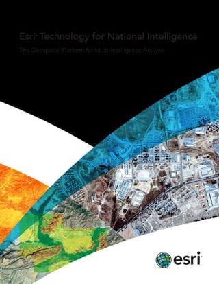
  • 1. Esri® Technology for National Intelligence The Geospatial Platform for Multi-Intelligence Analysis
  • 2. Turn Data into Actionable Intelligence With ArcGIS, you can manage, analyze, and visualize data from your Multi-INT sources and bring it together into an easy-to-understand geographic picture. Seemingly unrelated data from satellite imagery, full-motion video, sensors, human intelligence, social media, and other sources is transformed to help determine options, set priorities, and develop orders. You can use ArcGIS server, portal, desktop, mobile, and cloud software, templates, and services with your workflows to do the following: • View assets and resources as you task, plan, and direct intelligence activities • Collect, store, manage, and discover imagery and other geospatial information • Process imagery and terrain data • Exploit, analyze, and fuse multiple data types • Disseminate and share data, products, and services National intelligence today involves monitoring a complex set of global threats, from cyberattacks to political and social uprisings. Esri® ArcGIS® software, the complete geospatial technology platform, works with all your multiple intelligence (Multi-INT) sources to produce timely, accurate, and actionable intelligence for responding to those threats. Use templates to improve workflows for analyzing incidents and patterns.
  • 3.
  • 4. Better Source Management Manage data from a variety of sources. Collect, catalog, and share multiple data types including video, imagery, location information, and social media. Use tools and templates to maintain accurate, up-to- date information that you can search for, find, and quickly add to your maps, apps, and presentations. Powerful Analysis and Fusion Analyze patterns, examine relationships, and determine probabilities using tools and templates. Fuse data from multiple sources to create change detection, incident analyses, and other intelligence information and products. Create powerful image analysis products such as change detection. Use web apps to find and edit imagery and other data.
  • 5. esri.com/intelligence Relevant Situational Awareness Track assets, monitor indicators and warnings, and assess battle damage. View information in a dashboard using an operational picture defined to fit your specific mission, with data synchronized in near real time to help you make faster and smarter decisions. Easy Information Sharing Use secure web services; dashboards; office suite tools; and apps, such as story maps and mobile briefing books, to share maps and other intelligence information in daily briefs, threat analysis reports, and mission plans. View events and other information in near real time by using Operations Dashboard for ArcGIS. View and publish full-motion video within your map. Share your information using interactive story maps.
  • 6. Printed in USA Contact Esri 380 New York Street Redlands, California 92373-8100  usa 1 800 447 9778 t  909 793 2853 f  909 793 5953 info@esri.com esri.com Offices worldwide esri.com/locations Esri inspires and enables people to positively impact their future through a deeper, geographic understanding of the changing world around them. Governments, industry leaders, academics, and nongovernmental organizations trust us to connect them with the analytic knowledge they need to make the critical decisions that shape the planet. For more than 40 years, Esri has cultivated collaborative relationships with partners who share our commitment to solving earth’s most pressing challenges with geographic expertise and rational resolve. Today, we believe that geography is at the heart of a more resilient and sustainable future. Creating responsible products and solutions drives our passion for improving quality of life everywhere. Copyright © 2013 Esri. All rights reserved. Esri, the Esri globe logo, ArcGIS, @esri.com, and esri.com are trademarks, service marks, or registered marks of Esri in the United States, the European Community, or certain other jurisdictions. Other companies and products or services mentioned herein may be trademarks, service marks, or registered marks of their respective mark owners. 135638 CRWN5M9/13sp