SlideShare a Scribd company logo
1 of 4
Esri
®
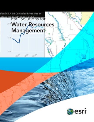
Solutions for
Water Resources
Management
3
A Better Design for Water Resources Management
Design water resources plans that will serve your community for years to come. From defining the problem to
creating the solution, rely on Esri®
to help you work through every phase of your planning process.
Understanding the Problem
Go deep into your data to understand the water resources
system. Esri offers a framework for you to manage large
complex datasets and visualize hydrologic information as
tables, charts, and maps. Integrate historical, real-time,
and projected information and rate the areas of greatest
concern. Create maps to analyze what has happened and
predict what could happen.
Create a high-water report using a map or a graph.
Considering Possibilities
Through planning and analysis you can work toward
meeting your sustainability goals. Use Esri®
geospatial
analysis and planning technologies to do these tasks:
•	 Track contaminants and identify their types,
locations, and sources
•	 Visualize and study climate and weather
•	 Create a 3D map of the watershed
•	 Correlate society and watershed relationships
•	 Compare scenarios using water system models
•	 Determine Floodplains
•	 Integrate engineering water models
4
Designing a Plan
Your job may be to create a plan for groundwater
reclamation or flood prevention activities. Esri products
allow you to use information from many sources to design
an integrated water resources management (IWRM)
solution. Our services and platforms create an environment
for planners to design stormwater management low impact
development (LID) plans. No matter what your needs may
be, Esri can help.
Getting Buy-in
You need sign-off to implement your plan. Make your
supporting information accessible to policy makers,
resource managers, environmentalists, and other
stakeholders. Rely on Esri web applications, online services,
and database search tools to get your data, applications,
and maps to the people who will authorize the plan.
Empower your staff with the tools they need to work with
local and state agencies, support researchers, equip policy
makers, and inform the public.
Use ArcGIS
sm
Online to build web mapping applications and publish
your work for others to use. This map, which was published on ArcGIS
Online, shows the average annual available water in South Asia.
Implementing a Solution
Built on industry standards, Esri technology works
seamlessly with core business systems. This means your
water resources staff can use geographic information
tools to accomplish plan-related tasks such as managing
regulatory compliance or issuing work orders. Esri
provides a complete system that water resources staff and
shareholders can continue to use everywhere, at any time,
and on any device.
Read case studies, explore options, and
connect with experts at
esri.com/waterresources.
Printed in USA
Contact Esri
380 New York Street
Redlands, California 92373-8100  usa
1 800 447 9778
t  909 793 2853
f  909 793 5953
info@esri.com
esri.com
Offices worldwide
esri.com/locations
Esri inspires and enables people to positively impact their
future through a deeper, geographic understanding of the
changing world around them.
Governments, industry leaders, academics, and nongovernmental
organizations trust us to connect them with the analytic knowledge
they need to make the critical decisions that shape the planet. For
more than 40 years, Esri has cultivated collaborative relationships
with partners who share our commitment to solving earth’s most
pressing challenges with geographic expertise and rational resolve.
Today, we believe that geography is at the heart of a more resilient
and sustainable future. Creating responsible products and solutions
drives our passion for improving quality of life everywhere.
Copyright © 2012 Esri. All rights reserved. Esri, the Esri globe logo, ArcGIS, @esri.com, and esri.com are
trademarks, service marks, or registered marks of Esri in the United States, the European Community, or certain
other jurisdictions. Other companies and products or services mentioned herein may be trademarks, service
marks, or registered marks of their respective mark owners.
132058
XXXXXX9/12dg

More Related Content

What's hot

GIS in South America
GIS in South AmericaGIS in South America
GIS in South AmericaEsri
 
2013 Enterprise Track, GIS Provides Dynamic Situational Awareness in the Adam...
2013 Enterprise Track, GIS Provides Dynamic Situational Awareness in the Adam...2013 Enterprise Track, GIS Provides Dynamic Situational Awareness in the Adam...
2013 Enterprise Track, GIS Provides Dynamic Situational Awareness in the Adam...GIS in the Rockies
 
Esri News for Health & Human Services Spring 2013 newsletter
Esri News for Health & Human Services Spring 2013 newsletterEsri News for Health & Human Services Spring 2013 newsletter
Esri News for Health & Human Services Spring 2013 newsletterEsri
 
GIS Platform for National Security
GIS Platform for National SecurityGIS Platform for National Security
GIS Platform for National SecurityEsri
 
Introduction to GIS _ 2014
Introduction to GIS _ 2014Introduction to GIS _ 2014
Introduction to GIS _ 2014Atiqa khan
 
Summer 2013
Summer 2013Summer 2013
Summer 2013Esri
 
ArcGIS: A Platform for Intelligent 3D Imagery
ArcGIS: A Platform for Intelligent 3D ImageryArcGIS: A Platform for Intelligent 3D Imagery
ArcGIS: A Platform for Intelligent 3D ImageryEsri
 
Disruptive Diner GIS Erin Barbaro
Disruptive Diner GIS Erin BarbaroDisruptive Diner GIS Erin Barbaro
Disruptive Diner GIS Erin BarbaroOpenly Disruptive
 
Esri Technology for Homeland Security
Esri Technology for Homeland SecurityEsri Technology for Homeland Security
Esri Technology for Homeland SecurityEsri
 
Blue Raster Natureserve Synergy Workshop Presentation
Blue Raster Natureserve Synergy Workshop PresentationBlue Raster Natureserve Synergy Workshop Presentation
Blue Raster Natureserve Synergy Workshop PresentationBlue Raster
 
Digital cartography and natural disaster management
Digital cartography and natural disaster managementDigital cartography and natural disaster management
Digital cartography and natural disaster managementGCUF
 
abstract on Solid waste management using remote sensing
abstract on Solid waste management  using remote sensingabstract on Solid waste management  using remote sensing
abstract on Solid waste management using remote sensingAglaia Connect
 
Calculus in different field
Calculus in different fieldCalculus in different field
Calculus in different fieldShayshab Azad
 

What's hot (16)

GIS in South America
GIS in South AmericaGIS in South America
GIS in South America
 
2013 Enterprise Track, GIS Provides Dynamic Situational Awareness in the Adam...
2013 Enterprise Track, GIS Provides Dynamic Situational Awareness in the Adam...2013 Enterprise Track, GIS Provides Dynamic Situational Awareness in the Adam...
2013 Enterprise Track, GIS Provides Dynamic Situational Awareness in the Adam...
 
Esri News for Health & Human Services Spring 2013 newsletter
Esri News for Health & Human Services Spring 2013 newsletterEsri News for Health & Human Services Spring 2013 newsletter
Esri News for Health & Human Services Spring 2013 newsletter
 
GIS Platform for National Security
GIS Platform for National SecurityGIS Platform for National Security
GIS Platform for National Security
 
Introduction to GIS _ 2014
Introduction to GIS _ 2014Introduction to GIS _ 2014
Introduction to GIS _ 2014
 
Summer 2013
Summer 2013Summer 2013
Summer 2013
 
GIS in EDS
GIS in EDSGIS in EDS
GIS in EDS
 
ArcGIS: A Platform for Intelligent 3D Imagery
ArcGIS: A Platform for Intelligent 3D ImageryArcGIS: A Platform for Intelligent 3D Imagery
ArcGIS: A Platform for Intelligent 3D Imagery
 
Disruptive Diner GIS Erin Barbaro
Disruptive Diner GIS Erin BarbaroDisruptive Diner GIS Erin Barbaro
Disruptive Diner GIS Erin Barbaro
 
Mobile app for i pad water resources
Mobile app for i pad water resourcesMobile app for i pad water resources
Mobile app for i pad water resources
 
Esri Technology for Homeland Security
Esri Technology for Homeland SecurityEsri Technology for Homeland Security
Esri Technology for Homeland Security
 
Blue Raster Natureserve Synergy Workshop Presentation
Blue Raster Natureserve Synergy Workshop PresentationBlue Raster Natureserve Synergy Workshop Presentation
Blue Raster Natureserve Synergy Workshop Presentation
 
Digital cartography and natural disaster management
Digital cartography and natural disaster managementDigital cartography and natural disaster management
Digital cartography and natural disaster management
 
Cap4City Template
Cap4City TemplateCap4City Template
Cap4City Template
 
abstract on Solid waste management using remote sensing
abstract on Solid waste management  using remote sensingabstract on Solid waste management  using remote sensing
abstract on Solid waste management using remote sensing
 
Calculus in different field
Calculus in different fieldCalculus in different field
Calculus in different field
 

Similar to Esri Solutions for Water Resources Management

ArcGIS for National GIS Data Sharing
ArcGIS for National GIS Data SharingArcGIS for National GIS Data Sharing
ArcGIS for National GIS Data SharingEsri
 
Spring 2013
Spring 2013Spring 2013
Spring 2013Esri
 
GIS for Everyone
GIS for EveryoneGIS for Everyone
GIS for EveryoneEsri
 
Esri News for Oceans Fall 2012 newsletter
Esri News for Oceans Fall 2012 newsletterEsri News for Oceans Fall 2012 newsletter
Esri News for Oceans Fall 2012 newsletterEsri
 
ArcGIS for Local Government
ArcGIS for Local GovernmentArcGIS for Local Government
ArcGIS for Local GovernmentEsri
 
ArcGIS
ArcGISArcGIS
ArcGISEsri
 
Esri News for State and Local Government Winter 2012/2013 issue
Esri News for State and Local Government Winter 2012/2013 issueEsri News for State and Local Government Winter 2012/2013 issue
Esri News for State and Local Government Winter 2012/2013 issueEsri
 
Esri Technology for National Intelligence
Esri Technology for National IntelligenceEsri Technology for National Intelligence
Esri Technology for National IntelligenceEsri
 
GIS for Facilities Overview
GIS for Facilities OverviewGIS for Facilities Overview
GIS for Facilities OverviewEsri
 
Boost Mining Profits with Esri
Boost Mining Profits with EsriBoost Mining Profits with Esri
Boost Mining Profits with EsriEsri
 
ArcGIS
ArcGISArcGIS
ArcGISEsri
 
Apa sustainability
Apa sustainabilityApa sustainability
Apa sustainabilityTerry Martin
 
GIS for Electric Transmission
GIS for Electric TransmissionGIS for Electric Transmission
GIS for Electric TransmissionEsri
 
Decision Support System
Decision Support System Decision Support System
Decision Support System priyabogra1
 
Implementing ArcGIS for Water Utilities
Implementing ArcGIS for Water UtilitiesImplementing ArcGIS for Water Utilities
Implementing ArcGIS for Water UtilitiesEsri
 
PMDataDrivenAdvertorial
PMDataDrivenAdvertorialPMDataDrivenAdvertorial
PMDataDrivenAdvertorialPeter LiCalsi
 
Improving Citizen Engagement: Gov 2.0
Improving Citizen Engagement: Gov 2.0Improving Citizen Engagement: Gov 2.0
Improving Citizen Engagement: Gov 2.0Esri
 
Gis for Electric Distribution
Gis for Electric DistributionGis for Electric Distribution
Gis for Electric DistributionEsri
 
Esri News for State and Local Government Spring 2013 issue
Esri News for State and Local Government Spring 2013 issueEsri News for State and Local Government Spring 2013 issue
Esri News for State and Local Government Spring 2013 issueEsri
 

Similar to Esri Solutions for Water Resources Management (20)

ArcGIS for National GIS Data Sharing
ArcGIS for National GIS Data SharingArcGIS for National GIS Data Sharing
ArcGIS for National GIS Data Sharing
 
Spring 2013
Spring 2013Spring 2013
Spring 2013
 
GIS for Everyone
GIS for EveryoneGIS for Everyone
GIS for Everyone
 
Esri News for Oceans Fall 2012 newsletter
Esri News for Oceans Fall 2012 newsletterEsri News for Oceans Fall 2012 newsletter
Esri News for Oceans Fall 2012 newsletter
 
ArcGIS for Local Government
ArcGIS for Local GovernmentArcGIS for Local Government
ArcGIS for Local Government
 
ArcGIS
ArcGISArcGIS
ArcGIS
 
Esri News for State and Local Government Winter 2012/2013 issue
Esri News for State and Local Government Winter 2012/2013 issueEsri News for State and Local Government Winter 2012/2013 issue
Esri News for State and Local Government Winter 2012/2013 issue
 
Esri Technology for National Intelligence
Esri Technology for National IntelligenceEsri Technology for National Intelligence
Esri Technology for National Intelligence
 
GIS for Facilities Overview
GIS for Facilities OverviewGIS for Facilities Overview
GIS for Facilities Overview
 
Boost Mining Profits with Esri
Boost Mining Profits with EsriBoost Mining Profits with Esri
Boost Mining Profits with Esri
 
ArcGIS
ArcGISArcGIS
ArcGIS
 
Apa sustainability
Apa sustainabilityApa sustainability
Apa sustainability
 
GIS for Electric Transmission
GIS for Electric TransmissionGIS for Electric Transmission
GIS for Electric Transmission
 
Decision Support System
Decision Support System Decision Support System
Decision Support System
 
Implementing ArcGIS for Water Utilities
Implementing ArcGIS for Water UtilitiesImplementing ArcGIS for Water Utilities
Implementing ArcGIS for Water Utilities
 
2013 GISitR Program
 2013 GISitR Program 2013 GISitR Program
2013 GISitR Program
 
PMDataDrivenAdvertorial
PMDataDrivenAdvertorialPMDataDrivenAdvertorial
PMDataDrivenAdvertorial
 
Improving Citizen Engagement: Gov 2.0
Improving Citizen Engagement: Gov 2.0Improving Citizen Engagement: Gov 2.0
Improving Citizen Engagement: Gov 2.0
 
Gis for Electric Distribution
Gis for Electric DistributionGis for Electric Distribution
Gis for Electric Distribution
 
Esri News for State and Local Government Spring 2013 issue
Esri News for State and Local Government Spring 2013 issueEsri News for State and Local Government Spring 2013 issue
Esri News for State and Local Government Spring 2013 issue
 

More from Esri

INIA- CISA: Análisis de las amenazas en la fauna silvestre
INIA- CISA: Análisis de las amenazas en la fauna silvestreINIA- CISA: Análisis de las amenazas en la fauna silvestre
INIA- CISA: Análisis de las amenazas en la fauna silvestreEsri
 
Aena Aeropuerto Adolfo Suárez-Barajas crea potentes aplicaciones para sus cli...
Aena Aeropuerto Adolfo Suárez-Barajas crea potentes aplicaciones para sus cli...Aena Aeropuerto Adolfo Suárez-Barajas crea potentes aplicaciones para sus cli...
Aena Aeropuerto Adolfo Suárez-Barajas crea potentes aplicaciones para sus cli...Esri
 
Plataforma Smart City de Móstoles
Plataforma Smart City de MóstolesPlataforma Smart City de Móstoles
Plataforma Smart City de MóstolesEsri
 
ArcGIS Online para Organizaciones
ArcGIS Online para OrganizacionesArcGIS Online para Organizaciones
ArcGIS Online para OrganizacionesEsri
 
Molina de Segura se convierte en una smart city
Molina de Segura se convierte en una smart cityMolina de Segura se convierte en una smart city
Molina de Segura se convierte en una smart cityEsri
 
Portal for ArcGIS
Portal for ArcGISPortal for ArcGIS
Portal for ArcGISEsri
 
GIS-Based Web Services Provide Rapid Analysis and Dissemination of Maritime Data
GIS-Based Web Services Provide Rapid Analysis and Dissemination of Maritime DataGIS-Based Web Services Provide Rapid Analysis and Dissemination of Maritime Data
GIS-Based Web Services Provide Rapid Analysis and Dissemination of Maritime DataEsri
 
An Effective Tool for Drinking Water Protection
An Effective Tool for Drinking Water ProtectionAn Effective Tool for Drinking Water Protection
An Effective Tool for Drinking Water ProtectionEsri
 
GeoCollector for ArcPad
GeoCollector for ArcPadGeoCollector for ArcPad
GeoCollector for ArcPadEsri
 
GeoCollector for ArcGIS for Windows Mobile
GeoCollector for ArcGIS for Windows MobileGeoCollector for ArcGIS for Windows Mobile
GeoCollector for ArcGIS for Windows MobileEsri
 
Data Appliance for ArcGIS
Data Appliance for ArcGISData Appliance for ArcGIS
Data Appliance for ArcGISEsri
 
Esri and BlackBridge
Esri and BlackBridgeEsri and BlackBridge
Esri and BlackBridgeEsri
 
GeoPlanner for ArcGIS
GeoPlanner for ArcGISGeoPlanner for ArcGIS
GeoPlanner for ArcGISEsri
 
Esri and AccuWeather
Esri and AccuWeatherEsri and AccuWeather
Esri and AccuWeatherEsri
 
Esri and Airbus Defense & Space
Esri and Airbus Defense & SpaceEsri and Airbus Defense & Space
Esri and Airbus Defense & SpaceEsri
 
Esri US Data Fact Sheet
Esri US Data Fact SheetEsri US Data Fact Sheet
Esri US Data Fact SheetEsri
 
ArcGIS for Server on Microsoft Azure Jumpstart
ArcGIS for Server on Microsoft Azure JumpstartArcGIS for Server on Microsoft Azure Jumpstart
ArcGIS for Server on Microsoft Azure JumpstartEsri
 
ArcGIS for the Military--Maritime Operations
ArcGIS for the Military--Maritime OperationsArcGIS for the Military--Maritime Operations
ArcGIS for the Military--Maritime OperationsEsri
 
Esri Geoportal Server
Esri Geoportal ServerEsri Geoportal Server
Esri Geoportal ServerEsri
 
ArcGIS GeoEvent Extension for Server
ArcGIS GeoEvent Extension for ServerArcGIS GeoEvent Extension for Server
ArcGIS GeoEvent Extension for ServerEsri
 

More from Esri (20)

INIA- CISA: Análisis de las amenazas en la fauna silvestre
INIA- CISA: Análisis de las amenazas en la fauna silvestreINIA- CISA: Análisis de las amenazas en la fauna silvestre
INIA- CISA: Análisis de las amenazas en la fauna silvestre
 
Aena Aeropuerto Adolfo Suárez-Barajas crea potentes aplicaciones para sus cli...
Aena Aeropuerto Adolfo Suárez-Barajas crea potentes aplicaciones para sus cli...Aena Aeropuerto Adolfo Suárez-Barajas crea potentes aplicaciones para sus cli...
Aena Aeropuerto Adolfo Suárez-Barajas crea potentes aplicaciones para sus cli...
 
Plataforma Smart City de Móstoles
Plataforma Smart City de MóstolesPlataforma Smart City de Móstoles
Plataforma Smart City de Móstoles
 
ArcGIS Online para Organizaciones
ArcGIS Online para OrganizacionesArcGIS Online para Organizaciones
ArcGIS Online para Organizaciones
 
Molina de Segura se convierte en una smart city
Molina de Segura se convierte en una smart cityMolina de Segura se convierte en una smart city
Molina de Segura se convierte en una smart city
 
Portal for ArcGIS
Portal for ArcGISPortal for ArcGIS
Portal for ArcGIS
 
GIS-Based Web Services Provide Rapid Analysis and Dissemination of Maritime Data
GIS-Based Web Services Provide Rapid Analysis and Dissemination of Maritime DataGIS-Based Web Services Provide Rapid Analysis and Dissemination of Maritime Data
GIS-Based Web Services Provide Rapid Analysis and Dissemination of Maritime Data
 
An Effective Tool for Drinking Water Protection
An Effective Tool for Drinking Water ProtectionAn Effective Tool for Drinking Water Protection
An Effective Tool for Drinking Water Protection
 
GeoCollector for ArcPad
GeoCollector for ArcPadGeoCollector for ArcPad
GeoCollector for ArcPad
 
GeoCollector for ArcGIS for Windows Mobile
GeoCollector for ArcGIS for Windows MobileGeoCollector for ArcGIS for Windows Mobile
GeoCollector for ArcGIS for Windows Mobile
 
Data Appliance for ArcGIS
Data Appliance for ArcGISData Appliance for ArcGIS
Data Appliance for ArcGIS
 
Esri and BlackBridge
Esri and BlackBridgeEsri and BlackBridge
Esri and BlackBridge
 
GeoPlanner for ArcGIS
GeoPlanner for ArcGISGeoPlanner for ArcGIS
GeoPlanner for ArcGIS
 
Esri and AccuWeather
Esri and AccuWeatherEsri and AccuWeather
Esri and AccuWeather
 
Esri and Airbus Defense & Space
Esri and Airbus Defense & SpaceEsri and Airbus Defense & Space
Esri and Airbus Defense & Space
 
Esri US Data Fact Sheet
Esri US Data Fact SheetEsri US Data Fact Sheet
Esri US Data Fact Sheet
 
ArcGIS for Server on Microsoft Azure Jumpstart
ArcGIS for Server on Microsoft Azure JumpstartArcGIS for Server on Microsoft Azure Jumpstart
ArcGIS for Server on Microsoft Azure Jumpstart
 
ArcGIS for the Military--Maritime Operations
ArcGIS for the Military--Maritime OperationsArcGIS for the Military--Maritime Operations
ArcGIS for the Military--Maritime Operations
 
Esri Geoportal Server
Esri Geoportal ServerEsri Geoportal Server
Esri Geoportal Server
 
ArcGIS GeoEvent Extension for Server
ArcGIS GeoEvent Extension for ServerArcGIS GeoEvent Extension for Server
ArcGIS GeoEvent Extension for Server
 

Recently uploaded

What is DBT - The Ultimate Data Build Tool.pdf
What is DBT - The Ultimate Data Build Tool.pdfWhat is DBT - The Ultimate Data Build Tool.pdf
What is DBT - The Ultimate Data Build Tool.pdfMounikaPolabathina
 
TrustArc Webinar - How to Build Consumer Trust Through Data Privacy
TrustArc Webinar - How to Build Consumer Trust Through Data PrivacyTrustArc Webinar - How to Build Consumer Trust Through Data Privacy
TrustArc Webinar - How to Build Consumer Trust Through Data PrivacyTrustArc
 
Moving Beyond Passwords: FIDO Paris Seminar.pdf
Moving Beyond Passwords: FIDO Paris Seminar.pdfMoving Beyond Passwords: FIDO Paris Seminar.pdf
Moving Beyond Passwords: FIDO Paris Seminar.pdfLoriGlavin3
 
Rise of the Machines: Known As Drones...
Rise of the Machines: Known As Drones...Rise of the Machines: Known As Drones...
Rise of the Machines: Known As Drones...Rick Flair
 
SALESFORCE EDUCATION CLOUD | FEXLE SERVICES
SALESFORCE EDUCATION CLOUD | FEXLE SERVICESSALESFORCE EDUCATION CLOUD | FEXLE SERVICES
SALESFORCE EDUCATION CLOUD | FEXLE SERVICESmohitsingh558521
 
Developer Data Modeling Mistakes: From Postgres to NoSQL
Developer Data Modeling Mistakes: From Postgres to NoSQLDeveloper Data Modeling Mistakes: From Postgres to NoSQL
Developer Data Modeling Mistakes: From Postgres to NoSQLScyllaDB
 
DevEX - reference for building teams, processes, and platforms
DevEX - reference for building teams, processes, and platformsDevEX - reference for building teams, processes, and platforms
DevEX - reference for building teams, processes, and platformsSergiu Bodiu
 
How AI, OpenAI, and ChatGPT impact business and software.
How AI, OpenAI, and ChatGPT impact business and software.How AI, OpenAI, and ChatGPT impact business and software.
How AI, OpenAI, and ChatGPT impact business and software.Curtis Poe
 
What's New in Teams Calling, Meetings and Devices March 2024
What's New in Teams Calling, Meetings and Devices March 2024What's New in Teams Calling, Meetings and Devices March 2024
What's New in Teams Calling, Meetings and Devices March 2024Stephanie Beckett
 
Dev Dives: Streamline document processing with UiPath Studio Web
Dev Dives: Streamline document processing with UiPath Studio WebDev Dives: Streamline document processing with UiPath Studio Web
Dev Dives: Streamline document processing with UiPath Studio WebUiPathCommunity
 
"Debugging python applications inside k8s environment", Andrii Soldatenko
"Debugging python applications inside k8s environment", Andrii Soldatenko"Debugging python applications inside k8s environment", Andrii Soldatenko
"Debugging python applications inside k8s environment", Andrii SoldatenkoFwdays
 
Training state-of-the-art general text embedding
Training state-of-the-art general text embeddingTraining state-of-the-art general text embedding
Training state-of-the-art general text embeddingZilliz
 
Gen AI in Business - Global Trends Report 2024.pdf
Gen AI in Business - Global Trends Report 2024.pdfGen AI in Business - Global Trends Report 2024.pdf
Gen AI in Business - Global Trends Report 2024.pdfAddepto
 
Take control of your SAP testing with UiPath Test Suite
Take control of your SAP testing with UiPath Test SuiteTake control of your SAP testing with UiPath Test Suite
Take control of your SAP testing with UiPath Test SuiteDianaGray10
 
Merck Moving Beyond Passwords: FIDO Paris Seminar.pptx
Merck Moving Beyond Passwords: FIDO Paris Seminar.pptxMerck Moving Beyond Passwords: FIDO Paris Seminar.pptx
Merck Moving Beyond Passwords: FIDO Paris Seminar.pptxLoriGlavin3
 
The Ultimate Guide to Choosing WordPress Pros and Cons
The Ultimate Guide to Choosing WordPress Pros and ConsThe Ultimate Guide to Choosing WordPress Pros and Cons
The Ultimate Guide to Choosing WordPress Pros and ConsPixlogix Infotech
 
WordPress Websites for Engineers: Elevate Your Brand
WordPress Websites for Engineers: Elevate Your BrandWordPress Websites for Engineers: Elevate Your Brand
WordPress Websites for Engineers: Elevate Your Brandgvaughan
 
How to write a Business Continuity Plan
How to write a Business Continuity PlanHow to write a Business Continuity Plan
How to write a Business Continuity PlanDatabarracks
 
The Fit for Passkeys for Employee and Consumer Sign-ins: FIDO Paris Seminar.pptx
The Fit for Passkeys for Employee and Consumer Sign-ins: FIDO Paris Seminar.pptxThe Fit for Passkeys for Employee and Consumer Sign-ins: FIDO Paris Seminar.pptx
The Fit for Passkeys for Employee and Consumer Sign-ins: FIDO Paris Seminar.pptxLoriGlavin3
 
TeamStation AI System Report LATAM IT Salaries 2024
TeamStation AI System Report LATAM IT Salaries 2024TeamStation AI System Report LATAM IT Salaries 2024
TeamStation AI System Report LATAM IT Salaries 2024Lonnie McRorey
 

Recently uploaded (20)

What is DBT - The Ultimate Data Build Tool.pdf
What is DBT - The Ultimate Data Build Tool.pdfWhat is DBT - The Ultimate Data Build Tool.pdf
What is DBT - The Ultimate Data Build Tool.pdf
 
TrustArc Webinar - How to Build Consumer Trust Through Data Privacy
TrustArc Webinar - How to Build Consumer Trust Through Data PrivacyTrustArc Webinar - How to Build Consumer Trust Through Data Privacy
TrustArc Webinar - How to Build Consumer Trust Through Data Privacy
 
Moving Beyond Passwords: FIDO Paris Seminar.pdf
Moving Beyond Passwords: FIDO Paris Seminar.pdfMoving Beyond Passwords: FIDO Paris Seminar.pdf
Moving Beyond Passwords: FIDO Paris Seminar.pdf
 
Rise of the Machines: Known As Drones...
Rise of the Machines: Known As Drones...Rise of the Machines: Known As Drones...
Rise of the Machines: Known As Drones...
 
SALESFORCE EDUCATION CLOUD | FEXLE SERVICES
SALESFORCE EDUCATION CLOUD | FEXLE SERVICESSALESFORCE EDUCATION CLOUD | FEXLE SERVICES
SALESFORCE EDUCATION CLOUD | FEXLE SERVICES
 
Developer Data Modeling Mistakes: From Postgres to NoSQL
Developer Data Modeling Mistakes: From Postgres to NoSQLDeveloper Data Modeling Mistakes: From Postgres to NoSQL
Developer Data Modeling Mistakes: From Postgres to NoSQL
 
DevEX - reference for building teams, processes, and platforms
DevEX - reference for building teams, processes, and platformsDevEX - reference for building teams, processes, and platforms
DevEX - reference for building teams, processes, and platforms
 
How AI, OpenAI, and ChatGPT impact business and software.
How AI, OpenAI, and ChatGPT impact business and software.How AI, OpenAI, and ChatGPT impact business and software.
How AI, OpenAI, and ChatGPT impact business and software.
 
What's New in Teams Calling, Meetings and Devices March 2024
What's New in Teams Calling, Meetings and Devices March 2024What's New in Teams Calling, Meetings and Devices March 2024
What's New in Teams Calling, Meetings and Devices March 2024
 
Dev Dives: Streamline document processing with UiPath Studio Web
Dev Dives: Streamline document processing with UiPath Studio WebDev Dives: Streamline document processing with UiPath Studio Web
Dev Dives: Streamline document processing with UiPath Studio Web
 
"Debugging python applications inside k8s environment", Andrii Soldatenko
"Debugging python applications inside k8s environment", Andrii Soldatenko"Debugging python applications inside k8s environment", Andrii Soldatenko
"Debugging python applications inside k8s environment", Andrii Soldatenko
 
Training state-of-the-art general text embedding
Training state-of-the-art general text embeddingTraining state-of-the-art general text embedding
Training state-of-the-art general text embedding
 
Gen AI in Business - Global Trends Report 2024.pdf
Gen AI in Business - Global Trends Report 2024.pdfGen AI in Business - Global Trends Report 2024.pdf
Gen AI in Business - Global Trends Report 2024.pdf
 
Take control of your SAP testing with UiPath Test Suite
Take control of your SAP testing with UiPath Test SuiteTake control of your SAP testing with UiPath Test Suite
Take control of your SAP testing with UiPath Test Suite
 
Merck Moving Beyond Passwords: FIDO Paris Seminar.pptx
Merck Moving Beyond Passwords: FIDO Paris Seminar.pptxMerck Moving Beyond Passwords: FIDO Paris Seminar.pptx
Merck Moving Beyond Passwords: FIDO Paris Seminar.pptx
 
The Ultimate Guide to Choosing WordPress Pros and Cons
The Ultimate Guide to Choosing WordPress Pros and ConsThe Ultimate Guide to Choosing WordPress Pros and Cons
The Ultimate Guide to Choosing WordPress Pros and Cons
 
WordPress Websites for Engineers: Elevate Your Brand
WordPress Websites for Engineers: Elevate Your BrandWordPress Websites for Engineers: Elevate Your Brand
WordPress Websites for Engineers: Elevate Your Brand
 
How to write a Business Continuity Plan
How to write a Business Continuity PlanHow to write a Business Continuity Plan
How to write a Business Continuity Plan
 
The Fit for Passkeys for Employee and Consumer Sign-ins: FIDO Paris Seminar.pptx
The Fit for Passkeys for Employee and Consumer Sign-ins: FIDO Paris Seminar.pptxThe Fit for Passkeys for Employee and Consumer Sign-ins: FIDO Paris Seminar.pptx
The Fit for Passkeys for Employee and Consumer Sign-ins: FIDO Paris Seminar.pptx
 
TeamStation AI System Report LATAM IT Salaries 2024
TeamStation AI System Report LATAM IT Salaries 2024TeamStation AI System Report LATAM IT Salaries 2024
TeamStation AI System Report LATAM IT Salaries 2024
 

Esri Solutions for Water Resources Management

  • 2. 3 A Better Design for Water Resources Management Design water resources plans that will serve your community for years to come. From defining the problem to creating the solution, rely on Esri® to help you work through every phase of your planning process. Understanding the Problem Go deep into your data to understand the water resources system. Esri offers a framework for you to manage large complex datasets and visualize hydrologic information as tables, charts, and maps. Integrate historical, real-time, and projected information and rate the areas of greatest concern. Create maps to analyze what has happened and predict what could happen. Create a high-water report using a map or a graph. Considering Possibilities Through planning and analysis you can work toward meeting your sustainability goals. Use Esri® geospatial analysis and planning technologies to do these tasks: • Track contaminants and identify their types, locations, and sources • Visualize and study climate and weather • Create a 3D map of the watershed • Correlate society and watershed relationships • Compare scenarios using water system models • Determine Floodplains • Integrate engineering water models
  • 3. 4 Designing a Plan Your job may be to create a plan for groundwater reclamation or flood prevention activities. Esri products allow you to use information from many sources to design an integrated water resources management (IWRM) solution. Our services and platforms create an environment for planners to design stormwater management low impact development (LID) plans. No matter what your needs may be, Esri can help. Getting Buy-in You need sign-off to implement your plan. Make your supporting information accessible to policy makers, resource managers, environmentalists, and other stakeholders. Rely on Esri web applications, online services, and database search tools to get your data, applications, and maps to the people who will authorize the plan. Empower your staff with the tools they need to work with local and state agencies, support researchers, equip policy makers, and inform the public. Use ArcGIS sm Online to build web mapping applications and publish your work for others to use. This map, which was published on ArcGIS Online, shows the average annual available water in South Asia. Implementing a Solution Built on industry standards, Esri technology works seamlessly with core business systems. This means your water resources staff can use geographic information tools to accomplish plan-related tasks such as managing regulatory compliance or issuing work orders. Esri provides a complete system that water resources staff and shareholders can continue to use everywhere, at any time, and on any device. Read case studies, explore options, and connect with experts at esri.com/waterresources.
  • 4. Printed in USA Contact Esri 380 New York Street Redlands, California 92373-8100  usa 1 800 447 9778 t  909 793 2853 f  909 793 5953 info@esri.com esri.com Offices worldwide esri.com/locations Esri inspires and enables people to positively impact their future through a deeper, geographic understanding of the changing world around them. Governments, industry leaders, academics, and nongovernmental organizations trust us to connect them with the analytic knowledge they need to make the critical decisions that shape the planet. For more than 40 years, Esri has cultivated collaborative relationships with partners who share our commitment to solving earth’s most pressing challenges with geographic expertise and rational resolve. Today, we believe that geography is at the heart of a more resilient and sustainable future. Creating responsible products and solutions drives our passion for improving quality of life everywhere. Copyright © 2012 Esri. All rights reserved. Esri, the Esri globe logo, ArcGIS, @esri.com, and esri.com are trademarks, service marks, or registered marks of Esri in the United States, the European Community, or certain other jurisdictions. Other companies and products or services mentioned herein may be trademarks, service marks, or registered marks of their respective mark owners. 132058 XXXXXX9/12dg