SlideShare ist ein Scribd-Unternehmen logo
1 von 4
Downloaden Sie, um offline zu lesen
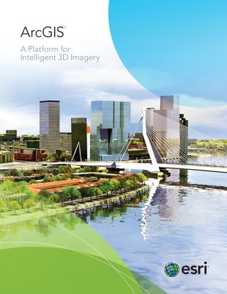
ArcGIS
A Platform for
Intelligent 3D Imagery
®
2D
GIS Lidar 3D
Map+ =
ArcGIS:
A Platform for Intelligent 3D Imagery
The ArcGIS®
platform provides more than simple, realistic 3D maps. Realize the full
potential of 3D data with the ArcGIS platform. Share 3D maps, apps, and content
through web browsers; create new 3D solutions via ArcGIS Runtime SDK for
Windows Mobile; and add 3D content into ArcGIS Marketplace. Get the most out
of your 3D mapping with ArcGIS.
Use existing 2D technology and data.
No need to change established processes, data, or technology—bring your existing 2D data to life in 3D with
ArcGIS. The height of 2D objects can be readily populated using information from many different types of sensors.
Automate processes
and workflows.
Automate the ingestion of imagery
and lidar. Instead of manually adding
heights to 2D building footprints
and contour lines or creating models
from scratch, set up automation once
and use it many times. Readily create
3D data for large geographic areas
including national mapping; city
mapping; or complex, data-rich
mapping inside facilities.
Unleash 3D.
Thanks to increased processing power of smart devices and the ability to bring
processing to the cloud, 3D data can be delivered anytime, anywhere.
Use Esri web scenes to easily create apps and share them with anyone.
Step 1
Geodatabase/2D
Information
Step 2
3D Streets, Blocks,
and Parcels (import
or creation)
Step 3
3D Extrusion, Roof
Generation, and
Street Furniture
Step 4
Texturing and Facade
Creation (details)
Step 5
Finished 3D City Shared on
the Web and Updated in
the Geodatabase
Power maps, apps, and analytics with an intelligent data model.
Esri’s 3D city information model allows users to move away from the need to access and
process hundreds of thousands of shapefiles to a database-centric production process.
Work in every scale, from city to building. Replicate environments and automate updates
so more time can be spent performing analytics.
The future is now. Extend 3D mapping to fuse all data, including full-motion video, and
create and use augmented reality. Provide 3D basemaps for standard visualizations or
to embed analytics. Interact with data in any number of ways. It all starts with standard
2D data and the familiar ArcGIS production environment.
Don’t wait —learn more at esri.com/3Dmapping.
Printed in USA
Contact Esri
380 New York Street
Redlands, California 92373-8100 USA
1 800 447 9778
T 909 793 2853
F 909 793 5953
info@esri.com
esri.com
Offices worldwide
esri.com/locations
Esri inspires and enables people to positively impact their
future through a deeper, geographic understanding of the
changing world around them.
Governments, industry leaders, academics, and nongovernmental
organizations trust us to connect them with the analytic knowledge
they need to make the critical decisions that shape the planet. For
more than 40 years, Esri has cultivated collaborative relationships
with partners who share our commitment to solving earth’s most
pressing challenges with geographic expertise and rational resolve.
Today, we believe that geography is at the heart of a more resilient
and sustainable future. Creating responsible products and solutions
drives our passion for improving quality of life everywhere.
Copyright © 2014 Esri. All rights reserved. Esri, the Esri globe logo, ArcGIS, ArcScene, @esri.com, and esri.com are
trademarks, service marks, or registered marks of Esri in the United States, the European Community, or certain
other jurisdictions. Other companies and products or services mentioned herein may be trademarks, service
marks, or registered marks of their respective mark owners.
139397
ESRI6C4/14dl

Weitere ähnliche Inhalte

Was ist angesagt?

Esri Technology for National Intelligence
Esri Technology for National IntelligenceEsri Technology for National Intelligence
Esri Technology for National IntelligenceEsri
 
Summer 2013
Summer 2013Summer 2013
Summer 2013Esri
 
GIS in South America
GIS in South AmericaGIS in South America
GIS in South AmericaEsri
 
ArcGIS Online
ArcGIS OnlineArcGIS Online
ArcGIS OnlineEsri
 
Esri News for Federal Government Winter 2012/2013 issue
Esri News for Federal Government Winter 2012/2013 issueEsri News for Federal Government Winter 2012/2013 issue
Esri News for Federal Government Winter 2012/2013 issueEsri
 
MODERN trends of GIS
MODERN trends of GISMODERN trends of GIS
MODERN trends of GISVAISHALI JAIN
 
GIS in Africa 2
GIS in Africa 2GIS in Africa 2
GIS in Africa 2Esri
 
The future of GIS as we know it
The future of GIS as we know itThe future of GIS as we know it
The future of GIS as we know itJan Willem van Eck
 
ArcGIS for Local Government
ArcGIS for Local GovernmentArcGIS for Local Government
ArcGIS for Local GovernmentEsri
 
Esri News for State and Local Government Winter 2012/2013 issue
Esri News for State and Local Government Winter 2012/2013 issueEsri News for State and Local Government Winter 2012/2013 issue
Esri News for State and Local Government Winter 2012/2013 issueEsri
 
Future of GIS, Moving to the Enterprise Platform
Future of GIS, Moving to the Enterprise PlatformFuture of GIS, Moving to the Enterprise Platform
Future of GIS, Moving to the Enterprise PlatformSSP Innovations
 
Location analytics-put-the-where
Location analytics-put-the-whereLocation analytics-put-the-where
Location analytics-put-the-whereEsri
 
ArcGIS for Desktop
ArcGIS for DesktopArcGIS for Desktop
ArcGIS for DesktopEsri
 
GIS for Facilities Overview
GIS for Facilities OverviewGIS for Facilities Overview
GIS for Facilities OverviewEsri
 
Arc news - Fall-2015
Arc news - Fall-2015Arc news - Fall-2015
Arc news - Fall-2015what3words
 
Spring 2013
Spring 2013Spring 2013
Spring 2013Esri
 
Spring 2013
Spring 2013Spring 2013
Spring 2013Esri
 
GIS for Everyone
GIS for EveryoneGIS for Everyone
GIS for EveryoneEsri
 
Esri CityEngine
Esri CityEngineEsri CityEngine
Esri CityEngineEsri
 
Esri News for Facilities Winter 2012/2013 newsletter
Esri News for Facilities Winter 2012/2013 newsletterEsri News for Facilities Winter 2012/2013 newsletter
Esri News for Facilities Winter 2012/2013 newsletterEsri
 

Was ist angesagt? (20)

Esri Technology for National Intelligence
Esri Technology for National IntelligenceEsri Technology for National Intelligence
Esri Technology for National Intelligence
 
Summer 2013
Summer 2013Summer 2013
Summer 2013
 
GIS in South America
GIS in South AmericaGIS in South America
GIS in South America
 
ArcGIS Online
ArcGIS OnlineArcGIS Online
ArcGIS Online
 
Esri News for Federal Government Winter 2012/2013 issue
Esri News for Federal Government Winter 2012/2013 issueEsri News for Federal Government Winter 2012/2013 issue
Esri News for Federal Government Winter 2012/2013 issue
 
MODERN trends of GIS
MODERN trends of GISMODERN trends of GIS
MODERN trends of GIS
 
GIS in Africa 2
GIS in Africa 2GIS in Africa 2
GIS in Africa 2
 
The future of GIS as we know it
The future of GIS as we know itThe future of GIS as we know it
The future of GIS as we know it
 
ArcGIS for Local Government
ArcGIS for Local GovernmentArcGIS for Local Government
ArcGIS for Local Government
 
Esri News for State and Local Government Winter 2012/2013 issue
Esri News for State and Local Government Winter 2012/2013 issueEsri News for State and Local Government Winter 2012/2013 issue
Esri News for State and Local Government Winter 2012/2013 issue
 
Future of GIS, Moving to the Enterprise Platform
Future of GIS, Moving to the Enterprise PlatformFuture of GIS, Moving to the Enterprise Platform
Future of GIS, Moving to the Enterprise Platform
 
Location analytics-put-the-where
Location analytics-put-the-whereLocation analytics-put-the-where
Location analytics-put-the-where
 
ArcGIS for Desktop
ArcGIS for DesktopArcGIS for Desktop
ArcGIS for Desktop
 
GIS for Facilities Overview
GIS for Facilities OverviewGIS for Facilities Overview
GIS for Facilities Overview
 
Arc news - Fall-2015
Arc news - Fall-2015Arc news - Fall-2015
Arc news - Fall-2015
 
Spring 2013
Spring 2013Spring 2013
Spring 2013
 
Spring 2013
Spring 2013Spring 2013
Spring 2013
 
GIS for Everyone
GIS for EveryoneGIS for Everyone
GIS for Everyone
 
Esri CityEngine
Esri CityEngineEsri CityEngine
Esri CityEngine
 
Esri News for Facilities Winter 2012/2013 newsletter
Esri News for Facilities Winter 2012/2013 newsletterEsri News for Facilities Winter 2012/2013 newsletter
Esri News for Facilities Winter 2012/2013 newsletter
 

Ähnlich wie ArcGIS: A Platform for Intelligent 3D Imagery

ArcGIS as a Platform
ArcGIS as a PlatformArcGIS as a Platform
ArcGIS as a PlatformGovLoop
 
StevesDWESlide_exported
StevesDWESlide_exportedStevesDWESlide_exported
StevesDWESlide_exportedSteve Snow
 
ArcGIS Online
ArcGIS OnlineArcGIS Online
ArcGIS OnlineEsri
 
Summer 2013
Summer 2013Summer 2013
Summer 2013Esri
 
Esri News for Petroleum Winter 2013/2014 newsletter
Esri News for Petroleum Winter 2013/2014 newsletterEsri News for Petroleum Winter 2013/2014 newsletter
Esri News for Petroleum Winter 2013/2014 newsletterEsri
 
Geocirrus cities overview v1.1.1
Geocirrus cities overview v1.1.1Geocirrus cities overview v1.1.1
Geocirrus cities overview v1.1.1RyanKent21
 
SkyMap Global - Google Maps Premier Partner
SkyMap Global - Google Maps Premier PartnerSkyMap Global - Google Maps Premier Partner
SkyMap Global - Google Maps Premier PartnerSkyMap Global
 
Esri Maps for MicroStrategy
Esri Maps for MicroStrategyEsri Maps for MicroStrategy
Esri Maps for MicroStrategyEsri
 
FlightlineGeo_ESRI_Newsletter_winter2014
FlightlineGeo_ESRI_Newsletter_winter2014FlightlineGeo_ESRI_Newsletter_winter2014
FlightlineGeo_ESRI_Newsletter_winter2014Devon Humphrey
 
ArcGIS por
ArcGIS porArcGIS por
ArcGIS porWizoAli
 
Richard Leadbeater - Technology Solutions for Improved Service Delivery - GCS16
Richard Leadbeater - Technology Solutions for Improved Service Delivery - GCS16Richard Leadbeater - Technology Solutions for Improved Service Delivery - GCS16
Richard Leadbeater - Technology Solutions for Improved Service Delivery - GCS16KC Digital Drive
 
3D GIS for urban development
3D GIS for urban development3D GIS for urban development
3D GIS for urban developmentYash Shah
 
AABSyS Information Technology Private Limited - A GIS, CAD and Software Company
AABSyS Information Technology Private Limited - A GIS, CAD and Software CompanyAABSyS Information Technology Private Limited - A GIS, CAD and Software Company
AABSyS Information Technology Private Limited - A GIS, CAD and Software Companywebaabsys
 
09165566d individual
09165566d individual09165566d individual
09165566d individuallsgi4321
 
ArcGIS
ArcGISArcGIS
ArcGISEsri
 
The Best Performing GIS Companies To Follow In 2023.pdf
The Best Performing GIS Companies To Follow In 2023.pdfThe Best Performing GIS Companies To Follow In 2023.pdf
The Best Performing GIS Companies To Follow In 2023.pdfCIOLOOKIndia
 

Ähnlich wie ArcGIS: A Platform for Intelligent 3D Imagery (20)

Esri cityengine
Esri cityengineEsri cityengine
Esri cityengine
 
ArcGIS as a Platform
ArcGIS as a PlatformArcGIS as a Platform
ArcGIS as a Platform
 
StevesDWESlide_exported
StevesDWESlide_exportedStevesDWESlide_exported
StevesDWESlide_exported
 
ArcGIS Online
ArcGIS OnlineArcGIS Online
ArcGIS Online
 
Summer 2013
Summer 2013Summer 2013
Summer 2013
 
Esri News for Petroleum Winter 2013/2014 newsletter
Esri News for Petroleum Winter 2013/2014 newsletterEsri News for Petroleum Winter 2013/2014 newsletter
Esri News for Petroleum Winter 2013/2014 newsletter
 
Day4_WebGIS
Day4_WebGISDay4_WebGIS
Day4_WebGIS
 
Geocirrus cities overview v1.1.1
Geocirrus cities overview v1.1.1Geocirrus cities overview v1.1.1
Geocirrus cities overview v1.1.1
 
( G . i . s )
( G . i . s )( G . i . s )
( G . i . s )
 
SkyMap Global - Google Maps Premier Partner
SkyMap Global - Google Maps Premier PartnerSkyMap Global - Google Maps Premier Partner
SkyMap Global - Google Maps Premier Partner
 
Esri Maps for MicroStrategy
Esri Maps for MicroStrategyEsri Maps for MicroStrategy
Esri Maps for MicroStrategy
 
FlightlineGeo_ESRI_Newsletter_winter2014
FlightlineGeo_ESRI_Newsletter_winter2014FlightlineGeo_ESRI_Newsletter_winter2014
FlightlineGeo_ESRI_Newsletter_winter2014
 
ArcGIS por
ArcGIS porArcGIS por
ArcGIS por
 
Richard Leadbeater - Technology Solutions for Improved Service Delivery - GCS16
Richard Leadbeater - Technology Solutions for Improved Service Delivery - GCS16Richard Leadbeater - Technology Solutions for Improved Service Delivery - GCS16
Richard Leadbeater - Technology Solutions for Improved Service Delivery - GCS16
 
3D GIS for urban development
3D GIS for urban development3D GIS for urban development
3D GIS for urban development
 
Insights success the 10 fastest growing gis solution providers 18th dec 2017
Insights success the 10 fastest growing gis solution providers 18th dec 2017Insights success the 10 fastest growing gis solution providers 18th dec 2017
Insights success the 10 fastest growing gis solution providers 18th dec 2017
 
AABSyS Information Technology Private Limited - A GIS, CAD and Software Company
AABSyS Information Technology Private Limited - A GIS, CAD and Software CompanyAABSyS Information Technology Private Limited - A GIS, CAD and Software Company
AABSyS Information Technology Private Limited - A GIS, CAD and Software Company
 
09165566d individual
09165566d individual09165566d individual
09165566d individual
 
ArcGIS
ArcGISArcGIS
ArcGIS
 
The Best Performing GIS Companies To Follow In 2023.pdf
The Best Performing GIS Companies To Follow In 2023.pdfThe Best Performing GIS Companies To Follow In 2023.pdf
The Best Performing GIS Companies To Follow In 2023.pdf
 

Mehr von Esri

INIA- CISA: Análisis de las amenazas en la fauna silvestre
INIA- CISA: Análisis de las amenazas en la fauna silvestreINIA- CISA: Análisis de las amenazas en la fauna silvestre
INIA- CISA: Análisis de las amenazas en la fauna silvestreEsri
 
Aena Aeropuerto Adolfo Suárez-Barajas crea potentes aplicaciones para sus cli...
Aena Aeropuerto Adolfo Suárez-Barajas crea potentes aplicaciones para sus cli...Aena Aeropuerto Adolfo Suárez-Barajas crea potentes aplicaciones para sus cli...
Aena Aeropuerto Adolfo Suárez-Barajas crea potentes aplicaciones para sus cli...Esri
 
Plataforma Smart City de Móstoles
Plataforma Smart City de MóstolesPlataforma Smart City de Móstoles
Plataforma Smart City de MóstolesEsri
 
ArcGIS Online para Organizaciones
ArcGIS Online para OrganizacionesArcGIS Online para Organizaciones
ArcGIS Online para OrganizacionesEsri
 
Molina de Segura se convierte en una smart city
Molina de Segura se convierte en una smart cityMolina de Segura se convierte en una smart city
Molina de Segura se convierte en una smart cityEsri
 
Portal for ArcGIS
Portal for ArcGISPortal for ArcGIS
Portal for ArcGISEsri
 
GIS-Based Web Services Provide Rapid Analysis and Dissemination of Maritime Data
GIS-Based Web Services Provide Rapid Analysis and Dissemination of Maritime DataGIS-Based Web Services Provide Rapid Analysis and Dissemination of Maritime Data
GIS-Based Web Services Provide Rapid Analysis and Dissemination of Maritime DataEsri
 
An Effective Tool for Drinking Water Protection
An Effective Tool for Drinking Water ProtectionAn Effective Tool for Drinking Water Protection
An Effective Tool for Drinking Water ProtectionEsri
 
GeoCollector for ArcPad
GeoCollector for ArcPadGeoCollector for ArcPad
GeoCollector for ArcPadEsri
 
GeoCollector for ArcGIS for Windows Mobile
GeoCollector for ArcGIS for Windows MobileGeoCollector for ArcGIS for Windows Mobile
GeoCollector for ArcGIS for Windows MobileEsri
 
Data Appliance for ArcGIS
Data Appliance for ArcGISData Appliance for ArcGIS
Data Appliance for ArcGISEsri
 
Esri and BlackBridge
Esri and BlackBridgeEsri and BlackBridge
Esri and BlackBridgeEsri
 
GeoPlanner for ArcGIS
GeoPlanner for ArcGISGeoPlanner for ArcGIS
GeoPlanner for ArcGISEsri
 
Esri and AccuWeather
Esri and AccuWeatherEsri and AccuWeather
Esri and AccuWeatherEsri
 
Esri and Airbus Defense & Space
Esri and Airbus Defense & SpaceEsri and Airbus Defense & Space
Esri and Airbus Defense & SpaceEsri
 
Esri US Data Fact Sheet
Esri US Data Fact SheetEsri US Data Fact Sheet
Esri US Data Fact SheetEsri
 
ArcGIS for Server on Microsoft Azure Jumpstart
ArcGIS for Server on Microsoft Azure JumpstartArcGIS for Server on Microsoft Azure Jumpstart
ArcGIS for Server on Microsoft Azure JumpstartEsri
 
ArcGIS for the Military--Maritime Operations
ArcGIS for the Military--Maritime OperationsArcGIS for the Military--Maritime Operations
ArcGIS for the Military--Maritime OperationsEsri
 
Esri Geoportal Server
Esri Geoportal ServerEsri Geoportal Server
Esri Geoportal ServerEsri
 
ArcGIS GeoEvent Extension for Server
ArcGIS GeoEvent Extension for ServerArcGIS GeoEvent Extension for Server
ArcGIS GeoEvent Extension for ServerEsri
 

Mehr von Esri (20)

INIA- CISA: Análisis de las amenazas en la fauna silvestre
INIA- CISA: Análisis de las amenazas en la fauna silvestreINIA- CISA: Análisis de las amenazas en la fauna silvestre
INIA- CISA: Análisis de las amenazas en la fauna silvestre
 
Aena Aeropuerto Adolfo Suárez-Barajas crea potentes aplicaciones para sus cli...
Aena Aeropuerto Adolfo Suárez-Barajas crea potentes aplicaciones para sus cli...Aena Aeropuerto Adolfo Suárez-Barajas crea potentes aplicaciones para sus cli...
Aena Aeropuerto Adolfo Suárez-Barajas crea potentes aplicaciones para sus cli...
 
Plataforma Smart City de Móstoles
Plataforma Smart City de MóstolesPlataforma Smart City de Móstoles
Plataforma Smart City de Móstoles
 
ArcGIS Online para Organizaciones
ArcGIS Online para OrganizacionesArcGIS Online para Organizaciones
ArcGIS Online para Organizaciones
 
Molina de Segura se convierte en una smart city
Molina de Segura se convierte en una smart cityMolina de Segura se convierte en una smart city
Molina de Segura se convierte en una smart city
 
Portal for ArcGIS
Portal for ArcGISPortal for ArcGIS
Portal for ArcGIS
 
GIS-Based Web Services Provide Rapid Analysis and Dissemination of Maritime Data
GIS-Based Web Services Provide Rapid Analysis and Dissemination of Maritime DataGIS-Based Web Services Provide Rapid Analysis and Dissemination of Maritime Data
GIS-Based Web Services Provide Rapid Analysis and Dissemination of Maritime Data
 
An Effective Tool for Drinking Water Protection
An Effective Tool for Drinking Water ProtectionAn Effective Tool for Drinking Water Protection
An Effective Tool for Drinking Water Protection
 
GeoCollector for ArcPad
GeoCollector for ArcPadGeoCollector for ArcPad
GeoCollector for ArcPad
 
GeoCollector for ArcGIS for Windows Mobile
GeoCollector for ArcGIS for Windows MobileGeoCollector for ArcGIS for Windows Mobile
GeoCollector for ArcGIS for Windows Mobile
 
Data Appliance for ArcGIS
Data Appliance for ArcGISData Appliance for ArcGIS
Data Appliance for ArcGIS
 
Esri and BlackBridge
Esri and BlackBridgeEsri and BlackBridge
Esri and BlackBridge
 
GeoPlanner for ArcGIS
GeoPlanner for ArcGISGeoPlanner for ArcGIS
GeoPlanner for ArcGIS
 
Esri and AccuWeather
Esri and AccuWeatherEsri and AccuWeather
Esri and AccuWeather
 
Esri and Airbus Defense & Space
Esri and Airbus Defense & SpaceEsri and Airbus Defense & Space
Esri and Airbus Defense & Space
 
Esri US Data Fact Sheet
Esri US Data Fact SheetEsri US Data Fact Sheet
Esri US Data Fact Sheet
 
ArcGIS for Server on Microsoft Azure Jumpstart
ArcGIS for Server on Microsoft Azure JumpstartArcGIS for Server on Microsoft Azure Jumpstart
ArcGIS for Server on Microsoft Azure Jumpstart
 
ArcGIS for the Military--Maritime Operations
ArcGIS for the Military--Maritime OperationsArcGIS for the Military--Maritime Operations
ArcGIS for the Military--Maritime Operations
 
Esri Geoportal Server
Esri Geoportal ServerEsri Geoportal Server
Esri Geoportal Server
 
ArcGIS GeoEvent Extension for Server
ArcGIS GeoEvent Extension for ServerArcGIS GeoEvent Extension for Server
ArcGIS GeoEvent Extension for Server
 

Kürzlich hochgeladen

Breaking the Kubernetes Kill Chain: Host Path Mount
Breaking the Kubernetes Kill Chain: Host Path MountBreaking the Kubernetes Kill Chain: Host Path Mount
Breaking the Kubernetes Kill Chain: Host Path MountPuma Security, LLC
 
TrustArc Webinar - Stay Ahead of US State Data Privacy Law Developments
TrustArc Webinar - Stay Ahead of US State Data Privacy Law DevelopmentsTrustArc Webinar - Stay Ahead of US State Data Privacy Law Developments
TrustArc Webinar - Stay Ahead of US State Data Privacy Law DevelopmentsTrustArc
 
Workshop - Best of Both Worlds_ Combine KG and Vector search for enhanced R...
Workshop - Best of Both Worlds_ Combine  KG and Vector search for  enhanced R...Workshop - Best of Both Worlds_ Combine  KG and Vector search for  enhanced R...
Workshop - Best of Both Worlds_ Combine KG and Vector search for enhanced R...Neo4j
 
Raspberry Pi 5: Challenges and Solutions in Bringing up an OpenGL/Vulkan Driv...
Raspberry Pi 5: Challenges and Solutions in Bringing up an OpenGL/Vulkan Driv...Raspberry Pi 5: Challenges and Solutions in Bringing up an OpenGL/Vulkan Driv...
Raspberry Pi 5: Challenges and Solutions in Bringing up an OpenGL/Vulkan Driv...Igalia
 
2024: Domino Containers - The Next Step. News from the Domino Container commu...
2024: Domino Containers - The Next Step. News from the Domino Container commu...2024: Domino Containers - The Next Step. News from the Domino Container commu...
2024: Domino Containers - The Next Step. News from the Domino Container commu...Martijn de Jong
 
Handwritten Text Recognition for manuscripts and early printed texts
Handwritten Text Recognition for manuscripts and early printed textsHandwritten Text Recognition for manuscripts and early printed texts
Handwritten Text Recognition for manuscripts and early printed textsMaria Levchenko
 
Strategies for Unlocking Knowledge Management in Microsoft 365 in the Copilot...
Strategies for Unlocking Knowledge Management in Microsoft 365 in the Copilot...Strategies for Unlocking Knowledge Management in Microsoft 365 in the Copilot...
Strategies for Unlocking Knowledge Management in Microsoft 365 in the Copilot...Drew Madelung
 
Powerful Google developer tools for immediate impact! (2023-24 C)
Powerful Google developer tools for immediate impact! (2023-24 C)Powerful Google developer tools for immediate impact! (2023-24 C)
Powerful Google developer tools for immediate impact! (2023-24 C)wesley chun
 
Driving Behavioral Change for Information Management through Data-Driven Gree...
Driving Behavioral Change for Information Management through Data-Driven Gree...Driving Behavioral Change for Information Management through Data-Driven Gree...
Driving Behavioral Change for Information Management through Data-Driven Gree...Enterprise Knowledge
 
[2024]Digital Global Overview Report 2024 Meltwater.pdf
[2024]Digital Global Overview Report 2024 Meltwater.pdf[2024]Digital Global Overview Report 2024 Meltwater.pdf
[2024]Digital Global Overview Report 2024 Meltwater.pdfhans926745
 
Presentation on how to chat with PDF using ChatGPT code interpreter
Presentation on how to chat with PDF using ChatGPT code interpreterPresentation on how to chat with PDF using ChatGPT code interpreter
Presentation on how to chat with PDF using ChatGPT code interpreternaman860154
 
04-2024-HHUG-Sales-and-Marketing-Alignment.pptx
04-2024-HHUG-Sales-and-Marketing-Alignment.pptx04-2024-HHUG-Sales-and-Marketing-Alignment.pptx
04-2024-HHUG-Sales-and-Marketing-Alignment.pptxHampshireHUG
 
Histor y of HAM Radio presentation slide
Histor y of HAM Radio presentation slideHistor y of HAM Radio presentation slide
Histor y of HAM Radio presentation slidevu2urc
 
What Are The Drone Anti-jamming Systems Technology?
What Are The Drone Anti-jamming Systems Technology?What Are The Drone Anti-jamming Systems Technology?
What Are The Drone Anti-jamming Systems Technology?Antenna Manufacturer Coco
 
Finology Group – Insurtech Innovation Award 2024
Finology Group – Insurtech Innovation Award 2024Finology Group – Insurtech Innovation Award 2024
Finology Group – Insurtech Innovation Award 2024The Digital Insurer
 
Slack Application Development 101 Slides
Slack Application Development 101 SlidesSlack Application Development 101 Slides
Slack Application Development 101 Slidespraypatel2
 
The Codex of Business Writing Software for Real-World Solutions 2.pptx
The Codex of Business Writing Software for Real-World Solutions 2.pptxThe Codex of Business Writing Software for Real-World Solutions 2.pptx
The Codex of Business Writing Software for Real-World Solutions 2.pptxMalak Abu Hammad
 
A Year of the Servo Reboot: Where Are We Now?
A Year of the Servo Reboot: Where Are We Now?A Year of the Servo Reboot: Where Are We Now?
A Year of the Servo Reboot: Where Are We Now?Igalia
 
How to convert PDF to text with Nanonets
How to convert PDF to text with NanonetsHow to convert PDF to text with Nanonets
How to convert PDF to text with Nanonetsnaman860154
 
08448380779 Call Girls In Diplomatic Enclave Women Seeking Men
08448380779 Call Girls In Diplomatic Enclave Women Seeking Men08448380779 Call Girls In Diplomatic Enclave Women Seeking Men
08448380779 Call Girls In Diplomatic Enclave Women Seeking MenDelhi Call girls
 

Kürzlich hochgeladen (20)

Breaking the Kubernetes Kill Chain: Host Path Mount
Breaking the Kubernetes Kill Chain: Host Path MountBreaking the Kubernetes Kill Chain: Host Path Mount
Breaking the Kubernetes Kill Chain: Host Path Mount
 
TrustArc Webinar - Stay Ahead of US State Data Privacy Law Developments
TrustArc Webinar - Stay Ahead of US State Data Privacy Law DevelopmentsTrustArc Webinar - Stay Ahead of US State Data Privacy Law Developments
TrustArc Webinar - Stay Ahead of US State Data Privacy Law Developments
 
Workshop - Best of Both Worlds_ Combine KG and Vector search for enhanced R...
Workshop - Best of Both Worlds_ Combine  KG and Vector search for  enhanced R...Workshop - Best of Both Worlds_ Combine  KG and Vector search for  enhanced R...
Workshop - Best of Both Worlds_ Combine KG and Vector search for enhanced R...
 
Raspberry Pi 5: Challenges and Solutions in Bringing up an OpenGL/Vulkan Driv...
Raspberry Pi 5: Challenges and Solutions in Bringing up an OpenGL/Vulkan Driv...Raspberry Pi 5: Challenges and Solutions in Bringing up an OpenGL/Vulkan Driv...
Raspberry Pi 5: Challenges and Solutions in Bringing up an OpenGL/Vulkan Driv...
 
2024: Domino Containers - The Next Step. News from the Domino Container commu...
2024: Domino Containers - The Next Step. News from the Domino Container commu...2024: Domino Containers - The Next Step. News from the Domino Container commu...
2024: Domino Containers - The Next Step. News from the Domino Container commu...
 
Handwritten Text Recognition for manuscripts and early printed texts
Handwritten Text Recognition for manuscripts and early printed textsHandwritten Text Recognition for manuscripts and early printed texts
Handwritten Text Recognition for manuscripts and early printed texts
 
Strategies for Unlocking Knowledge Management in Microsoft 365 in the Copilot...
Strategies for Unlocking Knowledge Management in Microsoft 365 in the Copilot...Strategies for Unlocking Knowledge Management in Microsoft 365 in the Copilot...
Strategies for Unlocking Knowledge Management in Microsoft 365 in the Copilot...
 
Powerful Google developer tools for immediate impact! (2023-24 C)
Powerful Google developer tools for immediate impact! (2023-24 C)Powerful Google developer tools for immediate impact! (2023-24 C)
Powerful Google developer tools for immediate impact! (2023-24 C)
 
Driving Behavioral Change for Information Management through Data-Driven Gree...
Driving Behavioral Change for Information Management through Data-Driven Gree...Driving Behavioral Change for Information Management through Data-Driven Gree...
Driving Behavioral Change for Information Management through Data-Driven Gree...
 
[2024]Digital Global Overview Report 2024 Meltwater.pdf
[2024]Digital Global Overview Report 2024 Meltwater.pdf[2024]Digital Global Overview Report 2024 Meltwater.pdf
[2024]Digital Global Overview Report 2024 Meltwater.pdf
 
Presentation on how to chat with PDF using ChatGPT code interpreter
Presentation on how to chat with PDF using ChatGPT code interpreterPresentation on how to chat with PDF using ChatGPT code interpreter
Presentation on how to chat with PDF using ChatGPT code interpreter
 
04-2024-HHUG-Sales-and-Marketing-Alignment.pptx
04-2024-HHUG-Sales-and-Marketing-Alignment.pptx04-2024-HHUG-Sales-and-Marketing-Alignment.pptx
04-2024-HHUG-Sales-and-Marketing-Alignment.pptx
 
Histor y of HAM Radio presentation slide
Histor y of HAM Radio presentation slideHistor y of HAM Radio presentation slide
Histor y of HAM Radio presentation slide
 
What Are The Drone Anti-jamming Systems Technology?
What Are The Drone Anti-jamming Systems Technology?What Are The Drone Anti-jamming Systems Technology?
What Are The Drone Anti-jamming Systems Technology?
 
Finology Group – Insurtech Innovation Award 2024
Finology Group – Insurtech Innovation Award 2024Finology Group – Insurtech Innovation Award 2024
Finology Group – Insurtech Innovation Award 2024
 
Slack Application Development 101 Slides
Slack Application Development 101 SlidesSlack Application Development 101 Slides
Slack Application Development 101 Slides
 
The Codex of Business Writing Software for Real-World Solutions 2.pptx
The Codex of Business Writing Software for Real-World Solutions 2.pptxThe Codex of Business Writing Software for Real-World Solutions 2.pptx
The Codex of Business Writing Software for Real-World Solutions 2.pptx
 
A Year of the Servo Reboot: Where Are We Now?
A Year of the Servo Reboot: Where Are We Now?A Year of the Servo Reboot: Where Are We Now?
A Year of the Servo Reboot: Where Are We Now?
 
How to convert PDF to text with Nanonets
How to convert PDF to text with NanonetsHow to convert PDF to text with Nanonets
How to convert PDF to text with Nanonets
 
08448380779 Call Girls In Diplomatic Enclave Women Seeking Men
08448380779 Call Girls In Diplomatic Enclave Women Seeking Men08448380779 Call Girls In Diplomatic Enclave Women Seeking Men
08448380779 Call Girls In Diplomatic Enclave Women Seeking Men
 

ArcGIS: A Platform for Intelligent 3D Imagery

  • 2. 2D GIS Lidar 3D Map+ = ArcGIS: A Platform for Intelligent 3D Imagery The ArcGIS® platform provides more than simple, realistic 3D maps. Realize the full potential of 3D data with the ArcGIS platform. Share 3D maps, apps, and content through web browsers; create new 3D solutions via ArcGIS Runtime SDK for Windows Mobile; and add 3D content into ArcGIS Marketplace. Get the most out of your 3D mapping with ArcGIS. Use existing 2D technology and data. No need to change established processes, data, or technology—bring your existing 2D data to life in 3D with ArcGIS. The height of 2D objects can be readily populated using information from many different types of sensors.
  • 3. Automate processes and workflows. Automate the ingestion of imagery and lidar. Instead of manually adding heights to 2D building footprints and contour lines or creating models from scratch, set up automation once and use it many times. Readily create 3D data for large geographic areas including national mapping; city mapping; or complex, data-rich mapping inside facilities. Unleash 3D. Thanks to increased processing power of smart devices and the ability to bring processing to the cloud, 3D data can be delivered anytime, anywhere. Use Esri web scenes to easily create apps and share them with anyone. Step 1 Geodatabase/2D Information Step 2 3D Streets, Blocks, and Parcels (import or creation) Step 3 3D Extrusion, Roof Generation, and Street Furniture Step 4 Texturing and Facade Creation (details) Step 5 Finished 3D City Shared on the Web and Updated in the Geodatabase Power maps, apps, and analytics with an intelligent data model. Esri’s 3D city information model allows users to move away from the need to access and process hundreds of thousands of shapefiles to a database-centric production process. Work in every scale, from city to building. Replicate environments and automate updates so more time can be spent performing analytics. The future is now. Extend 3D mapping to fuse all data, including full-motion video, and create and use augmented reality. Provide 3D basemaps for standard visualizations or to embed analytics. Interact with data in any number of ways. It all starts with standard 2D data and the familiar ArcGIS production environment. Don’t wait —learn more at esri.com/3Dmapping.
  • 4. Printed in USA Contact Esri 380 New York Street Redlands, California 92373-8100 USA 1 800 447 9778 T 909 793 2853 F 909 793 5953 info@esri.com esri.com Offices worldwide esri.com/locations Esri inspires and enables people to positively impact their future through a deeper, geographic understanding of the changing world around them. Governments, industry leaders, academics, and nongovernmental organizations trust us to connect them with the analytic knowledge they need to make the critical decisions that shape the planet. For more than 40 years, Esri has cultivated collaborative relationships with partners who share our commitment to solving earth’s most pressing challenges with geographic expertise and rational resolve. Today, we believe that geography is at the heart of a more resilient and sustainable future. Creating responsible products and solutions drives our passion for improving quality of life everywhere. Copyright © 2014 Esri. All rights reserved. Esri, the Esri globe logo, ArcGIS, ArcScene, @esri.com, and esri.com are trademarks, service marks, or registered marks of Esri in the United States, the European Community, or certain other jurisdictions. Other companies and products or services mentioned herein may be trademarks, service marks, or registered marks of their respective mark owners. 139397 ESRI6C4/14dl